
Scan the QR code and open PeakVisor on your phone
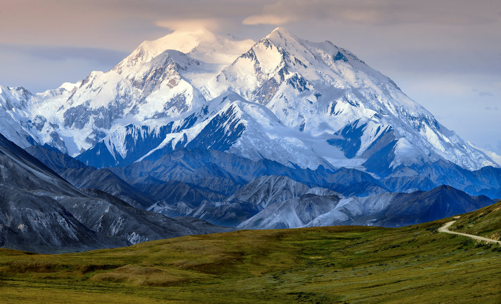
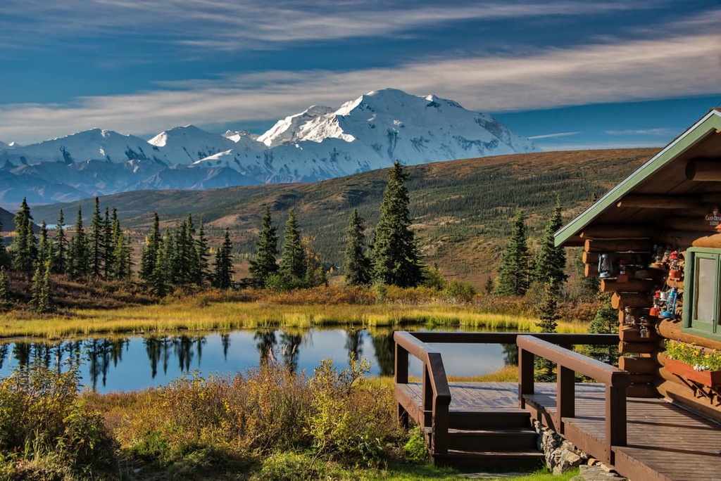
The Denali Wilderness is a remote protected region situated in the central part of the US state of Alaska. The rugged landscape in the wilderness is home to 76 named mountains, including the tallest peak in North America. The tallest and most prominent peak in the wilderness is Denali at 20,310 ft (6,191 m) in elevation and with 20,194 ft (6,155 m) of prominence.
The Denali Wilderness is located within the Denali National Park and Preserve in the central part of the US state of Alaska. The expansive wilderness covers 2,146,580 acres (868,700 ha) in area. The designated wilderness includes the land that was originally within Denali National Park’s boundaries before the park was expanded in 1980.
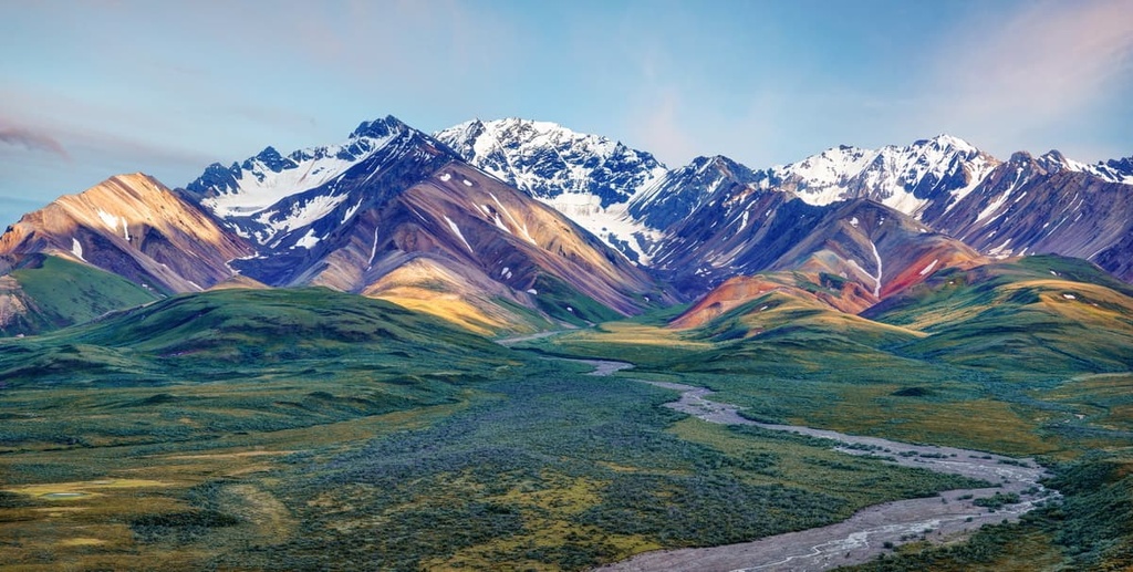
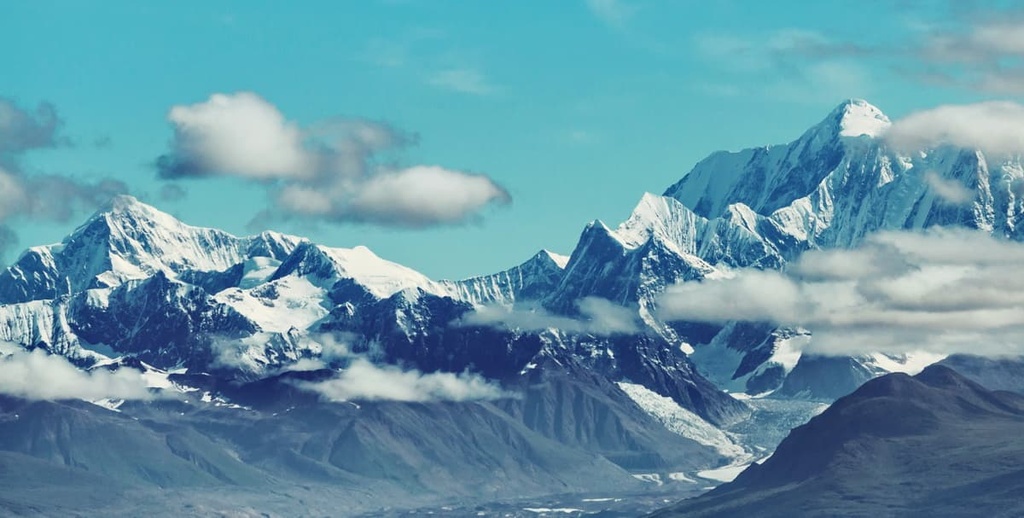
The wilderness runs along the spine of the highest portion of the Alaska Range. Here, rugged mountains tower above the surrounding landscape.. The southern side of the peaks in the wilderness are home to numerous glaciers and glacial valleys, and there are a few glaciers on the northern side of the region, too.
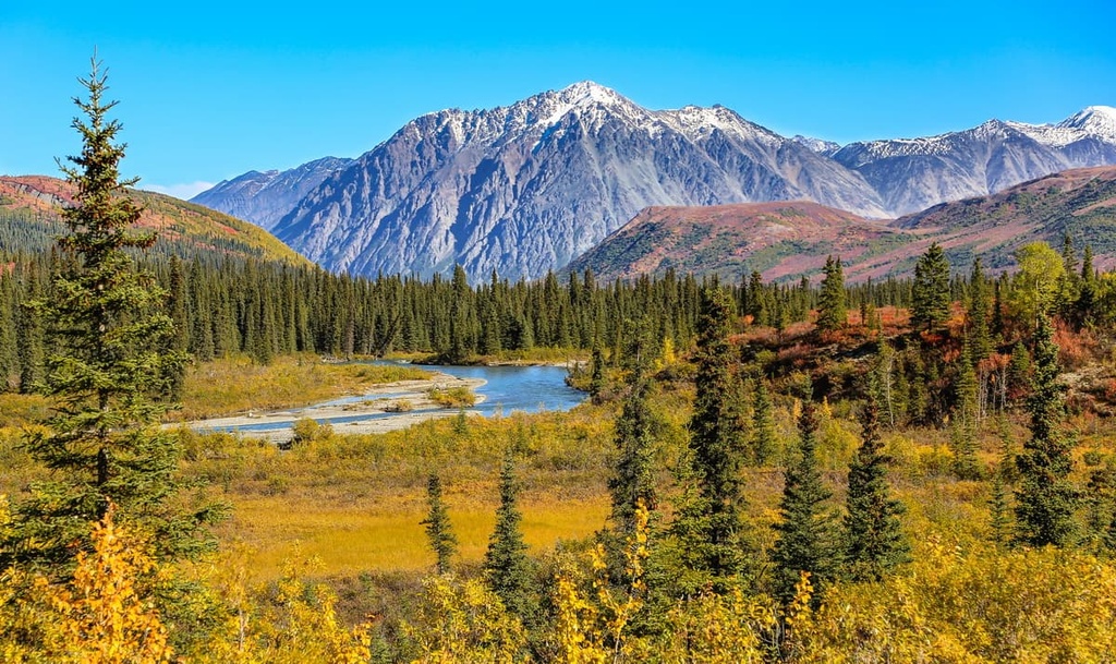
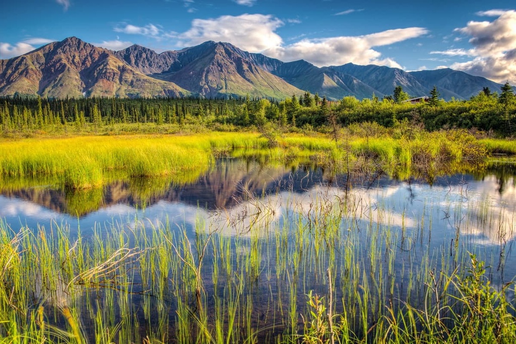
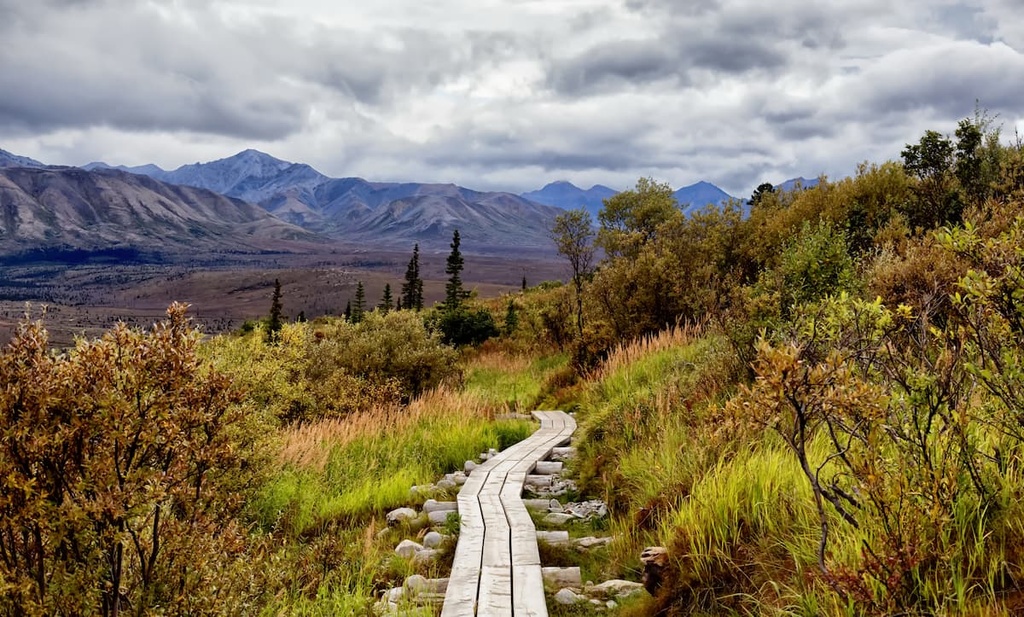
Meanwhile, the northern stretches of the wilderness encompass the McKinley, Toklat, and Foraker rivers. Here, the staggering mountains give way to alpine tundra and taiga landscapes that feature minimal plant life.
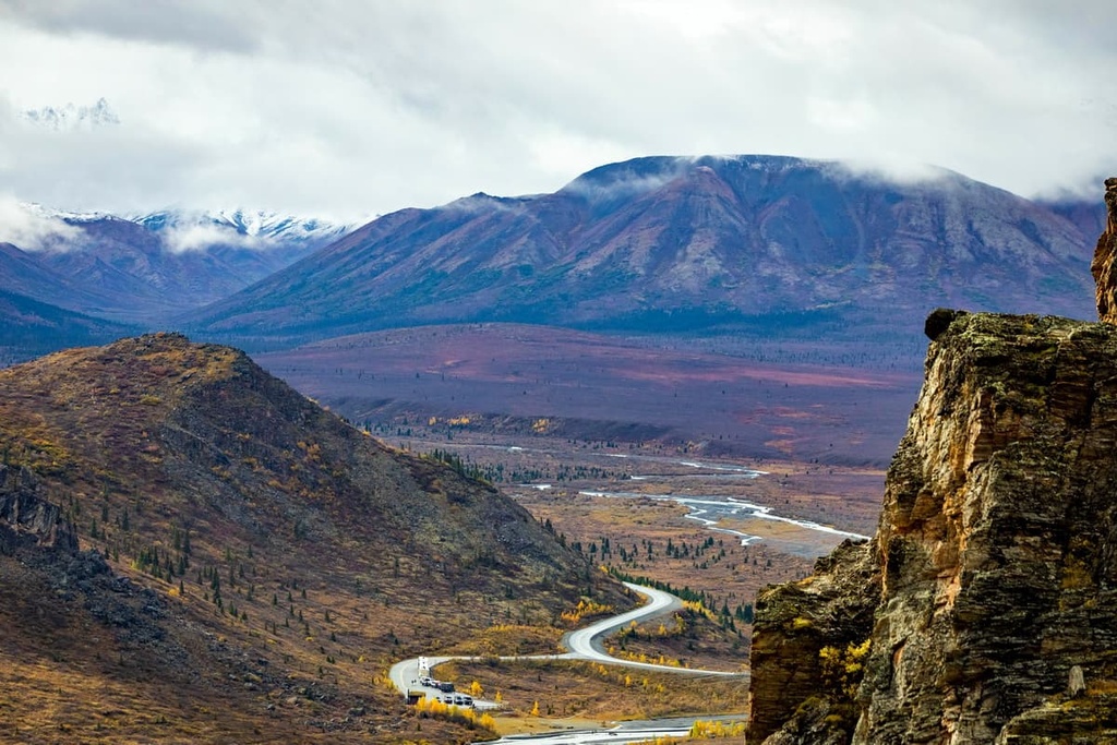
As you move to the north and south of the wilderness, the average elevation drops and the glacier-covered peaks transform into rolling foothills. Alpine glacial lakes and streams can be seen throughout the range. The Chulitna River flows to the south of the Alaska Range toward the city of Anchorage.
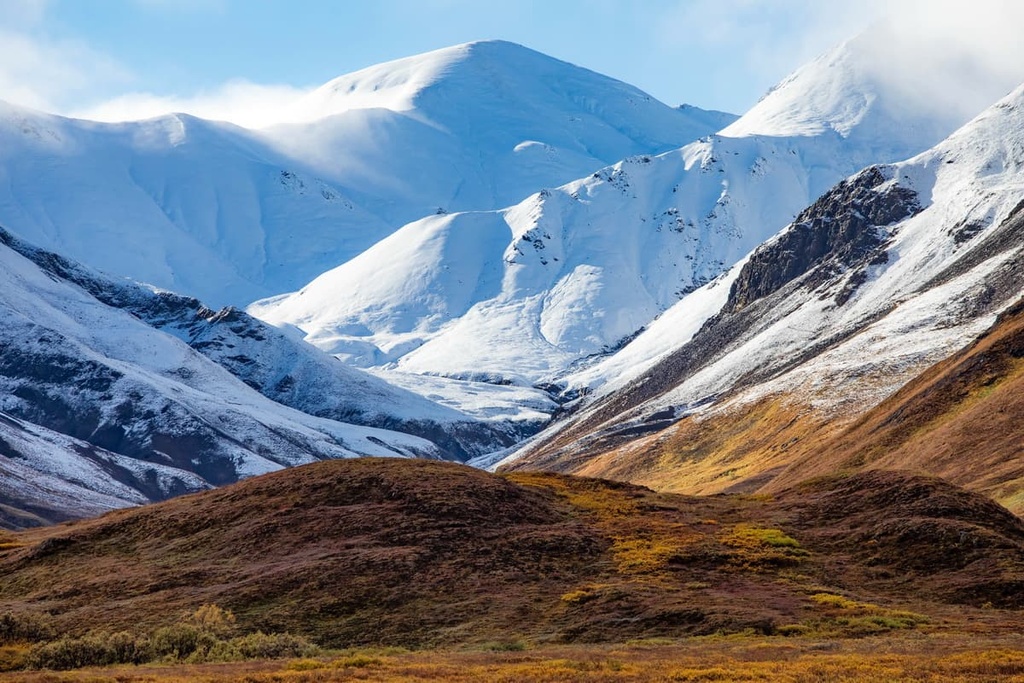
The longest glacier in Alaska is also located within the wilderness. Known as the Kahiltna Glacier, this sheet of ice is situated on the southwestern slope of Denali. At the highest elevations, the landscape opens up to rocky and rugged peaks. Many of the tallest peaks in the wilderness are covered in clouds for more than 75 percent of the year.
Additionally, the Denali Wilderness is located near numerous national forests, national parks, and wilderness areas. The wilderness lies within Denali National Park and Preserve. It is located just a short distance from the Nowitna National Wildlife Refuge to the north, Denali State Park to the south, and Lake Clark National Park and Preserve to the southwest.
The peaks within the Denali Wilderness are part of Alaska Range which is approximately 600 miles (965 km) long. The range forms an east to west trending arc across central Alaska.
The epicenter of the wilderness and the range as a whole is Denali, which is the tallest peak in North America. The peaks throughout the range are being uplifted to this day as the North American and Pacific Plate continue to collide.
The geological history of the region is greatly influenced by the collision of these tectonic plates. The rock throughout the range was once part of the ocean floor, and it formed about 400 million to 1 billion years ago. Since the rocks that formed the range come from the seafloor, the peaks feature the fossilized remains of ancient sea creatures.
These peaks are part of the Pacific Ring of Fire. In fact, the Denali Fault is located along the southern edge of the range and wilderness. The fault was created by the Pacific Plate as it was subducted underneath the North American plate.
After the peaks were thrust upward, alternating periods of glaciation and glacial retreat further carved out the landscape. These glaciations left behind glacial cirques and wide sweeping valleys that mark the foothills of the range to this day.
Common rocks found throughout the wilderness include slate, schist, quartzite, marble, phyllite, and limestone.
Major peaks within the Denali Wilderness include Denali, Mount Foraker, Mount Russell, Scott Peak, and Mount Silverthrone.
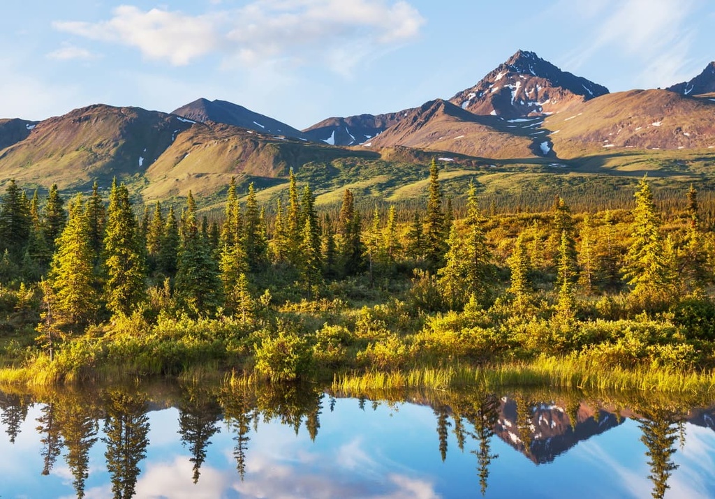
A majority of the wilderness is marked by the rugged peaks of the Alaska Range. High elevations and harsh weather conditions make it difficult for a variety of flora to thrive.
To the north of the snow capped peaks in the wilderness lies a tundra landscape. Here, the flora consists of minimature wildflowers and dwarf shrubs. Mosses, ferns, lichen, and low growing grasses begin to grow as the tundra transitions into the taiga. The taiga forest is also quite sparse, often featuring spruce and willow trees that do not reach full size.
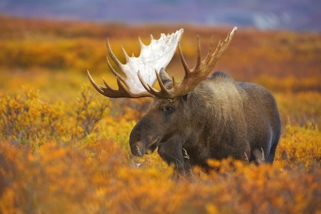
The tundra and taiga landscapes of the wilderness are home to about 37 recorded mammal species. Some of the larger mammals include grizzly bears, moose, Dall sheep, and caribou. Smaller mammals in the wilderness include lynx, martens, marmots, pikas, foxes, weasels, and lemmings.
The land surrounding the Denali Wilderness has been inhabited by humans for thousands of years. It is estimated that humans have traveled through the region for at least the last 11,000 years.
However, the high elevations and harsh weather conditions in the area prevented many Indigenous communities from establishing long term settlements within the boundaries of the wilderness.
Evidence found within the park boundaries indicates that the regions were mostly likely used more for hunting grounds rather than for permanent settlements. Over the last 500 years, the land surrounding the wilderness has been inhabited by the Koyukon, Tanana (Tth'itu') and Dena’ina people.
These Indigneous communities are traditionally hunter-gatherers who would often migrate with the changing of the seasons. The arrival of European settlers to the region led to a drastic decrease in the populations of many of the area’s Indigenous communities. Many Indigenous people died from smallpox and other infectious diseases that were brought by the settlers.
The first event that led to the protection of the region was in 1906. During this time, the conservationist Charles Alexander Sheldon worked to convince the representatives of Alaska about his plan and the importance of protecting the mountains.
The park was eventually established in 1917 as Mount McKinley National Park. It was named after the 25th president of the United States, William McKinley, who, coincidently, never actually traveled to Alaska.
The peak of Denali was first submitted in 1913 by a group of climbers that included Alaska Native Walter Harper who traveled via the South Summit Route. Legendary climber Bradford Washburn pioneered a new route up the West Buttress in 1951 that is considered the standard route on the mountain to this day.
Denali National Park would later be expanded in 1922, 1932, and 1947. The Park Road, which is 93 miles (150 km) long and leads into the surrounding region, was completed in 1938. The Denali Highway was later completed in 1957.
The Denali Wilderness was created in 1980 after the park was combined with the Denali National Monument through ANILCA. This also coincided with a change in the name of the park to Denali National Park and Preserve.
The name change reflected the Koyukon name for the mountain, Dinale, which translates to “tall one.” Interestingly, the federal government’s official name for the peak of Denali wasn’t changed until 2015.
There are very few hiking trails within the Denali Wilderness. A majority of the trails can be found in the northern portion of the wilderness, primarily in the foothills of the range.
Mountaineering routes exist in order to reach the summit of many of the rugged mountains. Those wishing to summit a peak must obtain a permit and have extensive mountaineering experience.
With that in mind, here are some of the best hikes in the Denali Wilderness that you can consider for your next visit to the region.
The Savage Alpine Trail is a point-to-point route that’s 4.1 miles (6.5 km) long and has 1,414 ft (431 m) of elevation gain. The trail winds through low growing shrubs, so it offers excellent views of the surrounding region.
Hikers can take the Savage River Shuttle back to the trail’s starting point. Those hiking this route should note that it can often be closed due to bear sightings. The trail can also be extended to connect to the Savage River region.
The Savage River Loop is a shorter hike in the Denali Wilderness. The trail is 2.1 miles (3.4 km) long and it has 413 ft (126 m) of elevation gain. The loop follows the banks of the Savage River while passing through a wide and sweeping river valley.
If the weather cooperates, on this trail, you’ll also get to see the peaks of the Alaska Range, which tower above the valley. This trail can also be accessed by bus during the summertime.
The Thorofare Ridge Trail is an out-and-back route that is 2.2 miles (3.5 km) in length with 1,105 ft (337 m) of elevation gain.
The trail climbs steeply up to the Thorofare Ridge. From the top of the ridge, you can enjoy sweeping views of the Alaska Range as well as the surrounding alpine valleys and rolling foothills.

Looking for a place to stay near the Denali Wilderness? Here are some of the best cities and villages to check out in the region.
Fairbanks is the closest major city to the Denali Wilderness. Home to around 32,000 residents, Fairbanks is the most populated city in Alaska’s Interior and the second most populated city in the state. As it is rather remote, the city is surrounded by rugged mountain peaks, rolling foothills, and sweeping river valleys.
On a clear and dark night during the winter months, visitors to Fairbanks can often spot the northern lights. During the summer months, the city gets near-constant sunlight, which provides you with ample time to explore the surrounding nature. Fairbanks lies along the Chena River and features numerous historical sites, local restaurants, and museums.
Talkeetna is a small historic town located just to the south of the Denali Wilderness and Denali National Park and Preserve. The small town has a population of around 1,000 people and it is located within the Mat-Su Valley. Talkteetna’s small downtown is lined with historic buildings, shops, as well as a few local restaurants and a brewery.
Visitors to Talkeetna can learn more about the region’s rich history in the Mountaineering Ranger Station and in the Talkeetna Historical Society Museum. During the summer months, visitors can also hike, bike, or take a boat trip along the Susitna River. The winter months provide locals and tourists alike with many miles of groomed cross country ski trails to enjoy.


14er
ultra
glacier
alaska-13ers
fred-beckey-great-peaks
alaska-ultras
14er
ultra
alaska-13ers
alaska-ultras
14er
ultra
glacier
alaska-13ers
fred-beckey-great-peaks
alaska-ultras
14er
ultra
alaska-13ers
alaska-ultras


