
Scan the QR code and open PeakVisor on your phone
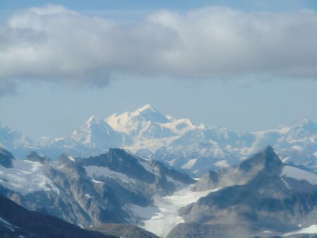
Tatshenshini-Alsek Provincial Park has 46 named peaks. The highest is Mount Fairweather at 4,671 m. Other notable peaks include Mount Quincy Adams, Mount Root and Unmarked Boundary Point 166.
Situated in the northwest corner of British Columbia, Tatshenshini-Alsek Provincial Park protects roughly 2.3 million acres of glacier-covered peaks, wild rivers, precipitous canyons, and forested valleys. The park lies between Kluane National Park in the Yukon and Glacier Bay and Wrangell-St. Elias National Parks in Alaska. Combined, these impressive parks make up the largest protected area in the world.
The Tatshenshini-Alsek region is the traditional territory of the Champagne and Aishihik First Nations, who thrived on the land by hunting, fishing, gathering, trapping, and trading. The historic Tlingit and Southern Tutchone people also built fishing villages along the banks of the region’s powerful rivers and utilized and utilized trading routes to barter with one another. Unfortunately, the indigenous population was badly affected by epidemics introduced by non-native explorers.
In the 1960s, the first geological exploration for minerals took place in the area and copper deposits were found near Windy Craggy Mountain. In the 1980s, a proposal was introduced to develop Windy Craggy into a large, open pit mine. Fortunately, in 1993, Tatshenshini-Alsek was given Class A wilderness designation, which effectively halted the project.
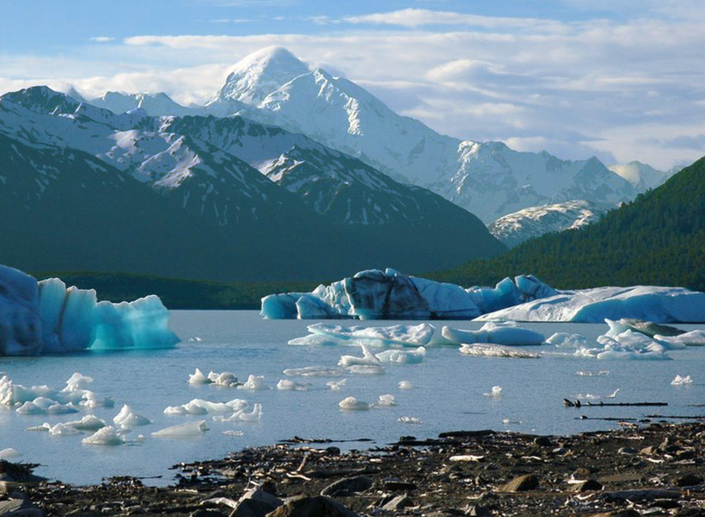
In December 1994, Tatshenshini-Alsek was designated a UNESCO World Heritage Site for its outstanding natural features, including the Tatshenshini and Alsek Rivers. The Tatshenshini and Alsek Rivers are the only major protected rivers in northwestern British Columbia. These powerful waterways not only offer some of the world’s finest river rafting, but support major populations of sockeye, coho, and chinook salmon.
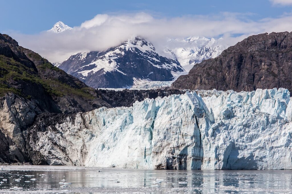
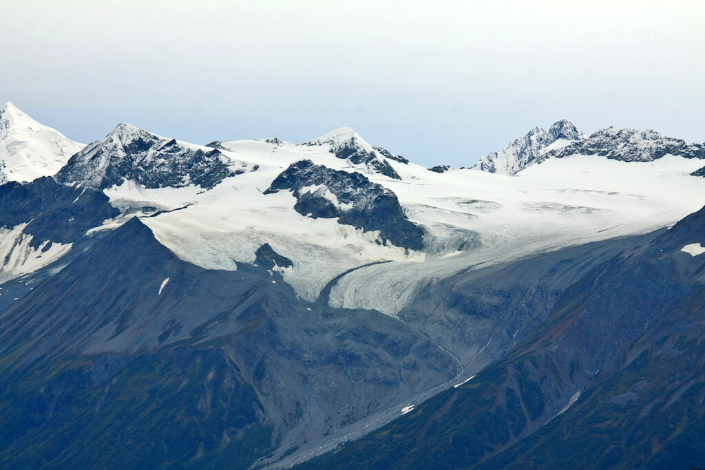
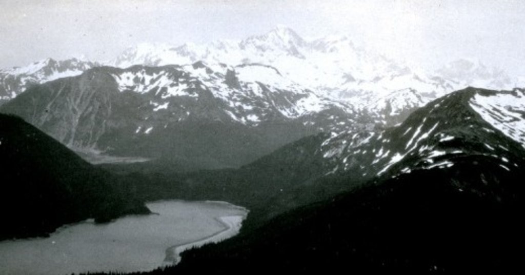
Tatshenshini-Alsek Provincial Park is the only park in British Columbia to contain an entire ecoregion – the Icefield Range Ecoregion. This ecoregion contains British Columbia’s largest and most extensive set of valley glaciers and icefields. The imposing St. Elias summits, including Mount Fairweather, Mount Root, and Mount Lodge, dominate the park’s landscape. The park also contains British Columbia’s only tidewater glacier, the Grand Pacific Glacier.
In 1999, a party of sheep hunters located the remains of a young male at the foot of one of the park’s glaciers. Referred to as ‘Kwäday Dän Tsʼìnchi,’ the naturally mummified body is believed to be between 300 and 550 years old, making it the oldest well-preserved human remains in North America. Kwäday Dän Tsʼìnchi was found with a number of artifacts, including a robe, a small bag of beaver fur, a carved and painted stick, an iron-bladed knife, and an atlatl and dart. In 2000, DNA tests conducted of the Champagne and Aishihik First Nations concluded that 17 living persons were related to Kwäday Dän Tsʼìnchi through their direct maternal line.
Today, Tatshenshini-Alsek remains a vital habitat for grizzly bear, black bear, and the rare glacier bear. The park also contains the only population of Dall sheep to live within a protected area in British Columbia and protects populations of gray wolf, red fox, lynx, mountain goat, and moose.
Despite its remote location, Tatshenshini-Alsek attracts an increasing number of recreationalists. Kayakers and rafters are drawn to the park's incredible river system, hikers and mountaineers appreciate the region’s virtually limitless wilderness, and mountain bikers look to explore old mining roads that dissect the park.
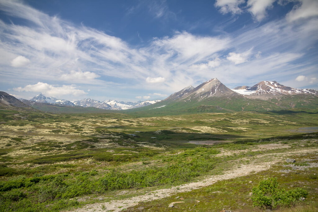
The only designated and maintained trail in Tatshenshini-Alsket is the Chuck Creek Trail, which follows an old mining road through a wide sub-alpine valley and boasts incredible mountainous vistas in all directions. Several other routes exist in the Parton River, Squaw Range, and Copper Butte region. However, these routes are generally located along abandoned access roads, are not maintained, and regularly present unique obstacles and challenges. Visitors looking to hike or mountain bike in the park are urged to regularly check weather conditions and are expected to be proficient in backcountry travel.
River rafting and kayaking opportunities are available by permit only, except for non-commercial trips along the flat water on the upper Tatshenshini River from Mosquito Flats to the Yukon Territory. Rafting or kayaking the park’s river system has been popular since the 1970s. Rafters are expected to factor the remoteness of the park into their preparation. Some portions of the river can also be extremely hazardous and water levels are variable. Guided multi-day trips are a great way to explore the park’s waterways.

There are two ways hikers, backpackers, and mountain bikers can enter the park along the Haines Highway (Hwy 3 and 7) from the Yukon or Alaska. There are no facilities or services in the area. Wilderness camping is permitted. The closest major city to the park, Whitehorse, is roughly 3 hours away.
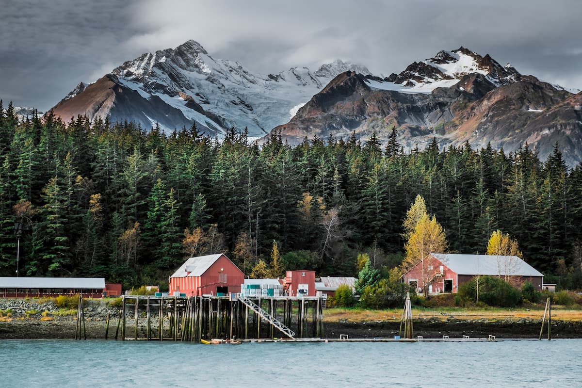
Many rafting expeditions use small coastal towns in Haines, Alaska as a basecamp before venturing several hours to Dalton Post to access the Tatshenshini River. The most common ‘take-out’ location is Dry Bay, Alaska.


14er
ultra
4000ers-canada
11ers-bc
alaska-13ers
canada-sampler
british-columbia-ultras
alaska-ultras
14er
ultra
4000ers-canada
11ers-bc
alaska-13ers
canada-sampler
british-columbia-ultras
alaska-ultras
The highest peak in Tatshenshini-Alsek Provincial Park is Mount Fairweather, at 4,671 m.
Notable peaks in Tatshenshini-Alsek Provincial Park include Mount Fairweather, Mount Quincy Adams, Mount Root, Unmarked Boundary Point 166 and Mount Eliza.


