
Scan the QR code and open PeakVisor on your phone
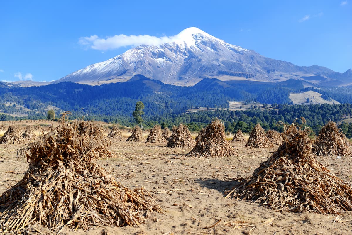
Boasting a rich cultural history, beautiful landscapes, and some truly delectable cuisine, Mexico is a diverse, exciting country located in the southern part of North America. Mexico contains an impressive 47,539 named mountains, the highest and most prominent of which is Pico de Orizaba (5,636m/18,491ft), which also happens to be the third highest peak on the continent.
Located in the southern part of the North American continent, Mexico is a large and topographically diverse country. Mexico shares its borders with the United States to the north and both Belize and Guatemala to the south.
With a total area of some 1.9 million square kilometers (761,600 sq. mi), Mexico is the 13th largest country on Earth. It has a population of about 128.6 million people, which makes it the 10th largest country by population, the most populous majority Spanish-speaking country, and the 142nd most densely populated country.
Due to the sheer size of Mexico and the immense variety of its terrain, the best way to discuss the geography of the country is by region. Within Mexico, there are 31 states, plus Mexico City (Ciudad de México), which was called the Federal District (Distrito Federal) until 2016. Moreover, these states and Mexico City can be further categorized into 9 regions, each of which has its own unique geography.
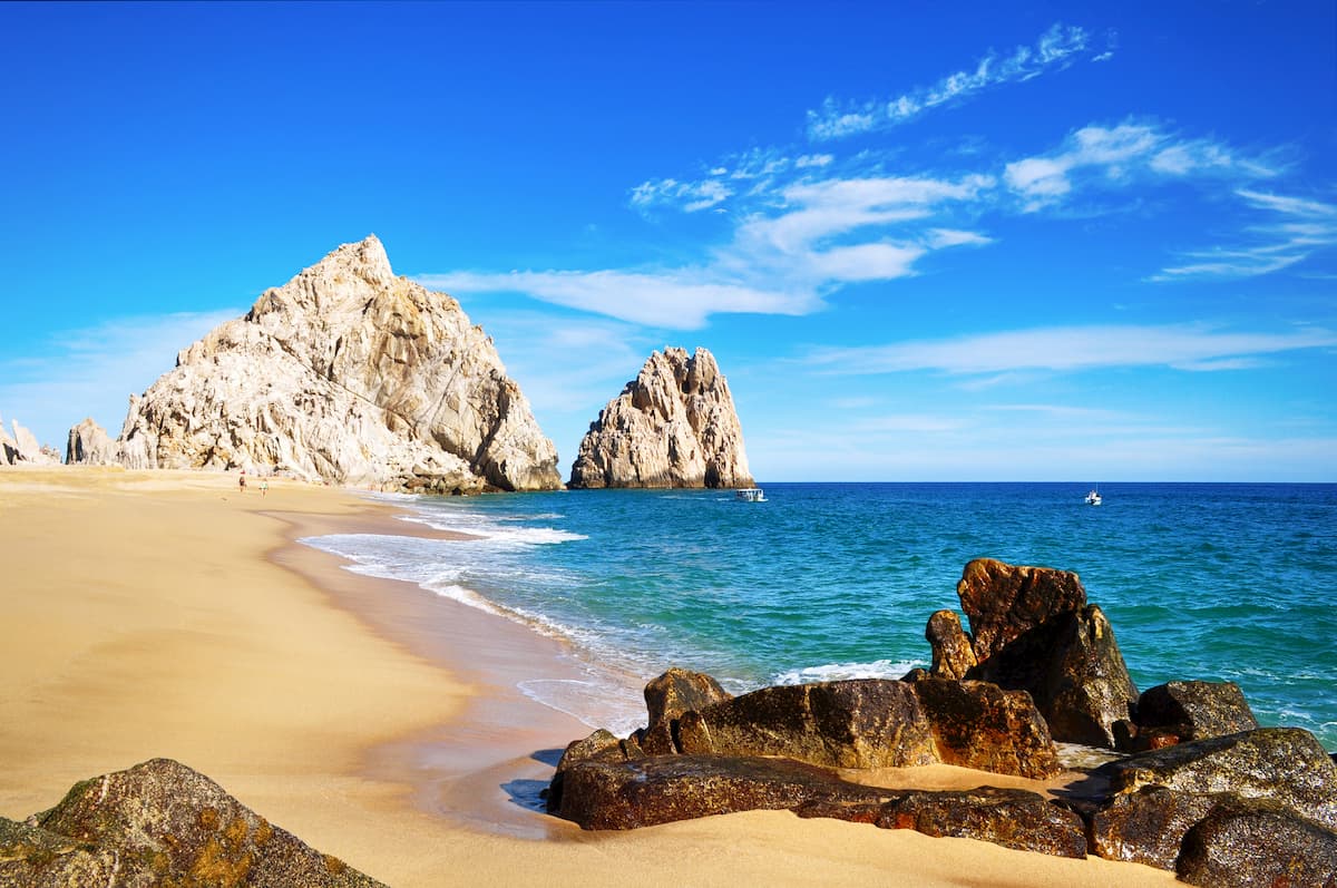
The Baja California region includes the northernmost and westernmost parts of Mexico, though the region is usually just referred to as “Baja,” particularly among tourists.
It encompasses the states of Baja California and Baja California Sur to the south of the US state of California. The region is separated from the rest of Mexico by the Gulf of California and a small strait of land, which is bisected by the Colorado River delta.

Baja is perhaps best known for its stunning sandy beaches, deserts, and sunny weather, though it’s more mountainous than the region’s bustling beach tourism industry might let on. In fact, this region includes part of the California Ranges (Peninsular Ranges) and the Baja California Mountains.
Approximately 4 million people live in Baja and many of the region’s residents live either in Mexicali and Tijuana to the north or in Cabo San Lucas, Loreto, and La Paz to the south.
Within Baja, there is also a number of major protected areas, including:
As the name suggests, the region of Northern Mexico includes the northern part of the country, between the Gulf of California and the Gulf of Mexico. It includes the states of Sonora, Chihuahua, Coahuila, Nuevo León, Tamaulipas, Sinaloa, and Durango, as well as the longest part of Mexico’s border with the US, where it borders the states of Arizona, New Mexico, and Texas.

Northern Mexico is home to the hottest and driest regions in the country, including the majority of the Chihuahuan Desert and the Sonoran Desert. Moreover, Northern Mexico is home to about 23 million people, many of whom live in the region’s major cities of Durango, Monterrey, Hermosillo, Ciudad Victoria, Saltillo, and Chihuahua.
In addition to containing large sprawling deserts, Northern Mexico includes parts of some of the country’s major mountain ranges, including the Sierra Madre Occidental, the Sierra Madre Oriental, and the Mexican Plateau. Some of the most popular outdoor destinations in the region include:
Bajío, or the “lowlands” is the region just to the south of Northern Mexico in the central part of the country. Depending on who you ask, the region can include only the states of Aguascalientes, Guanajuato, and Querétaro, as well as Zacatecas and San Luis Potosí.
The region is home to about 12.5 million people and it’s often considered to have some of the best quality of life in the country. Some of the largest cities include Santiago de Querétaro, Aguascalientes, León, and San Luis Potosí.
Bajío is one of the fastest-growing parts of Mexico and it was once one of the main governmental seats during the years of the Spanish Empire. Tourism and the service industry are some of the largest economic drivers in the area.
This region is home to parts of a number of mountain ranges, including the Sierra Madre Occidental, the Sierra Madre Oriental, and the southern edge of the Mexican Plateau. It also contains a handful of popular national parks, such as:
Aptly named, the Pacific Coast region of Mexico includes the majority of the country’s western states. Generally speaking, the states of Nayarit, Jalisco, Colima, Michoacán, and Guerrero are considered to be part of the same region, which is dominated by stunning beaches, beautiful stratovolcanoes, and dense forests.
The Pacific Coast region of Mexico is home to about 16.6 million people, many of whom live in the cities of Colima, Tepic, Guadalajara, and Moreila. This area is highly mountainous and it includes parts of a number of large mountain ranges, including:
Mexico’s Pacific Coast is also dotted with parks and outdoor recreation areas for those looking for a bit of activity during their stay. Some of the most popular places to check out include:
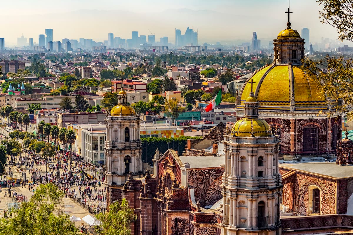
The most densely populated part of the country, Central Mexico is a lively and surprisingly mountainous region home to some of the largest cities in North America. Although it can be defined in a number of different ways, the Central Mexico region almost always includes the states of Hidalgo, México, Morelos, Puebla, and Tlaxcala, as well as the Ciudad de México (Mexico City).

Central Mexico has a population of about 36 million people, though it is growing at an exponential rate. The largest city is, by far, Mexico City, which, with just around 9 million inhabitants, is the most heavily populated place in North America. Other major cities in the region include Pachuca, Ecatepec, Cuernavaca, Puebla, and Vincente Guerrero.
Despite being densely populated, the Central Mexico region is also heavily mountainous. It contains the bulk of the towering Cordillera Neovolcanica as well as sizable portions of the Sierra Madre Oriental. This area of Mexico also contains a fantastic array of national parks, including:
Although the state of Veracruz is often combined with its neighbors as part of Central Mexico, it can usually be considered its own region since it occupies such a large portion of the coast of the Gulf of Mexico.

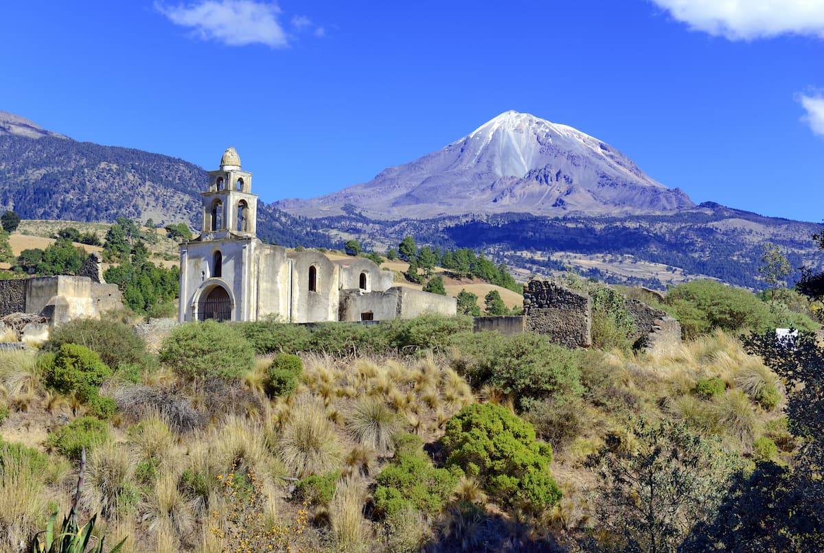
Veracruz is home to about 8.1 million people, which makes it the third largest state in the country. It is known for its great beaches, natural resources, and strong agricultural economy. The state also contains parts of the Cordillera Neovolcánica and the Sierra Madre Oriental, as well as the country’s highest peak - Pico de Orizaba.
Moreover, Veracruz is lauded for its rich biodiversity, some of which is protected in its 4 national parks:
The only other state to get its own region, Oaxaca is located in the southern part of Mexico, along the country’s Pacific Coast. Although it could technically be considered part of the Pacific Coast region, Oaxaca’s rich cultural history and strong Indigenous population, as well as its unique landscape makes it an entity in its own right.

As a whole, Oaxaca is home to nearly 4 million people, many of whom live in Oaxaca de Juárez, Huajuapan de León, Salina Cruz, and Puerto Escondido. The region is a major part of Mexico’s tourism industry as it is home to some stunning beaches, dense forests, and critically important cultural sites.
Oaxaca also includes the majority of the Sierra Madre del Sur mountain range as well as a handful of national parks:
The southernmost part of Mexico, the Chiapas & Tabasco Region is home to, well, the states of Chiapas and Tabasco. This area borders Guatemala and is just to the east of the Yucatan Peninsula.
In this region, there are about 7.5 million residents between the 2 states. Much of the southern part of the region is dominated by the peaks of the Chiapas Ranges (Sierra Madre de Chiapas) while the northern part is covered by dense rainforests. Some of the most popular parks include:
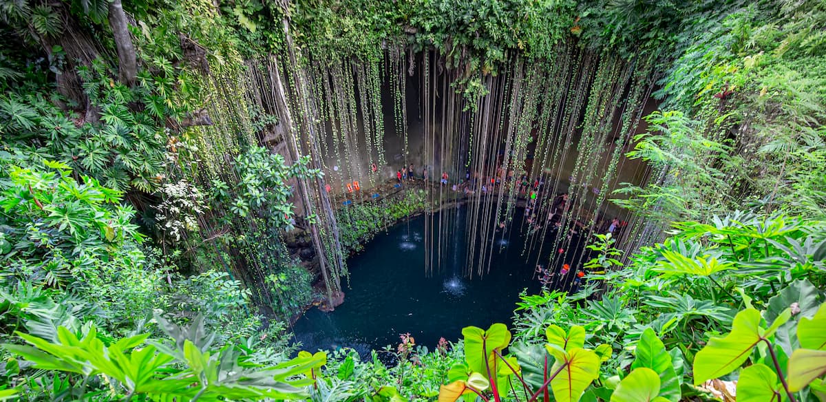
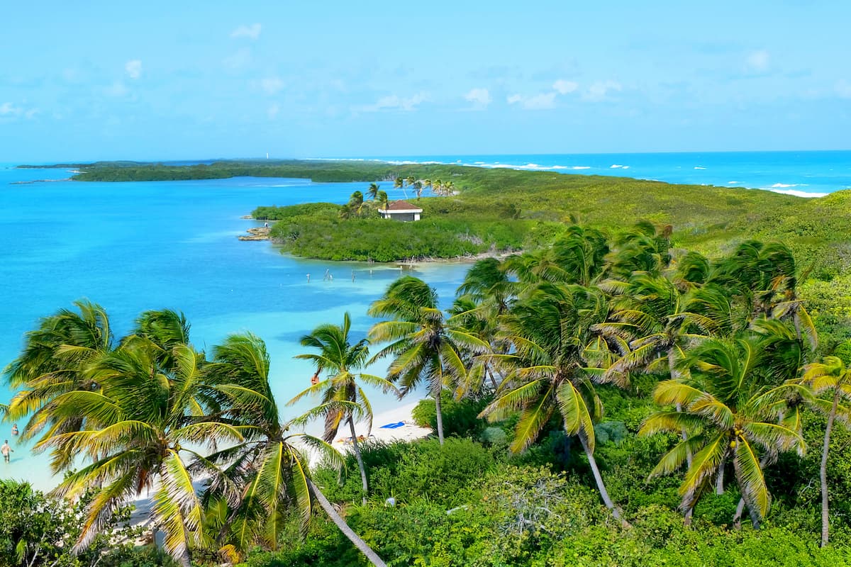
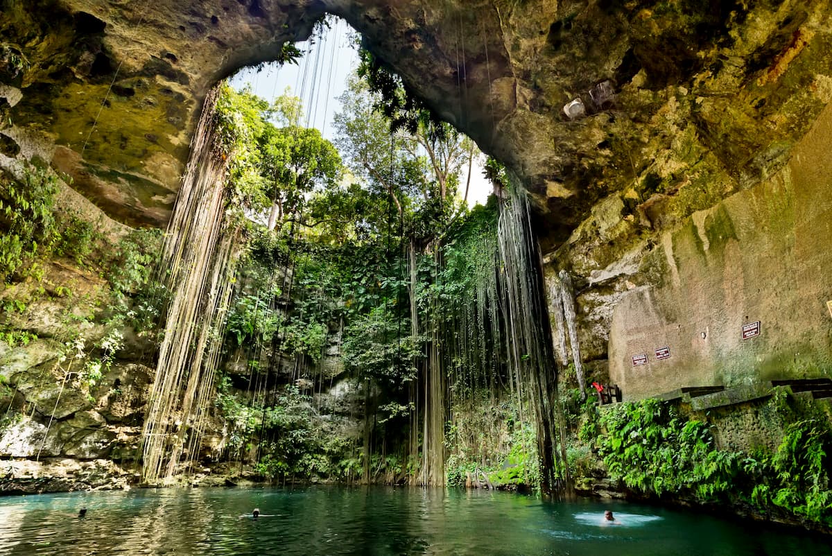
The final region of Mexico is the Yucatán Peninsula, which includes the states of Campeche, Quintana Roo, and Yucatán. This region is located in southeastern Mexico and it is located on the Yucatán Peninsula, which forms a natural barrier between the Gulf of Mexico and the Caribbean Sea. It also shares a border with both Guatemala and Belize and it is just a short distance by sea to Cuba (about 941km/585mi from Cancún).
About 4 million people live on the Mexico side of the Yucatán Peninsula and some of the largest cities and municipalities include Mérida, Cancún, Playa del Carmen, Cozumel, and San Francisco de Campeche.
The region is famous for its beaches and tourism is a major industry in the area. There are also quite a few important Mayan and other cultural sites throughout the peninsula.
Although much of the region is fairly low-lying, there are a handful of high points within the Yucatán Mountains. Moreover, there are quite a few parks and protected areas in the region, including:
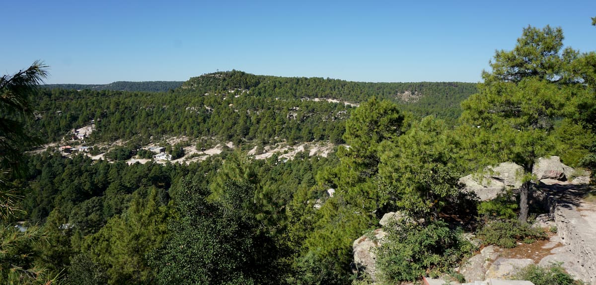
Mexico is a large and greatly geologically diverse country whose landscape formed over millions of years as a result of a number of complex geological processes. The country is also home to a number of major mountain ranges, each of which has its own unique geological history.
Covering a wide swath of land from Jalisco and Colima to the west all the way to Veracruz to the east, the Cordillera Neovolcanica is a massive range that’s home to the highest peaks in Mexico. The range includes 9,180 named mountains, the highest and most prominent of which is Pico de Orizaba.
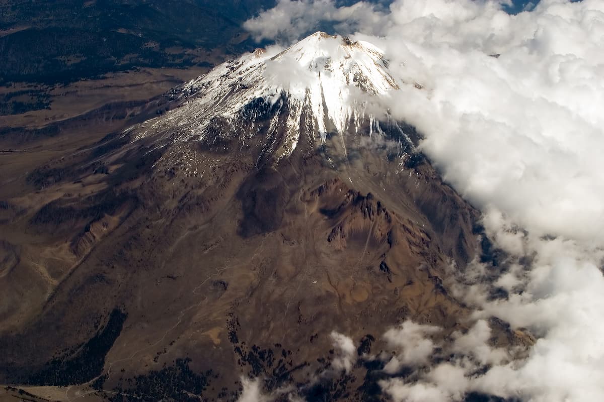
Having formed through an extensive period of subduction, which formed the Trans-Mexican Volcanic Belt, the Cordillera Neovolcanica is a highly volcanic area that’s similar in origin to the Mexican West Coast Ranges. Many of the range’s major peaks, such as Pico de Orizaba, Popocatépetl, and Iztaccíhuatl, and Cofre de Perote, are either active or dormant volcanoes.
Running down the western coast of Mexico, the Sierra Madre Occidental is a rugged chain of summits and deep canyons (known as barrancas). The range contains 10,935 named mountains, the highest and most prominent of which is Cerro Gordo.
Unlike many of the other nearby ranges, the Sierra Madre Occidental is actually the remains of a massive plateau composed of extrusive igneous rock that once existed in the area. This plateau eventually eroded away to reveal the sedimentary and intrusive igneous rocks that we see today.
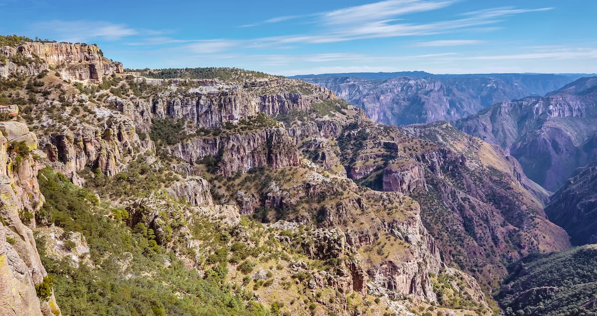
This area is also home to some sizable gold and silver deposits, which are evidence of the range’s past volcanic history. It also features quite a bit of basin and range-style faulting, like one would see in the Southwest Basins and Ranges to the north.
In direct contrast to the Sierra Madre Occidental, the Sierra Madre Oriental runs down the eastern coast of Mexico. This range contains 4,941 named peaks, the highest of which is Cerro El Potosi, and the most prominent of which is Cerro La Joya.
This range is mostly comprised of Cretaceous-age sedimentary rocks which date back some 145 to 65 million years. However, the Sierra Madre Oriental really started to form about 23 million years ago, through a series of faulting and uplifting events.
The range also contains a fairly large number of igneous intrusions, as well as some sizable deposits of zinc, lead, and copper
Stretching from western Guerrero to eastern Oaxaca, the Sierra Madre del Sur is a major collection of peaks along Mexico’s Pacific Coast. The range contains 4,720 named mountains, the highest of which is Cerro Nube Flane, and the most prominent of which is Cerro Teotepec.
Although they formed separately, the Sierra Madre del Sur, like the Sierra Madre Oriental are predominately made up of Cretaceous-age sedimentary rock. This range also demonstrates a substantial amount of east to west folding and it has been heavily eroded by the Río Balsas over the years.
Aptly named, the Chiapas Ranges (a.k.a. the Sierra Madre de Chiapas) are almost exclusively found in the state of Chiapas, though a small section can be found in Oaxaca and Tabasco. The Chiapas Ranges contain 1,206 named mountains, the highest and most prominent of which is Tajumulco.
A part of the Central America Volcanic Arc, which extends into Guatemala, Nicaragua, Costa Rica, Panama, and El Salvador, the Chiapas Ranges are home to hundreds of volcanic formations. These include lava domes, cinder cones, and some massive volcanoes, including Tajumulco and Tacaná.
Forming the border between the Sierra Madre Occidental to the west and the Sierra Madre Oriental to the east, the Mexican Plateau is a large, elevated area in the central part of the country. There are 8,889 named mountains in the Mexican Plateau, the highest of which is El Fierro, and the most prominent of which is Cerro El Anteojo.
Unlike its neighboring ranges, the Mexican Plateau dates back to about the Mesozoic Era and is mostly sedimentary in origin. During the Cenozoic, the plateau also experienced large outpourings of lava from nearby volcanic areas as well as substantial uplift, which turned the region into the plateau that exists today.
Additionally, the northern part of the Mexican Plateau is usually considered to be a part of the Basin and Range Province, which also includes the Great Basin Ranges and the Southwest Basins and Ranges.
The Mexican West Coast Ranges are home to a number of major volcanoes, which stretch from Nayarit in the north to Michoacán in the south. Within the ranges, there are 1,710 named mountains, the highest of which is Cerro Viejo and the most prominent of which is Las Conchas.
Depending on who you ask, the Mexican West Coast Ranges can be included as part of the Cordillera Necovolcánica. Both of these ranges are highly volcanic, which is evidenced by the many stratovolcanoes, such as Volcán de Tequila and Volcán Ceboruco, which dot the landscape.
For the most part, the Yucatán Peninsula is fairly low-lying terrain, though there are a few high points that dot the region. In fact, there are 153 named high points in the Yucátan Mountains, the highest and most prominent of which is Doyle’s Delight.
The peninsula itself is mostly sedimentary in origin, with limestone and other soluble rocks making up the majority of the region, though there are some dolomites scattered about.
Perhaps the most interesting geological oddity in the region is the Chicxulub crater off the coast of the peninsula, which is believed to be where the large asteroid that caused the extinction of the dinosaurs hit Earth.
The final major mountain system in Mexico is found in the states of Baja California and Baja California Sur. These states are home to parts of the California Ranges, which are a subsection of the Peninsular Ranges.
However, the overall geology of the Baja California Peninsula is complex and there are at least 5 distinct geological provinces in the region.
Formation wise, the mountains in the Baja California Peninsula started to form during the Mesozoic when the Pacific plate began to subduct under the North American plate. This subduction eventually led to the creation of a large granitic batholith, which also shows evidence of widespread metamorphism.
Tectonic activity began to pick up toward the middle Cenozoic with the formation of the San Andreas Fault to the north, as well as a rift which eventually created the Gulf of California, separating Baja California from the rest of Mexico.
With a country as large as Mexico, a dizzying array of biodiversity is to be expected. In fact, the World Wildlife Fund has identified nearly 4 dozen different terrestrial ecoregions and 9 biomes in Mexico, alone! Here are some of the largest biomes in Mexico that you might encounter on your travels:
Found mostly in Northern Mexico and Baja California, the deserts and shrublands of Mexico are known for being particularly hot and dry. Despite this, the region is actually home to a surprising array of flora and fauna.
Xeric shrubs (drought-tolerant shrubs), succulents, and other hearty plants are the most common foliage found in this region. Within the Sonoran Desert and the Chihuahuan Desert, in particular, the harsh climate favors only the most drought-tolerant of flora.
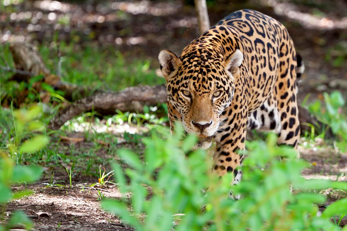
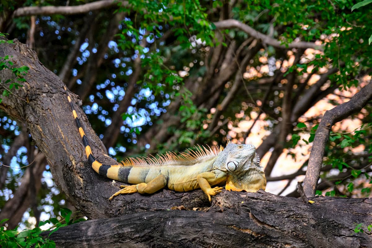
Wildlife in this region includes everything from pronghorn to jaguars, though smaller mammals like San Quentin kangaroo cats, and birds, such as the golden eagle, are also prolific.
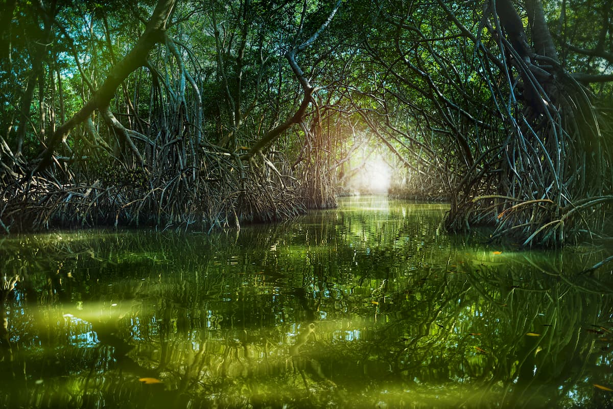
Located predominantly along the coasts of Mexico, mangrove ecosystems are woodlands that grow in saline or brackish water. These ecoregions are constantly under threat by human development, though they are home to some truly fantastic wildlife and plant species.
Trees found in Mexico’s mangroves include the red mangrove, the white mangrove, and the black mangrove, and the button mangrove. Major wildlife species found in the area include lynx, ocelot, jaguars, oysters, crabs, and plenty of seabirds.
Throughout the higher elevation regions of Mexico, visitors can find large stands of both tropical and subtropical coniferous forests.
These forests include the Central American pine-oak forests, the Sierra de la Laguna pine-oak forests, the Sierra Madre de Oaxaca pine-oak forests, the Trans-Mexican Volcanic Belt pine-oak forests, and the Sierra Juárez and San Pedro Mártir pine-oak forests.
As you can surmise from the name, the one common trait between all these forests is that they contain sizable concentrations of coniferous trees.
Common tree species in these ecoregions include sugar pine, Jeffrey pine, Tamarack pine, white fir, Parry pinyon, California incense cedar, Montezuma pine, smooth-bark Mexican pine, Hartweg’s pine, Mexican pinyon, Guatemalan fir, and cypress.
Meanwhile, wildlife varies greatly from region to region, though species such as mule deer, mountain lions, coyotes, grey foxes, ringtails, and jaguars all call Mexico’s coniferous forests home. Moreover, some parts of the country’s coniferous forests, particularly in Central Mexico, are the winter habitat for millions of monarch butterflies.
At lower elevations throughout southern and central Mexico, the landscape is dominated by dry broadleaf forests.
Dry broadleaf forests in Mexico include the Sonoran-Sinaloan transition subtropical dry forest, the Balsas dry forest, the Bajío dry forests, the Central American dry forests, the Chiapas Depression dry forests, the Jalisco dry forests, the Sierra de la Laguna dry forests, the Sinaloan dry forests, the Southern Pacific dry forests, the Veracruz dry forests, and the Yucatán dry forests.
Unlike the country’s many rainforests, the dry forests of Mexico simply don’t receive enough rainfall to form massive forest canopies. Despite this, these forests still boast an impressive array of flora and fauna.
Depending on where you are in the country, dry broadleaf forests may include species like jabín, yellow mastic, Spanish cedar, Jamaican dogwood, pink poui, guanacaste, sapoto, breadnut, and palo santo, though many of these forests have been extensively clear-cut.
Wildlife in this ecoregion includes everything from white-tailled deer, javelinas, jaguars, coyotes, Mexican wolves, and many species of bats.
Mexico’s most biodiverse ecoregions, the country’s many moist broadleaf forests boast tropical, humid conditions, which allow for the proliferation of vibrant ecosystems. These ecoregions are mostly found in the southern part of the country, where warm, moist climates are prevalent.
Tree species in these forests include American sweetgum, Mexican royal oak, xalapa oak, eastern redbud, American hophornbeam, black olive, logwood, bitter angelim, gumbo-limbo, mahogany, and cedar.
Wildlife is particularly abundant in these forests and it includes animals such as Morelet’s crocodiles, tropical gars, mantled howler monkeys, jaguars, and mountain lions.
The land that is now part of Mexico has a long and storied history of human inhabitation. Countless peoples have lived in the region over the last 13,000 years, including the Olmecs, the Aztec Empire and the Maya peoples, the ancestors of the 3 dozen federally-recognized Indigenous tribes and nations, and many others.
Long before the arrival of Spanish conquistadors, the Aztec Empire and many other smaller nations lived throughout the region that is now Mexico. The Spanish came to the region in the late 15th and early 16th centuries, setting the stage for centuries of colonialism, western settlement, violence, and mass genocide of the region’s Indigenous peoples.
From the early 16th century to the early 19th century, the land that is now Mexico was under the rule of Spain. During this time, Mexico was referred to as “New Spain,” and it was governed by a viceroy who acted on behalf of the Spanish crown. At the same time, the Spanish colonization efforts extended well past the current US-Mexico border, and well into the southwestern United States.
The early 1800s saw the beginnings of the first concerted independence movements by settlers in Mexico. From 1810 to 1821, the country fought what is now known as the Mexican War of Independence, after which point the regino, which also included parts of Nicaragua, Guatemala, Honduras, El Salvador, and Costa Rica, briefly became part of the short-lived Mexican Empire.
In 1824, the United Mexican States were established and the country created its first constitution. This led to a period of political instability, which characterized much of the mid-1800s and came to a head during the Texas War of Independence and the Mexican-American War, which saw Mexico lose substantial parts of its territory.
The 1850s saw the rise of the War of Reform and, later during the early 1860s, French invasion. Mexico was then turned into an empire, once again, with Emperor Maximilian I of Mexico on the throne until his execution in 1867. After the US Civil War, the US demanded that France withdraw its troops from Mexico and the Mexican Republic was restored once again.
After the turn of the century, Mexico entered into a revolutionary period from 1910 to 1920, which saw some of the largest and most rapid changes in Mexico’s societal structures. The country got yet another new constitution, saw a number of rebellions, and fell into a civil war.
In the years since, Mexico has experienced substantial economic growth as well as large crises, particularly after the 1985 Mexico City earthquake. Since the start of the 21st century, Mexico has solidified its place on the world stage, becoming a rapidly industrialized country with a booming tourism industry.
Mexico is home to some of the most stunning natural landscapes in the world, so there are plenty of excellent hiking areas to check out during your visit. Here are some of the crown jewels of Mexico’s national parks:
Covering some 19,750 ha (48,800 acres) of land around Pico de Orizaba, this national park is one of Mexico’s most popular climbing destinations. The park is a must-visit for anyone looking to climb Pico de Orizaba, a major attraction to the region between October and March each year.
There are many climbing routes up to the summit of Pico de Orizaba, though most climbers choose to head up the Jampa Glacier. That being said, the peak’s altitude and technical difficulty require a decent grasp of climbing skills if you’re looking to make a summit attempt.
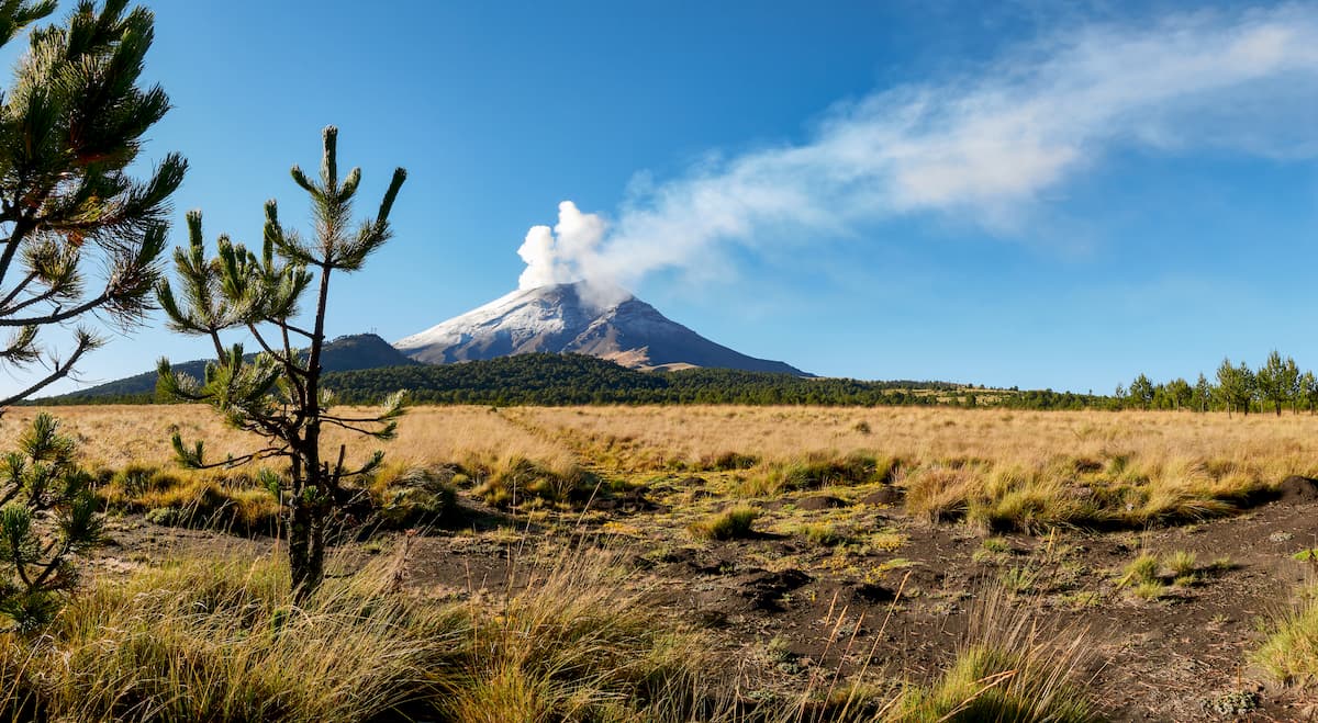
Home to the second and third highest peaks in Mexico - Popocatépetl and Iztaccíhuatl - Izta-Popo Zoquiapan National Park is a great place to visit if you’re staying in Mexico City. The park contains 39,819 ha (98,395 acres) of land and it is a popular hiking destination.
Although Popocatéptl was a common climbing destination in years past, however, it is now very volcanically active, so it’s no longer open to climbers. On the other hand, Iztaccíhuatl is a dormant volcano and its La Arista del Sol route is a popular path to the summit for most hikers.
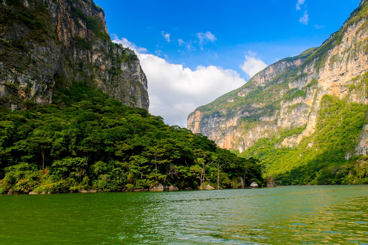
Located in Chiapas, the Sumidero Canyon National Park is a stunning region located on the banks of the Grijalva River. The park features massive cliffs on either side of the river, some of which are more than 1,000m (3,300 feet) high.
Sumidero Canyon is one of the busiest tourist sites in Chiapas, though most visitors head to the region by boat. You can also check out the park’s many caves and waterfalls, keeping your eye out for the crocodiles that roam through the river.
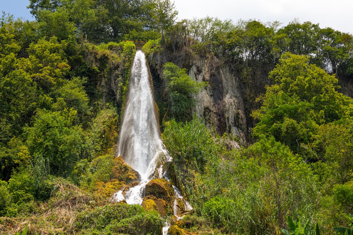
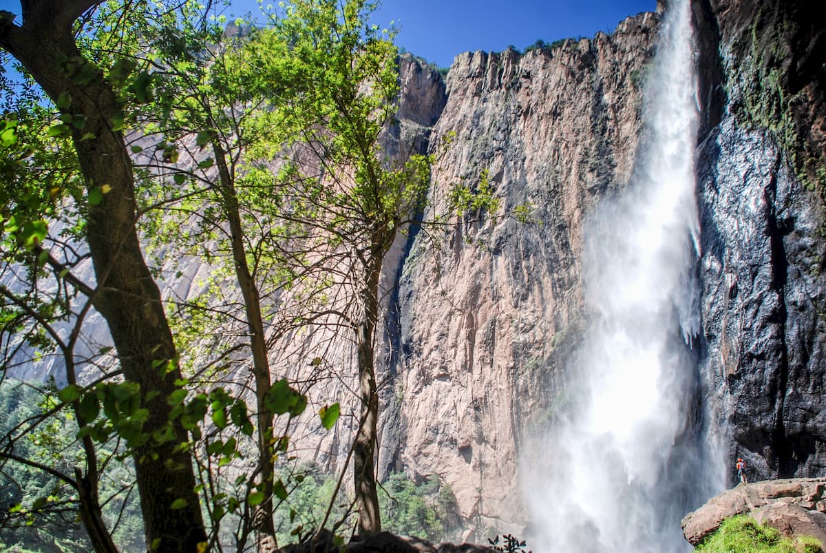
Nestled in the northern region of Chihuahua, Basaseachic Falls National Park contains the second highest waterfall in the country. The waterfall itself boasts a height of 246m (853ft) and it is located in the heart of the Sierra Madre Occidental, so it’s a perfect place to visit if you’re looking to see a diversity of landscapes in Mexico.
Overall, Mexico contains 10 cities with over 1 million inhabitants, with some rapidly growing cities threatening to break that threshold in the coming years. While you have plenty of cities to choose from during your stay, here are some of the best places to check out if you’re in Mexico:
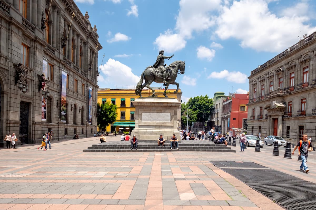
The largest city in Mexico and in North America, Mexico City is home to some 8.8 million people as well as the country’s capital. Mexico City is a major financial and cultural center for the country and its overall metropolitan area has a population of over 21.3 million people. The city is also the site of one of the busiest airports in Latin America, so it’s a great place to start your travels.
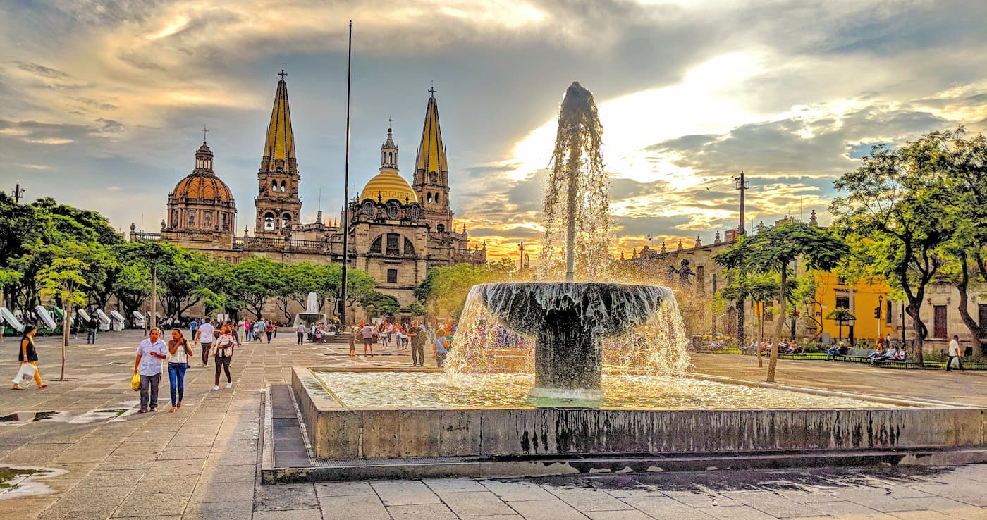
Located in the state of Jalisco, Guadalajara is the third largest city in Mexico with about 1.4 million inhabitants. It is the second most densely populated city in the country, after Mexico City, and it is known for its business, finance, arts, and cultural importance. Guadalajara is also a center for education, tourism, and technology, and it contains a number of important cultural buildings that are well worth a visit.
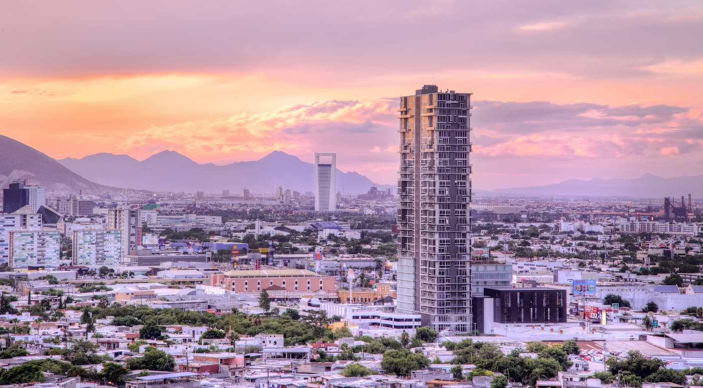
Monterrey is the capital of Nuevo León and the ninth largest city in Mexico with about 1.1 million residents. Monterrey is situated at the foothills of the Sierra Madre Oriental and it is the hub for a large number of Meixcan company, making it a major economic center for the region.
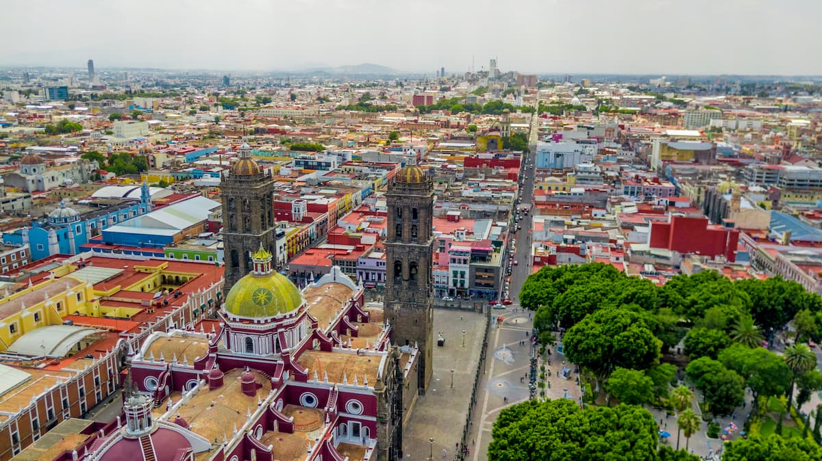
The fourth largest city in the country with some 1.5 million people, Puebla is located in southeastern Mexico within the state of Puebla. Perhaps best known for its prestigious universities, Puebla is also a major center for Mexico’s automobile industry. The city is also a UNESCO World Heritage Site, so it’s a must-visit for history buffs everywhere.


ultra
volcano
fred-beckey-great-peaks
mexico-ultras
ultra
volcano
fred-beckey-great-peaks
mexico-ultras
ultra
volcano
mexico-ultras
guatemala-ultras
ultra
sierra-club-desert
desert-peaks-section-emblem
mexico-ultras


