Scan the QR code and open PeakVisor on your phone
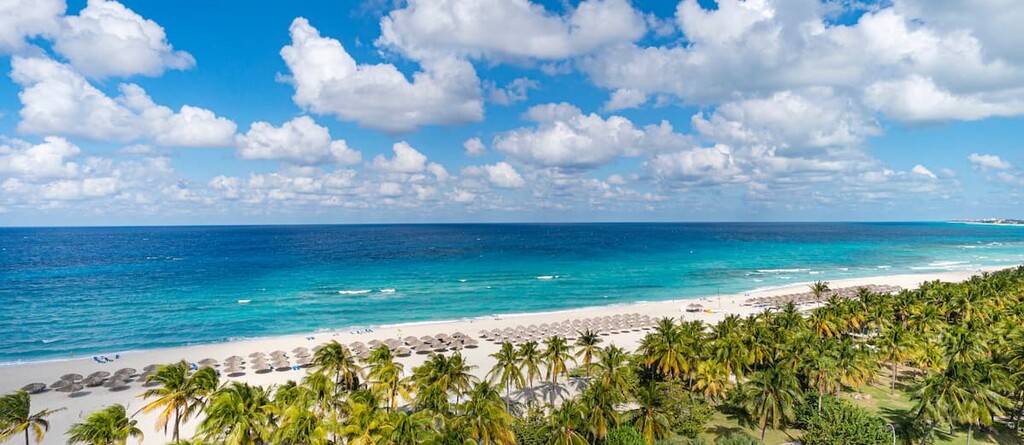
A land of beautiful beaches, colorful cities, and funky classic cars, Cuba is an island nation located at the intersection of the Caribbean Sea, the Atlantic Ocean, and the Gulf of Mexico. Cuba is home to 842 named mountains, the highest and most prominent of which is Pico Turquino (1,974m/6,476ft).
The country of Cuba (officially the Republic of Cuba/República de Cuba) is located in the northernmost part of the Caribbean Sea at the point where it intersects with the Atlantic Ocean to the northeast and the Gulf of Mexico to the northwest.
With a total land area of 109,884 square kilometers (42,426 square miles), Cuba is the largest island in the Caribbean Sea and the 17th largest island on Earth, as well as the 104th largest country in the world.
As an island nation, Cuba has no land borders. However, it is located very close to a number of other countries and territories. In particular, Cuba is located to the west of Haiti, the Dominican Republic, Turks and Caicos, and Puerto Rico, as well as to the south of the United States (specifically the state of Florida) and the Bahamas.
Furthermore, Cuba is just around 217 kilometers (135 miles) from Mexico to the west across the Yucatán Channel and it is situated to the north of both Jamaica and the Cayman Islands.
Cuba is officially divided up into 15 provinces (provincias) and one special municipality (municipio especial). However, the country can also be roughly categorized into three geographic regions.
As the name suggests, Western Cuba includes, well, the bulk of the western third of the island. In particular, this region encompasses Pinar del Río, Artemisa, La Habana, Mayabeque, and Matanzas provinces, as well as the special municipality of Isla de la Juventud.
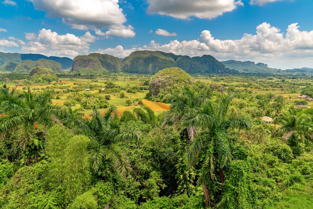
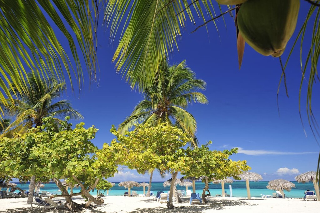
Western Cuba is a particularly popular place to visit, least of all because of its proximity to the country’s capital, Havana (La Habana). This region boasts amazing cuisine, fantastic beaches, and lush valleys.
Furthermore, it contains a great collection of national parks and protected areas, such as:
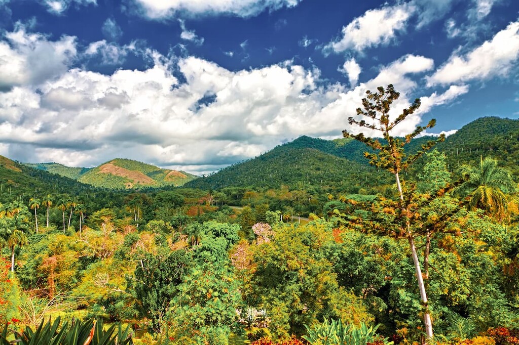
Home to a rich cultural history, gorgeous cities, and a number of mountain ranges, the Central Cuba region is a geographically diverse area that includes the provinces of Cienfuegos, Villa Clara, Sancti Spíritus, Ciego de Ávila, and Camagüey.
Central Cuba is a topographically varied place, with large areas of mostly flat plains bisected by the Sierra del Escambray mountain range. Furthermore, the southern coast of the region is a particularly great place to explore some sandy beaches without the crowds that you can often find closer to Havana.
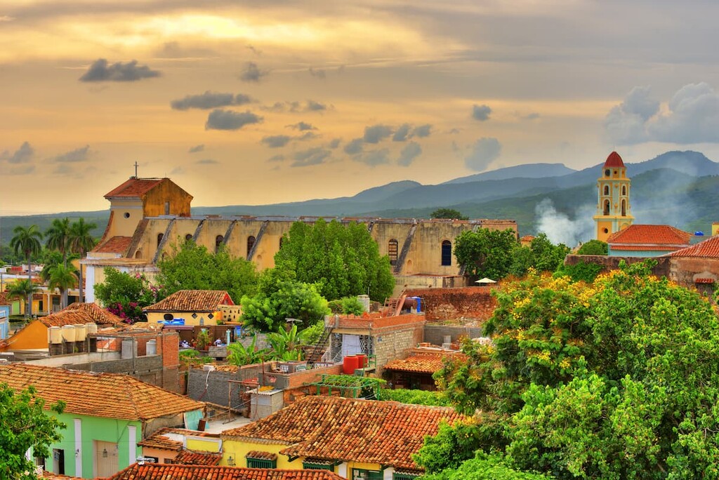
The Central region of Cuba is home to a number UNESCO World Heritage Sites, including those in the city of Trinidad. It also contains a handful of national parks and protected areas, such as:
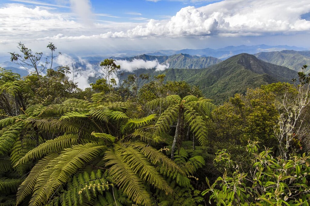
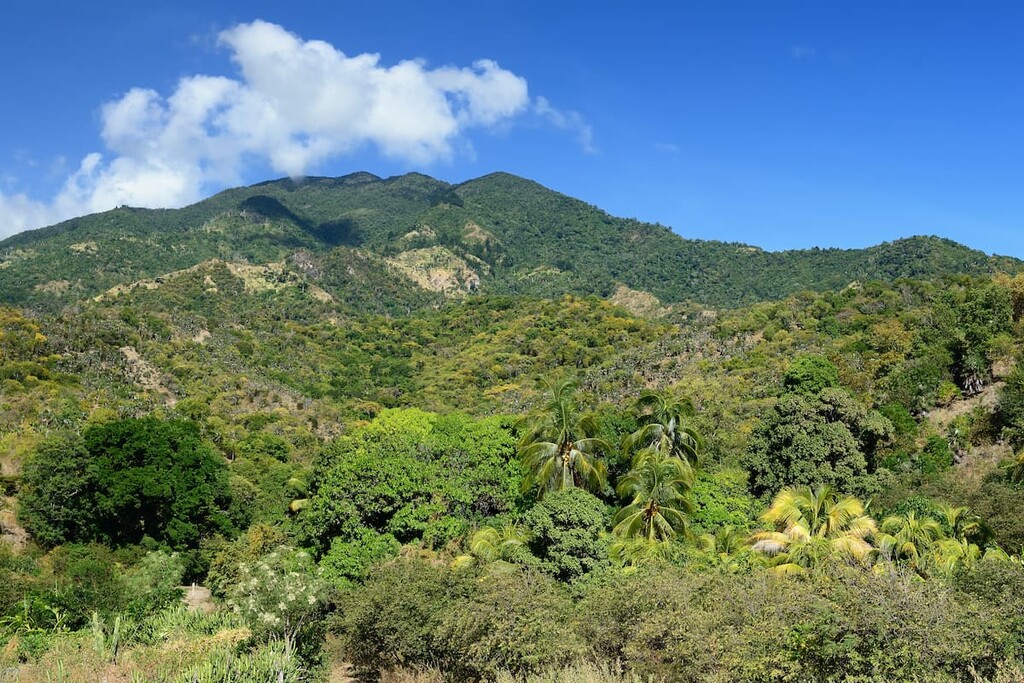
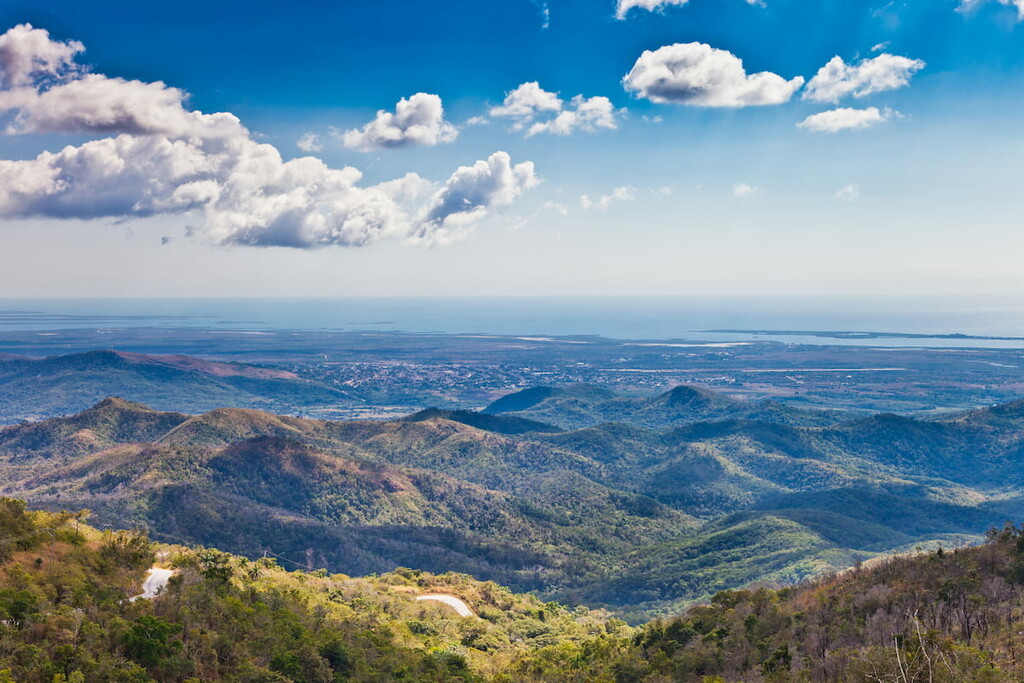
Sometimes referred to as Cuba’s adventure capital, Eastern Cuba is a stunning region that boasts everything from tall mountains to fantastic beaches. This region contains the provinces of Las Tunas, Granma, Holguín, Santiago de Cuba, and Guantánamo.
While not as well-visited by tourists as some of the other areas of Cuba, the eastern part of the island provides endless opportunities for outdoor adventure. In addition to its status as the home of Cuba’s highest peak, the eastern part of the island also contains both rugged pine forests and sandy, secluded beaches.
There are also plenty of parks and reserves in Eastern Cuba, including:
Geologically, Cuba is a complex and interesting place.
The island is a part of a Caribbean archipelago known as the Greater Antilles and it is mostly part of the North American plate. However, it is located close to the boundary between the North American plate and the Caribbean plate in an area known as the Caribbean Transform Fault System.
As a result, the island of Cuba (as well as its surrounding islands) contain aspects of both the North American plate and the Caribbean plate. It also contains large terranes that acreted to the North American plate at various times in the region’s geologic history.
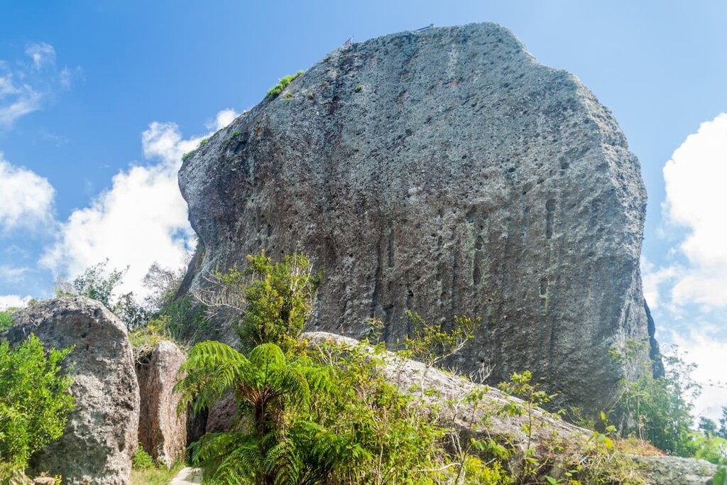
Rock types throughout Cuba vary, though there are some outcroppings of limestones, shales, cherts. The island is also home to some nearly 1 billion year old metamorphic rocks, particularly in the Villa Clara province.
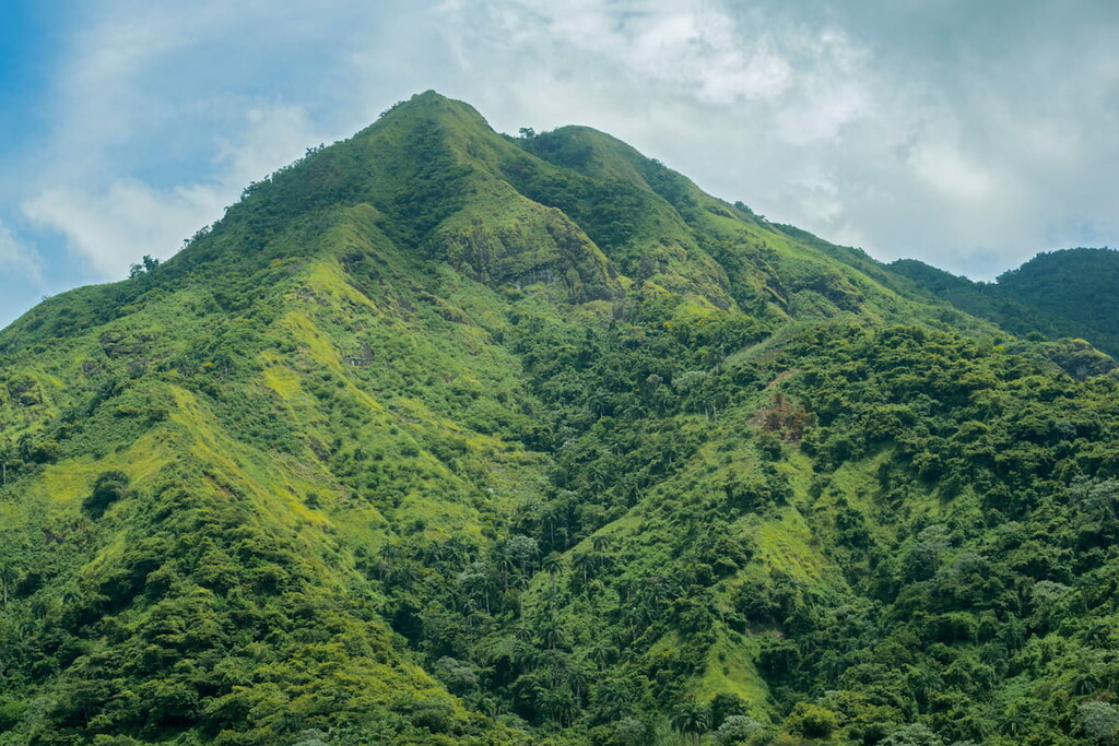
Within Cuba, there are a number of small mountain ranges, including the Sierra Maestra, the Sierra del Rosario, the Sierra Nacimiento, and the Sierra del Escambray.
Furthermore, the country also contains sizable deposits of natural resources, such as petroleum, silica, cobalt, iron ore, nickel, and copper, with nickel being one of Cuba’s most important exports. In fact, Cuba is believed to have one of the largest nickel deposits in the world after Russia.
Major peaks in Cuba include Pico Turquino, Pico La Bayamesa, Pico Máximo Gómez, Pico San Juan, Gran Piedra, and Pico Cristal.
As Cuba is one of the largest islands in the world, it comes as no surprise that it is home to a superb array of ecoregions.
The natural ecoregions of Cuba vary widely and they include everything from swamps and wetlands to dry forests and low-lying plains.
As far as wildlife goes, Cuba is the perfect habitat for an abundance of different species. While the majority of land mammals on the island have been hunted to extinction, there are a number of interesting and unique species found in Cuba.
Some of the most notable include the zunzuncito or “bee hummingbird” (Mellisuga helenae), which is believed to be the smallest living bird with an average weight of around 2.6 g (0.092 oz).
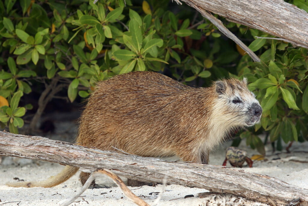
Other notable animal species on the island include the jutía (hutia), which is a massive rodent in the Capromyidae family. The island is also home to the Monte Iberia dwarf frog (Eleutherodactylus iberia), which is believed to be the smallest living frog in the world, with an average length of just 10 mm (0.4 in).
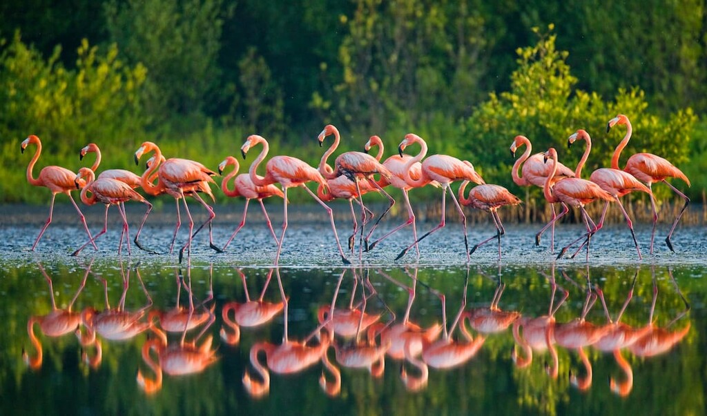
The country’s marine life is also particularly abundant, which helps compensate for its relative lack of land mammals. For example, the waters around Cuba are home to manatees, whale sharks, and multiple turtle species. The island is also home to the Cuban crocodile (Crocodylus rhombifer), which is critically endangered.
However, Cuba has also experienced widespread land degradation that has threatened the natural habitats of many of its species. Deforestation is a pervasive issue throughout the Caribbean and Cuba is no exception.
That being said, the country’s natural environment commission (Comarna) is working to help restore some of the island’s wonderful natural ecosystems in a way that also provides Cubans with economic opportunities.
Like many other islands in the Caribbean, Cuba is believed to have first been settled by humans some 5,000 years ago.
The first people to have arrived in what is now Cuba were likely the Taíno, who probably traveled to the island from the Amazon Basin in what is now Venezuela and Guyana. Another group, the Guanahatabey, also lived in the western part of Cuba at the time of European contact. They, too, likely came from the northern part of South America, though it is possible that they came from the area that is now Belize or Honduras.
Although the island that is now called Cuba had already been inhabited for thousands of years, the first peoples of European descent to arrive on the island were members of Christopher Columbus’ 1492 sailing aboard La Pinta, La Niña, and Santa María. They landed on the island near what is now the Holguín Province and claimed the island for Spain.
The Spanish did not establish their first settlement on the island until about 1511, when Diego Velázquez de Cuéllar founded a settlement at Baracoa. This was later followed by settlements at what is now Havana (La Habana).
During the time of Spanish colonization, the Taíno people were forced into encomienda, which is a type of labor system that was effectively a hybrid of the feudal system and slavery. As a result of this system, introduced diseases, and violence, the vast majority of the Taíno population died within just a century or two of Spanish colonization.
Throughout the next few centuries of Spanish colonization on the island, Cuba developed a fairly diversified agricultural economy. This economy relied heavily on slavery and contributed substntially to the growth of the Transatlantic slave trade.
In the aftermath of the Seven Years’ War and the signing of the Treaty of Paris in 1763, the Spanish gave the United Kingdom control over their territory in what is now Florida. In exchange, Britain returned control over Cuba to the Spanish as Britain had captured control of the island during the war.
By the early nineteenth century, neighboring Haiti had gained its independence from France through the world’s first-ever successful slave revolt. While Cuba had a much smaller population of enslaved peoples in proportion to its population of non-enslaved peoples, the island still had more than 200,000 enslaved black people.
Despite a number of unsuccessful slave rebellions and the increasing number of countries in South America and Central America that had declared their independence, Cuba remained loyal to Spain throughout the early 1800s.
However, Cuba did gain its independence from Spain after a nearly 3 year-long war of independence. Toward the end of the Cuban War of Independence, the fighting developed into the Spanish-American War.
This then led to the occupation of Cuba by the United States and, eventually, the establishment of the first Republic of Cuba (now known as the Neocolonial Republic/República Neocolonial or Free Cuba/Cuba Libre, depending on who you ask) in 1902.
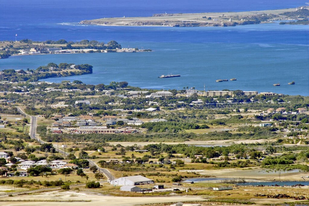
Cuba gained its independence in 1902. However, Cuba’s constitution retained the right for the US to intervene in Cuban affairs. Furthermore, the United States’ Platt Amendment allowed for the leasing of Guantánamo Bay from Cuba to the United States as a naval base.
By the 1930s, a revolution was well underway in Cuba. This led to the drafting of a new constitution, which was adopted in 1940.
The 1940s and 1950s were a particularly tumultuous time in Cuba as a result of political instability and rising unemployment.
By 1959, Fidel Castro and his revolutionary 26th of July Movement had gained control of the Cuban government after ousting President Fulgencio Batista. Over time, this resulted in worsening relationships with the United States, though it also allowed for improved relations with the Soviet Union and, later, the People’s Republic of China.
While Fidel Castro retired from his role as Cuba's head of state in 2011, passing the reins of his party to his brother, Raúl Castro, the Communist Party of Cuba remains the leading political party in the country to this day.
These days, Cuba’s economy somewhat varied with agricultural exports and natural resource exports making up a sizable portion of its economy. Manufactured items, such as Cuban cigars, and natural resources, such as nickel, are particularly important to the economy. Furthermore, Cuba has a fairly large medical tourism industry, due to its generally well-regarded healthcare system.
Although there has been some controversy surrounding aspects of Cuba’s tourism industry over the last few decades due to various restrictions about where tourism was allowed, the country currently has a strong and growing tourism industry.
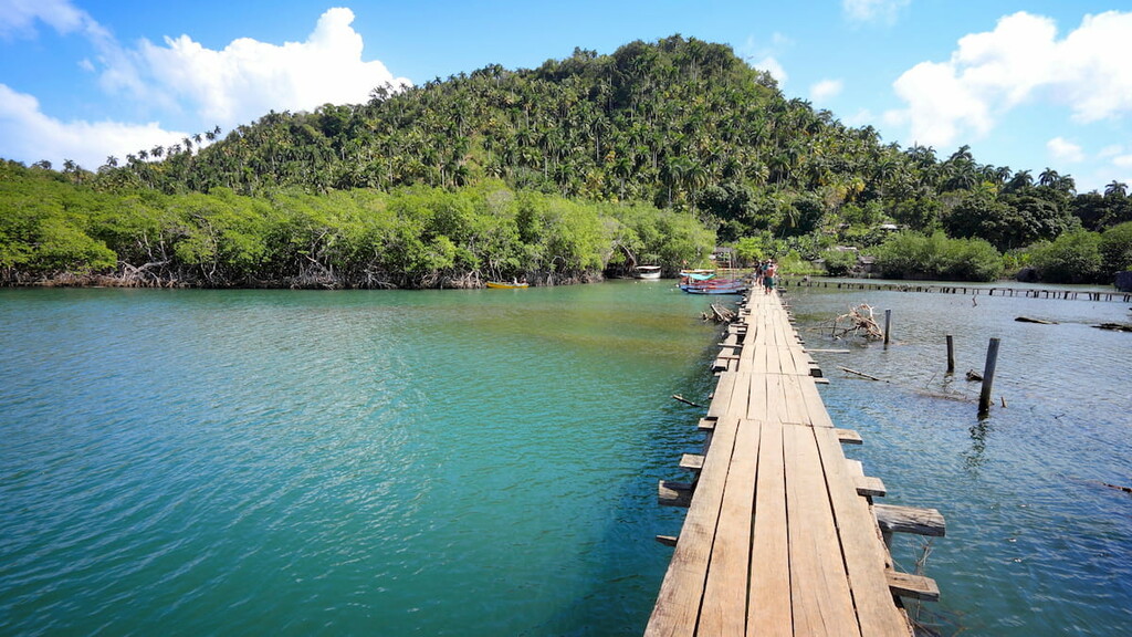
In particular, the country draws a lot of tourists from Canada and the European Union. It is also believed that Cuba has great potential for a strong outdoor recreation-based tourism industry, thanks to its fantastic hiking, climbing, biking, diving, and caving opportunities.
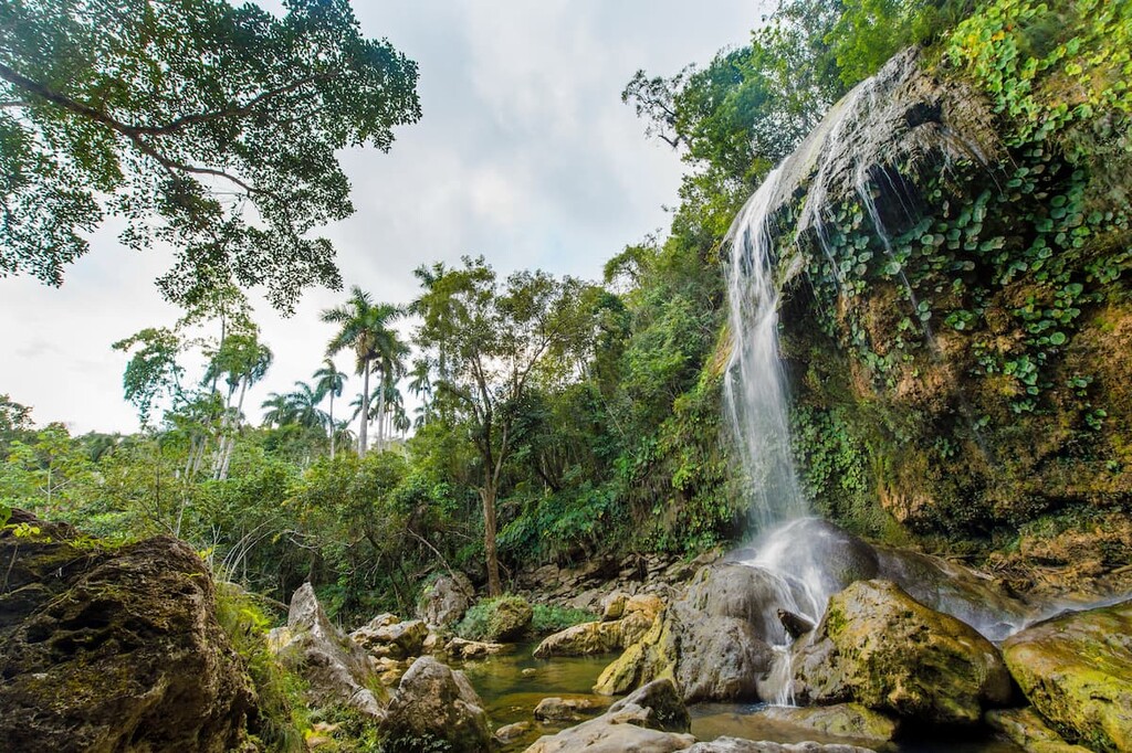
Cuba is home to a spectacular assortment of parks and outdoor recreation areas. Here are some of the best places to visit if you’re planning a trip to Cuba:
Located in the easternmost region of Cuba, Alejandro de Humboldt National Park (Parque nacional Alejandro de Humboldt) is one of the country’s most important areas for biodiversity. The park contains 7 named mountains, the highest and most prominent of which is Pico El Toldo.
Sometimes called the Alexander von Humboldt National Park, this park is well-noted for its exceptional collection of flora and fauna. Interestingly, much of the soil in the park is underlain by rocks that contain toxic compounds. As a result, many of the plants in the region have developed their own adaptations in order to survive in this often inhospitable landscape.
There are a number of hiking trails within the park that make for excellent day trips if you’re in the area. However, due to the remoteness of parts of the park, many travelers hire local guide services during their visit.
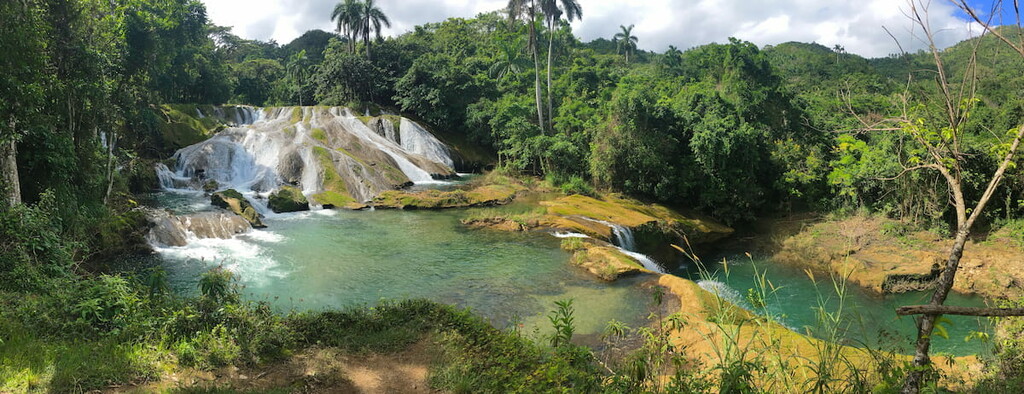
Caguanes National Park (Parque nacional Caguanes) is located in the north-central part of Cuba. It is a mostly low-lying area that’s situated around the Caguanes Peninsula and its associated keys (the Cayos de Piedra).
Here, you can find a number of stunning caves and beautiful geologic formations, as well as some gorgeous mangroves. Additionally, there are a number of archaeological sites here, which are well worth visiting if you’re in the region.
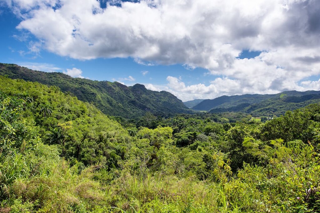
Encompassing a large stretch of the southeastern coast of Cuba, Turquino National Park (Parque nacional Turquino) is a federally-protected area that’s noted for its mountainous terrain. The park contains 28 named mountains, the highest and most prominent of which is Pico Turquino.
Turquino National Park is situated around the Sierra Maestra range near Guamá. It is home to some beautiful examples of Cuba’s moist forest ecoregions as well as some of its pine forests.
As one of the most mountainous places in the country, and the home of Cuba’s highest mountain, Turquino National Park is a must-visit.
Looking for a place to stay in Cuba? Here are some of the best cities to check out on the island:
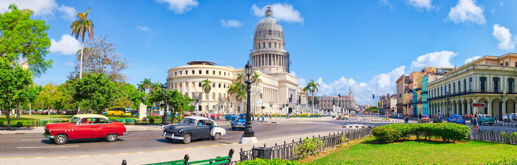
The capital and largest city in Cuba, Havana (La Habana) is home to about 2.1 million people who live in the northwestern part of the country. Havana is one of the oldest European-established cities on the island and it is well-known for its unique architecture.
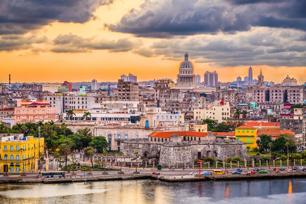
It is often characterized as three cities in one as Vedado (the business district), Old Havana (the historic district) and the city’s suburbs all have distinct feels and aesthetics.
Havana is also a tourist and transport hub for Cuba. The city is home to the country’s largest airport and it is well-connected by a network of rail lines and roads that crisscross the country.
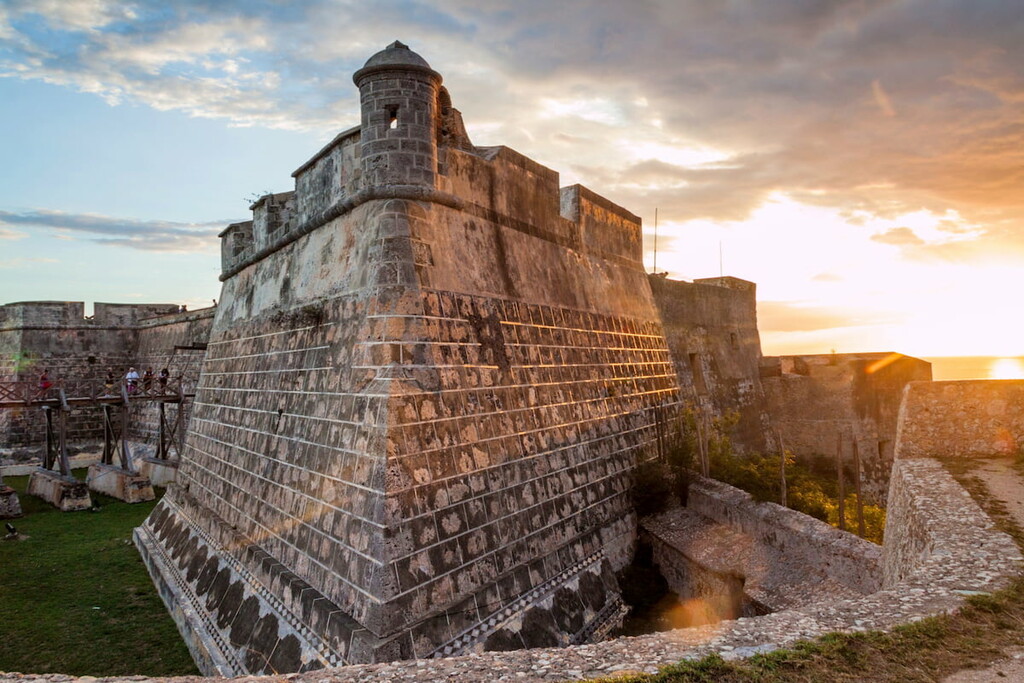
Cuba’s second-largest city, Santiago de Cuba is located on the southeastern shores of the island. It is home to about 500,000 residents and it is an important player in Cuba’s economy thanks to its major sea port on the Caribbean Sea.
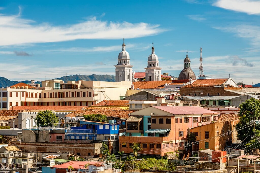
While Santiago de Cuba doesn’t get as much tourism as Havana, it is home to a great collection of historic sites that are worth checking out. In fact, it is one of the oldest European-established cities in Cuba and it contains a UNESCO World Heritage Site that preserves some of the finest remaining examples of Spanish-Ameircan military architectural design.
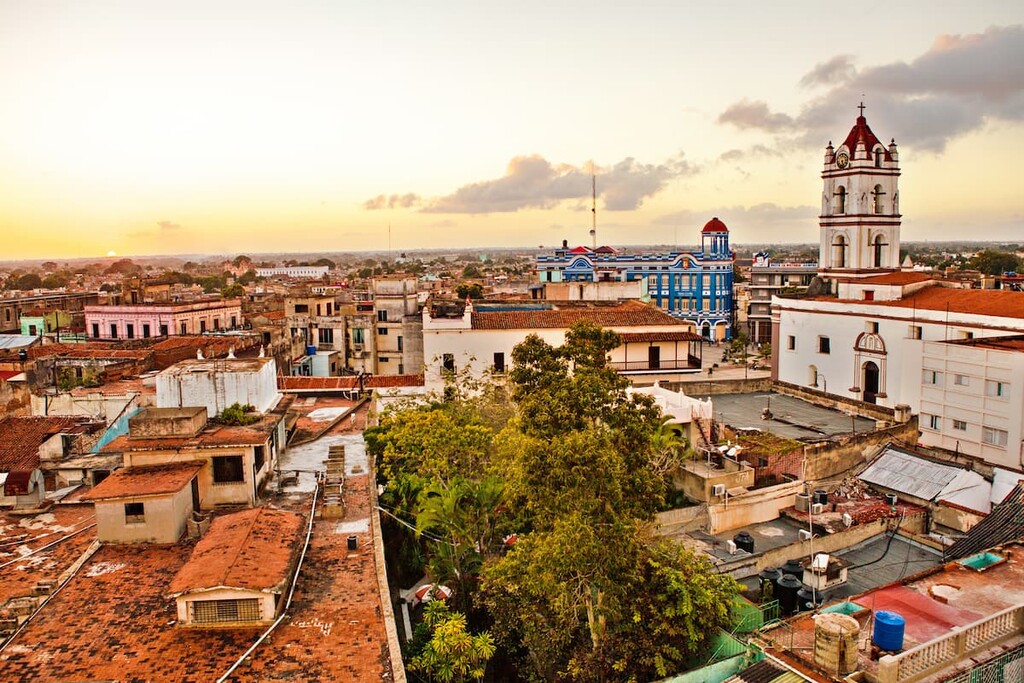
Located in central Cuba, the city of Camagüey is home to about 320,000 people, which makes it the third-most populous urban area on the island. Camagüey is located along the rail line/highway between Havana and Santiago, and it has its own international airport so it’s easy to get to by road, train, and air.
Additionally, Camagüey’s city center is a designed UNESCO World Heritage Site, which makes it a superb destination for the history buffs among us.
While Guantánamo might be better known for its association with the infamous US naval base, Guantánamo Bay, the city of Guantánamo is located just outside the base on the eastern shore of the island.
The city of Guantánamo is home to about 200,000 residents and it is the hub for a highly agricultural area. Some of the many crops grown in the region include coffee, sugar cane, and cocoa.