Scan the QR code and open PeakVisor on your phone
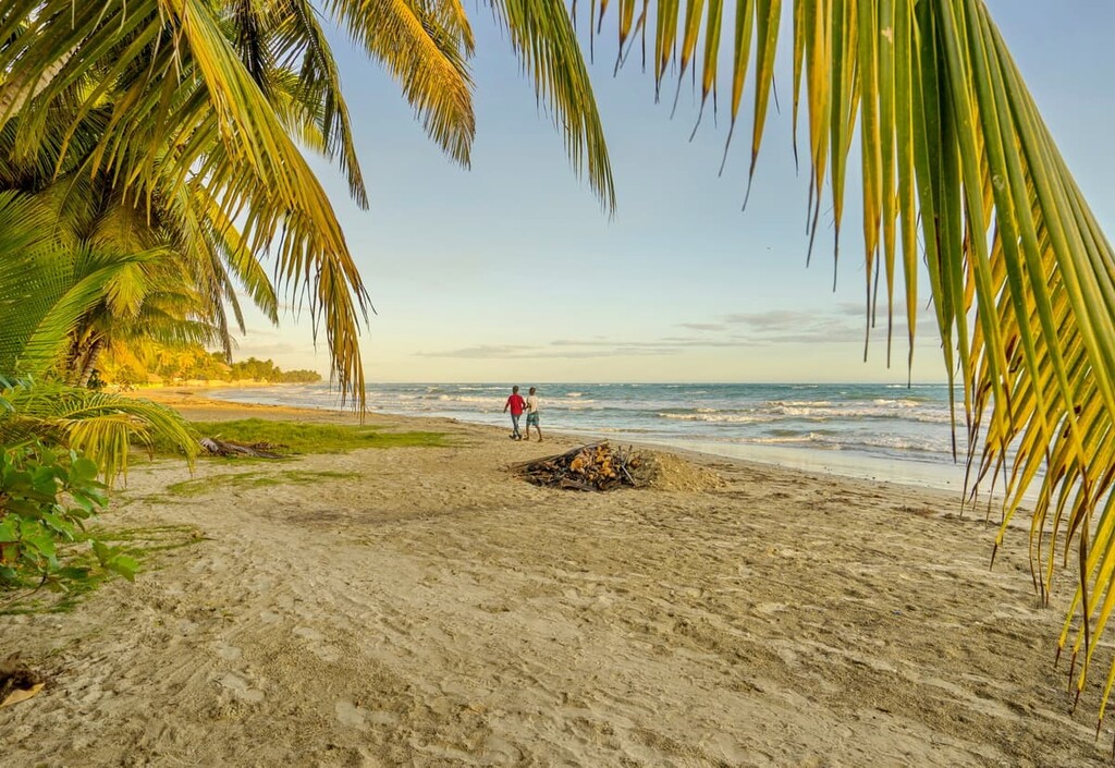
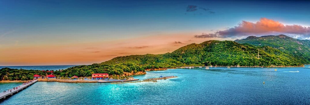
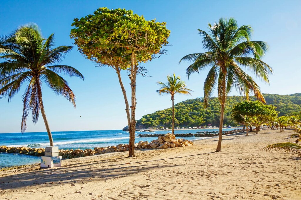
Boasting a spectacular mix of beautiful beaches, rugged mountains, and fantastic cuisine, Haiti is a country situated on the western portion of the island of Hispaniola in the Caribbean Sea. It contains 922 named mountains, the highest and most prominent of which is Pic la Selle (2,680m/8,793ft).
The country of Haiti (officially the Republic of Haiti/République d’Haïti/Repiblik d Ayiti) is a small country located in the western part of the island of Hispaniola in the Greater Antilles of the Caribbean Sea.
With a total land area of 27,750 square kilometers (10,710 square miles), Haiti is the 143rd largest country in the world and it is approximately the same size as the US state of Maryland.
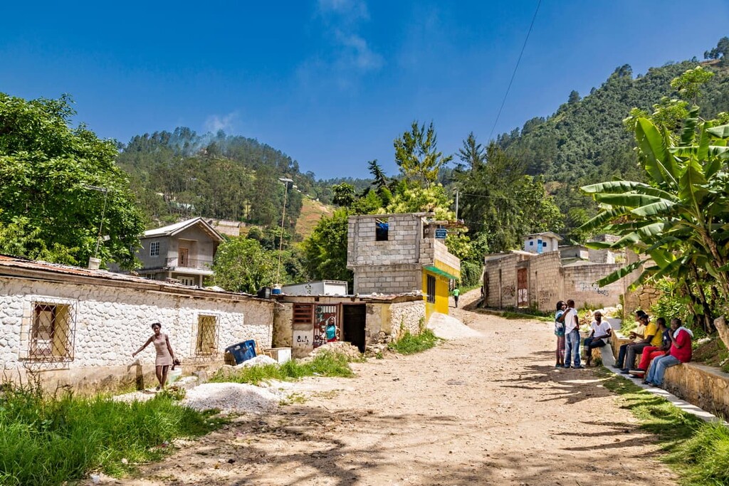
However, while it is fairly small in terms of land area, Haiti is home to about 11.5 million people, which more or less ties it with Cuba for the honor of being the most populous country in the Caribbean. As a result of its large population, Haiti is also among the top 40 most densely populated countries on Earth.
Geographically, Haiti is located on the western portion of the island of Hispaniola, which it shares with the Dominican Republic (República Dominicana). Haiti encompasses approximately the western three-eighths of the island as well as some of its minor outlying islands. But, the control of Navassa Island (l'île de la Navasse/La Navasse) is the subject of some dispute between Haiti and the United States.
Due to its status as an island nation, Haiti does not have many land borders, with the exception of its shared border with the Dominican Republic. However, it is surrounded by other Caribbean island nations, including Jamaica, Cuba and the Cayman Islands to the west as well as the Bahamas and Turks and Caicos to the north. Furthermore, the country is located across the Caribbean Sea from Venezuela, Colombia, and both Aruba and Curaçao of the Netherlands.
Haiti is officially divided up into 10 departments (départements d’Haïti) that are then subdivided into a total of 42 arrondissements as well as 144 communes and 571 communal sections (sections communales).
From a geographical perspective, the country can also be informally divided into three main geographic regions and one insular (island) region.
As the name suggests, Haiti’s northern region encompasses the majority of the northern part of the country. This includes the departments of Nord-Ouest, Nord, Nord-Est, and part of the Artibonite department.
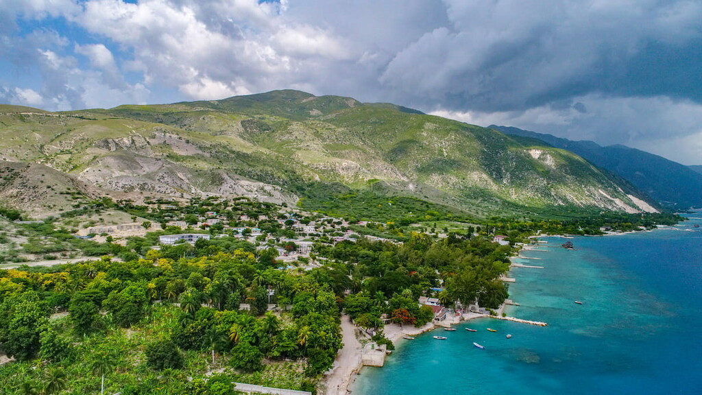
The northern region of Haiti is home to the mountains of the Massif du Nord as well as the relatively low-lying area of the Plaine du Nord. It is home to a number of sizable cities including Cap-Haïtien and Port-de-Paix.
This area was once one of the major exporters of bananas, sugar, and coffee in Haiti, though it is now less agricultural. However, it does have two important federally protected areas: Three Bays Natural Resource Protection Area (Aire protégée de ressources naturelles gérées de Trois Baies) and Citadelle - Sans-Souci Ramiers National Historic Park (Parc National Historique Citadelle - Sans-Souci Ramiers).
Haiti’s central region includes the bulk of the country located in between its two main peninsulas to the north and the south. This includes the majority of the Artibonite department as well as the Centre and Ouest departments.
This region is mostly dominated by the Central Plateau, though it also boasts the Montagnes Noires to the southwest.
Furthermore, this region is home to the plain of the Artibonite River (le fleuve Artibonite/Río Artibonito/Latibonit). The Plaine de l’Artibonite is one of the most important agricultural areas in the country as the rest of Haiti is quite mountainous.
As a result, much of the land in the region is either privately owned or used for agriculture.
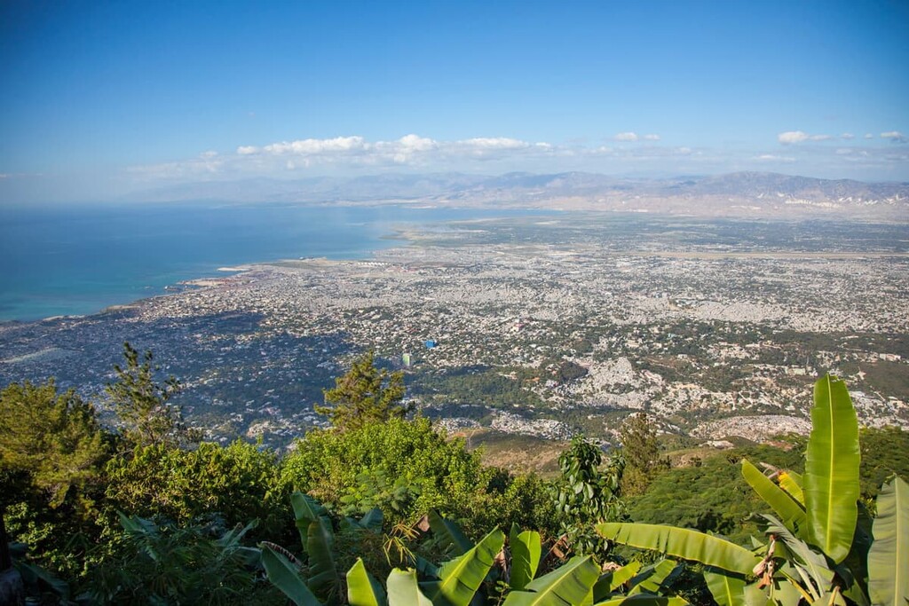
The southern region of Haiti includes all or most of the departments of Grand’Anse, Nippes, Sud, Sud-Est, and Ouest. It is also home to Haiti’s capital, Port-au-Prince (Pòtoprens), which is also its largest city.
This region is home to both the Plaine du Cul-de-Sac to the southeast, which is another major agricultural region of Haiti. The Plaine du Cul-de-Sac has been an important farming area for both indigo and sugar cane for many years.
Additionally, much of Haiti’s southern region is located on the Tiburon Peninsula (Péninsule de Tiburon/Penensil Tibiwon). This peninsula is home to the Massif de la Hotte, which is a remote and biologically diverse mountain range. In fact, this range is home to some of the last remaining cloud forest in the country.
There are a number of parks in southern Haiti, including:
The final region of Haiti is the country’s minor outlying islands.
The country claims a number of islands both in the north Atlantic and in the Caribbean, such as Gonâve Island (Île de la Gonâve/Lagonav), the Cayemites (les Cayemites/Kayimit), Tortuga (Île de la Tortue/Latòti), Grosse Caye (Gwòskay), and Navassa Island (L'île de la Navasse/La Navasse), though the later is also claimed by the United States.
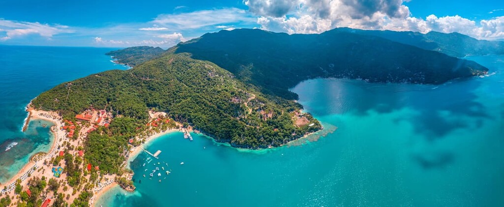
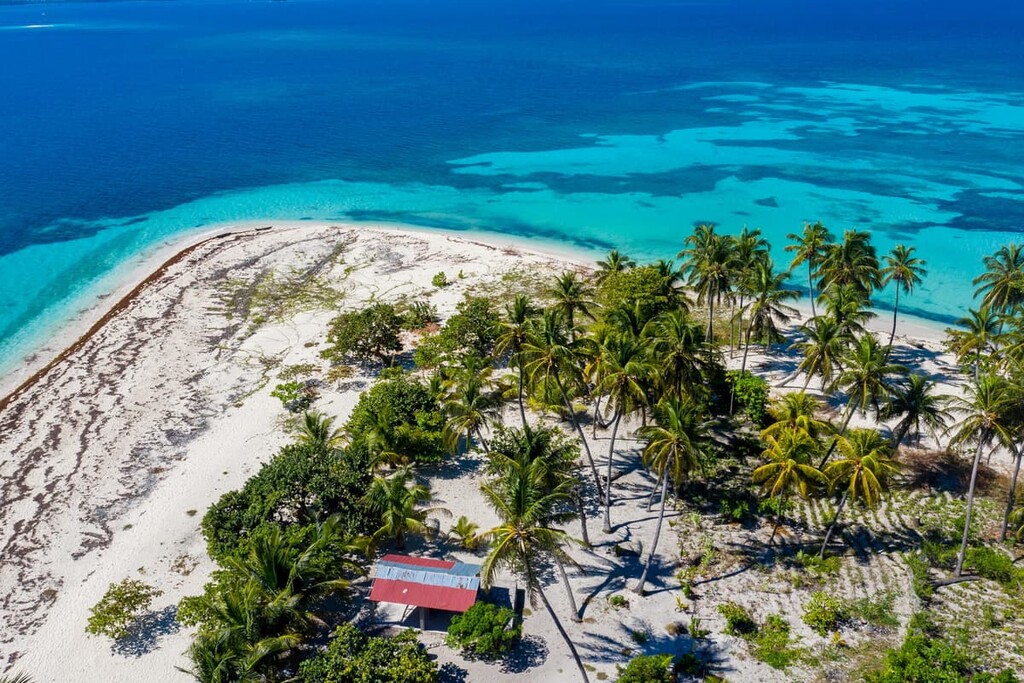
One of Haiti’s most popular islands for tourists is Île-à-Vache (Isla Vaca/Lilavach), which is located off of the country’s southern coast. Île-à-Vache is now home to quite a few popular hotels and beaches, which make it a frequent destination among tourists to the country.
Due to the fact that Haiti is located on the island of Hispaniola in the Caribbean, the geology of the country is inextricably linked to the formation of both the island itself and the greater Caribbean Sea.
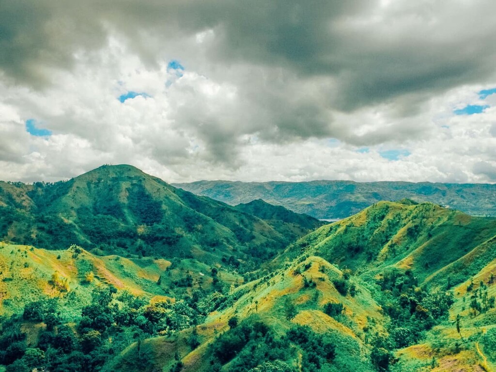
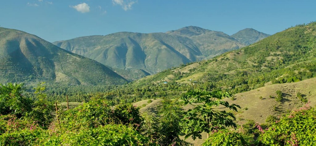
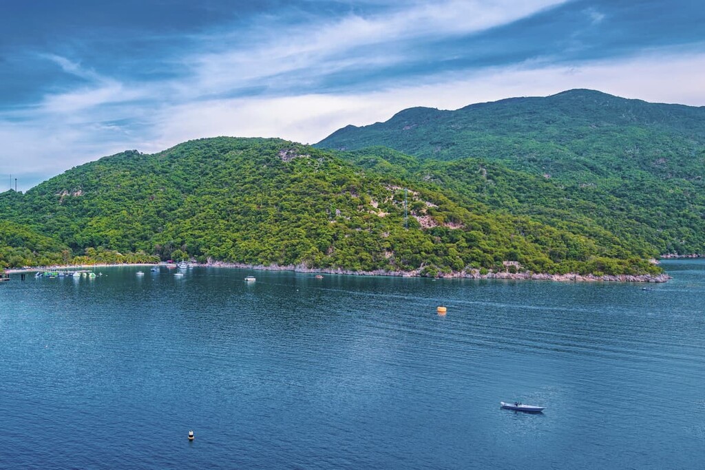
Hispaniola is a highly mountainous island, especially when compared to some of the other islands in the Caribbean, such as Barbados, Anguila (United Kingdom), and Saint Vincent and the Grenadines, which have relatively small hills. In particular, Haiti is home to four principal mountain ranges—Chaîne de la Selle, Chaîne des Matheux, Massif de la Hotte, Massif du Nord, Montagnes Noires—and the lofty Plateau Central.
The predominant rock type in the country is sedimentary, with limestone outcroppings being quite common. Haiti isn’t particularly rich in mineral natural resources, though there are small reserves of gold, tin, silver, sulphur, bauxite, gypsum, iron, salt, tungsten, manganese, antimony, nickel, and lignite in the country.
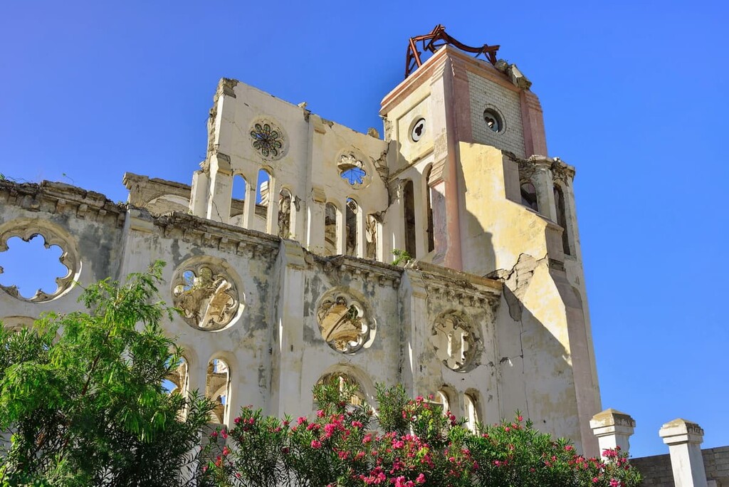
Furthermore, Haiti is known to be located in an area of relatively high seismic activity. A fault line actually runs across the Tiburon Peninsula in the south of the country near Port-au-Prince (Pòtoprens). Seismic activity within this area was responsible for the massively destructive earthquake that hit Haiti in 2010, which is believed to have killed at least 250,000 people.
Major peaks in Haiti include Pic la Selle, Pic Macaya, Morne La Visite, La Grande Colline, Station Bonhomme, Morne Eloi, and Morne Tonnerre.
The ecology of Haiti is somewhat difficult to categorize due to the widespread deforestation that has taken place in the country since the time of European colonization.
Estimates vary from source to source, but it is believed that Haiti has anywhere from less than 1% to about 5% of its initial forest cover remaining. Deforestation in the region has increased significantly since the early part of the twentieth century when it was estimated that the country still had about 60% of its original forest cover.
Before the time of European colonization, Hispaniola was home to more than 6,000 different plant species, many of which were endemic. Furthermore, the island was once home to extensive cloud forests that existed high up in its mountain ranges.
These days, Haiti’s remaining forests are almost exclusively cloud forests that exist in the La Hotte Biosphere Reserve (Réserve de biosphère de la Hotte) and in Pic Macaya National Park (Pac nacional Macaya). This area is home, not only to Pic Macaya (the country’s second-highest mountain), but to some of the last remaining mangroves, coastal ecosystems, and cloud forests in Haiti.
The area that is now part of the country of Haiti has been inhabited by humans for thousands of years. It is believed that the first humans came to Haiti by boat from what is now Venezuela.
In particular, the first peoples to have lived in what is now Haiti were likely Taíno and that they may have come from the Amazon Basin before travelling throughout the Caribbean Sea.
Although humans had been living on the island that is now known as Hispainola for thousands of years, Christopher Colombus (sailing for Spain) is likely the first person of European descent to have arrived in the area.
Columbus landed at what is now Haiti in 1492 and he directed a few dozen of his sailors to establish a settlement called La Navidad, though that settlement was short-lived.
Not long after the arrival of Europeans, smallpox became rampant on the island. These introduced diseases, coupled with violence from the Eruopeans quickly led to the decimation of the Taíno people.
Nevertheless, the Spanish Empire soon shifted its focus more on its new colonies in South America, Central America, and Mexico, so it left Hispaniola to become more of a trading post than a major colony. As a result, French buccaneers began to settle the western half of the island, which was then officially considered French territory after the signing Treaty of Ryswick in 1698.
From the mid-seventeenth century to the early nineteenth century, the western third of Hispaniola, which was called Saint-Domingue, was a French colony. The colony was predominantly agricultural as the French established many coffee and sugar plantations. These plantations relied extensively on slave labor, which made the region a center for the Transatlantic slave trade.
In fact, by the nineteenth century, the French settlers were well outnumbered by slaves. Conditions were particularly brutal for slaves on the island, both in terms of horrendous living conditions, over-work, and introduced diseases.
By the end of the eighteenth-century, the region was well on its way to a revolution. In fact, the Haitian Revolution that took place during this time and led to Haitian Independence remains the only successful slave revolt in recorded history.
After Haiti declared its independence, Jean-Jacques Dessalines declared himself Emperor of Haiti as Jacques I. His rule as an emperor was short-lived as he died soon thereafter.
Around this same time, large numbers of people from Haiti also emigrated from the country to other neighboring locations. However, the most popular destination for immigrants from Haiti was easily New Orleans in the US state of Louisiana.
After Dessalines’ death, Henri Christophe declared himself to be King Henri I of Haiti. His rule was also relatively short-lived as he committed suicide in 1820 out of fear of a coup.
This then led to a period of unification on Hispaniola where the entire island was united under one flag, though the Dominicans generally considered this to be an invasion. Unification of the island lasted just over 20 years until the Dominican Republic declared its independence in 1844.
After the partition of the island, Haiti experienced a period of great political instability that lasted throughout the eighteenth century.
This eventually led to the occupation of Haiti by the United States and the declaration of martial law on the island by the US Marine Corps. During this occupation, the United States created a new constitution for Haiti and installed a new president.
The US left Haiti in 1934 and the proceeding years were marred by violence and political instability. Throughout the twentieth century, Haiti experienced some economic growth, yet political turmoil continued.
In 1991, the Haitian military led a coup d’état to overthrow President Jean-Bertrand Aristide. Then, in 1994, the United States sent military personnel back to the country.
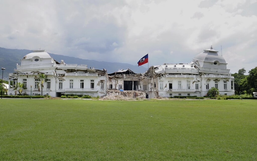
The end of the twentieth century was also politically tumultuous in Haiti, a situation that was only made worse by a number of major natural disasters. In addition to Tropical Storm Jeanne in 2004 and a record-breaking hurricane season in 2008, Haiti experienced a massive magnitude 7.0 earthquake in 2010 that killed hundreds of thousands of people and destroyed countless buildings. This earthquake was then made worse by a subsequent cholera outbreak.
Since then, Haiti has been in the process of rebuilding its economy and its infrastructure. The country still faces many challenges, but the resilience of its people and the beauty of its natural landscape hold promise for the future.
Although it is a heavily populated place, there are still a number of excellent outdoor recreation areas to visit in Haiti. Here are some of the best places to check out during a visit to the country:
Located to the south of Port-au-Prince, La Visite National Park (Parc national La Visite) is a federally-protected area that encompasses the Massif de la Selle. It contains 8 named mountains, the highest and most prominent of which is Morne La Visite.
The park is one of the country’s most visited protected areas due to its proximity to the capital. It offers spectacular opportunities for hiking, birdwatching, and general outdoor adventure, so it’s a nice place to check out if you’re looking to see some of Haiti’s natural ecosystems.
Home to some of the last remaining stands of cloud forests in Haiti, Macaya National Park (Parc national Macaya) is a small protected area located in the southwestern part of the country. It is primarily situated around the summit of Pic Macaya, which is the second-highest peak in Haiti.
Macaya National Park is home to some of the best hiking in the country, even if there aren’t many maintained trails. It is usually possible to hike up to the summit of Pic Macaya, though this can be a logistical challenge.
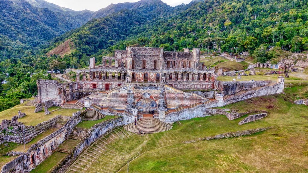
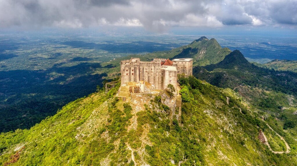
While not technically a major hiking area, Citadelle - Sans-Souci Ramiers is a historic site located in the northern part of Haiti that’s one of the most popular tourist destinations in the country. It is, however, home to 2 main high points, Pic Lafferière and Morne Bellevue.
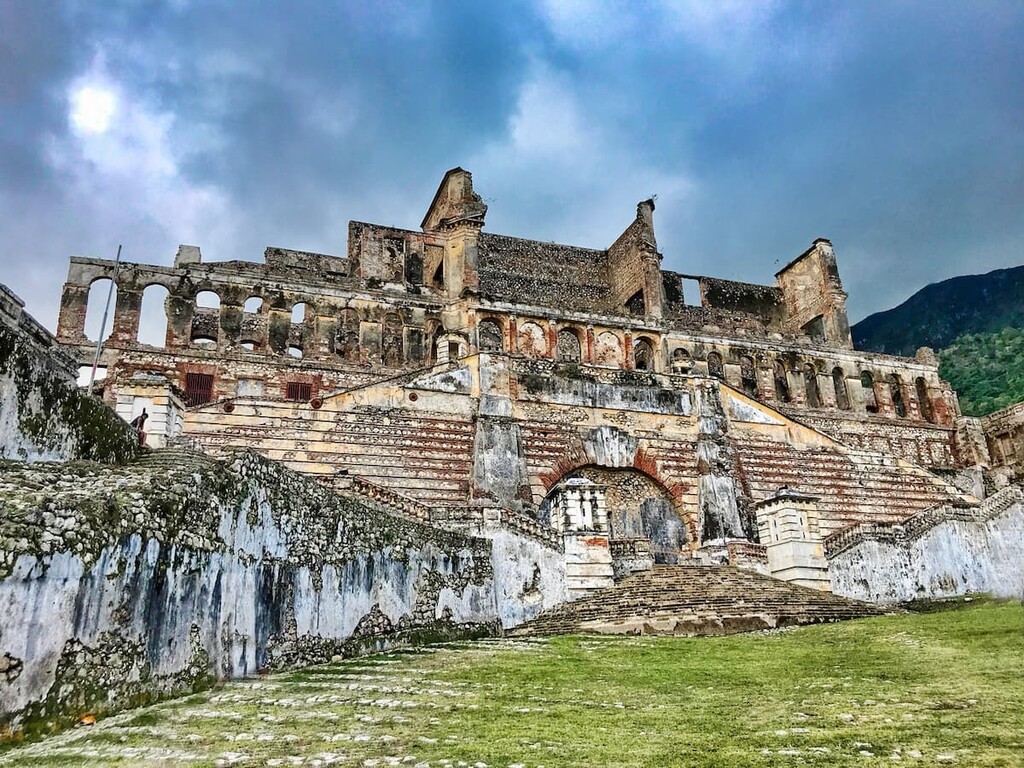
Citadelle - Sans-Souci Ramiers actually contains two important heritage sites—the Palace of Sans-Souci (Palais Sans Souci) and the Citadelle Laferrière. Both sites were constructed under orders from Henri Christophe, who was Haiti’s only king. These days, they are both part of a UNESCO World Heritage Site that seeks to preserve these important cultural artefacts from the years after Haiti’s independence.
Looking for a place to stay in Haiti? Here are some of the largest cities to check out during your trip:
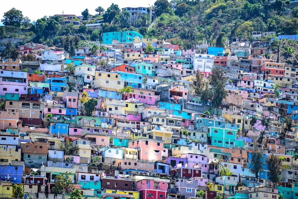
The capital and largest city in Haiti, Port-au-Prince (Pòtoprens) is home to nearly 1 million people who live on the Gulf of Gonâve (Golfe de la Gonâve/Gòf Lagonav). Port-au-Prince is the commercial and cultural center for the country as it has long played a role in exporting many of Haiti’s crops for international trade.
Furthermore, Port-au-Prince is often the first stopping point for tourists to Haiti as it is home to the country’s largest airport. There are also a number of cultural sites and museums to check out in the city, including some interesting examples of early nineteenth-century architecture on the island.
Gonaïves (Gonayiv) is a city of some 300,000 people located in the Artibonite department. It has come to be known as the country’s capital of independence because it was the site of a number of important battles during the Haitian Revolution as well as the site of Jean-Jacques Dessalines’ formal declaration of independence from France.
Gonïaves is home to a number of fantastic monuments and cultural sites that are well worth checking out. It is also one of the largest cities in the northern region, so it’s a great starting point for your travels in the country.
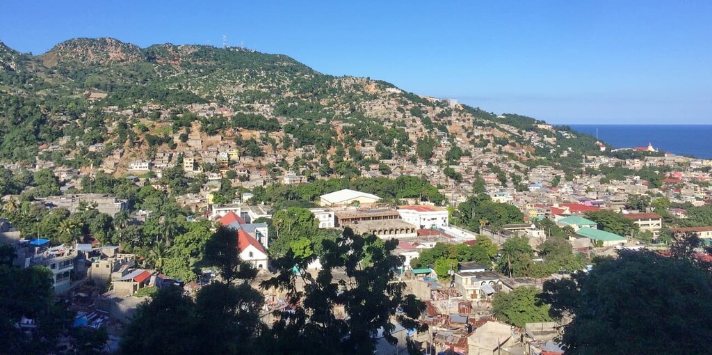
A commune of around 200,000 residents, Cap-Haïtien (Kap Ayisyen) is a medium-sized city located along the northern coast of Haiti. It has long been known as a center for culture in Haiti, thanks to its stunning architecture and vibrant arts scene.
Cap-Haïten is a popular tourist destination within the country. It has a number of beautiful beaches and historic sites. Perhaps the most notable is the Citadelle Henry, which is a UNESCO World Heritage Site that was originally built by the self-proclaimed King Henry Christophe after Haiti declared its independence.
Situated on the southern showers of Haiti, Jacmel is a commune of some 140,000 people that serves as a cultural hub for the southern part of the country. One of Jacmel’s main claims to fame is that it was the first city in the Caribbean to get electricity.
Furthermore, Jacmel is noted for its beautiful colonial architecture, some of which is still well-preserved, despite damage from the 2010 earthquake. The city is a popular place to visit due to its bustling arts scene and beautiful natural landscapes, so it’s worth stopping by if you’re in the area.