Scan the QR code and open PeakVisor on your phone
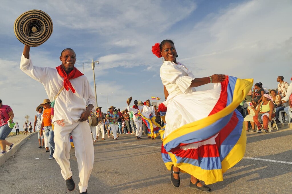
Famous for its fantastic cuisine, rich cultural heritage, and diversity of landscapes, Colombia is an exciting and stunning country located in the northwestern part of South America. Columbia is home to 7,641 named mountains, the highest and most prominent of which is Pico Cristóbal Colón (5,689m/18,655ft).
The country of Colombia (officially the Republic of Colombia/República de Colombia) is located in the northwestern part of South America. With a total land area of 1,141,748 square kilometers (440,831 square miles), Colombia is the 25th largest country on Earth and the fourth largest in South America, after Peru, Argentina, and Brazil.
Colombia is located at an interesting crossroads between South America to the south and Central America to the North. The country shares its land borders with a number of nations, including Ecuador and Peru to the south, Brazil and Venezuela to the east, and Panama to the west.
Furthermore, Colombia shares a maritime border with a handful of other countries, including Ecuador, Venezuela, Panama, Costa Rica, Nicaragua, and Honduras. Interestingly, it is the only country in South America that has both a Caribbean and Pacific coastline.
Colombia is officially divided up into 32 departments (departamentos) and one capital district (Bogotá) that has the same administrative status as the other departments. There are also four other cities (Barranquilla, Santa Marta, Buenaventura, and Cartagena) who have a special municipality status.
That being said, Colombia can also be divided up into six wholly distinct geographic regions based on the natural topography and ecology. While these regions do not have any official function, they are widely recognized throughout the country and they are as follows:
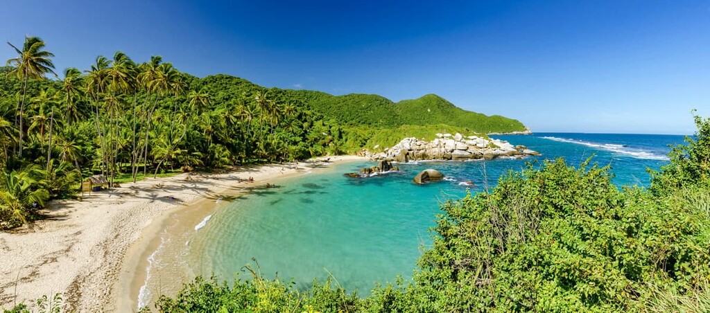
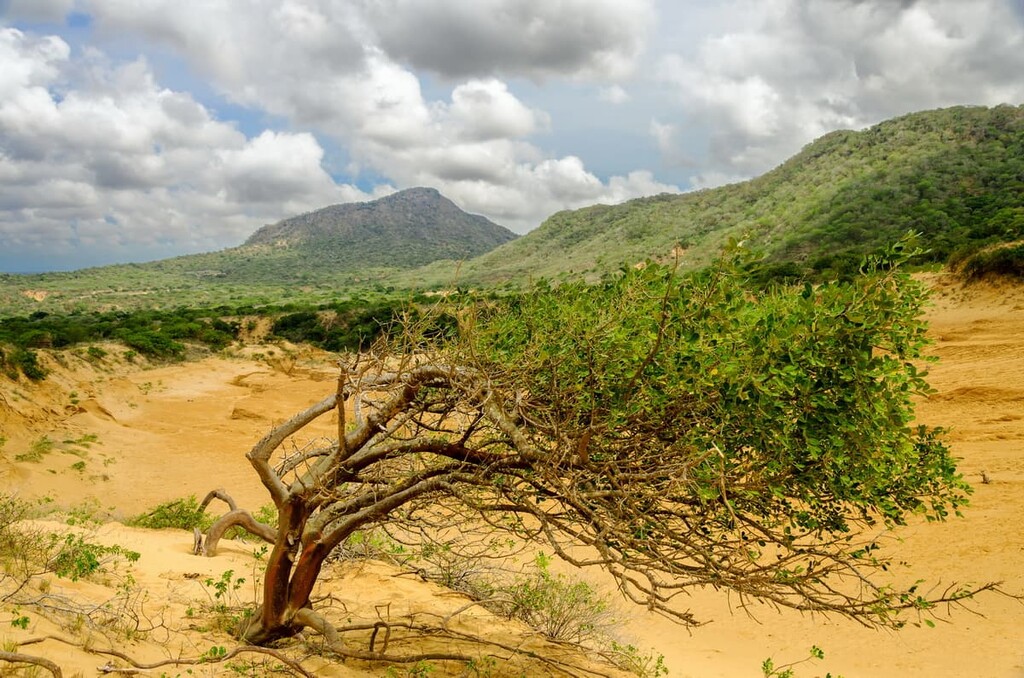
Encompassing the entire northern coast of Colombia along the Caribbean, as well as some of the country’s islands, the Costa del Caribe (Caribbean Coast) includes most or all of Sucre, Atlántico, Bolívar, Cesar, Córdoba, La Guajira, Magdalena, Antioquia, and Chocó departments.
This area includes about 10% of all of Colombia, though it is home to about 20% of the population. Here, the primary economic activities involve agriculture or resource extraction. Tourism is also a big player here as the beaches along the coast and the nearby Sierra Nevada de Santa Marta offer plentiful hiking opportunities.
There are a number of national parks and reserves in the region, including:
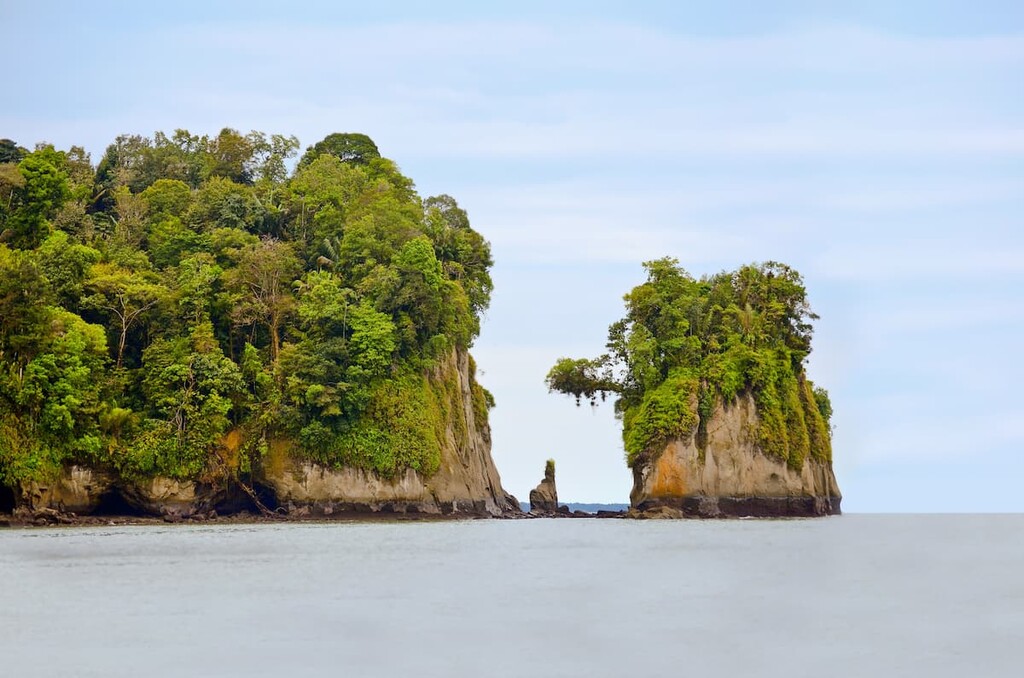
Covering the entire western coast of Colombia, the Costa del Pacífico (Pacific Coast) region contains all or part of Chocó, Valle del Cauca, Cauca, and Nariño departments. This region contains about 7% of the total land area of Colombia, though it has just 1.5 million inhabitants, making it much less populous than the Caribbean coast.
The Pacific Coast region is generally quite humid and it gets a substantial amount of rain. Due to the coastal nature of this region, the primary economic activity is fishing. However, there is also a decent amount of agriculture in the region as well as gold and platinum mining.

This region is relatively flat, however, it is home to a number of beautiful parks, such as:
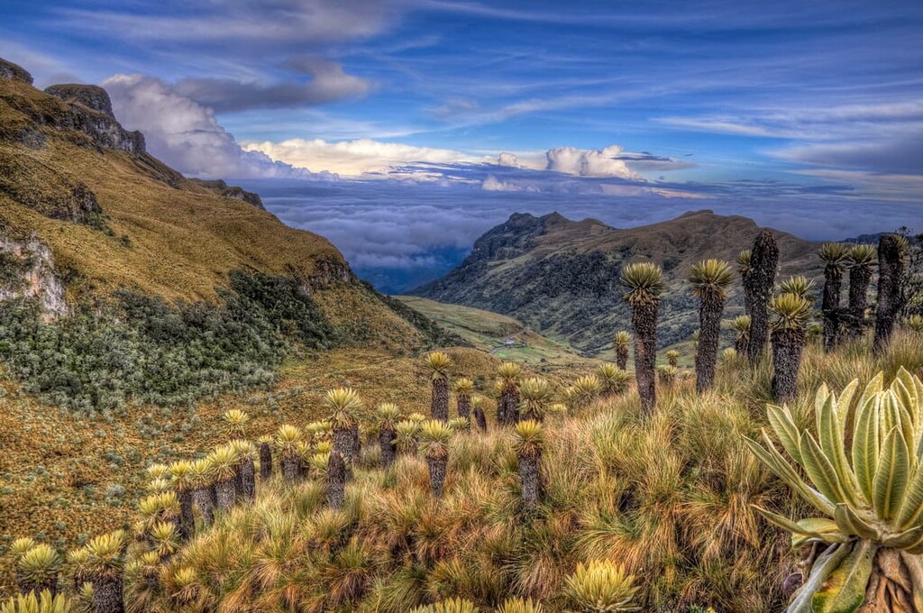
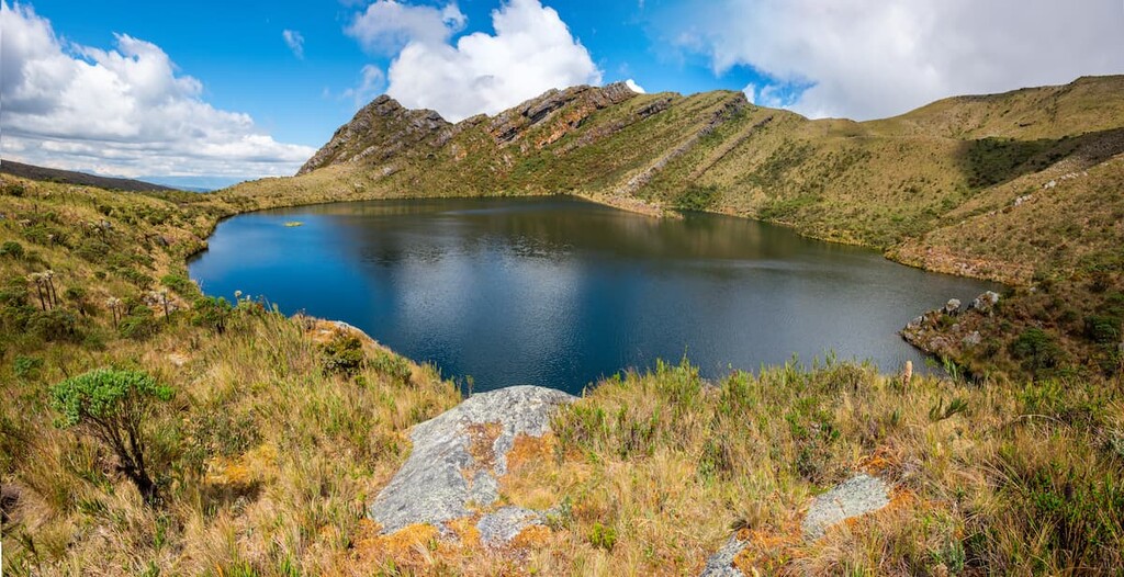
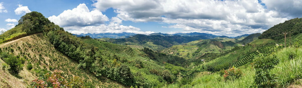
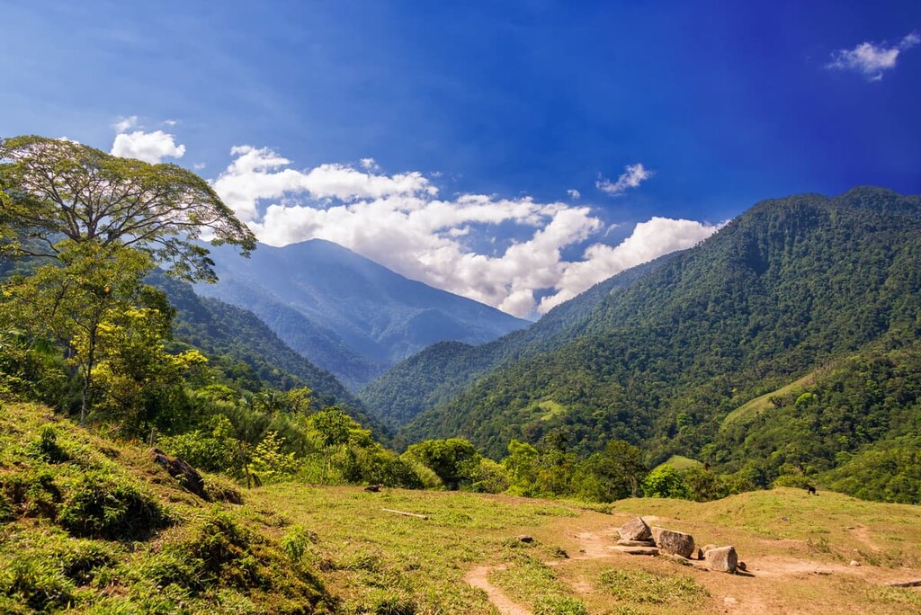
Stretching across the central part of Colombia, the Andes region is both the most mountainous and the most heavily populated part of the country. It includes all or most of many departments, including Antioquia, Boyacá, Caldas, Caquetá, Cauca, Cesar, Chocó, Cundinamarca, Huila, Nariño, Norte de Santander, Putumayo, Quindío, Risaralda, Santander, Tolima, and Valle del Cauca.
The Andes Mountains cover about 25% of Colombia’s total territory and they are home to about 37 million people, or about 75% of the total population. This makes Colombia somewhat unique as its mountainous regions are more heavily populated than its coasts.
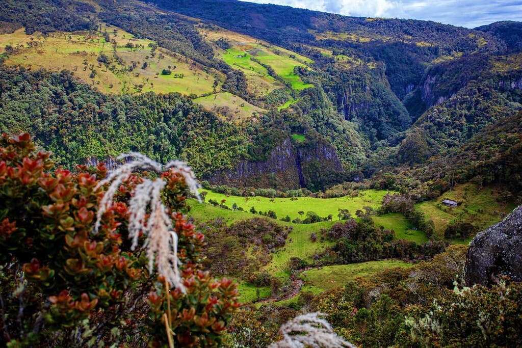
Due to the fact that the Andes are home to Bogotá, the country’s largest city, the region has a varied and growing economy. However, tourism to the Colombian Andes is also a growing industry, thanks to the many parks and outdoor recreation areas in the region.
Some of the many national parks in the region include:
Additionally, the region contains a handful of wildlife areas, such as:
Also known as the Oriental Plains, Orinoquía (Orinoco) is a large, mostly flat region located in northeastern Colombia. It contains all or part of Arauca, Casanare, Meta, and Vichada departments.
This region contains about 18% of Colombia’s total land area, though it is home to only about 1.7 million people. The Orinoquía is a very large and flat plain that exists within the watershed of the Orinoco River.
It is predominantly an agricultural area where cattle ranching is the primary industry. However, Oil extraction is also a dominant economic activity in the area.

While the region is mostly agricultural, there are also a few protected natural areas. These include El Tuparro National Nature Park (Parque nacional natural El Tuparro) and Sierra de La Macarena National Nature Park (Parque nacional natural Sierra de La Macarena).
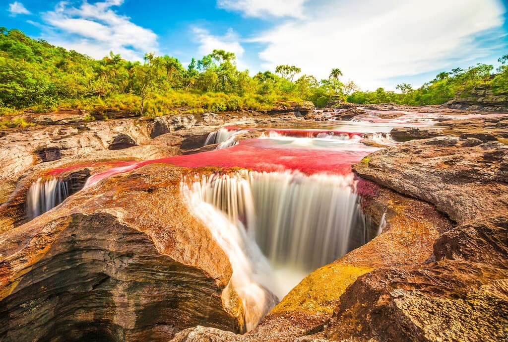
The largest of Colombia’s regions, Amazonía (Amazon) is situated in the southeastern part of the country. It contains Amazonas, Caquetá, Guainía, Guaviare, Meta, Putumayo, Vaupés, and Vichada departments.
Despite being the largest region, Amazonía is also the least populated region on the mainland. In fact, it contains 40% of the total land area but only 270,000 residents.
The region’s low population density is a result of its heavy forest cover. It is part of the massive Amazon Rainforest, which also covers parts of Bolivia, Suriname, Ecuador, Guyana, Peru, Brazil, and Venezuela.
Here, the primary economic activities include timber production, mining, farming, and fishing.
While the landscape isn’t particularly mountainous, much of it is protected within a large number of national parks. These include:
Colombia’s sixth and final region, the Insular (Islands) region includes the majority of the country’s islands. This includes San Andrés y Providencia, Islas del Rosario (Bolívar), Islas de San Bernardo (Bolívar), Isla Gorgona (Cauca), and Isla de Malpelo (Valle del Cauca).
The Insular region is very small and it includes just about 300 square kilometers (116 sq. km) of land. It is home to just about 74,000 residents, the majority of whom live in Saint Andrés on Isla de San Andrés.
Within this region, the main economic driver is tourism, thanks to the islands’ many stunning beaches. There are a number of parks and protected areas on the islands, including:
Colombia is a geologically complex country as it is located at the intersection of a number of tectonic plates. Nevertheless, there are two primary mountain ranges in the country: the Andes and the Sierra Nevada de Santa Marta.
Running the length of Colombia from north to south, the Colombian Andes are just one section of the world’s longest mountain range.
The Andes formed as a result of the subduction of the Nazca Plate under the South American Plate. This subduction allowed for widespread volcanism throughout the range, though the active volcanoes of the Andes are mostly located to the south of Colombia.
Alongside neighboring Venezuela, Colombia’s Andes are the northernmost extent of the range. These peaks form a major natural barrier between the country’s coastline and its interior plains and rainforests.
Major peaks in the Colombian Andes include Ritacuba Blanco, Pico Central, Cerro Tatamá, and Nevado del Ruiz.
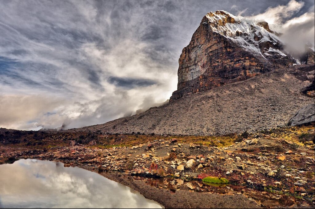
Home to the tallest peak in Colombia, the Sierra Nevada de Santa Marta is an isolated mountain range in the northern part of the country. It is one of the tallest coastal ranges in the world as it is just slightly smaller than the Saint Elias Mountains in the Yukon Territory and the province of British Columbia in Canada and the US state of Alaska.
The Sierra Nevada de Santa Marta are geologically distinct from the Andes. It consists mostly of a central core of igneous rocks that date back about 160 million years and was not built as part of the orogeny that created the Andes. However, due to its proximity to the Andes, it is often considered to be a subrange.
Major peaks in the Sierra Nevada de Santa Marta include Pico Cristóbal Colón, Pico La Reina, Pico Ojeda, Pico Simmonds, and Pico Guardián.
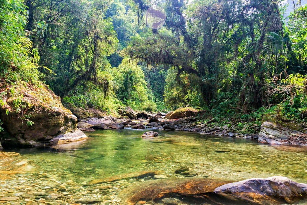
Due to its vast array of flora and fauna, Colombia is considered to be one of the world’s 17 megadiverse countries. It boasts thousands of plant and animal species thanks to its many different ecoregions.

Due to the fact that the country is home to coastal areas, low-lying plains, alpine regions, tropical rainforests, and everything in between, it contains a truly stunning collection of wildlife. In fact, Colombia is often considered to have the largest number of species proportionate to its total land area of any country on Earth.
Furthermore, Colombia is believed to have more endemic species than any other country. It is believed that about 10% of the world’s animal species can be found in Colombia.
While new species are identified on a regular basis, it is believed that there are more than 1,800 bird, 450 mammal, 580 amphibian, 1,400 fish, and 580 reptile species living within the country.
Some of the most notable species in the country include spectacled bears, sloths (multiple species), giant anteaters, tamanduas, jaguarundi, mountain lions, jaguars, ocelots, pampas cats, bush dogs, coatis, and tapirs.
The area that is now Colombia has been home to humans for at least the last 12,000 years. Due to the country’s location along the intersection of South America and Central America, it has long been used as a corridor of travel for humans.
Archaeological finds in what is now Colombia date back potentially as far as 18,000 BCE, though there is more concrete evidence that humans lived in the region at around 12,500 BCE.
Many, many tribes and nations lived in what is now Colombia at the time of European contact. Some of the many Indigenous peoples that lived in the region and, in many cases, continue to live in the country include the Musica, Wiwa, Wayuu, Arhuaco, Guambiano, Puinave, Páez, and Embera Chamí.
The first Europeans to reach what is now Colombia likely came around the end of the fifteenth century. Alonsa de Ojeda of Spain made it to the Guajira Peninsula in northern Colombia in 1499. Over the course of the next few years, a number of sailors, including Rodrigo de Bastidas and Christopher Columbus, also sailed through the area.
It is believed that, in 1508, Vasco Núñez de Balboa also established one the first permanent European settlement in what is now Colombia at Santa María la Antigua del Darien, though it was destroyed soon afterward.
By the 1530s, the Spanish had established a number of towns, including what is now Santa Marta and Cartagena. The arrival of the Spanish brought disease and violence to the region, which led to the decimation of the Indigenous peoples of what is now Colombia.
In 1542, what is now Colombia became part of the Viceroyalty of Peru, a Spanish administrative district. During the sixteenth century, the region also became a hub for the trans-Atlantic slave trade.
By 1717, Colombia was made part of the Viceroyalty of New Granada, which helped establish Bogotá as a major administrative center on the continent.
Almost a century later, Colombia declared its independence from Spain in 1810. However, King Ferdinand VII of Spain then sent in military forces to the region after the end of the Napoleonic Wars in order to take back Colombia.
For nearly a decade, Colombia was back under Spanish rule until the country was able to declare its independence again in 1819 with the help of Simón Bolíivar of Spain.
Colombia established its first constitution as part of Gran Colombia in 1821. However, Gran Colombia broke apart in 1820 at which time it became part of New Granada.
It later became the Confederación Granadina (Grenadine Confederation) in 1858, until a two-year civil war broke out and led to the formation of Colombia, which also included what is now Panama. After quite a bit of influence from the United States during the construction of the Panama Canal, Panama became an independent country.
The twentieth century was a relatively tumultuous time in the country, with alternating periods of political stability and unrest. Interestingly enough, Colombia was the only country on the continent to join Korean War.
Furthermore, the country has seen a decent amount of armed conflict between competing factions since about the 1960s. However, in 1991, the country also created a new Constitution, which continues to be in effect.
While there are still issues with regional violence, Colombia has South America’s third-largest economy. It is expected to grow substantially in the coming years, thanks to the country’s rich natural resources and burgeoning financial, science, and technology industries.
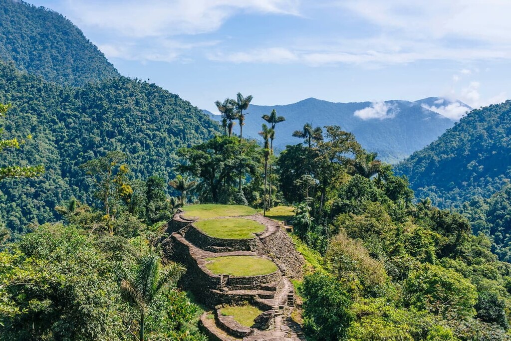
Tourism in Colombia is also growing steadily as people around the world take note of the country’s rich culture and gorgeous landscapes. With over 50 national parks and wildlife sanctuaries, there’s also plenty of outdoor adventure to be had in Colombia.
Colombia’s diverse landscapes offer a lifetime’s worth of adventure for anyone willing to seek it out. Here are some of the best parks to visit during your trip to the country:
Located in the northern part of Columbia, Sierra Nevada de Santa Marta National Nature Park (Parque Nacional Natural Sierra Nevada de Santa Marta) is a small national park that almost completely surrounds the Sierra Nevada de Santa Marta. The park contains 85 named mountains, the highest and most prominent of which is Pico Cristóbal Colón.
The park is considered to be a sanctuary for wildlife in the region. It offers a sharp contrast in the landscape from the low-lying coastal areas to the north, which makes it an exciting getaway for visitors to the area. It is also a UNESCO World Heritage Site, so it’s worth a visit if you’re looking to learn more about the region’s rich cultural heritage.
Los Nevados National Park (Parque Nacional Los Nevados) is located in the heart of the Colombian Andes, just outside the city of Bogotá. The park contains 45 named mountains, the highest and most populous of which is Nevado del Ruiz.
The park is situated around the main volcanic complex of Nevado del Ruiz, so some parts of the park are closed due to volcanic activity in the area. However, it is still a major outdoor recreation area thanks to its stunning landscapes and ample hiking opportunities.
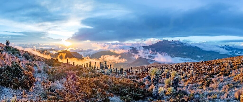
Additionally, Los Nevados is also home to some of the last remaining glaciers in Colombia. Unfortunately, these glaciers are rapidly retreating, as are most other glaciers around the world.
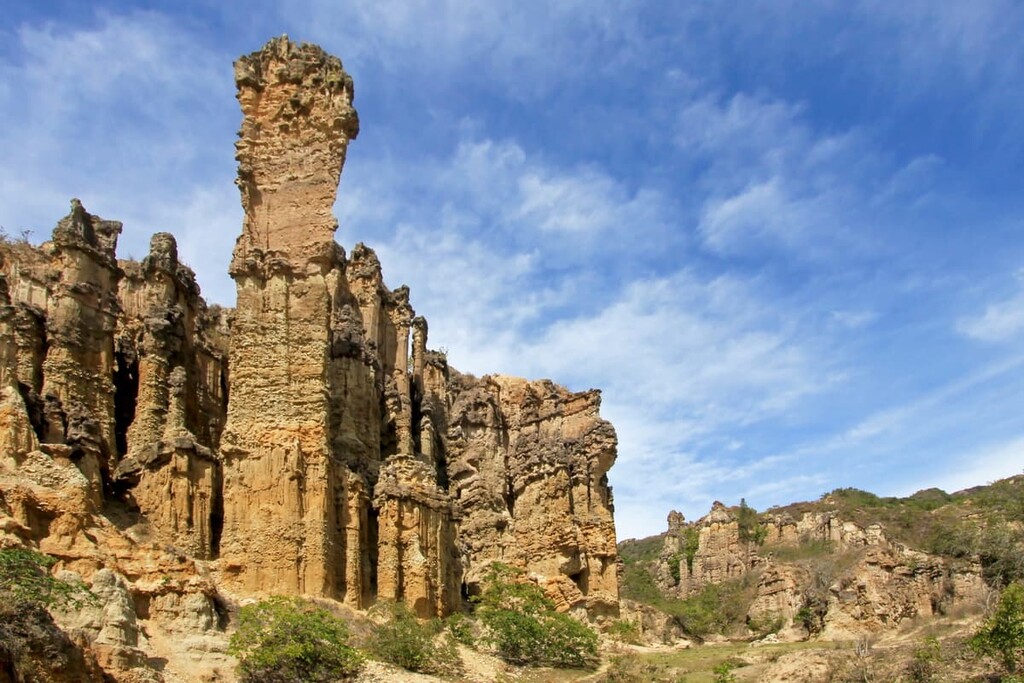
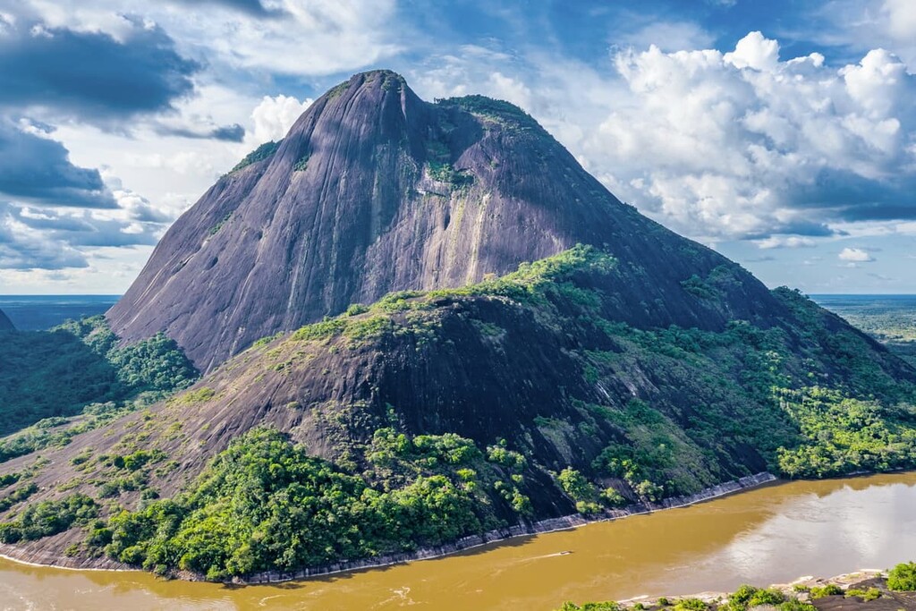
One of the largest protected areas in Colombia, Serranía de Chiribiquete National Park (Parque Nacional Serranía de Chiribiquete) is a major national park situated in the southeastern part of the country. It contains 44 named mountains, the highest and most prominent of which is Cerro Chiribiquete.
The park is home to some of the largest intact tropical rainforests in the country. It also contains over 600,000 individual examples of rock art and petroglyphs that date back at least the last 10,000 years.
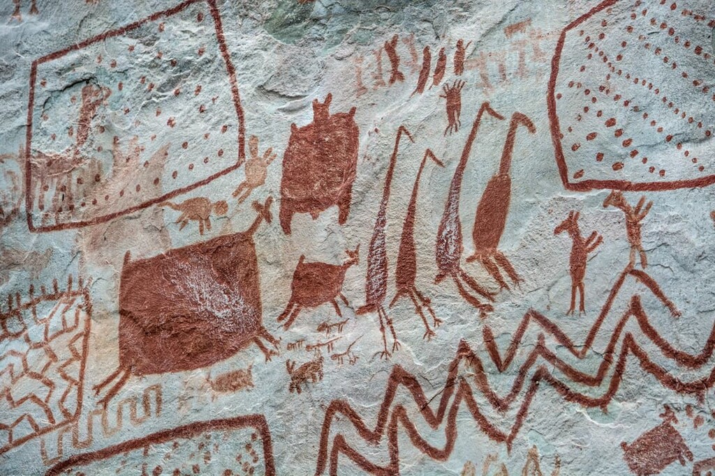
Additionally, Serranía de Chiribiquete is one of the most biologically diverse areas in the country, with over 1,800 species of plants having been discovered within its boundaries to date.
While the park is very difficult to get to due to its remoteness, it is well worth the effort to visit. In fact, access to Serranía de Chiribiquete was highly restricted for a very long time as it is also home to a number of uncontacted Indigenous tribes. Nevertheless, the government has recently started to allow for limited access to the park for visitors on guided tours to see the region’s sacred cultural sites.
Looking for a place to stay during your trip to Colombia? Here are some of the best cities to check out:
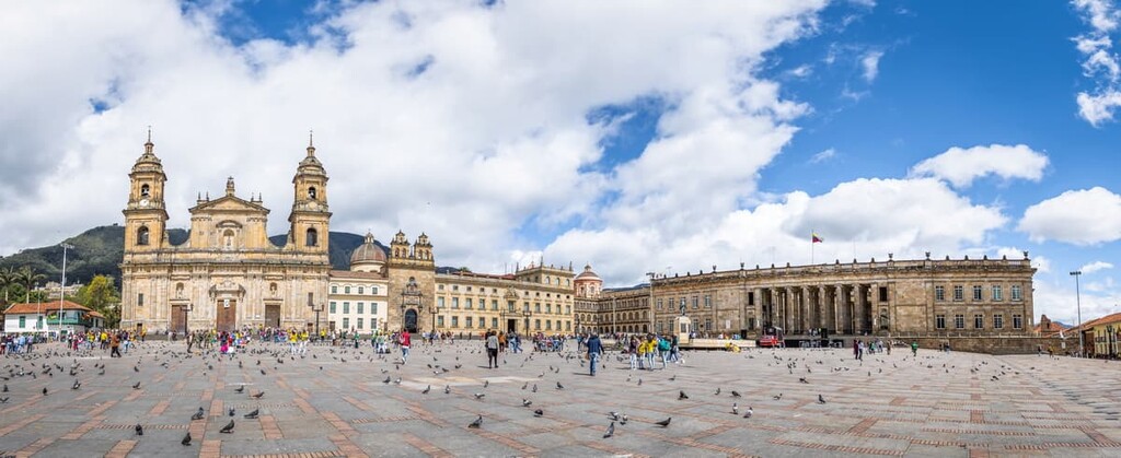
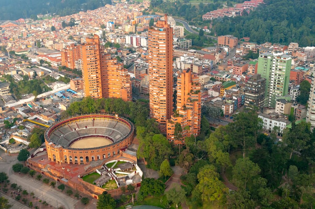
The capital and largest city in Colombia Bogotá is home to some 7.4 million people, which makes it one of the largest cities in the Americas. Bogotá is located in the heart of the country on a high plateau in the Andes. As a result, it is the third-highest capital city on Earth after La Paz, Bolivia and Quito, Ecuador.
Bogotá is a major center for tourism, commerce, education, and culture in Colombia. It is home to the country’s largest universities as well as thousands of multinational corporations.
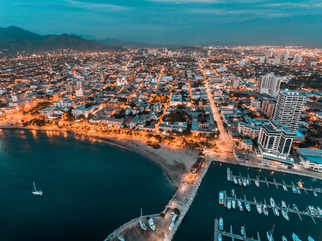
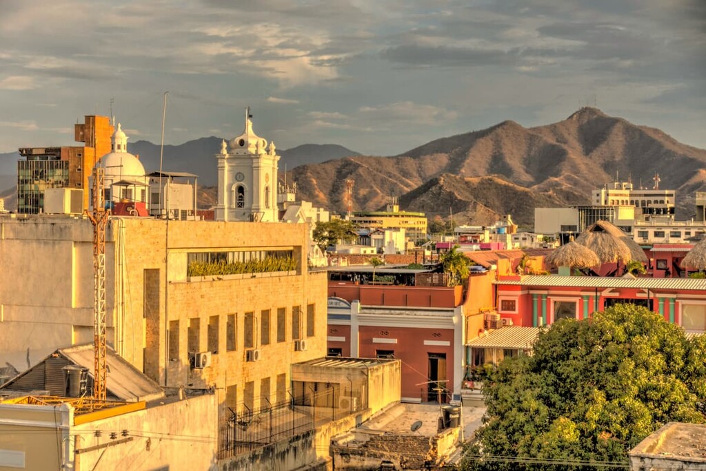
Home to about 500,000 people, Santa Marta is situated along the country’s Caribbean Coast. It is one of the oldest surviving Spanish cities in Colombia, making it the perfect place to visit if you enjoy history.
Santa Marta also has a strong tourism industry due to its beautiful beaches and fantastic historic sites.
One of the most populous cities near Colombia’s Pacific Coast, Cali is home to about 2.2 million people. The city is the main economic center for southern Colombia, so it is one of the fastest-growing urban areas in the region.
Furthermore, Cali is a popular center for sporting events as it’s hosted the Pan American Games, the World Wrestling Championships, and a number of other major tournaments.
The second-largest city in the country, Medellín is located in the north-central part of the country. It is home to around 2.5 million people and it is a popular tourist destination for the region. Medellíin is a rapidly growing city with a burgeoning technology, science, and education industry.
Plus, the city hosts a number of major festivals each year, which are well worth checking out, including its annual Festival of Flowers and its Christmas lighting celebration.

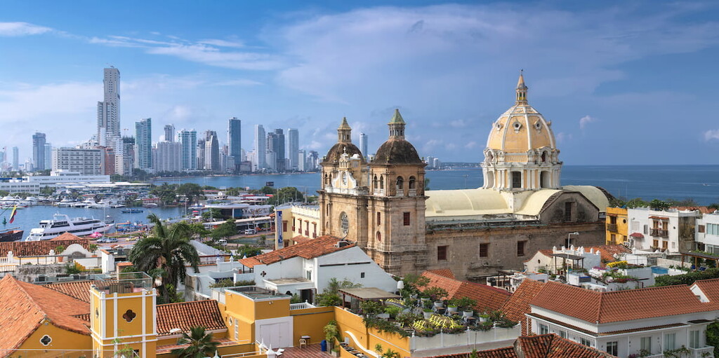
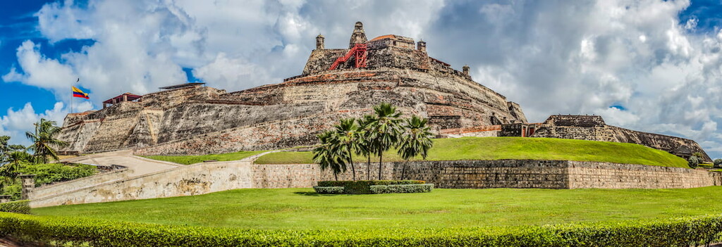
Situated on the northern coast of Colombia, Cartagena is a city of some 900,000 people that’s known for its stunning architecture. Cartagena was one of the first cities established by the Spanish, so it boasts beautiful colonial buildings that have earned it the status of being a UNESCO World Heritage Site.
The city is also a hub for commerce and culture within the region, so it’s a must-visit if you’re traveling to Colombia.