
Scan the QR code and open PeakVisor on your phone
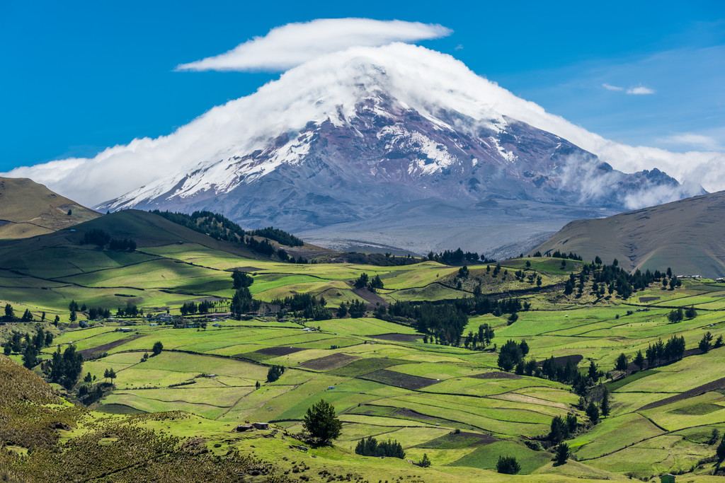
Blending lush tropical rainforests and snow-capped mountains, Ecuador is a fantastically diverse and vibrant country located along the Equator in the northwestern part of South America. The country is home to 1,289 named mountains, the highest and most prominent of which is Chimborazo (6,268m/20,564ft).
The country of Ecuador (officially the Republic of Ecuador/República del Ecuador) is a small by geographically diverse country located in the northwestern region of South America. Aptly named, Ecuador, which translates to “equator,” is located along the Equator itself.
With a total land area of 283,561 square kilometers (109,484 sq. mi), Ecuador is the 73rd largest country in the world. Nevertheless, it is also the fifth smallest country in South America, surpassing only Uruguay, Surinam, Guyana, and French Guiana in size (though, technically, French Guiana is an overseas department of France and not an independent country).
Ecuador is located along the coast of the Pacific Ocean. It has a total coastline of about 2,237 kilometers (1,390 miles), which is nearly equal to its land border with Colombia to the north. It also shares its eastern and southern borders with Peru, which separates it from nearby Brazil.
The country is officially broken up into 24 provinces (provincias). It is also technically broken up into 7 administrative regions, which include two or more adjacent provinces as part of an attempt to allow for a more decentralized government.
Nevertheless, from a geographic perspective, Ecuador can also be categorized into four broad geographic regions, each of which has its own unique topography and outdoor recreation opportunities.
Encompassing the entire western edge of the country, the Coast (La Costa) region of Ecuador is one of the more populous areas in the country. This region contains all or most of a number of provinces, including El Oro, Guayas, Santa Elena, Manabí, and Esmeraldas.
The Coast region was once heavily forested, though these native forests have mostly been replaced with urbanized and agricultural landscapes. Outside of the major city of Guayaquil in the southern part of the region, banana, coffee, and cacao plantations as well as cattle ranches are the norm.
Although this area is very low-lying and heavily developed, there are a decent number of national parks, preserves, and wildlife refuges in the region, such as:
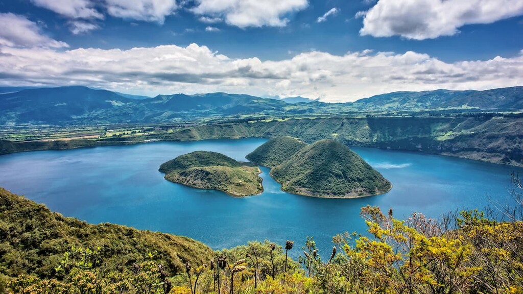
Running down the central third of Ecuador from north to south, the Mountains (Sierra) region of the country is a rugged area that’s home to the Andes Mountains. This region contains all or part of many provinces, such as Zamora Chinchipe, Loja, Azuay, Cañar, Chimborazo, Tungurahua, Napo, Carchi, Imbabura, Pichincha, Cotopaxi, Bolívar, Santo Domingo de los Tsáchilas, and Los Ríos.
Ecuador’s capital, Quito, is located in this mountainous region of the country, as are many other popular destinations, such as Baños de Agua Santa. Many of the major cities in the region are located either in the foothills, as is the case with Baños, or in one of the range’s many deep valleys.
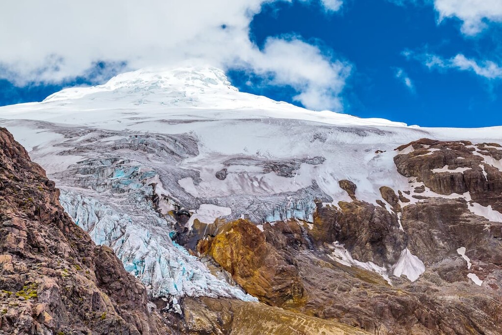
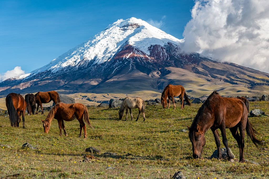
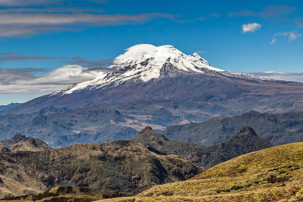
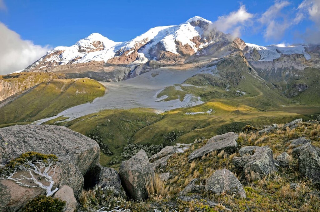
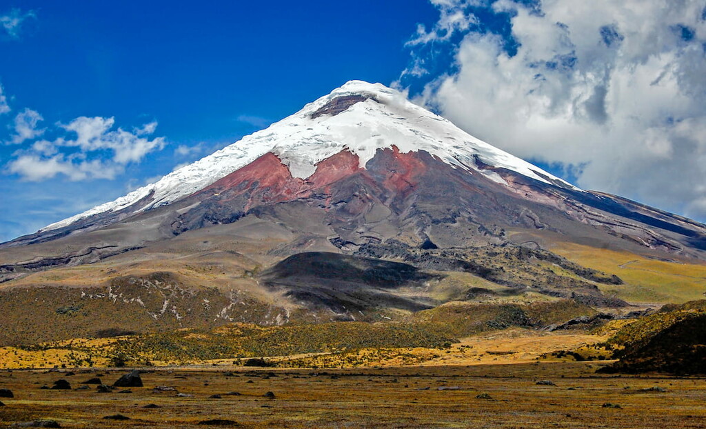
Ecuador’s highest mountains are all located within this region, such as Chimborazo, Cotopaxi, Illiniza, and Tungurahua. Interestingly enough, Chimborazo’s summit is the furthest point on the planet from the center of the Earth due to the fact that the Earth bulges at the equator and Chimborazo is located just below 1ºS.
There are many national parks and recreation areas in the Ecuadorian Andes, including:
Additionally, this region contains a large number of ecological reserves and wildlife preserves, such as:
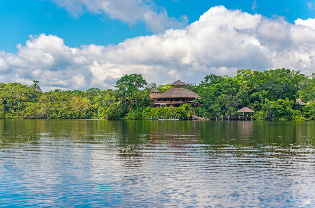
Ecuador’s East (El Oriente) region is located in the eastern part of the country. This region includes most or all of Sucumbíos, Orellana, Pastaza, and Morona Santiago provinces, which are all located within the Amazon Basin.
Also known as Amazónica, an expanded version of this region might also include the provinces of Napo and Zamora Chinchipe, though these two provinces are a bit more rugged than their neighbors to the north and east.
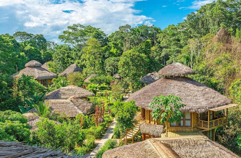
Here, the landscape is dominated by tropical rainforests. However, much of the region is also home to a number of natural resources, such as petroleum and gold. As such, it has long been the source of mineral extraction practices.
Nevertheless, the region is also the site of a number of fairly large parks and preserves that seek to protect the biological diversity of the region. Some of the largest reserves and parks include:
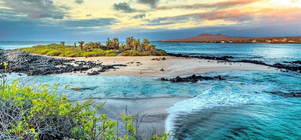
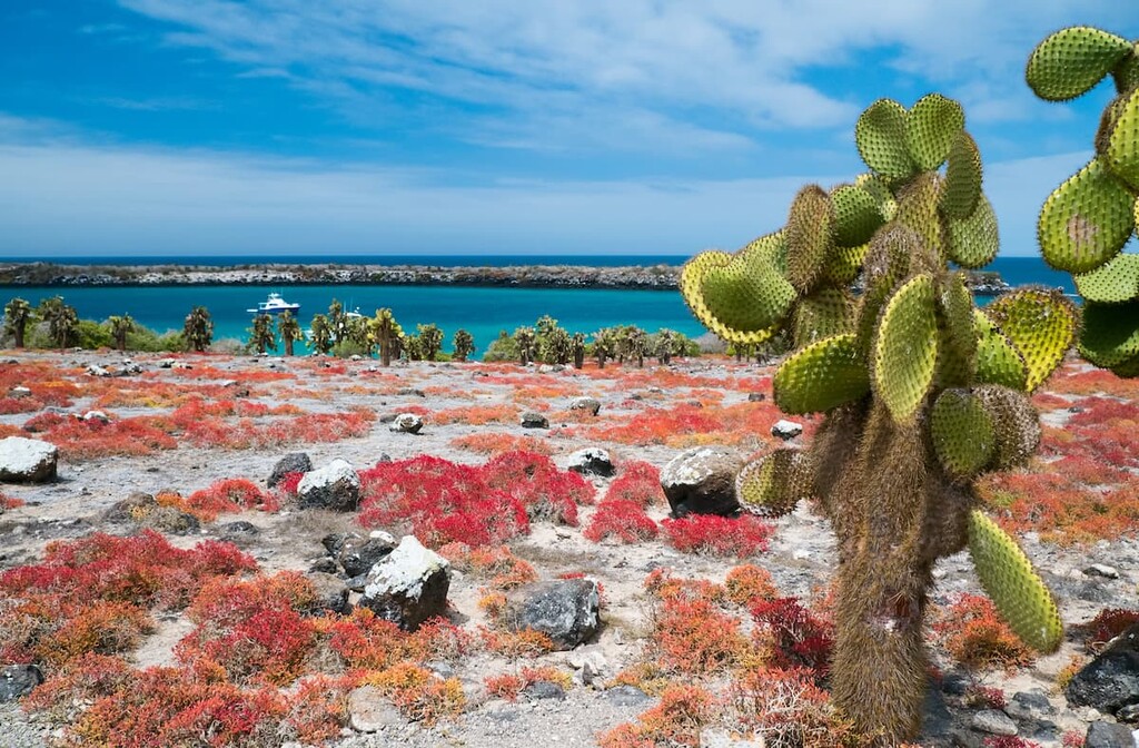
One of Ecuador’s most popular destinations, the Galápagos are a group of islands located about 1000 km (600 mi) off the country’s west coast. The archipelago contains about 13 primary islands and 6 smaller islands, as well as an assortment of islets.
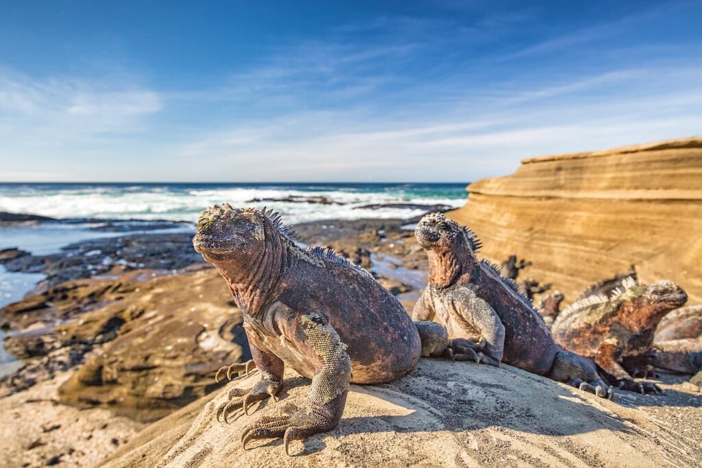
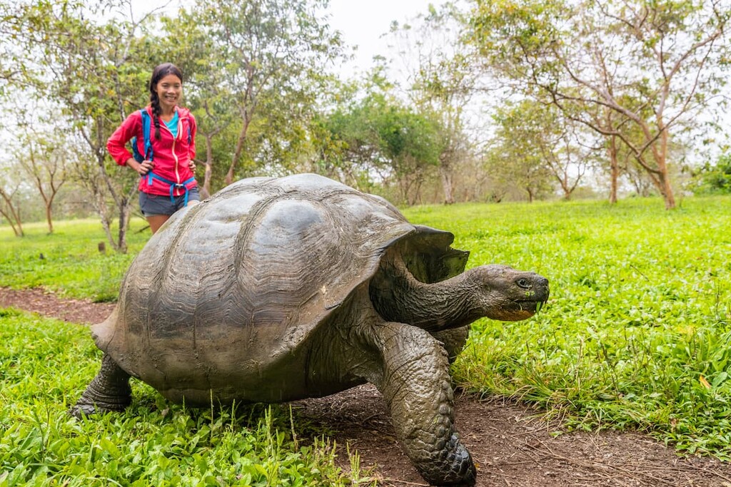
The Galápagos are home to about 25,000 people who live throughout the archipelago’s main islands. In the Galápagos, people live close to a fantastically diverse array of wildlife species. On the island, visitors can find a great mix of animals, including Galápagos fur seals, Galápagos tortoise, and the Galápagos penguin.
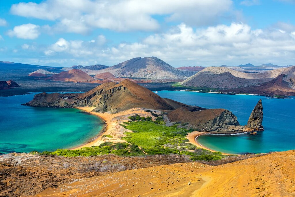
Furthermore, the Galápagos Islands are almost completely contained within Galápagos National Park (Parque nacional Galápagos), which is the country’s oldest national park and a designated UNESCO World Heritage site.
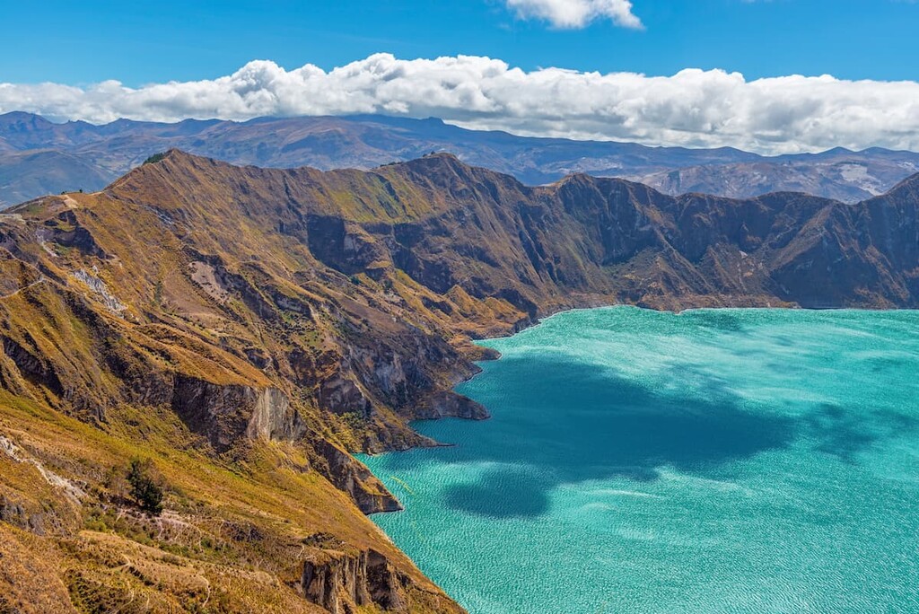
The geologic history of Ecuador is complex, however, the country’s geologic past has been dominated by volcanic activity. Ecuador can be divided up into two sites of particular geologic importance: the Andes Mountains and the Galápagos Islands.
Stretching from 7,000 km (4,350 mi) from the northern edge of Colombia and Venezuela all the way to Chile and Argentina in the south, the Andes Mountains are one of the world’s longest mountain ranges.
The range cuts a nearly straight course through the heart of Ecuador, forming a natural barrier between the Amazon Basin to the east and the coast to the west.
Geologically, the Andes are the result of subduction of the Nazca Plate (bordered by the Pacific Plate to the west) under the South American Plate. This subduction resulted in the formation of the Andes, which is home to a substantial number of active, dormant, and extinct volcanoes.
Major peaks within the Ecuadorian Andes include Chimborazo, Cotopaxi, Cayambe, Antisana, and Obispo.
The Galápagos Islands are located some 1,000 km (600 mi) off the coast of Ecuador, though they share the mainland of the country’s volcanic past. In fact, the Galápagos are located on the other side of the Nazca Plate (which helped form the Andes Mountains).
Interestingly enough, the Galápagos are situated on top of a hot spot in the Earth’s crust where the magma in the mantle is hotter than its surroundings. As a result, magma from the mantle often pushes up through cracks within the crust to create volcanoes and, subsequently, islands, like the Galápagos. This same hot spot volcanism was also responsible for the islands of the US state of Hawai’i.
Major mountains on the islands include Volcán Wolf, Volcán La Cumbre, Volcán Darwin, Volcán Cerro Azul, and Volcán Alcedo.
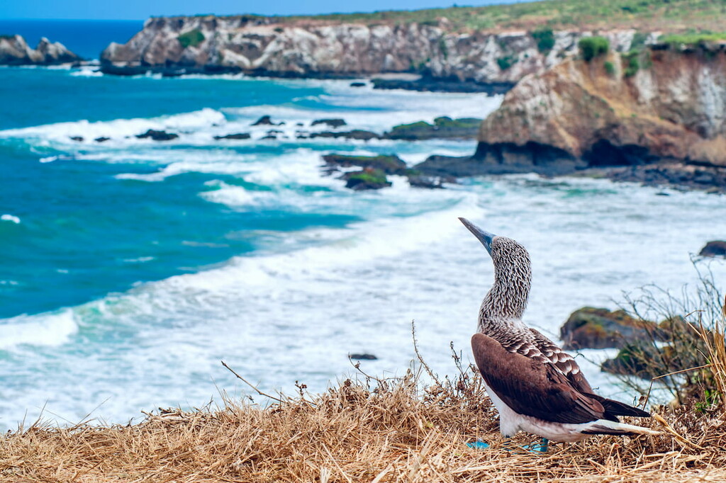
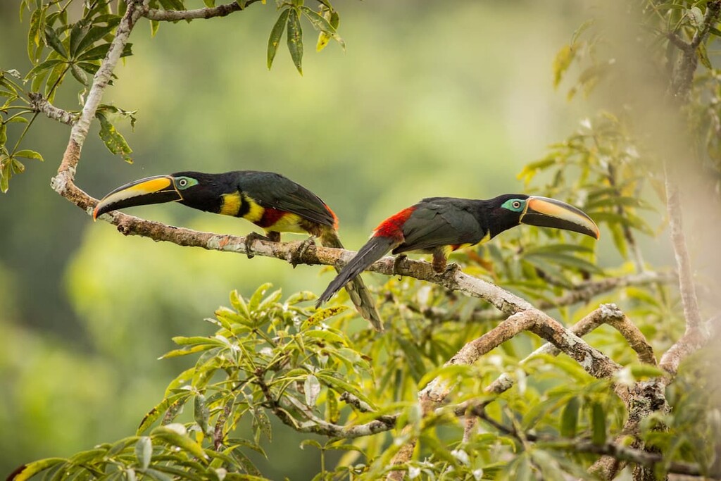
Ecuador is considered to be one of the world’s seventeen megadiverse countries, which means it has at least 5,000 species of endemic plants as well as a substantial marine ecosystem. The country’s biodiversity comes from its highly varied topography, which includes coastal regions, high mountains, and tropical rainforests, as well as its location along the Equator.
Throughout the country’s many ecosystems, one can find a wide array of different animal species. There are dozens of primate, feline, canine, and ungulate species that roam the country’s forests and mountains.
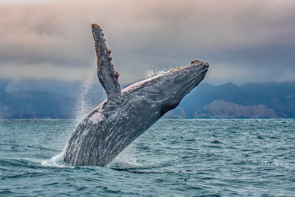
Some of the major species that call Ecuador home include tapirs, mountain lions, ocelots, jaguars, culpeo, bush dogs, spectacled bears, coatis, and pudús. The marine areas off the coast of Ecuador are also particularly biodiverse, with a wide range of seals, whales, and dolphins venturing to the region’s warm waters for breeding.
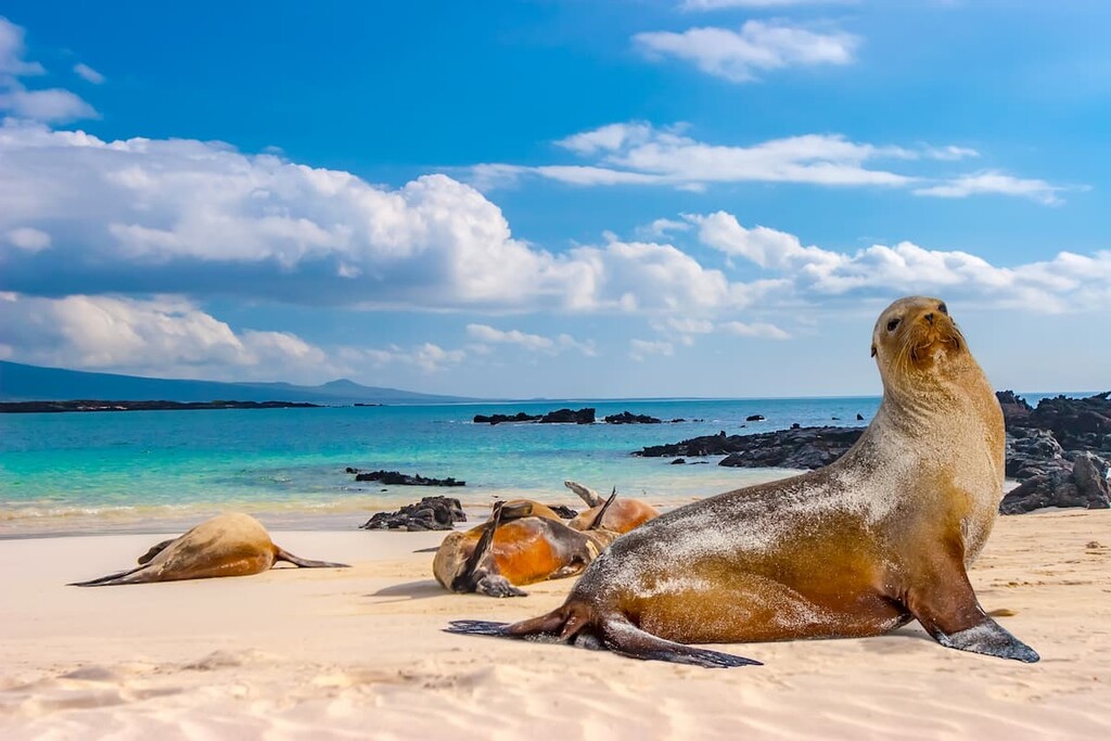
Additionally, the Galápagos Islands are particularly noted for their biodiversity. The islands have a large number of endemic animal species, including the Galápagos penguin, the Galápagos tortoise, the Galápagos seal, and the Galápagos land iguana.
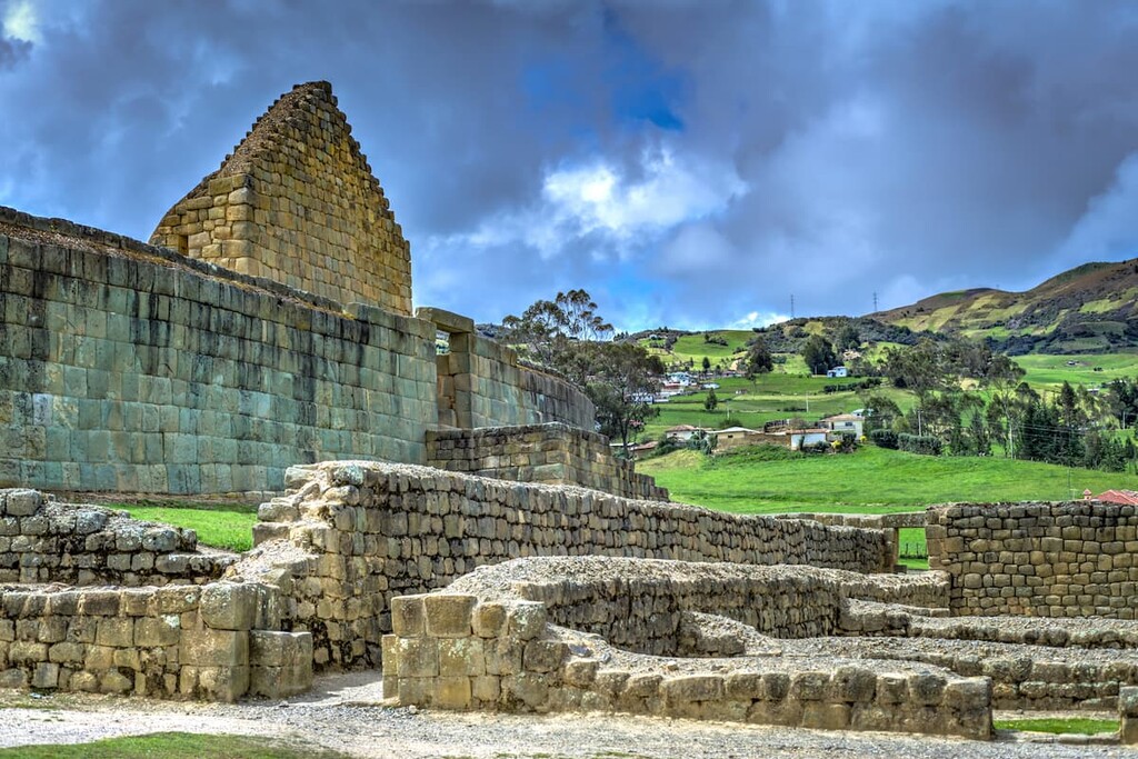
The region that is now the Republic of Ecuador has a long and storied history of human inhabitation. Indeed, the region has been inhabited by humans for at least the last 10,000 years.
Many, many tribes and nations have lived in what is now Ecuador over the millennia. This includes the Puruhá, the Caras, the Cañari, and the Panzaleo.
However, by the fifteenth century, the Inca Empire had expanded through much of what is now Ecuador, conquering many of the tribes that were already living in the region, such as the Quitu. Quechua, which is part of the Quechuan language family that was spoken by the Incans, is widely spoken throughout parts of western South America to this day.
Furthermore, Ecuador has a large Indigenous population, with around one-quarter of the country claiming Indigenous ancestry. The country is also home to a handful of uncontacted tribes, including the Taromenane and the Tagaeri who live in the Ecuadorian Amazon Basin.
The first peoples of European descent to have arrived in what is now Ecuador came to the region in the early 1530s. They were led by Francisco Pizarro of Spain who eventually captured the last Inca Emperor, Atahualpa, not long after his arrival. The Spanish later executed Atahualpa, which essentially brought an end to the Inca Empire and the start of the Spanish colonial period.

Around the same time, Fray Tomás de Berlanga also made it to the Galápagos, though Europeans did not settle the islands for many decades. Interestingly enough, the Galápagos did not appear on European maps until those of Abraham Oretlius of modern-day Netherlands and Geradus Mercator of modern-day Belgium. Charles Darwin didn’t make his famous voyage to the islands on the HMS Beagle until the 1830s.
After the fall of the Inca Empire, the land that is now Ecuador was actually administered under the Viceroyalty of Peru until the 1560s when it became part of the Viceroyalty of New Granada. Spanish colonial rule continued until the early nineteenth century when Ecuador, like most other countries in South America gained its independence.
Ecuador gained its independence in 1822, though it was part of Gran Colombia until 1830 and it was not recognized as an independent country by Spain until 1840.
The early years of Ecuador’s independence were tumultuous. During the first few decades of its independence, Ecuador went through a number of different administrations on both sides of the political spectrum.
Ecuador also had a long-standing territorial dispute with Peru that culminated in the Ecuadorian invasion of Peruvian territory. Eventually, the two countries signed the Rio Protocol, with Chile, Brazil, Argentina, and the United States acting as mediators to end the territorial dispute.
During the mid twentieth-century, Ecuador also underwent a period of military rule which eventually returned to a democratic government in the late 1970s.
Toward the end of the twentieth century, Ecuador plunged into an economic crisis. By 2008, the country had a new constitution and the economy began a relatively steady upward trajectory, though it’s seen some setbacks since then.
These days, Ecuador has a rapidly developing economy that boasts a large commodities sector. It also has a growing tourism industry thanks to its many outdoor recreation and cultural sites.
Ecuador is home to a superb mix of outdoor recreation destinations. Whether you’re looking to explore the Galápagos, venture into the rainforest, or stand atop one of the country’s lofty peaks, there’s an adventure out there in Ecuador for you to check out. Here are some of the best places to visit during your time in the country:
Encompassing about 97% of the Galápagos Islands, Galápagos National Park (Parque nacional Galápagos) is a world-famous tourist destination. The park contains 26 named mountains, the highest and most prominent of which is Volcán La Cumbre.
Galápagos National Park was the country’s first national park, having been established in 1968. It is currently the only park that charges an entrance fee, and you can get there by air or by boat (there are many ship-based tour operators in the region.
There are many hotels on the four inhabited islands of the archipelago, though camping in the park is not allowed. Nevertheless, the Galápagos are one of the country’s crown jewels and shouldn’t be missed on your trip to Ecuador.
Home to one of the tallest active volcanoes on the planet, Cotopaxi National Park (Parque nacional Cotopaxi) is a major outdoor recreation destination located just outside Quito. The park contains 8 named mountains, the highest and most prominent of which is Cotopaxi.
Cotopaxi is one of the most popular mountains to climb in the country thanks to its relatively easy access and straightforward route to the summit. However, it does involve roped travel, so mountaineering skills are a must.
One of the largest parks in Ecuador, Yasuní National Park (Parque nacional Yasuní) is located in the eastern part of the country along its border with Peru. It is a mostly flat area located deep in the Ecuadorian Amazon Basin, making it one of the most remote places in the country.
Yasuní National Park is a designated UNESCO Biosphere Reserve and it is home to two uncontacted Indigenous tribes. Getting to the park can be a challenge and it can be quite expensive.
There are a number of lodges in the park, however, which can help you arrange transportation from Quito. You will usually need to fly to Coca and then take a boat to get to the park. But, when it comes to the biodiversity of the region, Yasuní National Park can’t be beat.
Looking for a place to stay in Ecuador? Here are some of the best cities to check out:
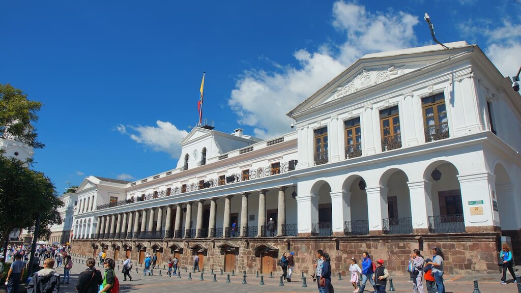
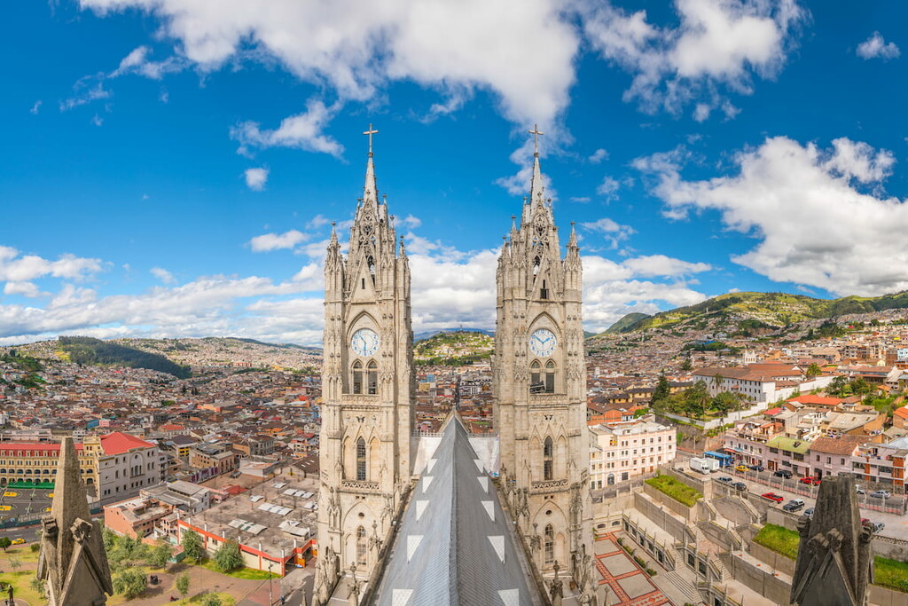
Home to some 2 million people, Quito (Kitu) is the capital of Ecuador and its second most populous city. Quito is located in the heart of the Andes at about 2,850 m (9,350 ft) above sea level, which makes it both the second highest capital city in the world (after La Paz, Bolivia) and the closest capital city to the Equator.
Quito is a designated UNESCO World Heritage Site, thanks to its many historic buildings and cultural sites. It is also home to Ecuador’s busiest airport, making it a hub for travel in the country.
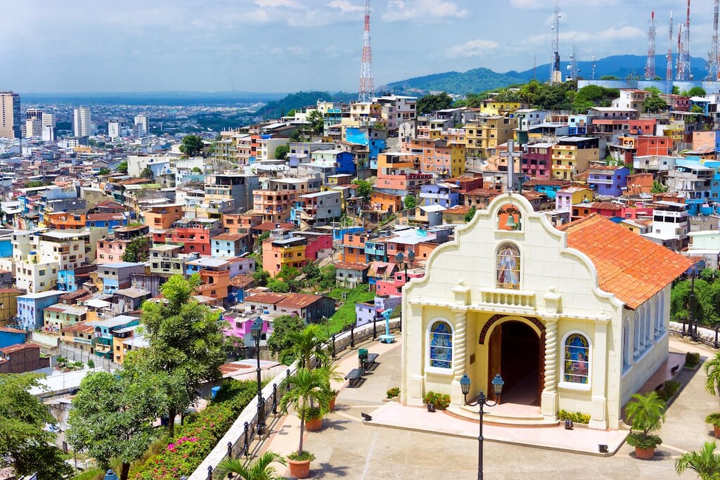
The largest city in Ecuador with some 2.6 million residents, Guayaquil (Wayakil) is a major port city located along the Gulf of Guayaquil. As a hub for commerce, industry, and trade for the country, Guayaquil is a rapidly developing city that should be on every visitor’s must-see list. Guayaquil also has an intricate public transportation system, so it’s a nice place to start your adventures in Ecuador.
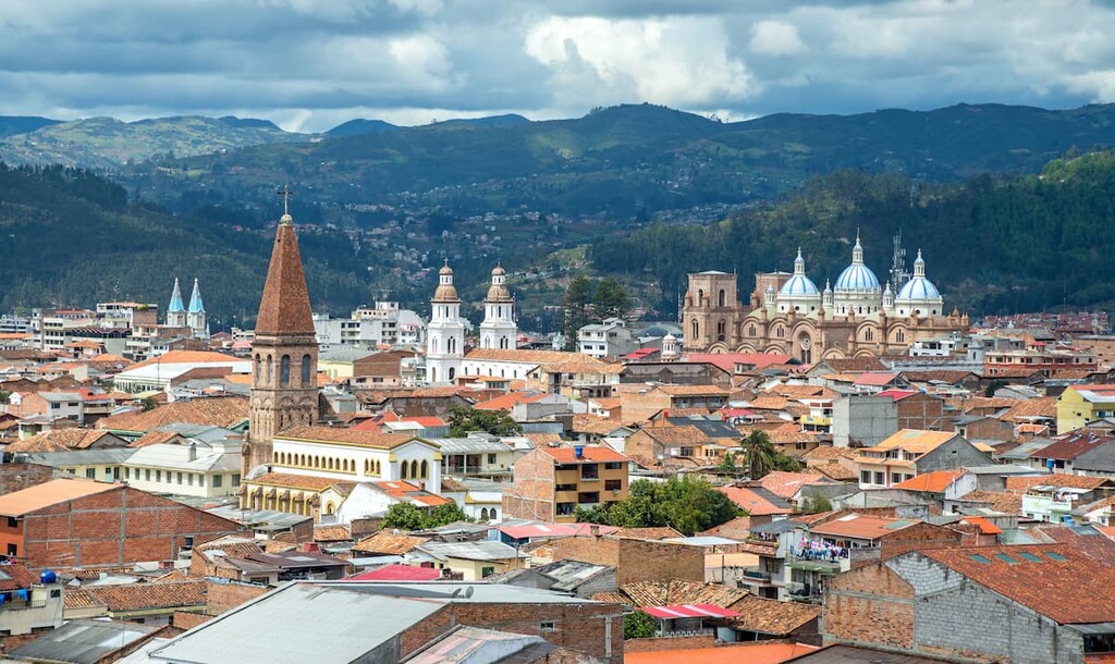
Located in the heart of the Ecuadorian Andes, Cuenca (Tumipampa) is a city of some 330,000 residents who live at about 2,560 m (8,400 ft) above sea level. Cuenca is a popular tourist destination thanks to its historic buildings and many festivals. In fact, the city is a UNESCO World Heritage Site, so it’s worth visiting if you get the chance.
Situated in the west-central region of Ecuador, Santo Domingo (Tsachila) is the country’s fourth-largest city with a population of about 460,000 people. Santo Domingo has long been a hub for commerce and industry though the many parks in and around the city are a testament to its natural biodiversity.


ultra
volcano
andes-6000ers
ecuador-ultras
ultra
volcano
andes-6000ers
ecuador-ultras


