
Scan the QR code and open PeakVisor on your phone
Guyana is a small country on the northern coast of South America. With land territory spanning 214,969 square kilometers (83,000 sq mi), it is one of the smallest countries on the continent. Guyana is also one of the least densely populated countries in the entire world, with a total population of approximately 835,000.
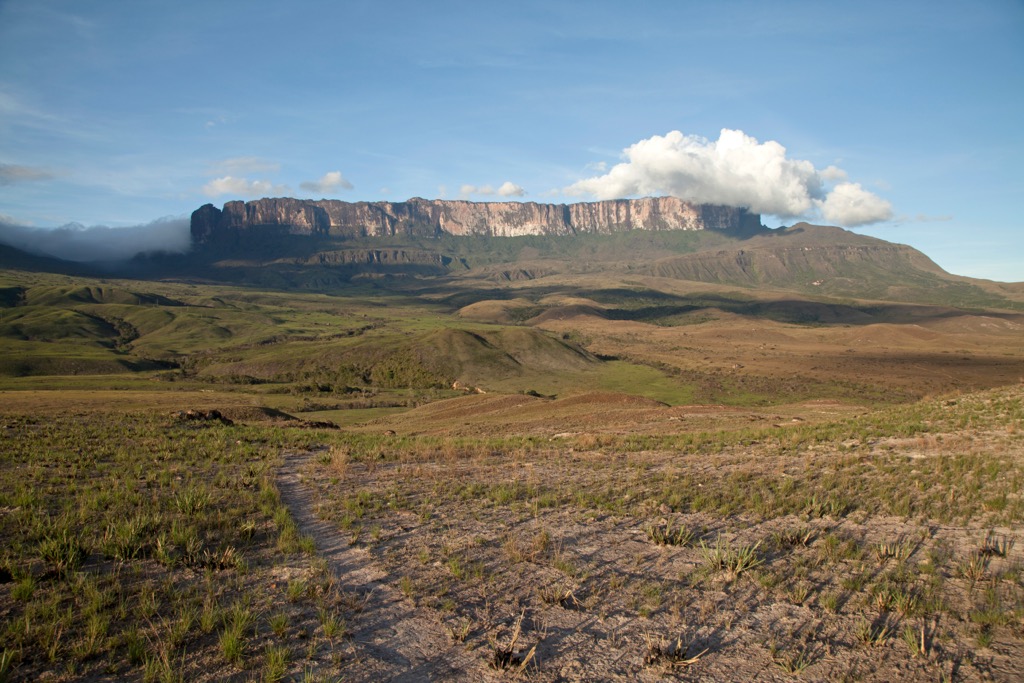
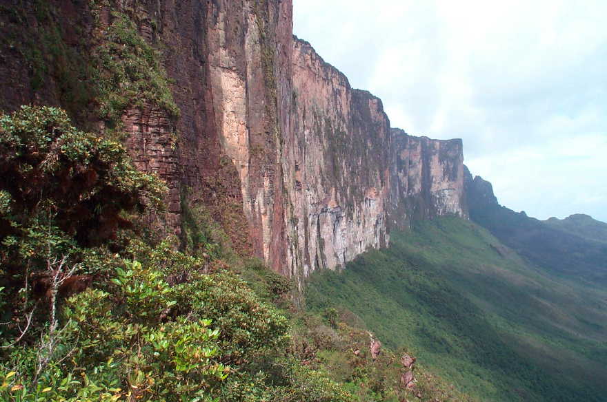
There are 296 named mountains in Guyana, the highest among them in the Pacaraima chain of table-top mountains, or tepuis, in the west. The tallest of these is Monte Roraima (2,772 m / 9,094 ft), a wide, flat summit, which is also shared with neighboring Brazil and Venezuela. The most topographically prominent point in Guyana is another Pacaraima mountain, Mount Ayanganna (2,045 m / 6,709 ft), which has over 1,000 meters (3,300 ft) of prominence.
Guyana is bordered by the Atlantic Ocean to the north, Suriname to the east, Brazil to the south and southwest, and Venezuela to the west. As mentioned above, its territory includes 214,969 square kilometers (83,000 sq mi) and encompasses four distinct geographical regions.
The northern region of Guyana is a narrow, low-lying coastal plain, extending 15 to 65 kilometers (9 to 40 mi) inland. This area, largely below high tide sea level and protected by an extensive system of sea defenses and canals, is composed of fertile alluvial deposits. Though it makes up barely 10% of Guyana’s land area, this narrow coastal plain supports a staggering 90% of Guyana's population, not to mention much of the country’s agricultural production.
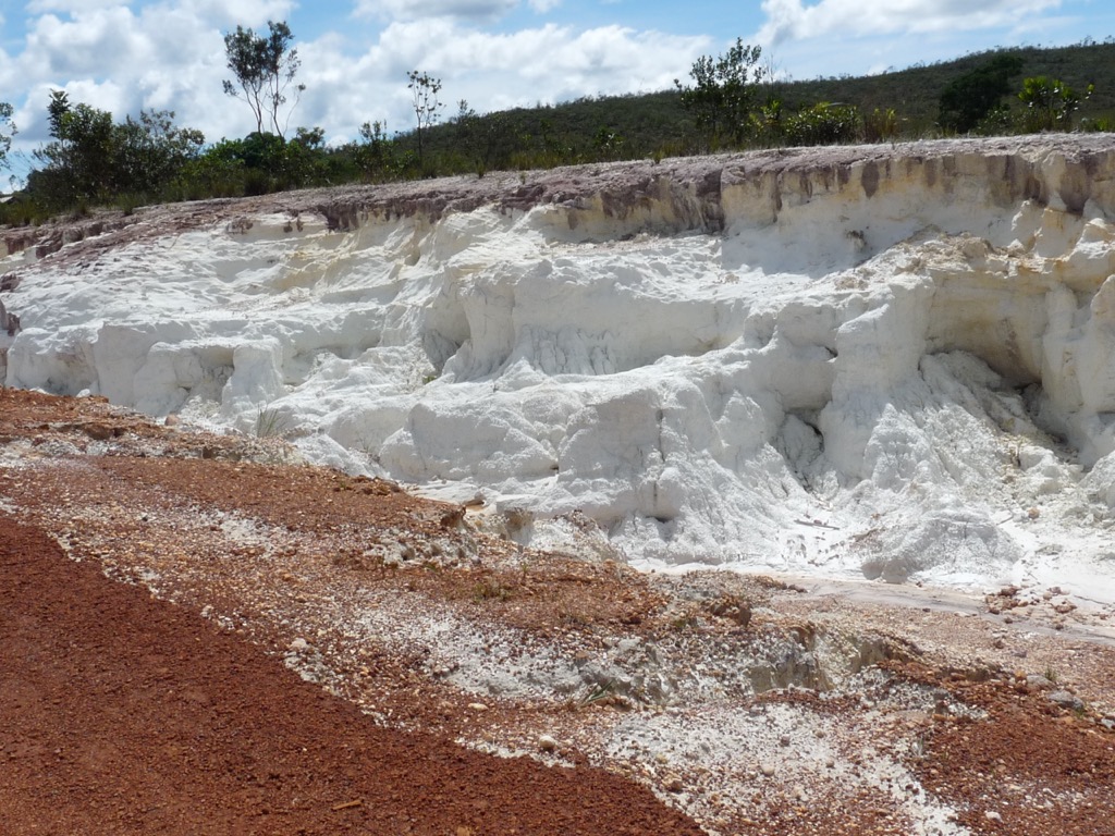
Inland from this plain lies the “Hilly Sand and Clay Region,” an undulating belt of predominantly white sandy soils of lower fertility. The land here contains significant bauxite deposits. Bauxite mining is a key industry in Guyana. The mineral is refined to create aluminum metal and is also used in manufacturing industrial products such as abrasives, cement, and chemicals.
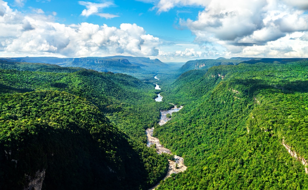
Further south and west are the forested highlands, Guyana’s largest geographical zone. Dense rainforests, vast plateaus, escarpments, and numerous waterfalls characterize this area. The region includes the Pacaraima (Pakaraima) Mountains in the west, culminating in Monte Roraima (2,772 m / 9,094 ft), the country’s highest peak, at the tripoint border with Brazil and Venezuela. The portion of Monte Roraima inside Venezuela reaches slightly higher than in Guyana, up to 2,810 meters (9,220 ft).
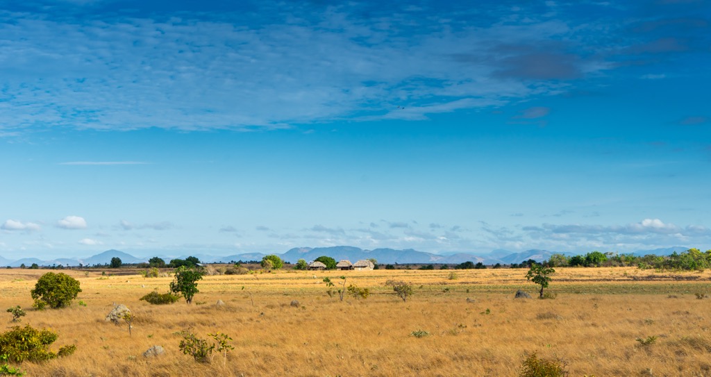
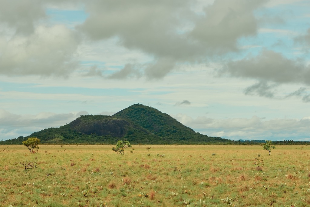
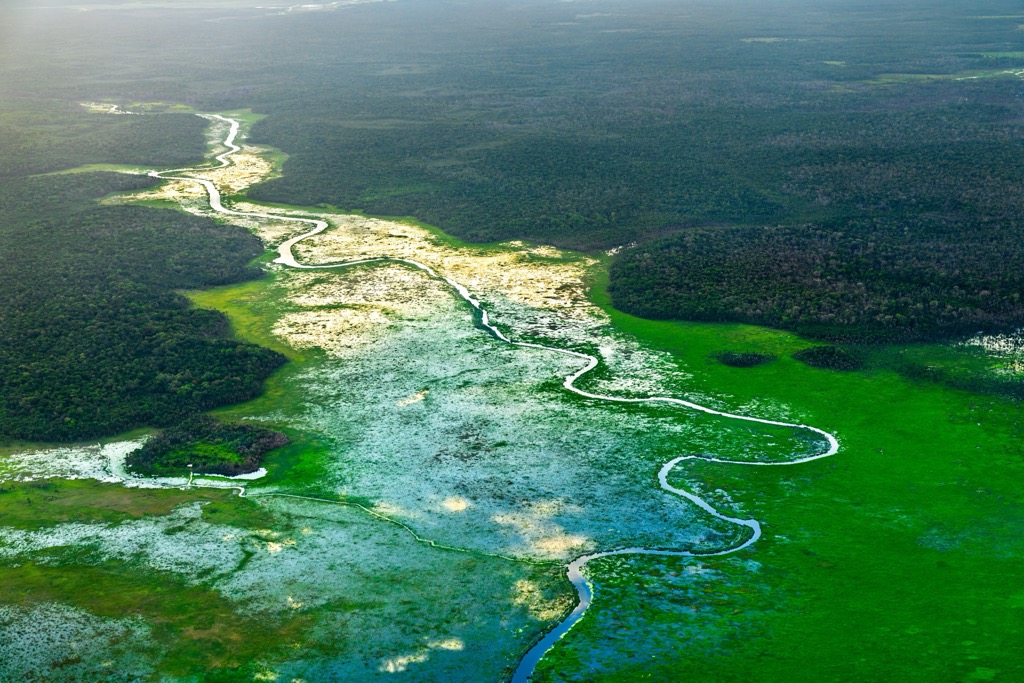
Adjacent to these forested highlands, primarily in the southwest, is the fourth geographic region, the interior savannahs. The most notable of these is the Rupununi, a sprawling swathe of dry, rolling grasslands (13,000 sq km / 5,000 sq mi), and one of the most biodiverse areas in the country (see “Ecology” below).
In addition to the Pacaraima range, the country has three other mountain chains: the Imataka Mountains, in the far northwest, the Kanuku Mountains, which bisect the Rupununi savannahs, and the Acarai Mountains, in the far south.
The latter, a low range (high point: 1,009 m / 3,310 ft) lying along the Brazilian border, contains the headwaters of the 1,000 kilometer (600 mi) Essequibo River, the longest river in Guyana. The Essequibo flows due south-north across the entire nation, emptying into the Atlantic Ocean.
On that note, Guyana is dominated by several major river systems, including the Essequibo, Demerara, Berbice, and Courantyne. The Courantyne, which also originates in the Acarai Mountains, forms Guyana’s eastern border with Suriname.
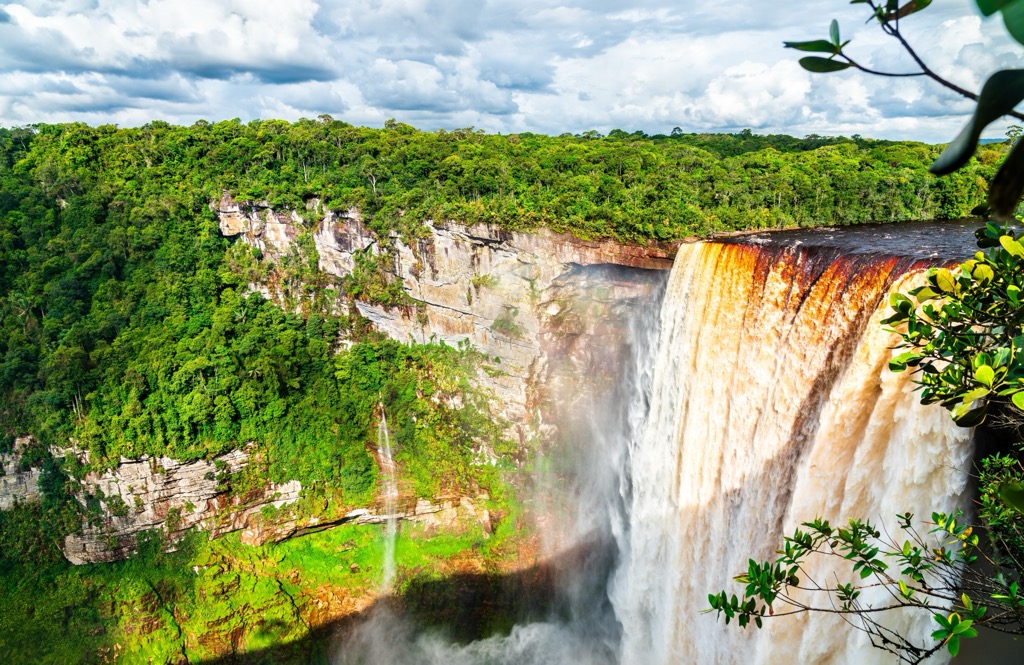
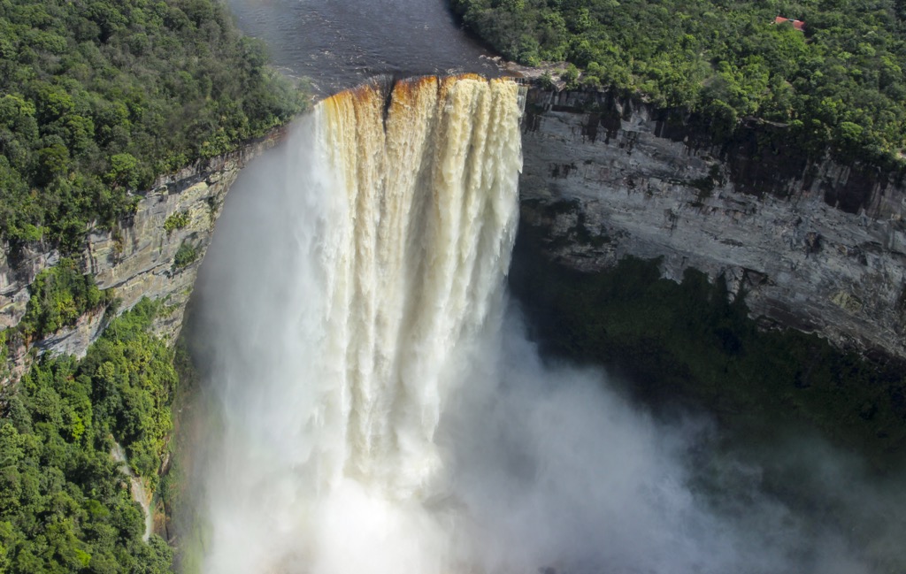
These rivers and numerous tributaries, such as the Potaro, host impressive waterfalls. One example is the 226-meter (740 ft) Kaieteur Falls, on the Potaro River, one of the world's most powerful waterfalls. Although many waterfalls are taller or have more overall volume, Kaieteur pumps out a staggering 663 cubic meters [23,400 cubic ft] per second.
Guyana’s climate is tropical, marked by high temperatures, humidity, and substantial rainfall. Coastal temperatures average around 27°C (80°F), moderated by northeast trade winds. Two distinct wet seasons occur on the coast (May to August and November to January), while the interior generally experiences a single wet season, from May to August. Annual rainfall typically ranges from 2,000 to 2,500 millimeters (79 to 98 in) on the coast, and 1,500 to 1,800 millimeters (59 to 71 in) in the interior grasslands.
Guyana sits atop the Guiana Shield, an ancient Precambrian craton (a highly dense, deep, and stable part of the continental lithosphere).
The country’s geological history begins more than two billion years ago, through protracted periods of volcanic activity, sedimentation, metamorphism, and tectonic accretion. They were significantly shaped by the Trans-Amazonian Orogeny (when two small “proto-continents” in the region collided) around 2.2 billion years ago.
Overlying this ancient basement, particularly in the western highlands, is the Roraima Supergroup (c. 1.9-1.78 Ga). This thick sequence consists predominantly of continental clastic sedimentary rocks: hard quartz sandstones, conglomerates, and shales.
Unlike many other peaks around the world, the iconic flat-topped mountains (tepuis) of Guyana’s Pacaraima range, including Monte Roraima (2,772 m / 9,094 ft), are not products of recent collisional orogeny. Instead, these dramatic table-top landscapes are immense erosional remnants of the Roraima Supergroup. Their formation resulted from the broad uplift of the Guiana Shield, followed by prolonged differential erosion within the highly resistant sandstone and conglomerate layers, stripping away less resistant surrounding materials and leaving the stark, right-angled formations we see today.
Other notable geological features in Guyana include extensive bauxite deposits, primarily in the “Hilly Sand and Clay Region,” formed through deep lateritic weathering of aluminous rocks, and the Takutu Graben in the southwest, vast rift valley (280 km / 174 mi long and 40 km / 25 mi wide) filled with Mesozoic sediments.
Guyana boasts exceptional biodiversity primarily due to its extensive and relatively pristine tropical rainforests, diverse freshwater systems, and multiple distinct geographic regions. Its flora is characterized by vast expanses of tropical rainforest (estimated to cover over 80% of the country).
Dominant tree species include commercially significant hardwoods such as greenheart (Chlorocardium rodiei), mora (Mora excelsa), and wallaba (Eperua spp.). The unique ecosystems of the Pacaraima range, particularly on the slopes and summits of tepuis, support a specialized flora with high rates of endemism, including numerous species of orchids, bromeliads, and carnivorous plants. Coastal regions feature mangrove forests, while the Rupununi savannahs are characterized by open grasslands interspersed with moriche palm (Mauritia flexuosa) stands.
The country's faunal diversity is equally impressive. Notable mammalian species include apex predators like the jaguar (Panthera onca) and puma (Puma concolor), alongside large herbivores such as the lowland tapir (Tapirus terrestris).
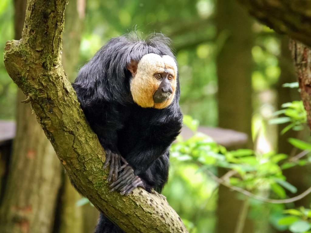
Rivers and wetlands are home to the giant otter (Pteronura brasiliensis), capybara (Hydrochoerus hydrochaeris), and the West Indian manatee (Trichechus manatus) in coastal estuaries. Guyana also supports a rich primate assemblage, including the white-faced saki (Pithecia pithecia) and a unique subset of red howler monkey (Alouatta macconnelli).
Avian diversity is exceptionally high. Iconic species include the harpy eagle (Harpia harpyja) and the resplendent Guianan cock-of-the-rock (Rupicola rupicola), but there are also numerous subsets of macaws and toucans.
The reptilian and amphibian fauna include formidable species like the black caiman (Melanosuchus niger), the green anaconda (Eunectes murinus), and a vast array of colorful poison dart frogs (Dendrobatidae family). Guyana's rivers are full of diverse fish life, including the massive arapaima (Arapaima gigas) and various species of piranha.
Indigenous peoples, including the Warao, Arawak, and Carib peoples, have likely inhabited modern-day Guyana for thousands of years. These societies developed distinct cultures adapted to the diverse coastal, riverine, and interior environments.
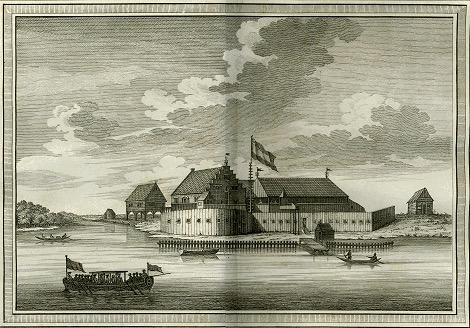
European contact with these peoples began in the late 16th century (Christopher Columbus was reportedly the first European to sight Guyana’s coastline). However, sustained colonization efforts were not undertaken until the early 17th century, led by the Dutch. They established trading posts and, later, lucrative sugar plantations along the Essequibo, Demerara, and Berbice rivers, and forcibly introduced enslaved Africans to labor on these estates.
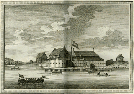
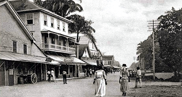
Throughout the 17th and 18th centuries, control of the colonies shifted among European powers, but influence from the Dutch remained paramount until the Napoleonic Wars. In 1814, the colonies were formally ceded to Great Britain, and in 1831, they were consolidated into a single colony dubbed British Guiana.
However, the subsequent abolition of slavery in the British Empire in 1834 (with full emancipation in 1838) created a significant labor vacuum on the plantations. This led to a large-scale system of indentured servitude, bringing laborers primarily from India, but also from Portugal, China, and other parts of the Caribbean, shaping Guyana into a multi-ethnic nation.
The 20th century witnessed the rise of labor movements and a burgeoning nationalist sentiment. Political figures such as Cheddi Jagan and Forbes Burnham emerged as leaders in the struggle for self-governance (though their rivalry often exacerbated ethnic divisions). Guyana finally achieved independence from Britain on May 26, 1966, with Burnham becoming the nation’s first prime minister.

The post-independence period under Burnham, who ruled for over two decades, was marked by experiments with cooperative socialism and significant economic challenges. Subsequent years saw a transition towards a market-oriented economy, though political tensions and border disputes with Venezuela and Suriname persisted. The discovery of substantial offshore oil reserves in the 2010s has introduced a new dynamic to Guyana, offering the potential for economic transformation while also presenting governance and socio-economic challenges.
Modern-day Guyana is divided into ten administrative regions. The country’s main industries are agriculture (rice and sugar), timber, seafood, mining for bauxite, gold, diamonds, and other minerals, and extraction of crude oil and natural gas. Guyana’s official language is English, but in communities near the borders with Brazil, Suriname, and Venezuela, the languages of these countries are often dominant.
Guyana’s protected areas included five traditionally protected areas and four urban parks, protecting, in total, roughly 8.5% of the country’s land area.
Established in 1929, Kaieteur was the first national park in the Amazon region, and remains the only national park in Guyana. Though Kaieteur is home to a number of hiking trails winding through the dense rainforest, the most popular attraction is Kaieteur Falls, one of the most powerful waterfalls in the world. The park is also home to several endemic species, such as the tiny golden rocket frog (Anomaloglossus beebei), which spends its entire life on the fronds of the bromeliad Brocchinia micrantha.
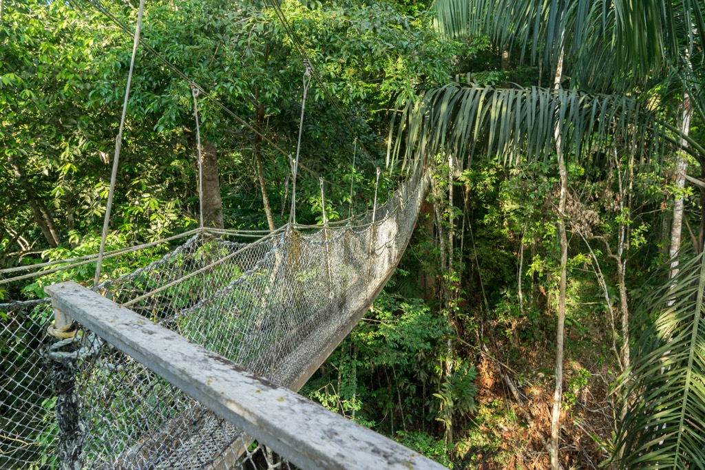
The country’s second-oldest protected area, the Iwokrama Rainforest Reserve, was established in 1996. A lowland tropical forest protecting roughly 10,000 square kilometers (1,430 sq mi), Iwokrama is extremely biodiverse, home to toucans and macaws, howler monkeys and giant anteaters, and the famous Guianan cock-of-the-rock.
According to Wildlife Worldwide, Iwokrama has more fish varieties (~420 species) and bats (~90 species) than any area of comparable size in the world. It is also one of the best places in Guyana to spot a jaguar. Don’t miss the Iwokrama Canopy Walkway, a series of suspended platforms and walkways hanging roughly 30 meters (100 ft) above the rainforest floor.
Located on the Atlantic Coast near Guyana’s border with Venezuela, Shell Beach has been a protected area since 2011. The beach stretches for 120 kilometers (75 mi). It is a major nesting site for four of the world’s eight species of endangered sea turtle: the leatherback (Dermochelys coriacea), green (Chelonia mydas), hawksbill (Eretmochelys imbricata), and olive ridley (Lepidochelys olivacea).
Due to the influx of nutrients from the nearby estuary of the Essequibo and the the larger Orinoco Delta, the waters around Shell Beach are incredibly biodiverse, and its nearby mangrove forests also serve as breeding grounds for a variety of fish species, and as a home for endangered West Indian manatees (Trichechus manatus).
The tepui Monte Roraima (2,772 m / 9,094 ft) is Guyana’s tallest peak, with a vast, flat summit defended on all sides by sheer vertical walls, rising anywhere from 400 metres (1,312 ft) up to 1,000 meters (3,300 feet) off the jungle floor. The top of this peak spans a whopping 50 square kilometers (19 sq mi).
Unfortunately, in order to hike to Roraima’s high points, you must enter from Venezuela or Brazil, as the portion of the mountain in Guyana is sheer and inaccessible, and requires a technical rock climb. To reach the summit, the easiest access is from Venezuela, hiking through Canaima National Park. Most ascents take three to five days, and permits are limited, so ensure you plan ahead.
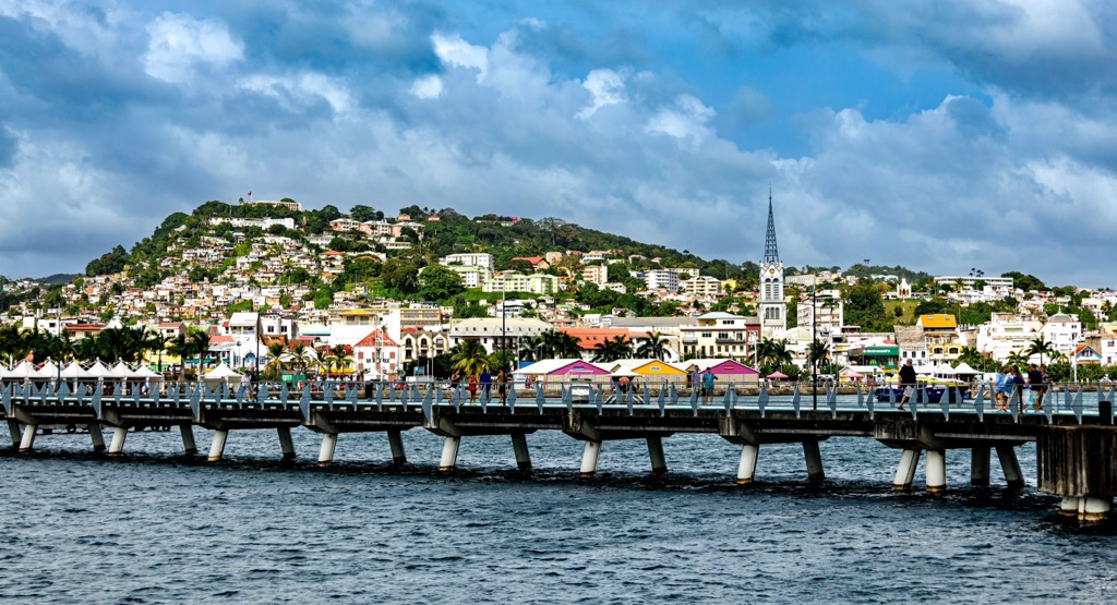
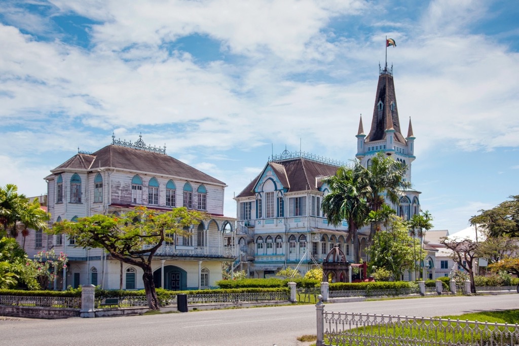
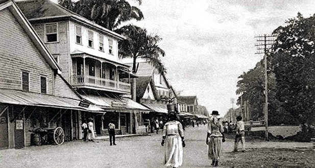
Guyana’s vibrant capital and largest city, Georgetown, is home to around 230,000 people. It is situated on the Atlantic Coast at the mouth of the Demerara River, in the Demerara-Mahaica region. Georgetown is known for its charming colonial architecture, including the iconic wooden St. George's Cathedral and the bustling Stabroek Market, with its distinctive clock tower.
The city's grid layout, tree-lined avenues, and historic seawall offer a unique glimpse into a rich heritage and Caribbean culture. While in town, be sure to explore the National Museum, the Walter Roth Museum of Anthropology, and stroll through the Botanical Gardens.
Located approximately 105 kilometers (65 mi) south of Georgetown on the Demerara River, Linden is Guyana's second-largest town, with the last recorded population at 30,000 (in 2012). It is the capital of the Upper Demerara-Berbice region.
Historically the heart of Guyana's bauxite mining industry, Linden’s landscape still tells this story. While active mining sites aren't great tourist stops, for obvious reasons, the town is surrounded by a number of “blue lakes” (former mining pits now filled with strikingly clear water), which offer unusual swimming spots. Other notable sights include the distinctive Mackenzie-Wismar Bridge and the Christianburg Water Wheel, a relic from a former plantation.
New Amsterdam, a historic town with around 17,000 residents, serves as the regional capital of East Berbice-Corentyne. Positioned on the eastern bank of the Berbice River, just a few kilometers south of the Atlantic Ocean, it offers a quieter, more laid-back atmosphere than Georgetown.
Worthy tourist sights include several historic churches, such as the Mission Chapel Congregational Church and All Saints' Anglican Church, which illustrate New Amsterdam’s colonial past under Dutch and British influence.


