Scan the QR code and open PeakVisor on your phone
Home to an exceptional array of wildlife, beautiful national parks, and stunning beaches, Venezuela is a topographically diverse country with a rich cultural history located in the northern part of South America. Venezuela contains 8,133 named mountains, the highest and most prominent of which is Pico Bolívar (4,978m/16,322ft).
The country of Venezuela (officially the Bolivarian Republic of Venezuela/República Bolivariana de Venezuela) is located in the northern part of South America.
With a total land area of 916,445 square kilometers (353,841 square miles; not counting disputed territories), Venezuela is the 32nd largest country on Earth and the sixth largest in South America after Brazil, Argentina, Peru, Colombia, and Bolivia.
Venezuela is shaped more or less like a triangle and it occupies a large portion of South America’s coastline along the Caribbean Sea. It shares its land borders with a number of countries. This includes Colombia to the west, Guyana to the east, and the states of Roraima and Amazonas in Brazil to the south.
Furthermore, Venezuela is situated to the south of a number of Caribbean island countries and territories. This includes its close neighbor Trinidad and Tobago, as well as Grenada, Barbados, Saint Vincent and the Grenadines, Saint Lucia. It is also located to the south of the territories of Aruba and Curaçao of the Netherlands and the territory of Martinique of France.

Venezuela is officially divided up into 23 states (estados), 1 Capital District (Distrito Capital), and its Federal Dependencies (Dependencias Federales). The country also claims Guayana Esequiba as part of its territory, though this is disputed with Guyana.
Furthermore, Venezuela can be divided up into 8 natural regions, each of which has its own unique topography and ecology. However, these are not to be confused with the country’s 9 official administrative regions. While these two region classification systems are actually quite similar, they have some notable differences, particularly around Los Llanos.
The 8 natural regions include:
Located to the east and west of the Maracaibo Basin, the Venezuelan Andes (Región Los Andes/The Andes Region) are the primary mountain range within the country. This region includes all or part of the states of Táchira, Trujillo, Mérida, Barinas, Apure, Portuguesa, and Zulia.
The Andes Region is the fifth largest in the country, occupying some 5.2% of the total land area. As the name suggests, this region is highly mountainous, so it is a popular destination for outdoor recreation.
Within the region, there are many fantastic national parks and natural monuments to check out, including:
Situated just to the northeast of the Venezuelan Andes and the Maracaibo Basin, the Región Formación Lara-Falcón (Lara-Falcón Highlands Region) is a relatively hilly area that accounts for about 5.75% of Venezuela’s total land area. It includes all or most of Falcón, Lara, Zulia, and Yaracuy states.
When compared to the nearby Andes, the Lara-Falcón Highlands Region is substantially less mountainous. However, it is the home of the only true desert in Venezuela—the Médanos de Coro.
Here, the economy is mostly based on subsistence agriculture, though there are a few oil deposits in the area. Nevertheless, the region is also home to a number of great parks, including:
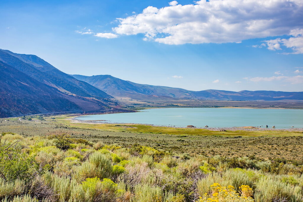
Región Depresión del lago de Maracaibo (Maracaibo Basin Region) is a large lowland area situated around Lake Maracaibo, a tidal estuary. This region is wholly contained within the state of Zulia and it contains about 4% of Venezuela’s total land area
Maracaibo Basin is known for being particularly rich in oil. It has already produced well over 30 billion barrels of oil and it is responsible for around 50% of the country’s total oil exports.
While the region is best-known for its oil industry, it does also contain a national park, Ciénagas del Catatumbo National Park (Parque nacional Ciénagas de Juan Manuel), which is worth checking out.
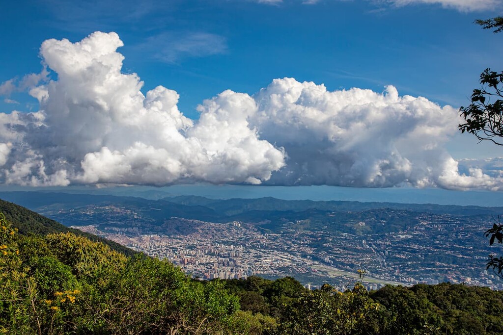
Broken up into two discontinuous sections, the Región Cordillera de La Costa (Cordillera de La Costa Region) is located along the northern coast of Venezuela. It includes parts of Yaracuy, Carabobo, Aragua, Vargas (La Guaira), Distrito Capital, Miranda, and Sucre states and contains about 5.3% of the country’s total land area.
Although it’s not as lofty as the nearby Andes, the Cordillera de La Costa Region is home to a mountain chain that’s sometimes called the Venezuelan Coastal Range or the Serranía de la Costa.
As this region is home to Caracas, the capital and largest city of Venezuela with about 2.2 million residents, the Cordillera de La Costa is one of the most population dense places in the country.
Due to the region’s proximity to the mountains, however, it’s also an excellent place to go hiking. In fact, it contains a number of parks, including:
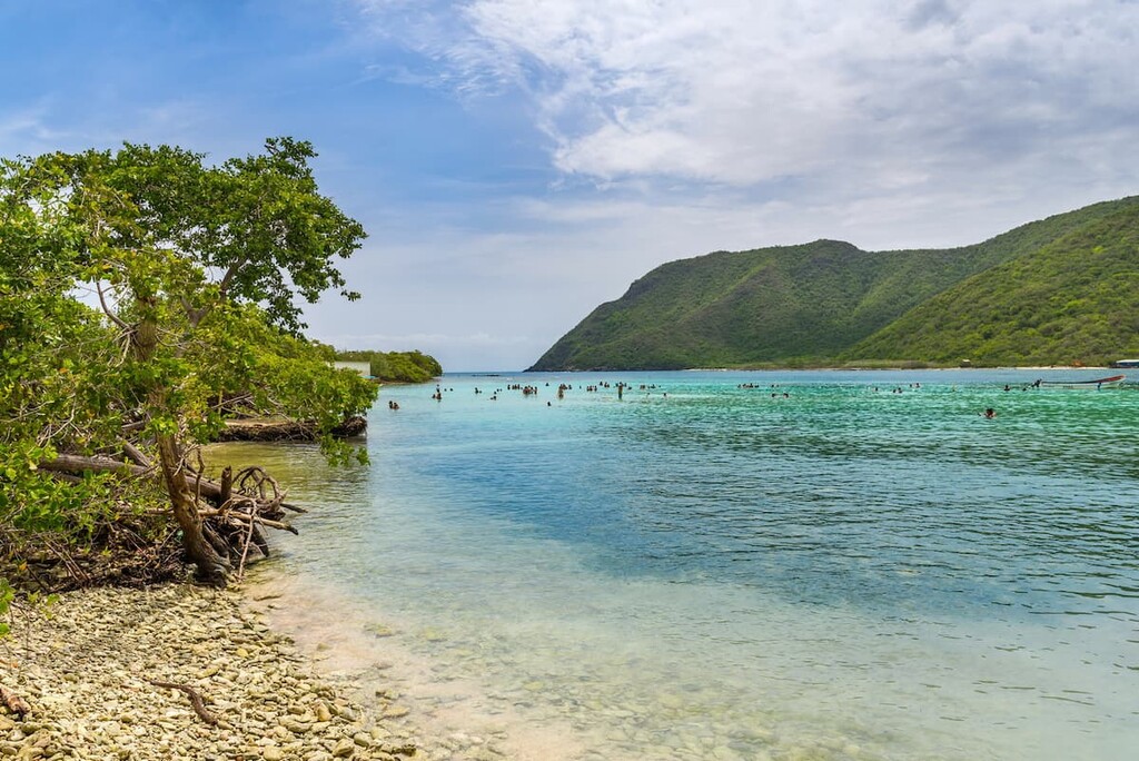
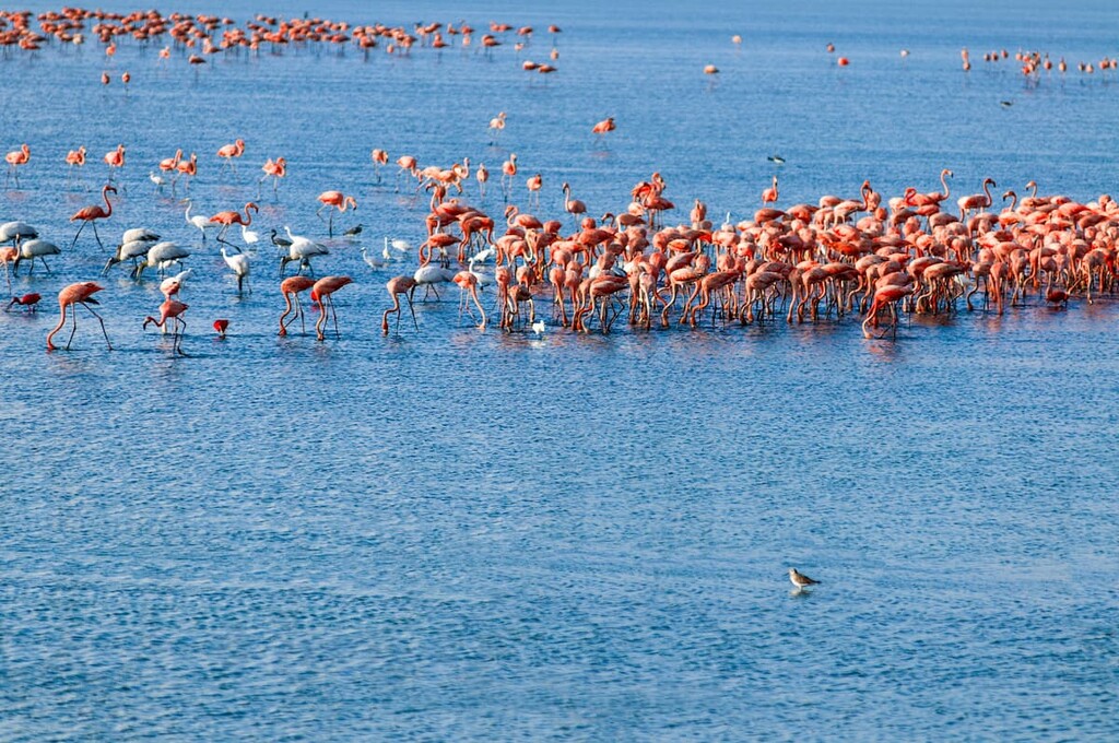
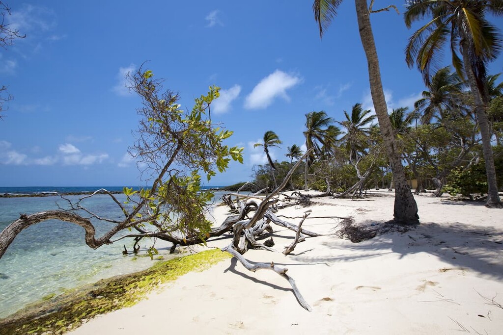
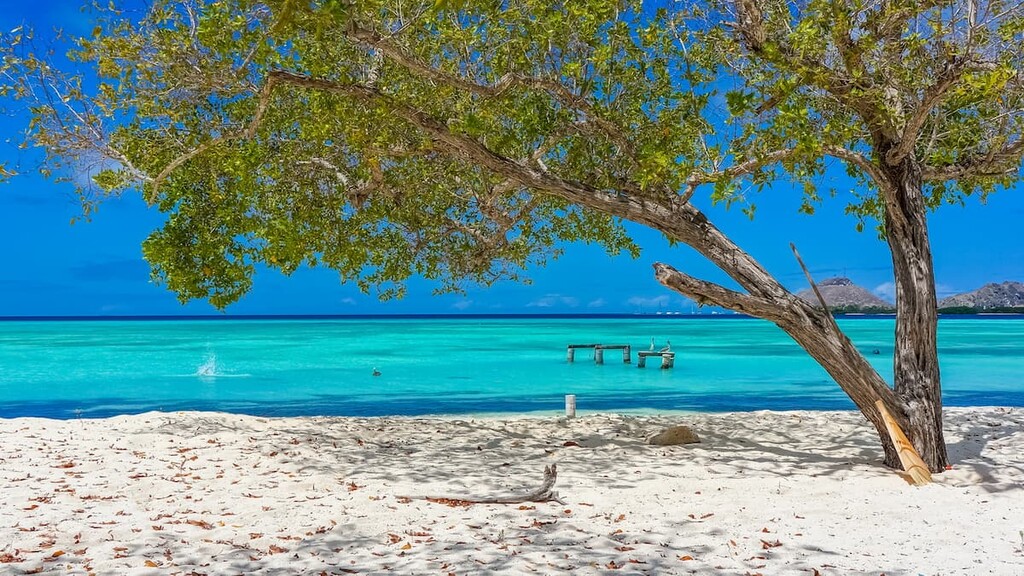
The smallest of Venezuela’s natural regions, the Región Insular (Insular Region) includes nearly all the country’s island territories in the Caribbean. This includes the state of Nueva Esparta as well as the Dependencias Federales de Venezuela, which together account for less than 0.50% of the country’s total land area.
For the most part, the population of the Región Insular is concentrated within Nueva Esparta. Tourism is the primary economy in the region as the islands’ beautiful beaches draw people to their shores.
There are also quite a few monuments and national parks within the Región insular, including:
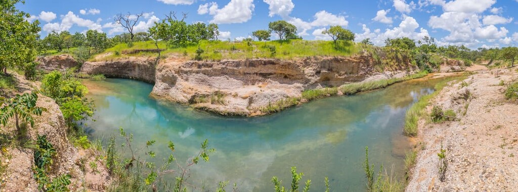
Encompassing over one-quarter of Venezuela’s total land area, Región Los Llanos (Los Llanos Region) is the large, mostly flat plain that lies in the central part of the country. It includes all or part of the states of Barinas, Portuguesa Cojedes, Guárico, Apure, Anzoátegui, and Monagas.
Due to the mostly flat terrain in Los Llanos, the region is mostly agricultural. Grazing is a particularly common economic pursuit in the region, though oil extraction has also become an important industry in recent years.
Although it is mostly agricultural, there are two national parks located within Los Llanos: Aguaro-Guariquito National Park (Parque nacional Aguaro-Guariquito) and Santos Luzardo National Park (Parque nacional Santos Luzardo).
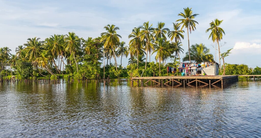
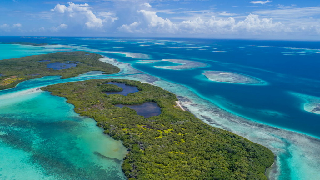
Perhaps the flattest of Venezuela’s regions, the Región Delta del río Orinoco (Orinoco Delta Region) is home to the river delta of the mighty Orinoco River in the northeastern part of the country. It almost completely contains Delta Amacuro and it includes about 4% of the country’s total land area.
Here, the landscape is dominated by swamps and mangroves, though agriculture is becoming more of a dominant force on the landscape. Oil, peat, and gold mining, as well as timber production are also important economic activities in the region.
Tourism is fairly limited in Región Delta del río Orinoco (Orinoco Delta Region), however the region’s natural landscapes are particularly stunning. There are also a number of beautiful historic buildings within the region, particularly in the city of Tucupita.

Easily the largest region in the country, the Región Guayana (Guayana Region) covers about 50% of Venezuela's land area. It is located in the southeastern part of the country and includes the states of Amazonas and Bolívar, as well as a small portion of Delta Amacuro.
The Guayana Region is home to a wide range of ecosystems, including Venezuela’s tropical rainforests. It is also home to the Guiana Highlands, which contain a number of notable peaks and rock formations.
Due to the sheer size of this region and the remoteness of its terrain, the Guayana Region is one of the least densely populated parts of the country. In fact, Amazonas State contains about one-fifth of the country’s land area but only 1% of its population.
Within this region, there are many national parks. These include:
Furthermore, much of the Guayana Region is included within various natural monuments, such as:
For the most part, Venezuela’s mountainous regions can be divided up into two distinct sections: the Andes and the Guiana Highlands.
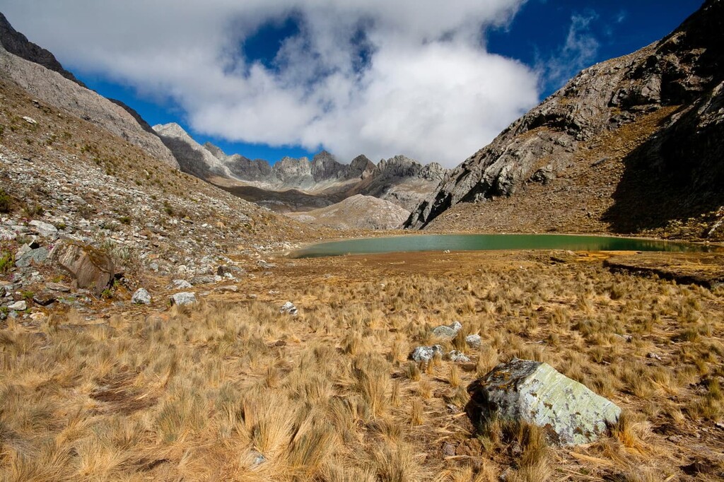
Home to the highest peaks in Venezuela, the Andes are one of the world’s longest mountain chains. Alongside neighboring Colombia, Venezuela contains the northernmost extent of the Andes, which run down the western edge of South America to the southern tip of Chile and Argentina.
The range formed mostly as a result of the subduction of the Nazca Plate under the South American Plate. This subduction also led to widespread volcanism throughout the range.
These days, the Andes are still home to a number of volcanoes, but these are mostly located to the south of Venezuela
Major peaks in the Venezuelan Andes include Pico Bolívar, Pico Los Nevados, Pico El Toro, Páramo de Agua Blanca, and Pico Naiguatá.
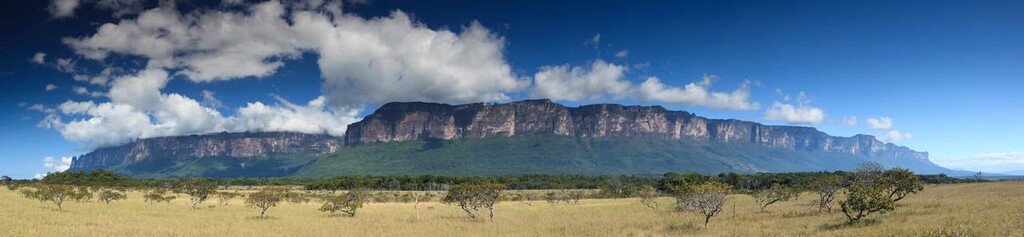
Covering much of southeastern Venezuela, as well as parts of Guyana, Suriname, Brazil, and French Guiana, the Guiana Highlands are an ancient geological formation that’s composed mostly of metasedimentary, metavolcanic, and sedimentary rocks. The range contains some 1,857 named peaks, the highest of which is Pico de Neblina in Brazil, though the second highest is Cerro Marahuaca of Venezuela.
The oldest rocks within the Guiana Highlands date back some 1.8 billion years. Within the range, particularly within Venezuela, there are a number of tepuis, which are massive table-top mountains that rise dramatically above the landscape below.

Major peaks in the Venezuelan Guiana highlands include Cerro Marahuaca, Monte Roraima, Illú-Tramen Tepui, Auyán Tepui, and Aprada Tepui.
Venezuela is one of the world’s most biodiverse countries. It is listed among the 17 megadiverse countries on Earth, which are a collection of countries that contain high numbers of endemic species and a vast array of flora and fauna.
Due to the many distinct natural regions of Venezuela, the country contains a large number of different ecosystems. These include alpine ecosystems in the Andes, tropical rainforests in the Amazon Basin, llanos plains in the central part of the country, and mangroves in the Orinoco River Delta.
However, many of Venezuela’s natural ecosystems are threatened or at risk due to human activity.
The country is home to a truly fantastic collection of wildlife, which includes about 8,000 individual species. In particular, the country contains about 1,400 bird, 340 reptile, 350 mammal, 315 amphibian, and 2,000 fish species.
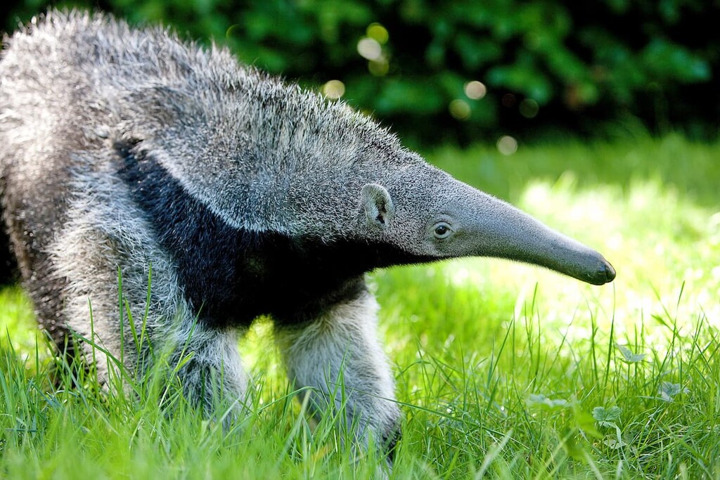
Some of the most notable animals in the country include capybaras, giant anteaters, howler monkeys, jaguars, sloths, giant otters, bush dogs, crab-eating foxes, spectacled bears, ocelots, jaguarundis, and tapirs.
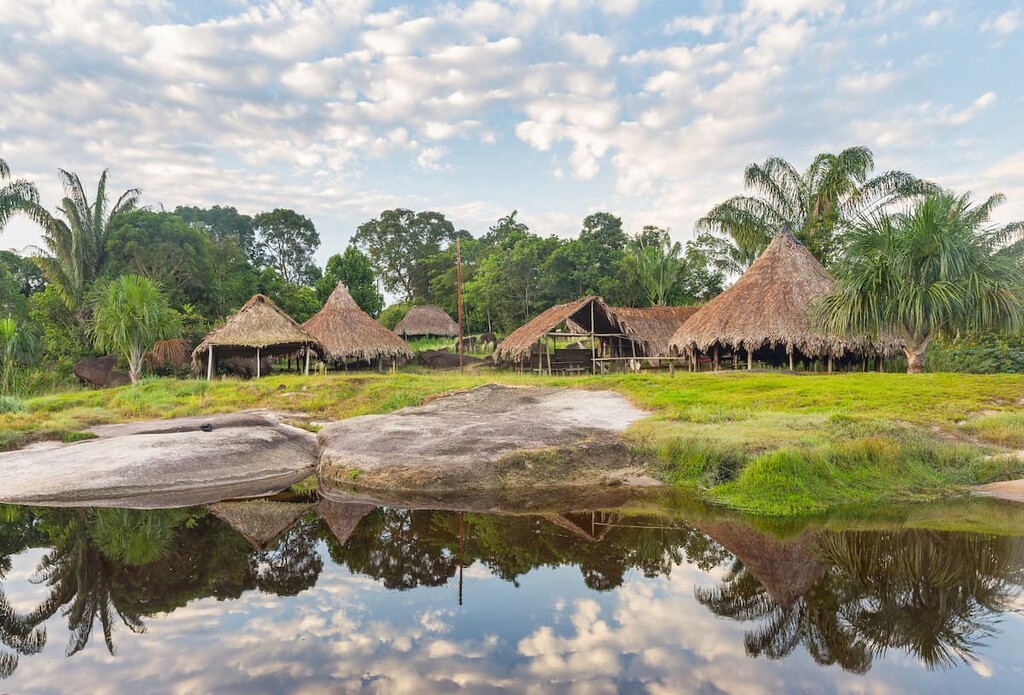
Humans have been living in what is now Venezuela for tens of thousands of years. The region has been home to countless groups of people over the millennia, including the Kalina, Caquetio, Timoto-Cuicas, Auaké, and Mariche.
Many Indigenous groups that consider the region to be part of their traditional territory, such as the Ya̧nomamö, Wayuu, Yaruno, Motilone, Pemon, and Barí continue to live in the country to this day. While it is not known how many Indigenous peoples lived in the region before the arrival of the Spanish, the pre-colonization population of the area is believed to be around 1 million people.
The first people of European descent to have arrived in what is now Venezuela was likely Christopher Colombus, who sailed near the Orinoco Delta on his third voyage in 1498.
In 1522, the Spanish returned to the region in order to colonize it, establishing a settlement at what is now Cumaná. The period of Spanish colonization led to a rapid decline in the population of the region's many Indigenous tribes and nations due to violence and introduced diseases.
Interestingly enough, the Spanish actually gave their claims to the land to the Welser family of Germany from 1528 to 1546 as part of a debt repayment on behalf of Emperor Charles V. This debt repayment allowed the Welser family, which was a prominent banking and merchant family at the time, a chance to colonize and survey the region for gold. However, King Charles I eventually revoked the charter.
After the German charter was revoked in 1546, the region became part of Spain’s colonial territories in South America. It went by many names over the course of its more than 300 years of colonization, including New Andalusia, New Granada, and Venezuela.
Alongside nearly every other Spanish colony in South America, Venezuela gained its independence in the early nineteenth century. Simón Bolívar played a major role in Venezuela’s long fight for independence, eventually being labeled as El Liberatador (The Liberator).
After proclaiming its independence in the early part of the nineteenth century, Venezuela experienced a tumultuous first few decades. It experienced a significant amount of political unrest, which eventually led to civil war.
Toward the end of the nineteenth century, the country entered what is now called the Venezuela Crisis of 1895, which was the culmination of a long-standing dispute with the United Kingdom over control of Guayana Esequiba. The control over the area is still a subject of debate and tension in the region.
Perhaps the biggest single event in independent Venezuela’s history, at least from an economic standpoint, was the discovery of oil in Lake Maracaibo during World War I. This led to a boom in the Venezuelan economy, which lasted until about the 1980s, though the country remains one of the world’s top exporters of oil.
The rest of the twentieth century was politically quite tumultuous. It eventually ended with the Bolivarian Revolution, which saw the start of a left-wing populist social movement in the country as led by Hugo Chávez.
The years after Chávez’s death have been challenging politically and economically for the country. However, Venezuela is home to an abundance of natural resources and some truly wonderful outdoor recreation areas, so it is well-poised to assert itself as a major player in the region in the coming years.
Venezuela’s diversity of landscapes offer a lifetime of adventure for visitors. Here are some of the most popular parks and outdoor recreation areas to visit when in Venezuela:
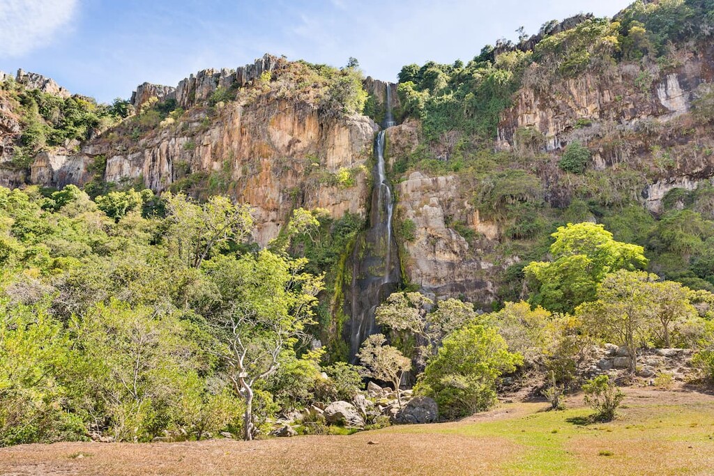
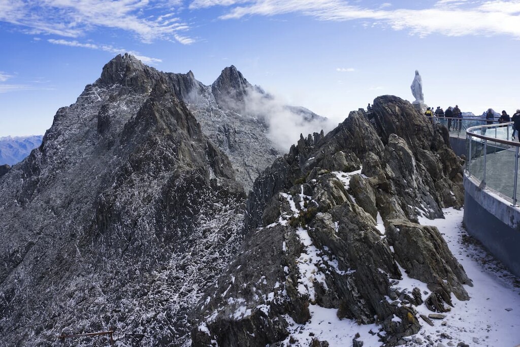
Home to Venezuela’s highest peak, Sierra Nevada National Park (Parque nacional Sierra Nevada) is a popular hiking destination in the Venezuelan Andes. It contains 57 named mountains, the highest and most prominent of which is Pico Bolívar.
Sierra Nevada National Park is the second-oldest park in the country after Henri Pittier. It preserves some of the important alpine habitat within the Andes, which is the perfect habitat for endangered species, like the spectacled bear.
The park can be accessed by the Mérida Cable Car, which starts at the city of Mérida and ascends to Pico Espejo. This makes it one of the longest and highest cable cars in the world, as well as an exciting way to visit this spectacular national park.
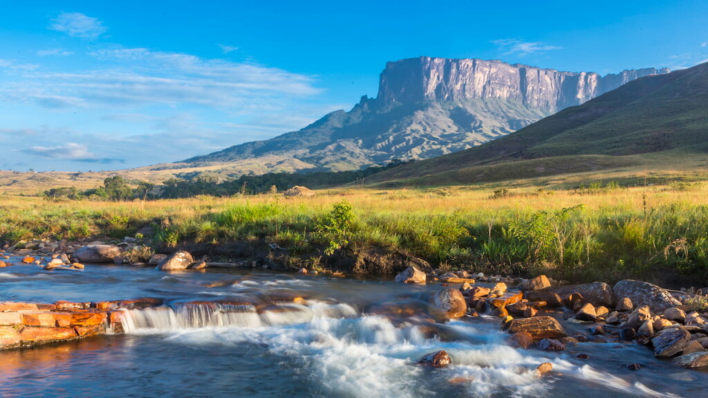
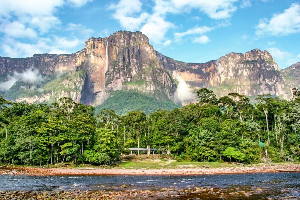
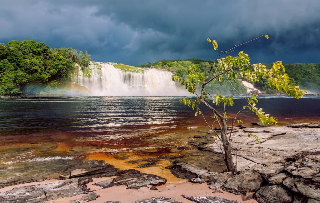
Canaima National Park (Parque nacional Canaima) is located in the southeastern part of Venezuela. It contains 43 named mountains, the highest and most prominent of which is Monte Roraima.
The park is among the largest in the country and it is designed to protect the tropical rainforests of the region. It also contains a number of tepuis (table-top mountains), which offer a dramatic backdrop to the rainforest below.
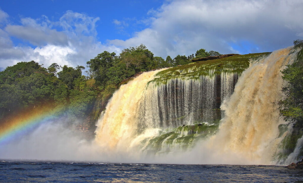
Furthermore, Canaima National Park contains Angel Falls (Salto Ángel), which is the highest uninterrupted waterfall on Earth with a total height of 979m (3,212ft). The falls are among the major tourist attractions in the country, though they are isolated and difficult to get to. Most people reach the falls by boating along the river, which can normally be arranged from about June to December.
One of the smallest national parks in Venezuela, Médanos de Coro National Park (Parque nacional Médanos de Coro) is located in the state of Falcón on the small natural isthmus (the Médanos Isthmus) that connects the mainland to the Paraguaná Peninsula. The park contains just one high point, Cerro Paguara.
Medanos de Coro contains the only natural desert in Venezuela. Here, you can find a number of large sand dunes, which provide a fantastic contrast to the mangrove swamps, salt marshes, and coastal terrain that surround the park.
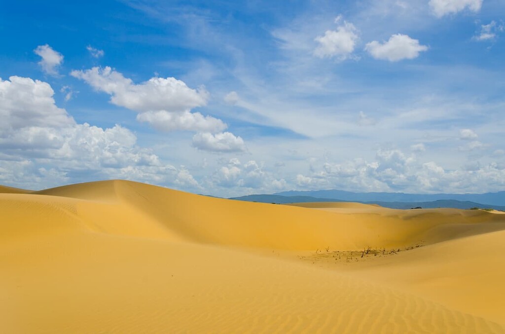
Visitors are generally free to walk around the sand dunes in the park, which are much more reminiscent of dunes in the Sahara than nearly anything else that you’d find in Venezuela.
Looking for a place to stay during your trip to Venezuela? Here are some of the largest cities to check out:
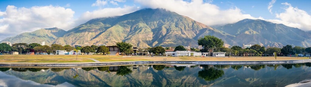
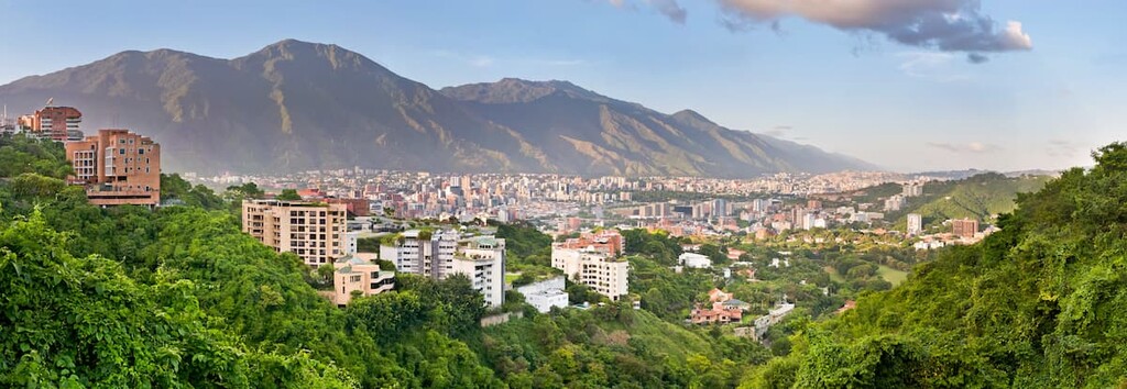
Located along the country’s northern coastline, Caracas is the capital and largest city in Venezuela. It has a population of about 2.2 million people and a greater metropolitan region that’s home to about 5 million people.
Caracas offers both stunning views of the country’s coastal mountains as well as great access to the beach. That being said, Caracas has a reputation for crime, so be sure to take care when visiting the city, particularly if travelling solo.
One of the largest cities in Venezuela, Maracaibo is located in the northwestern part of the country along the shores of Lake Maracaibo. The city is a hub for economic activity in the country, thanks to the massive oil reserves in the region. Maracaibo also has a unique culture and its streats boast some beautiful historic buildings, so it’s worth visiting if you get the chance.
Ciudad Guayana is a city of nearly 1 million people located along the banks of the Orinoco River in the northeastern part of Venezuela. It is one of the newest cities in the country, so it has a distinct architectural style and atmosphere when compared to some of the urban areas in Venezuela that were established during colonial times.
However, Ciudad Guayana is also a great place to visit if you want to see some of the stunning waterfalls along the Orinoco River. Plus, there are even some colonial castles located just outside the city that are fun to visit if you’re touring the area.