
Scan the QR code and open PeakVisor on your phone
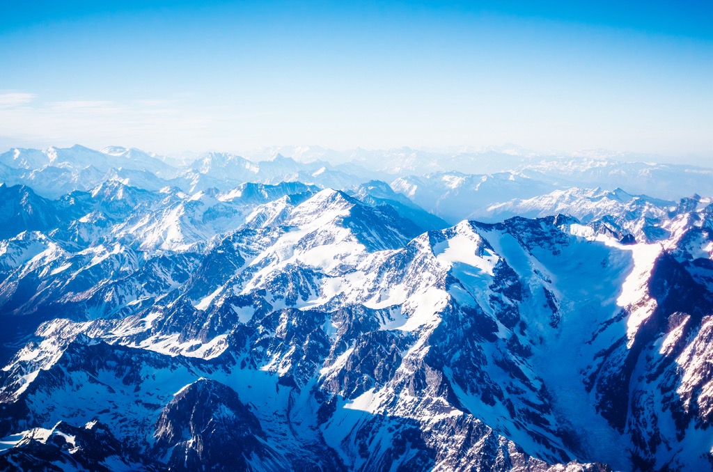
Occupying the narrow strip of land between the high peaks of the Andes and the Pacific, the Republic of Chile has captivated the hearts of adventurers, nature enthusiasts, and explorers for centuries. Chile stretches from the Atacama Desert in the north, through the lush agricultural valleys of central Chile, to the majestic Patagonian Andes, with vast grasslands, glaciers, and rugged fjords. Chile is the eighth most mountainous country in the world, with over 80% of its terrain classified as mountainous. The country boasts around 10761 named peaks, of which Nevado Ojos del Salado (6,893 m/22,615 ft) is the highest point, and Monte San Valentín (4,070 m/13,353 ft) is the most prominent.
Chile is a long, narrow country that occupies the southwest of the South American continent between the Andes Mountains and the Pacific Ocean. Peru and Bolivia border the north of Chile, with Argentina along the long eastern border.

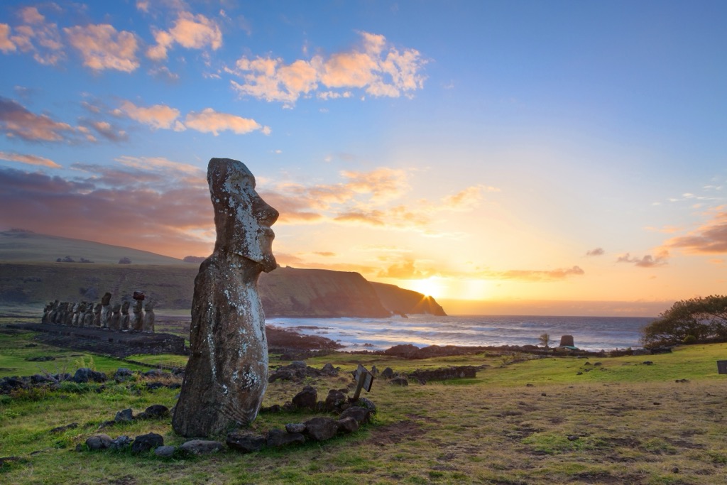
The country’s mainland is over 750,000 square kilometers (290,000 square miles); it also controls several Pacific islands and claims a portion of Antarctica. The Pacific territories of Chile include the Juan Fernández Islands, Isla Salas y Gómez, the Desventuradas Islands, and Easter Island. The Chilean Antarctic Territory consists of a 1,250,000 square kilometer (480,000 sq mi) chunk of the continent, located to the south of mainland Chile.
Chile is a land of extremes. Although the country is never more than 177 km (110 mi) wide, Chile's 4,270 km (2,653 mi) length produces significant diversity. The crest of the Andes and Ojos del Salado crater lake, the world’s highest lake, are less than 200 km (120 mi) from the Pacific Ocean. The north end of Chile has the Atacama desert, the driest place in the world, while in the South, the city of Valdivia is one of the rainiest places in the world. Chile’s ecological diversity may be surprising until you consider that the country is as long as the distance from New York to San Francisco or London to Tehran (Iran).
Politically Chile is divided into 16 regions subdivided into provinces and communes. However, five zones describe Chile geographically: Norte Grande (the Far North), Norte Chico (the Near North), Zona Central (Central Chile), Zona Sur (the South), and Zona Austral (the Far South).
The following is more detailed information on Chile’s geographical regions.
The Far North is an extremely arid region extending from the Peruvian border to roughly the Copiapó River. The Atacama Desert is the primary feature of the Far North. It’s one of the driest areas in the world; some parts have not recorded rain for hundreds of years.
Mountains and hills of all shapes and sizes rise from the ocean to an elevation of about 1,000 m (3,281 ft), providing visitors with views of a stunning landscape. The hills and bluffs along the coast, which are part of the Cordillera Domeyko, create microclimates along the borders of the desert where fog forms. Plants have adapted to collecting moisture from the fog rather than the ground.
The Far North also contains a large section of the Andean Plateau which can receive considerable rainfall during the summer. Some water is lost to evaporation, some is absorbed by the sand, some flows to form shallow, saline lakes, and some even reaches the Pacific as part of the Loa River.
These rivers have carved narrow, fertile valleys in stark contrast to the bone-dry hills. Most communities are situated in these fertile valleys or along the coast, such as Iquique and Antofagasta, two of the area's major cities. Chuquicamata, the world’s largest open-pit copper mine, is also found in the Far North.

The Far North has incredible scenery and unique wilderness areas to visit. The following are the major wilderness areas and parks:

The Near North extends from the Copiapó River to just north of the capital city of Santiago. This region is semiarid, and while it receives significantly more precipitation than the Far North, it’s still subject to seasonal droughts. However, enough snow falls on the Andes that the rivers flow year-round.
While the flow of the rivers changes seasonally, they have still managed to cut deep, broad valleys from the Andes to the Pacific. The river valleys provide a break in the coastal elevations and allow coastal moisture to penetrate inland, making them fertile for ranching and orchards.
Coquimbo is one of the larger cities in the region, and the following are the wilderness areas and major parks:

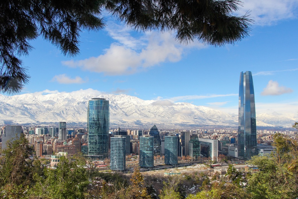
Central Chile has a Mediterranean-type climate with rainfall increasing considerably from north to south. The Central Zone is the most populated part of Chile, extending from Valparaíso to Concepción. Along with Santiago, these two cities are the country’s largest metropolitan areas. Other notable cities are Curico, Chillán, and Rancagua.
A coastal range of mountains aptly named the Chilean Coast Range runs parallel to the Andes, through the Central Zone. Between the two mountain ranges is the Central Valley, which contains some of Chile's most prosperous agricultural lands. This region is a major producer of fruits for worldwide export and the birthplace of some of the best Chilean wines.
Astute readers may draw parallels between the Zona Central of Chile and another legendary, mountainous region: California. The two territories are remarkably similar. Both occupy similar latitudes along the Pacific Ocean, albeit one in the Northern Hemisphere and one in the South. Both consist of a smaller Coast Range, followed by a fertile Central Valley and a towering Sierra. Both are major wine producers and exporters.

Toward the south end of the zone, some areas were deforested early in the colonization of Chile to turn into agricultural land. The land was quickly stripped of its nutrients and became far less productive. Some of this area is now part of reforestation efforts for industry.
Fortunately, some areas still contain old-growth forests. These forests exist among the taller mountains of the Coast Range and the pre-Andean highlands.
Zona Central also has some unique parks and wilderness areas, such as:

The South is Chile's “lake region” and extends from the Bio-Bio River to the Chacao Channel. Some major cities in this area of Chile are Temuco, Puerto Montt, and Valdivia.
In the South, the Andes still dominate the eastern horizon; however, the Chilean Coast Range and the central valley gradually lose elevation. The central valley falls into the sea at the southern end of this zone, just south of the city of Puerto Montt, to form the Gulf of Chiloé.
In this zone, the hundreds of rivers that flow from the Andes form lakes throughout the Central Valley, some of which are quite large. The lakes then drain to the ocean through other rivers, including the Calle-Calle River, one of Chile's most navigable waterways.

Unlike the Far North, which contains the driest area in the world, the South is one of the world’s rainiest areas, with an average annual rainfall of over 2,500 mm (98 inches) near the city of Valdivia. Its vast, lush tracts of wilderness feature many old-growth forests.
The Zona Sur has beautiful wilderness areas, vast lakes, and stunning waterfalls cascading from the Andes. The following are some of the major parks and wilderness areas.
The Far South of Chile reaches from the Chacao Channel to Cape Horn. The central valley separating the Andes from the Chilean Coast Range has submerged into the ocean. The rolling hills upon Isla de Chiloé are the last significant elevations of the Chilean Coast Range.
Snow-capped mountains and rugged fjords and islands characterize the Far South of Chile. The Chilean Coast Range is submerged beneath the Pacific at the north end of this zone. Along this final length of Chile, the mighty peaks of the Andes Mountains fall away to mere islands before becoming completely submerged in the Strait of Magellan.
Punta Arenas is the most southern city in Chile and the largest in the Far South. While oil and gas extraction is the region's main economic activity, vast grasslands are used for raising sheep.

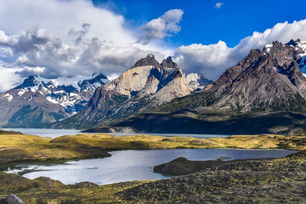
The highways through southern Chile are not continuous, and many areas are most easily accessible by passing through Argentina. The Andes Mountains of Patagonia and the rugged coastline have spectacular views and wilderness adventures. The following are some parks and wilderness areas in the Far South of Chile.

The geological history of Chile started over 600 million years ago when the supercontinent of Gondwana formed. The Andean orogeny was the major event that created Chile as we know it today, and geological processes are still ongoing.
During the Proterozoic, massive pieces of the Earth’s crust started coming together as a result of plate tectonics. The formation of Gondwana began with India connecting with Madagascar, the Arabian Peninsula, and East Africa. This communal gathering was followed by the accretion of South America to West Africa. Finally, Antarctica and Australia collided with South Africa about 530 million years ago.
For around 200 million years, these continents formed Gondwana. Present-day Chile sat along the western margin of the supercontinent. Approximately 335 million years ago, Pangea formed when Gondwana connected with Laurasia, connecting all of the major landmasses on Earth.
Starting 215 million years ago, the same tectonic forces that brought all the continents together began pushing and pulling them apart. The major geological event that created the current topography of Chile was the Andean orogeny, which started during the Jurassic about 175 million years ago.
An orogeny refers to any large-scale mountain-building event over the course of geologic time. The Andean orogeny resulted from the subduction of oceanic tectonic plates, which first affected Chile by creating a volcanic arc along the coast at the beginning of the orogeny. For about five million years, volcanoes erupted along the coast, forming significant layers of the Chilean Coast Range.
About 90 million years ago, during the Cretaceous period, the Andean orogeny dramatically changed. The west coast of South America was now being pushed over oceanic plates, producing immense pressure and heat and causing the layers of sedimentary and metamorphic rocks to fold, break, and uplift as the Andes Mountains of Chile.
Tectonic forces pushed the Andes upwards, uplifting the older Chilean Coast Range. Near the beginning of the Cenozoic, about 66 million years ago, the Chilean Coast Range began to separate from the Andes, creating Chile’s Central Valley.
During the Pleistocene, the southern half of Chile cooled, and glaciers formed among the peaks of the Andes. The glaciers carved deep, U-shaped valleys as they flowed toward the Pacific, which the ocean later filled to create the rugged fjords of southern Chile.

The Northern and Southern Patagonian Ice Fields are the remnants of the Patagonian Ice Sheet, which covered all of Chile south of Puerto Montt. Unlike North America and Europe, there were no major extinctions or biodiversity loss since Chile was not completely covered in ice during the Pleistocene.
Chile’s coast is still an active continental margin where the Nazca and Antarctic plates are subducting beneath South America. The strain of the subduction zone causes earthquakes throughout the country and volcanic activity.
The volcanism across Chile is also responsible for most of Chile’s mineral wealth. Chile is a world leader in the production of copper, lithium, and molybdenum. Relatively large deposits of gold, potassium nitrate, and rhenium also exist.
Chile’s territory stretches 4,270 km (2,653 mi) from north to south, including deserts, rainforests, dry steppes, and many more unique ecosystems. The Atacama Desert in the north and the Andes in the east have effectively isolated Chile's flora and fauna, resulting in many endemic species.
While Chile has a vast range of climates and environments, the three major ecological zones are the desert areas in the north, the central temperate area, and the humid area in the south.

While the rock formations of the Atacama desert are stunning, the driest parts are so arid that no plant or animal can survive. However, there are microclimates where plants have adapted to trap moisture from ocean fog.
The cacti, desert shrubs, and spiny brambles rely on fog condensing upon their spines and thick leaves, funneling the moisture to their central base, where it falls to the ground to water the roots. The southern end of the desert sustains larger shrubs such as Adesmia and hardwoods such as Espino and Algarrobo.
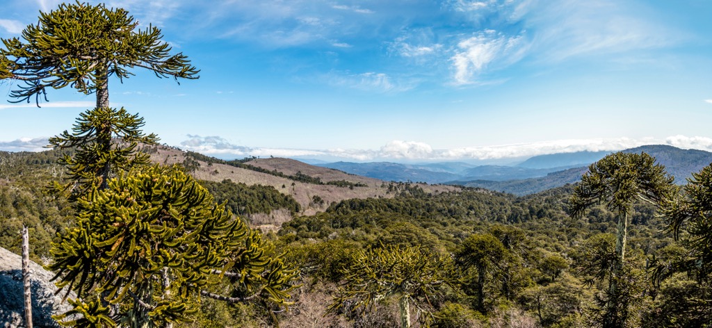
The central part of Chile transitions from semi-arid grasslands to dense forests. Rauli, or southern cedar, is a dominant tree in the central forests, while roble beech, evergreen laurel, and ulmo also colonize the region. The Chile pine, or monkey puzzle tree, forms dense stands upon the western slopes of the Andes.
Antarctic beech, Chilean cedar, and the giant Patagonian cypress fill the impenetrable forests of the south. However, the southernmost extremes of Chile are too cold and windswept to allow more than dwarf silver beech and tough grasses to grow.

There is a lack of diversity of animals in Chile because the Andes and Atacama desert restrict animal migrations. Birds are the most abundant animals in Chile, including Humboldt penguins which inhabit the coast of the Atacama Desert, parrots, and flamingos.
Rodents are the most abundant terrestrial animal, of which the chinchilla, viscacha, and degu are known for their fine furs. There are two members of the deer family, the rare huemul and the pudu, the world’s smallest known deer. Finally, the wild guanaco and the domesticated vicuñas roam the Andean highlands, which the indigenous have relied upon for thousands of years for textiles and food.

In the Monte Verde Valley in south-central Chile, there is evidence of stone tools that suggest people frequented the region as early as 15,000 years ago. Additional evidence of early human habitation exists at Cueva del Milodón in the Chilean Patagonia.
Around 10,000 years ago, migrating groups finally settled along the coast and in the fertile valleys of Chile. Mapuche, Aymara, Rapanui, Atacameño or Likan Antai, Quechua, Colla, Chango, Diaguita, Kawésqar, and Yagán are the main indigenous peoples that now inhabit Chile.
Of the indigenous people, the Mapuche are typically the most well-known and currently account for about 80% of Chile’s indigenous population. Known for their textiles and silversmithing, the Mapuche lived an agrarian lifestyle when the conquistadors arrived in the sixteenth century.
The Mapuche were already accustomed to invaders. Only about 75 years before, the Inca invaded Chile and subdued the northern regions to the central Maipo Valley. The Mapuche resistance may have ultimately halted this southern expansion of the Incan empire.
In 1540, Pedro de Valdivia advanced through northern Chile with his band of soldiers to start the Spanish conquest of Chile. The expedition was initially relatively peaceful, and Valdivia established Santiago de la Nueva Extremadura as the territory's capital in 1541. Furthermore, Valdivia separated Chile from the Viceroyalty of Peru to become the governor of an independent colony.
While Valdivia had attempted to work peacefully, relations between the Spanish and the indigenous soon began to break down. The breakdown was exacerbated when the Spanish began to enslave the locals to work in nearby mines, chasing after rumors of gold.
There was Mapuche resistance from the founding of Santiago and Chile as a territory. For nearly 350 years, the Mapuche resisted Spanish incursion. Over 700,000 Mapuche occupied Chile when the Spanish arrived, but their population soon dwindled through wars and epidemics.

Chile was a frontier garrison protecting Spanish interests in South America. Chile battled Spain’s European enemies, pirates, and the Mapuche during the early years for regional dominance.
In 1810, Chile proclaimed independence from Spain. However, it wasn’t until after much bloodshed that Chile finally achieved independence in 1818.
Over the next two hundred years, Chile expanded its initial territory to extend from the Atacama Desert to the Strait of Magellan, facing intense political turmoil. The initial infighting between separatists and royalists paved the way for a horrific dictatorship near the end of the twentieth century.

After centuries of struggle, Chileans have become strong and beautiful people with a rich culture and heritage.
Chile is a place where visitors can ski and surf on the same day. In less than 177 km (110 mi), the country rises from the Pacific Ocean to an elevation of nearly seven kilometers at the peak of Nevado Ojos del Salado (6,893 m/22,615 ft).
There are many beautiful, unique, and exciting places for visitors to experience Chile. The following are some of Chile's most popular parks and natural attractions.
Conguillío National Park is in the Andes in the south of Chile and is one of the country’s most popular parks. Some of the major attractions are the Sierra Nevada and Llaima volcanoes. Llaima is the most active volcano in Chile, having most recently erupted in 2008.
The park is filled with lush vegetation, including the unique Araucarias (monkey puzzle trees). The park has many scenic hikes; some trails explore the Sierra Nevada, while others wind through the Araucaria forests and around the Captrén Lagoon.

After their first visit to the Chacabuco Valley in 1995, Kris and Doug Tomkins began a conservation effort to preserve and restore the region’s unique ecosystems. During the previous century, the region had been subjected to intensive sheep ranching, resulting in widespread desertification of the arid and sandy soils of the Andes highlands.
The Tompkins Conservation purchased holdings in the valley to create a contiguous reserve that borders Jeinimeni and Lago Cochrane (Tamango) national reserves, calling it Parque Patagonia. In 2018 they presented the park to Chile and then combined it with the adjacent reserves to create Patagonia National Park.

The park is home to some of Chile’s unique wildlife, such as Andean condors, guanacos, and huemul. The park has several campgrounds, a lodge, a restaurant, and around 250 km (155 mi) of trails. Patagonia National Park offers visitors an incredible opportunity to appreciate Chile's wild spaces and the effort it takes to preserve them for future generations.
The driest place on Earth is the thin strip of land between the Pacific Ocean and the Andes in the north of Chile. It is an expanse of inhospitable wildlands and lifeless landscapes. There are also vibrant oases in the river valleys and upon the Altiplano.
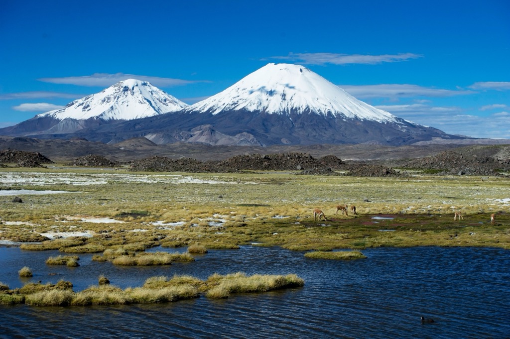
One of the places to visit in the Atacama Desert is Nevado Tres Cruces National Park, home to hot springs, incredible volcanic views, and lagoons filled with flamingos. Other wildlife-rich parks are Lauca National Park and Las Vicuñas National Reserve.

Mountaineers trek through the desert to climb Ojos del Salado, the world’s tallest active volcano. There are also many other activities, such as fat-biking, off-roading, paragliding, sandboarding, hiking, and stargazing. Visitors can also check out historical attractions such as the desert mummies and the Pintados geoglyphs, which rival Nazca in Peru.
Along the way, there are many coastal towns to stay in, as well as smaller villages around the desert. There are also dozens of ghost towns to explore, such as Humberstone, which has an opera house and trading post and gives a glimpse into life at the turn of the twentieth century in northern Chile.
The following are a few of Chile’s most notable cities, from which visitors can explore the vast desert, the rugged steppe, the massive peaks, or the lush forests of Chile.
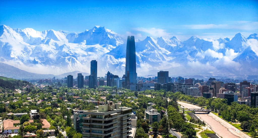
Located in central Chile, Santiago is the capital and largest city in the country. The city was established in 1541; however, the area has been inhabited for over 12,000 years. At first, nomadic hunter-gatherers traveled from the coast to hunt guanacos. By 800 CE, agricultural communities cultivated maize, potatoes, beans, and domesticated camelids like the vicuña.
Santiago is a cosmopolitan city with many attractions and festivals to visit. The city is also home to many fantastic restaurants, museums, galleries, and theaters. From Santiago, visitors can go hiking or skiing in the Andes in the morning and then watch the sunset over the Pacific Ocean from the beach.
East of Santiago, visitors can find hiking trails and wilderness adventures in Cordillera Yerba Loca National Park and Río Olivares Park with its stunning waterfalls. West of the city are the beautiful beaches of Viña del Mar, as well as La Campana National Park and Lago Peñuelas National Reserve for hiking opportunities.
While certainly not one of the largest cities in Chile, San Pedro de Atacama is one of the best places to experience the incredible Atacama Desert. With steamy hot springs, panoramic desert landscapes, and a vibrant downtown with the majestic volcanoes of the Andes as a backdrop, San Pedro de Atacama represents the Atacama Desert.
Many international visitors stay at the chic hotels of San Pedro de Atacama while visiting the surrounding attractions of the desert. Also nearby are the Flamencos National Reserve, Llullaillaco National Park, and Alto Loa National Reserve.

Named after Chile’s first governor, Valdivia is a vibrant city along Chile’s south-central coast. Indigenous people settled in the area around 14,000 years ago, and when the Spanish arrived, the Huilliche had a large village at the site of the current downtown. The Museo Austral showcases the indigenous and settlement history of Valdivia.
During the seventeenth century, the Spanish fortified Valdivia to maintain a foothold in southern Chile. Visitors can explore the fortifications around Corral Bay or the San Sebastián de la Cruz Castle, where you can see the original cannons and maybe even a reenactment of Spanish soldiers fending off a pirate attack.
Furthermore, in addition to fantastic historical sites and museums that showcase the region’s indigenous history, visitors can visit some of the nearby wilderness areas, such as the tropical rainforests in Parque Oncol or the Valdivian Coastal Reserve. The Andes are a short drive to the west; visitors can explore the incredible landscapes and forests of Puyehue National Park or Villarrica National Park.


ultra
volcano
andes-6000ers
chile-ultras
argentina-ultras
ultra
volcano
andes-6000ers
chile-ultras
argentina-ultras
ultra
volcano
andes-6000ers
chile-ultras
argentina-ultras
ultra
volcano
andes-6000ers
chile-ultras
argentina-ultras
ultra
andes-6000ers
chile-ultras
bolivia-ultras
ultra
volcano
andes-6000ers
chile-ultras
argentina-ultras
ultra
volcano
andes-6000ers
chile-ultras
argentina-ultras
ultra
volcano
chile-ultras
argentina-ultras
ultra
volcano
chile-ultras
argentina-ultras
ultra
volcano
andes-6000ers
chile-ultras
argentina-ultras


