Scan the QR code and open PeakVisor on your phone
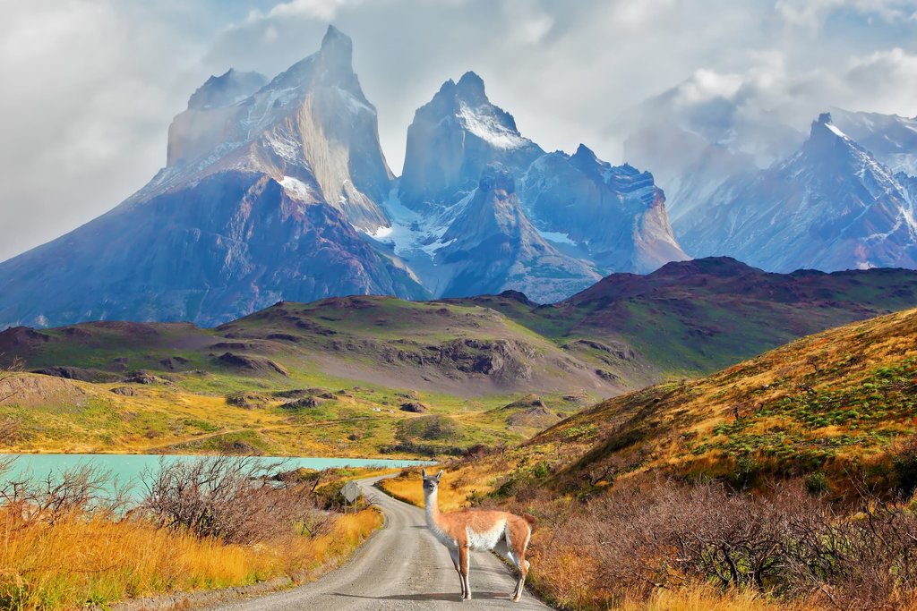
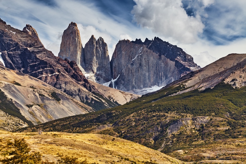
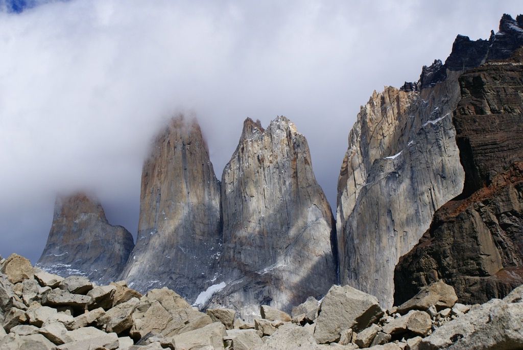
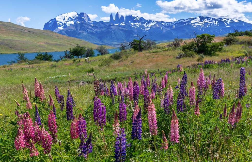
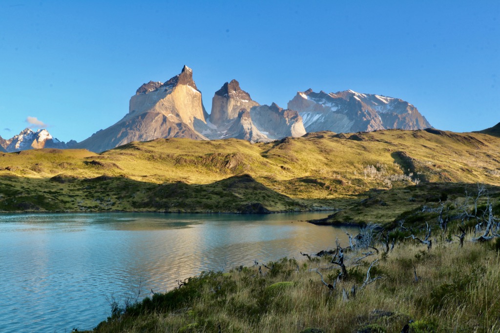
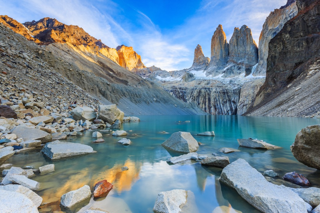
Torres del Paine National Park lies on the southern tip of Patagonia in Chile. Three mythical granite towers ("torres" in Spanish) - Torre Sur (2,501 m/8,205 ft), Torre Central (2,460 m/8,071 ft), and Torre Norte (2,260 m/7,415 ft) - give this wild and picturesque park its name.
These peaks belong to the Cordillera del Paine massif of the greater Andes range. There are 29 mountains in the park. Cerro Paine Grande (2,854 m/9,464 ft) is the tallest and the most prominent (2,195 m/7,201 ft).
Torres del Paine National Park lies on the southern tip of Patagonia in southern Chile. The spectacular landscape of granite peaks, turquoise lakes, and glacial ice fields draws visitors from around the world. It is part of the Reserva de Biósfera Torres del Paine and sits within the Provincia de Última Esperanza and XII Region of Magallanes and Chilean Antarctica.
The park covers 1,813 sq km (700 sq mi) and is 155 km (96 mi) northwest of the nearest town, Puerto Natales. The park was declared a UNESCO Biosphere Reserve in 1978. Neighboring parks include Bernardo O’Higgins National Park in Chile and Los Glaciares National Park in Argentina.
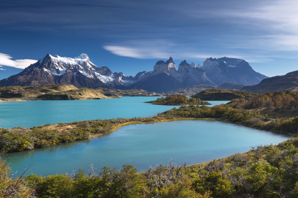
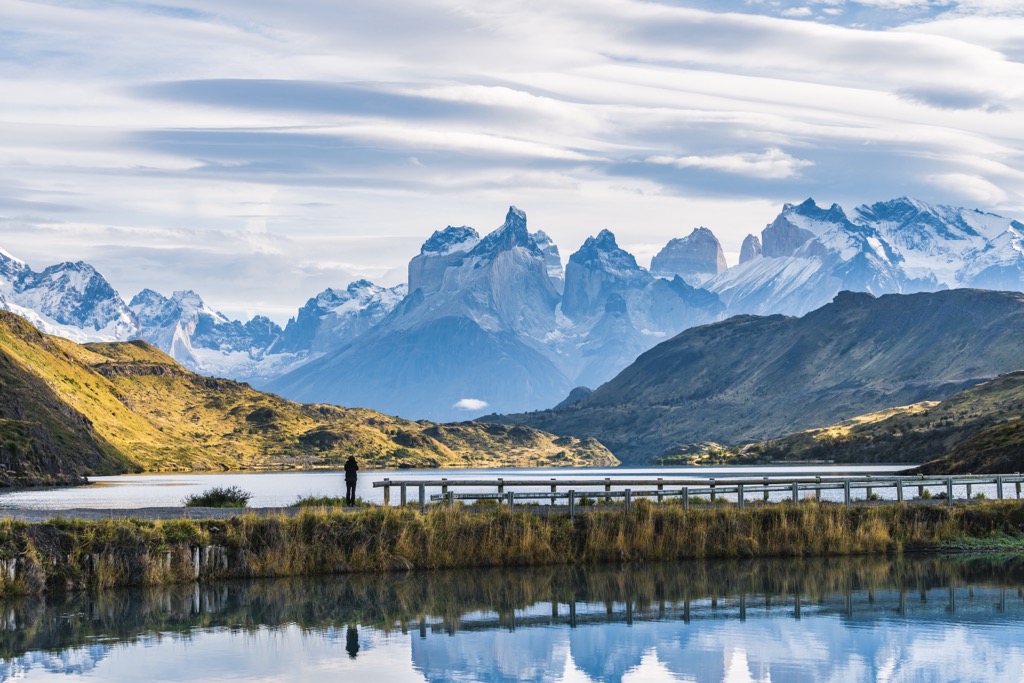
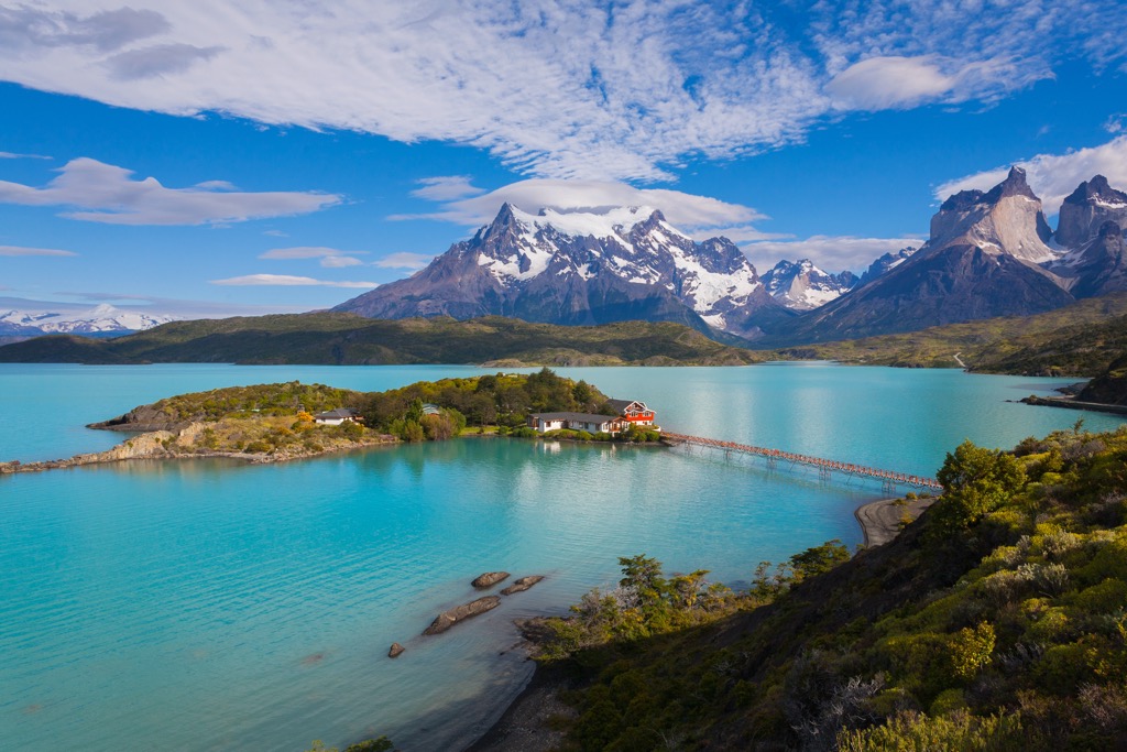
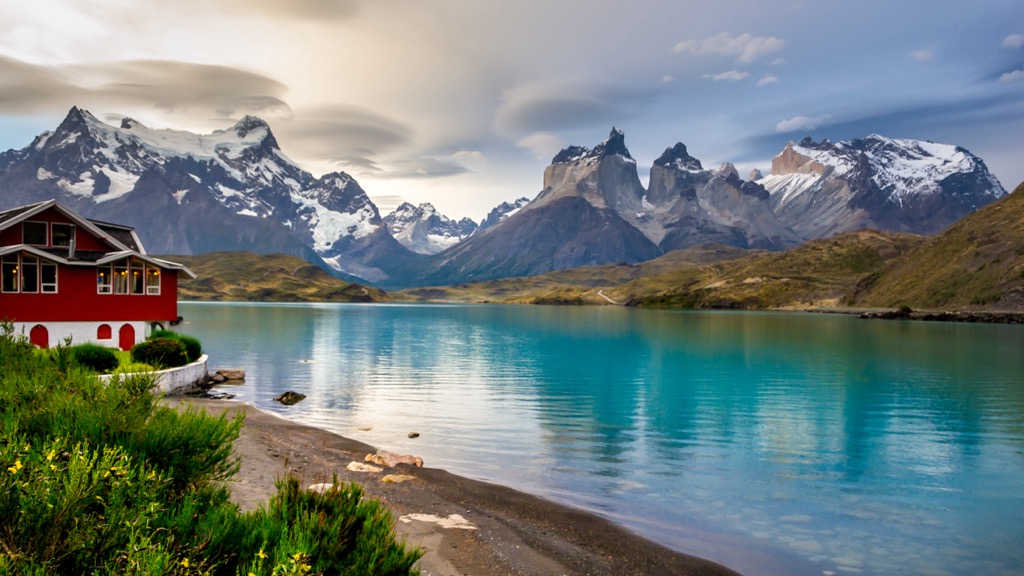
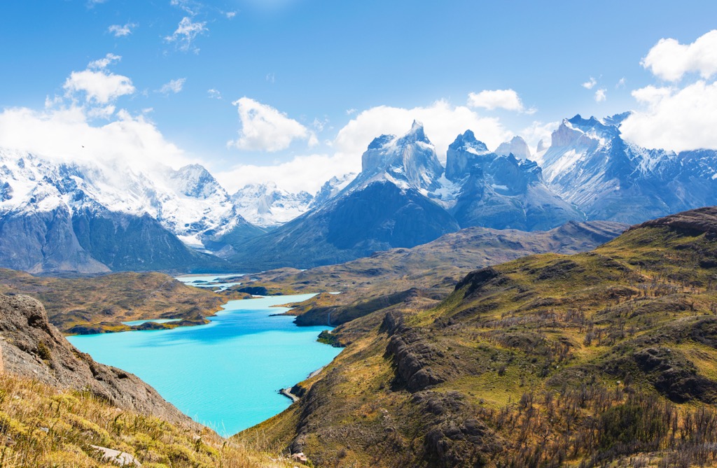
The park's rugged wilderness attracts thousands of hikers, climbers, and photographers each year. The park's prominent landmarks include Grey Lake and Pehoe Lake; the Grey, Pingo, and Tyndall glaciers; and French Valley, Ascension Valley, and the Valley of Silence. The Paine River serves as the park’s primary drainage.
Cerro Catedral rises to 2,168 m (7,113 ft) and is the central point of French Valley. Cerro Fortaleza (2,861 m/9,386 ft) and Cerro Escudo (2,512 m/8,241 ft) form enormous granite walls opposite each other in Valley of Silence.
Two of the best-known hiking routes through the park are the five-day W Trek and the seven to nine-day O Trek.
The peaks in the park are part of the Andes, a range stretching from Colombia to the tip of Patagonia. More specifically, the park contains the mountain group Cordillera del Paine, a massif with distinct characteristics from the greater Andes.
The massif formed around 12 million years ago in an upward thrusting of the Earth’s crust known as an orogeny. Glaciers subsequently eroded the upper-level sedimentary rock to expose the granite basement layer. Sandstone and mudstone are newer, softer rock layers susceptible to erosion. Meanwhile, hundreds of millions of years of heat and pressure slowly formed granite, a much older metamorphic rock. Granite is harder, more resistant to erosion, and thus still visible today.
Throughout the park are excellent opportunities to see distinct rock groupings. One example is Cuernos del Paine – a wall of light gray granite with a thick band of dark metamorphic rocks on top. The laccolith began forming over 12.5 million years ago as the granite inserted itself parallel to sedimentary layers of the Cerro Toro Formation. The hot granite converted the mudstone and sandstone into a dark metamorphic rock that crowns today's granite slab.
Sedimentary rock in the park remains from the Magallanes Basin. This area was active from the Early Cretaceous to the Middle Tertiary and collected more than 5,000 m (16,400 ft) of deposited sediment. The zones can be divided into the Punta Barrosa, Cerro Toro, and Tres Pasos Formations. Remnant examples of orange sandstone and gray mudstone are still visible.
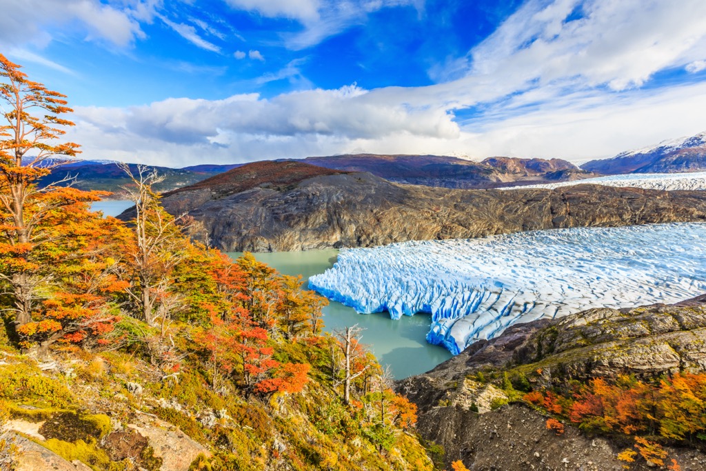
The park contains a handful of glaciers that are part of the Southern Icefield, a remnant of the glacial maximum of 15,000 years ago. Covering over 12,000 sq km (4,635 sq mi), it is the second-largest icefield in the world. Unfortunately, glaciers are rapidly shrinking due to the changing climate. Many lakes throughout the park have a bright turquoise color that comes from rock flour particles resulting from glacial erosion.
Torres del Paine National Park can reach up to 20 Celsius (68 F) in summer, fall well below 0 Celsius (32 F) in winter, and is notoriously windy. At 51 degrees south latitude, the park gets up to 16 hours of daylight in the summer but also features dark, cold winters.
Four habitat regions exist in the park:
Here’s a quick look at several common plant species in the park.
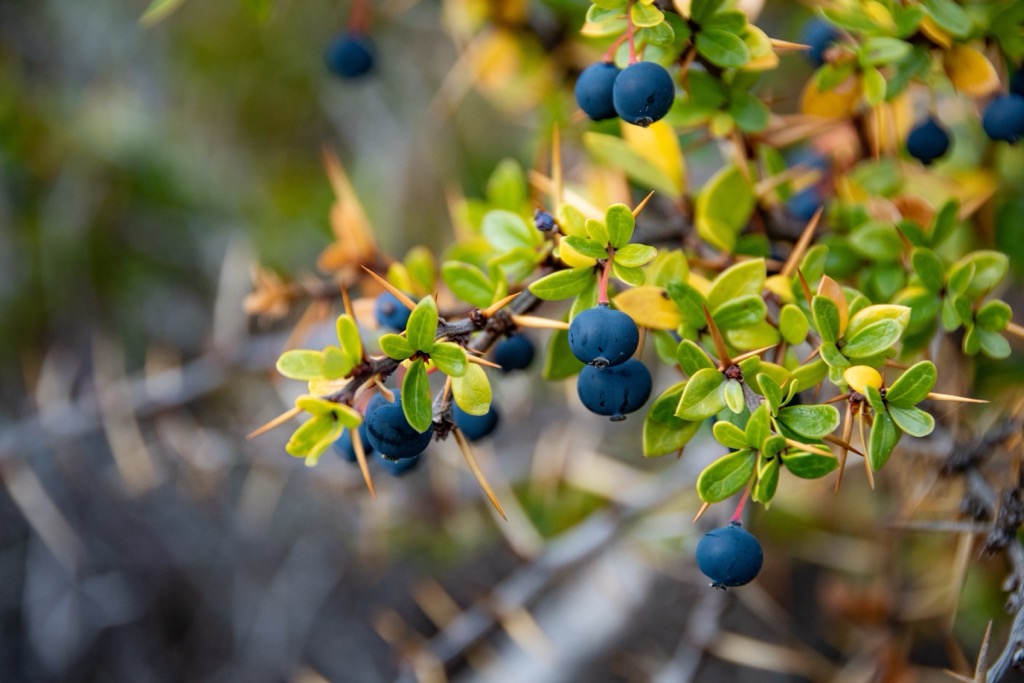
Several iconic Patagonian species make their home in the vast expanse of Torres del Paine National Park.
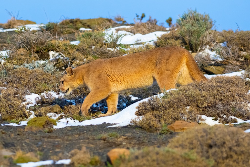
The park is home to 15 birds of prey and countless other birds. The Andean condor is one of the park’s most iconic residents. Other birds include the rhea, Chilean flamingo, Magellanic woodpecker, coscoroba swan, Magellan goose, Patagonian Sierra finch, Diuca finch, chincol, and ringed kingfisher.
Archaeological evidence traces human inhabitation back more than 11,000 years. These early Paleo-Indian settlers existed in small, nomadic hunting groups. One of the most significant challenges for early inhabitants was adapting to glacial advance, retreat, and the accompanying floods and periods of drought.
The oldest evidence of humans within the park is cave paintings of lines and dots dating back 9,740 years. The Paleo-Indian cultures preceded the region's Aonikenk (or Tehuelche) culture, which had evolved by the time Spanish explorers arrived in the 16th century. Magellan called the Aonikenk ‘Patagons’.
Chilean cowboys called baqueanos came during the 1800s and became the region’s experts for guiding, hunting, and raising sheep and cattle. Indigenous communities lived around the park until around 1905.
The government first protected the area in 1959 as the 5,000 ha (12,355 acres) Lake Grey Tourism Park. At the time, the region was still used primarily for livestock grazing; there was little in the way of activities for tourists. The name changed to Torres del Paine National Park in 1970 and reached its current size in 1979.
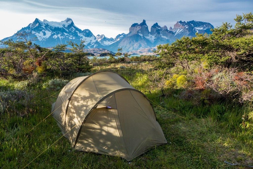
Torres del Paine National Park offers excellent hiking, backpacking, and climbing opportunities. The high season is October through April. Entrance fees are higher during this time, and accommodation within the park requires reservations. Go to Chile's National Forest Corporation website for camping reservations or book an overnight stay at the park’s refuges via Vertice Patagonia or Fantastico Sur.
No dogs are allowed in the park. There are huts with showers, beds, restaurants, and bars, as well as campsites in the more remote parts of the park. Wood-burning fires are not allowed; violations will result in expulsion from the park. Some areas require a guide, depending on the time of year.
The W Route is the park’s most popular trekking loop. It measures over 65 km (40 miles) with more than 2,895 m (9,500 ft) elevation gain and follows the park’s valleys, giving it a W shape. The journey typically takes five days, and there are huts for the entire route with showers, hot meals, and beds. The trek is a perfect way to see the park’s most picturesque landscapes without carrying camping gear and meals.
The O Route includes the W Route, adding several more days to more remote areas. This route takes an average of eight days and is about 112 km (70 mi), with over 5,180 m (17,000 ft) elevation gain. There are huts along the W Route, but the additional days require camping gear and food.
A trip to the base of the towers is an excellent option for a day hike. The towers sit at the end of the Ascencio Valley, and the trail climbs 800 m (2,625 ft) to reach the hike's high point (not the top of the towers).
Grey Lake and the glacier that formed it are key landmarks of the park. In fact, the earliest version of the park was named Grey Lake. Hikers along the W Route will see the lake. However, you also have the option to view the glacier from a boat or to arrange an ice hiking trip with a guide.
Within the park, several accommodation options offer beds, restaurants, and bars. With ATMs on site, visitors should have their money sorted before arriving. A small convenience store in the park sells basic supplies and food, and those looking to rent hiking and camping gear can do so from tour operators. However, any other services will be unavailable; potential visitors must address other needs in Puerto Natales.
Puerto Natales is the nearest town, although it takes two and a half hours of driving on a semi-paved road to reach the park. Visitors can arrive in Puerto Natales and Punta Arenas by plane from Santiago, by bus from around the region in Chile or Argentina, or by ferry. Nearly all guided excursions and itineraries include the trip from Puerto Natales. Book your stay here in advance if you plan to travel during peak season.
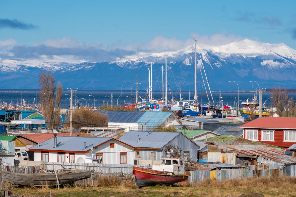
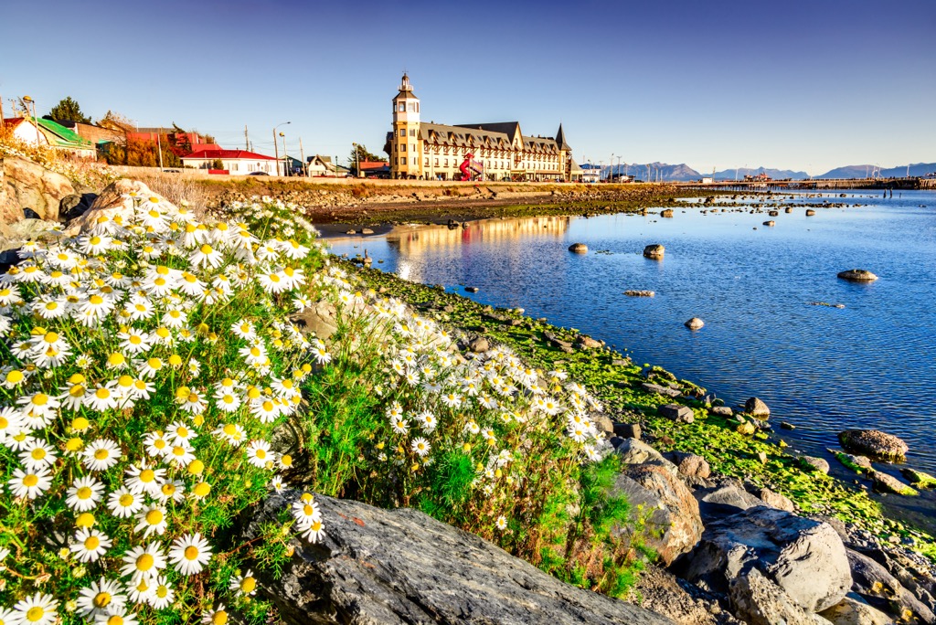
It isn’t a big town (18,500 people), but there are a few things worth checking out to get a feel for the place. Walk along the water to see Muelle Viejo, the main pier for arriving and departing ferries. You can also stop by the small local museum called Museo Historico Municipal.
On your way to the park, take a detour to the Mylodon Cave Natural Monument, located 24 km (15 mi) northwest of town. When German explorer Hermann Eberhard discovered the cave in 1895, it housed artifacts and human bones dating back to 6000 BC. He found a giant sloth (mylodon) skin dating to approximately 13,000 years ago, as well as remains of dwarf horses and saber-tooth cats.
Puerto Natales is small, but this tourist hotspot offers a range of accommodations from hostels to lodges and local and international cuisines.
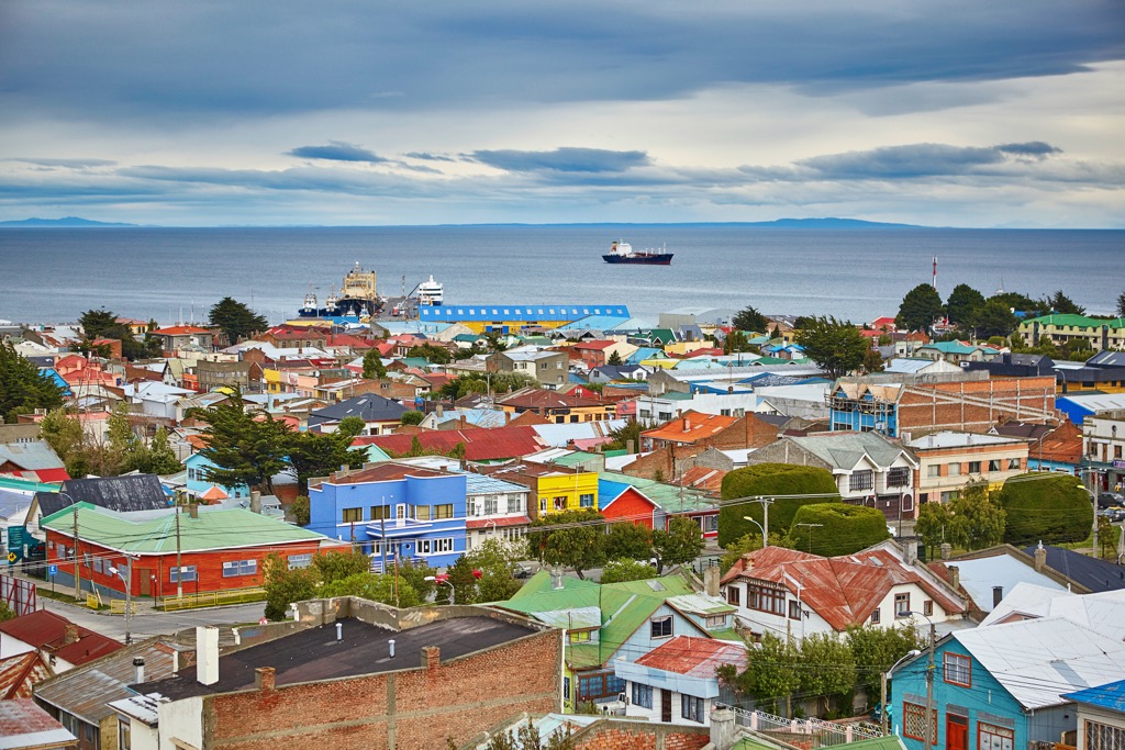
Further south of Puerto Natales is Punta Arenas. The city has a population of 124,000 and is about a four-hour drive from the national park.
Those spending a day or two in the area should check out the impressive history of the municipal cemetery and look for the Croatian influence in architecture and shops as they wander around town. A fun day trip from Punta Arenas is a trip to Isla Magdalena to see the colony of thousands of Magellanic penguins.
Visitors can find budget or upscale lodging in town. Local and international restaurants, pizzerias, and several cute cafes pepper the city.