
Scan the QR code and open PeakVisor on your phone
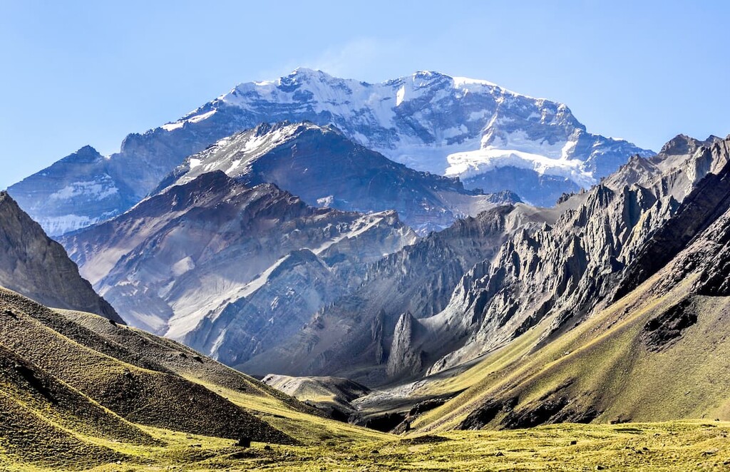
Home to the highest peak in the Southern and Western Hemispheres, the rugged Andes Mountains of Argentina and Chile are part of a major mountain range that extends down the western edge of South America. The range contains 15,450 named mountains, the highest and most prominent of which is Cerro Aconcagua (6,961m/22,838ft).
Running along the western edge of South America, the Andes are the longest mountain chain on Earth. The range technically covers an area some 7,000 km (4,350 mi) long from the southern tip of South America in Argentina and Chile along the Southern Ocean all the way north to Venezuela and Colombia on the coast of the Caribbean.
As the highest mountain range outside of Asia (which includes lofty ranges such as the Himalaya and Karakoram), the Andes are home to some of the tallest peaks on Earth. Interestingly, the Andes contain both the highest peak in the Western and Southern Hemispheres (Aconcagua), as well as the furthest peak from the center of the Earth (Chimborazo in Ecuador).
While many people would split the Andes into roughly three sections (northern, central, and southern), this article focuses on the southern half of the range.
The halfway point along the range is roughly along the tripoint border between Argentina, Chile, and Bolivia, so this article covers the Andes Mountains in both Argentina and Chile. However, the northern and central Andes, which include the mountains in Bolivia, Peru, Ecuador, Colombia, and Venezuela, are discussed elsewhere.
Interestingly, the southern Andes run nearly all of the length of the border between Argentina and Chile. This border, which has a total length of some 5,308 kilometers (3,298 mi), is the third longest international land border in the world, after the border between the United States and Canada, as well as the border between Russia and Kazakhstan (though the area in the Southern Patagonia Ice Field is still a matter of dispute).
As a result, it’s easiest to discuss the southern Andes by breaking up the range by country.
Encompassing the entirety of South America’s western coastline to the south of Peru, Chile is a long, narrow country that’s dominated by the Andes Mountains. Throughout its 4,270 km (2,653 mi) extent, Chile is heavily mountainous. In fact, less than a quarter of the country’s land area is home to relatively flat terrain, much of which is in the Chilean Central Valley (Valle Central).
As the Andes are found almost completely throughout Chile, there are many, many national parks and protected areas for visitors to enjoy. Some of the most popular national parks to check out in the region include:
Furthermore, the Chilean Andes also contain quite a few reserves and monuments that are popular outdoor recreation destinations, such as:
Finally, there are a number of large biosphere reserves found within the Chilean Andes that are home to some of the most biodiverse ecosystems in the country. These include:
Forming the eastern half of the southern Andes, Argentina is home to the range’s highest peak—Cerro Aconcagua—which also happens to be the highest point in the Southern and Western Hemispheres.
Unlike Chile, however, Argentina is not completely mountainous. In fact, the Andes cover just the westernmost and southernmost edges of the country, which is the world’s eighth-largest in terms of land area. Meanwhile, a substantial portion of the northern and eastern part of the country, namely, the Pampas, are exceptionally flat.
Nevertheless, the Argentine Andes are home to some spectacular national and provincial parks, such as:
The Argentine Andes also contain quite a few provincial and national reserves, which are havens for biodiversity in the country. These include:
Like their northern neighbor, the northern and central Andes, the southern Andes are part of a massive chain of peaks that extends from the southern tip of South America all the way north to the Brooks Range in Alaska. This mountain system, which is known as the American Cordillera, forms the backbone of the Americas.
Furthermore, the Andes are part of an even larger region known as the Ring of Fire. The Ring of Fire encompasses the edges of the Pacific Ocean, which is one of the most volcanically and seismically active regions on the planet.
The Andes themselves formed as a result of the subduction of a number of plates (primarily the Pacific) under the South American Plate. As a result of this subduction, the Andes also experienced widespread volcanism, which is evident to this day.
Major volcanic peaks in the range includes Nevado Ojos del Salado, Monte Pissis, Nevado Tres Cruces, Volcán Llullaillaco, Volcán Incahuasi, and Volcán Lautaro.
Furthermore, the region is home to quite a few large deposits of valuable minerals and metals, including copper and lithium, of which Chile is one of the world’s largest exporters.
Major peaks in the range include Cerro Aconcagua, Cerro Mercedario, Cerro Bonete Chico, Cerro del Nacimiento, and Monte San Valentín.
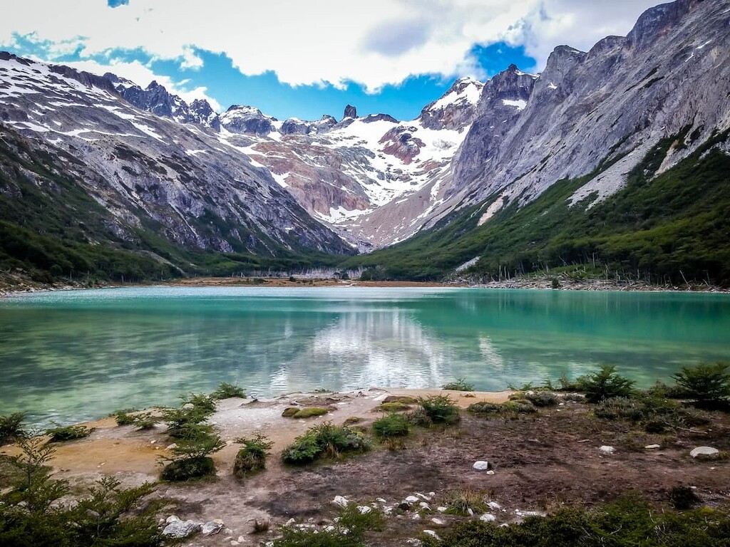
The southern Andes are home to a number of different ecoregions, each of which boasts its own unique collection of flora and fauna. Here are some of the largest ecoregions within the range:
A substantial portion of the northern part of the southern Andes is located within an ecoregion that’s known as the southern Andean steppe. This ecoregion is a mostly dry area that includes the range’s highest mountains.
Due to the wide array of different elevations found in the region, there are quite a few different ecosystems in the southern Andes. Indeed, there is clear altitudinal zonation throughout the range, with large shrubs at lower elevations, smaller shrubs and tussock at the mid-elevations, and various grasses at the highest sub-alpine elevations.
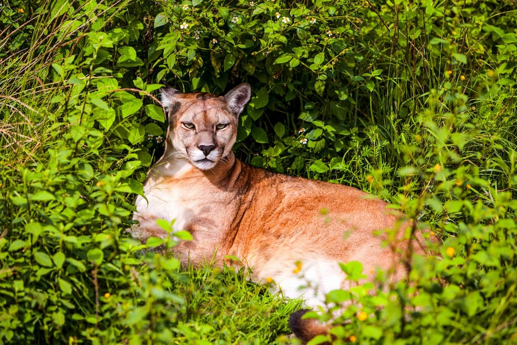
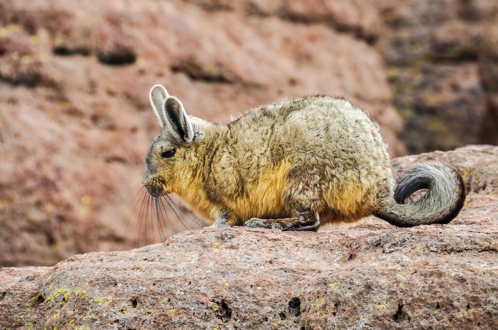
Furthermore, there are quite a few different animal species found throughout the southern Andes. Some of the most conspicuous species to call the range home include mountain lions (pumas), Andean foxes, guanaco, and vicuna.
Covering the majority of the southern half of the southern Andes, the magellanic subpolar forests are a temperate broadleaf and mixed forest ecoregion.
This ecoregion is home to some of the southernmost forests in the world as it covers much of Tierra del Fuego. Within the ecoregion, there are a number of ecosystems, including moorlands and temperate rainforests.
Major animal species found in the region include the mountain lion (puma, the Pagaonian mara, the viscacha, the southern river otter, and even the pudú, which is the smallest deer in the world.
The land in and around the southern Andes Mountains has long been home to humans. People have been living in these regions for tens of thousands of years. Some of the many tribes and nations that consider the region to be part of their ancestral homeland include the Mapuche, the Yámana, the Selk’nam, and the Kawésqar, among many others.
Europeans first arrived in the region in the early sixteenth century during Ferdinand Magellan’s expedition where he traveled through what is now called the Strait of Magellan. This made him the first European to set foot in the land that is now Chile (though it is likely that Amerigo Vespucci visited what is now northeastern Argentina a few decades earlier).
Spanish conquistadors then came later in the 1530s in search for gold and the conquest of both Chile and Argentina began not long afterward. Through violence and the introduction of diseases, this conquest led to a massive decline in the population of Ingidenous peoples in the Andes.
Like the rest of South America under Spanish rule, both Chile and Argentina gained their independence from Spain in the early nineteenth century. Around the same time, both countries started to take a more active interest in Tierra del Fuego and the land around Beagle Channel.
A long-standing dispute between the border of both Argentina and Chile came to a climax with a number of treaties in the 1970s and the 1980s, the latter of which was mediated by Pope John Paul II.
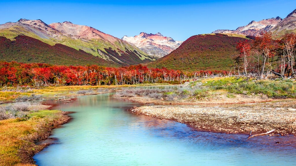
These days, the southern Andes remain one of the most popular tourist destinations in both countries, particularly in the area around Patagonia. Hiking, camping, and mountaineering adventures abound in the range, so there are plenty of opportunities to go for a wander if you’re willing to get off the beaten path.
The southern Andes are home to a lifetime of adventure. Here are some of the best parks and recreation areas to check out in the region:
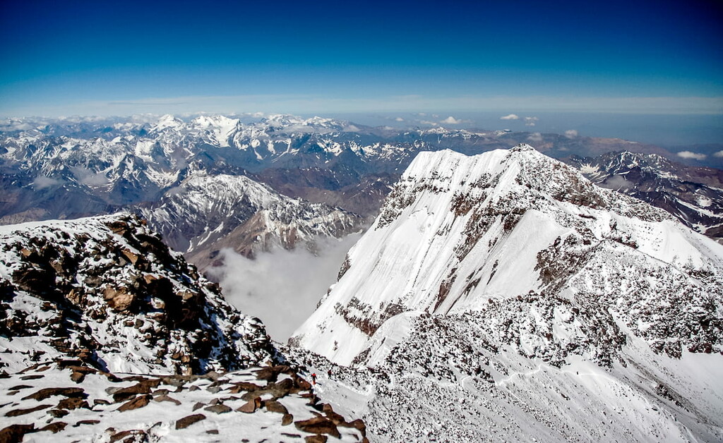
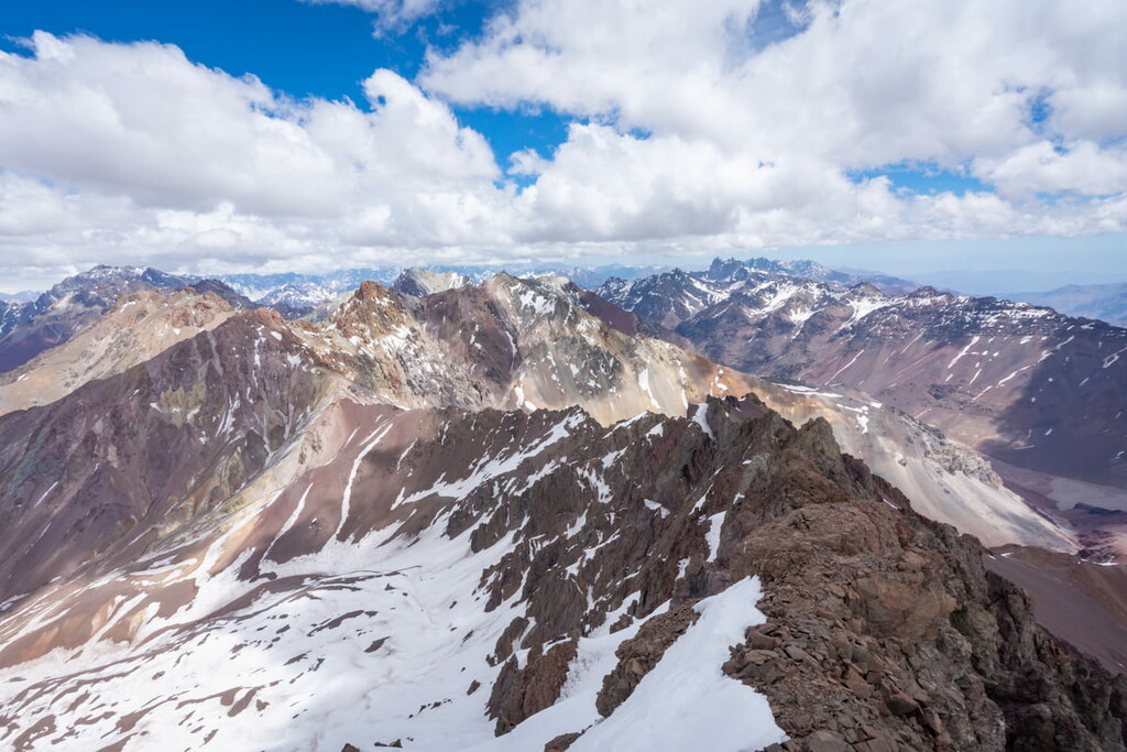
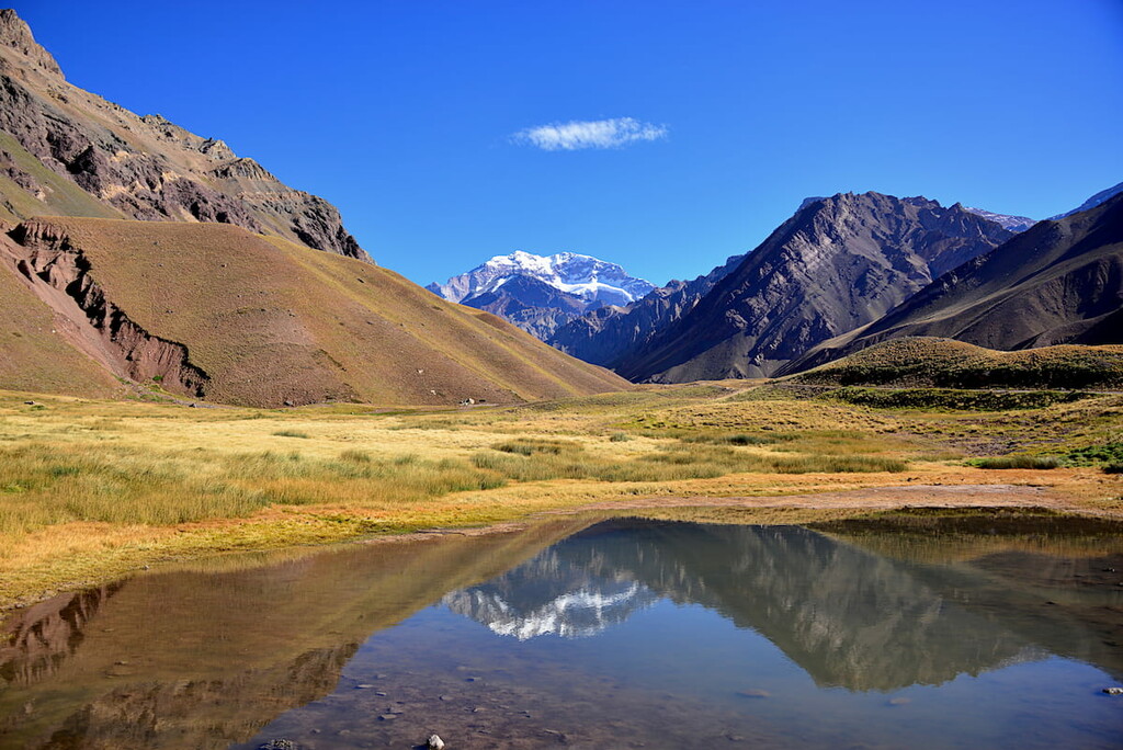
Home to the highest peak in the range, Aconcagua Provincial Park (Parque Provincial Aconcagua) is a popular international climbing destination. The park technically contains 24 named mountains, the highest and most prominent of which is Cerro Aconcagua.
Aconcagua Provincial Park fully ecompasses Aconcagua, so all climbers on the mountain need to enter the park to attempt the summit. The vast majority of climbers ascend the Normal Route, though the Polish Glacier route is another popular alternative.
While Aconcagua is not considered to be particularly technical, however, the peak’s high elevation makes it a challenge. If you are not already a very confident mountaineer, it is highly recommended that you hire a guide service if you’re interested in making a summit attempt on the mountain.
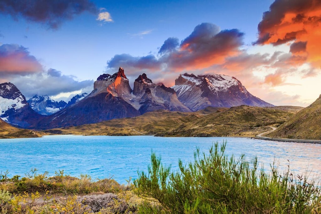
Located in southern Chile, Torres del Paine National Park (Parque Nacional Torres del Paine) is one of the most stunning regions in the range. The park contains 32 named mountains, the highest and most prominent of which is Cerro Paine Grande.
Torres del Paine is located fairly close to Puerto Natales. It borders Bernardo O’Higgins National Park to the west and Los Glaciares National Park to the east in Argentina.
The park is known for its jagged mountains and glistening lakes, which are some of the most popular hiking destinations in the country. In fact, the park gets well over a quarter million visitors per year, many of which take a trip to see the park’s namesake towers.
Located just outside the city of Ushuaia, Tierra del Fuego National Park (Parque Nacional Tierra del Fuego) is a land of dramatic scenery, rugged mountains, and beautiful waterfalls. The park contains 17 named mountains, the highest of which is Cerro Tonelli, and the most prominent of which is Cerro Lago.
Tierra del Fuego National Park is the southernmost national park in the country and it is a popular destination among tourists and locals, alike. Hiking is plentiful in the park and it is one of the best places to see the many seabirds of the Beagle Channel.
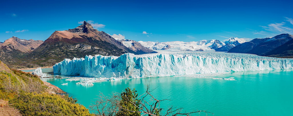
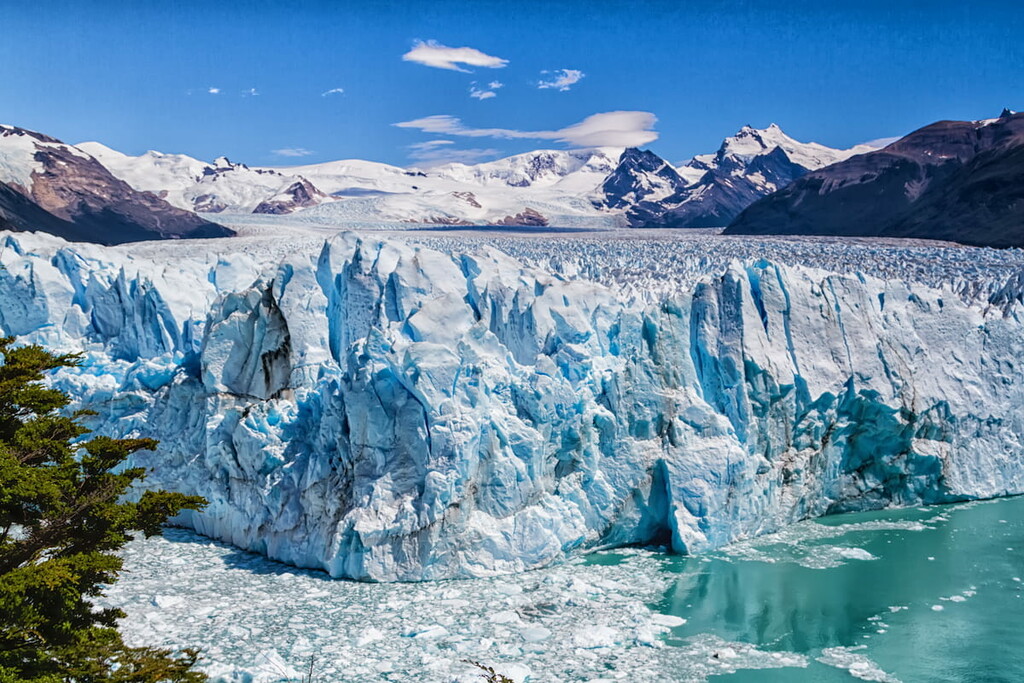
Covering much of the Patagonian Ice Cap, Los Glaciares National Park (Parque Nacional Los Glaciares) is a major area of protected land in the southern part of the range. It contains 111 named mountains, the highest and most prominent of which is Monte Fitz Roy.
The park’s boundaries technically include part of the disputed Argentine-Chilean territory, though a substantial portion of it is covered in ice. It is a popular mountaineering destination and a major tourist attraction in the region, thanks in no small part to the fact that it contains the famous Fitz Roy.
Looking for a place to stay in the southern Andes? Here are some of the best cities to check out:
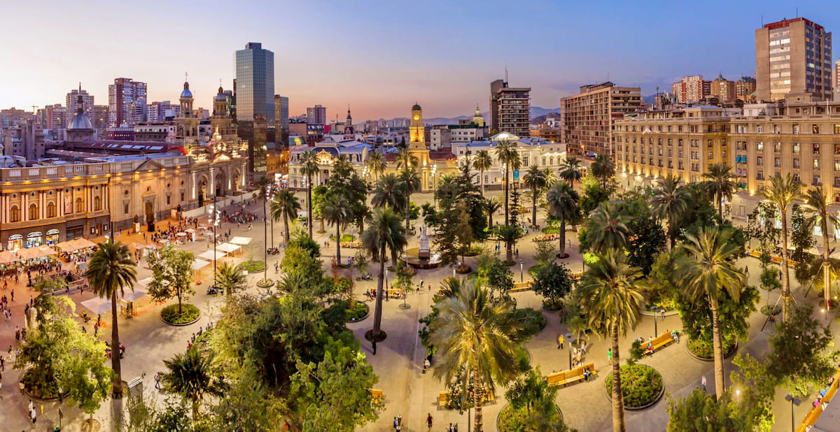
The capital and most populous city in Chile, Santiago is located in the central part of the country. It is home to about 6 million people and it offers excellent views of the Andes in the distance.
As the largest city in the country, Santiago is the cultural and commercial hub of the region. It is also home to the country’s busiest airport, which offers great connections around the world.
Situated just outside of Santiago, Valparíso is the second metropolitan area in Chile with about 300,000 residents. It is technically the headquarters of the Chilean National Congress and it has long played an important role in Chilean politics and history.
Valparíso is home to a historically important port, as well as a fantastic city center that retains many of the region’s historic buildings. It is also now a major center for education thanks to its many universities and vocational colleges.
The capital of Coyhaique Province, the city of Coyhaique is home to about 55,000 people who live in the heart of the Andes. The city has an airport, as well as a nearby seaport at Puerto Aysén, so it’s fairly easy to get to, all things considered. Furthermore, Coyhaique is a popular fly fishing and hiking destination, thanks to its proximity to the mountains.
Punta Arenas is home to about 130,000 people, making it the largest city in southern Chile. It is actually the largest city to the south of 46ºS and it is located within the Strait of Magellan (Estrecho de Magallanes).
These days, Punta Arenas also serves as an important launching point for air transportation to Antarctica, including for commercial expeditions to the Antarctic Peninsula. However, most ship-based expeditions leave from nearby Ushuaia.
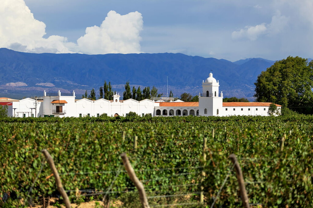
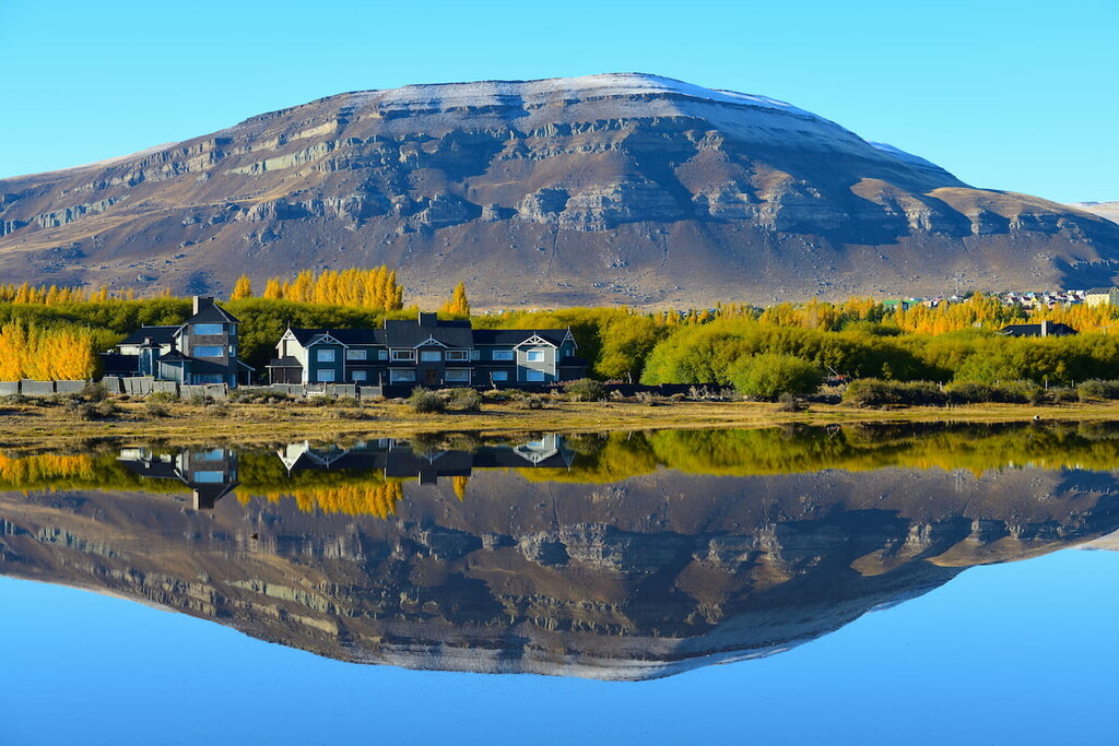
Home to a metropolitan population of some 1 million people, Mendoza is one of the largest cities in the Argentine Andes. It is located in the west-central part of the country, along the road that connects Buenos Aires and Santiago.
Mendoza is a popular destination as the city is located close to Aconcagua. It is also the hub of South America’s largest wine producing region, so it’s worth checking out the wineries if you’re in the area.
Home to about 6,000 people, El Calafate is a city in Argentina’s Patagonia region. It is one of the major tourist destinations in the area for visitors looking to see the Perito Moreno Glacier, Cerro Torre, and Cerro Chaltén.
El Calafate can be accessed by air, which makes it fairly easy to get to, despite its remoteness. There is also a (now) paved road between El Calafate and El Chaltén, which is a hub for hiking and climbing in the region. From El Chaltén, visitors can check out Monte Fitz Roy and Cerro Torre, which are world-famous climbing destinations.
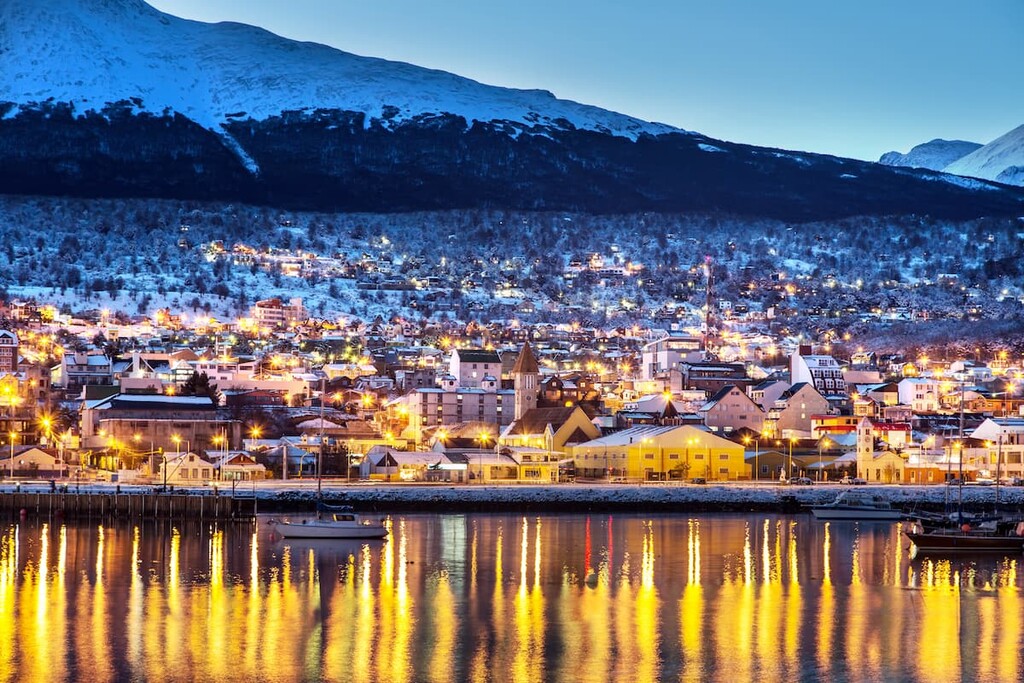
The southernmost city in the world, Ushuaia is located along the Beagle Channel in Argentina’s Tierra del Fuego Province. The city is home to about 60,000 people and it has a busy airport with regular service to Buenos Aires.
Ushuaia is a major tourist destination in the region, thanks to the fact that the vast majority of commercial ships heading to Antarctica leave from its port. Nevertheless, Ushuaia’s proximity to Tierra del Fuego National Park (Parque Nacional Tierra del Fuego) makes it a worthy destination in its own right.


ultra
volcano
andes-6000ers
chile-ultras
argentina-ultras
ultra
volcano
andes-6000ers
argentina-ultras
ultra
volcano
andes-6000ers
chile-ultras
argentina-ultras
ultra
volcano
andes-6000ers
chile-ultras
argentina-ultras
ultra
volcano
andes-6000ers
chile-ultras
argentina-ultras


