
Scan the QR code and open PeakVisor on your phone
Reserva Provincial San Lorenzo has 6 named peaks. The highest is Monte San Lorenzo o Cochrane at 3,706 m. Other notable peaks include Cerro Cochrane, Cerro Penitentes and Cerro Volcán.
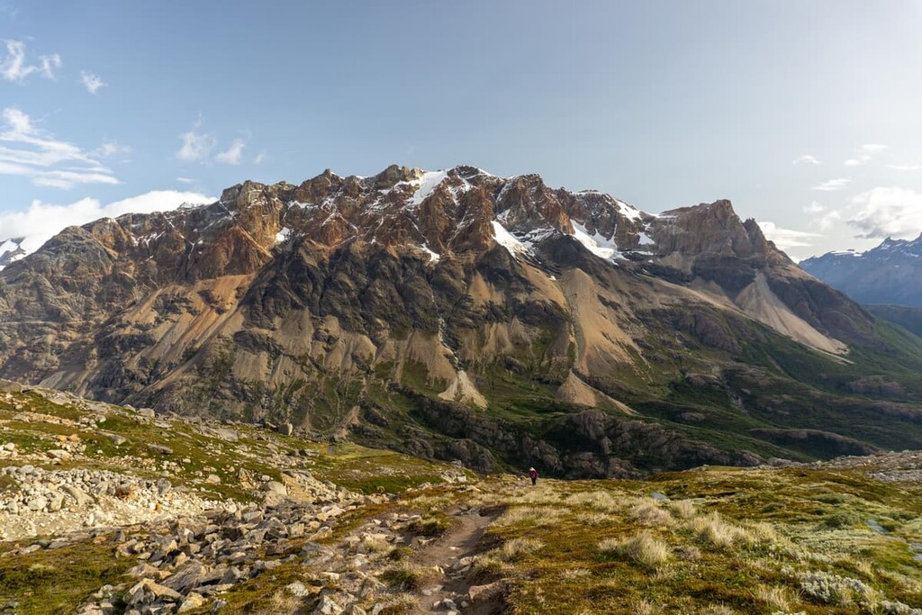
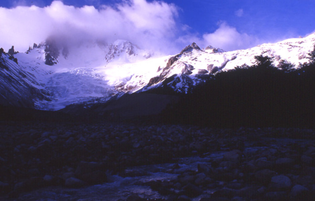
Reserva Provincial San Lorenzo (San Lorenzo Provincial Reserva) is a protected nature reserve located in the Santa Cruz province of Argentina that’s known for its rugged landscape in the Andes foothills. Reserva Provincial San Lorenzo contains 6 named mountains, the tallest and most prominent of which is Monte San Lorenzo o Cochrane at 3,706 m (12,160 ft) in elevation with 3,319 m (10,890 ft) of prominence.
Reserva Provincial San Lorenzo is situated in southwestern Argentina. The reserve is located in the eastern foothills of the Andes range just north of Perito Moreno National Park (Parque Nacional Perito Moreno). The reserve acts as a buffer zone for the northern stretches of this national park, helping provide even further protection to the region.
The high peaks of the Andes contrast beautifully with deep valleys and glacier-fed lakes that dominate the region. In particular, the mountains traverse the reserve heading from both east to west and north to south. The western boundary of the reserve is marked by the border between Argentina and Chile.
The tallest peak, Monte San Lorenzo o Cochrane, acts as the main focal point of the region and is often covered in clouds throughout the year. The lakes within the reserve feed into what becomes Río San Lorenzo and Río Lácteo, both of which travel southward before feeding into the waterways in Perito Moreno National Park.
Additionally, Reserva Provincial San Lorenzo is surrounded by other popular outdoor recreation areas. Perito Moreno National Park (Parque Nacional Perito Moreno) lies to the south, Patagonia National Park (Parque Nacional Patagonia) sits to the northeast, while both Lago del Desierto Provincial Reserve and Los Glaciares National Park (Parque Nacional Los Glaciares) are situated further south along the border between Argentina and Chile.
As the Reserva Provincial San Lorenzo is situated on the eastern foothills of the Southern Andes, the geology of this small reserve is deeply intertwined with this mountain range.
The Andes began forming around 25 million years ago as oceanic crust was subducted beneath the South American Plate. Over millions of years, this continual subduction, coupled with the eastern movement of the oceanic crust, gave rise to the Andes.
Because these peaks were formed by the movement of tectonic plates, the mountains continue to rise a few millimeters each year. The rainshadow formed by the peaks of the region allow for a drier landscape just east of the reserve, while the main portion of the reserve is characterized by its subalpine forest on its steep peaks.
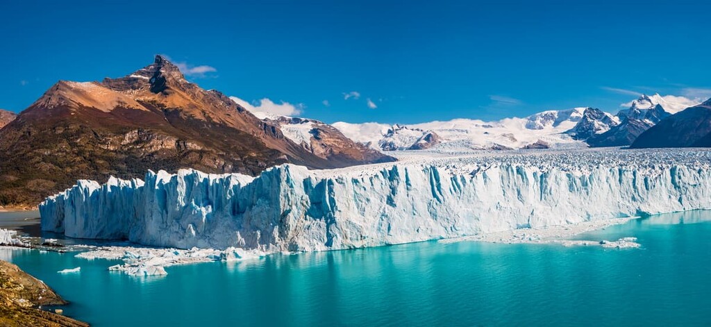
The glacial lakes of the region showcase further remnants of the continually retreating Southern Patagonian Ice Field. Today, the remains of this ice field, which once covered the entire region, can be found to the south of the reserve.
Major peaks within the park include Monte San Lorenzo o Cochrane, Cerro Cochrane, Cerro Penitentes, Cerro Volcán, Cerro Pirámide, and Cerro Peinado.
Flora and fauna within the small reserve is quite similar to that of Perito Moreno National Park, which lies directly south. Over two dozen species of mammals have been found throughout the region with the most common being the guanaco.
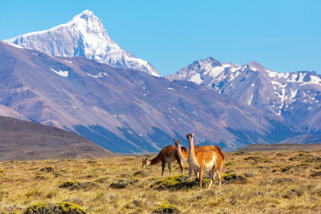
Other popular animals throughout the region include choiques (Darwin’s rhea), cougar, grey foxes, red foxes, dwarf armadillo, south Andean deer, and tuco-tuco. Many of the mammals in the reserve stay at higher elevations during the summer months and migrate eastwards during the winter.
The lakes and lagoons in the reserve can be home to geese, ducks, and even flamingos. Birds such as eagles, condors, owls, and woodpeckers have also been found within the region.
Though vegetation is limited within the reserve boundaries, groups of stipa grass and various beech species can be spotted in the area. These species provide an important source of shelter for the animals of the region.
Before Europeans ever arrived in the region, the land near the reserve was inhabited by the Tehuelche. Additionally, art made by the Toldense people within the Santa Cruz province dates back to over 10,000 years ago.
The Tehuelche people were traditionally hunter gatherers that migrated throughout the region, often inhabiting the eastern slopes of the Andes. Their historic movements were closely tied to that of the guanaco, which they relied on for a steady supply of food. However, there are now about 30,000 people of Tehuelche descent living in towns and communities throughout Argentina and Chile.
After the Spanish arrived during the 1500s, the population surrounding Reserva Provincial San Lorenzo was quite low.
Due to the area’s outstanding beauty, many of the parks in the region, including Perito Moreno National Park, were some of the first established protected areas in the country. However, Reserva Provincial San Lorenzo wasn’t created until 1993, making it one of the newest protected areas in the region.
Due to its remoteness, Reserva Provincial San Lorenzo has extremely limited access options for visitors. However, other parks throughout the region provide hiking and trekking opportunities. Here are some of the best in the region:
Perito Moreno National Park boasts a landscape similar to that of the Reserva Provincial San Lorenzo. It is known for its expansive valleys and numerous glacier lakes such as Belgrano Lake.
The park is less visited than those which lie to the south, yet is still home to some of the best views within southern Argentina. Popular hikes within the park include the treks to Cerro Leon and Río Volcán, both of which are under 10 km (6.2 mi).
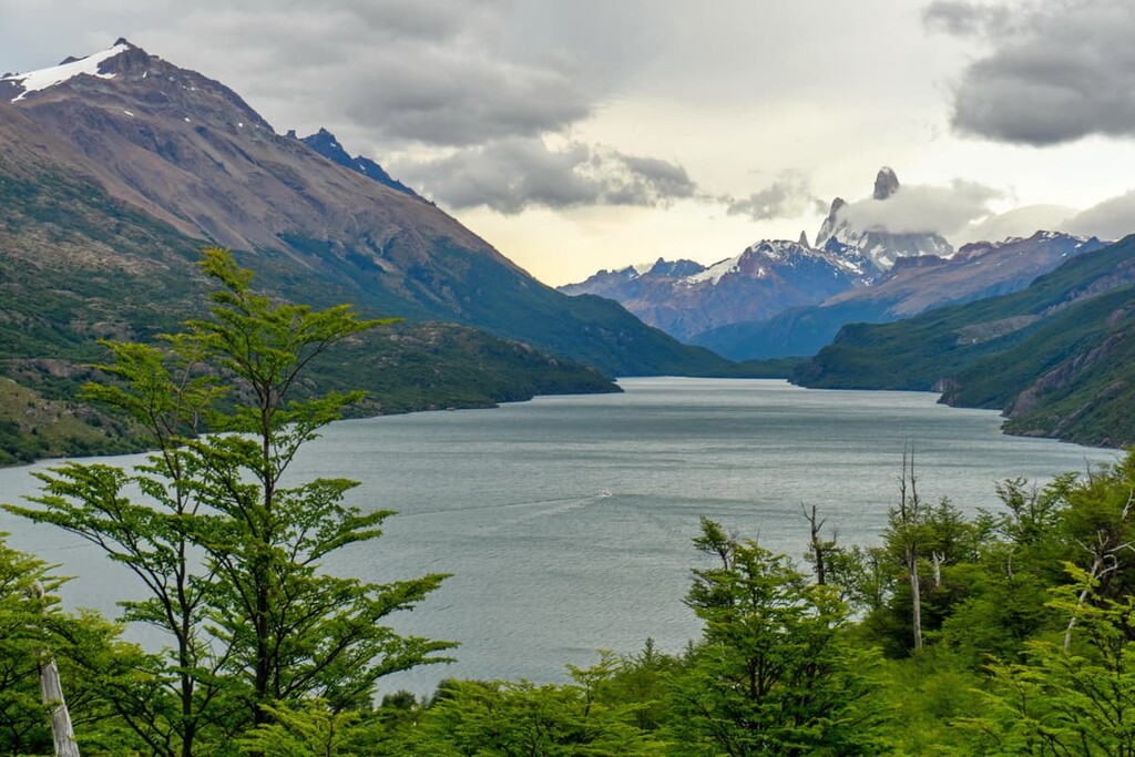
To the south of Reserva Provincial San Lorenzo lies Lago del Desierto Provincial Reserve. Like San Lorenzo, Lago del Desierto is situated along the border of Argentina and Chile.
The park’s main feature is Lago del Desierto, which is also known as Lake of the Desert. This long and narrow lake is surrounded by lush forests that dominate the landscape while the snow capped Andes loom overhead to the west.
Many of the major hikes in the reserve start from El Chaltén, a town located at the southern edge of the protected area. Common hiking routes in the reserve include those to the Cerro Torre Lookout, Condors-Eagles Lookout, and Loma del Pliegue Tumbado.
Looking for a place to stay near Reserva Provincial San Lorenzo? Here are some of the best cities and villages to check out in the region:
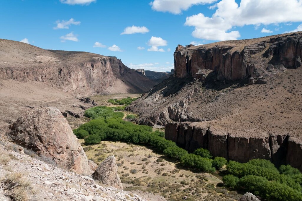
Located along Route 40, which travels north to south through the province, Bajo Caracoles is a small village with a population of just a couple dozen people. Bajo Caracoles also sits just 3 km (1.9 mi) to the south of the access road that leads to Cueva de las Manos and it features artwork that dates back over 10,000 years.
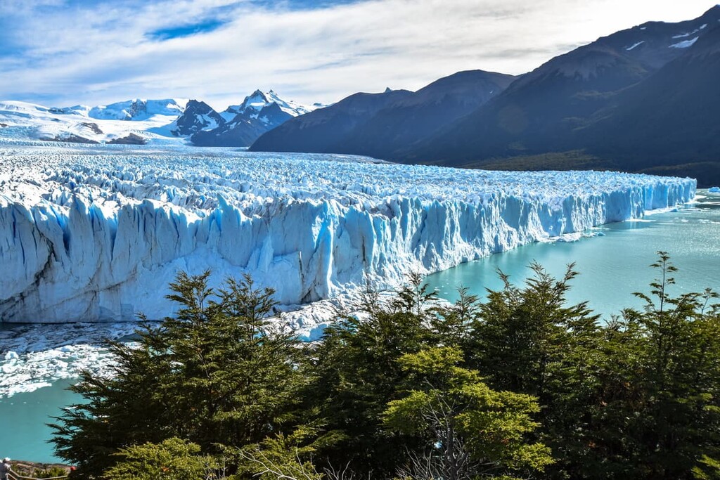
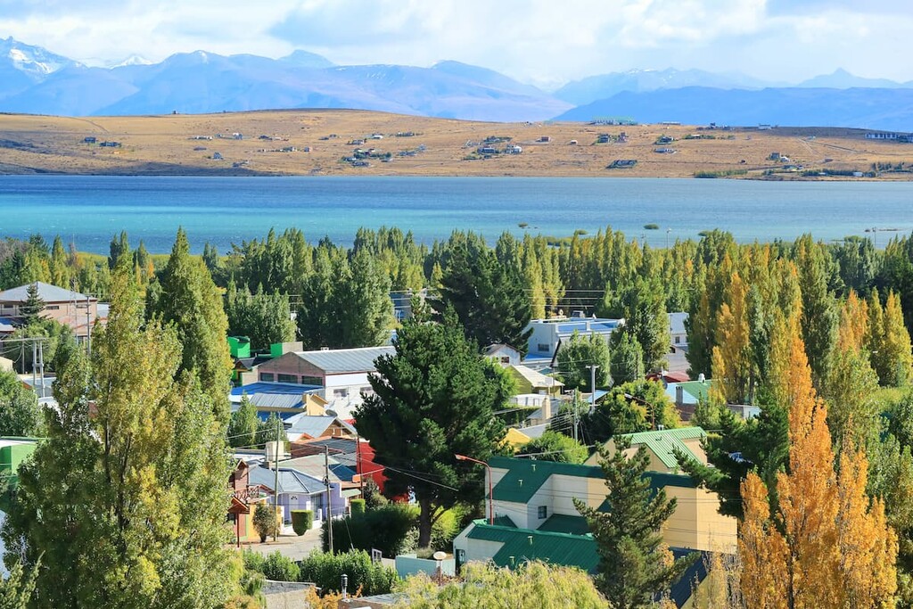
Though the city of El Calafate sits over six hours south of the park, it is popular amongst visitors of the region. Located just off Route 40, El Calafate acts as the gateways to Los Glaciares National Park, one of Argentina's most visited parks.
Situated along the southern border of Lake Argentino, El Calfate has grown exponentially over the past few decades with a population that’s now over 20,000 people. The city is also extremely close to the Perito Moreno Glacier, Cerro Torre, and Cerro Chaltén.


The highest peak in Reserva Provincial San Lorenzo is Monte San Lorenzo o Cochrane, at 3,706 m.
Notable peaks in Reserva Provincial San Lorenzo include Monte San Lorenzo o Cochrane, Cerro Cochrane, Cerro Penitentes, Cerro Volcán and Cerro Pirámide.


