Scan the QR code and open PeakVisor on your phone
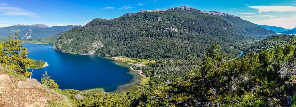
Los Alerces National Park is in the Chubut province of Argentina in northern Patagonia. The area contains Los Alerces National Park and Los Alerces National Reserve, and often the reserve is included when discussing the national park. Established in 1937, the protected regions span over 2,590 sq km (1,000 sq mi). There are 28 named peaks within the park. The highest and most prominent mountain is Cerro Situación standing at 2,307 m (7,569 ft) with 1,665 m (5,463 ft) of prominence.
Los Alerces National Park is split into two sections. The national park region is much larger and spans about 1,873 sq km (723 sq mi). Los Alerces National Reserve covers the protected area's remaining 715 sq km (276 sq mi). The park’s shape from above resembles a rectangle spanning 65 km (40 mi) north to south and around 40 km (25 mi) east to west.
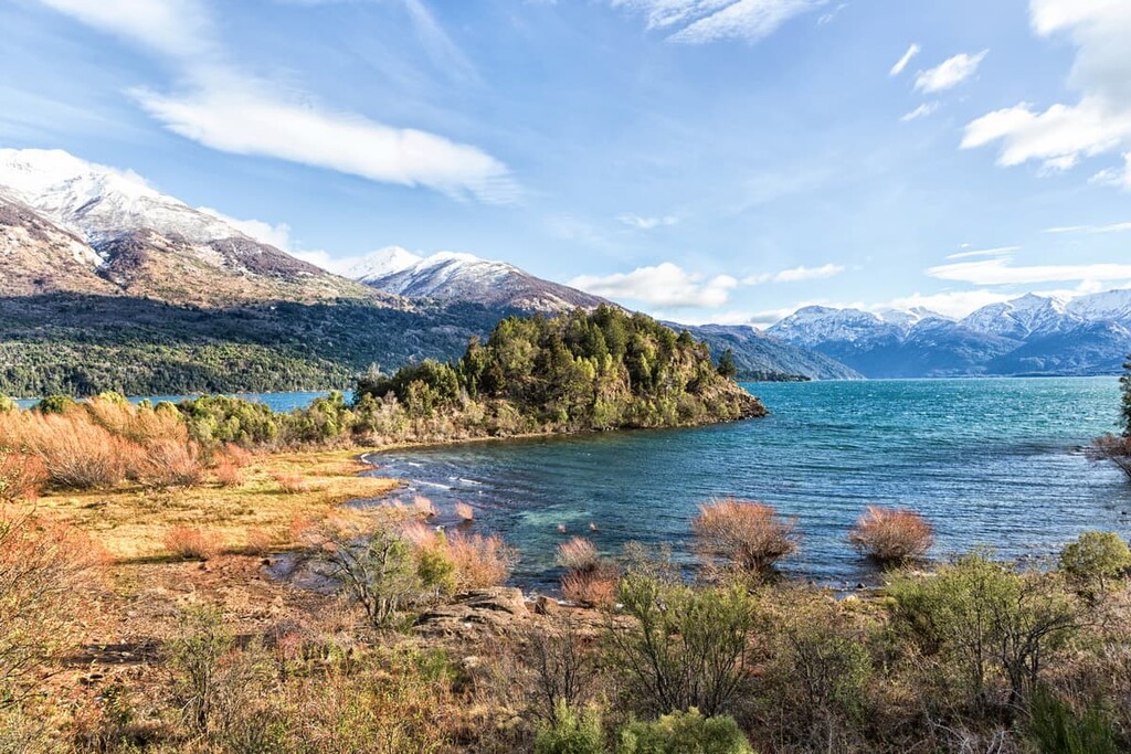
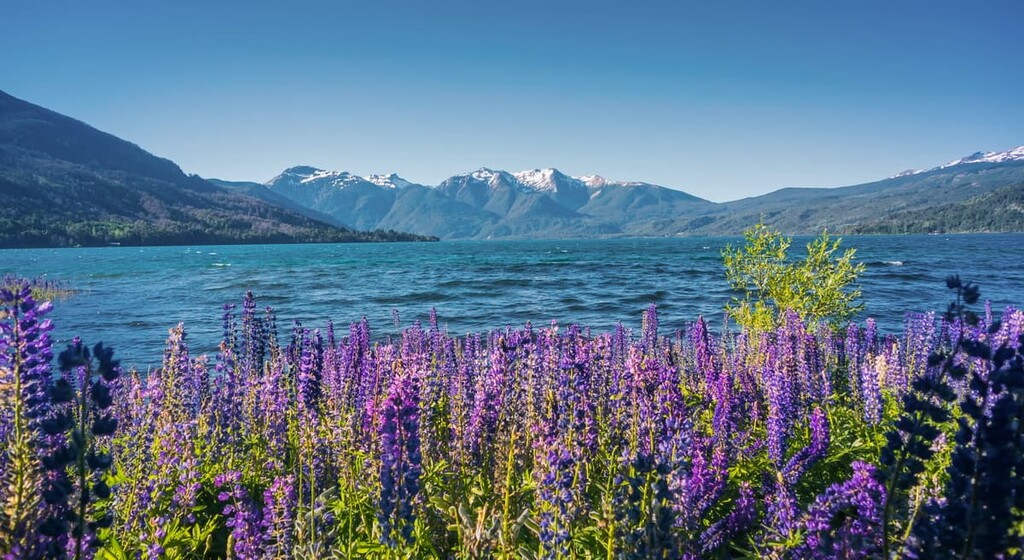
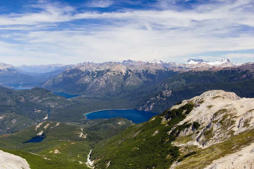
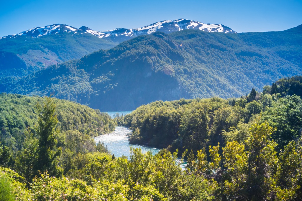
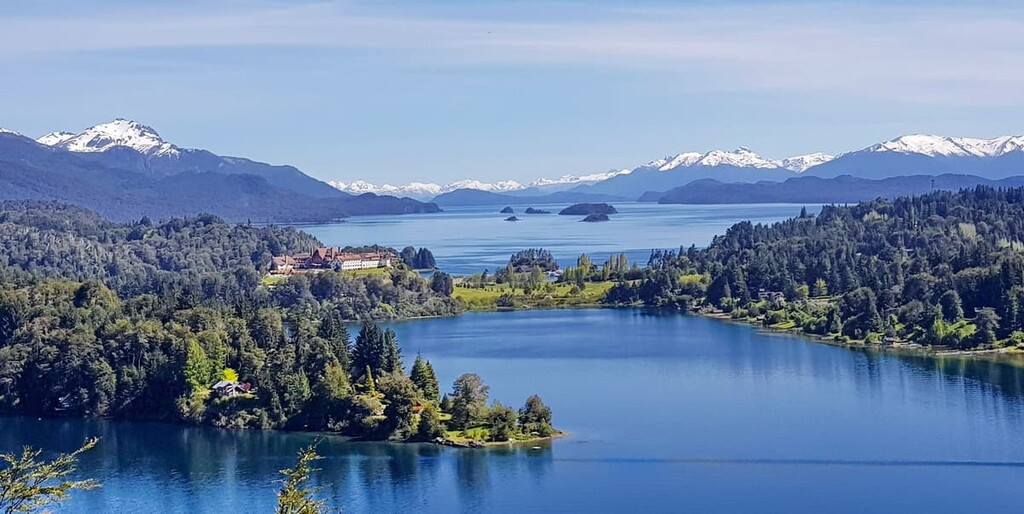
The park's western border is also the border between Chile and Argentina. Much of the landscape has been carved out by glaciers, leaving behind pristine lakes, moraines, and cirques. Temperate forests dominate the park's lower elevations while higher elevations rise into the alpine regions of the Andes. Among the rugged peaks lie alpine lakes and meadows.
Cerro Situación is the tallest peak in the park at 2,307 m (7,569 ft). The lowest point in the park lies at 329 m (1,080 ft), where the Futaleufu River crosses the border into Chile.
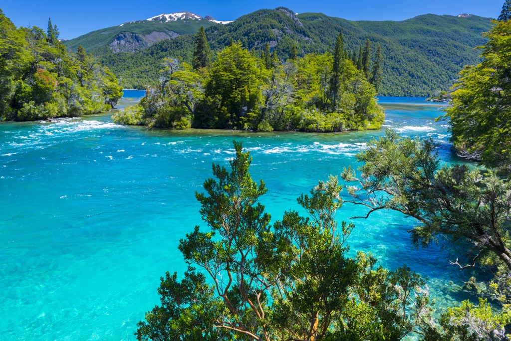
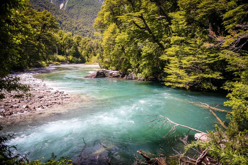
The park is part of the Futaleufu River basin. The river has numerous names throughout its course; it passes through Lake Rivadavia, Lake Menendez, Futalaufquen Lake, Amutui Quimey Reservoir, and various other small lakes before entering Chile. The national reserve houses the Futaleufú Dam, reservoir, and hydropower system constructed in the early 1970s.
Los Alerces National Park is part of the Andino Norpatagonica Biosphere Reserve and was declared a UNESCO Natural World Heritage Site in 2017.
The mountains within Los Alerces National Park are part of the Andes, an extensive range spanning from Colombia to the southern tip of Patagonia. The Andes were lifted during the Late Cretaceous as tectonic plates subducted beneath the South American Plate.
The zone is part of the Andean Volcanic Belt and contains outcroppings of rocks dating from the Paleozoic, Mesozoic, and Cenozoic eras.
Episodes of intense glaciation carved out today’s landscape. Several glaciers remain in the park, although they are rapidly shrinking with the changing climate. Throughout the park are moraines, glacial cirques, and lakes. Many glacial deposits overlie quaternary deposits.
The soil in the park is primarily composed of glacial deposits and volcanic ash. There are andosols with a dark horizon from uniform ash deposition and regosols, which are pale and formed from volcanic material mixed with sand and silt.
Los Alerces National Park falls within the Patagonian Forests ecoregion. It receives a fair amount of precipitation, ranging east to west from 80 cm to 300+ cm (31 to 118+ in) per year. More precipitation falls during winter during typically regular snowstorms.
The park protects enormous swathes of Valdivian temperate rainforest and the southernmost species of larch, coihue, and arrayan. Valdivian rainforests make up the only ecoregion of temperate forest in Latin America and the Caribbean. The park also contains the Andean-Patagonia forest, High-Andean steppe, and Patagonian steppe ecosystems.
The park is best known for its namesake tree, the Alerce (Fitzroya cupressoides), or lahuan in the indigenous Mapuche language. A conifer endemic to South America, Alerces are the second longest-living tree species in the world, and the park protects some of the oldest and largest intact groves.
The most popular spot for visiting these magnificent trees lies at the northern end of Lake Menendez. Within this section of the forest lies the tallest Alerce tree in Argentina at 60 meters (197 ft). Scientists estimate the tree to be 2,600 years old. In total, the park is home to approximately 7,405 ha (18,300 acres) of Alerce forest.
The park was declared a UNESCO Natural World Heritage Site to preserve these ancient trees and the area’s intact biodiversity and endemic species. Approximately 34% of the woody plant genera found in the park are endemic to the region, and several examples have survived through periods of glaciation.
The thick forest contains southern beeches such as lengas, ñires, coihues, and cordillera cypress. Deciduous birches (Nothofagus pumilio and Northofagus antarctica) also grow here, while Maniú and Chusquea bamboo thrive in the Valdivian forest. The Arrayanes River is named after the abundant arrayanes (Chilean myrtle) growing on its banks. Evergreen species include southern cypress, evergreen southern beech, radal, and maiten.
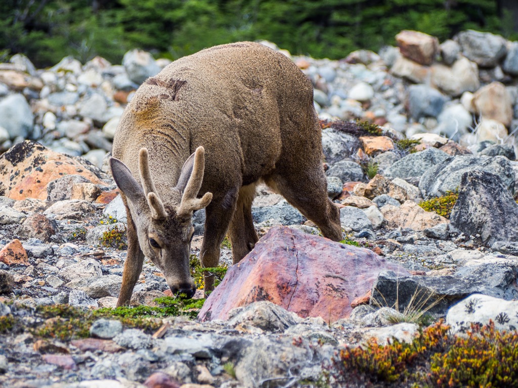
Mammals living in the park include pudu and huemul deer, huiña cats, pumas, culpeo foxes, grey foxes, and huillines – an endangered species of otter. Birds include Magellanic woodpeckers, chucao tapaculo, black-throated huets, white-crested elaenias, thorn-tailed rayaditos, and austral parakeets. Aquatic species include ashy-headed geese, great grebes, neotropic cormorants, southern wigeons, and torrent ducks. Raptors and scavengers include condors, black vultures, and black-chested buzzard eagles.
Several species of amphibians thrive within the park, such as the gracile frog and the Batrachyla fitzroya frog, which was only recently discovered in Lake Menendez. Also of note is the colocolo opossum (Dromiciops gliroides), an endemic marsupial that is the only surviving species from the Microbiotheria order of marsupials. It is the only remaining species of the taxon from which all marsupials in South America and Australia originated.
Evidence of human presence in the region goes back at least 3,000 years. In more recent history, the land was part of the region occupied by the indigenous Mapuche culture. Colonization began in the late 1800s when the indigenous Mapuche were forcibly removed from their lands.
Land conservation began in the early 1900s, sparing much of the forest on the newly colonized frontier from logging and forest conversion. The park was created in 1937 and encompassed 137 homesteads. Today around 40 families continue to have rights to land within the park and reserve. More than half practice livestock grazing, while others engage in tourism and commercial industry. Sheep are the primary livestock, followed by cattle and horses.
The park was declared a UNESCO Natural World Heritage Site in 2017.
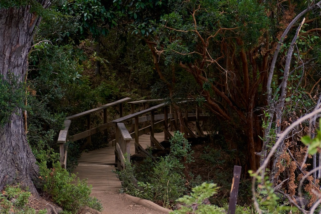
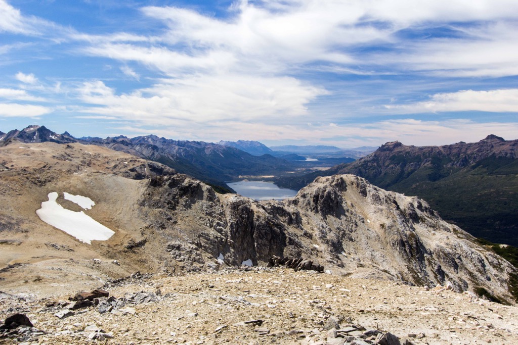
Los Alerces National Park is a hiker’s dream, with soaring ridgelines, thick forests, and rivers and lakes assuming the deepest shades of blue and green. Hiking options include short trails, lookout points, relatively flat trails along the rivers, and more strenuous hikes that ascend to offer epic vistas across the river and lake system. Kayaking is also popular here. Note that dogs are not allowed in the national park.
A visit to El Bosque de Alerces Milenarios, an old Alerce forest, is one of the park's unique attractions. To reach the forest, you must take a boat from Port Chucao on the north end of Lake Menéndez. After a scenic ride around the lake, the boat docks at Puerto Sagrario, and a 2 km (1.2 mi) trail offers stunning views of Lago Cisne and Rio Cisne.
This 6.4 km (4 mi) loop leaves from near Futaleufu, Los Lagos, and follows the southeastern shore of Lago Verde before crossing a suspension bridge across the Arrayanes River. The forest road leads to the Glacier Viewpoint and sweeping views of Lake Menendez. Take the Viejo Lahuan interpretive trail to return, passing a 300-year-old Alerce tree along the way. The track has about 250 m (820 ft) of elevation gain.
A 15.1 km (9.4 mi) out-and-back with nearly 1,341 m (4,400 ft) of elevation gain, the trail to summit Cerro Alto El Petiso is undoubtedly challenging. Departing from near Lago Verde, the path is mainly forested until the final 1.5 km (0.9 mi) across rocky and sometimes snowy terrain. From the top, incredible panoramic views take in several of the park’s green and blue lakes.
This short hike totals just 2.1 km (1.3 mi) with 76 m (250 ft) of elevation gain. Leaving from the highway, the trail climbs steadily up to a viewpoint over the lake surrounded by steep peaks.

This 8 km (5 mi) loop takes hikers up and down 354 m (1,160 ft) of elevation before coming to the southern tip of Lake Menendez. The trail winds through the forest along dirt paths before reaching the protected shoreline.
Campsites and lodges are available within the park, and the towns of Trevelin and Esquel are within a 30-minute drive from the park’s southern entrance.
Located near the park's southern border lies the city of Trevelin, with around 10,000 people. Trevelin receives a moderate climate compared to other parts of Argentina. With just 25 inches of precipitation annually, the city rarely receives significant snowfall.
The town was founded by Welsh immigrants and housed the first flour mill in the region. A visit to the local tea houses is a popular cultural stop, while those looking to explore near Trevelin can visit the Nant and Falls Waterfalls or Lago Rosario.
The town has a cozy feel and offers a small selection of restaurants and breweries, a few cafes, and often a small market around the central roundabout. Accommodation is available in town, and it is not far to reach one of the area’s scenic lodges.
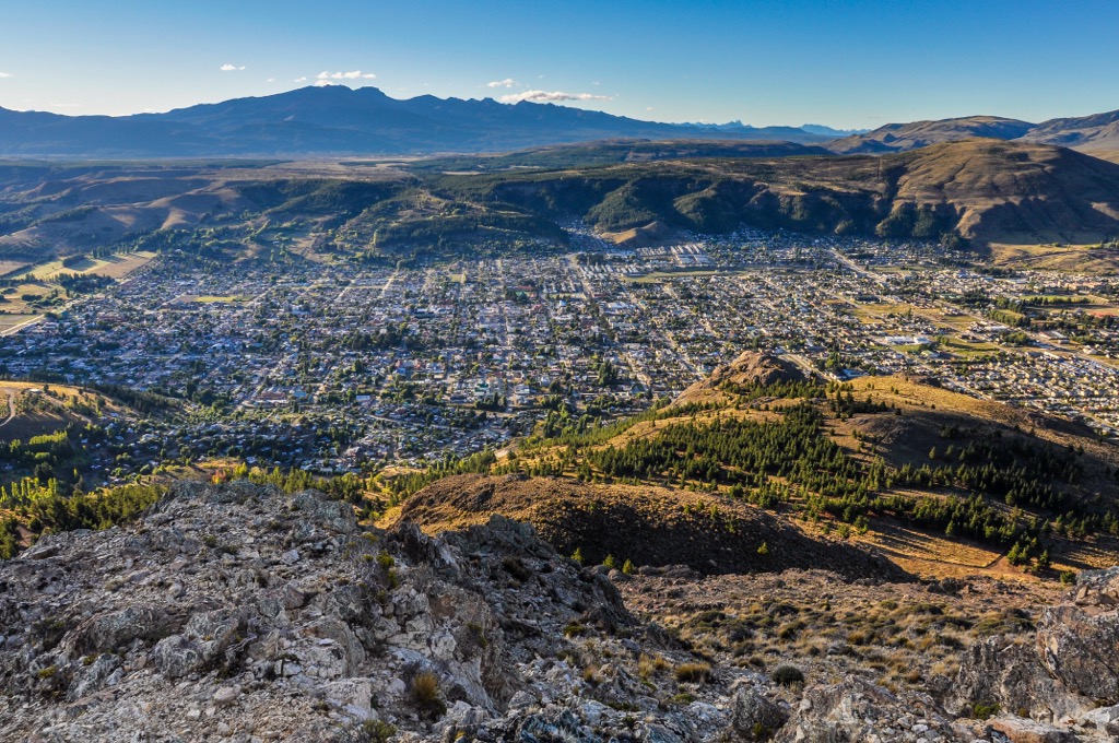
Esquel is thirty minutes from Trevelin and has a population of 35,000. The town is growing and supports thriving livestock, forestry, and tourism industries. Several key attractions in the city are La Trochita, the old Patagonian train that once ran through the region, and La Hoya ski center. The scenic town is the perfect stepping stone to reach Los Alerces National Park, hiking and biking trails in the surrounding hills, and some of Patagonia’s spectacular fly fishing spots.
The city has a trendy downtown with restaurants, cafes, and boutique shops. Accommodation around Esquel ranges from hotels and fly fishing lodges to AirB&Bs and campsites.