
Scan the QR code and open PeakVisor on your phone
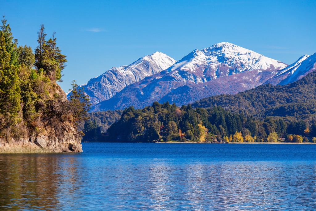
Nahuel Huapi National Park in the Neuquen and Rio Negro provinces of northern Patagonia in Argentina contains 215 mountains. The highest and most prominent peak is Cerro Tronador – an extinct stratovolcano that measures 3,478 m (11,411 ft), with a prominence of 2,648 m (8,688 ft). The National Park is 7,045 sq km (2,720 sq mi) and holds the distinction of being Argentina’s oldest and second-largest national park.
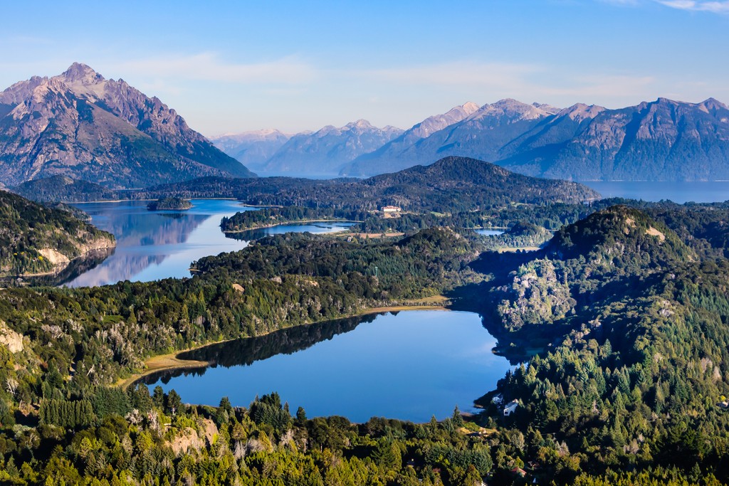
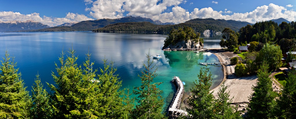
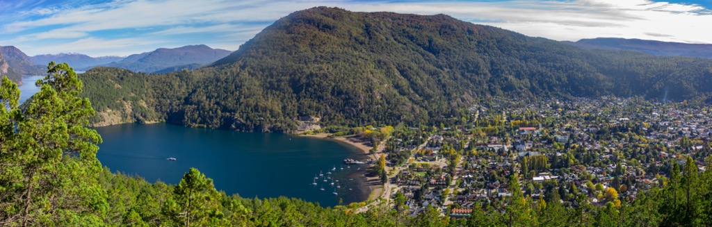
Located in the Neuquen and Rio Negro provinces of Argentina, Nahuel Huapi National Park encompasses 7,045 sq km (2,720 sq mi) of steppe, forest, rivers, lakes, mountains, and glaciers. The western boundary lies along the mountainous Andes, dividing Argentina and Chile. The main gateway to the park is the town of San Carlos de Bariloche on the southern shore of Lake Nahuel Huapi.
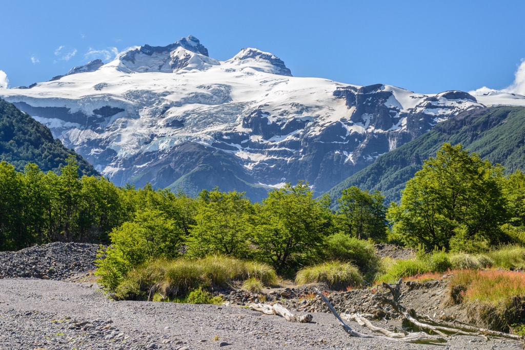
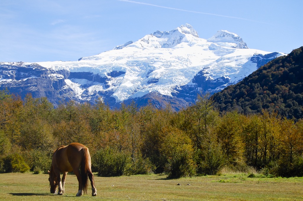
Formed in 1933, Nahuel Huapi is Argentina’s oldest national park. Its tallest point is Cerro Tronador, an extinct stratovolcano, at 3,478 m (11,411 ft). This mountain alone contains eight glaciers, several of which can be reached from the Refugio Otto Meiling. In Spanish, Tronador means “thunderer,” a name given for the sound of falling seracs.
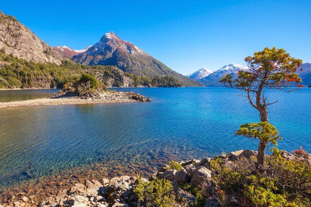
Lake Nahuel Huapi is the park’s deepest (425 m/1,394 ft) and largest (544 sq km/210 sq mi) lake. Other lakes include Perito Moreno, Fonck, Gutierrez, Guillelmo, and Mascardi. Lanín National Park and Los Arrayanes National Park neighbor Nahuel Huapi. All three are part of the Andino Norpatagónico Biosphere Reserve, along with Lago Puelo and Los Alerces National Parks.
Nahuel Huapi National Park spans a portion of the Andes as they run along the border between Argentina and Chile’s Lake Districts. The formation of the Andes, volcanism, and glaciation has shaped the region's geology.
The Andes stretch from Colombia to the southernmost tip of Patagonia. During the Late Cretaceous, the Andean orogeny began as tectonic plates subducted beneath the South American plate. Geologically speaking, it is a young range containing both active and extinct volcanoes.
The park's elevation ranges from 720 to 3,478 m (2,362 to 11,411 ft) at the top of Cerro Tronador. Another prominent peak is Cerro Catedral (2,405 m/7,890 ft), famous for winter sports, hiking, and backpacking. The mountain boasts one of the best ski areas in the Southern Hemisphere, the Catedral Alta Patagonia ski resort.
Various rock formations make up the region. Rocks around the south side of Lake Gutierrez are primarily gneisses that are part of the Andean geosyncline. The northern side of the lake has a series known as the Nahuel Huapi, containing tuffs mixed with dacitic, andesitic, and basaltic lava flows. The Tristeza granite series form the southwestern and western portion of Lake Nahuel Huapi.
During the last ice age, the region was covered by ice, and only the tallest peaks protruded. As glaciers retreated, they left behind moraines, outwash fans, deltas, and kames. They also fed the area’s rivers and lakes.
Except for alpine zones and recent alluvial fans, the soil type in the region is primarily eolian (moved by wind) and composed of volcanic ash and loess.
Moving east away from the spine of the Andes, the terrain flattens out. Nahuel Huapi National Park covers three main ecological zones. The Altoandino lies above 1,600 m (5,250 ft); the Andino-Patagonico occupies the lower slopes of the mountains; and the Patagonian steppe exists on the lower and flatter eastern portion of the park.
The region boasts a decent amount of biodiversity thanks to dramatic changes in elevation and precipitation. The eastern portion along the steppe is much drier, while the western region on the slopes of the Andes houses a temperate rainforest.
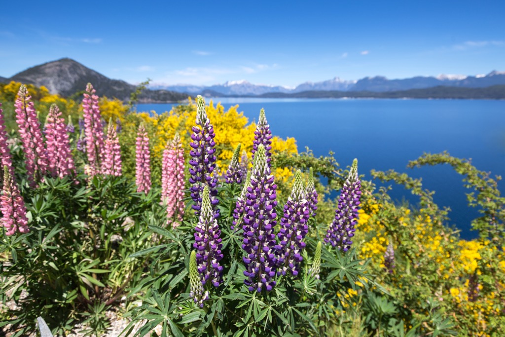
Valdivian forest accounts for approximately half of the park’s land cover. The lush forest boasts trees such as southern beeches called lengas, coihues, and ñires, as well as Chilean cedar and cypress. Common flowers include the amancay, mutisias, and notros.
Mammals in the park include cougars, foxes, pudus, guanacos, the southern deer huemulus, maras, river otters, and huillin, an endangered otter species. Notable birds include Andean condors, austral parakeets, green-backed firecrowns, blue-eyed cormorants, and Magellanic woodpeckers. Patagonia is well known for its fishing, and the rivers and lakes support several species of trout, catfish, perch, and common galaxias.
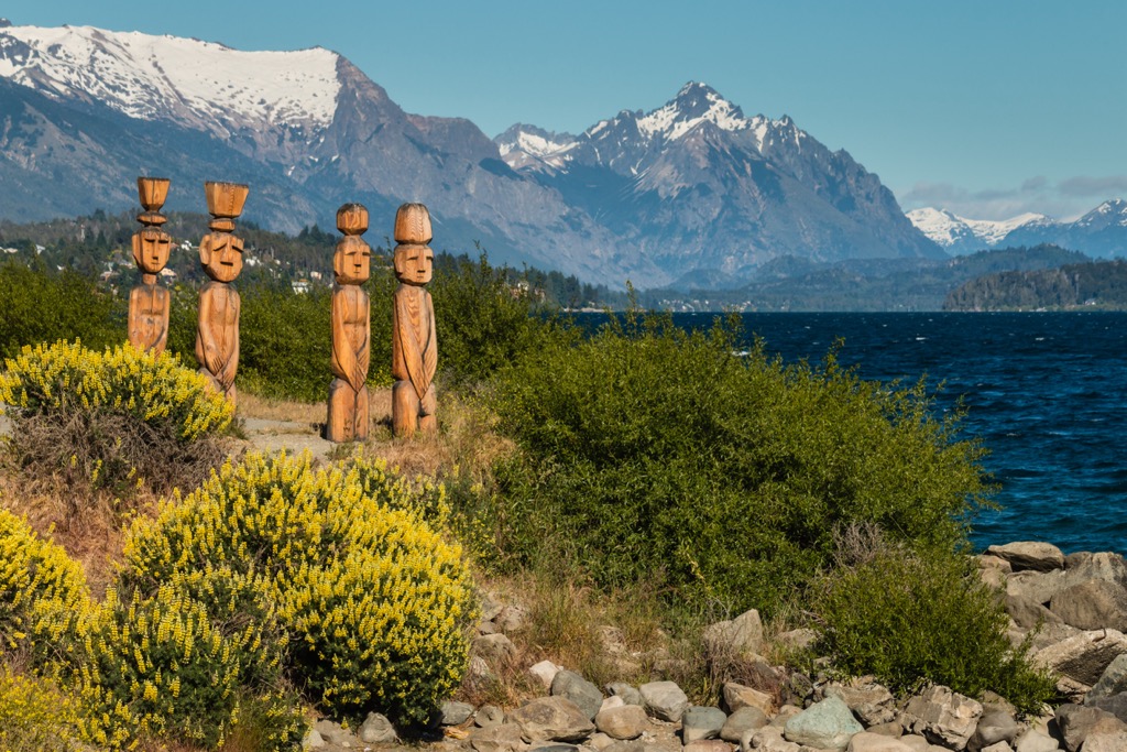
The national park was once part of the traditional territory of the Mapuche and Mapuche-Tehuelche people. Military campaigns led by the Argentine government between 1879 and 1884 sought to remove indigenous groups from their land. The Mapuche and Tehuelche were forced off their lands, sometimes into concentration camps. Discrimination continued even after the military campaign came to an end.
Likely the earliest attempt by outsiders to establish a community near Lake Nahuel Huapi was by Jesuit missionaries coming from a settlement on Chiloe Island in Chile. Several of the lakes in the national park bear names of Jesuit priests, such as Mascardi and Guillelmo.
The Argentine and Chilean governments violently removed indigenous peoples and laid claims to the region in the 19th century. Land disputes and conflict gave the area a bad reputation. One motivation for establishing the national park was to overwrite this negative association and to highlight the region’s rich natural resources and beauty.
An Argentinian explorer and scientist, Perito Francisco Moreno, donated a 7,500 ha (18,533 acres) parcel of land to the government in 1903. This was included when Nahuel Huapi National Park was established in 1934 as Argentina’s first national park.
Today the park lies in the heart of Argentina’s Lake District in northern Patagonia. Each year it draws national and international visitors to enjoy skiing and snowboarding, hiking and trekking, and watersports.
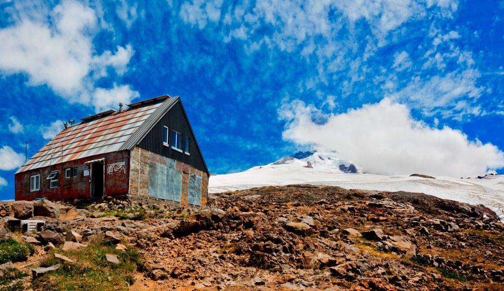
With soaring peaks, glacier-carved basins and lakes, and a handful of glaciers, there are extensive options for hiking, backpacking, and outdoor recreation in Nahuel Huapi National Park. A network of refuges (“refugios” in Spanish) allows hikers to string together multi-day trips with the option to sleep inside with hot meals and drinks for purchase. Reservations should be made in advance. However, camping is also permitted.
In addition to the hikes listed below, check out the Nahuel Huapi Traverse for a suggested five-day route with four nights at mountain refuges. Hiking is open from November through April, though be aware that there may be snow and cold weather in the shoulder months of the season.
One of the most popular day hikes leaves from Villa Cerro Catedral outside Bariloche and leads to Refugio Frey. The trail passes by Lake Gutierrez before climbing through the forest. Rising above the treeline, Refugio Frey sits on the banks of Laguna Toncek. The hike is about 19 km (11.8 mi) out and back with a 755 m (2,477 ft) elevation gain.
A second option for reaching Refugio Frey is to take the ski lifts of Cerro Catedral to the top and hike from above the rocky valley down to the refuge. This trail is relatively easy but requires some rock scrambling.
Refugio Frey offers spots to sleep, food, and drinks. Those hoping to stay overnight at the refuge or camp should book in advance. Buses run from Bariloche to near the trailhead.
Are you looking for a moderate hike with a spectacular view? Sendero Mirada del Doctor departs from Refugio Ilón and gains 368 m (1,207 ft) in elevation on this 8.5 km (5.3 mi) out-and-back trail. The trail itself is not exceptional, and there is one steep section. However, the panoramic views at the end make it a popular route.
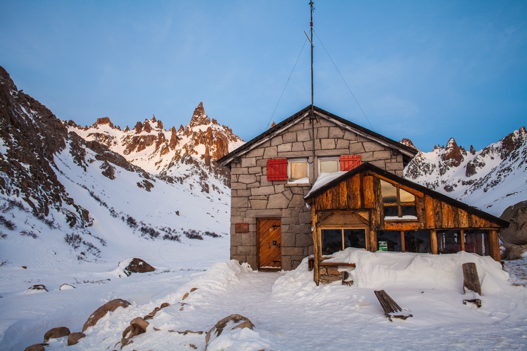
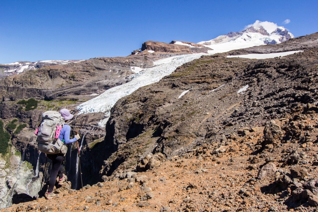
A challenging trail that takes you onto the slopes of the park’s tallest peak, the path to Refugio Otto Meiling is 23 km (14.3 mi) out and back and gains 1,093 m (3,586 ft) in elevation. The trail begins in Pampa Linda, about two hours drive from Bariloche. The refuge is located between the glaciers of Castaña Overa and Alerce.
Although the hike to the refuge can be completed in a day, many choose to stay overnight at the hut, which offers lodging and food. There are also guides and options to book more involved experiences, such as summiting Tronador or crossing one or two of the glaciers.
As the trailhead is further from Bariloche than other trails, generally fewer people are venturing up this breathtaking trail.
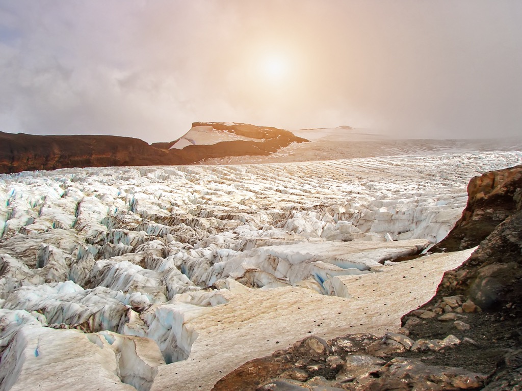
Summiting Cerro Tronador is only for experienced hikers and people with ice climbing experience. The hike leaves from Refugio Otto Meiling, requires a guide, and can expect to take about 12 hours roundtrip. There are also options to hike onto nearby glaciers for those wishing to hike beyond Refugio Otto Meiling but not to the summit of Cerro Tronador.
San Carlos de Bariloche, commonly called Bariloche, is the biggest hub for accessing Nahuel Huapi National Park and all the outdoor activities of the surrounding area. San Martin de los Andes is a smaller town located to the north. Quieter and less touristy, it offers easy access to the region’s numerous outdoor recreation activities.
Bariloche has a population of nearly 145,000 and is a significant town in the heart of Argentina’s Lake District. The city receives national and international tourists year-round – for skiing and snowboarding in the winter and hiking, trekking, whitewater rafting, and watersports in the warmer months.
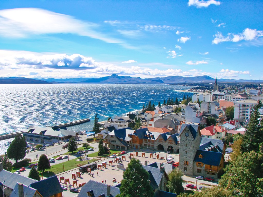
The town’s German and Swiss influence is evident in the architecture and the rich chocolate-making tradition. Bustling with tourists, the city offers a range of cafes, craft breweries, and restaurants ranging from Argentine parrillas and empanadas to Italian cuisine and vegetarian options. Accommodation is available from lakeside hotels, B&Bs, cabins, hostels, and campsites.
The city also offers Western Union and money exchange for those looking to withdraw or exchange money at a reasonable rate.
Lying north of Nahuel Huapi National Park, San Martin de los Andes lies in the Neuquen province with over 30,000 inhabitants. It sits on the edge of Lanin National Park and offers quick access to everything from hiking to biking to boating. There are even hot springs in Lanin National Park.
The scenic Seven Lakes Route is a popular section of Route 40 between San Martin and Villa la Angostura outside Bariloche. There are tours, or visitors can rent a car or bike to enjoy the scenic road at their own pace.
The downtown offers artisan fairs, cute cafes, and a decent selection of restaurants, including traditional, meat-heavy Argentinian meals, pizzerias, and bistros. Lodging options include hotels, hostels, B&Bs, cabins, and camping.


ultra
volcano
chile-ultras
argentina-ultras
ultra
volcano
chile-ultras
argentina-ultras


