
Scan the QR code and open PeakVisor on your phone
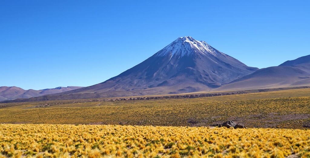
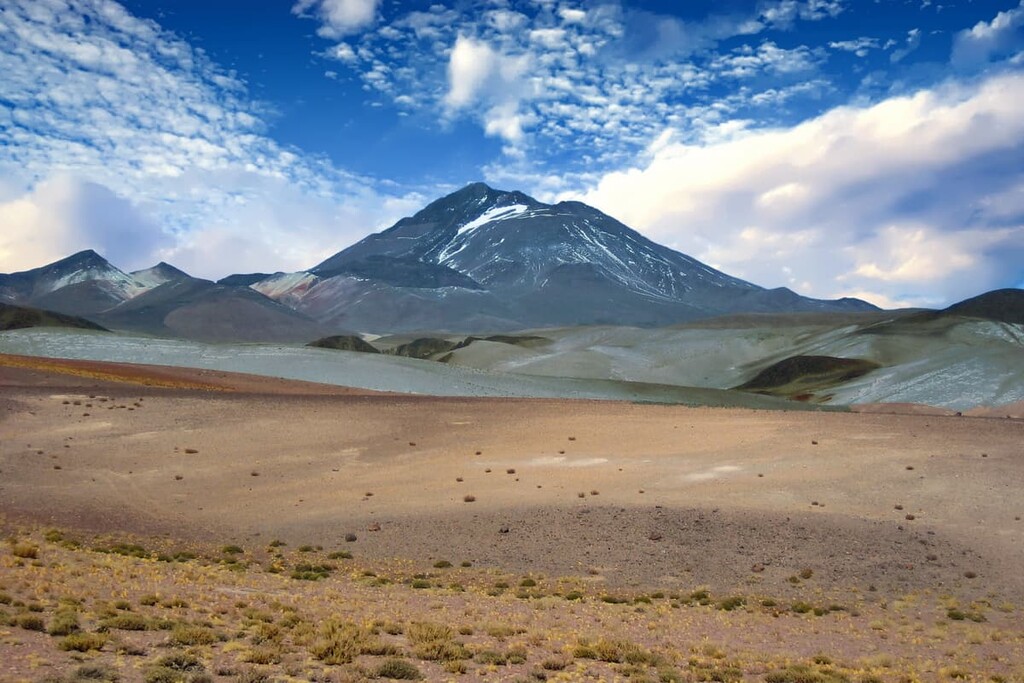
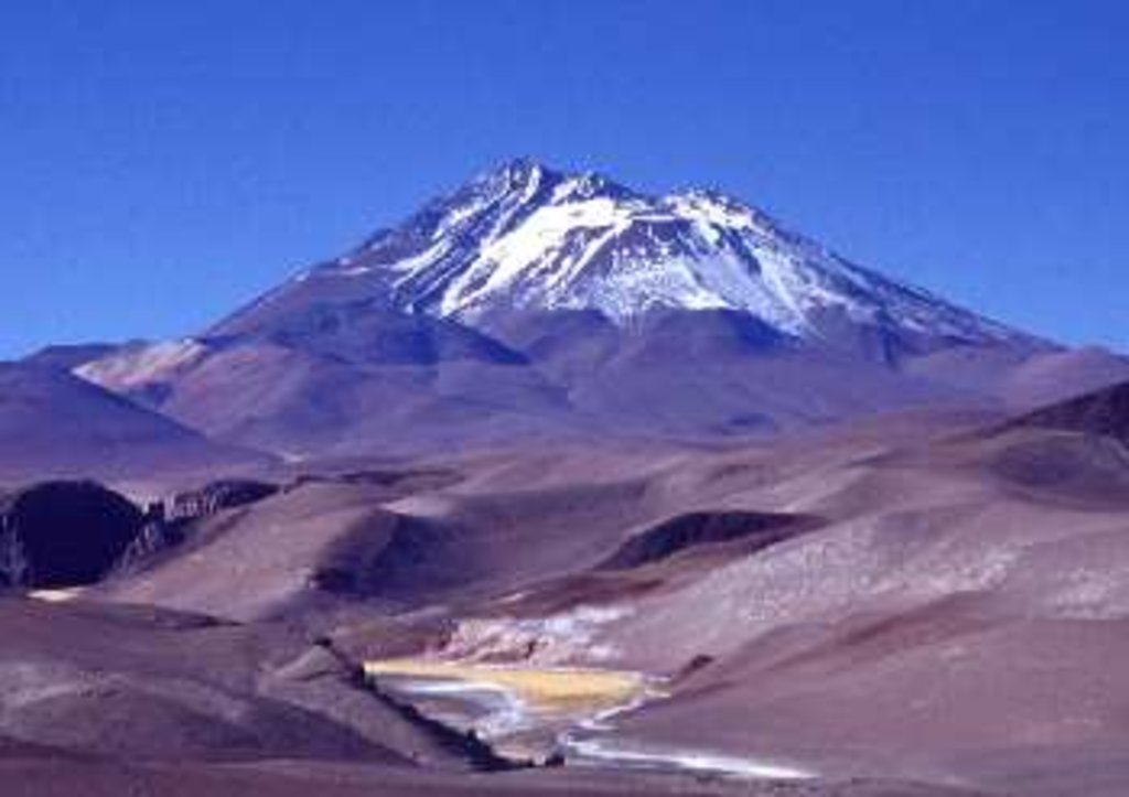
Reserva Provincial de Flora y Fauna Los Andes (Los Andes Provincial Reserve) is a protected region nestled in the northwestern section of Argentina. Situated along the eastern foothills of the Andes, the reserve has numerous volcanoes including the second highest active volcano in the world, Volcán Llullaillaco. The reserve contains 92 named mountains. The tallest peak and most prominent peak is Volcán Llullaillaco standing at 6,739 m (22,110 ft) with 2,345 m (7,694 ft) of prominence.
Los Andes Provincial Reserve is located in the northwestern region of Argentina along the country’s borders with Chile, just south of Bolivia. The protected area spans 14,440 sq km (5,575 sq miles) and it covers over half of the Los Andes department within the Salta province.
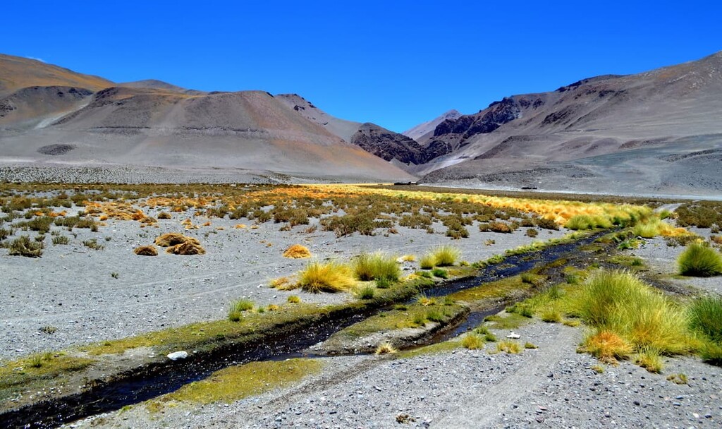
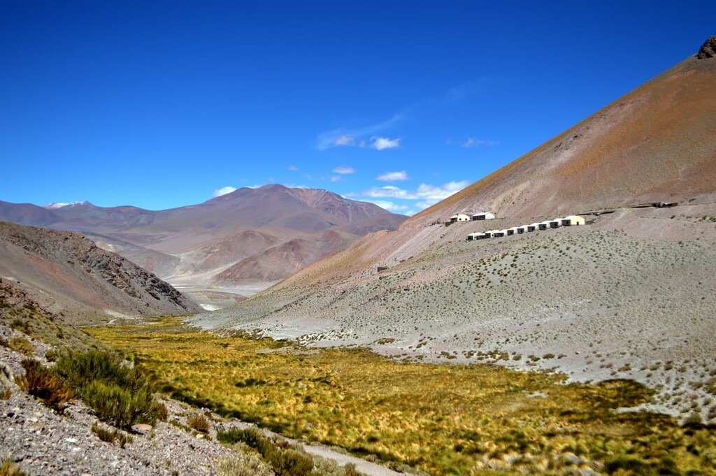
While most of the protected regions near the Andes are known for their rugged and glaciated peaks, Los Andes Provincial Reserve is characterized by numerous dormant volcanoes. The reserve is often broken down into two main ecoregions: the Puna and the High Andes.
Together, these two ecoregions are home to snow-capped peaks, high plateaus, valleys, and dry grasslands, extending northwards into the lagoons of nearby preserves. The volcanoes within the reserve are primarily found along the western coast of the protected region.
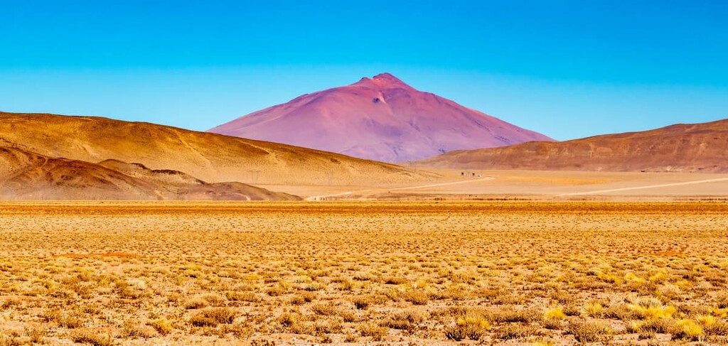
The southern portion of the reserve is marked by the massive salt flat known as Salar de Arizaro. The flat is the sixth largest in the world and the second largest within the entire country, after Salinas Grandes.
The land surrounding the salt flat, in the southern section of the reserve, receives little rainfall each year. Additionally, the northern stretches of the reserve are quite barren, though they do receive slightly more rainfall.
Los Andes Provincial Reserve is surrounded by other popular outdoor recreation areas. The Reserva de Fauna y Flora Olaroz Cauchari (Olaroz Cauchari Wildlife Reserve) and La Chinchilla High Andean Provincial Reserve (Reserva Provincial Altoandina de La Chinchilla) lie directly north of the reserve, while Los Cardones National Park (Parque Nacional Los Cardones) is located to the southeast, and Laguna Blanca Biosphere Reserve (Reserva Natural Provincial Laguna Blanca) is situated to the south.
The volcanism within the Andes was caused by the subduction of both the Nazca Plate and Antarctic Plate beneath the South American Plate. This subduction began around 25 million years ago at a speed of around 8 centimeters per year (3 inches).
The volcanism of the Andes is not a continuous chain throughout but rather broken down into four main sections. The volcanoes within Los Andes Provincial Reserve are part of the Central Volcanic Zone.
The western stretches of the reserve mark the southern edge of the Central Volcanic Zone. The Earth’s crust in this region is thought to be up to 70 km (43 miles) thick. Immediately east of these volcanoes lies the Salar de Arizaro salt flat.
Salar de Arizaro is thought to have formed between 5 to 10 million years ago. A salty inland sea once covered the region, showcased by the remnants of its former shorelines.
Major peaks within the park include Volcán Llullaillaco, Nevado de Quehuar, Volcán Aracar, Volcán Socompa, and Volcán Salín.
One of the main reasons that the Los Andes Provincial Reserve was established in the first place was to protect the region’s threatened fauna. The vicuña population throughout the region was rapidly declining until the reserve was established.
At the foot of Volcán Socompa lies the Socompa Laguna. Here 27 different bird species inhabit the land including waterbirds and terrestrial birds. Common bird species include the yellow-billed teal, austral negrito, barn swallow, and crested duck. Besides birds, the region is also home to chinchillas, Andean cat, and the Andean rhea.
Flora is quite sparse throughout the reserve due to the lack of rainfall and extreme conditions in the region. Alpine grasses can be found throughout with more plant life surrounding the eastern stretches of the park, near the city of Salta. Here, other grasses such as reed and yareta can be found amongst various species of cacti.
Human inhabitation of the region dates back to around 3000 BCE. The Qulla people (also known as Colla or Omaguacas) inhabited the region long before for thousands of years prior to the arrival of the Spanish in the sixteenth century.
Many of the Indigenous communities in the region traditionally maintained small villages of huts surrounded by a stone way. Known as a Pucara de Tilcara, this type of village allowed for tribal nations to remain protected in one region rather than having to continually relocate.
The Qulla traditionally practice agriculture, growing potatoes and quinoa. Furthermore, the Qulla are also known for having domesticated the guanaco. There are currently about 120,000 people of Qulla descent living throughout parts of Argentina, Chile, and Bolivia today.
Spanish colonizers erected a village in the region in 1593, despite resistance from Indigenous communities. The population of colonizers continued to grow with rapid growth taking place during the early nineteenth century with the increased production of sugarcane.
In 1999 the mummies of three Inca children, which are now known as the Mummies of Llullaillaco, were discovered near the summit of Volcán Llullaillaco. Archaeologists and anthropologists believe that the children were sacrificed as part of a traditional Inca ritual that took place around 1500 CE. These mummies are considered to be some of the best preserved Inca mummies on record.
The first recorded climb up Volcán Llullaillaco was in 1950. However, there are a number of other paths and routes up the summit, indicating that humans likely ventured up the mountain long before the first recorded ascent.
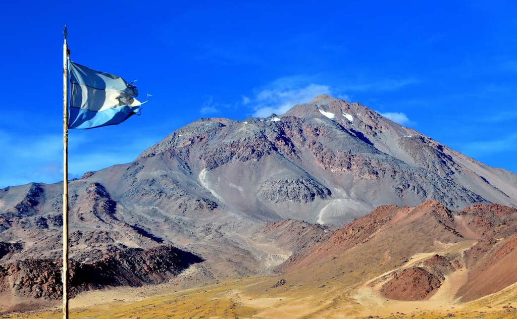
The Los Andes Provincial Reserve was established in 1980. It now is tasked with protecting a large and unique landscape that’s steeped in cultural heritage.
There are no marked trails throughout Los Andes Provincial Reserve due to its high level of protection. However, nearby trails can be found surrounding the city of Salta which lies to the east of the reserve.
Though not within the reserve boundaries, these hiking trails are quite accessible and they still offer views of the surrounding landscape. Common trails include Chorro de Lesser, Rio San Lorenzo, Cerro San Bernardo, and Cerro Aladelta.
Over the past decade, the region of Salta has established a high-elevation trek that roughly follows the route of the Incas. The trail spans from the Mendoza region to Salta and passes some of the country’s most famous ruins and landscape. Many tours offer day long trips along this remote route where you can learn more about this historic region.
Looking for a place to stay near Los Andes Provincial Reserve? Here are some of the best cities and villages to check out in the region:
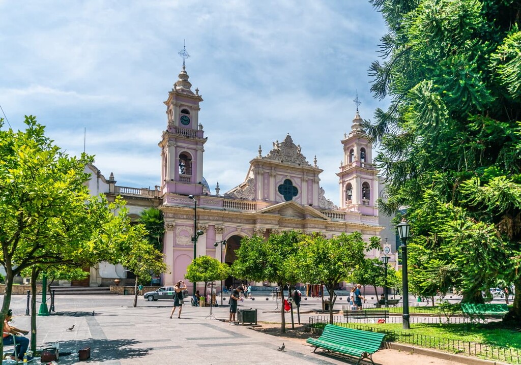
The city of Salta is located east of Los Andes Provincial Reserve. It is the capital of the Salta province with a metro population of 620,000 people. Salta is the eighth most populous city in Argentina.
Salta is known for its stunning architecture and its close proximity to the region’s many protected parks and vineyards. A popular sight near the city includes the cable car up Cerro San Bernardo, which provides panoramic views of the city and its surrounding hills and mountains.
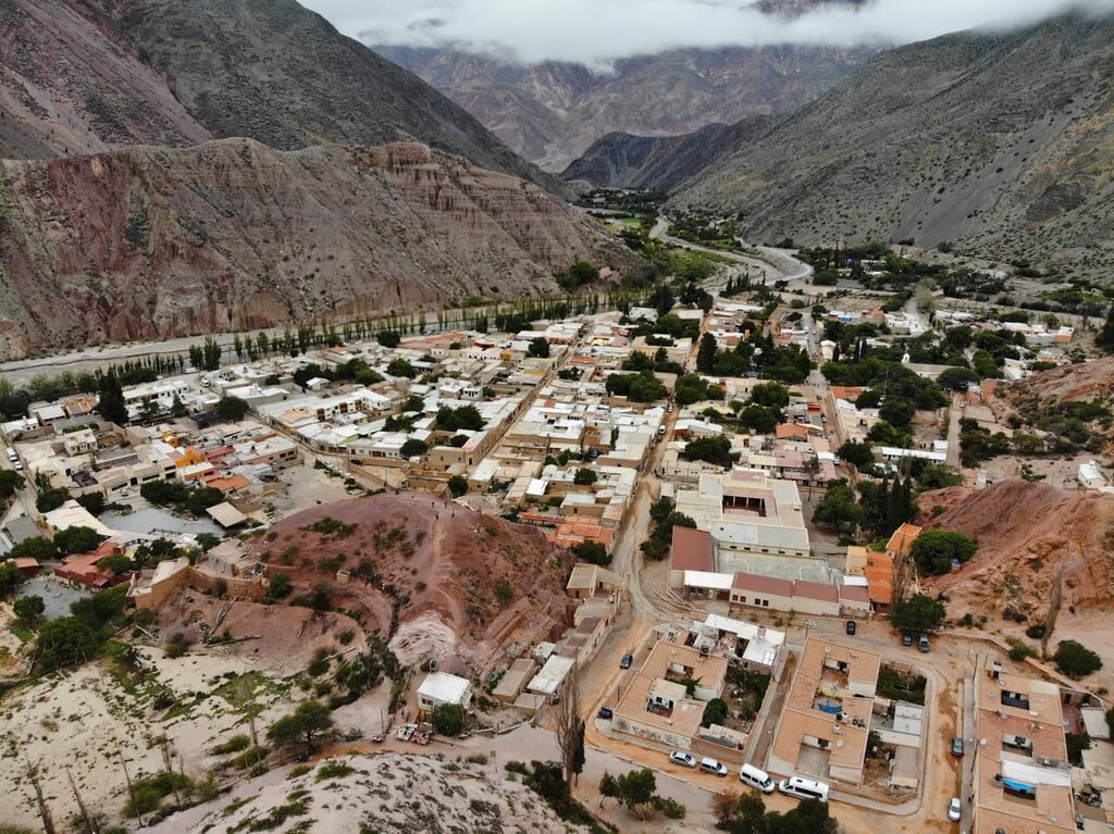
San Salvador de Jujuy lies just north of the city of Salta. Though San Salvador de Jujuy lies in the Jujuy province it is still near the reserve. The urban population of the city is around 260,000 people.
The city is also in close proximity to Calilegua National Park, which has more accessible hiking trails. Other notable sights include the Quebrada de Humahuaca gorge along with the Salinas Grandes salt flats.


.jpg)
ultra
volcano
andes-6000ers
chile-ultras
argentina-ultras
ultra
volcano
andes-6000ers
argentina-ultras
ultra
volcano
andes-6000ers
argentina-ultras
ultra
volcano
andes-6000ers
chile-ultras
argentina-ultras
ultra
volcano
andes-6000ers
chile-ultras
argentina-ultras
ultra
volcano
andes-6000ers
chile-ultras
argentina-ultras
ultra
volcano
andes-6000ers
argentina-ultras
ultra
volcano
andes-6000ers
argentina-ultras


