Scan the QR code and open PeakVisor on your phone
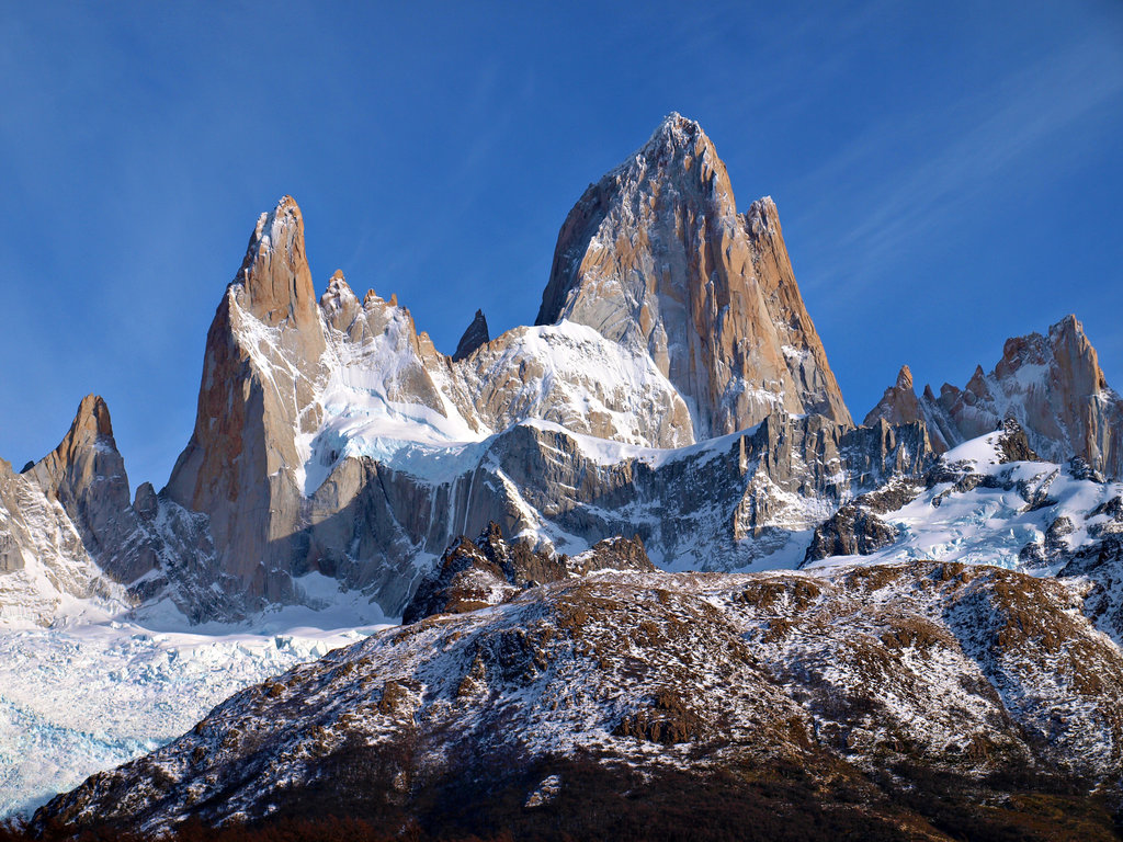
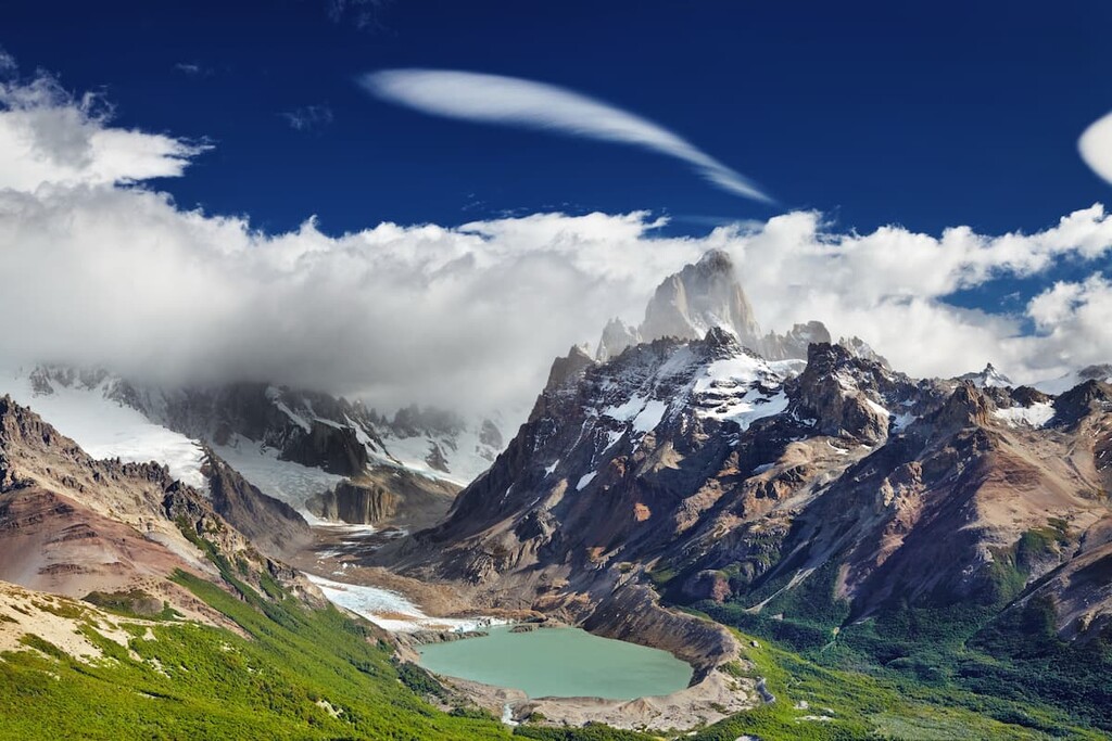
Surrounding Mount Fitz Roy and Val de Biois in the Los Glaciares National Park of Argentina, lies the Monumento Natural Provincial Cerro Chalten. The protected region lies within this much larger park and primarily protects the land surrounding that of Mount Fitz Roy. Within the Santa Cruz province, near the city of El Chalten, lies this rugged and dominating peak. There are 2 named mountains in Monumento Natural Provincial Cerro Chalten. The highest and the most prominent mountain is Mount Fitz Roy standing at 11,171 feet with 6,417 feet of prominence.
Mount Fitz Roy has various other names including Cerro Chalten, Cerro Fitz Roy of Mount Fitz Roy. The iconic peak sits on the border of Chile and Argentina. The two countries have agreed that the border between them goes directly over the highest peak of the mountain. Though much of the surrounding border is undefined, the peak acts as a symbol of the Santa Cruz province of Argentina.
The peak was named after Robert FitzRoy who charged the Patagonian coast in the early 1800s. The other name given to the peak, Cerro Chalten, comes from the Tehuelche word that means “smoking mountain”. The geography of the peak results in there often being a cloud near the summit which is why it is often referred to as Cerro Chalten. The first known ascent of the peak occurred in 1952.
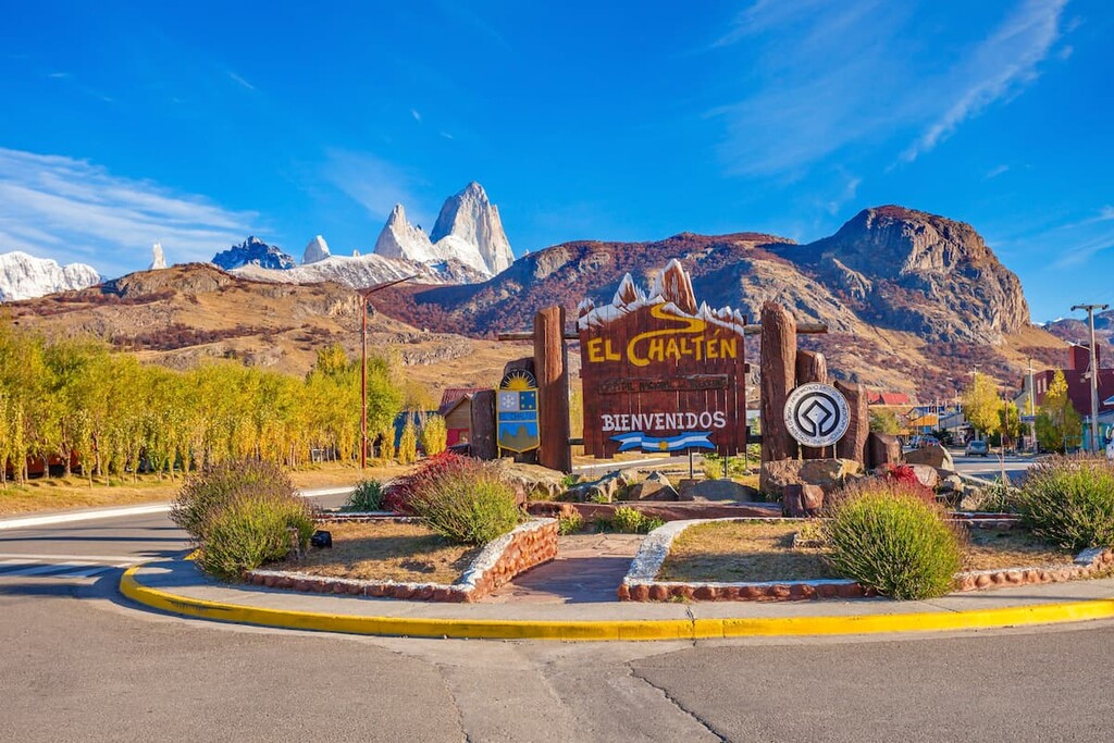
Mount Fitz Roy, as well as the surrounding region, has a subpolar oceanic climate. The region recipes high amounts of rainfall though it is spread out through much of the year. Despite snow falling throughout the winter months, the average temperature at night only drops down to around 24 degrees Fahrenheit. The small mountain town of El Chalten acts as a gateway into Los Glaciares National Park as well as for summiting Mount Fitz Roy.
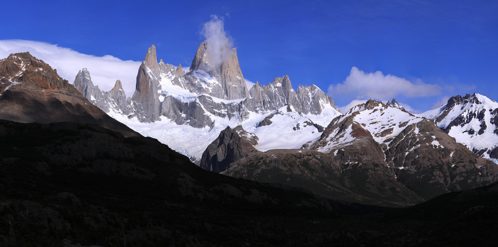
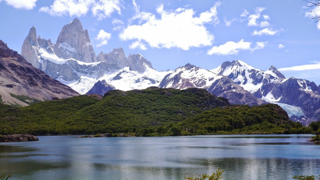
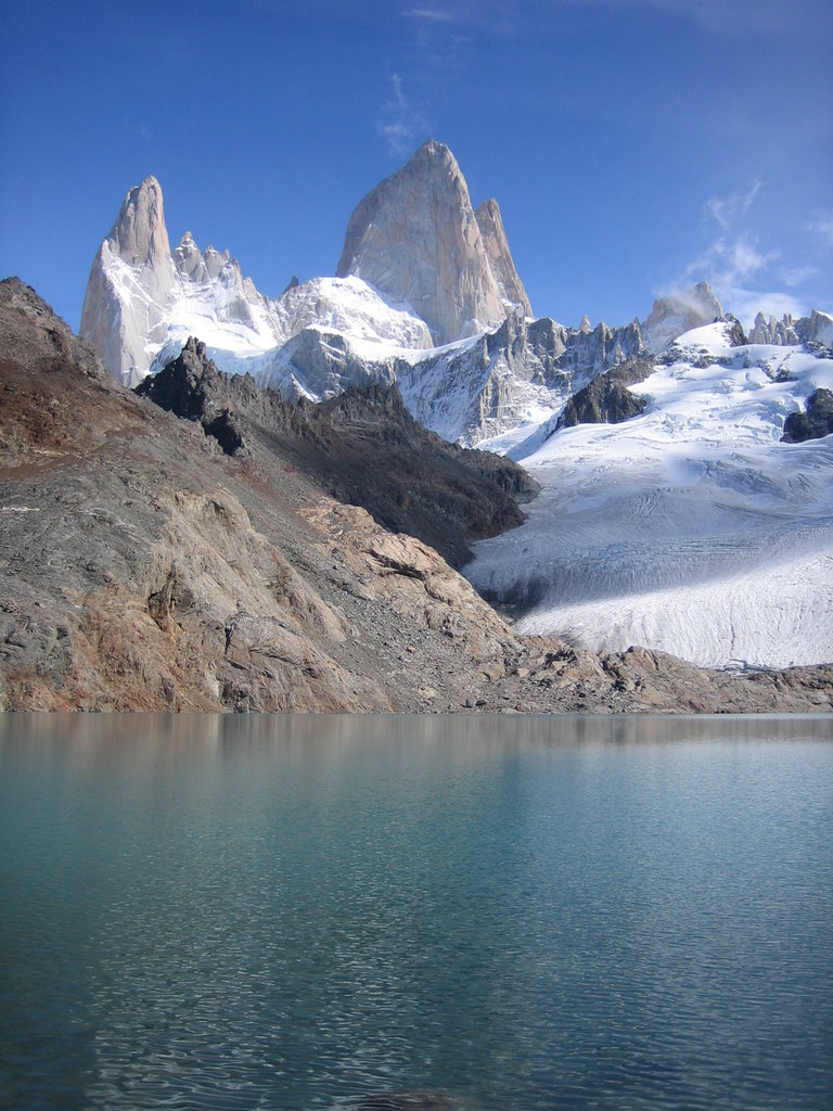
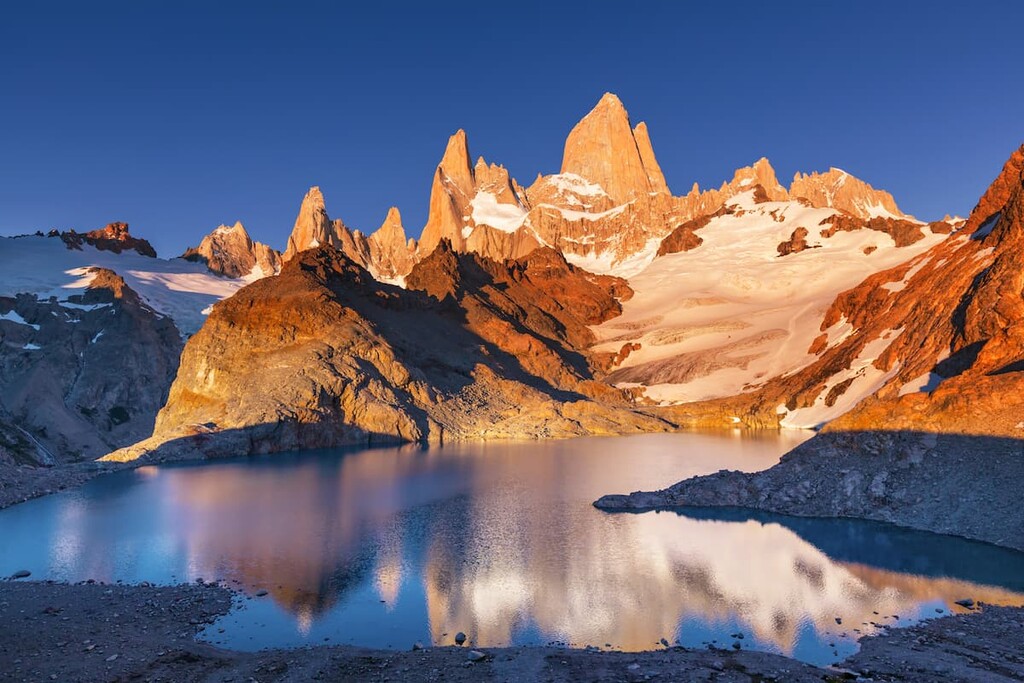
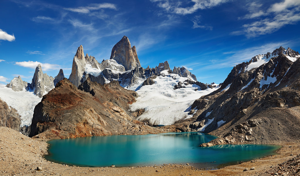
Laguna de Los Tres: The Laguna de Los Tres trail that leads from El Chalten is one of the most popular routes in the entire park. The trail totals 13 miles roundtrip with 3,325 feet of elevation gain. After a steep ascent into the mountains, the trail provides panoramic views of Los Tres Glacier, Cerro Madsen and Mount Fitz Roy. While the hike turns around after 6.5 miles, this trail also marks the beginning ascent up Mount Fitz Roy though extensive mountaineering experience is required to reach the summit.
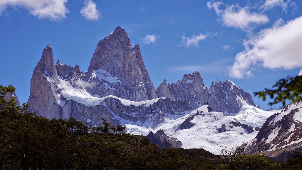
Laguna Torre: Starting from El Chalten, the Laguna Torre hike is 11 miles round trip with 1,770 feet of elevation gain. The lake, though beautiful on its own, sits at the base of Cerro Torre. The trail climbs steadily, predominantly following the Fitz Roy river.
Located within the Los Glaciares National Park lies the small town of El Chalten. The town sits at the base of Cerro Torre which is popular for both hiking and mountaineering. It’s close proximity to numerous trails within the park led to it being named Argentina’s Trekking Capital. The city is reliant on tourism with less than 1,000 full-time residents. During the warmer months, visitors come to the village for trekking, camping, and exploring the gorgeous surroundings. The rise of tourism has led to a few bars and restaurants being established along with shops for purchasing outdoor gear.
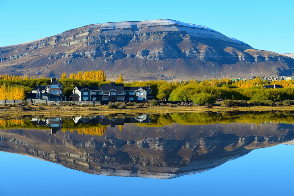
Located along the southern shore of Lake Argentino lies the city of El Calafate. The city’s location makes it a popular destination for visitors of Los Glaciares National Park, Perito Moreno Glacier and Cerro Torre. The population of the city fluctuates with the seasons with an estimated 10,000 full time residents. Besides being surrounded by outdoor activities, the city is also home to Glaciarium, a museum dedicated to glaciers primarily within the Southern Patagonia Ice Field.