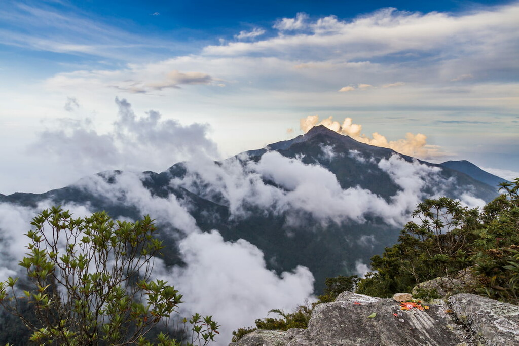
Pico Naiguatá is the summit of a mountain in South America near Caracas, Venezuela, part of the Venezuelan Coastal Range, of which it is the highest peak. It is situated on the border of the Venezuelan states Miranda and Vargas. With a summit elevation of 2,765 metres (9,072 ft) above sea level and a prominence of 2,455 metres (8,054 ft), it is the highest point in both of these states and the fourth highest of the Caribbean after Pico Simón Bolivar and Pico Cristóbal Colón of the Sierra Nevada de Santa Marta range in Colombia and Pico Duarte in the Dominican Republic.
There's a trail leading to the summit.
By elevation Pico Naiguatá is
# 1 out of 188 in Vargas # 1 out of 188 in Municipio Vargas # 1 out of 728 in Miranda # 1 out of 31 in Municipio Sucre # 1 out of 138 in Parque Nacional Waraira Repano
By prominence Pico Naiguatá is
# 1 out of 188 in Vargas # 1 out of 188 in Municipio Vargas # 2 out of 8317 in Venezuela # 1 out of 728 in Miranda # 1 out of 31 in Municipio Sucre # 1 out of 138 in Parque Nacional Waraira Repano # 9 out of 39148 in the Andes (Bolivia, Peru, Ecuador, Colombia, Venezuela)
We use GPS information embedded into the photo when it is available.
3D mountains overlay
Adjust mountain panorama to perfectly match your photos because recorded by camera photo position might be imprecise.
Move tool
Rotate tool
Zoom
More customization
Choose which peak labels should make into the final photo and what photo title should be.
Next
Photo Location
Satellitte
Flat map
Relief map
Latitude
Longitude
Altitude
OR
Latitude
°'''
Longitude
°'''
Apply
Register Peak
Peak Name
Latitude
Longitude
Altitude
Register
Teleport
PeakVisor
This 3D model of Sagarmatha National Park in Nepal was made using the PeakVisor app topographic data. The mobile app features higher precision models worldwide, more topographic details, and works offline. Download PeakVisor maps today.
Download OBJ model
PeakVisor
The download should start shortly. If you find it useful please consider supporting the PeakVisor app.
PeakVisor for iOS and Android
Be a superhero of outdoor navigation with state-of-the-art 3D maps and mountain identification in the palm of your hand!