
Scan the QR code and open PeakVisor on your phone
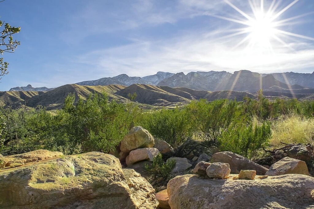
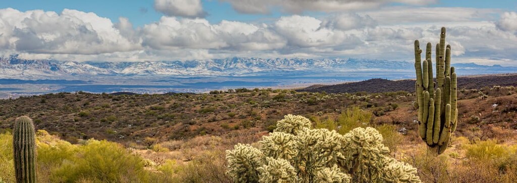
Lovingly known as the Grand Canyon State, Arizona is a state located in the southwestern United States that’s known for its stunning canyons, rugged mountains, and vast deserts. Arizona contains 4166 named mountains, the highest of which is Humphreys Peak (12,635ft/3,851m), and the most prominent of which is Mount Graham (10,696ft/3,260m).
The state of Arizona is located in the southwestern region of the United States. It shares a border with five states, including California and Nevada to the west, Colorado and New Mexico to the east, and Utah to the north. It is also located to the north of the state of Sonora in Mexico.
With a total land area of 113,990 square miles (295,234 sq. km), Arizona is the sixth largest state in the union after Alaska, Texas, California, Montana, and neighboring New Mexico. However, with a total population of just 7.2 million, Arizona is only the 14th largest state and the 33rd most densely populated.
There are also 21 federally-recognized tribes in Arizona, most of which retain a reservation within the state.
In fact, the Navajo Nation, which is partially located within Arizona, retains the largest land area of any Tribal Nation in the United States. The Navajo Nation reservation is actually larger than ten states, including West Virginia, New Jersey, Connecticut, Delaware, Rhode Island, Hawaii, Maryland, Massachusetts, Vermont, and New Hampshire.
The state is officially divided up into 15 counties. Furthermore, the state of Arizona can be categorized into many different regions based on shared topographical and ecological characteristics. Although none of these regions have an official function, the following regions correspond to the regions identified by the Arizona Wilderness Coalition.
One of the most famous regions in Arizona, the Greater Grand Canyon Region encompasses the entire northern third of the state. This includes part of Mohave, Coconino, Navajo, Apache, and Yavapai counties as well as all or part of the lands of the sovereign Navajo Nation, Hopi Tribe, Kaibab Paiute Tribe, Havasupai Tribe, and Hualapai Tribe.
This northern region of Arizona is mostly dominated by the Colorado Plateau and its many subranges, which include:
Furthermore, the very northern edge of this region is also technically home to peaks that are within the Southwest Basins and Ranges such as the Beaver Dam Mountains, the Cerbat Mountains, and the Black Mountains (Nevada).
As one of the most popular outdoor recreation destinations in Arizona, this region has no shortage of parks and protected areas. These include:
Additionally, the Greater Grand Canyon Region is also home to a fantastic selection of wilderness areas, such as:
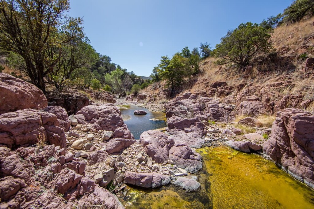
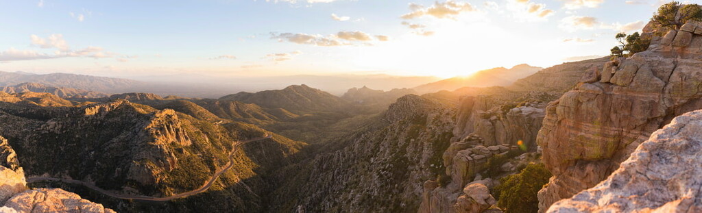
Covering the southeastern corner of Arizona, the Sky Island Region is a mountainous and rugged area that’s home to a number of biodiverse ecoregions. This region contains all or part of Navajo, Apache, Gila, Graham, Cochise, Greenlee, Pinal, Pima, and Santa Cruz counties, and it is home to a number of Tribal Nations, including the San Carlos Apache Nde Nation and the White Mountain Apache Tribe.
This mountainous region is located along the intersection between subtropical and temperate climates. It is also located at the intersection between the Sonoran and the Chihuahuan deserts.
Here, one can find peaks that are part of both the Colorado Plateau, such as the White Mountains, and the Southwest Basins and Ranges. There are a number of Basin and Range subranges located in this region, such as:
Additionally, this region contains a great selection of parks and conservation areas, including:
Encompassing much of the central and southern parts of Arizona, the Central Mountains/Sonoran Region contains both vast desert and rugged peaks. This region includes parts of Yavapai, Gila, Maricopa, Pinal, and Pima counties. It is also home to a number of Tribal Nations, such as the Tohono O’odham Nation, Gila River Indian Community, Tonto Apache Tribe, Ak-Chin Indian Community, and Pascua Yaqui Tribe.
The northern part of this region is located along the intersection of the Southwest Basins and Ranges and the Colorado Plateau. It includes a number of Colorado Plateau subranges, such as:
There are also quite a few notable national monuments, forests, and wildlife refuges in this central part of Arizona, such as:
Additionally, wilderness areas are in no short supply within the Central Mountains/Sonoran Region. Some of the many wilderness areas in this region include:
The fourth and final region in Arizona is the Western Deserts Region. Aptly named, this region contains the desert areas in the western part of the state in Mojave, La Paz, and Yuma counties. This region is also home to many Tribal Nations, including the Fort Mojave Indian Tribe, Colorado River Indian Tribes, Fort Yuma Quechan Indian Tribe, and Cocopah Indian Tribe.
The Western Deserts Region is dominated by the peaks of the Southwest Basins and Ranges and its many subranges, which include:
There are a number of important wildlife refuges and monuments in this region, too, such as:
Furthermore, the Western Deserts Region contains a superb collection of wilderness areas, including:
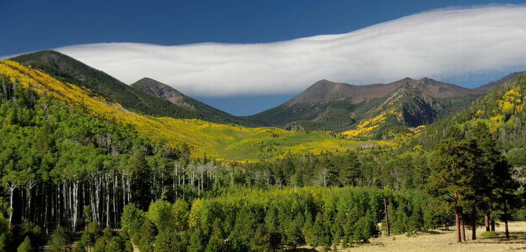
Arizona has an interesting and varied physical geography with three distinct regions: the Colorado Plateau, the Basin and Range, and the Transition Zone. Each of these physiographic regions contains its own unique geologic history and topographical features.
The Colorado Plateau is one of the largest physiographic regions in the United States. It covers much of Colorado, Utah, New Mexico, and Arizona. In Arizona, in particular, it covers the majority of the northern third of the state.
This region is very dry and it is dominated by plateaus with deep canyons, such as the Grand Canyon. It is often called “Red Rock Country” because of its characteristic bright red sandstone. Although it’s not entirely clear what caused the Colorado Plateau’s uplift, it’s believed that the plateau was uplifted about 20 million years ago.
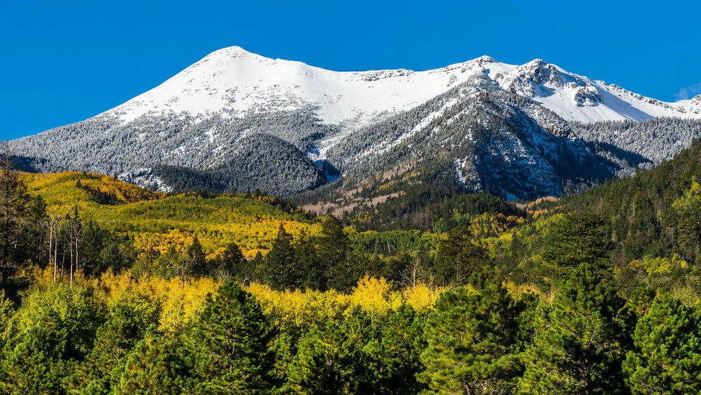
Major peaks in the Arizona section of the Colorado Plateau include Humphreys Peak, Agassiz Peak, and Mount Baldy.
The Transition Zone is a northwest to southwest trending region that covers much of the central third of the state. It includes a number of mountain ranges, such as the Mazatzal Mountains, the Santa Maria Mountains, the White Mountains, and the Sierra Ancha.
This area is, as the name suggests, a transitional zone between the Colorado Plateau to the north and the Great Basin Ranges to the south. As a result, it shares many of the geologic characteristics of both of its neighboring regions.
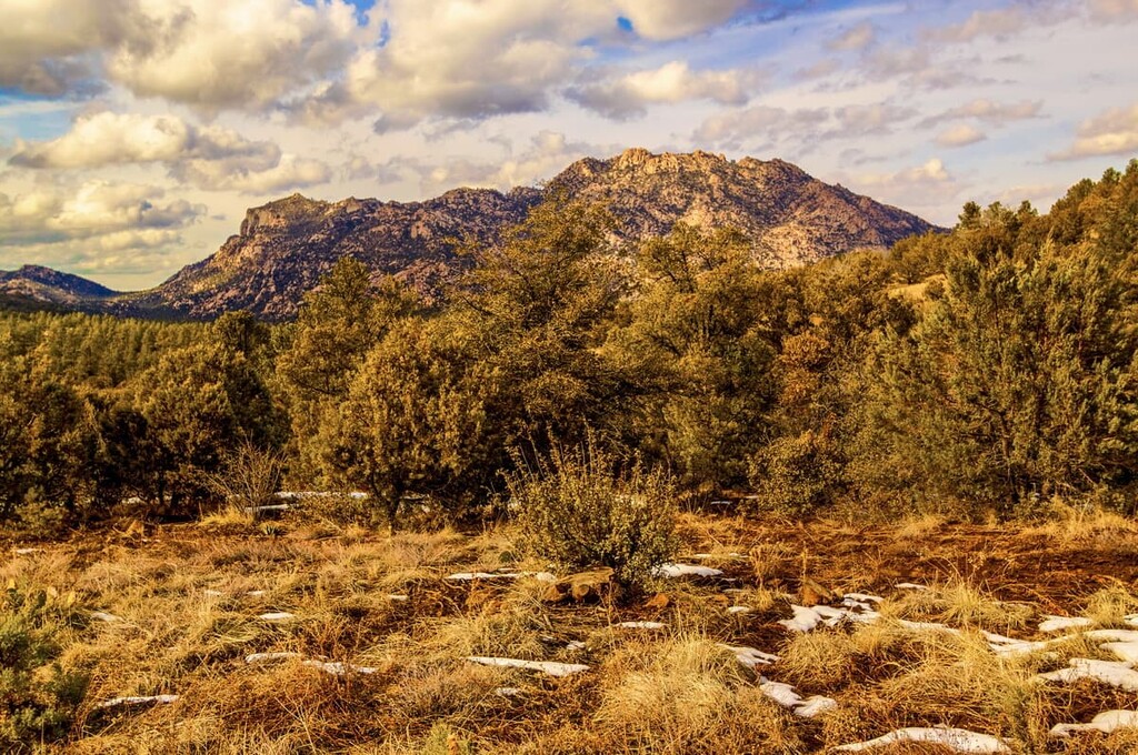
Major peaks include Mount Davis, Woodchute Mountain, Camp Wood Mountain, and Granite Mountain.
The southern third of Arizona is dominated by the Southwest Basins and Ranges, which is an extension of the Great Basin Ranges.
Geologically, the Great Basin Ranges formed likely as a result of widespread tectonic extension during the Miocene. It is home to alternating series of linear mountain ranges and their associated valleys.
This region is particularly rich in mineral resources. In fact, much of Arizona’s gold, barite, silver, and copper can be found in this area.
Major peaks include Mount Graham, Mount Lemmon, Chiricahua Peak, Miller Peak, and Wrightson Peak.
Due to its large size and varied topography, Arizona is home to a fantastic array of different ecosystems. Here are some of the major ecoregions found within the state:
Located in a small part of western Arizona, the Mojave Basin and Range is dominated by creosote brush, saltbrush, and sagebrush. This region also has some areas of palo verde-cactus shrub and even some saguaro cactus, though these are not as common as the other ecosystems.
It is mostly located in lower-lying regions to the south and southeast of Lake Mead, much of which is on federally-managed land. However, due to the relative lack of water, this region is not as heavily grazed as others, which has helped preserve some of its natural vegetation.
Covering just a small sliver of the northernmost part of Arizona, the Colorado Plateaus is a rugged ecoregion that’s dominated by deep canyons.
Here, the dominant ecoregions include saltbrush-greasewood, especially in drier locales. Additionally, you can also find some pinyon-juniper woodlands at the higher elevations.
The Arizona/New Mexico Plateau encompases a wide swath of northern Arizona. It is a transitional region between the Colorado Plateau to the north and the Chihuahuan Desert to the south.
This region is dominated by shrublands at the lower elevations, though there are some forested regions at higher locales.
Located mostly to the south of the Arizona/New Mexico Plateau, the Arizona/New Mexico Mountains is a mostly higher elevation region. It contains a dry, mostly warm environment that supports forests of Douglas fir and spruces.
There are also large areas of chaparral at the lower elevations in this ecoregion. Meanwhile, pinyon-juniper and oak forests are more common in middle elevations and ponderosa pine forests are found at higher elevations.
One of the largest and hottest deserts in North America, the Chihuahuan Deserts ecoregion covers a small section of southeastern Arizona.
Here, the landscape is hot and dry, so the primary ecosystems are grass and shrubland. However, the highest slopes can also sometimes support oak-juniper woodlands, though these are less common.
Sometimes called the “Sky Islands,” the Madrean Archipelago is a large ecoregion located in the southeastern corner of Arizona and the southwestern corner of New Mexico. It contains a collection of peaks with large amounts of prominence, which allows them to support unique sky island ecoregions.
Here, the landscape is covered by an array of different ecosystems. This includes grama-tobosa shrub steppe, oak-juniper woodlands, and ponderosa pine forests.
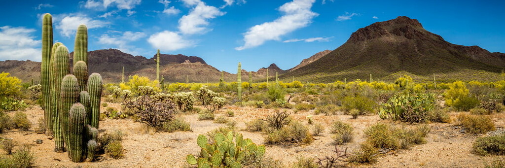
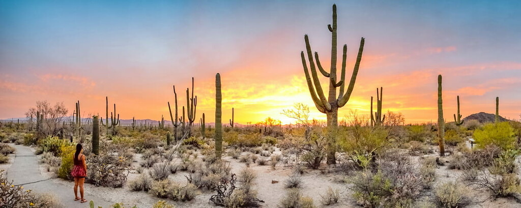
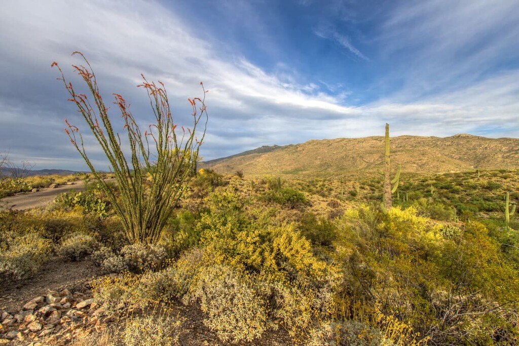
The Sonoran Basin and Range ecoregion covers most of southwestern Arizona. This area coincides with much of the Sonoran Desert in the state. It contains palo verde-cactus shrub grass, creosote bush, and even saguaro cactus.
However, most of this region is federally-managed and much of it is used for military purposes. So, various degrees of habitat loss have taken place throughout this region.
The land that is now part of Arizona has been home to humans for tens of thousands of years. The earliest peoples in the region were likely of the Ancestral Puebloan, Mogollon, and Hohokam cultures. There is a fairly large abundance of archaeological remains in the state that date back to this early period.
Arizona also has a rich cultural history that dates back to time immemorial. The state is currently home to 21 federally-recognized sovereign Tribal Nations who consider the region to be part of their traditional territory and ancestral homelands. Arizona is home to some of the largest Tribal Nations and reservations in the United States, including the Navajo Nation.
While the region that is now Arizona has been home to humans for thousands of years, the first Europeans to visit the area were likely members of Marcos de Niza of Spain’s 1539 expedition or Francisco Vázquez de Coronado’s 1540 expedition.
From the sixteenth to nineteenth centuries, the area that is now Arizona was claimed by Spain as part of New Spain.
During this time, the Spanish established a number of missions in the region in order to convert Indigenous peoples to Christianity. Many of these missions were responsible for the introduced diseases, violence, and forced labor that removed Indigenous peoples from their homelands and decimated the first peoples of the region.
After Mexico gained its independence from Spain in 1821, the land that is now Arizona became part of Mexico’s Alta California territory. Mexico maintained control over the region until the Mexican–American War and the signing of the Treaty of Guadalupe Hidalgo, which ceded the region to the United States in 1848.
The US gained control over what is now Arizona in 1848. Not long after, in 1853, Arizona grew in size as a result of the Gadsden Purchase.
This area was administered as part of the Territory of New Mexico until a portion of the territory ceded from the Union in 1861 to form the Territory of Arizona. The Territory of Arizona fought on the side of the Confederacy during the Civil War and lost. After, this region became part of the Arizona Territory.
During this time, Arizona Territory saw a fairly large influx of immigrants from nearby Utah. Brigham Young of the Church of Jesus Christ of Latter-day Saints sent many of his mormon followers to Arizona to establish towns toward the end of the nineteenth century.
The territory also saw a number of gold and silver rushes during this time, but the copper industry became the primary mineral economic impetus in the region by the end of the nineteenth century.

Arizona achieved its statehood in 1912, making it the very last of the contiguous United States to join the union. Only Alaska and Hawaii joined the country as states after Arizona.
The first few years of Arizona’s statehood were tumultuous, especially in the wake of a number of major miner strikes and the Bisbee Deportation of 1917.
In the aftermath of the Great Depression, Arizona’s economy received a bit of a boom through its new tourism industry. “Old West”-style activities became popular among tourists, so a number of resorts opened in the state to cater to this increasing demand.
The state also contains a number of Japanese American internment camps during World War II. There were also a number of prisoner of war camps in Arizona during this time. Furthermore, the state was home to a number of Native American boarding schools that attempted to forcibly assimilate Indigenous children into white American culture.
After World War II, Arizona’s population grew exponentially. It became a popular destination for retirement communities, especially among folks looking to escape the harsh winters in the northern states and Canada.
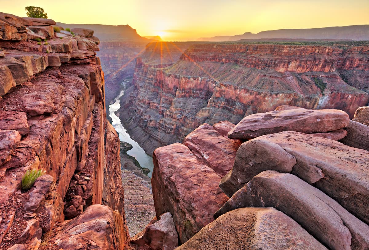
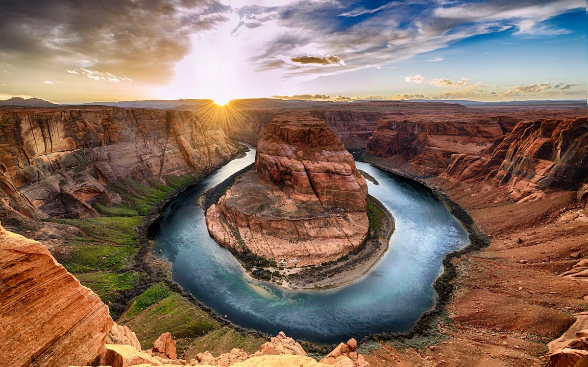
In more recent years, Arizona has also become a major tourist destination, thanks to its stunning natural landscapes. The state is home to one of the most popular national parks in the country: Grand Canyon National Park.
Arizona boasts a lifetime’s worth of outdoor adventure opportunities. Here are some of the best places to check out:
One of the most famous national parks in the United States, Grand Canyon National Park is a land of canyons and stunning scenic beauty located in the northwestern corner of Arizona. The park contains 278 named mountains, the highest and most prominent of which is Lindbergh Hill.
Grand Canyon offers a spectacular array of hiking and camping opportunities. Most visitors to the park head to the South Rim where hiking trails are abundant. One of the more challenging hikes in the park is the Rim-to-Rim hike, which traverses the canyon from south to north. For even more adventure, you can attempt a Rim-to-Rim-to-Rim hike and cross the canyon twice.
Do keep in mind that Grand Canyon is hot and dry. So, be sure to pack plenty of water and avoid hiking during the middle of the day during the summer months.
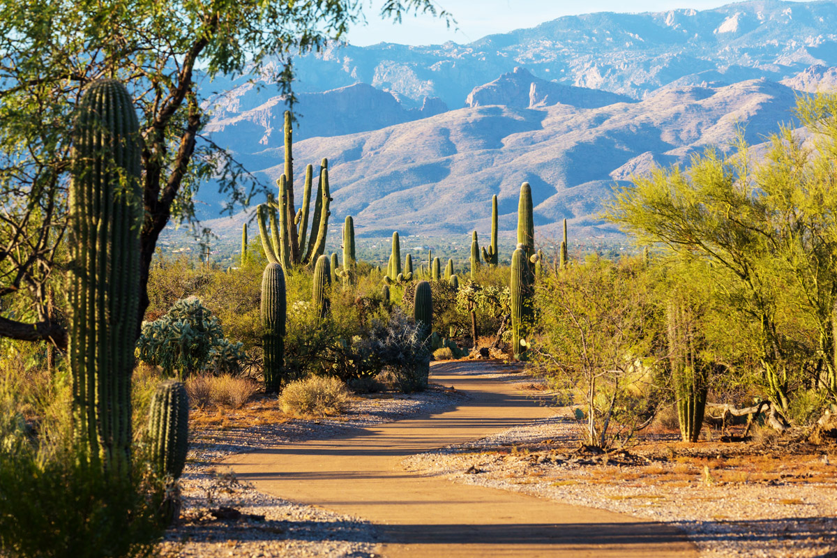
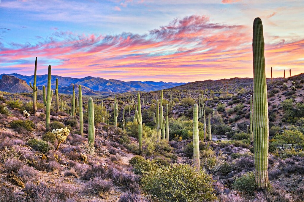
Situated just outside the city of Tucson, Saguaro National Park is home to some of the largest cacti in the world. The park contains 18 named mountains, the highest and most prominent of which is Mica Mountain.
Saguaro National Park is famous for its namesake cactus, the saguaro cactus, which can grow to be over 40 feet (12 m) tall. The cactus is only found in the Sonoran desert and it is believed to live for well over 100 years.
While Saguaro National Park is not the only place where these cacti grow, it is home to a dense concentration of them. There are a number of superb hiking trails in the park, including the trek to Signal Hill and the Sendero-Esperanza Trail.
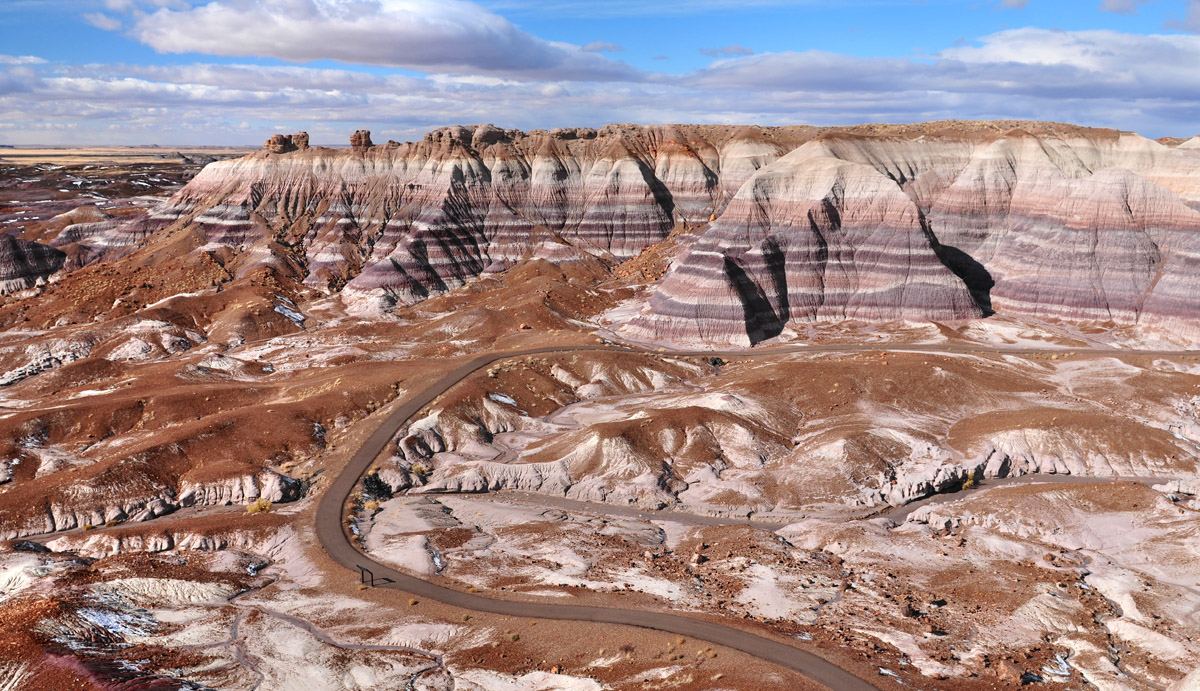
Petrified Forest National Park is one of the more unique units within the US National Park system. It is located to the east of Flagstaff along I-40 and it contains 16 named mountains, the highest and most prominent of which is Pilot Rock.
Although it’s one of the least visited parks in the contiguous United States, Petrified Forest is home to scenery like no other. It actually contains large deposits of petrified wood, many of which date back hundreds of millions of years.
The park is also home to colorful badlands, which offer great hiking opportunities. Some of the many great hikes in the area include the Painted Desert Rim Trail and the Crystal Forest Trail.
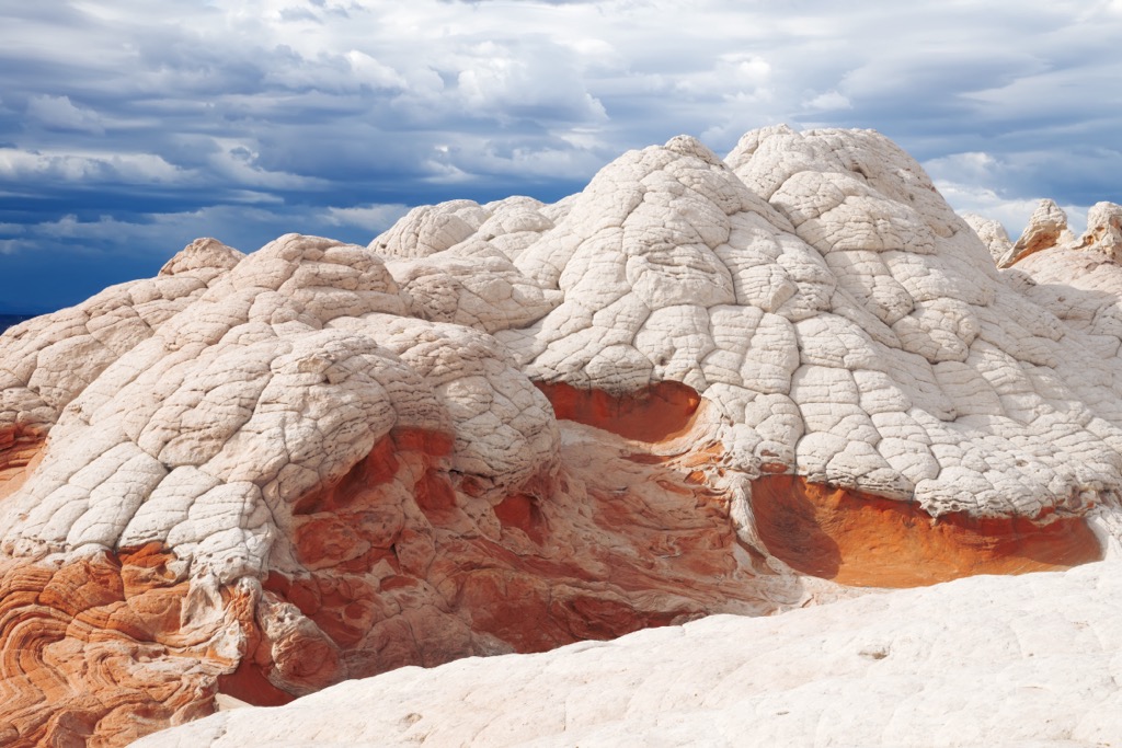
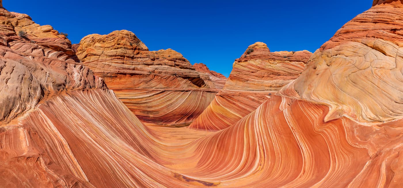
Boasting a stunning array of geologic features, Vermilion Cliffs National Monument is a must-visit destination in northern Arizona. It contains 11 named mountains, the highest and most prominent of which is White Knolls.
Vermilion Cliffs is one of the most beautiful national monuments in Arizona. It is perhaps best known, however, for its world-famous The Wave, which is a formation of swirled sandstone that’s particularly popular among hikers.
Do keep in mind that permits for The Wave are highly regulated. Permits are available on a lottery basis from the Bureau of Land Management, though there are sometimes last-minute permits available. So, be sure to plan far in advance if you’d like to visit this gorgeous destination.
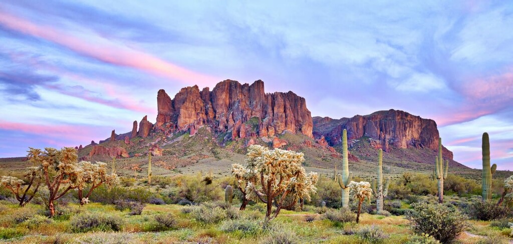
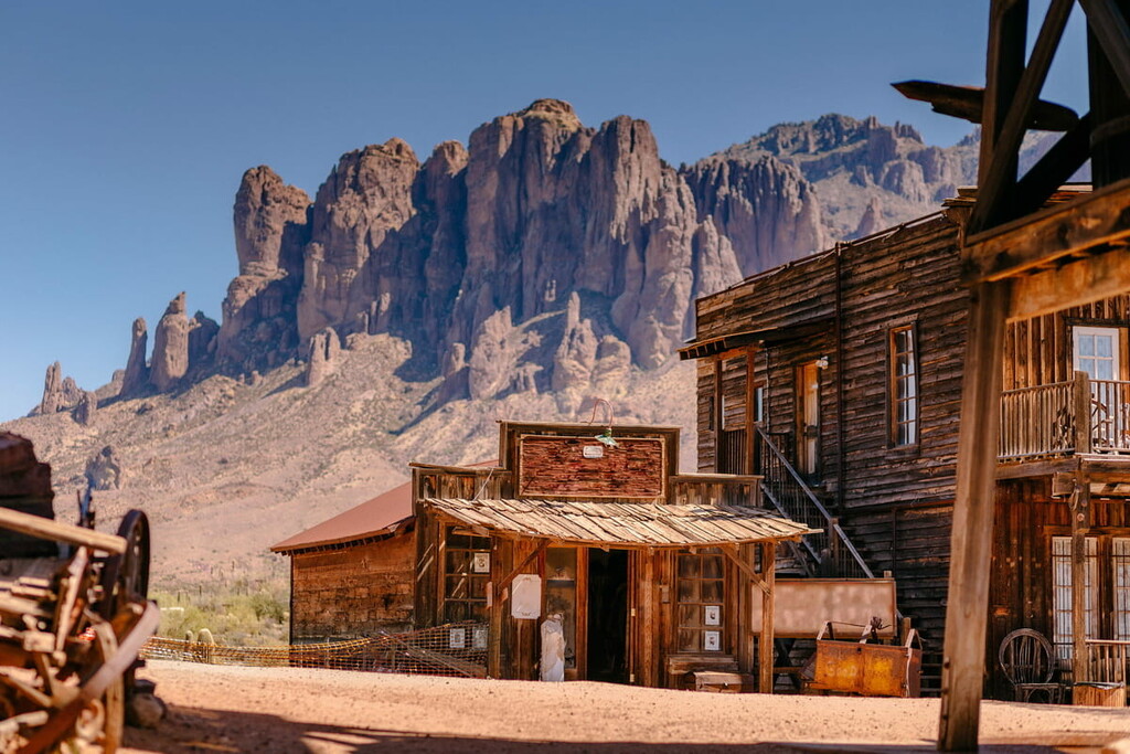
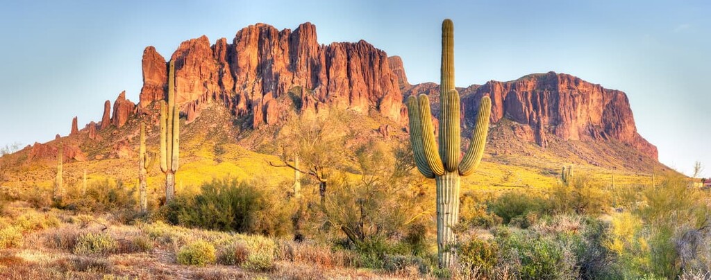
Located in the heart of Arizona, just outside Phoenix, the Superstition Wilderness is a federally-designated wilderness that offers fantastic hiking opportunities. The wilderness contains 42 named mountains, the highest of which is Mound Mountain.
The Superstition Wilderness is a rugged area that’s steeped in cultural history. Within the wilderness, there are many cultural remains, including a number of notable petroglyphs. Indeed, the region is considered to be sacred to a number of Tribal Nations.
There are also plenty of formal and informal hiking trails in the region. However, water is hard to come by, especially in the summer and fall, so care is needed when traveling through the Superstition Wilderness.
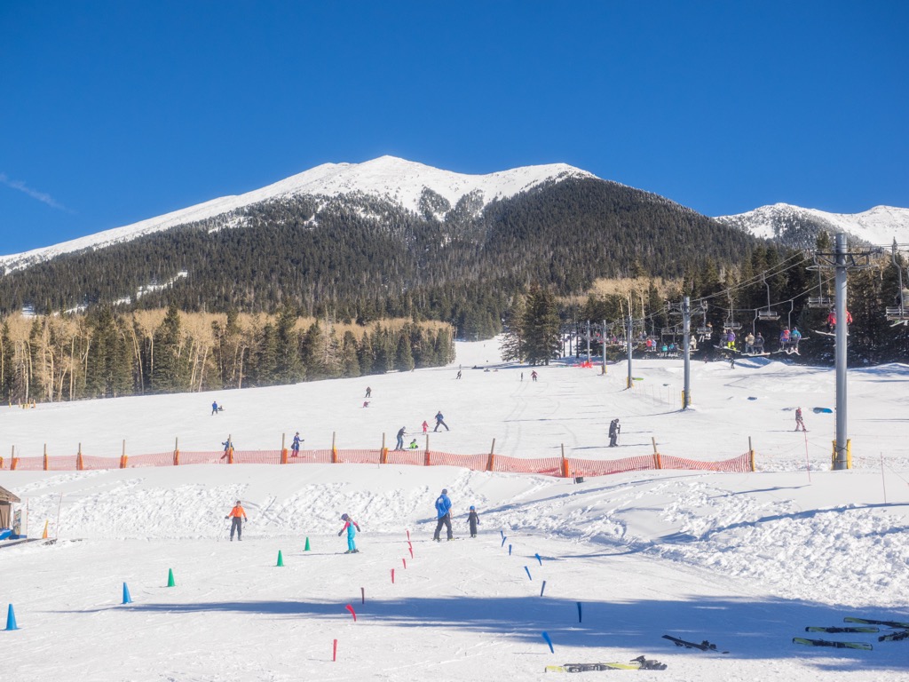
For skiing and snowboarding enthusiasts, there is one major ski resort in Arizona, Arizona Snowbowl, which is also the nearest ski resort to Phoenix, located to the north of the city. It has more than 15 km (9 mi) of slopes and more than 5 ski lifts.
Check the Arizona ski resorts map and the larger USA ski resorts map in the World Mountain Lifts section of the site. It includes information about open ski lifts / slopes in Arizona in real-time with opening dates and hours. There are also year-round cable cars, funiculars, cog railways, aerial tramways, and all other types of mountain lifts.
Looking for a place to stay during your trip to Arizona? Here are some of the best cities to check out:
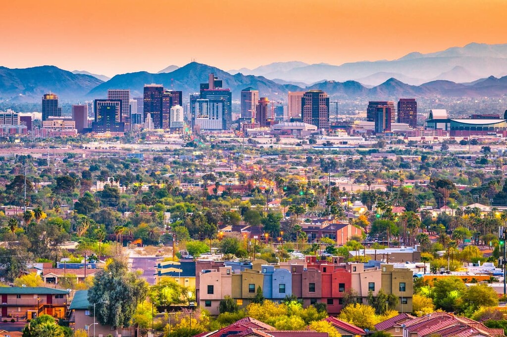
Hikers, bikers, and climbers will agree that Phoenix is a mecca for outdoor recreation in Arizona. Phoenix offers a variety of hiking opportunities, like Echo Canyon, Cholla, Double Butte, and Pinnacle Peak—all of which provide incredible mountain views.
Minutes from downtown Phoenix, visitors can also experience Papago Park, home of red rock buttes and South Mountain Park and Preserve, a 16,000-acre (6,470 ha) preserve that offers 50 miles (80 km) of hiking trails within the Sonoran Desert. Visitors can also take a short 5.5-mile (8.9 km) drive up Summit Road to check out Dobbins Lookout and experience skyline views.
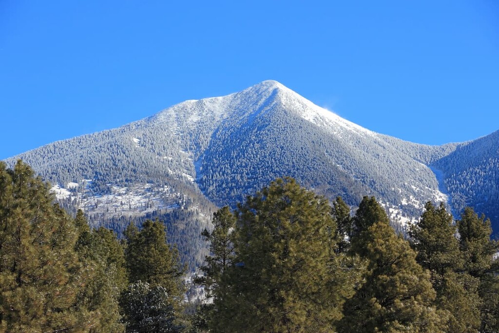
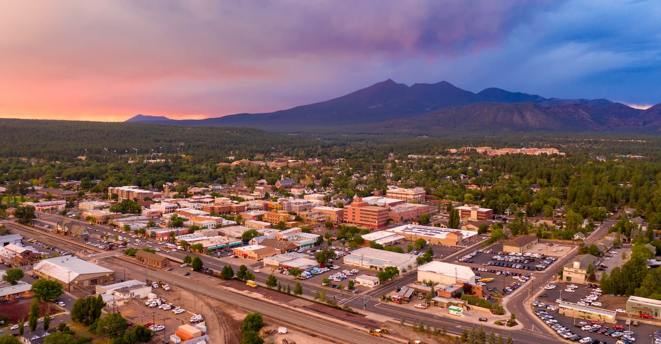
At 7,000 feet (2,130 m), Flagstaff is the perfect place to escape Arizona’s arid desert landscape. Nestled within the world’s largest ponderosa pine forest, Flagstaff is home to the world-famous Lowell Observatory and the ideal place for a family adventure.
Flagstaff is considered an all-season recreational hotspot in Arizona because it is close to the Grand Canyon, San Francisco Mountains, and seven national forests, parks, and monuments.
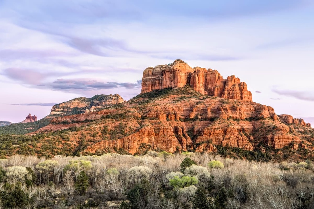
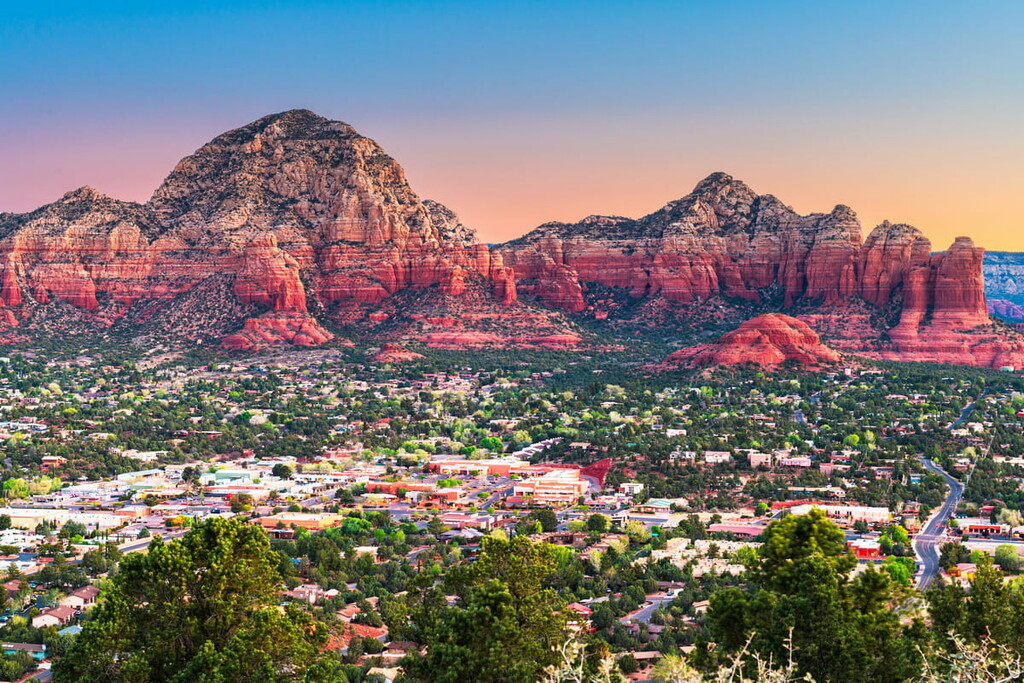
Sedona, in central Arizona, is notorious for its proximity to iconic red rock formations and is known to be a perfect place to stay for visitors looking to experience Arizona’s diverse landscape.
The Enchantment Resort is a popular destination for visitors interested in trekking through Boynton Canyon or hiking to Bear Mountain, Fay Canyon, or the Vista Trail. In addition to a variety of hiking trails, Sedona is close to the Grand Canyon and several popular scenic drives, like Oak Creek Canyon, which is one of the top scenic drives in the United States.


ultra
arizona-10ers
las-vegas-mountaineers-classics
arizona-20-20-challenge
sierra-club-desert
fred-beckey-great-peaks
arizona-ultras
ultra
arizona-10ers
southern-arizona-hiking-club
southern-arizona-hiking-club-coronado-12
arizona-ultras
ultra
arizona-10ers
las-vegas-mountaineers-classics
arizona-20-20-challenge
sierra-club-desert
fred-beckey-great-peaks
arizona-ultras
ultra
arizona-fire-lookouts
arizona-20-20-challenge
southern-arizona-hiking-club
southern-arizona-hiking-club-emblem
southern-arizona-hiking-club-coronado-12
arizona-ultras
ultra
arizona-20-20-challenge
southern-arizona-hiking-club
southern-arizona-hiking-club-emblem
southern-arizona-hiking-club-coronado-12
arizona-ultras
ultra
arizona-fire-lookouts
arizona-20-20-challenge
southern-arizona-hiking-club
southern-arizona-hiking-club-emblem
southern-arizona-hiking-club-coronado-12
arizona-ultras
arizona-fire-lookouts
arizona-20-20-challenge
southern-arizona-hiking-club
southern-arizona-hiking-club-emblem
southern-arizona-hiking-club-coronado-12


