Scan the QR code and open PeakVisor on your phone
The Cabeza Prieta National Wildlife Refuge is situated in the southwestern part of the US state of Arizona. The protected region helps support a variety of wildlife and marks one of the most extreme desert terrains in the country. There are 26 named peaks with Growler Mountains being the highest at 3,248 feet (990 m) tall and Buck Peak being the most prominent with 1,604 feet (489 m) of prominence.
The Cabeza Prieta National Wildlife Refuge lies in the southwestern stretches of the US state of Arizona. This section of terrain is marked by a rugged Sonoran Desert landscape with elevations ranging from around 700 feet (213 feet) up to the summit of Growler Mountains.
Barry M. Goldwater Air Force Range marks the northern and western borders of the refuge with the US-Mexico border to the south, and the Organ Pipe Cactus National Monument in the southeast.
Spanning 860,010 acres (348,034 ha), the Cabeza Prieta National Wildlife Refuge marks the third largest national wildlife refuge in the contiguous 48 states. The Cabeza Prieta Mountains lie in the northwestern stretches of the refuge, covering around twenty percent of the protected region.
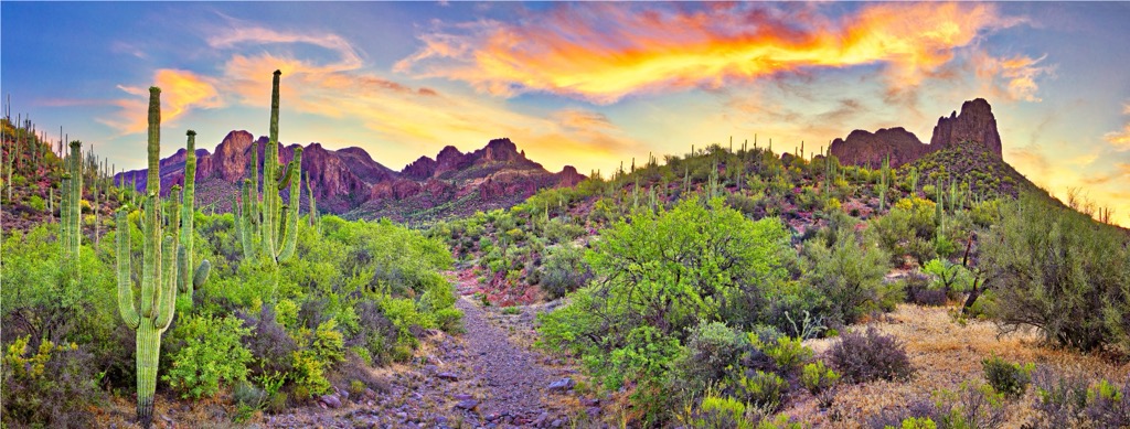
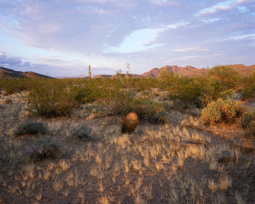
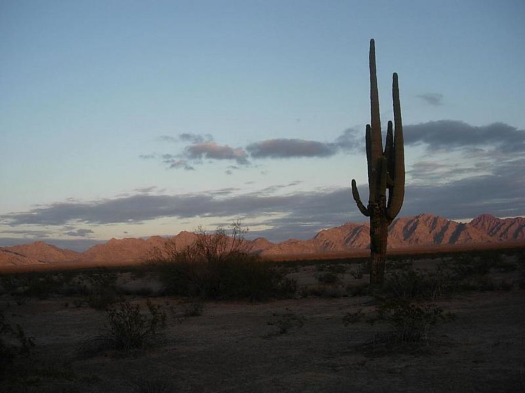
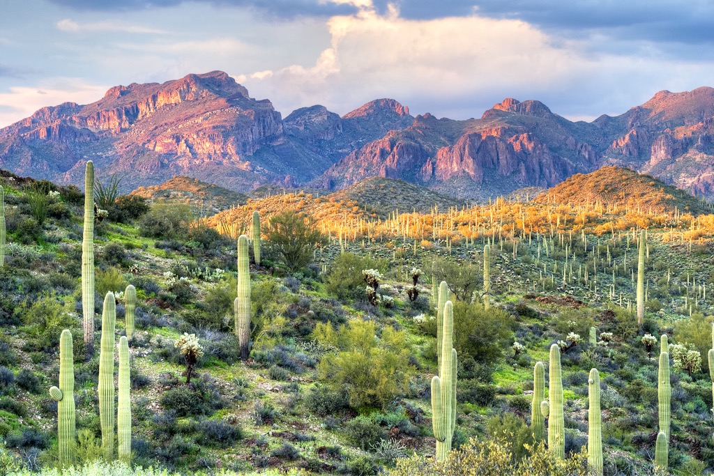
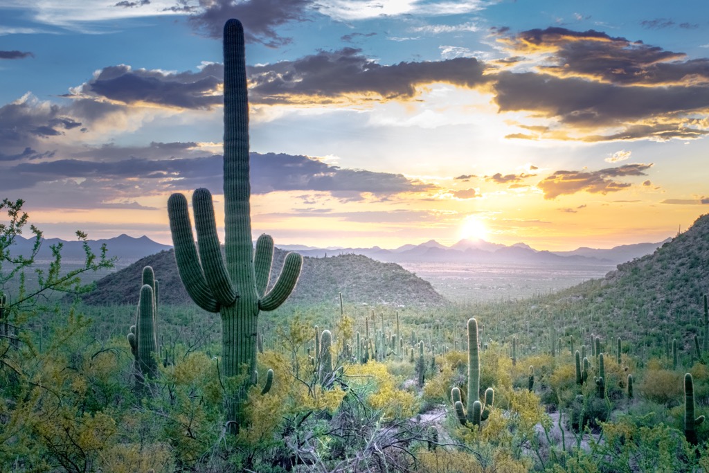
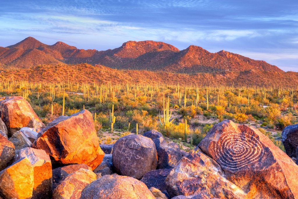
Mountains in the region are met with sweeping desert valleys along with lava flows and sand dunes. A majority of the landscape is relatively flat, supporting various shrubs and cacti species. Extreme temperatures and lack of annual rainfall, has made the refuge one of the most isolated and extreme regions in the country.
The Cabeza Prieta Mountains lie within the Sonoran Desert and mark the northern stretches of the Gran Desierto de Altar of Mexico. The northern section of the Pinacate volcanic field extends into this mountain range. Cabeza Prieta Wilderness extends throughout a majority of the refuge.

Additionally, the Cabeza Prieta National Wildlife Refuge is surrounded by popular outdoor recreation areas. Northeast of the refuge lies the Sonoran Desert National Monument and South Maricopa Mountains Wilderness. The Kofa Wilderness and Kofa National Wildlife Refuge are to the northwest while the Organ Pipe Cactus National Monument is located directly east of the refuge.
The entire national wildlife refuge lies within the Sonoran Desert which extends across southwestern Arizona and into portions of California, Baja California, and Mexico.
The desert is geologically part of the Basin and Range Province which extends north of the desert landscape across Utah, Idaho, Nevada, Arizona, and California. Formation of the surrounding mountain ranges began roughly 40 million years ago.
During this time, volcanic activity close to the Earth’s crust was widespread in the region. As the Pacific Ocean tectonic plate shifted, the Basin and Range Province was continually stretched and folded, forming the north to south trending ranges that define the region.
Volcanic activity over the past 10 million years has further shaped the desert landscape, leaving behind various minerals and metals. Over the course of millions of years, monsoons have carved out the landscape, leaving behind the canyons, basins, and reshaping rock formations.
Major peaks within the refuge include Growler Mountains, Buck Peak, Growler Peak, and Cabeza Prieta Peak.
Despite the harsh living conditions in this desert region, the refuge is home to over 275 species of animals and almost 400 species of plants.
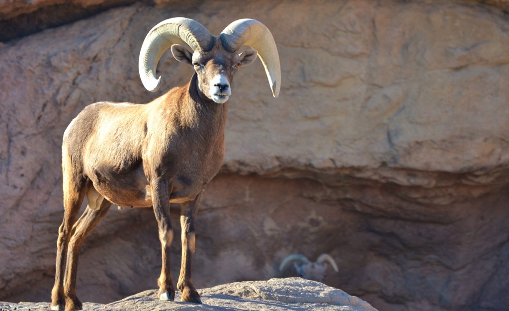
Some of the most prominent animal species in the region include the desert bighorn sheep, Sonoran pronghorn, rabbit, mule deer, pocket gopher, and kangaroo rat. Other animals able to withstand the extreme desert conditions include the Great Basin whiptail, side-blotched lizard, desert horned lizard, as well as six different species of rattlesnakes.
The refuge also supports populations of big brown bat, American badger, golden eagle, Western spotted skunk, Lesser long-nosed bat, and Morafka’s desert tortoise.
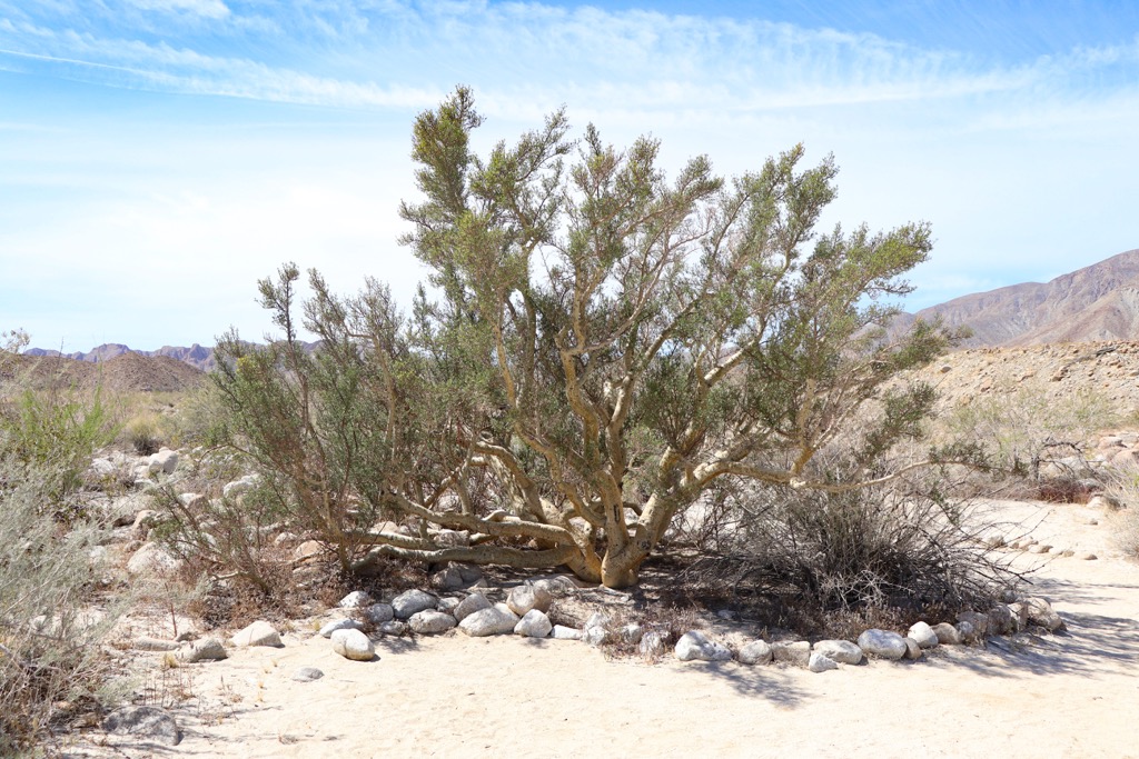
Plants able to withstand extreme temperatures and lack of rainfall in the region include low growing shrubs, grassees, and cacti. Hedgehog cactus and saguaro cacti are common along with chollas, mesquite, ocotillo and creosote bushes. Hiker may also spot the occasional elephant tree.
The land within and surrounding the national wildlife refuge has been home to humans for thousands of years. This desert terrain is thought to have been inhabited for nearly 11,000 years with the surrounding region featuring artifacts of the Mogollon, Sobaipuri, and Hohokam cultures.
The region marks part of the ancestral homelands of many peoples, including the Cocopah Tribe (Cocopah: Xawitt Kwñchawaay) and the Tohono O’Odham Nation. The Cocopah Tribe historically inhabited sections along the Lower Colorado River near the Gulf of California. They mark one of the seven descendant Tribes of the Yuman language speakers.
The Tohono O’Odham Tribal Nation also historically inhabited land that is now part of present-day Arizona and northern Mexico. Historical homelands extended to the San Miguel River Valley in the east and the Gila River in the north.
In 1540, Spanish explorer Hernando de Alarcon traveled the Colorado River and met the Cocopah Tribe, marking the first recorded contact between the Indigenous peoples of the area and people of European descent. This region was further explored by the Spanish missionary Eusebio Francisco who founded the Mission San Xavier del Bac near present-day Tucson in 1700.
Widespread westward expansion in the 1840s, coupled with the California Gold Rush in 1849, brought a plethora of migrants throughout the region. Following the Mexican War for Independence, the surrounding region was declared as part of the Mexican state of Sonora.
In 1848, after the Mexican-American War, the land was reallocated to the US, later becoming the state of Arizona. This divided the Cocopah Tribal lands between the two countries with the groups on either side of the border being forced to end their Tribal unity in 1930.
The Indigenous peoples of the region continually resisted assimilation that was forced on them by settlers and the US government. Despite these continual efforts, the Indigenous Tribes were repeatedly attacked, harassed, displaced, and killed by groups of American settlers and the US government.
Indigenous peoples who remained in the region were forced onto reservations. The Cabeza Prieta National Wildlife Refuge was established in 1939 in order to protect the population of desert bighorn sheep. In 1990, the Cabeza Prieta Wilderness, which encompasses the vast majority of the refuge, was established.
There are no defined trails in the region or any facilities offering water, sanitation, or gasoline. Those who travel in the area are encouraged to carry ample supplies in case of being stranded in the harsh conditions. Here are a few hiking areas in the surrounding region:
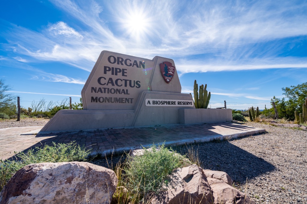
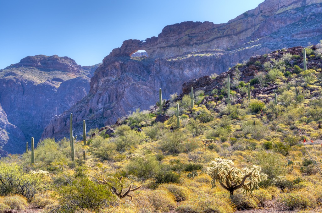
The Organ Pipe Cactus National Monument lies along the eastern edge of the refuge and is also classified as a UNESCO biosphere reserve. It marks the only place in the country where the organ pipe cactus grows in the wild. Below are a few popular trails in the monument:
The Kofa Wilderness and Kofa National Wildlife Refuge are situated north of the Cabeza Prieta National Wildlife Monument. The refuge was also established to protect the desert bighorn sheep and offers a variety of hiking opportunities:
Looking for a place to stay near the Cabeza Prieta National Wildlife Refuge? Here are some of the best cities and villages to check out in the region:
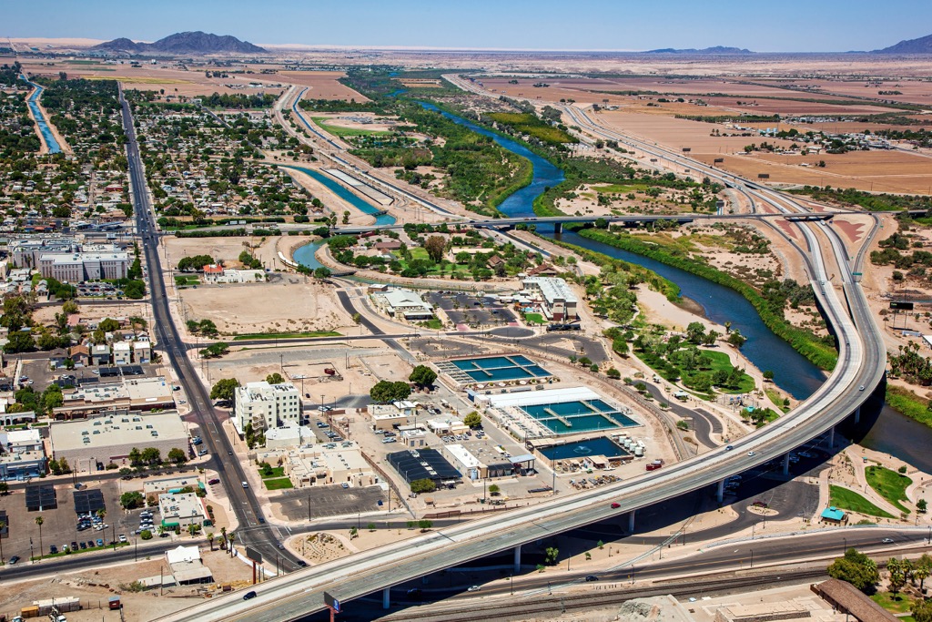
The city of Yuma lies northwest of the national wildlife refuge, situated along the Colorado River. Home to just under 100,000 residents, Yuma is known for being the “Sunniest City on Earth” with sunshine throughout ninety-one percent of the year.
This plethora of sunshine has allowed Yuma’s agricultural economy to thrive. Throughout the year, visitors and locals alike can enjoy hiking, mountain biking and bird watching. The nearby Imperial Sand Dunes offer off-roading experiences while the Colorado River offers opportunities for water sports.
Within the city also lie the historic Yuma Territorial Prison and Yuma Quartermaster Depot State Historic Park.
Under a three hours drive northeast of the national wildlife refuge lies the city of Phoenix, marking the closest major city to the region. With a metro population of 1.6 million people, Phoenix marks the most populous city in the state.
The city is surrounded by numerous parks and forests for outdoor recreation. Popular sites include vast sections of Tonto National Forest and Prescott National Forest. South of the city lies the Sonoran Desert National Monument.
Within the city also lies the Desert Botanical Garden and Taliesin West, the previous residence of Frank Lloyd Wright. As a major city in the state, Phoenix is home to dozens of museums and a thriving food scene.