Scan the QR code and open PeakVisor on your phone
The Kofa Wilderness is situated in the southwestern region of the US state of Arizona. The protected region, along with the surrounding Kofa National Wildlife Refuge, supports a wide range of wildlife, including the endangered desert bighorn sheep. The tallest and most prominent peak in the wilderness is Signal Peak at 4,859 feet (1,481 m) tall with 3,461 feet (1,055 m) of prominence.
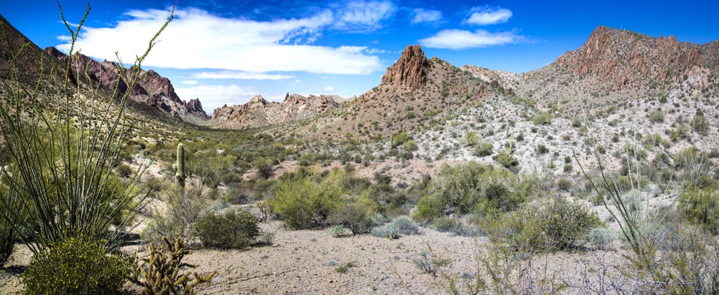
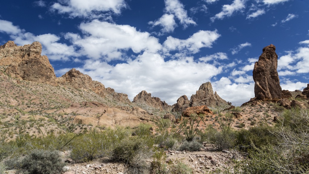
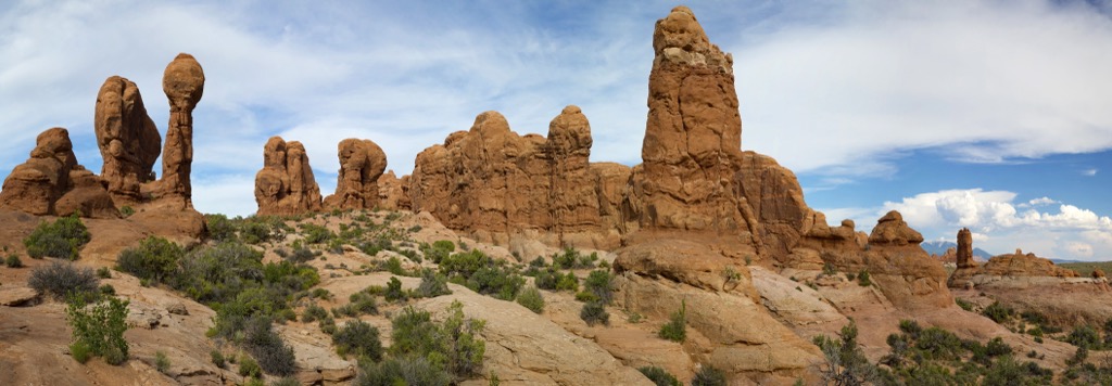
The Kofa Wilderness is located in the southwestern stretches of the US state of Arizona. This protected region encompasses terrain in the Yuma Desert portion of the Sonoran Desert. The desert landscape is interspersed with peaks from both the Kofa Mountains and Castle Dome Mountains.
Kofa Wilderness lies within the Kofa National Wildlife Refuge, which spans 665,400 acres (269,278 ha) across Yuma and La Paz counties. The wilderness encompasses 547,719 acres (221,654 m) of the wildlife refuge and marks the second largest wilderness in the state.
The Colorado River lies just west of the wilderness, marking part of Arizona’s border with California. The Pearl Harbor Memorial Highway is situated north of the wilderness while the Gila River is located to the south. Further south of the wilderness lies the US-Mexico border.
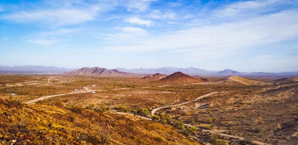
Amidst the mountainous desert landscape lie a few watering holes, helping to support the fauna of the region. Much of the terrain is dominated by the Kofa Mountains with the Castle Dome Mountains extending into the southern stretches of the wilderness and refuge.
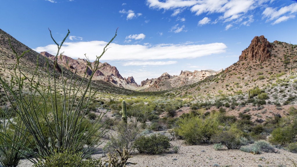
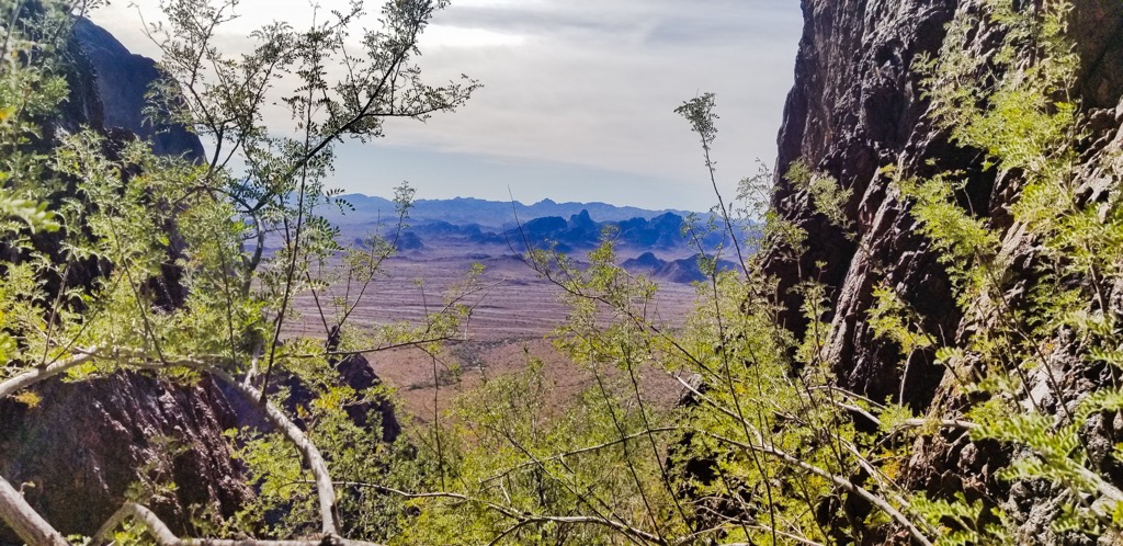
These two mountain ranges are separated by King Valley. Peaks and rugged ridgelines rise thousands of feet on either side of the valley. Despite the harsh desert conditions, the varying elevation helps support a diverse array of both flora and fauna.
Additionally, the Kofa Wilderness is surrounded by popular outdoor recreation areas. The Wilderness lies with the Kofa National Wildlife Refuge with the Imperial National Wildlife Refuge located to the west. To the southeast lies the Cabeza Prieta National Wildlife Refuge and Organ Pipe Cactus National Monument, located near the US-Mexico border. The Eagletail Mountains Wilderness lies east of the wilderness.
The Kofa Wilderness is located within the Sonoran Desert. This expansive region extends across southwestern Arizona and into portions of California, Baja California, and Mexico.
This desert region is geologically part of the larger Basin and Range Province, which covers land in Utah, Idaho, Nevada, Arizona, and California. Formation of the mountain ranges in the Basin and Range Province began roughly 40 million years ago.
As the Pacific Ocean tectonic plate was subducted beneath the North American tectonic plate, widespread volcanic activity began to occur. The Earth’s crust was continually stretched and folded, giving way to a series of north to south trending mountain ranges.
This region is named after the distinct series of alternating mountain ranges and basins. Since the Kofa Mountains are located on the outer stretches of the province, they feature less distinct patterns compared to terrain in nearby Nevada.
Volcanic activity occurred in the region over the past 10 million years, as showcased by the mineral and metal deposits found in the area. Millions of years of erosion and flooding carved out the landscape, further defining the dramatic changes in elevation between the peaks and the desert basin.
Major peaks within the wilderness include Signal Peak, Castle Dome Peak, Thumb Peak, and High Peak.
The Kofa Wilderness and National Wildlife Refuge support a variety of both flora and fauna. The surrounding refuge was originally established to help support the population of desert bighorn sheep. Today the population of desert bighorn sheep in the region is estimated to be 425.
In recent years, a population of cougars has begun inhabiting the landscape. Other common animals include badger, desert tortoise, and kit fox. Some common bird species spotted in the area are the American kestrel, cactus wren, northern flicker, and orange-crowned warbler amongst various others.
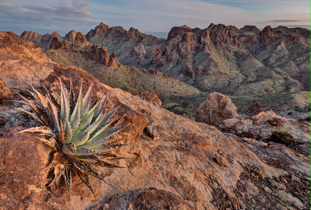
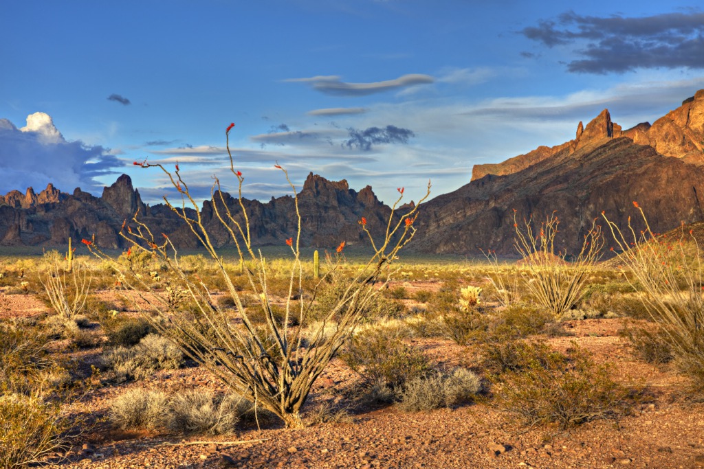
Large sections of the wilderness are free of flora, similar to the surrounding desert landscape. Hikers are likely to spot species of cacti, shrubs, grasses, and seasonal flowers though there are no large forested patches in the area. The Kofa Mountain barberry is endemic to the region. The wilderness is also home to the desert fan palm, which is the only palm species native to the state of Arizona.
This section of land, along with the surrounding terrain, has been inhabited by humans for over 10,000 years. For thousands of years before the arrival of Europeans, this marked the ancestral lands of the Mogollon, Sobaipuri, and Hohokam cultures.
Some of the most prominent tribes with ancestral ties to this region include the Cocopah Tribe (Cocopah: Xawitt Kwñchawaay) , Fort Yuma-Quechan Indian Tribe, and the Yavapai Apache Tribe. Today descendants of the Yavapai-Apache Tribe are part of the Yavapai-Apache Nation, Fort McDowell Yavapai Nation, and the Yavapai Prescott Indian Tribe.
Land near the Gulf of California was traditionally inhabited by the Cocopah Tribe. These people lived along the Lower Colorado River and are one of the seven descendant tribes of the Yuman language.
The first recorded contact between the Europeans and these Indigenous peoples occurred in 1540. An expedition led by the Spaniard Hernando de Alacron traveled along the Colorado River, leading to encounters with numerous different tribes. Spanish missionary Eusebio Francisco also explored this region, eventually founding the Mission San Xavier del Bac near present-day Tucson in 1700.

Following the Mexican War for Independence in 1821, this region became part of the Mexican state of Sonora. Continual westward expansion, coupled with the California Gold Rush, brought a large influx of Americans through present-day Arizona and Nevada.
In 1848, after the Mexican-American War, this land was reallocated to the US, later becoming the state of Arizona. The new US-Mexico border cut across the Cocopah Tribal lands, separating these peoples into two groups. The groups on either side of the border were forced to end tribal unity in 1930.
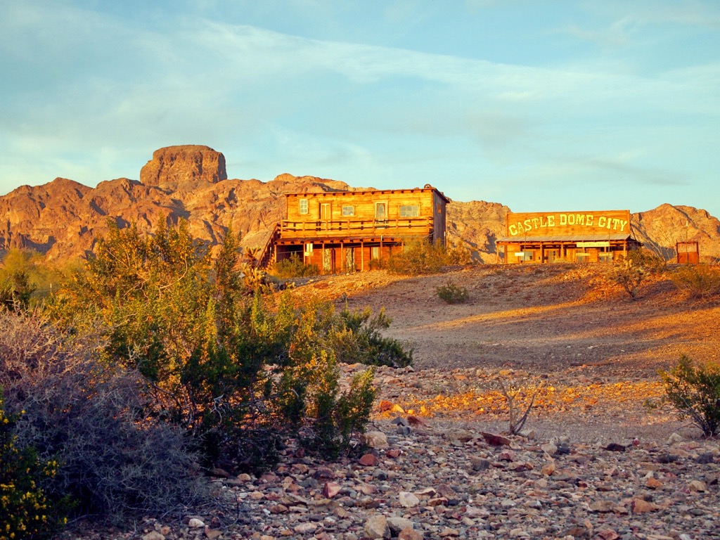
The Kofa Mountains were home to a gold mine from 1897 to 1910, for which the range is named after. Referred to as the “King of Arizona” this gold mine, along with westward expansion, continued to increase the population of the region.
Indigenous tribes continually resisted the forced assimilation brought on by the US government. Tribes were continually attacked, harassed, murdered, and eventually displaced by settlers that were often backed by the US government. Those who survived were forced onto reservations, often far away from their ancestral lands.
The surrounding refuge was created in 1939 after a group of Arizona Boy Scouts observed the dwindling numbers of desert bighorn sheep in the region. Roughly 1.5 million acres (607,028 ha) were set aside to later form both the Kofa National Wildlife Refuge and the Cabeza Prieta National Wildlife Refuge. The Kofa Wilderness would later be established in 1990.
There are a plethora of trails in the wilderness. Those visiting the region should be prepared to withstand the harsh desert conditions and pack extra water. Here are a few hiking areas in the surrounding region:
True to its name, this hike winds through the Palm Canyon, situated along the western stretches of the wilderness. The route climbs gradually throughout while the rugged canyon walls rise steeply on either side. This out and back route is 1.3 miles (2 km) and features 492 feet (150 m) of elevation gain. Visitors should be aware of any flash flood warnings before entering the canyon
Signal Peak marks the tallest and most prominent peak in the wilderness and the wildlife refuge. The route to the summit climbs steadily throughout, steepening near the summit. From the top of Signal Peak, hikers have panoramic views of the wilderness and expansive desert landscape that surrounds the protected region. This trail is 4.3 miles (6.9 km) long and features 2,047 feet (624 m) of elevation gain.
Castle Dome is the second most prominent peak in the wilderness, located in the southwestern stretches of the protected region. This primitive trail winds through the rocky desert landscape climbing steadily throughout. Near the summit the trail passes through a small scree patch while rock outcroppings tower above. The summit offers views of the southern section of the wilderness. This route is 5.4 miles (8.7 km) long and features 2,047 feet (624 m) of elevation gain.
Looking for a place to stay near the Kofa Wilderness? Here are some of the best cities and villages to check out in the region:
Yuma is a city located just southwest of the wilderness. Situated along the banks of the Colorado River, Yuma is home to 100,000 residents. The city boasts being the “Sunniest City of Earth”, having sunshine throughout roughly ninety-one percent of the year.
This near continual sunshine has helped Yuma become a prominent region for agriculture. Just outside the city lies options for hiking, bird watching and mountain biking. Both the Colorado River and the nearby Imperial Sand Dunes also provide opportunities for outdoor recreation.

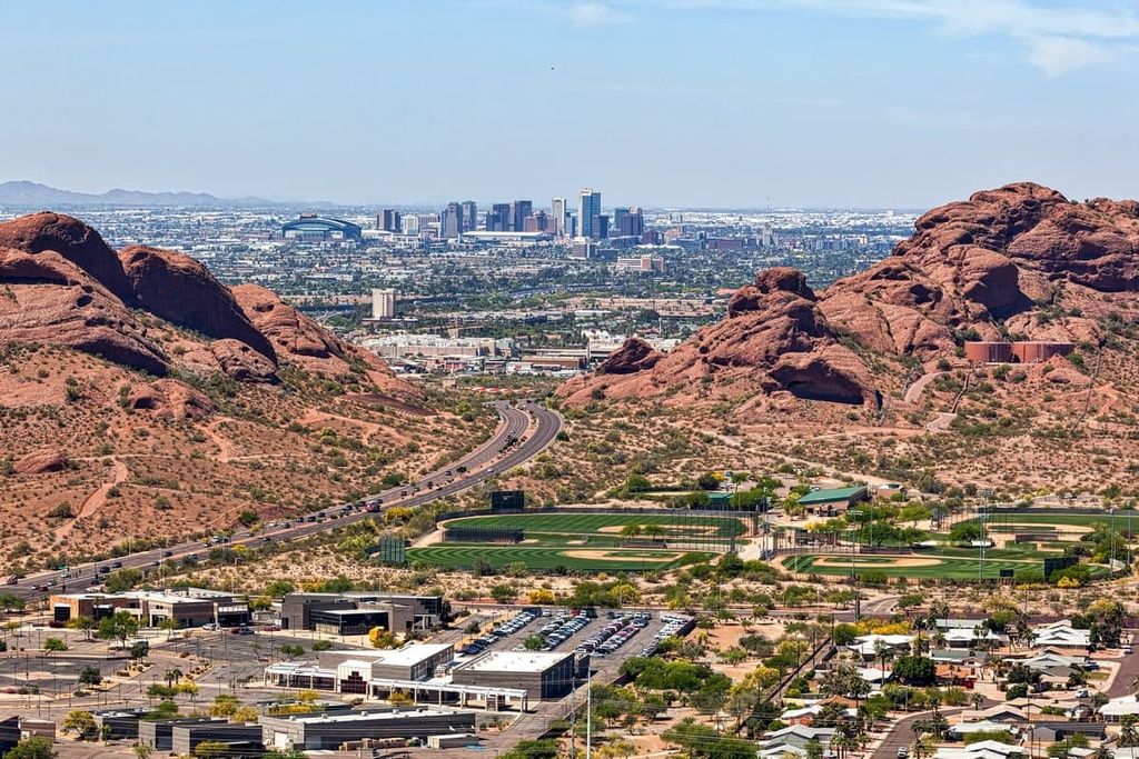
Situated a two hours drive east of the wilderness, lies the city of Phoenix. With a metro population of over 1.6 million, Phoenix marks the closest major city to the wilderness, as well as the most populous city in the state.
Despite this relatively large population, the Phoenix metropolitan area is surrounded by a plethora of protected landscape. Nearby attractions include Tonto National Forest, Prescott National Forest, and the Sonoran Desert National Monument.
As a major hub for the southwestern US, Phoenix is home to numerous museums, festivals, and a thriving food scene. Within the city also lies the Desert Botanical Garden and the Heard Museum which showcases the history, culture, and art of the Indigenous tribes of the region.