
Scan the QR code and open PeakVisor on your phone
Featuring spectacular desert landscapes, beautiful beaches and rugged mountain peaks, the Mexican state of Sonora is a fantastic place to visit if you’re looking for endless adventure. The state has 5,787 named mountains, the highest of which is Pico Guacama (2,620m/8,596ft), and the most prominent of which is Cerro Frailes (1,677m/5,502ft)
The state of Sonora (officially Estado Libre y Soberano de Sonora) is located in the northwestern part of Mexico. With a total area of 179,355 square kilometers (69,249 sq. mi), Sonora is the second largest of Mexico’s 32 federal entities, trailing only behind its neighbor Chihuahua in size.
However, with a population of just around 2.8 million people, Sonora is only the 18th largest state in terms of population. As a result, it is the 27th most densely populous state as much of its land area is either mountainous, desert, or agricultural.
Sonora is located in the northwestern part of Mexico along the country’s border with the United States. As a result, it shares its borders with a number of different Mexican and American states.
In particular, Sonora is located to the east of Baja California (it also shares a maritime border with Baja California Sur), and to the south of both Arizona and New Mexico. It is also located to the west of the state of Chihuahua and to the north of the state of Sinaloa.
The state of Sonora is split up into 72 administrative regions called municipios. However, it can be unofficially split up into 3 primary geographic regions based on regional topography.
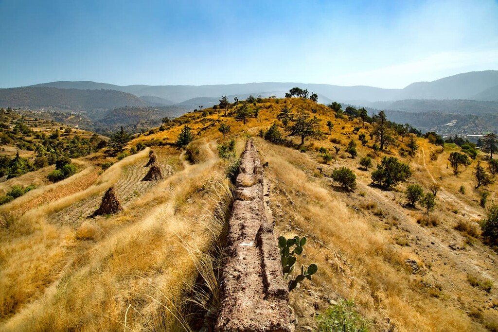
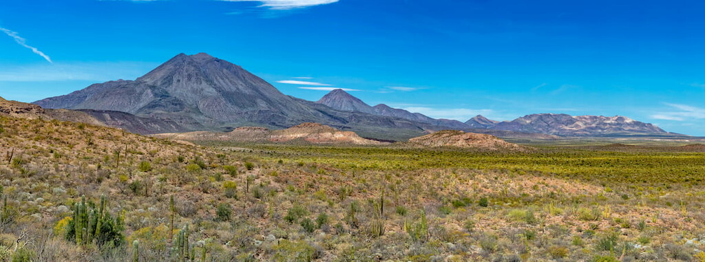
The easternmost part of the state of Sonora is dominated by the mountains of the Sierra Madre Occidental, though a small section of the eastern region is technically part of the Mexican Plateau. Extending down the western edge of Mexico from northeastern Sonora all the way to the state of Jalisco, the Sierra Madre Occidental is one of the country’s major mountain ranges.
However, within Sonora, the range only occupies the eastern half of the country, within part or all the following municipios:
The range is, of course, known for its mountains, though it is perhaps best characterized by its many deep canyons, which are known locally as barrancas.
Due to the ruggedness of the range, the Sierra Madre Occidental and eastern Sonora are fairly sparsely populated. While there are certainly plenty of communities within the eastern part of Sonora, the majority of the state’s major cities are located outside of the range.
Despite being highly mountainous, there is really only one major protected area in the eastern part of Sonora, the Sierra de Álamos-Río Cuchujaqui Flora and Fauna Protection Area (Área de protección de flora y fauna Sierra de Álamos-Río Cuchujaqui).
While eastern Sonora is dominated by the Sierra Madre Occidental, the central part of the state is better known for its plains and rolling hills. Indeed, much of central Sonora is covered by the hills of the Southwest Basins and Ranges, which are an extension of the Great Basin Ranges that also covers parts of Nevada, Arizona, New Mexico, Texas, and Chihuahua.
Arguably the largest of the state’s 3 major geographic regions, central Sonora contains the following municipios:
Here, the landscape is als dominated by the Sonoran Desert, which covers the vast majority of the northern and western parts of the state. With the exception of the Altar region, the land is predominantly scrubland, though the Altar region is actually quite sandy and the temperatures routinely crest 40ºC (104ºF) in the summer months.
However, the wider river valleys located in central Sonora also allow for some agriculture. That being said, Sonora is actually suffering from some of the fastest rates of desertification in the world due to its arid climate and the clearing of land for agricultural reasons, such as for growing buffelgrass for grazing.
Encompassing all of the state’s Gulf of California coast, western Sonora is home to the state’s largest city—Hermosillo.
Unlike central and eastern Sonora, the western part of the state has no major mountain range. Rather, western Sonora consists mostly of rolling hills, which eventually give way to the flatter terrain near the Gulf of California. It includes the following municipios:
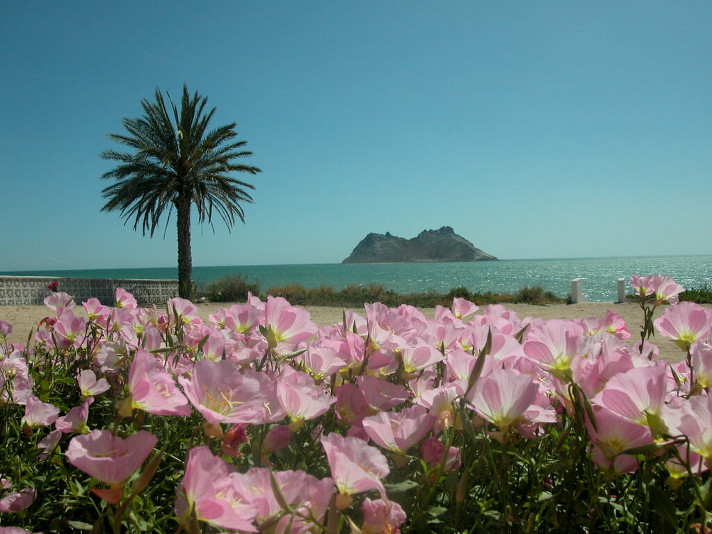
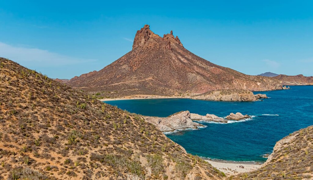
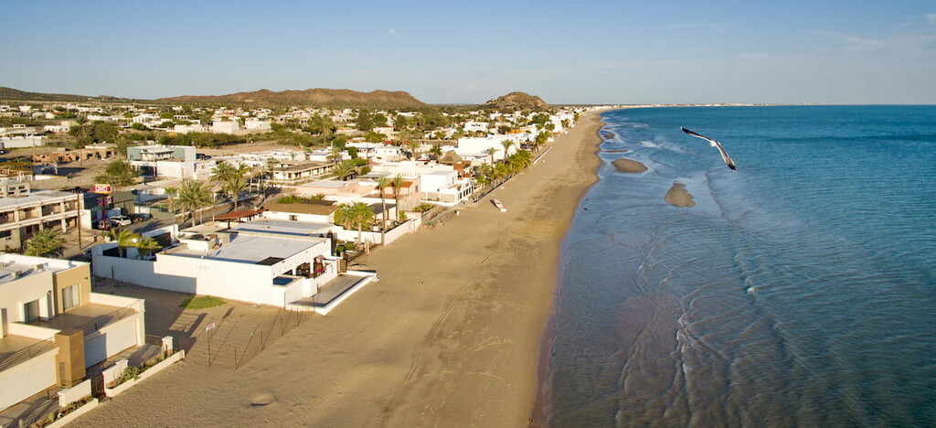
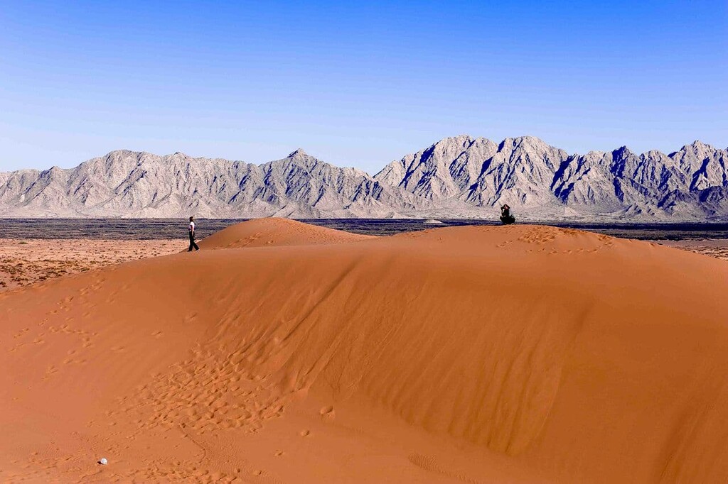
Western Sonora is known for its many beaches as well as for its unique desert landscapes. One of the most exciting desert landscapes in the state is that of the Reserva de la Biosfera El Pinacate y Gran Desierto de Altar, which is a UNESCO World Heritage Site that forms a single contiguous protected area with both Organ Pipe Cactus National Monument and Cabeza Prieta National Wildlife Refuge to the north in Arizona.
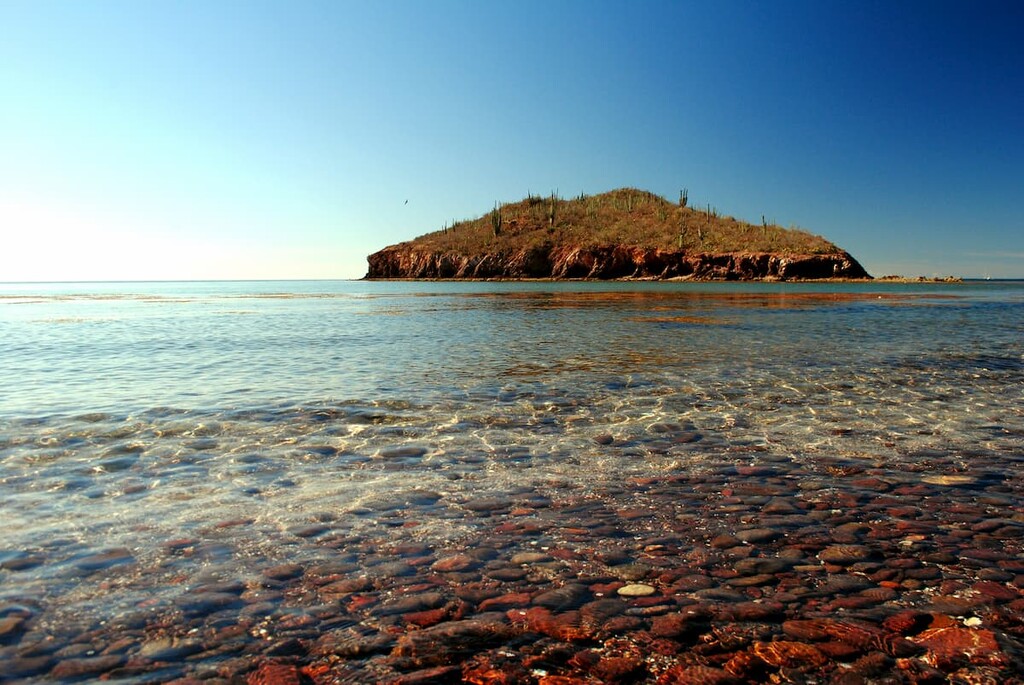
Other major protected areas in western Sonora include Reserva especial de Biosfera Cajón del Diablo, Área de Sujeta a Protección Ecológica Estero El Soldado, and Reserva de la Biosfera Isla San Pedro Mártir.
The state of Sonora is home to a complex array of geologic structures. Although there are a number of geologic provinces within the region, it’s easiest to discuss the state’s geology by dividing it up into the Sonoran Desert and the Sierra Madre Occidental.
Covering much of the northern and western part of the state of Sonora as well as parts of Baja California, California, and Arizona, the Sonoran Desert is one of the largest hot deserts in North America.
Geologically, the desert is a mix of metamorphic, sedimentary, and igneous rocks which run the gamut in terms of geological age from the 2 billion year old Precambrian rock in Arizona to the thousand year old rock in Puerto Peñasco.
The northwestern part of the state of Sonora is actually home to a number of volcanoes, including some that have erupted as recently as 11,000 years ago. Moreover, the region is dotted with lava vents, cinder cones, and massive calderas, all of which have left their mark on the topography of the region.
Furthermore, the Pinacate Peaks region in Puerto Peñasco is also home to the largest sand dunes in North America. However, the relative low-lying nature of much of the Sonoran Desert (at least in central and western Sonora) means that there are few major peaks in the region.
Running down the eastern edge of the state of Sonora, the Sierra Madre Occidental is one of Mexico’s major mountain ranges. Geologically, the range is part of the American Cordillera, which stretches from the Andes of Chile and Argentina to the south all the way through the US and Canada to the Brooks Range in the north of Alaska.
Interestingly, however, the Sierra Madre Occidental is what’s left of an ancient plateau of extrusive igneous rocks. Over the millennia, these rocks have eroded away to reveal sedimentary and intrusive igneous rocks below.
However, while the range did experience some volcanism millions of years ago, which helped to create gold and silver deposits in the region, these volcanoes are generally believed to be extinct or dormant.
Within Sonora, some of the major peaks of the Sierra Madre Occidental include Pico Guacamaya, Cerro Frailes, Cerro Las Flores, Cerro El Tigre, Cerro San José, and Cerro Azul.
There are a handful of different ecoregions within the state of Sonora, though 3 in particular stand out as a result of their large area coverage or their uniqueness. Here’s what you can expect to see when you visit the state:
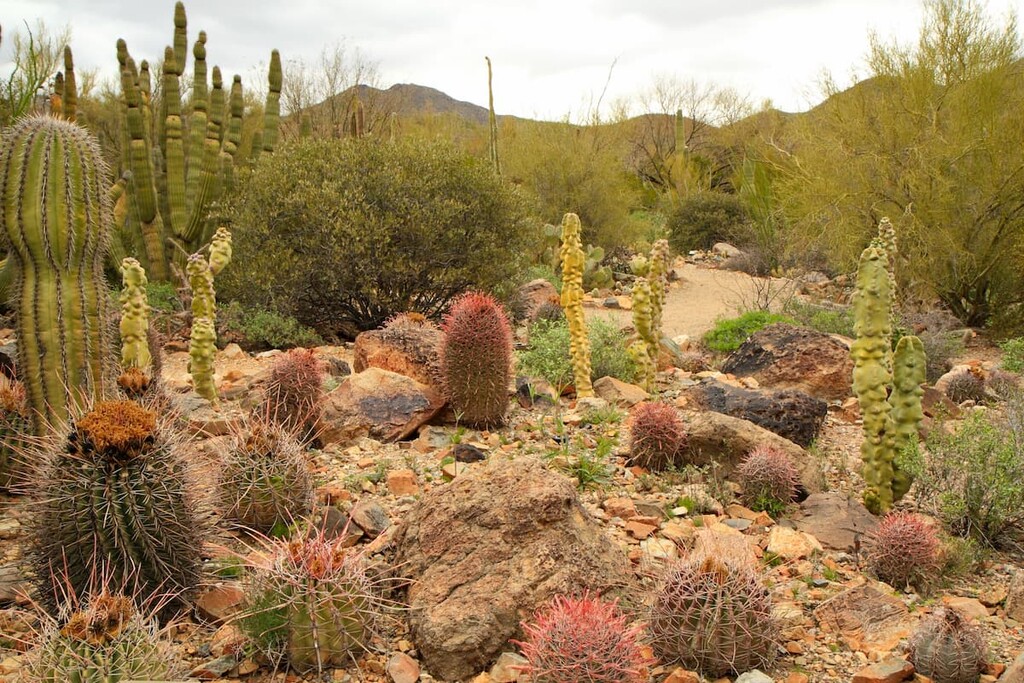
Aptly named, the Sonoran Desert covers much of the northern and western part of the state of Sonora. As we’ve mentioned, it is among the largest hot deserts in North America as it covers an area of about 260,000 square kilometers (100,000 sq. mi).
As a desert, the Sonoran Desert is an inhospitable place for many plants and animals. Nevertheless, plenty of species thrive in this hot and dry climate. In particular, plants such as succulents and creosote bush are prolific in the Sonoran Desert.
Major succulents include cholla, hedgehog, beavertail, organ pipe, and prickly pear, as well as the endemic saguaro cactus. Meanwhile, the desert also supports a unique mix of wildlife, including everything from bighorn sheep to jaguars.
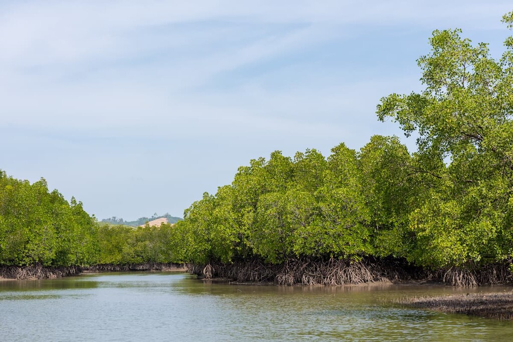
Although it’s certainly not the largest ecoregion in Sonora, the small Northwest Mexican Coast Mangroves are vitally important to Mexico’s biodiversity. They can be found in the coastal regions of Sonora, particularly near the deltas of the Mayo and Yaqui Rivers.
These mangroves are home to black, white, and red mangrove trees as well as a great mix of wildlife. Within these mangroves, one can find crabs, oysters, fish, seabirds, and other animals.
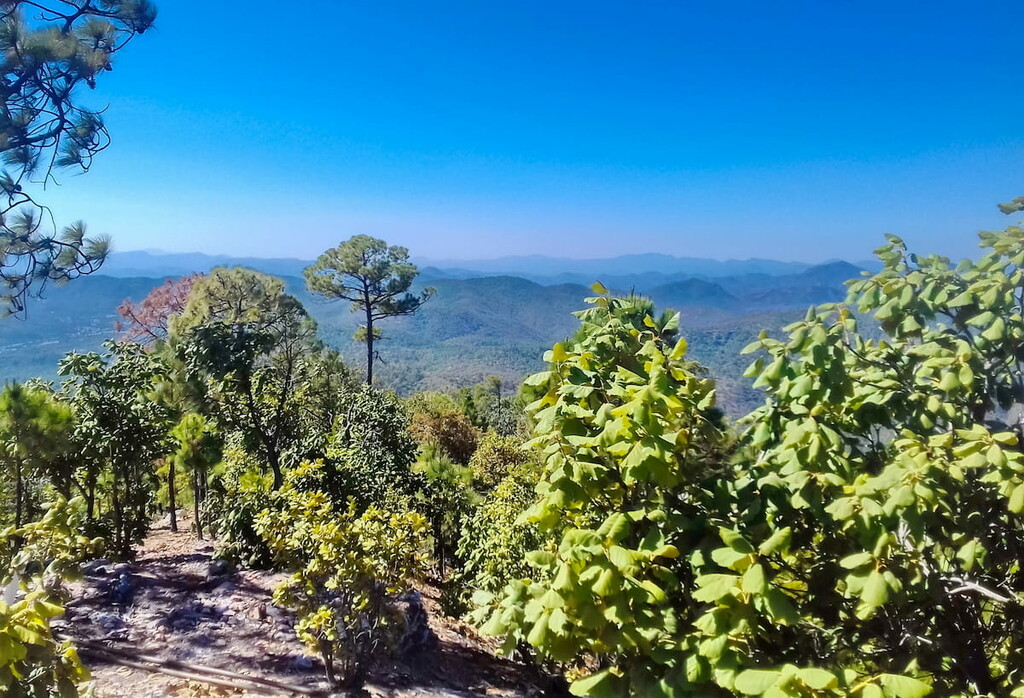
Encompassing much of the Sierra Madre Occidental, this ecoregion offers a reprieve from the arid heat of the nearby Sonoran and Chihuahuan deserts.
Within this ecoregion, there are quite a few different plant communities, though forests of oak, pine, and Douglas-fir are dominant. Some species include Apache pine, Mexican pinyon, Chihuahua pine, Mexican Douglas-fir, and Lumholtz’s pine.
Moreover, the forests are home to an excellent array of wildlife including black bears, jaguars, and the thick-billed parrot. They were once also home to both the Mexican grizzly bear, which is now extinct, as well as the Mexican wolf, which is highly endangered though is the subject of breeding programs that are designed to help the species recover.
The area that is now the state of Sonora has an extensive history of human inhabitation. Many peoples lived in the region long before the arrival of European colonizers, and there are 8 state-recognized groups of Indigenous peoples in Sonora, including the Seri, Yaqui, O’odham, and the Mayo.
That being said, the early years of the Spanish conquest of the region aren’t very clear. While it’s clear that the Spanish made their way northward after the fall of the Aztec Empire, it’s unclear if the first Spanish settlements in what is now Sonora were in 1530 or 1540.
Regardless, the Spanish did arrive in what is now Sonora sometime during the 16th or 17th centuries, at which point it’s clear that Jesuit priests did establish a number of missions along the coast.
Around this time, the regions that are now the states of Sinaloa and Sonora were actually administratively combined, a status that would continue until the end of the colonial period. Spanish colonization increased substantially in the region until the 19th century.

While Mexico fought its War of Independence in the early 1800s, however, Sonora was relatively uninvolved in the war. Sonora was technically declared a state in 1824, though it was re-combined with Sinaloa until 1831 when Hermosillo became the state capital.
The fertile lands in the Yaquis and Mayo river valleys were important attractions for immigrants, who flocked to the region to establish farms.
Nevertheless, Sonora was set to lose quite a bit of its territory during the Treaty of Guadalupe Hidalgo after the Mexican American War in 1848. Moreover, the Gadsden Purchase (La Venta de la Mesilla) also resulted in the loss of Sonoran land to Arizona and New Mexico, which further decimated the state’s economy.
During the 1850s, Mexico entered a brief period of French rule after the French attacked the port of Guaymas and installed their own monarch as head of the country until the 1860s.
The end of the 19th and the start of the 20th centuries were both tumultuous times in Mexican and Sonoran history. One of the most exciting advancements of the period was the discovery of the Esperanza Stone in 1909, which contains ancient rock carvings.
In more recent years, Sonora has developed a fairly strong economy, thanks to the growing manufacturing industry in the region. Many of the factories in the area are maquiladoras, which produce tariff-free goods to be sold in the US and overseas. Moreover, the state is seeing a rapid increase in tourism, which has been a boom to the economy.
In a state as big and exciting as Sonora, there’s plenty to see and enjoy. Here are some of the most popular hiking areas to visit in the state:
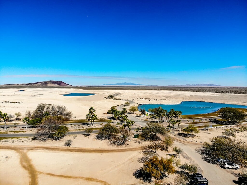
El Pinacate y Gran Desierto de Altar Biosphere Reserve (Reserva de la Biosfera El Pinacate y Gran Desierto de Altar) is a large protected area located in the northwestern part of Sonora along its border with Arizona. It contains 23 named mountains, the highest and most prominent is Cerro Pinto.
The reserve is a UNESCO World Heritage Site, thanks to its unique topographica formations. It contains a major system of volcanoes which have led to the creation of some of its many geological structures. Moreover, it contains some massive sand dunes as well as a fantastic mix of flora and fauna.
Within the reserve, there are a number of great hiking trails, as well as an informational visitor center, so it makes for a great outing if you’re in the area.
Located in western Sonora, just outside of the city of Guaymas, Estero El Soldado Ecological Protection Area (Área de Sujeta a Protección Ecológica Estero El Soldado) is a popular destination for hiking and outdoor recreation. Despite its small size, the park has 3 named mountains, the highest and most prominent of which is Cerro El Soldado.
The park was established in 2006 to protect a natural lagoon near the city of Guaymas. It is actually one of the last mangroves within northwestern Mexico, which makes it essential for the region’s biodiversity. It is home to 3 different mangrove species (black, red, and white), as well as dozens of migratory and resident birds.
Within the park, there are a number of recreation opportunities. Park rangers provide guided hikes, kayak trips, and bike tours to help you learn about the region. There is also a visitor’s center where you can get more information during your trip.
Looking for a place to stay during your trip to Sonora? Here are some of the best places to check out:
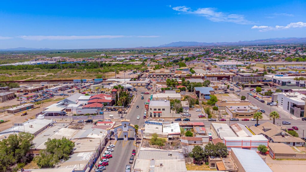
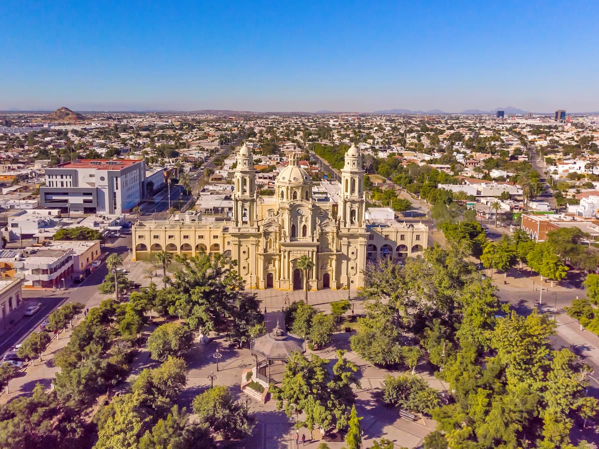
The capital and most populous city in Sonora, Hermosillo (formerly Pitic), is a city of some 800,000 people. Hermosillo is rapidly making a name for itself in the manufacturing sector, as it now has a strong automotive industry.
It is also frequently ranked high in the list of the most livable cities in Mexico, though it is worth mentioning that the city can get very, very hot in the summer with temperatures frequently cresting the 40ºC (104ºF) range. The city is a cultural, industrial, and travel hub for the entire state, so it’s a must-visit if you’re in the area.
Sonora’s second largest city, Ciudad Obregón is located to the south of Hermosillo within the Yaqui Valley in Cajeme. Like Hermosillo, Ciudad Obregón can get hot in the summer, though its temperatures are slightly more moderate.
It is one of the hubs for the most agricultural regions in Sonora as the fertile lands of the Yaqui Valley are some of the best in the state. It also has quite a few universities and institutes of higher education which make it a popular destination for students. Plus, the city is home to an artificial lagoon, which offers great watersports activities during the summer months.
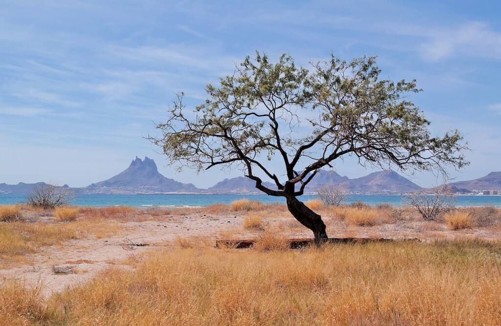
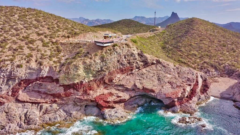
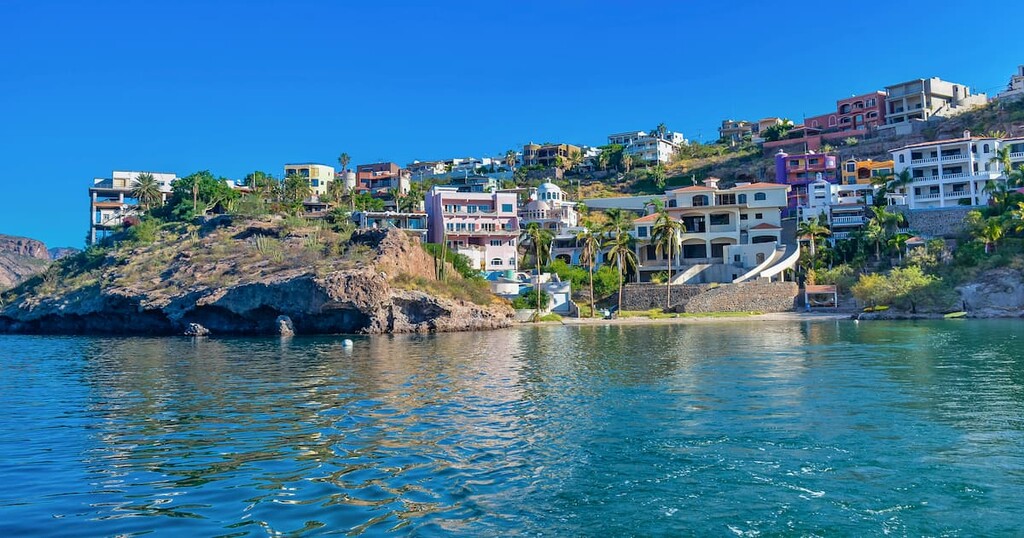
Situated along the Gulf of California, the city of Guaymas is one of the most important commercial ports in all of Sonora. Although it is located on the edge of the Sonoran Desert, the city’s proximity to the water and its many beaches make it a nice place to spend the summer.
Furthermore, the city is fairly close to the beaches at San Carlos, which are a major tourist attraction. Finally, Guayamas also holds an annual carnival before Ash Wednesday, which is one of the biggest in Mexico.


