
Scan the QR code and open PeakVisor on your phone
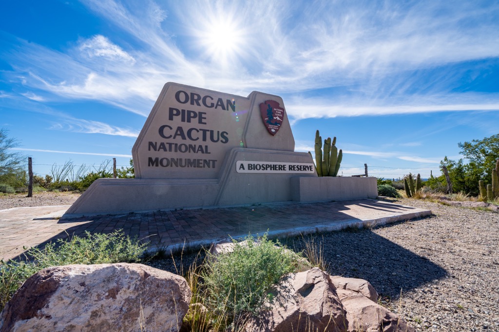
The Organ Pipe Cactus National Monument is a US National Monument and UNESCO Biosphere Reserve located in the southern region of the US state of Arizona. There are 16 named mountains in the monument, the tallest and most prominent of which is Mount Ajo (4,816 ft/1,468m).
Located in southern Arizona, along the US/Mexico border, the Organ Pipe Cactus National Monument protects about 330,880 acres of the vast Sonoran Desert.
The monument is one of many protected areas located within the Southwest Basin and Ranges, a series of mountain systems that stretch across the southwestern US, including portions of Texas, New Mexico, Arizona, and Nevada, as well as the states of Sonora and Chihuahua in northwestern Mexico.
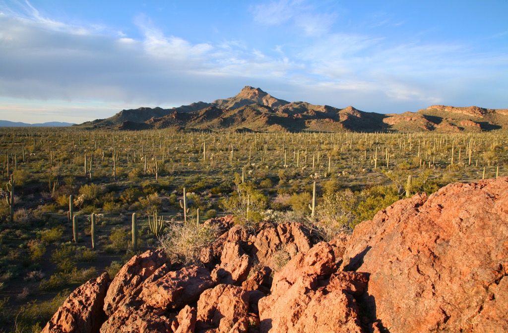
Elevations in the monument range from about 980 feet (299 m) to over 4,800 feet (1,463 m) at the summit of Mount Ajo, the highest peak in the park. Prominent mountain ranges in the monument include: the Ajo Range, Puerto Blanco Mountains, Bates Mountains, Diablo Mountains, Growler Mountains, and Sonoyta Mountains.
The Organ Pipe Cactus National Monument is bordered to the east by the Tohono O’odham Reservation and to the west/northwest by the Cabeza Prieta National Wildlife Refuge and Cabeza Prieta Wilderness. Much of the monument’s northern boundary abuts private land and federal land managed by the Bureau of Land Management (BLM).
South of the monument, in Mexico, the El Pinacate and Gran Desierto de Altar Biosphere Reserve protects an additional 1,765,731 acres (714,566 ha) of the Sonoran Desert, including a volcanic system known as Santa Clara and the Pinacate Peaks, a group of volcanic peaks and cinder cones.
About 95% of the Organ Pipe Cactus National Monument (300,000 acres/121,406 ha), is designated as the Organ Pipe Cactus Wilderness.
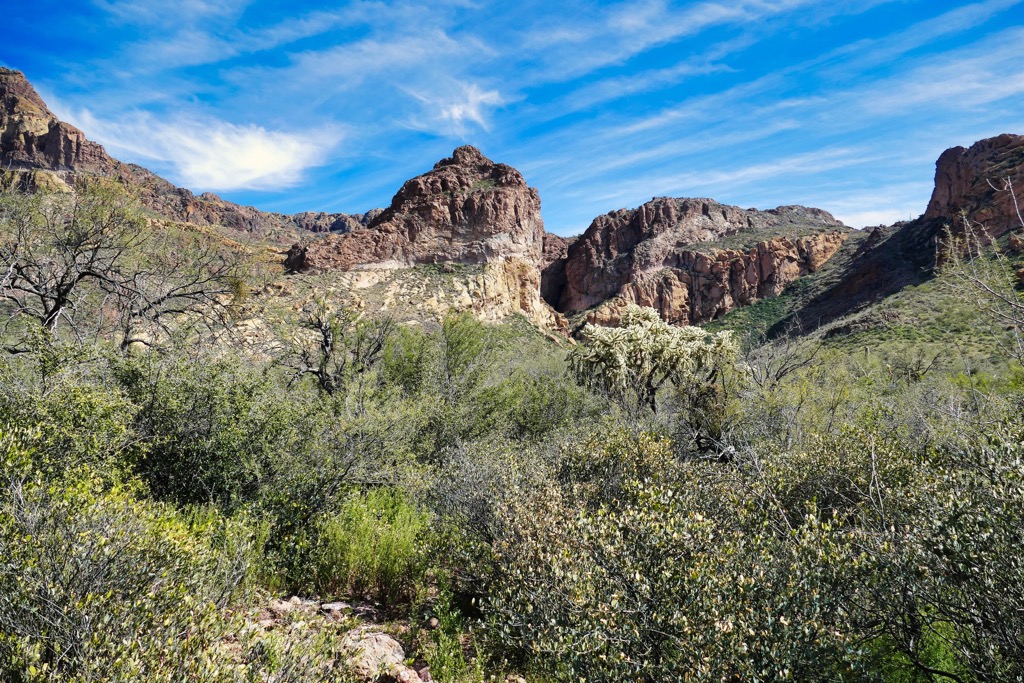
The Organ Pipe Cactus National Monument is located in the Basin and Range Province, a region characterized by narrow, alternating, north-south trending mountain ranges and intervening basin valleys.
Typical of the Basin and Range province, the Organ Pipe Cactus features wide alluvial basins separated by steep mountain ranges. Much of the area has been shaped by extensive faulting and volcanic activity.
One of the most unique geological features of the monument is the Pinacate volcanic field, a 55 by 60 km (34 mi by 37 mi) volcanic field that stretches across northern Sonora, Mexico and into southern Arizona. Pinacate features a large shield volcano and numerous maars, tuff rings, and cinder cones of late-Pleistocene to Holocene age.
The oldest rocks in the Organ Pipe Cactus National Monument are believed to be 1.8 to 1.6-billion-year-old gneisses and granites exposed in the Quitobaquito Hills. These rocks, along with 1.4-billion-year-old granites found in the Chico Shunie Hills, represent periods of continental crust formation and mountain building.
At the northern edge of the monument, near Growler Pass, 550 to 330-million-year-old (Cambrian, Devonian, and Mississippian) quartzite, schist, and marble evidence a period of deposition of sediment in shallow seas.
Between 180 to 145 million years ago (Jurassic time), the region saw several episodes of tectonic and volcanic activity, producing the volcanic and granitic rocks of the Puerto Blanco Mountains, Agua Dulce Mountains, and Quitobaquito Hills.
The current landscape really began to take shape about 30 to 24 million years ago, in the middle Tertiary, when the Earth’s crust was stretched in an east-west direction, producing large, tilted blocks. Another period of extensive faulting, 15 to 10 million years ago, uplifted mountain ranges and lowered valleys, shaping the region’s present-day Basin and Range topography.
As recent as just 11,000 years ago, eruptions of lava produced cinder cones and basalt flows in the Pinacate volcanic field. The Pinacate volcanic field is still considered to be an active volcanic field.
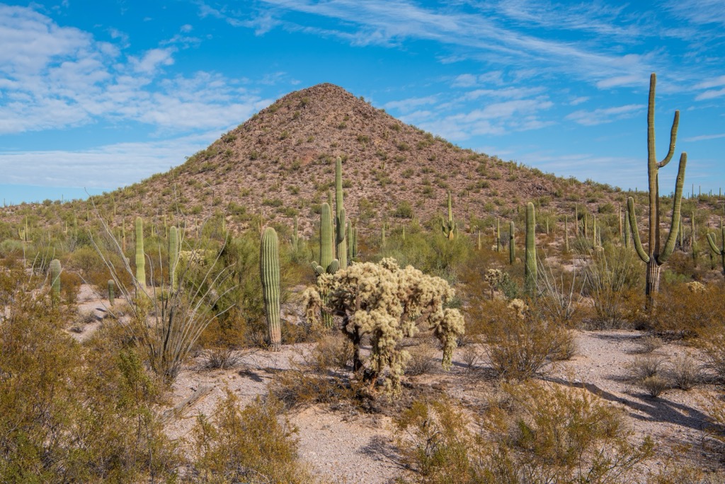
The Organ Pipe Cactus National Monument is one of the most biologically diverse areas of the Sonoran Desert. An International Biosphere Reserve, the monument provides habitat for wide variety of flora and fauna, including threatened, endangered, and sensitive plant and animal species.
The Monument contains five vegetation habitat types: mixed Sonoran Desert shrub, creosote-bursage, evergreen woodland/mesic evergreen scrubland, marsh and open water, and riparian communities.
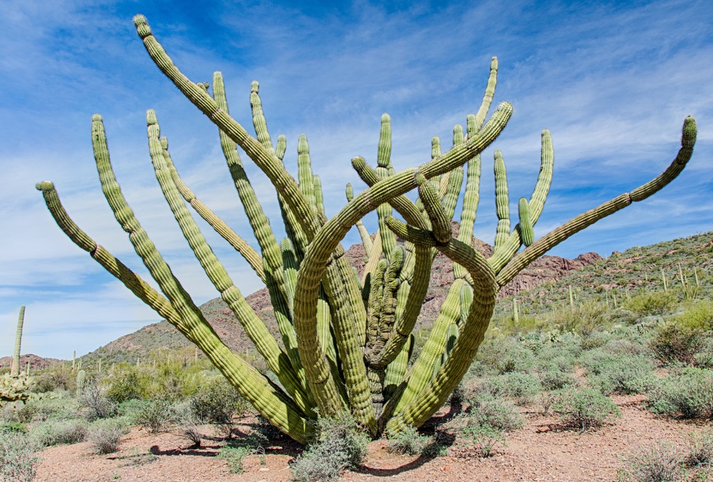
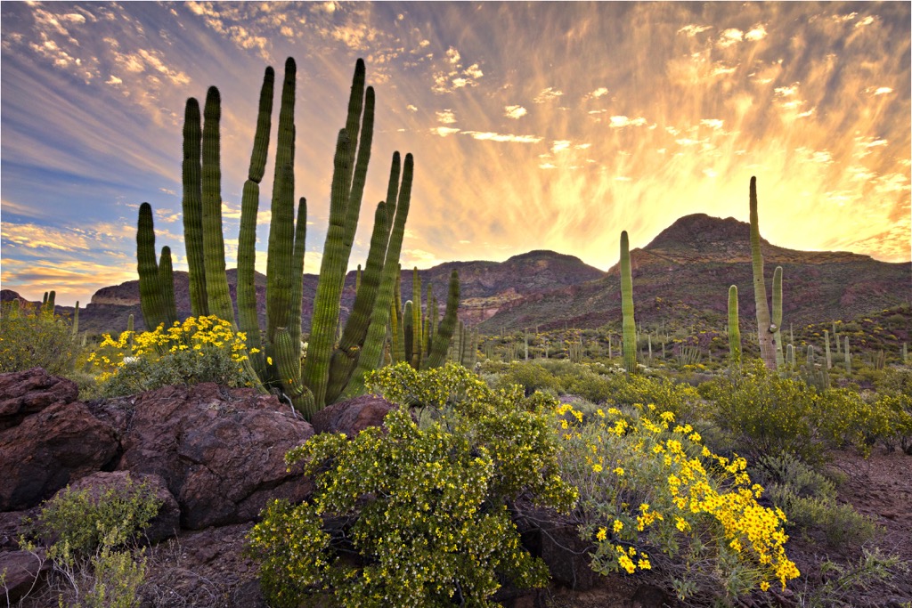
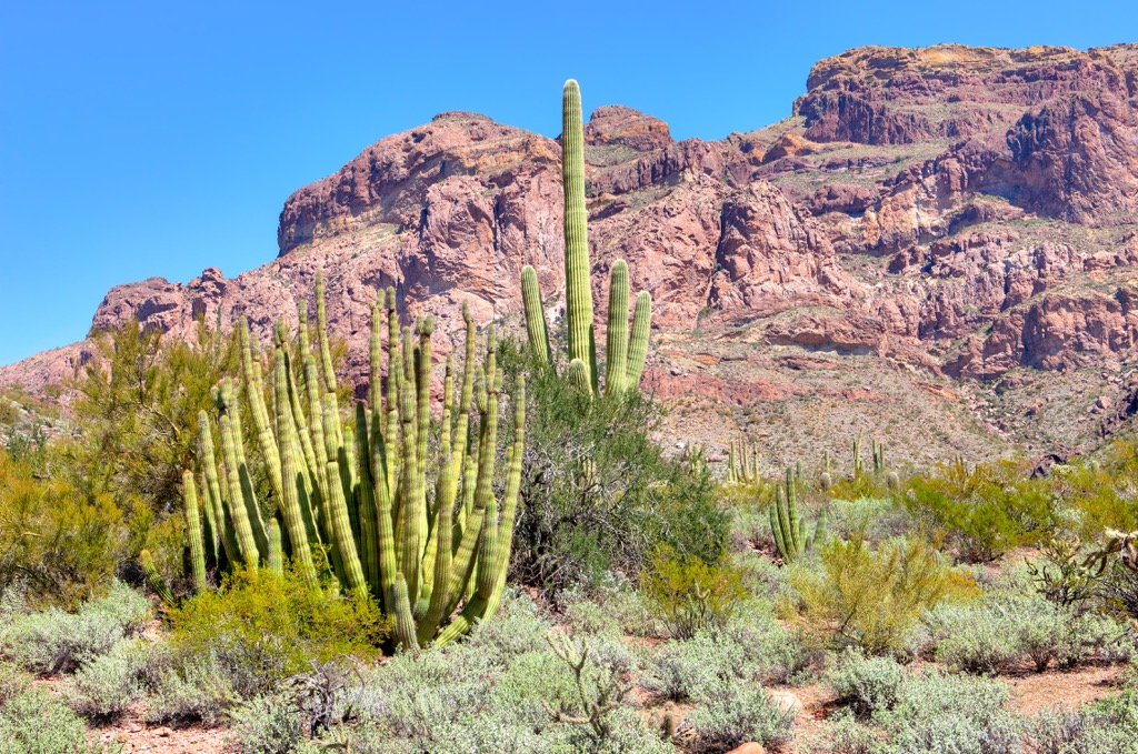
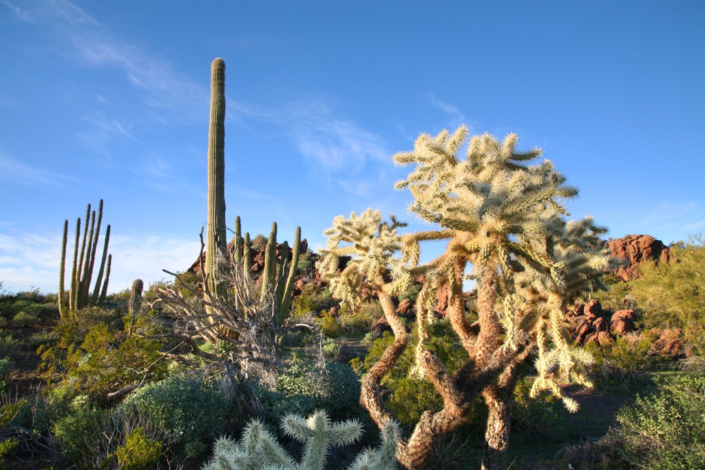
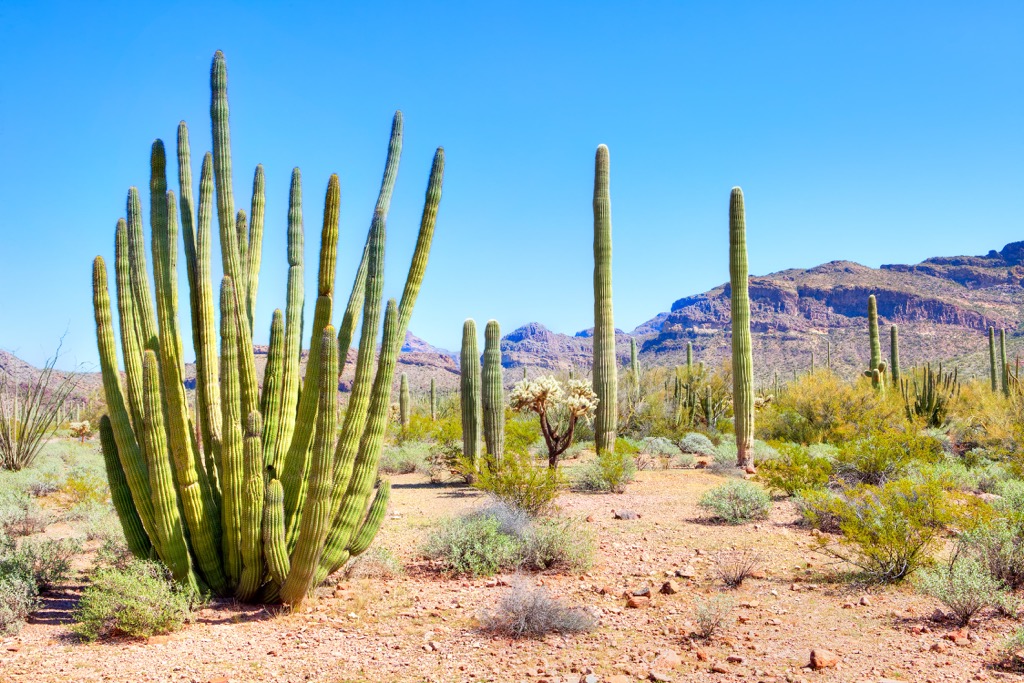
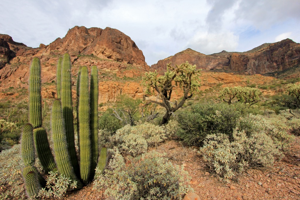
Though summer temperatures in the Organ Pipe Cactus National Monument can reach an astonishing 120 degrees Fahrenheit, about 31 species of cactus have learned to thrive in this unforgiving Sonoran Desert climate. Cacti species found in the monument include the saguaro, senita, chain fruit cholla, teddy bear cholla, Arizona barrell, and Engelmann’s prickly pear, among others.
Most notably, the monument protects about 90% of the US population of organ pipe cactus. In the early summer months, this rare, multi-spined cactus reveals beautiful lavender-white flowers after the sun goes down.
The Organ Pipe Cactus National Monument is also one of the few places in the US where elephant trees are found. Though cacti in the monument often tower over the trees, small trees and shrubs are widespread. Common tree and shrub species include creosote, brittlebush, jojoba, palo verde, mesquite, ironwood, ocotillo, and elephant tree.
The Organ Pipe Cactus National Monument protects many animal species, including bat, mountain lion, desert bighorn sheep, Sonoran pronghorn, kangaroo rat, packrat, coyote, and jackrabbit, among others.
The monument lies along a primary migratory flyway and more than 270 bird species take advantage of the desert’s seasonal flowers, fruits, and warm winters. Common bird species found in the monument include the Cactus Wren, Curve-Billed Thrasher, Gila Woodpecker, Common Raven, Phainopepla, Northern Cardinal, Costa’s Hummingbirds, Roadrunner, and Elf Owl.

A wide variety of desert reptiles, some of which are unique to the Sonoran Desert, thrive in the monument. Reptile species include Gila Monster, Desert Tortoise, Chuckwalla, Tree Lizard, Gopher Snake, and Rattlesnakes.
The land now occupied by Organ Pipe Cactus National Monument has been home to humans for approximately 15,000-years. The earliest inhabitants were likely the Hohokam, whose ancient trade routes bisect the monument, evidencing centuries of movement and trade across the Sonoran Desert.
Often revered as one of the greatest of the ancient southwest cultures, the Hohokam are credited for the creation of irrigation canals fed by the Salt and Gila Rivers. Remnants of these canals, which once supported fields of corn, beans, squash, tobacco, and cotton, can still be observed throughout the monument today.
It's estimated that the Hohokam dispersed into Tohono O’odham and Hia Ced O’odham cultures around CE 1450. Less than a century later, in 1540, the first Spanish conquistadors arrived in the area, claiming Arizona as part of “New Spain.”
When the Spanish arrived in the Sonoran Desert, the Tohono O’odham Nation, descendants of the Hohokam, inhabited much of southern Arizona and Northern Mexico, as well as parts of the Gulf of California.
Throughout the 17th and 18th centuries, the Spanish established missions in the area to convert indigenous peoples to Christianity. Missions were often responsible for the introduction and spread of deadly disease, as well as violence and forced labor.
Since the early 18th century, several foreign governments have occupied the ancestral lands of the O’odham people. In 1821, Mexico gained independence from Spain and Arizona became part of Mexico’s Alta California territory.
Just over two decades later, in 1848, Mexico succeeded more than half of its territory, including the area north of the Gila River in Arizona, to the US. However, the land now occupied by the Organ Pipe Cactus National Monument was still part of Mexico until 1853, when the US purchased the land south of the Gila River to build the Southern Pacific Railroad route.
By this time, gold fever had already drawn thousands of hopeful prospectors west and mineral mining operations were established throughout the Sonoran Desert. Ranching and mining quickly became the leading industries in the area.
Though the Organ Pipe Cactus National Monument was established in 1937, mineral mining was prevalent in the area throughout the mid to late 19th Century and continued until 1976, when the monument became an International Biosphere Reserve and subsequently received wilderness designation.
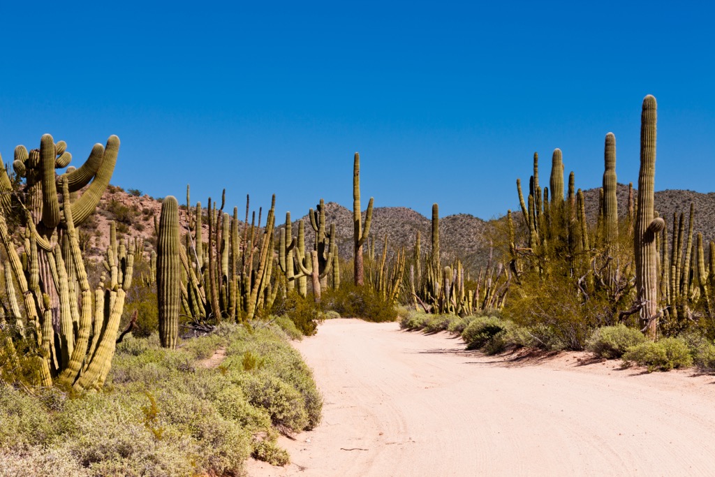
There are many miles of trail in the Organ Pipe Cactus National Monument. Generally, the park is separated into two main areas – the Ajo Range and Puerto Blanco Mountains. Two scenic roads, the Ajo Mountain Drive and Puerto Blanco Drive, lead to miles of hiking trails varying in difficulty.
The 21-mile (34 km) Ajo Mountain Drive is a graded, one-way dirt road that travels towards the foothills of the Ajo Range, a craggy ridge that forms the eastern boundary of the monument. Along the way, visitors will travel through a varied desert landscape surrounded by imposing volcanic peaks.
There are also several trails along the route, allowing visitors to further explore this unique desert landscape. These are some of the most popular trails in the area:
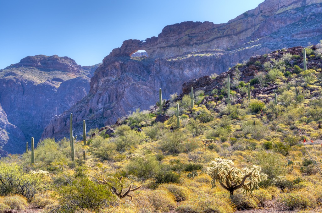
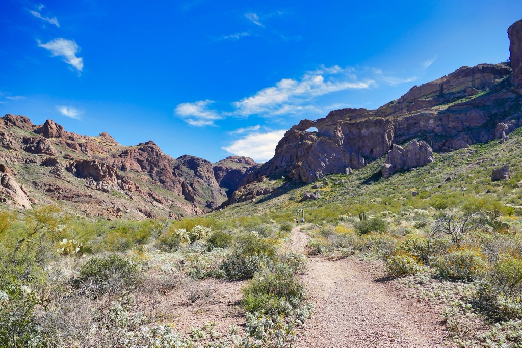
Arguably the most popular destination in the monument, Arch Canyon is an easy, relatively flat 1.2-mile (1.9 km) trail that leads to a set of beautiful rhyolite arches. In addition to the arches, the Arch Canyon trail highlights the area’s unique topography and vegetation. In the spring, it’s not uncommon to see many wildflowers blooming amidst cacti, shrubs, and grasses in the area.
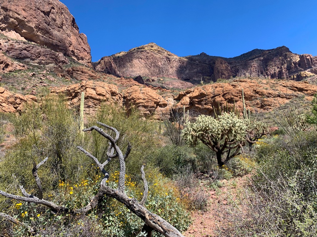
Rated as moderate, the Estes Canyon trail traverses through the Ajo Range. From the trailhead, hikers will follow a rocky, single-track trail, surrounded by many species of cacti and a variety of desert plants, including saguaros, chain fruit chollas, teddy bear chollas, and Engelmann’s prickly pear. Halfway around the loop, hikers can opt to take a strenuous spur trail to Bull Pasture, which boasts incredible views of Mount Ajo, the highest peak in the monument.
The Puerto Blanco Mountains lie in the southeast region of the Organ Pipe Cactus Monument. One of the most scenic drives in the area, the Puerto Blanco Drive, traverses through cactus plains and mountain foothills in this region. Along this route, a series of developed trails lead to historic mines and artifacts, as well highlight the area’s unique ecology.
These are some of the hiking trails in the Puerto Blanco Mountains region:
Beginning in the 1890s, the Victoria Mine was the site of gold and silver mining in the Organ Pipe Cactus National Monument region. Peak mining activity occurred between the 1890s and 1910s, but continued sporadically until 1976, when the monument was designated a wilderness area.
The 4.4-mile (7 km) trail to Victoria Mine begins near the Twin Peaks Campground and features old mining artifacts from the region’s once-robust silver and gold operations. Hikers can continue an additional 4 miles (6.4 km), round trip, to explore the Lost Cabin, another primitive stone mining house tucked in the Puerto Blanco Mountains.
Located on the south side of the Puerto Blanco Mountains, the Senita Basin trail is an easy, 2.9-mile (4.7 km) loop trail that allows visitors to explore one of the most impressive groves of senita cacti in the area. The lush Senita Basin also sustains other columnar cacti, including saguaro and organ pipes. One of the best times to visit this area is between April and August, when beautiful pale pink flowers bloom from the upper stems of the senita cacti.
Looking for a place to stay during your trip to the Organ Pipe Cactus National Monument? Here are some of the best cities to check out:
Located about 120 miles (193 km) east of the Organ Pipe Cactus National Monument is the city of Tucson, Arizona’s second-largest city. Tucson is best-known for being home to the University of Arizona, but it’s also centrally located to a variety of recreation opportunities including the Butterfly Peak Natural Area, Catalina State Park, Sabino Canyon Recreation Area, Tucson Mountain Park, and the Coronado National Forest.

The anchor of Arizona’s Phoenix metropolitan area, Phoenix, is home to over 1.6 million residents, making it one of the most populated cities in the US. The city’s warm, dry climate makes it a particularly popular destination for tourists looking to escape the snow and cold during winter months.

In addition to offering visitors a wide variety of shopping, dining, resort, and hotel options, Phoenix is also located near many acres of wilderness. This sprawling metropolis is surrounded by impressive mountain ranges, including the McDowell Mountains, White Tank Mountains, Superstition Mountains, South Mountains, and the Sierra Estrella. Additionally, the Tonto National Forest forms part of the city’s northeast boundary.


