Scan the QR code and open PeakVisor on your phone
Superstition Mountains (Yavapai: Wi:kchsawa) is a mountain range located in the central region of the US state of Arizona. The range gets its name due to the legends and lore that have surrounded it for centuries. There are 32 named peaks in the range with Cimeron Mountain being the tallest at 5,561 ft (1,695 m) and Peak 5057/ Superstition Mountain the most prominent with 1,844 ft (562 m) of prominence.
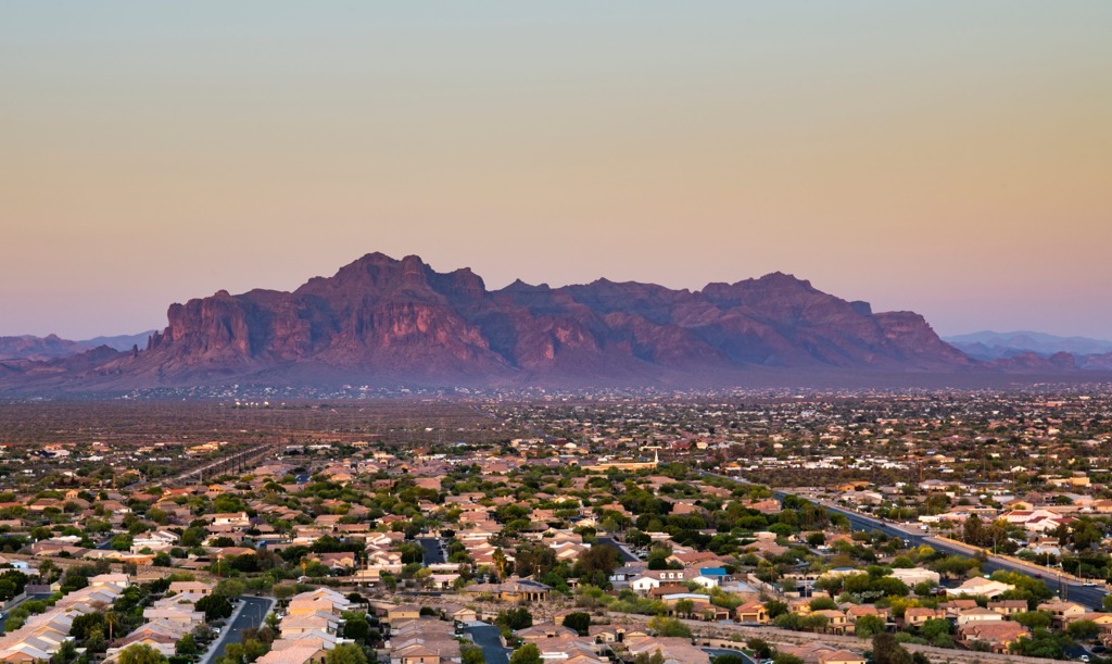
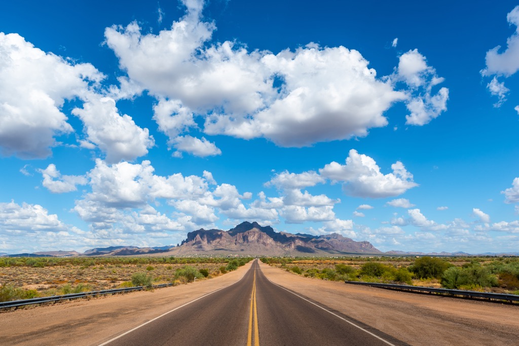
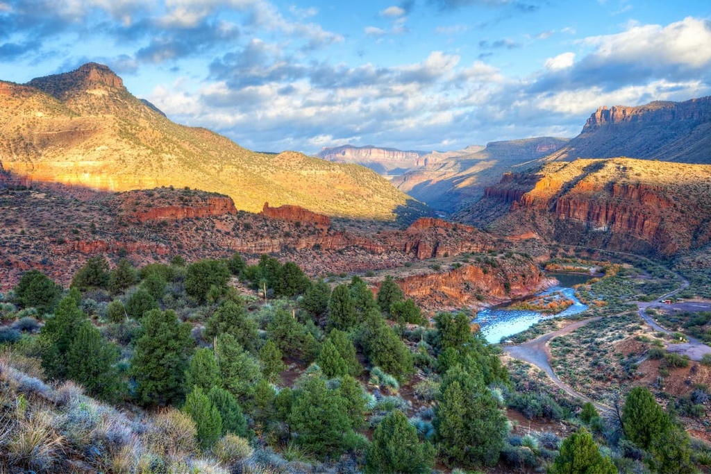
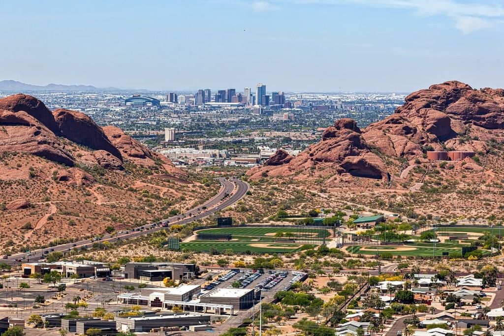
The Superstition Mountains are a mountain range situated in central Arizona. The range lies within Maricopa, Pinal, and Gila counties. This mountain range lies within the Superstition Wilderness which is part of Tonto National Forest.
The Salt River lies just north of the range while US Route 60 is to the south. Other boundaries for the range include State Route 88 in the northwest and State Route 188 in the northeast.
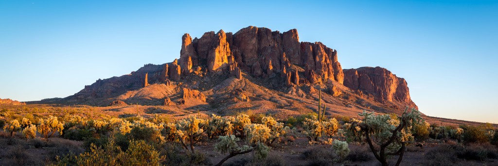
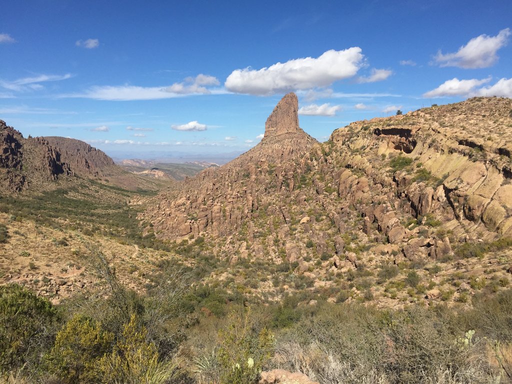
Elevations range from around 2,000 ft (610 m) up to the summit of Cimeron Mountain. One of the most prominent features in the range is Weaver’s Needle. This landmark has become popular amongst rock climbers and is a volcanic remnant that has been eroded over time.
The Superstition Wilderness surrounds the entire range and extends a bit east of the range. Peaks are often slightly higher in the eastern stretches of the range, resulting in slightly cooler temperatures.
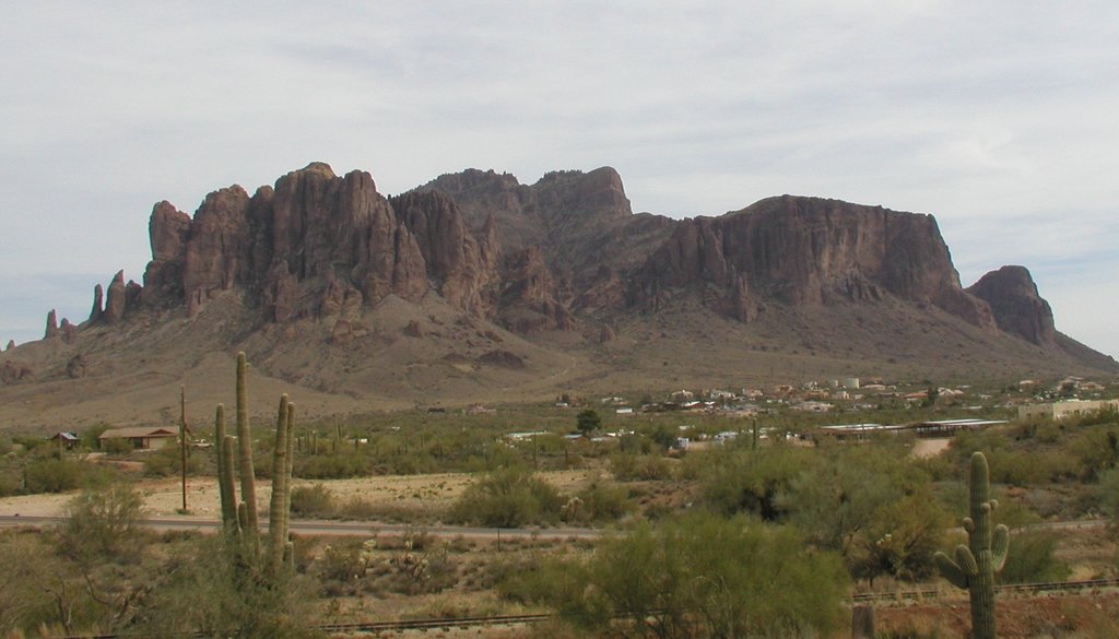
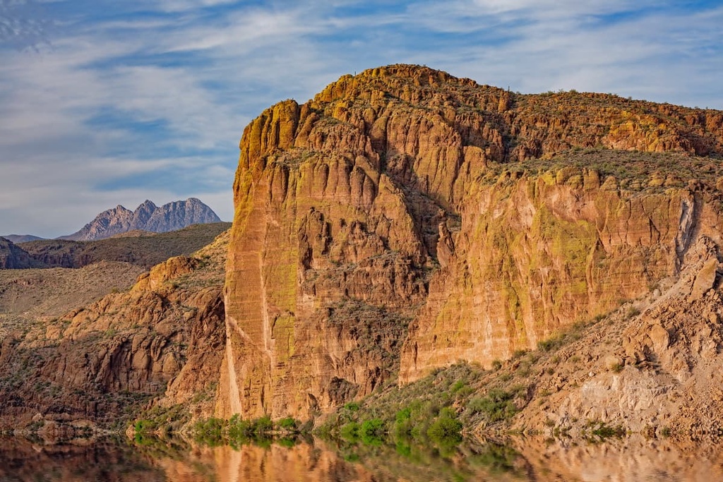
Red rock buttes are met with rolling hills, outcroppings, and sweeping basins throughout the Superstition Mountains. Tortilla Creek runs near the middle of the range while some small seasonal creeks and streams are scattered throughout the rest of the mountainous region.
Additionally, the Superstition Mountains are located near numerous other regions for outdoor recreation. Some of these include Salt River Canyon Wilderness, Sierra Ancha Wilderness, and the Salome Wilderness to the northeast. Sections of Tonto National Forest extend to the northwest, north, east, and southeast.
The Superstition Mountains have been formed by many natural forces over the course of millions of years. Immense amounts of volcanic activity in the region around 25 million years ago began to shape the range.
Volcanic eruptions continued through the mid-Tertiary period, covering the surrounding region in roughly 2,500 cubic mi (10,420 cu. km) of lava and ash. Following these eruptions, the magma chambers began collapsing, leaving behind calderas.
Further upthrusting of the Earth’s crust, coupled with widespread erosion, left behind the cliffs, peaks, rock outcroppings and sweeping valleys visible today. Common rock types in the range include tuff, granite, breccia, dacite, and basalt.
Major peaks within the range include Cimeron Mountain, Peak 5057, Tortilla Mountain, Weaver’s Needle, and Coffee Flat Mountain.
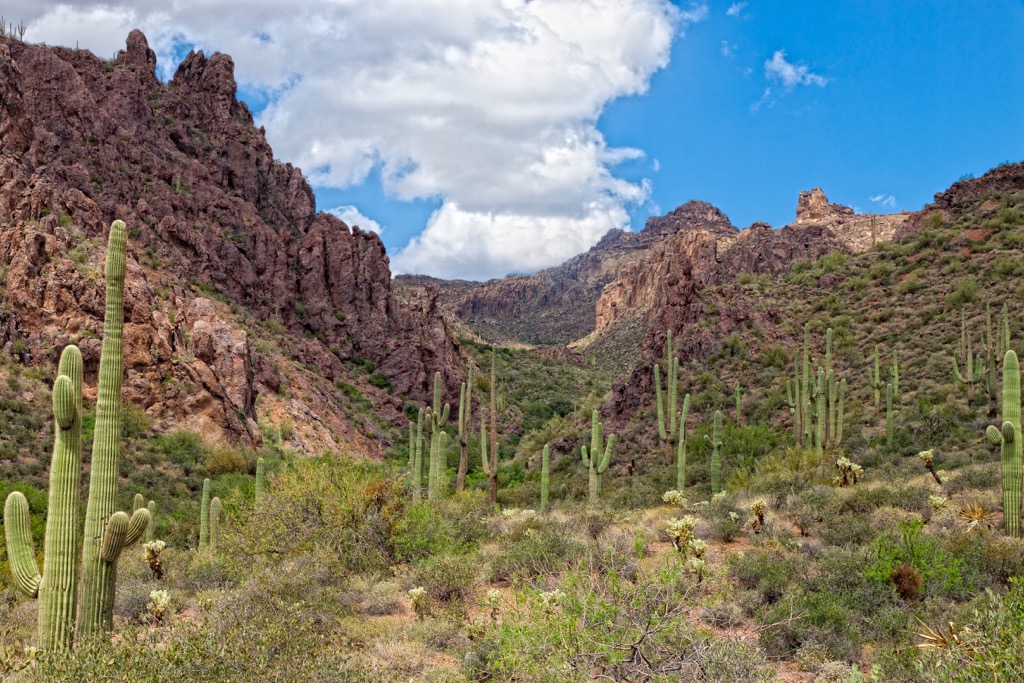
Flora and fauna found in the range is similar to that found throughout much of the surrounding Sonoran Desert.
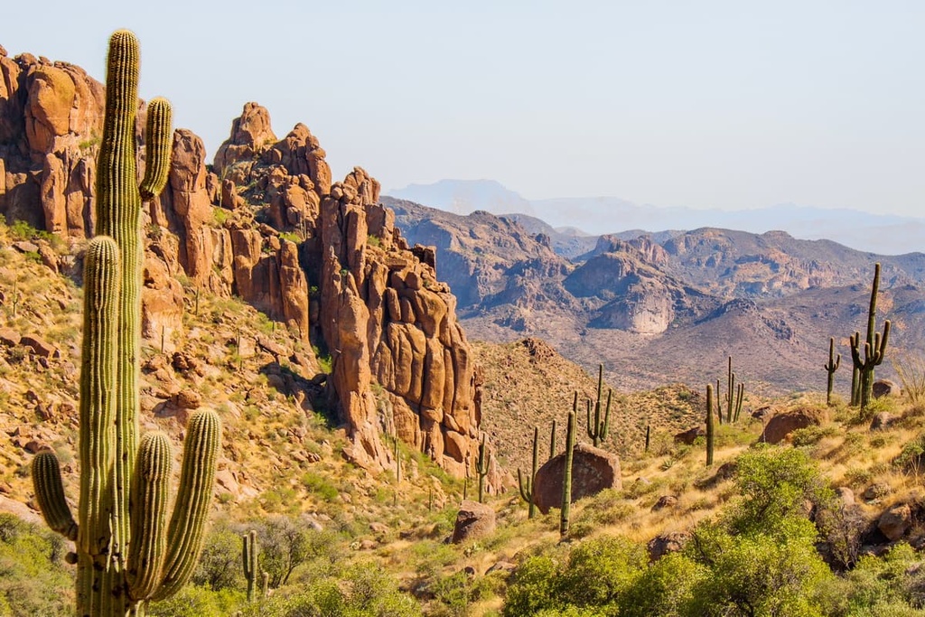
The extreme desert temperatures have allowed prickly pear, Saguaro cacti, yucca, agave, ocotillo, and cholla to thrive. As elevations increase, the flora transitions to semi-desert grasslands. Here hikers are likely to encounter some ponderosa pine, shrubs, and grasses.
Wildlife commonly found in the range include bighorn sheep, jackrabbits, coyotes, cottontail rabbits, roadrunners, and hawks. A variety of birds, insects, and lizards inhabit the Superstition Mountains as well.

Animal and plant species alike are both threatened by the seasonal wildfires that occur each summer. In recent years there has been a drastic increase in the number of fires throughout Tonto National Forest.
The land within and surrounding the Superstition Mountains has a long history of human inhabitation dating back thousands of years. Throughout this period of time, numerous Indigenous Tribes have lived in the area.
From 500 to 950 CE, the region was home to three distinct Indigneous cultures: the Mogollon which spanned to the east, Hohokam to the west, and the Sinagua to the north. Around 950 CE, the Salado culture began to appear in the region.
Over time the Hohokam grew to expand upon their traditional hunting and gathering practices to include trading, farming and craftsmanship. Lack of reliable rainfall in the desert led the Hohokam people to construct hundreds of miles of irrigation canals across the region.
Severe drought during the fifteenth century resulted in the Hohokam, Salado, and other Indigenous peoples to leave the region. While some would later return, many who left never did. Descendants of these Tribes are part of the contemporary Pima, Hopi, and Zuni tribes.
Those who chose to remain in the region were met with continual hardships as the population of settlers continued to grow. Prospect of mining, and large groups of people heading west, led the Phoenix region to grow.
During the nineteenth century, the US Army forcibly removed the Apache and Yavapai people of the region onto reservations. Today, nearby reservations include the Tonto Apache Reservation of the Tonto Apache Tribe, White Mountain Reservation of the White Mountain Apache Tribe, San Carlos Apache Reservation of the San Carlos Apache Nation, and the Fort McDowell Yavapai Reservation of the Fort McDowell Yavapai Nation.
After the brutal removal of the Indigneous Tribes in the region, more settlers began flocking to the area. Some of the early settlers were miners, Mormon missionaries, or ranchers. Following the completion of the railroad through present-day Arizona, Phoenix had established itself as an economic hub for the region.
The Superstition Mountains got their name due to the legends that have long surrounded the range. Some bands of Apache once believed that the entrance to the lower world, or hell, is located within the range. Further mystery of the range came from the Lost Dutchman’s Gold Mine.
On his deathbed, miner Jacob Waltz claimed to have discovered an immense amount of gold in the range. Though numerous mines in the region have claimed to be this said mine, none of these claims have ever been verified leaving some to believe that this mysterious mine is still out there. Today the Superstition Mountain Museum dives further into the lore of the range.
The surrounding Tonto National Forest was established in 1905 and was set to protect the Salt and Verde river watersheds. The Superstition Wilderness was a managed primitive area in 1939 and became an official wilderness area following the Wilderness Act of 1964.
The Superstition Mountains’ close proximity to the Phoenix metro region has allowed there to be a multitude of hiking trails in the range. Below are some unique hikes in the region which are less likely to be full of crowds of people:
This trail winds through Hieroglyphic Canyon, steadily climbing throughout. During the spring the route is full of seasonal wildflowers while cacti and rocky cliffs tower above on either side.
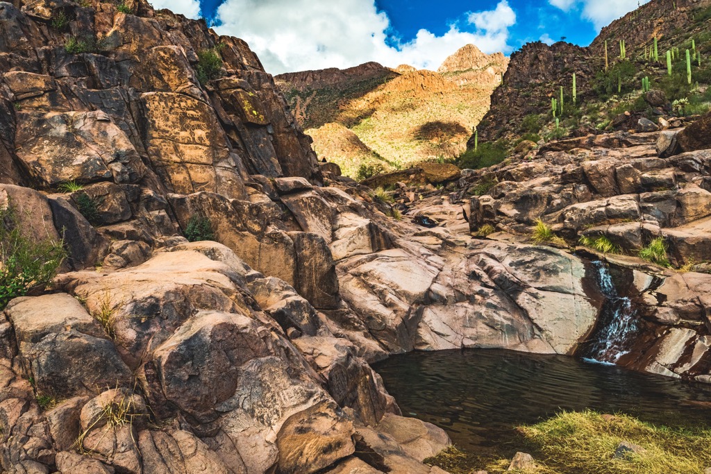
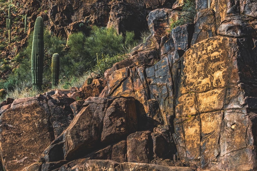
Once at the boulder-filled canyon, hikers can spot pools of water along with petroglyphs believed to be created by the Hohokam people. Hikers should respect this sacred region and refrain from touching or tampering with the art work.
Parts of the route can contain loose rock so proper footwear is recommended. This out and back trail is 2.9 miles (4.7 km) and features 564 feet (172 m) of total elevation gain.
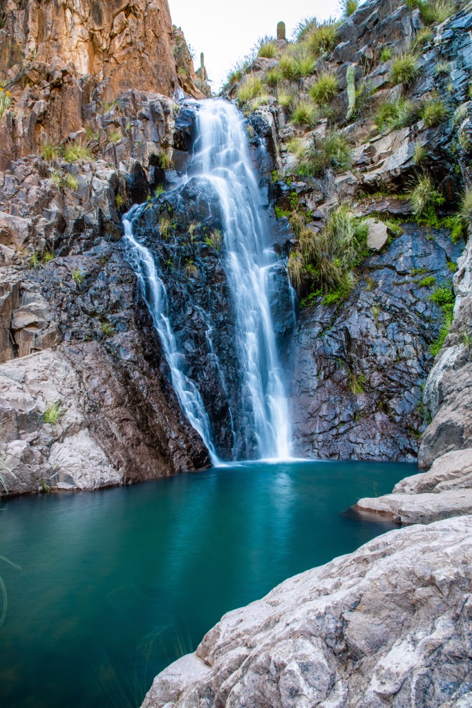
The Massacre Falls Trail lies along the western edge of the range. This route climbs steadily through the desert landscape, passing rocky buttes and peaks with minimal amounts of shade. The route culminates at Massacre Falls before descending back to the trailhead.
Hikers should note that the waterfalls are not always flowing and are very dependent on time of year and how much recent rainfall has occurred. Round trip the trail is 5.4 miles (8.7 km) and features 1,092 feet (333 m) of elevation gain.
Peak 5057, also known as Superstition Mountain, marks the most prominent peak in the range and features numerous hiking trails to reach its summit. One of the most common routes follows along Carney Springs Trail, climbing steadily throughout.
Hikers pass through the sagebrush and cacti before reaching the rocking ridgelines and summits of the range. Here the lack of flora allows hikers to take in panoramic views of the range from the summit. This out and back route is 8.7 miles (14 km) in length and features 3,346 feet (1,020 m) of total elevation gain.
Looking for a place to stay near the Superstition Mountains? Here are some of the best cities and villages to check out in the region:
The city of Phoenix lies just a 45 minute drive west of the Superstition Mountains, marking a major metropolitan region. Home to a metro population of 1.6 million people, Phoenix is the most populous city in the state.
Within the city lie the Desert Botanical Garden and Taliesin West, the previous residence of Frank Lloyd Wright. Just outside the city lie numerous parks along with vast sections of Tonto National Forest and Prescott National Forest. South of the city lies the Sonoran Desert National Monument.
Those visiting the region can explore the thriving food scene or one of the dozens of museums in the region. Despite the large size of the city, visitors can also find numerous campgrounds a short distance from Phoenix.
Mesa lies within the greater Phoenix region, nestled along near the western edge of the Superstition Mountains. The city is a short 20 minute drive from downtown Phoenix and provides easy access to much of Tonto National Forest.
Home to around 520,000 residents, Mesa marks one of the most populated cities in the state of Arizona. The region has become a hub from exploring the nearby national forests and parks. Common outdoor activities just outside of Mesa include rafting, mountain biking, hiking, and trail running. The Salt River runs just north of the city.