Scan the QR code and open PeakVisor on your phone
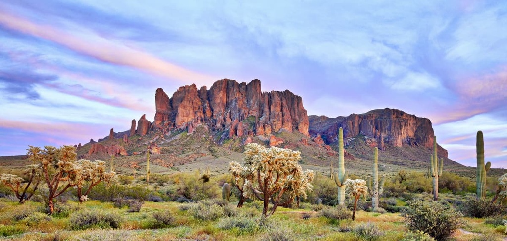
The Superstition Wilderness is a federally protected area that’s part of Tonto National Forest. It is located to the east of Phoenix, Arizona, in the southwestern US. The wilderness area contains 44 named peaks. Mound Mountain is the highest point in the wilderness area at 6,253 ft (1,906 m) in elevation, and Peak 5057 is the most prominent peak in the region with a prominence of 5,056 ft (1,541 m).
Located in the south-central part of the US state of Arizona, the Superstition Wilderness covers nearly 160,200 acres (64,831 ha) of the Sonoran Desert and its rugged mountains within Tonto National Forest. First designated as a wilderness area in 1939, the Superstition Wilderness was expanded in later years and reached its current size in 1984.
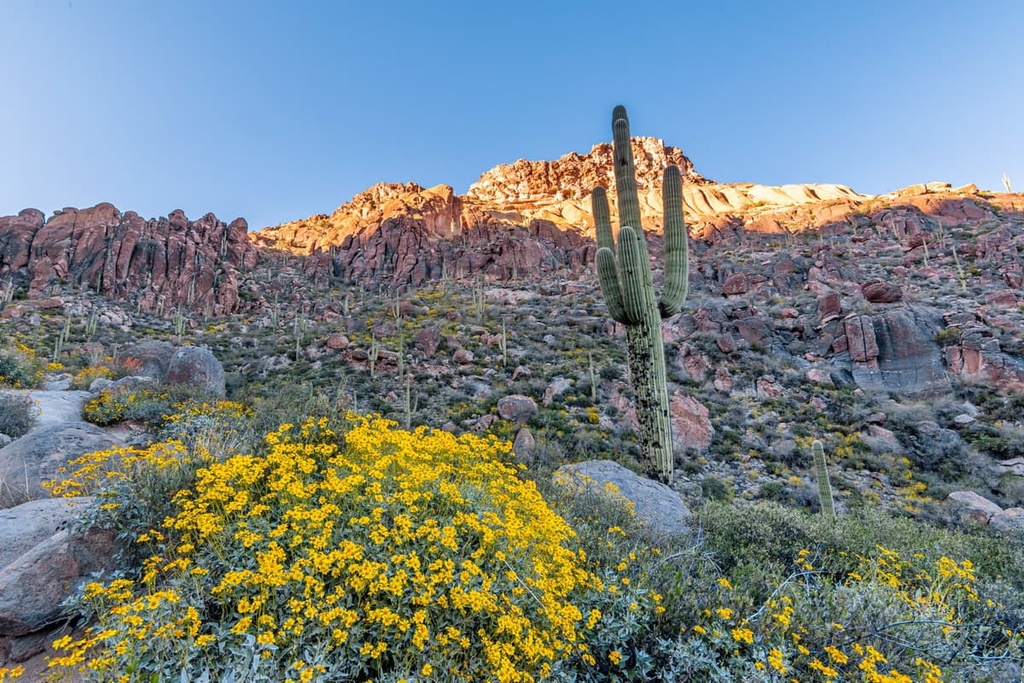
The peaks in the Superstition Wilderness range in elevation from lows of around 2,000 ft (610 m) in the west to highs of 6,253 ft (1,906 m) at the peak of Mound Mountain. Weaver’s Needle, an eroded volcanic plug, rises in an impressive spire to an elevation of 4,555 ft (1,388 m) in the wilderness, too.
Nearly 180 mi (290 km) of trails cross the wilderness area, some of which are fairly well maintained and others of which are quite rugged. More trails exist in the wilderness area but are not marked or maintained so they are only suitable for experienced hikers.
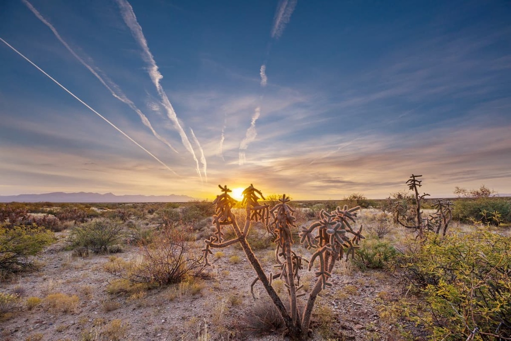
Visitors to the Superstition Wilderness should be aware that the weather in the area can be extreme. Summer temperatures in the wilderness area can rise to over 110 degrees Fahrenheit (43 degrees Celsius). Furthermore, there is little water available in the region all year long, and the winter can see bitter cold days with freezing rain or snow.
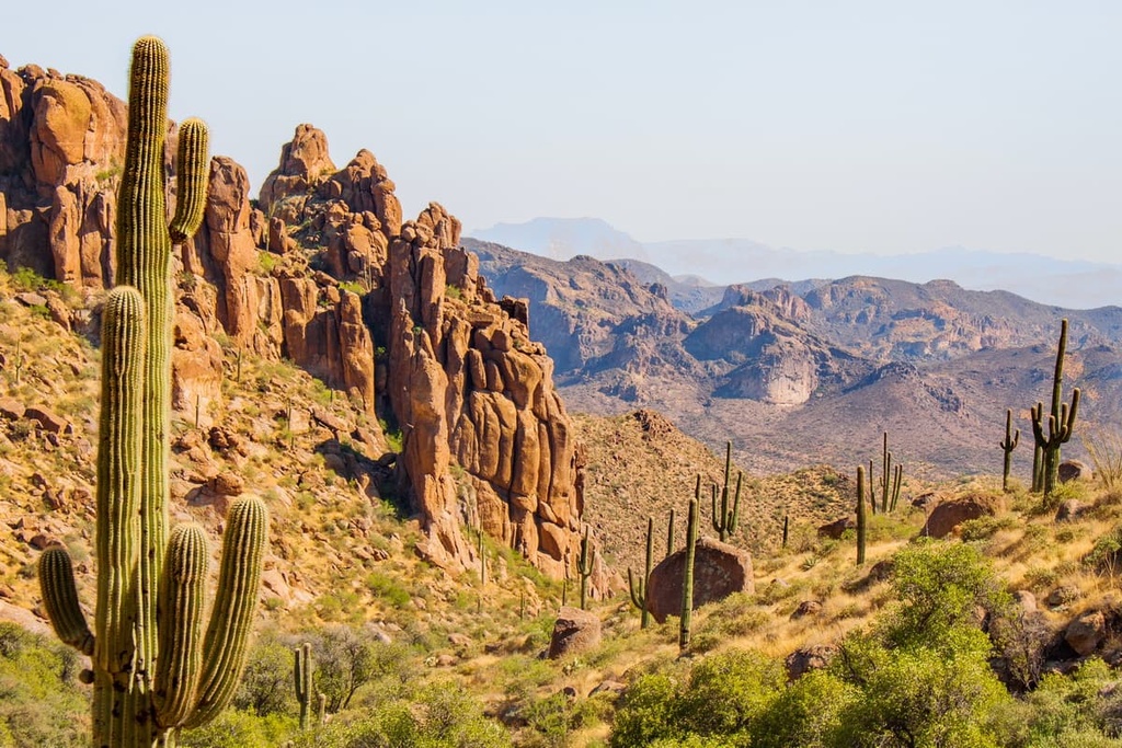
Volcanic activity that occurred around 25 million years ago shaped the rugged terrain that we see in the Superstition Mountains (also known locally as ‘the Superstitions’) to this day.
As volcanoes erupted during the mid-Tertiary period, they spewed nearly 2,500 cubic mi (10,420 cu. km) of ash and lava over the surrounding landscape. Calderas subsequently formed in the range as the empty magma chambers collapsed, leaving behind numerous topographic depressions in their wake.
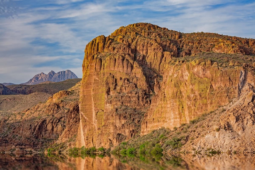
Later upthrusts of lava and widespread erosion created and carved out the peaks in the area. Tuff (volcanic ash welded by heat), breccia (fragments of rock cemented by lava or tuff), dacite, granite, and basalt are all rock types that are commonly found in the wilderness area.
Hikers in the Superstition Mountains sometimes hear rumbling that sounds like thunder. Geologists trace this to seismic activity that resonates off the canyon walls. This sound is one possible reason why some Apache legends call these mountains the home of the thunder gods.
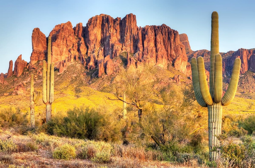
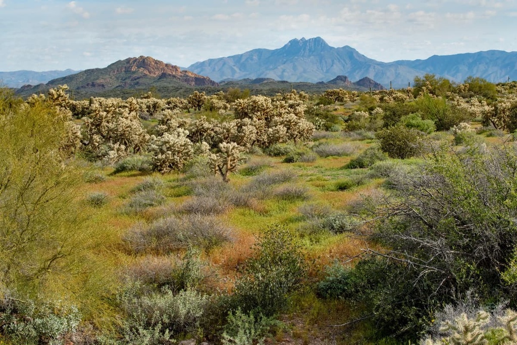
The majority of vegetation in the Superstition Wilderness is similar to what you’d find elsewhere in the Sonoran Desert.
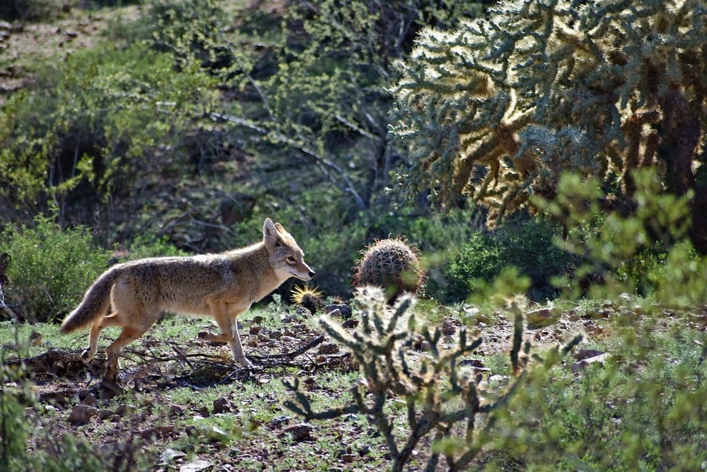
Saguaro cacti, prickly pears, ocotillo, chollas, yuccas, and agaves are abundant in the region. Semi-desert grasslands and chaparral grow at higher elevations in the wilderness. These grass and shrublands are punctuated by occasional pockets of ponderosa pine.
Wildlife that lives in this desert landscape include coyotes, jackrabbits, cottontail rabbits, bobcats, bighorn sheep, kangaroo rats, roadrunners, hawks, and a variety of lizards, insects, and other birds.
Fires are a seasonal hazard in the Superstitions Wilderness. The peak fire season in the wilderness is from May to mid-July. Both natural and human-caused fires occur in the region and they both quickly consume timber, chaparral, grass, and shrubs. In fact, throughout Tonto National Forest, there has been an average of 330 wildfires per year for the past 10 years.
The earliest human inhabitants of the region were the people of the Hohokam culture who first settled the area over 1,000 years ago. Although they built impressive towns and irrigation canals elsewhere in the region, the people who resided in what is now the Superstition Wilderness were able to build only small villages and cliff dwellings in the area’s harsh environment.
As the centuries passed, trade and conflict between different groups splintered the Hohokam and led to the creation of new cultures. One such new group, the Salados people, also came to call the region home.
By about 1400, severe weather and climate patterns, as well as conflict between different communities and bands, drove the Salado and Hohokam people away from the region. The contemporary descendants of the Hohokam and the Salado include the people of the Pima, Hopi, Tohono Oʼodham, and Zuni tribes. Other Indigenous peoples with ancestral claims to the land include the Yavapai and Apache.
During the mid- to late-1800s, conflict with the US Army resulted in the forced removal of Apache and Yavapai to reservations at San Carlos and Fort Apache. Today, members of the Apache tribe still return to the Superstition Wilderness to gather plants and carry out traditional practices.
After the Yavapai and Apache were forcibly removed from their ancestral homelands, the region saw an influx of miners and Mormon farmers. They were followed shortly thereafter by sheep and cattle ranchers.
Mining was, and continues to be, a major part of the local economy in the region surrounding the wilderness area. Multiple metals and minerals have been produced in the region, including gold, silver, copper, lead, zinc, uranium, manganese, asbestos, mercury, and molybdenum. Stories about lost mines still permeate the local culture, and “secret maps” are sometimes sold to tourists who fancy themselves as treasure hunters.
The Superstition Wilderness (Wi:kchsawa) was first designated as a federally managed primitive area in 1939. It subsequently became a proper wilderness area in 1940, but it didn’t become an official wilderness until the passage of the Wilderness Act in 1964.
Almost 180 mi (290 km) of trails run through the Superstition Wilderness. Ranging from well-kept to rugged, these trails invite hikers to explore the extreme but beautiful desert landscape of the region.
Hikers in the Superstitions should be sure to carry adequate water, especially during the warmer months when temperatures can rise quickly. Additionally, keep in mind that group sizes cannot exceed 15 people and 15 heads of stock within the Superstition Wilderness. For a full list of trails, visit the USFS website for the Superstition Wilderness.
Jacob’s Trail is a casual 6.5 mi (10.5 km) long point-to-point trail with 420 ft (128 m) of elevation gain. It runs along the western side of the Superstition Mountains and it stays at around 2,100 ft (640 m) in elevation for much of its route, giving hikers a stunning view of both the valley below and rock formations on the nearby mountains.
To reach the trailhead, take US Highway 60 east from Phoenix. At Exit 196, follow Idaho Road north for 1 mi (1.6 km) to State Highway 88. Turn right onto Hwy 88 and continue for 3.5 mi (5.6 km). Then turn right onto First Water Road/Forest Road and continue for 1 mi (1.6 km) to reach the trailhead.
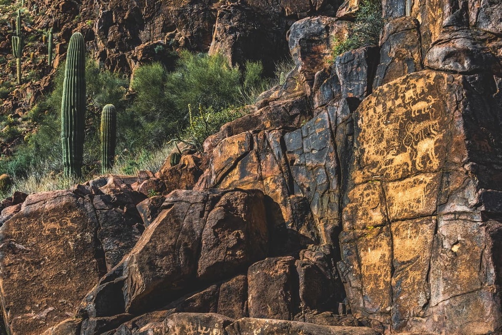
Quick but rewarding, the Hieroglyphic Trail is 1.1 mi (1.8 km) long and it leads to a collection of petroglyphs. The trail begins at the national forest boundary and crosses State Trust Land and private land, so visitors should respect these easements and stay on the trail at all times.
To get to the trailhead, head east on US 60 for 5 mi (8 km) past Apache Junction. Turn north onto Kings Ranch Road and continue for 1.6 mi (2.6 km). Go east on Baseline Ave for 0.3 mi (0.5 km), then north on Mohican Road for another 0.3 mi (0.5 km). Turn west on Valley View Drive, then north on Whitetail Road for 0.3 mi (0.5 km). Finally, go east onto Cloudview Ave, and after 0.4 mi (0.6 km) you arrive at a dead-end where the trail begins.
The Peralta Trail is a popular 12.4 mi (20 km) out-and-back trail that gains 1,360 ft (415 m) in elevation. On the way from Peralta Trailhead to Fremont Saddle, the footing is often bare bedrock and is not recommended for horses. This trail is moderately challenging but it rewards hikers with views of Weaver’s Needle and of other nearby mesas, buttes, and canyons.
To reach the trailhead, go east on Hwy 60 for 8.5 mi (13.7 km) past Apache Junction. Then turn onto Peralta Road/Forest Road 77 and continue north for 8 mi (12.9 km).
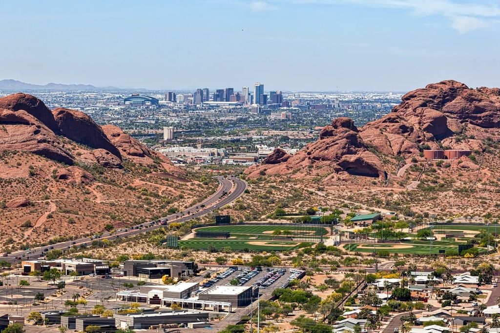
The closest large city to the Superstition Wilderness is Phoenix. The city of Mesa lies slightly to the east of Phoenix. Both are around two hours by car from the Superstition Wilderness and they each offer a broad selection of restaurants, accommodation options, and cultural activities for visitors to enjoy.
Tucson lies three hours to the south of the wilderness and is a great place to go if you want to be immersed in the landscape of the Sonoran Desert. Additionally, backcountry camping is allowed in the Superstition Wilderness so long as you follow a few regulations.
With that in mind, here are some of the best places to stay in the city during your next trip to the Superstitions.
Located just two hours from the Superstition Wilderness, Phoenix is a vibrant city with a population of 1.6 million people.
While in Phoenix, be sure to check out Roosevelt Row, Old Town Scottsdale, Heritage Square, and the Melrose District. You can also venture around the city’s downtown district to explore its galleries, museums, boutiques, nightlife, and wide array of restaurants. The city boasts a rich cultural scene that blends together its Indigenous history and Old Western roots.
Phoenix is also home to the Desert Botanical Garden and Taliesin West (the winter home of the famous architect Frank Lloyd Wright). South Mountain Park and Preserve and Papago Park are both located minutes from the city, and each park offers miles of trails for hiking and biking.
All types of accommodation are available in Phoenix, from resorts and hotels to guest ranches and RV parks. Visitors to Phoenix can easily find a place to stay that suits their budget and travel preferences.
Situated just to the east of Phoenix, Mesa is a smaller city with a population of around 500,000 inhabitants that offers a variety of cultural and outdoor activities.
There are a number of museums in Mesa that are well-suited for both adults and kids. In Mesa, you can also find live music, theater performances, and farmers' markets. Restaurants abound in Mesa, so it is easy to find quintessential southwest flavors, fresh farm-to-table options, and cuisines ranging from Mediterranean and Indian to Vietnamese within the city.
It takes just under two hours to reach the Superstition Wilderness from Mesa. The city is located even closer to the Apache Trail, Salt and Verde Rivers, and Usery Mountain Regional Park.

There are plenty of hotel options in Mesa and the surrounding outskirts of Phoenix. Those looking to camp can check out the campgrounds at Lost Dutchman State Park, McDowell Mountain Regional Park, and Usery Mountain Regional Park.
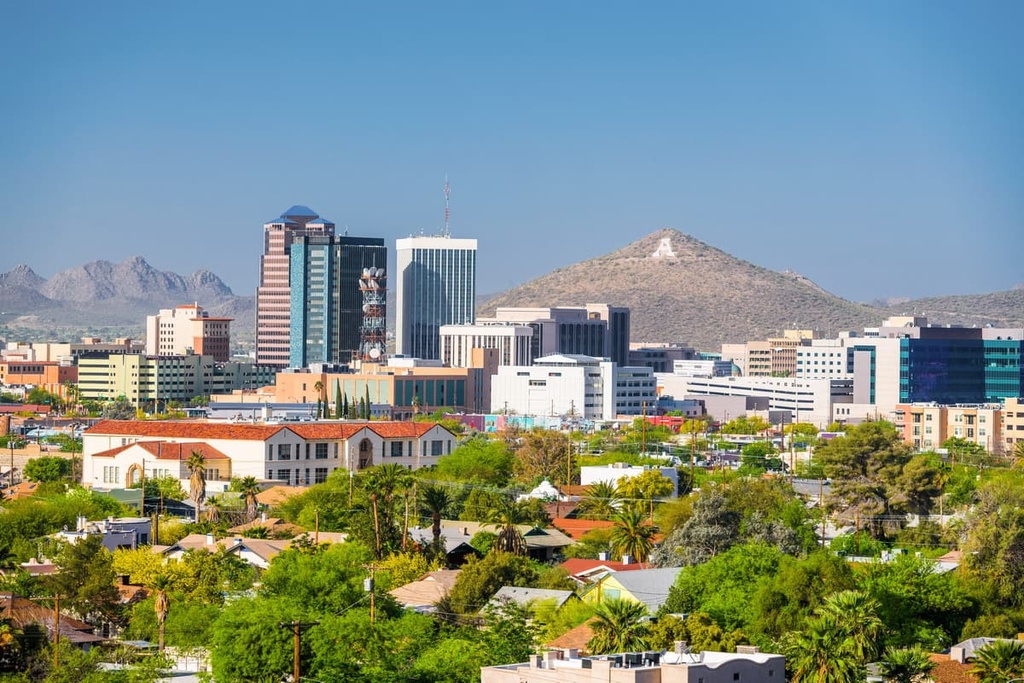
Tucson is a city located in the middle of the Sonoran Desert approximately 3 hours to the south of the Superstition Wilderness. The city of Tucson is a great destination if you’re looking for an authentic Desert Southwest experience.
With a population of around 500,000 people, the city of Tucson celebrates its rich history through museums, historic sites, and cultural events. Near the city, you can also find Saguaro National Park and the Sabino Canyon Recreation Area, both of which are great destinations for hiking and other outdoor activities.
Home to six distinct districts, one can easily spend the day exploring downtown Tucson’s arts, music, and dining scenes. Hotels, B&Bs, RV parks, campgrounds, guest ranches, and destination spas are all viable accommodation options for those looking to stay over in Tucson, too.