
Scan the QR code and open PeakVisor on your phone
The Sonoran Desert National Monument is situated in the south-central region of the US state of Arizona. The monument helps protect the surrounding desert landscape and mountain ranges, marking one of the most biologically diverse deserts in North America. The tallest and most prominent peak in the monument is Maricopa Peak at 4,065 feet (1,239 m) tall with 1,496 feet (456 m) of prominence.
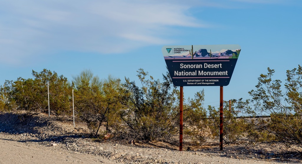
The expansive Sonoran Desert National Monument spans 496,400 acres (200,886 ha) across the south-central region of the US state of Arizona. True to its name, the monument covers land within the Sonoran Desert landscape. The desert extends well beyond the monument into the state of California and northern Mexico.
The monument covers land in both Maricopa and Pinal counties, while Interstate 8 cuts across the protected region in an east to west direction. While there is no one major attraction in the monument, the protected landscape helps showcases the biodiversity of the region.
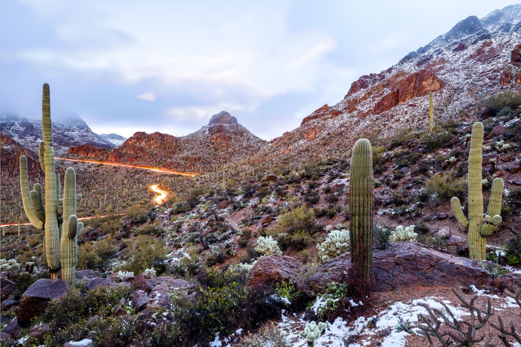
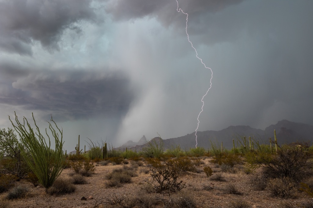
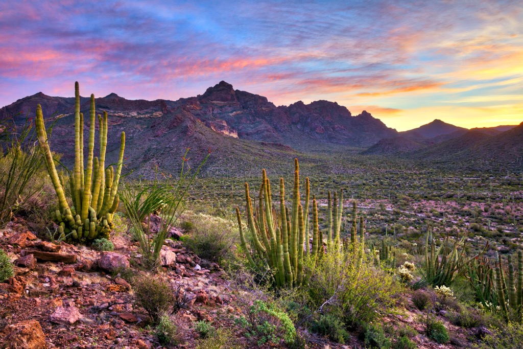
The entire Sonoran Desert marks the most biologically diverse desert in all of North America. From cactus forests to rugged mountain ranges, the monument features a variety of landscapes.
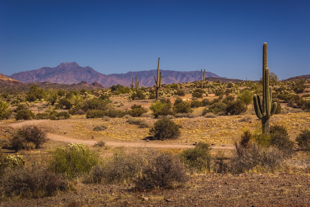
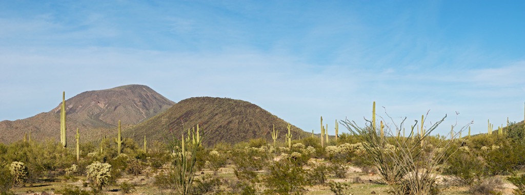
Within the monument lie three distinct mountain ranges; Maricopa Mountains, Sand Tank Mountains, and the Table Top Mountains. Terrain between these ranges is relatively flat, containing a majority of the flora in the monument.
This relatively untouched landscape features wide and sweeping valleys along with both the Booth and White Hills. While there are no major bodies of water within the boundaries of the monument, the Gila River is situated to the north while the Greene Wash is located to the east.
The main purpose of the national monument is to help protect the desert landscape, populations of flora and fauna, and important sites for the Indigenous peoples of the region. Within the monument lies the Table Top Wilderness, North Maricopa Mountains Wilderness, and the South Maricopa Mountains Wilderness.
Additionally, the Sonoran Desert National Monument is surrounded by popular outdoor recreation areas. The Ironwood Forest National Monument is located to the southeast along with sections of Coronado National Forest. Tonto National Forest lies to the northeast, along the eastern edge of the city of Phoenix. The Woolsey Peak Wilderness lies north of the monument along with White Tank Mountain Regional Park.
The Sonoran Desert National Monument lies within the Sonoran Desert which extends across southwestern Arizona and into sections of California, Baja California, and Mexico.
Geologically the Sonoran Desert is part of the larger Basin and Range Province which extends throughout the US states of Utah, Idaho, Nevada, Arizona, and California. Formation of this geological region began roughly 40 million years ago.
Widespread volcanic activity between 40 and 20 million years ago, helped form the massive claderas, cinder cones, and lava vents that define the region. This activity was formed as the Pacific Ocean tectonic plate was subducted beneath the North American tectonic plate. The immense pressure resulting in the folding, thrusting, and volcanism that has defined the region and much of the southwestern US.
The entire Basin and Range Province is known for its series of alternating peaks and basins that roughly run parallel to one another. This pattern is visible within the monument though it is less defined compared to the basin and ranges found in the nearby state of Nevada.
Sedimentary, igneous, and metamorphic rocks can be found in the monument, with some dating back over 1 billion years. Millions of years of erosion and flooding further carved out the landscape, leaving behind the geological features visible today.
Major peaks within the monument include Maricopa Peak, Margies Peak, Isanaklesh Peaks, and Booth Hills.
The Sonoran Desert National Monument is home to a diverse array of both flora and fauna, marking a portion of the most biodiverse desert in all of North America.
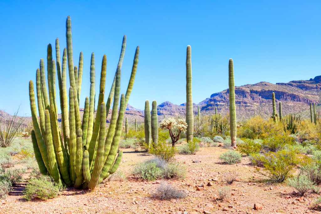
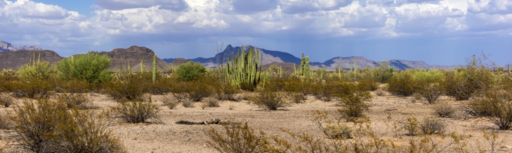
One of the most striking sections of the monument is the saguaro cactus forest. Amidst the cactus also lie populations of various shrubs, flowers, grasses, and succulents. Some common plants found throughout the Sonoran Desert include mesquite, creosotebush, yucca, agave, and prickly pear.
The slopes in the monument are populated by saguaro cactus, paloverde, and ironwood trees. Amidst the terrain lie numerous low growing shrubs and grasses.
This diverse desert landscape helps support a variety of wildlife. Common animals include deer, desert bighorn sheep, desert tortoise, coyote, bobcat, and fox. Birds such as Gambel’s quail, along with various species of raptors, inhabit the region.
The land within and surrounding the national monument has been home to humans for nearly 11,000 years. For thousands of years before Europeans arrived, this land was home to the Mogollon, Sobaipuri, and Hohokam cultures.
The region marks part of the ancestral homelands of many peoples, including the Cocopah Tribe (Cocopah: Xawitt Kwñchawaay) , O’odham, Maricopa (Maricopa: Piipaash), Hohokam, and Yavapai Apache. Today descendants of these tribes are part of the Cocopah Indian Tribe, Tohono O’Odham Nation, Hia-Ced O’odham Nation, Ak-Chin Indian Community, Yavapai-Apache Nation, Fort McDowell Yavapai Nation, and the Yavapai Prescott Indian Tribe.
The first recorded contact between Europeans and the Indigenous peoples of the region was in 1540. An expedition led by Spaniard Hernando de Alacron traveled along the Colorado River, encountering various tribes throughout the region.
Nearby terrain was later explored by the Spanish missionary Eusebio Franciso. Francisoc went on to later establish the Mission San Xavier del Bac in 1700 near present-day Tucson. As populations and Spanish military presence began to rise over the following decades, disputes arose between the two groups.
After the Mexican War for Independence in 1821, the region became part of the Mexican state of Sonora. Westward expansion by European-Americans during the 1840s led to even further population growth, especially near present-day Phoenix. In 1848, following the Mexican-American War, the region was reallocated to the US, later becoming the state of Arizona.
As populations continued to rise, the US government forcibly removed the Indigenous peoples from the region. The Tribes were continually attacked, harassed, murdered, and eventually placed on reservations as they fought to protect their ancestral lands.
Many of the surrounding wilderness areas were established in 1990. A Proclamation in 2001 established the national monument in order to protect the biodiversity, endangered species, and cultural sites within the region.
There are a few designated trails within the monument, covering a total of 26 miles (42 km). Those hiking in the region should note there is little to no shade and extreme temperatures can occur throughout the day. Here are a few hiking areas in the surrounding region to check out on your next visit:
Situated within the Table Top Wilderness portion of the national monument, this out and back trail begins by climbing steadily through the cactus forest. The route then steepens as it climbs up to the summit of Table Top. Hikers have sweeping views of the surrounding wilderness and Sonoran Desert landscape from the summit of the peak. The out and back path is 9.1 miles (14.6 km) long and features 2,395 feet (730 m) of total elevation gain.
This point to point trail follows along a section of the Historic Butterfield Stage Trail, which carried travelers and mail from the eastern US to San Francisco, California. The route climbs gradually up through a pass while the North Maricopa Mountains rise steeply on either side of the trail. The entire point to point route is 14 miles (23 km) long and features 557 feet (170 m) of elevation gain.
This relatively flat route is located in the North Maricopa Mountains Wilderness, in the northern stretches of the national monument. The out and back trail winds through the towering cactus of the region with views of the Maricopa Mountains throughout. Hikers have stunning views of the surrounding landscape from start to finish. Round trip this route is 7.4 miles (12 km) in length and features 456 feet (139 m) of total elevation gain.
Looking for a place to stay near the Sonoran Desert National Monument? Here are some of the best cities and villages to check out in the region:
The city of Maricopa lies northeast of the national monument, situated within the Gila River Valley. Home to over 62,000 residents, Maricopa marks the largest city in the surrounding Pinal County. Maricopa provides easy access to the national monument and the nearby wilderness areas.
Besides hiking, Maricopa is also located near the Harrah’s Ak-Chin Hotel and Casino, Ak-Chin Him-Dak EcoMuseum, and Pacana Park. The Copper Sky Recreation Complex provides opportunities for year round recreation along with the multiple golf courses in the city. The historic Butterfield Overland Mail Route passes through the city.
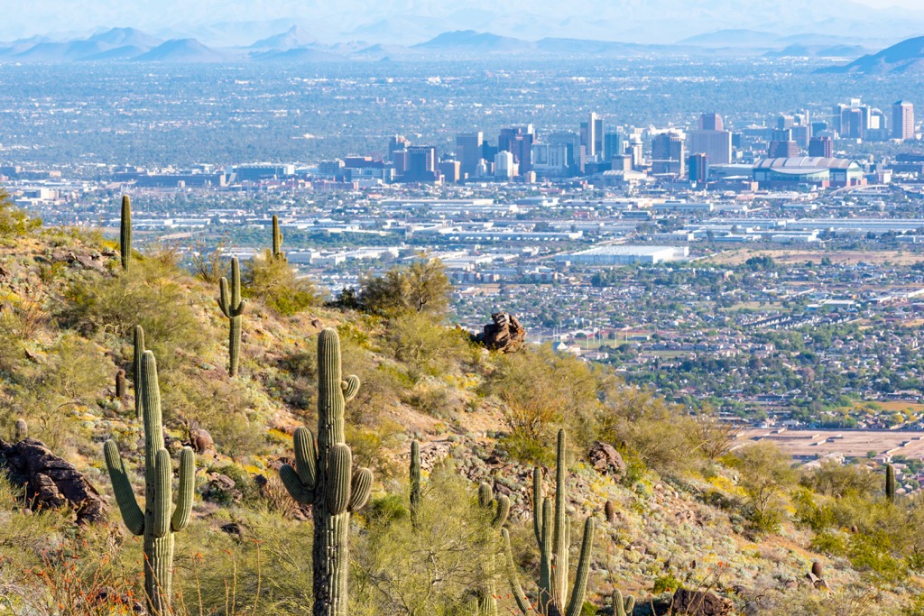
Phoenix lies a short drive north of the national monument, marking the closest major city. With a metro population of over 1.6 million people, Phoenix marks the most populous region in the state.

Despite its relatively large population, Phoenix is surrounded by protected lands ideal for year round outdoor recreation. Popular nearby attractions include Tonto National Forest, Prescott National Forest, and Coronado National Forest.
Besides the natural beauty of the region, Phoenix is also home to dozens of museums, showcasing the art, culture, and history of the region. The downtown streets offer a thriving food scene along with the Desert Botanical Garden. Taliesin West, the former residence of the famous architect Frank Lloyd Wright, is located in Phoenix.


