Scan the QR code and open PeakVisor on your phone
The Apache-Sitgreaves National Forests are an outdoor recreation area located in the US states of Arizona and New Mexico. The forests feature a diversity of landscapes and 206 named mountains. The highest peak in the forests is Escudilla Mountain at 10,876 ft (3,315 m) and the most prominent peak is Maple Peak with 2,392 ft (729 m) of prominence.
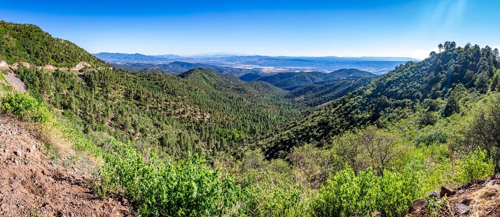
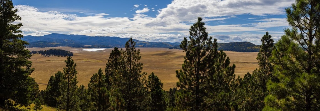
The Apache-Sitgreaves National Forests span across east-central Arizona and a small part of extreme western New Mexico. The forests contain a diverse range of landscapes that covers 4,315 sq. miles (11,175 sq. km) of area, making it the second largest national forest in the state.
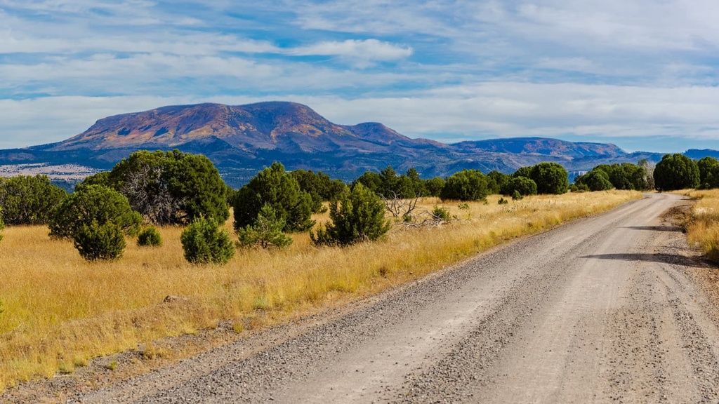
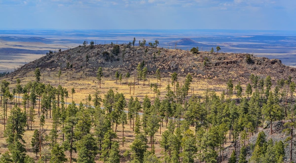
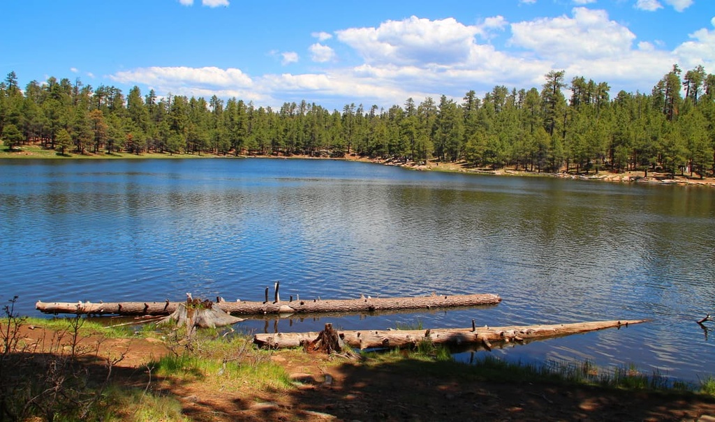
Elevations in the forests range from 3,500 ft (1,067 m) up to the summit of Escudilla Mountain. Some of the most prominent features found within the forests include the Mogollon Rim and the region’s eight cold water artificial lakes.
The Mogollon Rim features some of the highest peaks in the region, as it stands at 7,600 ft (2,316 m) in elevation. The Rim spans 200 miles (322 km) across the region from the city of Flagstaff to New Mexico.
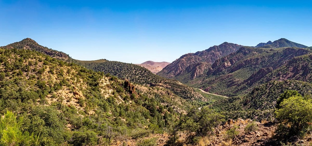
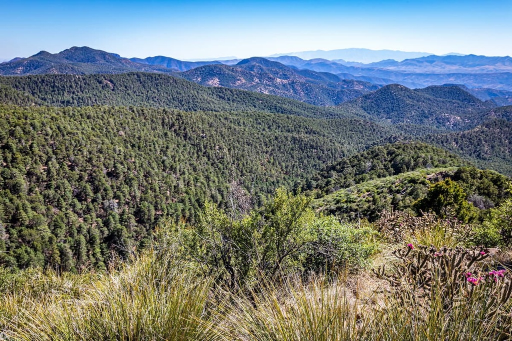
The forests feature a diverse range of landscapes, ranging from a rocky barren desert to densely forested hillsides that are full of wildflowers. The region between Mount Baldy and Escudilla Mountain is commonly referred to as the White Mountains.
Additionally, the Mogollon Rim transitions in the Hannagan Meadow before dropping in elevation to the high desert. There are three wilderness areas within the forests, the Mount Baldy Wilderness, Escudilla Wilderness, and Bear Wallow Wilderness.
Throughout the forests, there are over 680 miles (1,094 km) of lakes and streams along with 34 lakes and reservoirs. The numerous waterways have made the region known for one of the best forests for fishing in the country. Furthermore, the headwaters of the Black River, Little Colorado River, and San Francisco River are all located within the White Mountains.
Nearly 1,000 miles (1,609 km) of trails wind through the diverse array of landscapes found throughout the forests, so it’s a great place to visit for an outdoor adventure..
Additionally, Apache-Sitgreaves National Forests are surrounded by other popular outdoor recreation areas. For example, Tonto National Forest lies to the southwest, Coconino National Forest and Kaibab National Forests lie to the northwest, Prescott National Forest sits to the west, and Petrified Forest National Park lies to the northeast.
The Apache-Sitgreaves National Forests lies within the Arizona transition zone, which is situated between the Colorado Plateau to the north and the Basin and Range region to the south.
The Mogollon Rim that runs through the forests marks the southern border of the Mogollon Plateau region of the Colorado Plateau. The plateau region is known for being geologically stable as it has experienced minimal folding and thrusting over the last 600 million years.
The peaks surrounding the forests include the rugged Rocky Mountains, which date back to around 80 million to 55 million years ago. This range formed during the Laramide orogeny, which caused some surface-level changes to the Apache-Sitgreaves National Forests region of the Colorado Plateau.
Rocks found in the nearby Grand Canyon date back nearly 2 billion years. Both igneous and metamorphic rock can be found throughout the region. The landscape within the forests has been drastically shaped by erosion over the course of millions of years.
The rivers still present within the forests showcase some of the final remnants of the once vast rivers that carved out the region’s modern landscape. As the Colorado Plateau began to tilt, the angle of the rivers steepened, giving them more power to create the valleys that exist in the region to this day.
Major peaks within the forest include Escudilla Mountain, Maple Peak, Mitchell Peak, Rose Peak, Maverick Hill, and Blue Peak.
The Apache-Sitgreaves National Forests is home to a wide range of both flora and fauna. This diverse landscape allows for over 400 species of wildlife to flourish.
Larger animals found in the forests include antelopes, elk, deer, bighorn sheep, mountain lions, and black bears. The Mexican gray wolf was recently reintroduced to the region, too. Other common animals found throughout the forests include wild turkeys, along with a variety of songbirds and fish.
Drastic changes in elevation found across the vast forest allow for numerous ecosystems to coexist within the region. The forested areas of the national forests consist mostly of ponderosa pine and Arizona sycamore.
Other trees and shrubs found in the forests include brittlebush, desert willow, and creosote. The drier desert landscapes in the forest are home to numerous species of cacti and succulents. Some common species include fishhook barrel cactus, cholla cactus and prickly pear cactus. Visitors may also spot agave, sotol, and banana yucca in the desert portions of the forests.
Wildflowers thrive alongside the various streams and rivers in the Apache-Sitgreaves National Forests. Common flower species include cornflowers, larkspurs, shirley poppies, and red flax.
Humans have inhabited the region surrounding what are now the Apache-Sitgreaves National Forests for thousands of years. Prior to the arrival of European colonizers and settlers, Indigenous groups lived throughout the land in established communities.
Rock art found in the region dates back between 900 and 600 years ago. Petroglyphs found near Blue Crossing Campground are thought to be 800 years old.
Some of the earliest traces of human settlement in the region are thought to be from the Hokoham, a hunter gatherer culture. Over the course of hundreds of years, their cultural practices transitioned to also include farming, craftsmanship, and trading with other communities.
A lack of rainfall throughout Arizona led the Hohokam people to build hundreds of miles of canals to divert water from the major rivers in the region. However, it’s believed that the region’s aridity ultimately led the Hohokam, Salado, and other Indigenous tribes to leave the region during the fifteenth century, many of whom would never return.
Many of the descendants of these people are now citizens of the Pima, Hopi, and Zuni tribes. The Indigenous people who continued to inhabit the region were forcibly removed from and killed on their homelands with the arrival of settlers of European descent.
Throughout the nineteenth century, the US Army forced the remaining Apache and Yavapai peoples onto reservations.
Today, the forests share borders with the White Mountain Reservation of the White Mountain Apache Tribe. Other nearby reservations include San Carlos Apache Reservation of the San Carlos Apache Nation and the Fort McDowell Yavapai Reservation of the Fort McDowell Yavapai Nation.
After the removal of Indigenous tribes, many settlers began inhabiting the region. A majority of the early settlers were miners, ranchers and Mormon missionaries.
The Sitgreaves National Forest was established in 1908 and included portions of the present-day Black Mesa and Tonto National Forests. The Apache National Forest was also established in 1908 and would later be combined with the Sitgreaves National Forest in 1974.
The Apache-Sitgreaves National Forests are home to numerous trails for outdoor adventure. Here are some of the top hiking areas to visit in the national forests.
The Springs Trail is one of the most popular hiking routes in the forest. The loop trail is 3.4 miles (5.5 km) in length and it has 114 ft (35 m) of elevation gain. P
ine trees can be spotted throughout this trail along with towering rock formations. A small creek runs along the route, creating numerous small ponds for visitors to enjoy.
This route loops around Woods Canyon Lake, and it is 3.7 miles (6 km) in length with 157 ft (48 m) of elevation gain.
The trail offers views of the lake as it winds through the dense forested landscape. Camping, fishing, and swimming are all allowed in the area, making it a popular spot during the warm summer months.
The Panorama Trail is another popular loop trail situated near Lakeside, Arizona. The route is 9 miles (14.5 km) in length with 698 ft (213 m) of elevation gain.
Situated along the Arizona transition zone, hikers on this trail can enjoy views of the varying landscapes to the north and south. There are also numerous other trails in the region that make it easy to customize and extend this hike to suit your needs.
The Apache-Sitgreaves National Forests are home to four National Recreation Trails, which include Eagle, Blue Ridge, Escudilla, and General George Crook. Some barrier-free trails and drives in the area that are worth checking out include Mogollon Rim Interpretive Trail, Mogollon Rim Scenic Drive, and Pintail Lake Wetland.
Looking for a place to stay near Apache-Sitgreaves National Forests? Here are some of the best cities and villages to check out in the region.
Springerville lies near the eastern edge of the national forests and is home to the Forest Supervisor’s Office. Home to around 1,800 residents, the town of Springerville serves as a gateway to the White Mountains both within and outside of the forests’ boundaries.
The town is situated near numerous cultural, historical, and geographic sites. One of the major sites is Casa Malpaís, an archeological site that dates back to the time of the Ancestral Puebloans.
One of the twelve Madonna of the Trail monuments also lies within the town center. The Sunrise Ski Resort is also a short drive away, and it provides ample opportunities for winter recreation.
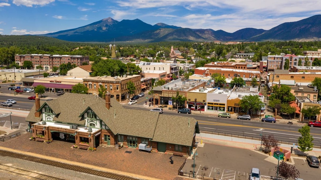
Flagstaff is a city that lies to the northwest of the national forest. With a population of around 140,000 residents, Flagstaff has garnered itself a reputation of being a hub for outdoor adventure. Numerous trail running and biking trails can be found within the city and its surrounding landscapes.
Flagstaff is surrounded by one of the largest contiguous ponderosa pine forests in the entire country, and it sits at an elevation of around 7,000 feet (2,133 m), making it a popular place for athletes who want to train at higher elevations.
The Grand Canyon also lies less than an hour's drive to the northwest of the city, and it draws millions of tourists each year. Local shops, restaurants, and breweries are located in the downtown area of the city, too, offering a relaxing end to a day spent adventuring outside.