
Scan the QR code and open PeakVisor on your phone
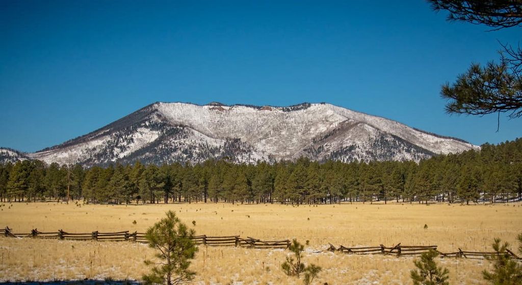
Kaibab National Forest has 159 named peaks. The highest is Kendrick Peak at 3,175 m. Other notable peaks include Sitgreaves Mountain, Bill Williams Mountain and V T Hill.
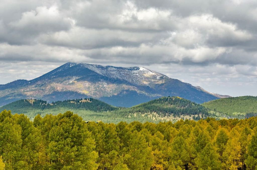
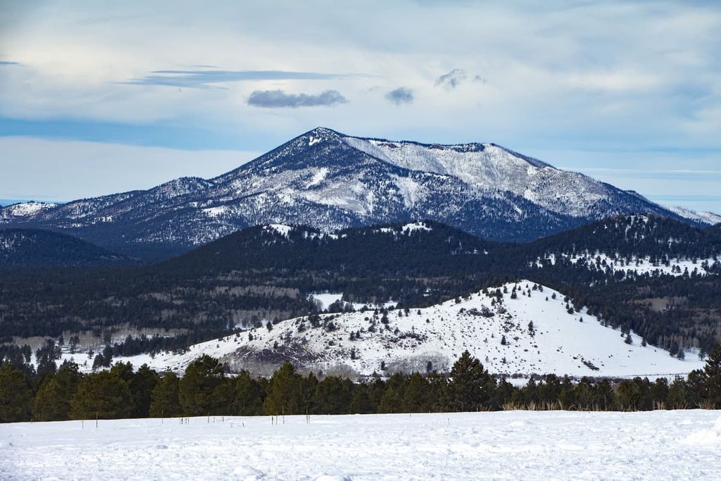
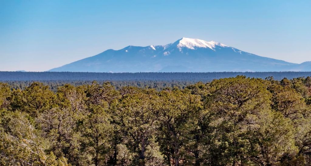
Boasting stunning canyons, dense forests, and vast desert plateaus, the Kaibab National Forest is a sprawling federally managed area of public land located in the north-central part of the US state of Arizona. The forest contains 159 named mountains in its multiple non-contiguous sections, the highest and most prominent of which is Kendrick Peak (10,417 ft/3,175 m).
Kaibab National Forest is a large area of public land located in the north-central part of the US state of Arizona. The forest is located in Coconino, Mohave, and Yavapai counties to the north of the city of Flagstaff.
As a whole, the Kaibab National Forest contains approximately 1.6 million acres (650,000 ha) of land. This makes it a slightly larger than average national forest that’s just barely smaller than the Cibola, Deschutes, and Bitterroot national forests in New Mexico, Oregon, and Montana/Idaho, respectively.
It is split up into two primary sections that are separated by the lands of Grand Canyon National Park. There are also three ranger districts (North Kaibab, Tusayan, and Williams) in the forest.
The aptly named North Kaibab section is located to the north of the Grand Canyon and contains approximately 646,400 acres (261,900 ha) of land. Meanwhile, the South Kaibab section is nearly 1 million acres (404,600 ha) in size.
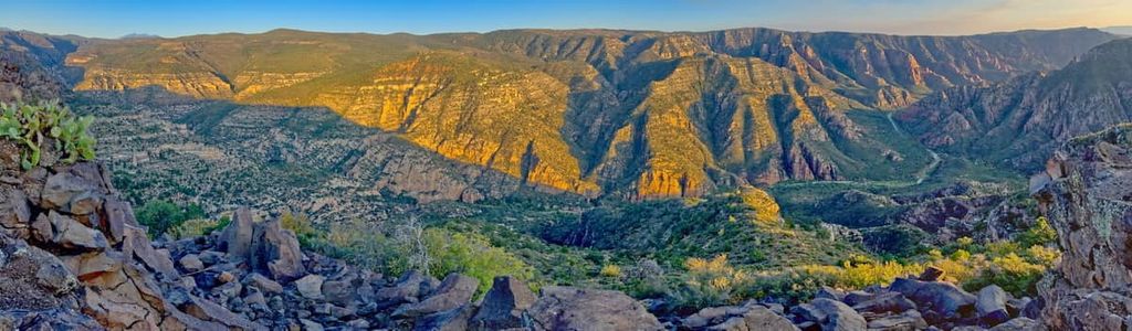
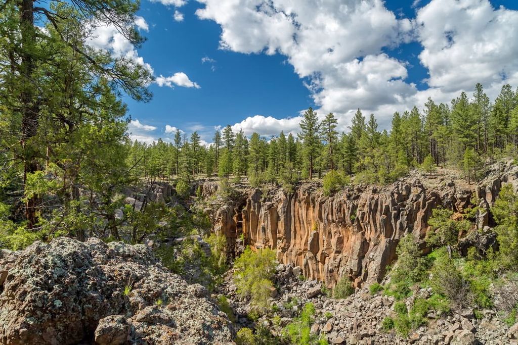
The landscape of Kaibab National Forest is mostly dominated by the mesas, peaks, canyons, and rugged terrain of the Colorado Plateau. Within the forest, there are a number of wilderness areas, including:
Furthermore, the Kaibab National Forest is located within driving distance of a number of very popular areas for outdoor recreation. This includes the Coconino National Forest to the east, the Prescott and Tonto national forests to the south, and both Grand Canyon National Park and Grand Canyon-Parashant National Monument to the west.
The forest is also located near the Sunset Crater Volcano National Monument, Walnut Canyon National Monument, Pipe Spring National Monument, Wupatki National Monument, the Glen Canyon National Recreation Area, and the Vermilion Cliffs National Monument.
Finally, the land that is now the Kaibab National Forest is located on the ancestral homelands of many Indigenous Nations. This includes a number of Nations that have reservations near the current forest boundaries.
Some of the many Indigenous Nations in the region include the Navajo Nation, the Hopi Tribe, the Kaibab Paiute Tribe, the Havasupai Tribe, the Hualapai Tribe, the Yavapai-Apache Nation, and the San Juan Southern Paiute Tribe.
The land within Kaibab National Forest is predominately part of the Colorado Plateau. There are a number of distinct plateau formations within the forest, including Kaibab Plateau and the Coconino Plateau.
The defining feature of this area is the Colorado River, which winds its way south from Lake Powell toward Grand Canyon National Park. The river snakes its way through steep and rugged canyons that are dominated by sandstones and other sedimentary rocks.
The plateau itself started to form during the Laramide orogeny when it experienced some minor uplift. However, the major uplift of the plateau really began in the Cenozoic. This uplifting event increased the overall gradient of the plateau, leading to widespread erosion and the formation of the many canyons we see in the region today.
It’s also worth mentioning that the Kaibab National Forest, particularly in the north, is home to a wide range of different fossils. Limited fossil collecting is usually allowed in the forest, but be sure to contact a forest ranger for more information before you start accumulating fossils.
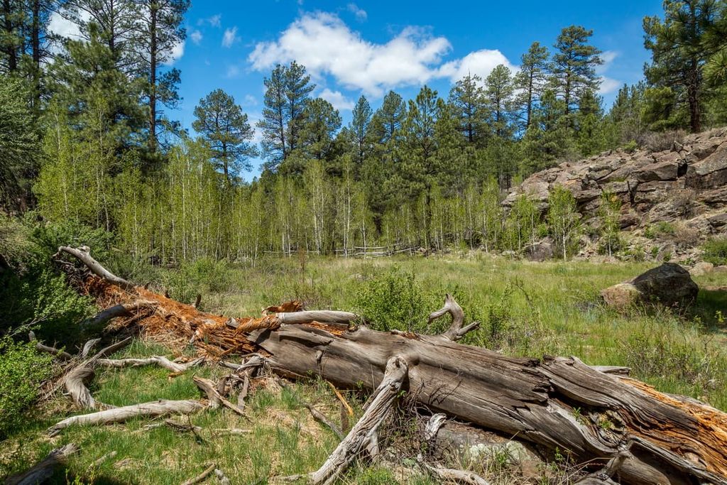
Kaibab National Forest is home to a diversity of different ecosystems. The vast land area within the forest allows for a plethora of plants and animals to thrive despite the extreme heat that often persists during the summer months in the region.
Furthermore, the great difference in elevation within the forest, which ranges from 5,500 to about 10,500 feet (1,676 to 3,200 m), supports an array of plant communities. In the lowest elevation regions in the forest, the landscape is mostly dominated by sagebrush, butterbrush, cliffrose, and Gambel oak.
Meanwhile, higher elevations are home to a variety of tree species, including juniper, piñon pine, blue spruce, Engelmann spruce, and Douglas fir. In fact, some of the Kaibab National Forest is part of the largest contiguous stand of ponderosa pine in the county. This stand can be found near the rims of the Grand Canyon.
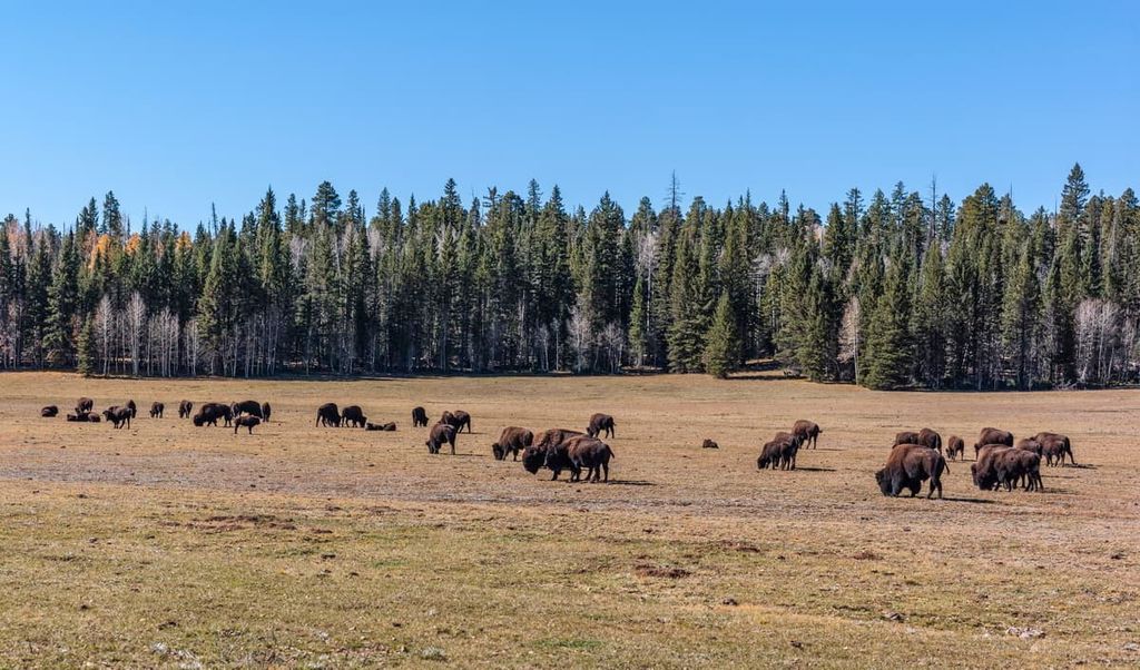
As far as wildlife goes, the Kaibab National Forest has no shortage of plant and animal species. Commonly spotted species include wild turkeys, elk, mule deer, white-tailed deer, and pronghorn. Furthermore, the forest is home to an array of black bears, bobcats, and mountain lions, though spotting one isn’t overly likely.
Additionally, you may see some bison roaming around in the forest. These bison aren’t native to the region, though they were introduced in the 1900s in an attempt to cross breed them with cattle on some of the nearby ranches. Nowadays, the state of Arizona issues hunting permits for the bison.
The land that is now part of Kaibab National Forest has a long and storied history of human inhabitation that dates back countless generations. Many tribal nations consider this land to be part of their traditional territory, including many of the sovereign nations that have reservations near the forest today, such as the Navajo Nation, Hopi Tribe, Havasupai Tribe, and the Hualapai Tribe.
The first peoples of European descent to visit the region were likely Spanish conquistadors and missionaries. This includes people like Francisco Garcés, who is known to have traveled to what is now Tuba City in the 1770s.
Mormon settlers started to settle the land in southern Utah and northern Arizona around the late nineteenth century. In fact, people affiliated with the Mormon Church claimed to have founded what is now Tuba City in 1872. Regardless of the truthfulness of that claim, we do know that John Wesley Powell led an expedition down the Colorado River and into the Grand Canyon in 1871–72.
During the late 1800s and the early 1900s, the region saw an influx of settlers from the eastern US, particularly around Flagstaff. The city became a popular destination as it was one of the largest cities on the railroad line at the time. It also became an important transportation hub after the completion of Route 66.
In 1893, part of what is now the North Kaibab Ranger District was set aside as part of the Grand Canyon Forest Reserve. In 1906, part of the forest reserve was set aside as a game preserve and was renamed Kaibab National Forest. Later, in 1908, President Theodore Roosevelt established the Grand Canyon National Monument, which would later become a national park.
After a period of intense debate and multiple land transfers, the Kaibab National Forest lost a sizable amount of its land to Grand Canyon National Park in 1927 to allow it to develop more tourist facilities. In 1934, the Kaibab and Tusayan national forests emerged to form the Kaibab National Forest that we know of today.
About one decade later, in 1941, the Kaibab Plateau-North Rim Parkway (Arizona State Route 67) was completed. This is one of the southwest region’s two National Scenic Byways and it’s a fantastic road to drive if you want some excellent views of the region.
The Kaibab National Forest has no shortage of outdoor recreation opportunities. Here are some of the best hikes to check out in the forest:
The Rainbow Rim Trail is one of the most popular hiking and mountain biking trails in the entire forest. It’s 36 miles (59 km) round-trip, so it makes for a fantastic long day of walking or biking.
The trail is actually a collection of paths that connects five different overlooks over the Grand Canyon. These overlooks are called “Points,” and the five on the trail are Timp, North Timp, Locust, Fence, and Parissawampitts. From each overlook, you get a different perspective of the stunning Grand Canyon and the surrounding landscape.
Do note, however, that there is no water on this trail, so you will need to carry everything you need for your adventure. It can also get very hot on the trail during the summer months, so this hike is best done in the spring or fall.
The 12.1 mile (19.5 km) long Sycamore Rim Trail offers a unique chance to see the upper parts of Sycamore Canyon. There are multiple access points for this trail, all of which provide superb views of the surrounding landscape and an opportunity to visit some natural springs.
Also note that Sycamore Falls is one of the more popular rock climbing areas in the region. You’re likely to see climbers if you venture out on the trail during the weekend.
Additionally, keep in mind that this trail has been known to close due to forest fires. Always check the trail’s current conditions and opening status before leaving home to avoid disappointment.
If you’re looking for some of the best views in north-central Arizona, the Kendrick Trail might be what you need. This trail gives you the opportunity to climb the highest peak in the forest—Kendrick Peak.
On this 9.4 mile (15.1 km) round-trip hike, you’ll begin in a beautiful ponderosa pine forest before you start quickly making your way uphill. You’ll soon pass by a historic cabin and then make your way up to the ridge that leads to the summit.
At the summit of Kendrick Peak, you can get superb views of Humphreys Peak to the east and even the Grand Canyon in the north. The summit actually has a fire lookout at the top, too, and a platform for enjoying a snack before you head downhill.
Perfect for folks who want just a short jaunt into the wilderness, the Keyhole Sink Trail is a 1.5 mile (2.4 km) roundtrip walk that takes you to see one of the best vistas in north-central Arizona.
This trail ventures into a scenic box canyon that’s home to a number of important cultural sites. This includes a number of petroglyphs and other artefacts that were created more than 1,000 years ago.
If you do venture to Keyhole Sink, please note that the area is both ecologically and culturally important. The Sink is one of the few natural oases in the forest, so it is an important water source for wildlife. Therefore, visitors are asked to stay on the trail to avoid damaging the flora in the oasis.
Additionally, visitors are reminded that the cultural sites in Keyhole Sink are federally protected. Vandalism of the sites is illegal and it causes, in some cases, irreversible damage to sacred works of art. Please do not touch the petroglyphs or any other artefacts in the Keyhole Sink. Furthermore, if you see any vandalism at the site, please report it to the forest rangers as soon as possible.
There are a number of fantastic accommodation options for any kind of trip into Kaibab National Forest. While there are plenty of hotels to stay in outside of the forest boundary, here are some of the top ways to spend a night in Kaibab National Forest:
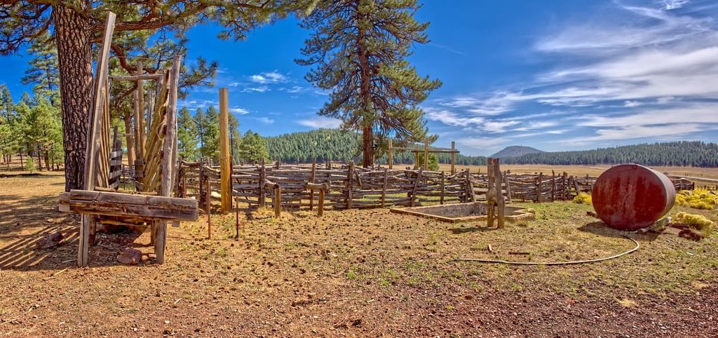
There are a number of different developed campgrounds within Kaibab National Forest. Some of the campgrounds in the forest accept reservations while others are available on a first-come, first-served basis.
Furthermore, some of the campgrounds offer a more basic experience with limited amenities, while others have picnic tables, grills, fire rings, and space to support RVs or trailers. The various campgrounds in the forest include:
For all reservations at the forest’s campgrounds, head to Recreation.gov or call the Forest Service directly.
Additionally, there are a number of cabins for rent in the Kaibab National Forest. Reservations are usually required months in advance and can be made either on Recreation.gov or by calling the Forest Service directly. The cabin rental options include:
Some of these locations are historic building complexes with a number of cabins on-site. In these situations, each cabin comes with an assortment of different beds and the complex usually has a shared toilet and shower facility. Some of these cabins have electricity and water on-site.
Other cabins are simpler and more remote destinations. For example, the Jumpup Cabin is a single, two-room historic building with no water or electricity. Others, such as the historic Hull Cabin, have a single bedroom, a fully equipped kitchen, and a solar shower with a vault toilet. So, there’s something for everyone in Kaibab National Forest.
With relatively few exceptions, the entirety of Kaibab National Forest is open for dispersed camping outside of a developed campground. However, there are a few rules that visitors need to follow.
First, note that you can actually drive up to 30 feet (9 m) off the side of a road to find a campsite if you’re looking to car camp. If you want more information about car camping outside of designated campgrounds in the forest, check out the frequently updated Motor Vehicle Use Map.
For more remote camping trips, all Leave no Trace principles should be followed while in the forest.
You are allowed to camp anywhere so long as you are more than 1 mile (1.6 km) away from any campground or developed area in the forest. You must also be at least 0.25 miles (400 m) away from any watering hole in order to protect wildlife and you must abide by any fire restrictions.
Finally, note that you may only camp in Kaibab National Forest for a maximum of 14 days in a 30 day period. This includes both developed and dispersed camping within the forest boundaries.
Despite the remoteness of much of the land within its borders, Kaibab National Forest is located within driving distance of a number of major cities and towns in northern Arizona and southern Utah. Here are some of the best places to check out if you’re looking for a place to stay during your adventures:
The city of Flagstaff (Kinłání Dookʼoʼoosłííd Biyaagi) is one of the largest communities in northern Arizona. With an estimated population of about 75,000 people, it is a major metropolitan hub for the region.
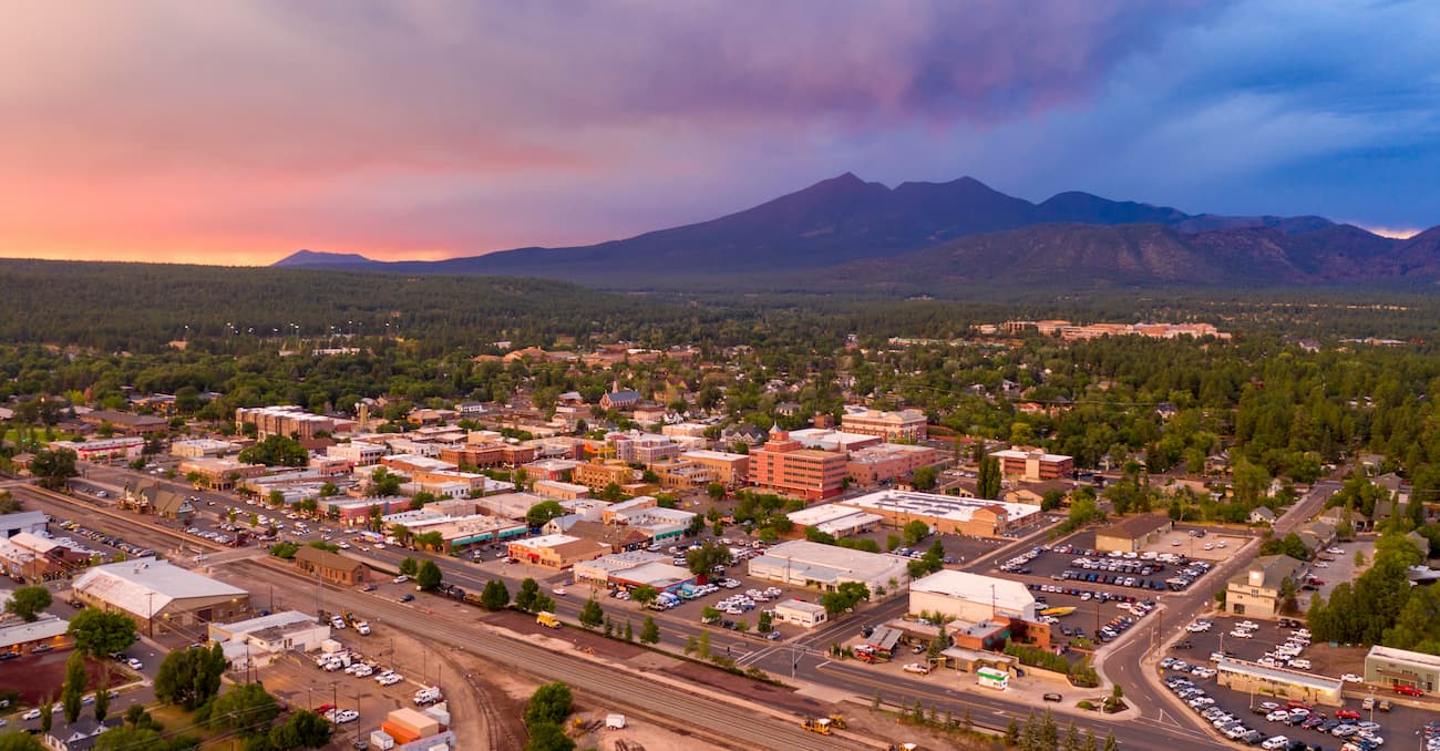
Flagstaff is a popular tourist destination due to its proximity to Grand Canyon National Park. However, the city is a great place to visit in its own right due to its plethora of historic buildings, bustling downtown, and excellent museums. It’s also a designated International Dark Sky City, so it’s a great place to see the Milky Way on a clear night.
Tuba City (Tó Naneesdizí) is a town of approximately 8,600 people located just to the east of Kaibab National Forest. It is the second-largest community in the Navajo Nation and it is situated within the stunning Painted Desert.
These days, Tuba City is not only a great starting point for backcountry adventures, but an excellent place to learn more about the culture of both the Navajo Nation and the Hopi Tribe. Monument Valley Navajo Tribal Park is located near the city, as is the Navajo National Monument and the Explore Navajo Interactive Museum.
The city of Kanab is located just to the north of the Kaibab National Forest in Kane County, Utah. The community is home to approximately 4,800 residents.
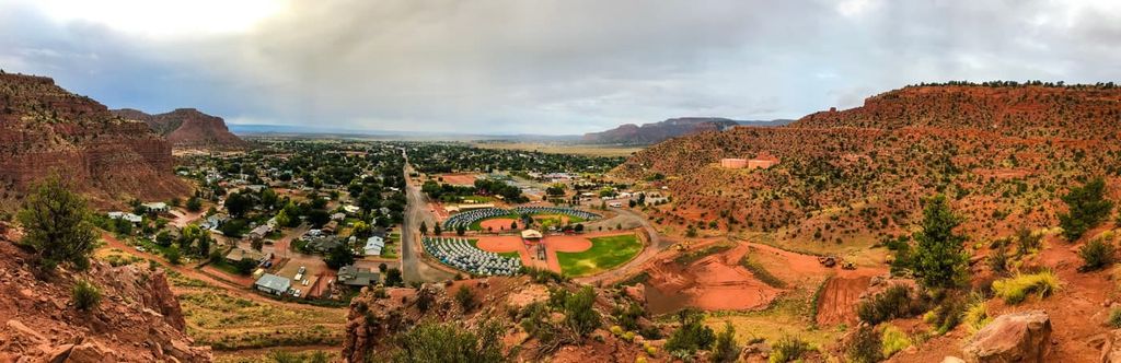
Kanab is considered a fantastic starting point for ventures into Vermilion Cliffs National Monument, Pipe Spring National Monument, the north rim of the Grand Canyon, Grand Staircase-Escalante National Monument, and both Bryce Canyon and Zion national parks.
The stunning landscapes that surround the city have also been used in a number of different films including Gunsmoke, Planet of the Apes, Buffalo Bill, and Stagecoach.
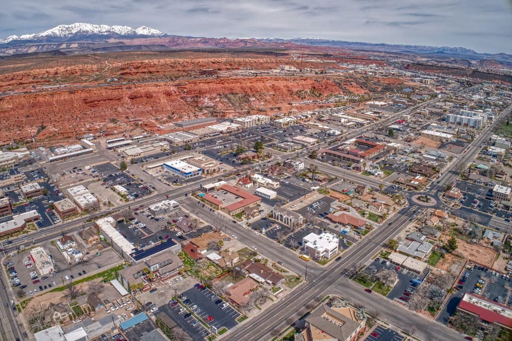
St. George is the largest city near the northern part of Kaibab National Forest. It is situated just north of the Arizona/Utah state line and it offers good road access to Las Vegas. The city is home to approximately 90,000 residents, which makes it the largest community in the state outside of the Wasatch Front.
The city is a popular destination for hikers, mountain bikers, and climbers due to its plethora of nearby outdoor recreation opportunities. It also has a small airport that offers good service to major cities in the western US.


volcano
arizona-10ers
arizona-fire-lookouts
arizona-20-20-challenge
volcano
arizona-10ers
arizona-fire-lookouts
arizona-20-20-challenge
The highest peak in Kaibab National Forest is Kendrick Peak, at 3,175 m.
Notable peaks in Kaibab National Forest include Kendrick Peak, Sitgreaves Mountain, Bill Williams Mountain, V T Hill and Telephone Hill.


