
Scan the QR code and open PeakVisor on your phone
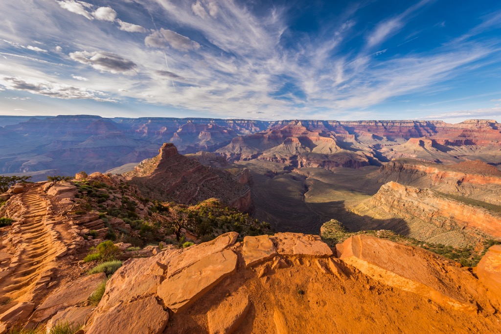
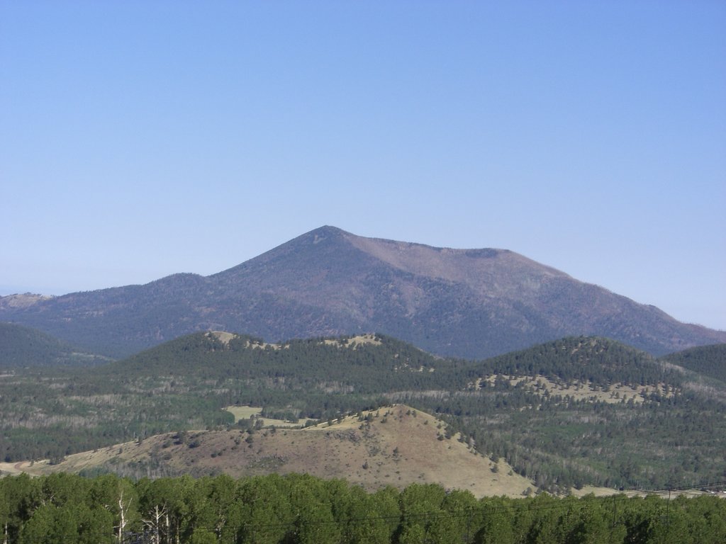
The Coconino Plateau is located on the Colorado Plateau in northwestern Arizona in the United States. The plateau has 210 named mountains. Desert View Point is the highest at 7,493 ft (2,284 m) and Mount Floyd (7,438 ft/2,267 m) is the most prominent (1,667 ft/508 m). Several of the peaks lie within Grand Canyon National Park.
Located on the Colorado Plateau, the Coconino Plateau lies within Kaibab National Forest in Arizona. A portion of the plateau falls inside Grand Canyon National Park, and another portion is encompassed by the Kendrick Mountain Wilderness.
In general, the plateau is situated to the south of the Grand Canyon and northwest of Flagstaff. The peaks range from just under 4,000 ft to 7,438 ft (1,219 m to 2,284 m) at Desert View Point.
Given the range in elevations and various canyons, creeks, and streams that cut through the region, the area is home to a variety of ecosystem types. Some areas boast dramatic desert scenery with cacti, shrubs, and other vegetation well adapted to dry conditions. Others support ponderosa pine, fir, and spruce, and the waterways house biodiverse riparian habitats.
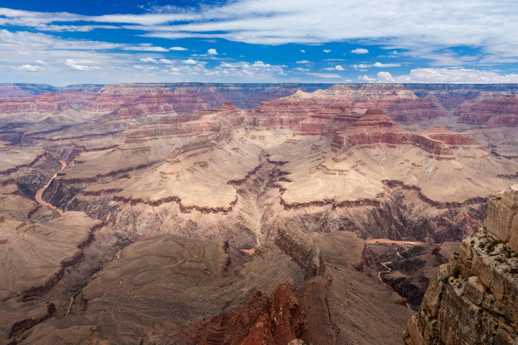
The Colorado Plateau is actually made up of a series of plateaus divided by north-south trending faults and monoclines. The Coconino Plateau is one of these smaller plateaus and houses the San Francisco mountain volcanic field.
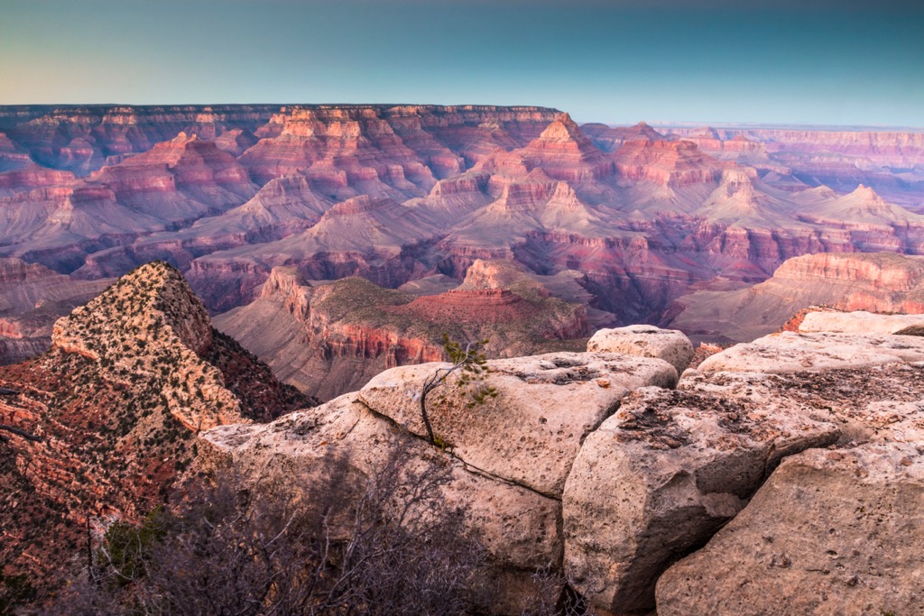
There is exposed Precambrian rock in the uplifts around the Colorado Plateau and in the Grand Canyon. Visible here are older metamorphose gneiss, schist, and younger sedimentary rocks. Layers of limestone, shale, and sandstone were overlaid in subsequent geologic eras.
About 5 million years ago, the Rocky Mountains and Colorado Plateau were uplifted between 4,000 and 6,000 ft (1,220 and 1,830 m). This resulted in the plateau tilting to the north and established the course of present day streams. During the Pleistocene, some glaciers formed at higher elevations. Temperatures were cooler and there was more precipitation which accelerated the rate of erosion.
The region around the Coconino Plateau contains five ecosystem types. Mixed conifer forests of Douglas fir, white fir, Engelmann spruce, and corkbark fir occupy higher elevations. Slightly lower comes the ponderosa pine forest. This forest type supports lupines on the forest floor, and is good habitat for sapsuckers and for the endemic Kaibab squirrel.
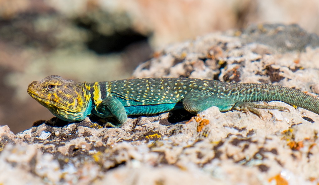
Receiving less precipitation, the pinyon juniper woodland is drier and tends to feature a healthy population of prickly pear cactus. At the lowest elevations, desert scrub fills the dry terrain, featuring cacti, sage, yucca, and blackbrush. Many reptiles prefer this habitat.
Riparian ecosystems along creeks and springs support large terrestrial and aquatic diversity. Cottonwoods and other lush vegetation grows here. Common wildlife across the plateau includes bighorn sheep, skunks, coyotes, rabbits, black bears, and deer.
Forest fires have damaged some areas. In these sections, the conifer forests, aspen stands, and high meadow grasslands are slowly recovering from fire damage.
The earliest humans lived in the region nearly 12,000 years during the end of the last ice age. Later, the Ancestral Pueblo occupied the plateau, followed by the Paiute, Navajo, Zuni, and Hopi. The first foreigners to the region arrived in the mid 1500s – Spanish explorers on the hunt for gold. The late 1800s saw the beginning of an influx of Westerners to the region.
The area around the Grand Canyon was utilized briefly for mining before it became evident that tourism was more profitable. When Grand Canyon National Park was created in 1919, the Havasupai were forced to give up much of their ancestral land. Decades later in 1975, the US government returned large portions of their land to them. Today they make most of their money from tourism, especially via visitors to the cerulean pools and dramatic red rocks of Havasu Falls.
The Coconino Plateau houses multiple trails worth checking out. Some lie within Grand Canyon National Park and others in Kendrick Mountain Wilderness.
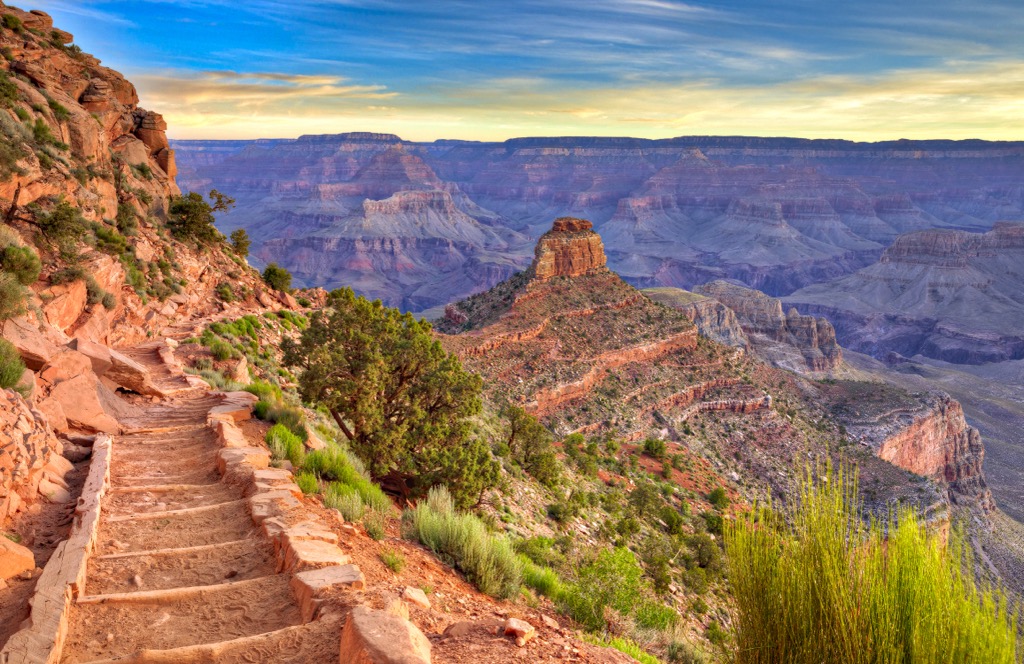
The South Kaibab Trail is located within Grand Canyon National Park along the south rim. The trailhead begins at 7,260 ft (2,213 m) and descends into the canyon. It is a steep trail, though a well maintained dirt path. There is no water available along the trail and not much shade. The views, however, are spectacular.
There are several lookout points along the way – Ooh-Aah Point, Cedar Ridge, and Skeleton Point. If they are used as turn around points on this out and back trail, they make for a 1.8 m (2.9 km), 3 mi (4.8 km), or 6 mi (9.7 km) hike respectively.
The Beale Road Historic Trail is part of a trail that extended 1,240 mi (1,996 km) from Ft. Smith, Arkansas to the Colorado River and was used by ranchers and immigrants moving west in the mid to late 1800s. There are 23 mi (37 km) of this trail within Kaibab National Forest. Motorized vehicles only allowed on sections of the historic road that are currently Forest Service roads.
One of the popular access points is at Laws Spring. This location has rock carvings and it is important to admire without touching since the oils from hands can damage the petroglyphs.
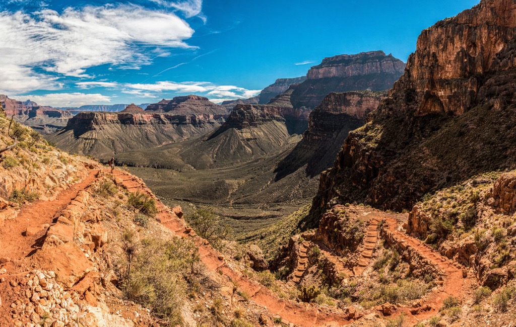
Pumpkin Trail is 9.6 mi (15.4 km) roundtrip. It begins in a forested valley of pine and juniper. From there it climbs through mountain meadows and along an old road up a steep canyon to summit Kendrick Peak (10,417 ft/3,175 m). Those looking for a longer hike can connect with Bull Basin Trail for an 11 mi (17.7 km) trail. There is no water along the way so be sure to carry enough.
There are several small towns around the Coconino Plateau, as well as a handful of campsites and RV parks. Flagstaff is a larger city located to the east and Las Vegas is not far across the Nevada state border.
Flagstaff, Arizona has a population of 77,000 people and is a prime city for enjoying the outdoors and some of the region’s rich cultural and geologic history. The city is surrounded by the world’s largest contiguous ponderosa pine forest. It also receives more than 100 in (255 cm) of snow per year on average, making it a year-round destination for those looking to get outside.
The city is the perfect base for day trips to geologic wonders such as Grand Canyon National Park and Sunset Crater Volcano National Monument, and cultural sites such as Walnut Canyon National Monument and Wupatki National Monument.
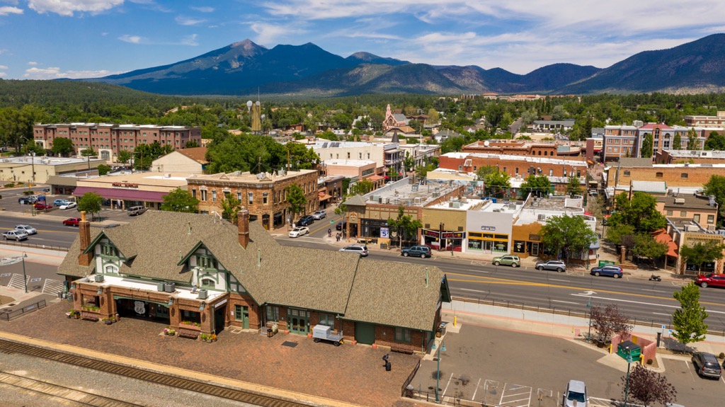
Some of the best restaurants in the city celebrate southwestern cuisine, but there are plenty of excellent dining options ranging from pizzerias to cuisines from around the world. Accommodation is not hard to come by whether you prefer a hotel, motel, B&Bs, campground, or RV park.
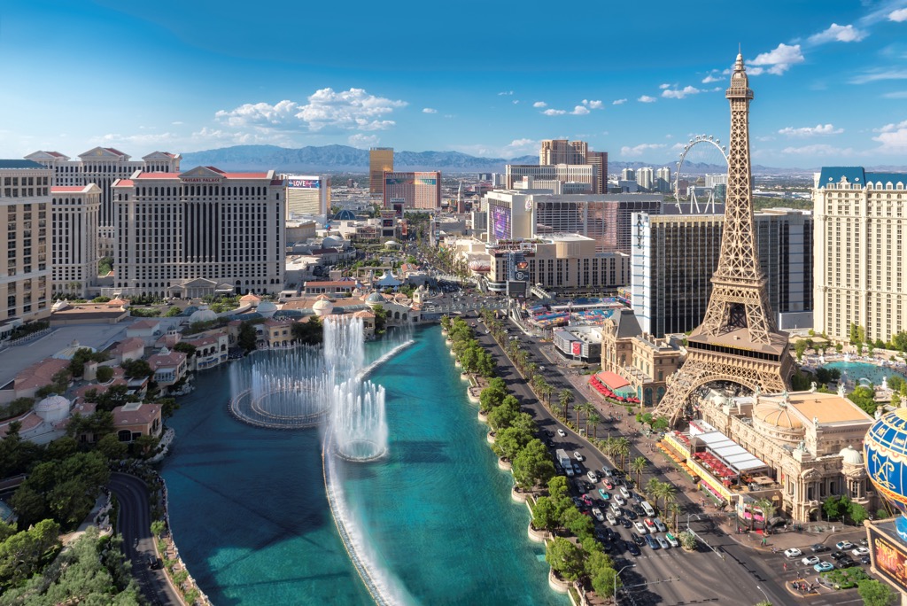
With a population of 647,000 people, Las Vegas welcomes thousands of visitors each year to its vibrant scene of casinos, lounges, concerts, shows, museums, amusement parks, and much more. The city has all kinds of accommodations and dining options, ranging from high end luxury to affordable.
Outside the city center are wildlife refuges and state parks with opportunities for hiking, rock climbing, and boating. There are also campgrounds and RV parks located outside the city for those looking for a more rustic place to stay.


volcano
arizona-10ers
arizona-fire-lookouts
arizona-20-20-challenge
volcano
arizona-10ers
arizona-fire-lookouts
arizona-20-20-challenge


