Scan the QR code and open PeakVisor on your phone
The Sandia Ranger District is the northeastern part of the extensive Cibola National Forest, which is located just east of Albuquerque in the US state of New Mexico. The Sandia Ranger District is home to two mountain ranges and a forest containing a variety of biomes. The highest and most prominent peak in the ranger district is Sandia Crest (10,678 ft/3,255 m).
The North Sandia Ranger District is an administrative area of the Cibola National Forest in central New Mexico.
Cibola National Forest is a federally managed outdoor recreation area that contains 1,633,783 acres (661,168 ha) of land and is divided into four ranger districts: Sandia, Mountainair (West and East), Mt. Taylor (West and East), and Magdalena (East, South, and North).
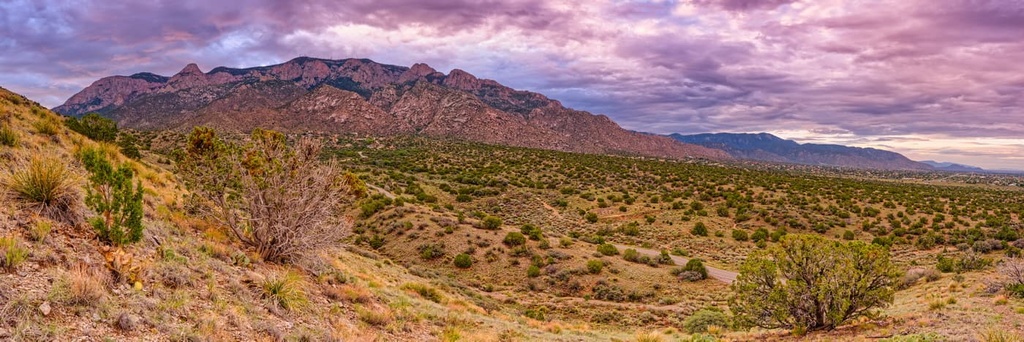
The majority of the Sandia Ranger District consists of the Sandia Mountains and the Manzanita Mountains, which are located to the east and southeast of Albuquerque. It also includes small areas of forest that cover the eastern foothills of these ranges.
In the northern part of the district, the Sandia Mountains are bordered by tribal lands of the Sandia Pueblo. The southern part of the district is surrounded by patches of open space and the rural East Mountains, which are considered part of the greater Albuquerque metropolitan area.
The Cibola National Forest's Sandia Ranger District includes the most visited mountains in the state, the Sandia Mountains. The Sandia District also includes national forest land in eastern Bernalillo and southeastern Sandoval counties.
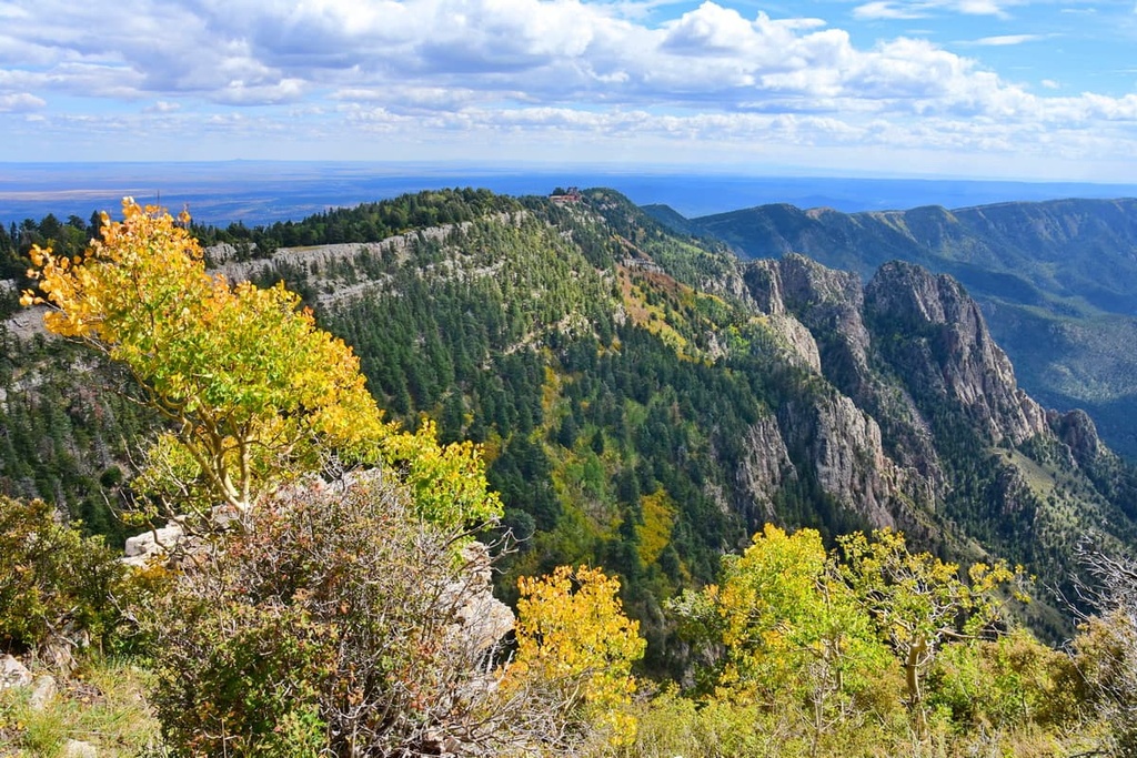
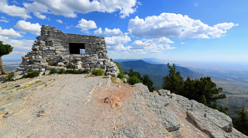
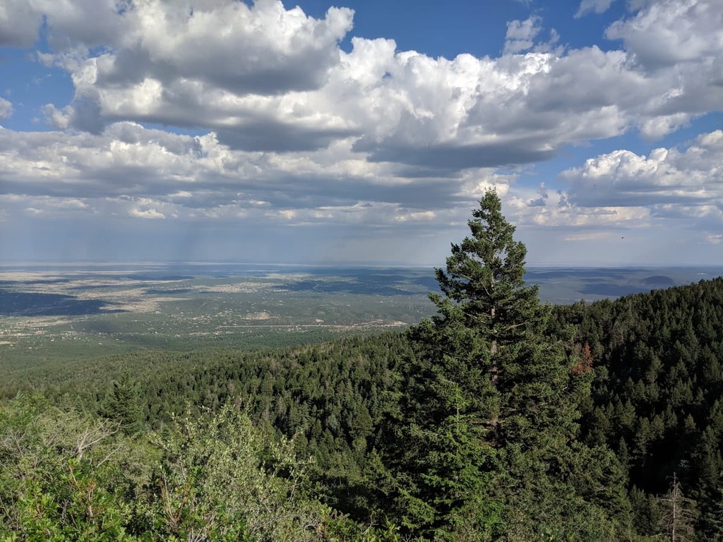
The Sandia Mountains form the northern portion of the Sandia District and include the Sandia Mountain Wilderness (37,200 acres/15,054 ha), which was designated in 1978.
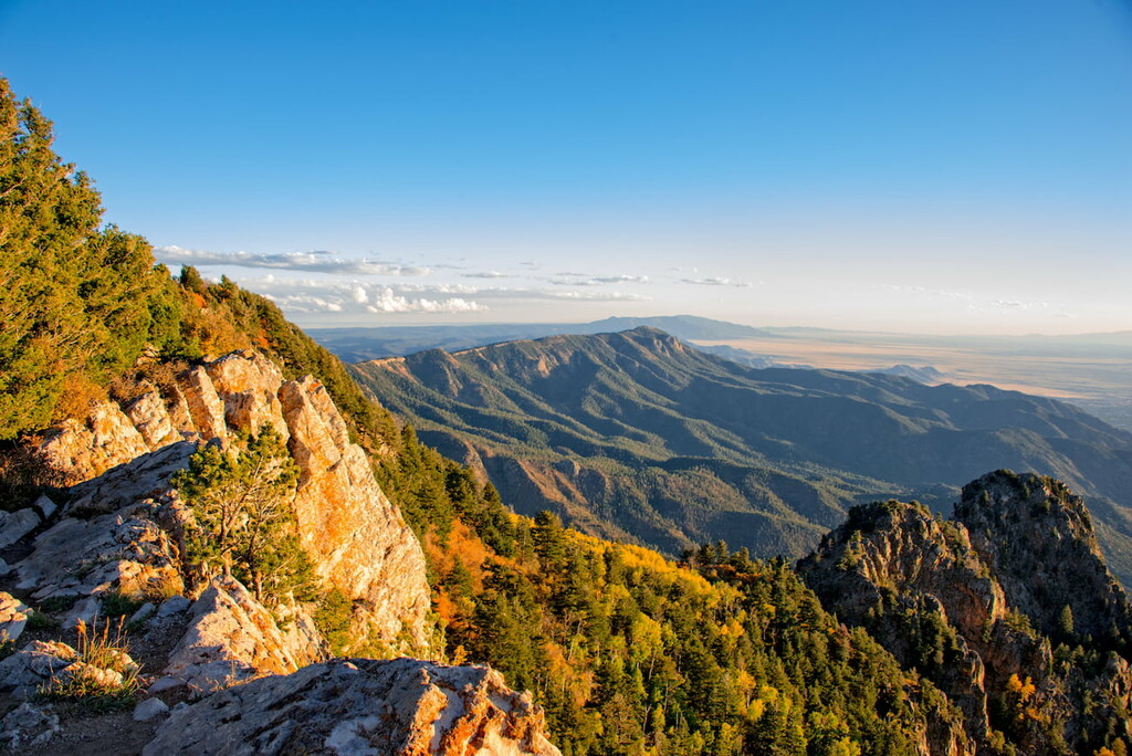
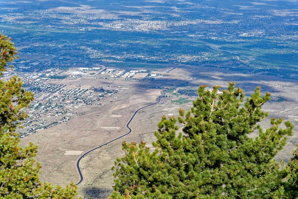
The Sandia Mountains range in elevation from approximately 5,300 ft (1,615 m) in Albuquerque to 10,678 ft (3,255 m) at the range’s highest peak, Sandia Crest. They are roughly 400 square miles (1,036 sq. km) in area.
The range runs approximately 17 miles (26 km) from north to south and between 4 and 8 miles (6 and 12 km) from east to west and contains two major summits: Sandia Crest and South Sandia Peak (9,702 ft/2,957 m).
Nearby points of interest include:
The Cibola's North Sandia Ranger District also includes the lesser-known Manzanita Mountains, which lie just south of US Interstate 40 and the Tijeras Canyon. The Manzanita Mountains separate the Sandia Mountains from the Manzano Mountains, which are managed by the Cibola National Forest's Mountainair Ranger District.
The Manzanita Mountains have an elevation of 6,972 feet (2,125 m) at their highest point, Cedro Peak. The Manzanita Range consists primarily of low ridges and peaks in the foothills of the larger Manzano Range, with many trails accessible near the town of Tijeras.
The trails in this area are used for hiking, mountain biking, two-wheel motorized vehicles, and horseback riding.
A portion of the Manzanita Range is contained within the Military Withdrawal Zone, which has been restricted to public use since 1943.
Nearby points of interest include:
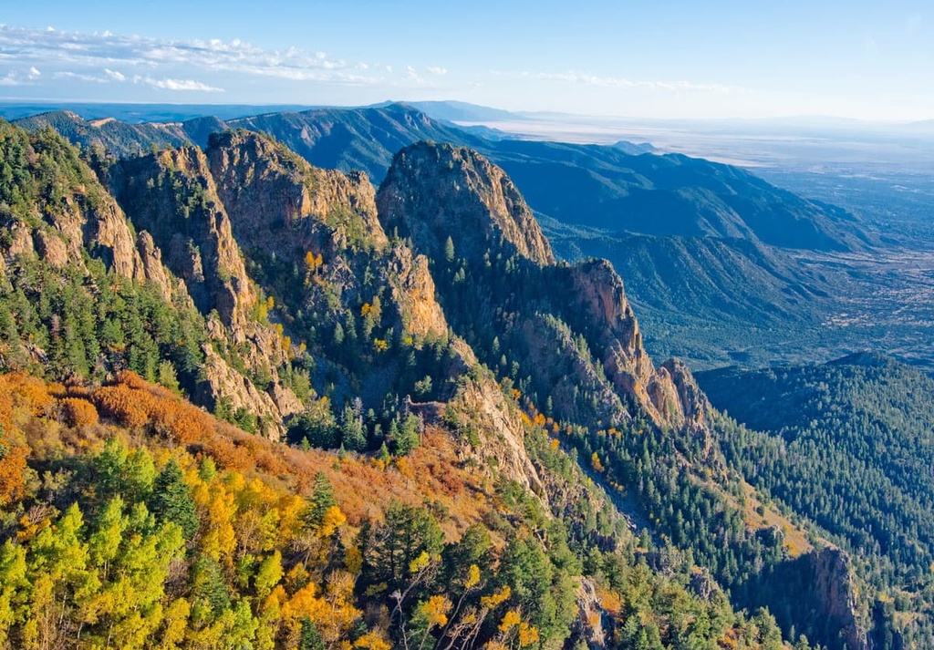
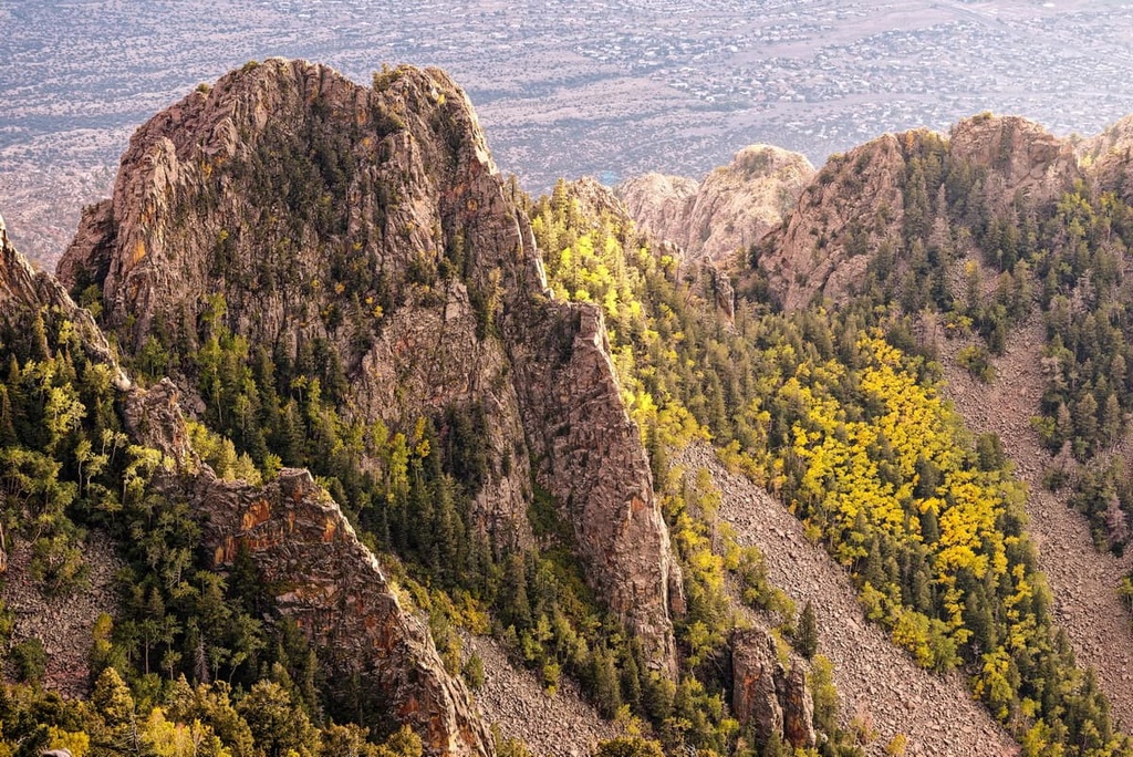
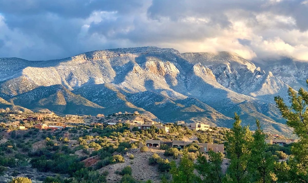
The Sandia Mountains are a small, north to south trending range built by a phenomenon known as rifting. The west side of the Sandias is steep and rugged, characterized by sheer rock walls and towers, especially surrounding the Sandia Crest. The east side of the range, in general, has a gentler slope and lacks the dramatic cliffs and peaks visible to the west.
The Sandia Mountains are a fault block range located on the eastern edge of the Rio Grande Rift Valley. Formed in the last ten million years as part of the Rio Grande Rift, the range is considered the eastern boundary of the Albuquerque Basin.
The core of the range is Sandia granite, which has an estimated age of about 1.4 billion years. In addition, there is metamorphic rock in the range that dates back 1.6 billion years. Atop this is a layer (approximately 300 feet/100 meters thick) of sedimentary rock composed mostly of limestone and sandstone that dates back about 300 million years.
Additional Precambrian rocks found in the range include gneiss, schist, quartzite, and greenstone. Sedimentary rocks ranging in age from Mississippian to Cretaceous are found within and immediately surrounding the mountains.
The limestone in the range contains marine fossils such as crinoids, brachiopods, gastropods, horn corals, and bryozoans, although many of these fossils are too small to be seen with the human eye.
The distinctive pink color that some say is the reason the mountains got their name (sandia means “watermelon” in Spanish) is due to potassium-feldspar crystals embedded in Sandia granite.
The Sandia Mountains are the southern terminus of the Rocky Mountains. They are part of a single larger geologic unit, the Sandia–Manzano Mountains, which also includes the Manzanita Mountains and the Manzano Mountains to the south.
Additionally, the Sandia Mountains are separated from the Manzano Mountains by the Manzanitas and Tijeras Canyon. The canyon is traversed by Interstate 40, which follows the historic US Route 66 (now NM-333).
Historically, there was some mining in the area of the Sandia Ranger District, though no mining currently happens in the region.
La Luz Mine is located at 10,049 feet (3,062 m) in elevation, somewhere off the popular La Luz Trail. Mining operations at La Luz began around 1887 and closed down early in the twentieth century, although the tunnel remained open for another 100 years.
La Luz operations consisted of underground workings in one known shaft that extends 275 ft (84 m). The ore mined is composed of gold and galena with waste material consisting primarily of limonite, calcite, and quartz.
Another abandoned mine can be found off the Strip Mine Trail in the far northern foothills of the ranger district, near Placitas. Little is known about this long-abandoned operation.
The biomes in the Sandia Ranger District are particularly diverse. Within the ranger district, you can find Chihuahuan Desert, which is dotted with a wide variety of cactus and desert succulents, as well as short grass prairies at lower elevation.
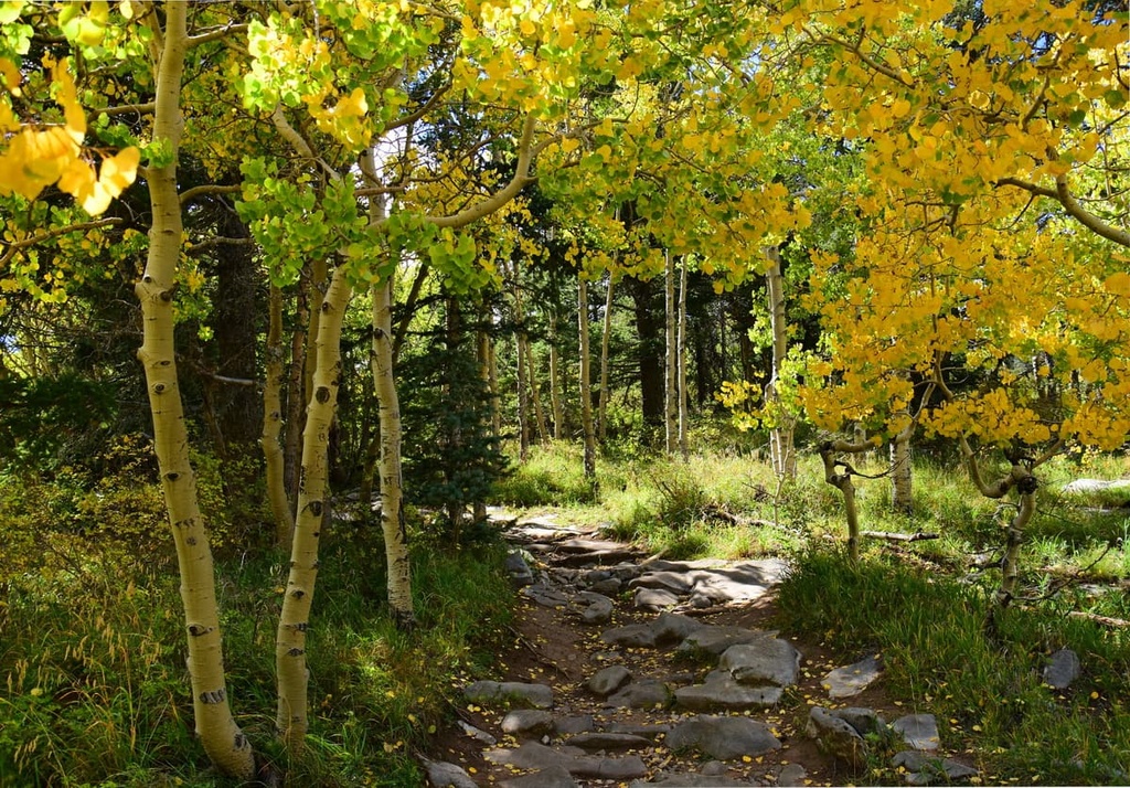
There are also forests of alligator juniper, pinyon pine, Emory oak, and Gamble oak at mid-level elevations as well as subalpine forest at higher elevations that feature ponderosa pine, spruce, fir, and aspen trees.
The Sandia Mountains encompass four different life zones:
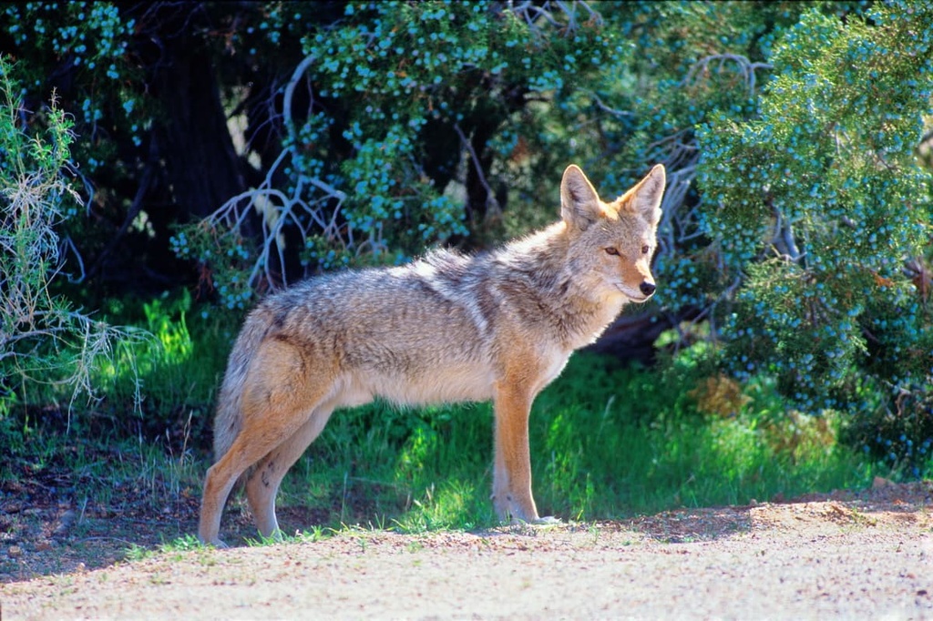
The fauna in the area is equally as diverse, with black bears, cougars, prairie dogs, bobcats, mule deer, Mexican spotted owls, and Albert’s squirrels all calling the region home.
The Manzanita Mountains and Sandia Mountains to the north are home to many raptor species, including ospreys, sharp-shinned hawks, Cooper's hawks, Swainson's hawks, and red-tailed hawks. There are also American kestrel, turkey vultures, golden eagles, northern harriers, peregrine falcons, and merlins.
The HawkWatch International research group also works on public land in the Cibola National Forest to learn more about the region’s raptors and their migration.
Non-raptors bird species found in the area include the migrating sandhill cranes, corvids, nuthatches, warblers, juncos, swallows, woodpeckers, and a variety of hummingbirds.
Cibola National Forest and surrounding area has a diverse and rich human history that is believed to date back to at least 700 CE.
The name cibola (sometimes cevola or sevola), is thought to be the Spanish transliteration of an Indigenous word for pueblo, as recorded by Francisco Vázquez de Coronado. Coronado led an expedition from New Spain (now Mexico) to the area in 1540 in search of the fabled Seven Golden Cities. The Spanish later interpreted cibola to mean buffalo.
Present day New Mexico is home to 23 tribal nations including 19 Pueblo tribal nations, 3 Apache tribal nations, and the Navajo Nation, all of which have called this region home since time immemorial.
In the 1200s, the Ancestral Puebloans abandoned their traditional canyon homelands for unknown reasons. The Tiwas are considered the first of the Tanoan Pueblo people to enter the northern Rio Grande region. Sandia Pueblo was founded around 1300.
The region around the Sandia Mountains is the ancestral home of many Indegenous groups, including the Sandia Pueblo (Tuf Shur Tia), directly adjacent to the Sandia Mountains. Other nearby groups include the Santa Ana Pueblo (Tamaya) to the north west, San Felipe Pueblo (Katishtya) to the north, and Isleta Pueblo (Shiewhibak) to the south, among others.
The Nearby Acoma Pueblo, also called “Sky City,” is located 60 miles (96.5 km) west of Albuquerque. It holds claim to the title of oldest continuously inhabited community in what is now the US, as it dates back to 1000 CE.
Coronado probably visited Sandia Pueblo in 1540. In 1598, Juan de Onate arrived in the area with settlers and founded the colony of New Mexico.
It was the Spanish expedition that gave the Sandia Pueblo people and their mountains the name Sandia. Some say it’s because of the mountain's shape and reddish hue as the sun sets to the west of the range, but another explanation is that they mistook a local gourd, the “coyote melon,” for watermelons. Sandia means “watermelon” in Spanish.
A site of note in the Sandia Mountains is the Sandia Cave, formerly known as the Sandia Man Cave. It is an archeological site within Cibola National Forest that’s located on the steep cliff walls of Las Huertas Canyon.
Excavated in the 1930s and declared a National Historic landmark in 1961, the cave is believed to have been in use by humans from 9,000 to 11,000 years ago.
In the Manzanita Mountains, the Tijeras Pueblo Archeological Site is a late pre-European contact period site in Tijeras that at one time was a thriving village. The site can be visited today and visitors can take a self-guided tour of the ruins.
Hiking trails are plentiful throughout the Sandia District. There are many trails that take you through a variety of terrains and ecological zones. Here are a few of the most popular trails in the ranger district:
More than 100 hiking trails traverse the Sandia Mountains, taking hikers through multiple biomes as they climb in elevation. Trails vary by length and difficulty, so there are hiking opportunities for all levels. Here are a few of the most popular trails.
The Manzanita Mountains are small in comparison to their neighboring ranges, but they are home to a network of trails that allow hikers, bikers, horseback riders, and motorbikers alike to explore the area. Trails can be connected to form longer loops. Here are a few of the most popular trails in the area:
Looking for a place to stay near the Sandia Ranger District of the Cibola National Forest? Here are some of the best cities and towns to check out:
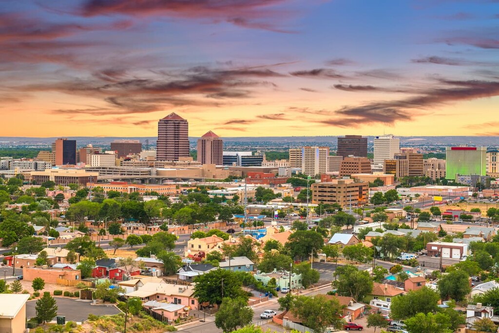
The largest city near the Manzano Mountains is Albuquerque, which is located to the north. New Mexico’s largest city was founded in 1706 as a Spanish colony, although Coronado first settled in the area that is modern day Albuquerque in 1540.
Named after the Viceroy of New Spain, who was also the tenth Duke of Alburquerque, the city served as an outpost on El Camino Real which linked Mexico City to the northern territories of New Spain.
Albuquerque is accessible by plane, train, and bus and is located off of US Interstate 40, as well as the historic US Route 66. Accommodation options include hotels, motels, and Airbnb properties.
Sitting in the high desert at an average elevation of 5,314 ft (1,619 m), the city has a population of 584,000 people. The city’s Old Town central plaza maintains the feel of a Spanish colony thanks to its historic adobe buildings. It also serves as a tourist center with shops and restaurants.
Albuquerque has five museums as well as a zoo and botanic gardens. The Rio Grande runs through the city to the west. The city also hosts the famed International Balloon Fiesta every October, which draws nearly 750,000 people each year.
The nearby Acoma Pueblo, also called “Sky City,” holds claim to the title of oldest continuously inhabited community in the US, dating back to 1000 CE.
Flanking the northern end of the Sandia Mountains, just north of Albuquerque, is Placitas. With a population of around 5,000 people, the small town draws artists and nature enthusiasts alike.
Placitas boasts a grocery store, a few restaurants, an art gallery, a library, a senior center, a dentist, and an independent pharmacy. There are roughly 20 bands of wild horses and nearly 40 miles of trails accessible from the town.
There are several Airbnb lodgings in Placitas as well as hotels, including the Hyatt Regency Tamaya, in the neighboring town of Bernalillo. There are many restaurants, stores, and gas stations in Bernalillo, too.
For a more rural mountain experience, and for easy access to hiking in the Sandia Mountains and Manzanita Mountain, consider staying in Tijeras, which means “scissors” in Spanish.
The southern gateway to the Turquoise Trail, the Village of Tijeras is small and charming, with a population of around 550 people. The village center sits at the only major intersection on Historic Route 66 in the region. It features a bank, a library, a community center, a Subway restaurant, and a feed store.
There is a cafe, a vet clinic, and some other small businesses nearby. There is no public transportation to or in the village, and there are no hotels either. There are a few Airbnb options located nearby.
On the eastern side of the Sandia Mountain range, located on Scenic Byway NM-14, you’ll find Cedar Crest. Bordering Tijeras to the south, Cedar Crest boasts a more diverse selection of shops and restaurants. It also offers access to the Sandia Crest National Scenic Byway that terminates at the Sandia Crest.
Access to public hiking trails in the foothills along NM-14, in the Manzanita Mountains in neighboring Tijeras, and of course in the Sandia Mountain Range. Horseback riding and biking are popular activities in the area.
Accommodations include several cozy mountain retreats, Airbnbs, and a campground with an RV park.
If you continue north on NM-14, you’ll eventually reach the historic coal mining town of Madrid. With a population of about 200 people, Madrid is a postcard photo-like town of the old Wild West with modern-day comforts.
Madrid is an artist community lined with galleries and quirky shops, bars, a cafe, ice cream parlor, and a diner. And don’t miss the photo park, a one-of-a-kind art experience that allows you to take photos with the installations.
At the south end of the town, you can find a mining museum that talks about the history in the area. The town has an inn and a bed and breakfast. There are also a variety of lodgings available on Airbnb.
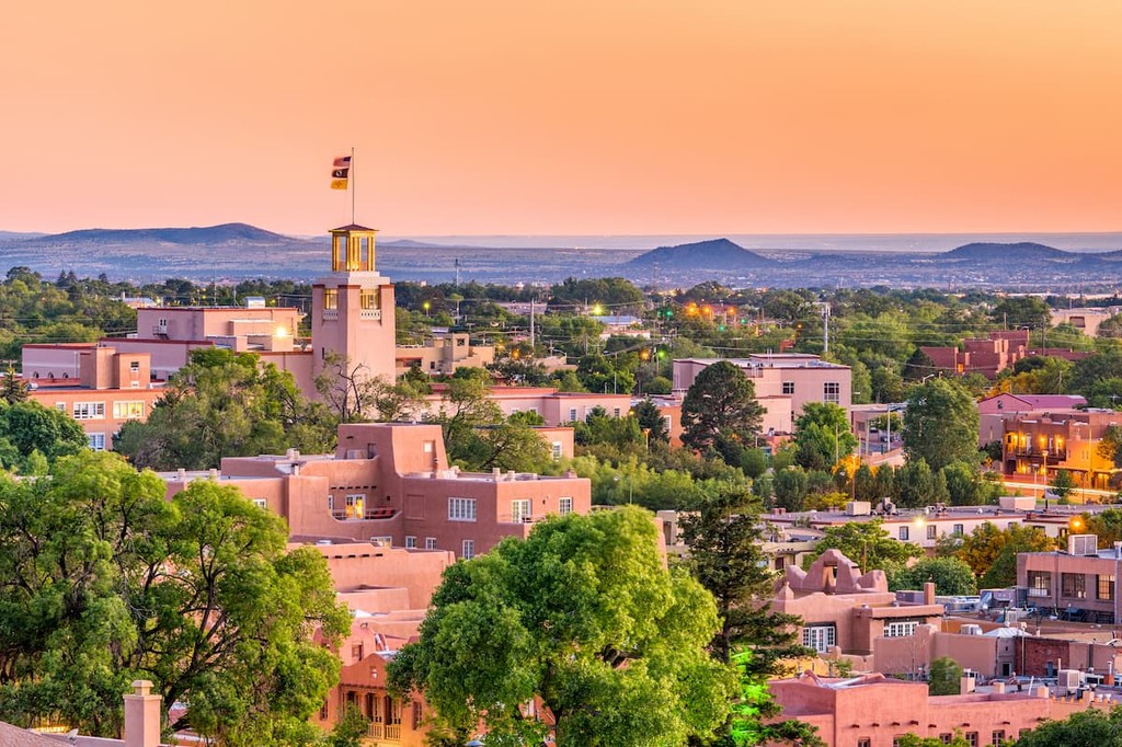
Situated slightly further to the north of the Sandia Mountain Range is the state capital, Santa Fe. Located in the foothills of the southern Rocky Mountains, and sitting at an average elevation of 7,000 feet (2,133 m), Santa Fe is the highest and oldest state capital in the country.
The quaint city, with a population of about 85,000 people, is renowned for its historic architecture, vibrant art scene, and rich history that melds Hispanic, Anglo and Indigenous cultures. The city boasts nearly 250 art galleries as well as dozens of museums, including the popular Meow Wolf.
Accommodation options in the city are diverse and the restaurants are aplenty. Its proximity to mountains and wilderness make Santa Fe a must-see for those who enjoy the outdoors, too. There are also ample hiking and skiing opportunities to enjoy in and around the city.