Scan the QR code and open PeakVisor on your phone
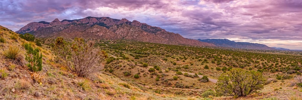
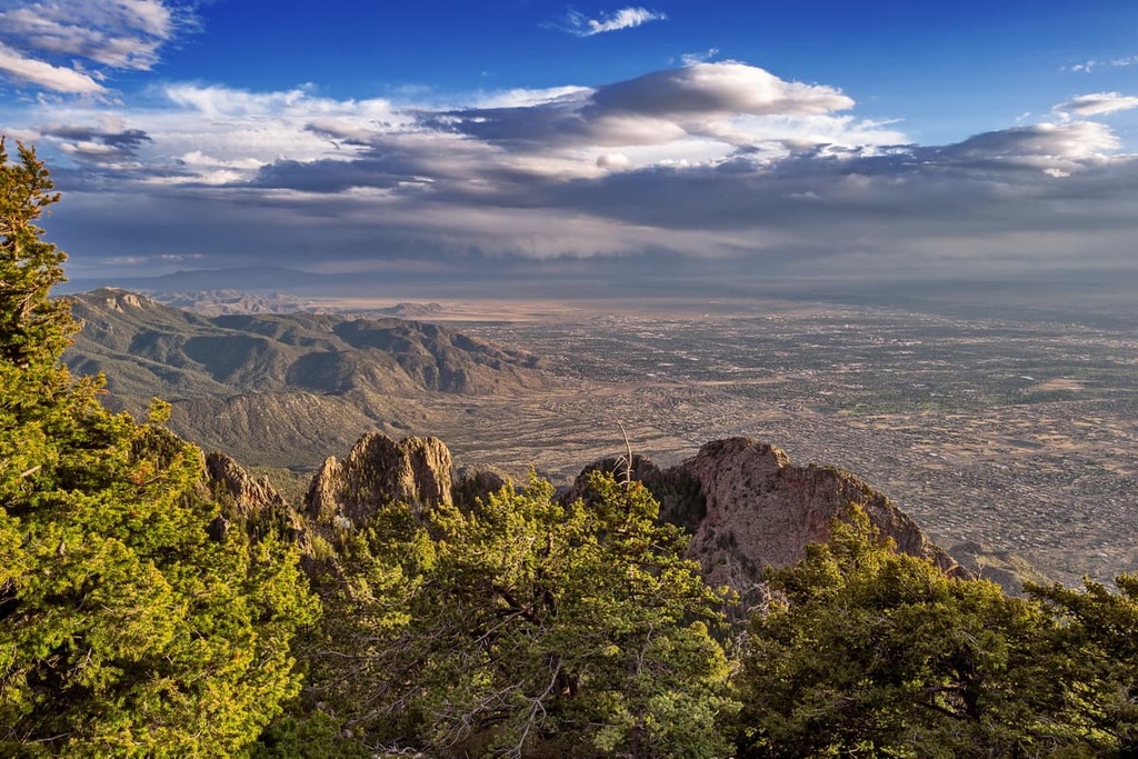
The Mountainair Ranger District is the southwesternmost district of the extensive Cibola National Forest, which is located just to the east of Albuquerque in the US state of New Mexico. Within the ranger district, there are two mountain ranges and a forest that features a variety of biomes. The highest and most prominent peak in the ranger district is Manzano Peak (10,098 ft/3,078 m).
The Mountainair Ranger District is an administrative area of the Cibola National Forest in central New Mexico. Cibola National Forest is a federally managed outdoor recreation area that contains 1,633,783 acres (661,168 ha) of land and is divided into four ranger districts: Sandia, Mountainair (West and East), Mt. Taylor (West and East), and Magdalena (East, South, and North).
The Mountainair District consists of the Gallinas and Manzano Mountains. The Manzano Mountains are located primarily in Torrance County, though a small section of the range is located in Valencia County to the west. The Gallinas Mountains straddle both Torrence and Lincoln counties.
The towns surrounding the Manzano Mountains are small communities that are generally agriculturally based and have very strong ties to the land. Many nearby communities use the land for grazing, gathering herbs and firewood, and recreation.
The closest village to the Gallinas Mountains is the village of Corona. The people of this small, rural community often use the Gallinas Mountains for hunting, collecting firewood, and livestock grazing.
The Mountainair Ranger District also oversees 19 active grazing allotments. Ten of these allotments are in the Gallinas Mountains, while nine are located in the Manzano Mountains. These allotments are grazed seasonally on a rotation schedule that’s overseen by the ranger district.
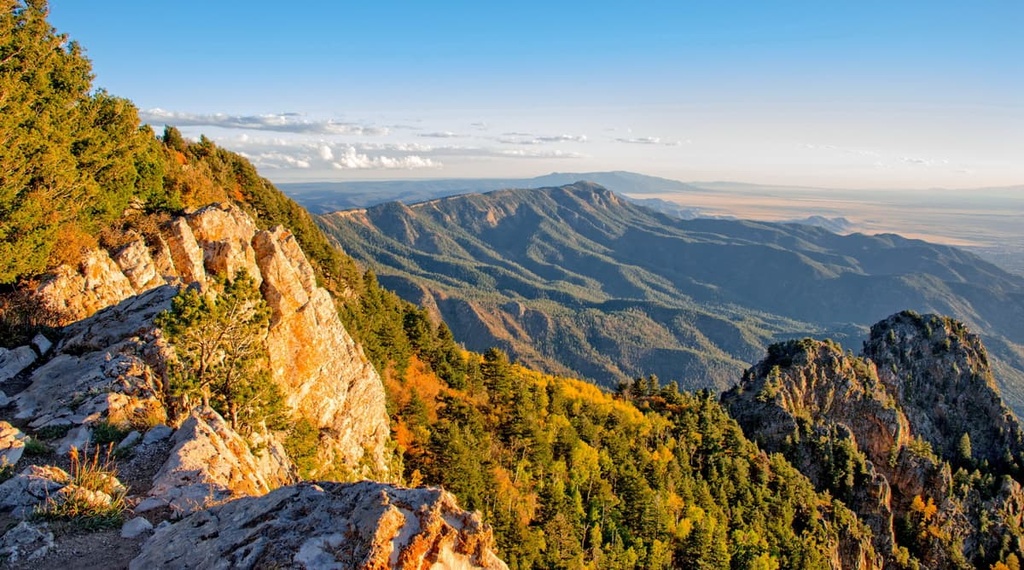
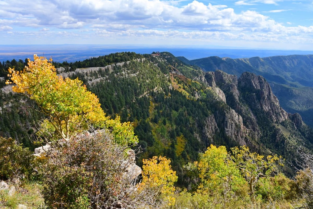
Within the Mountainair District lies the Manzano Mountain Wilderness area, which was designated by Congress in 1978. The wilderness covers 37,000 acres (14,970 ha) of land and contains 64 miles (103 km) of trails. Covering the western slope of the Manzano Mountains, the wilderness area varies in elevation from around 6,000 ft (1,829 m) to 10,098 ft (3,078 m) on Manzano Peak.
The Mountainair District shares a border with the Isleta Pueblo in the Manzano Mountains, the tribal lands of which are generally closed to the public. The Isleta Pueblo, which was established in its current location around 1200 CE, is home to the Tiwa people, who are descendants of the Shoshoncan.
The range is named for the apple trees (manzanos in Spanish) that are located in a nearby town, which is also named Manzano. Tree ring analysis dates the trees to the year 1800, although local legends say they were planted in the seventeenth century by Spanish Franciscan missionaries traveling to nearby Indigenous communities.
The Manzano Mountains are the southernmost range in the greater Sandia-Manzano Mountains, which are the southernmost tip of the Rocky Mountains. They also form the eastern edge of the Rio Grande Rift.
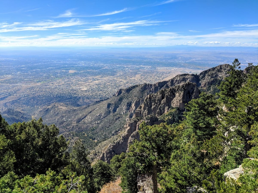
Although they are located very close to each other, the Manzano and Sandia Mountains are distinct ranges that are separated by the Manzanita Mountains and Tijeras Canyon. Interstate 40 (I-40), which covers much of the same route as the historic US Route 66, also runs through Tijeras Canyon.
The southern portion of the range is located in the Mountainair Ranger District, while the northern parts belong to the Sandia Ranger District (North) of the Cibola National Forest. Areas of the northern part of the Manzano Mountains and the adjacent Manzanita Mountains are part of either Kirtland Air Force Base or Isleta Pueblo and are not generally accessible to the public.
The western slopes of the mountains are included in the Manzano Mountain Wilderness area of the Cibola National Forest. The wilderness area covers 37,000 acres (14,970 ha) of land and offers 64 miles (103 km) of trails, the longest of which is the 22-mile (35 km) Crest Trail.
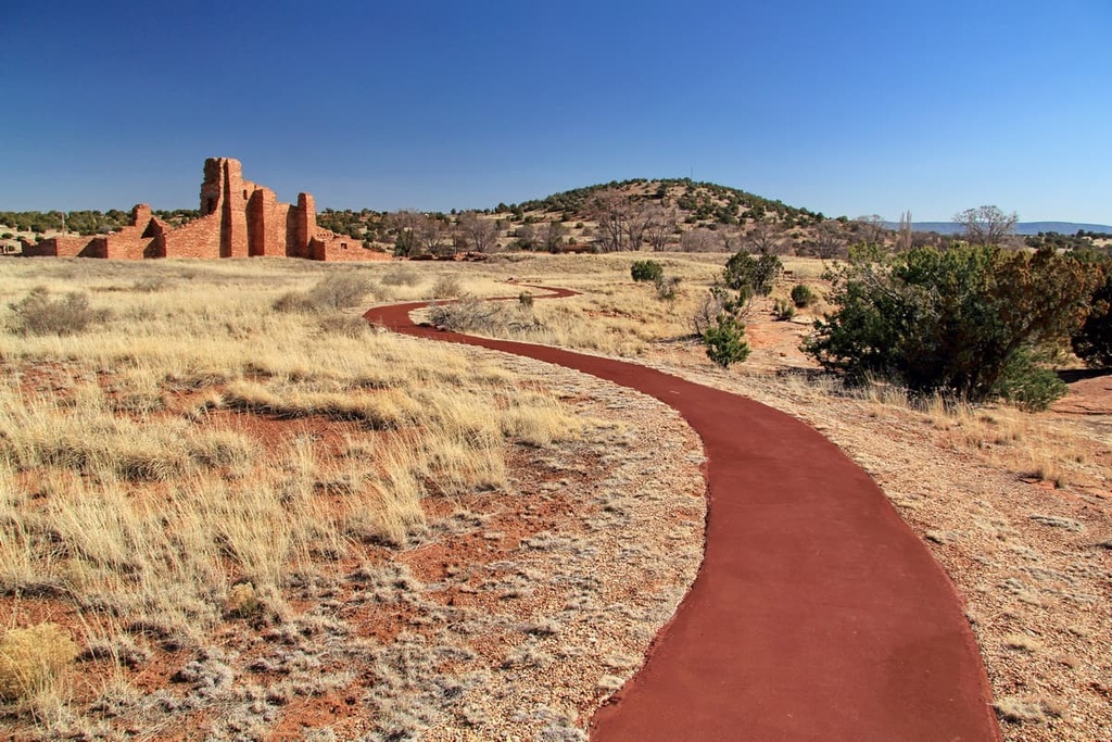
The Manzano Mountains contain the Manzano Mountains State Park as well as the Salinas Pueblo Missions National Monument, which are both located in the eastern foothills of the range.
Elevations within the Manzano Mountains vary between roughly 6,000 ft (1,828 m) and 10,098 ft (3,078 m) at Manzano Peak, the highest point in the range. Other notable peaks found in the Manzano Mountains include Bosque Peak, Mosca Peak, Gallo Peak, Guadalupe Peak, Capilla Peak, and Osha Peak.
You can see both Guadalupe Peak and Mosca Peak if you’re looking at the range from the city of Albuquerque. That said, Guadalupe Peak is located on the lands of the Isleta Pueblo and you generally need permission from the Tribal government in order to access the mountain.
Additionally, Capilla Peak is infrequently summited by hikers as it is home to the Capilla Peak Observatory. The observatory is operated by the Institute of Astrophysics at the University of New Mexico and it features a 24 in (61 cm) optical telescope.
There are a handful of major canyons within the Manzano Mountains, including Trigo, Comanche, Fourth of July, Red, and Ojito canyons. The Fourth of July Canyon is a popular destination as it is home to a campground and a handful of trails that make it easy for you to see the gorgeous foliage of the bigtooth maple trees in the fall months.
The Gallinas Mountains are an isolated, infrequently visited collection of peaks located near the small town of Corona that are surrounded by sparsely populated high desert plains. Gallinas Peak (8637 ft/2633 m), the highest point of the range, is heavily forested and dominates the surrounding landscape.
In 1906, the US Forest Service established the Gallinas National Forest to protect 78,480 acres (31,719 ha) of land in the Gallinas Mountains. In 1908, the area was transferred to Lincoln National Forest to the southwest, and finally, in 1958, the area became part of the Mountainair Ranger District of Cibola National Forest, which is now headquartered in Mountainair, New Mexico.
There is only one official trail in this remote part of the Cibola National Forest, but there is a road (Forest Road 99) that leads up the mountain. This section of the forest is also home to the Red Cloud Campground, which is located three miles to the southeast of Gallinas Peak. There is also a fire lookout station located atop Gallinas Peak.
During the Late Paleozoic era, shallow seas covered the area that is now New Mexico. These seas deposited sediments across the central part of the state. Over time, these sediments became the limestones, sandstones, and siltstones that we see in the region to this day.
The Mountainair Ranger District also lies along the eastern edge of the Rio Grande Rift, which formed during the Miocene, about 15 to 20 million years ago.
The geological features of the area vary from the high desert plains to the higher elevations of the Manzano and Gallinas mountains.
The Manzano Mountains are a north-south trending range. They are considered to be an east-tilted fault block and they formed in the Miocene, about 15 to 20 million years ago, as a result of tectonic movement at the Rio Grande Rift.
There are three main layers of Precambrian rocks found in the range. One of the most dominant layers is a basal Sais quartzite, which is overlain by both Blue Springs schist and White Ridge quartzite. Above these layers, there is a fairly thick section of intercalated basic sills and rhyolite flows.
In the northwestern part of the Manzano Mountains, you can also see a small outcropping of granite. The southern part of the range also features Priest granite with some aplite and pegmatite dikes. Finally, the range boasts a decent amount of quartz veins that, in some places, are up to 1,000 ft (305 m) thick.
The oldest rocks in this small range are Proterozoic gneisses and granites, which are exposed in Red Cloud Canyon. These gneisses and granites are covered by arkoses, quartz sandstones, siltstones, shales, and limestones of the Permian Abo, Yeso, and Glorieta formations. Proterozoic granite and granitic gneiss are exposed in three locations in the mountains.
Historically, the Gallinas Mountains housed various mining operations. These operations included the Corona, Iron Mountain, Red Cloud, and Gallinas mining districts.
The Gallinas Mountains were first mined commercially around 1881 for copper, silver, and lead. Fluorite was discovered in the mountains before the 1930s and was produced from the Red Cloud and Conqueror mines.
Like the nearby Sandia Mountains, the Manzano Mountains and Gallinas Mountains in the Cibola National Forest feature high desert landscapes at lower elevations and drought-tolerant trees at mid-elevations.
Within the Mountainair Ranger District of the Cibola National Forest, you can find a range of tree species at the mid-elevations, including pinyon pine, alligator juniper, Emory oak, and Gamble’s oak. As you move higher in elevation, the flora shifts toward a more subalpine forest ecosystem that’s dominated by aspens and ponderosa pines as well as various spruces and firs.
Furthermore, in the Fourth of July Campground area on the eastern side of the Manzano Mountains, you can find a sizable stand of bigtooth maples. These maples are particularly popular tourist attractions in the fall as they feature fantastic autumn foliage.
Wildlife in the national forest includes a range of mammals that are common in the central part of New Mexico, including black bears, elk, mule deer, antelopes, desert bighorn sheep, mountain lions, and Abert’s squirrels. As is the case in many desert ecosystems in the region, you can also find a slew of different snakes and lizards in the lower elevation parts of the district.
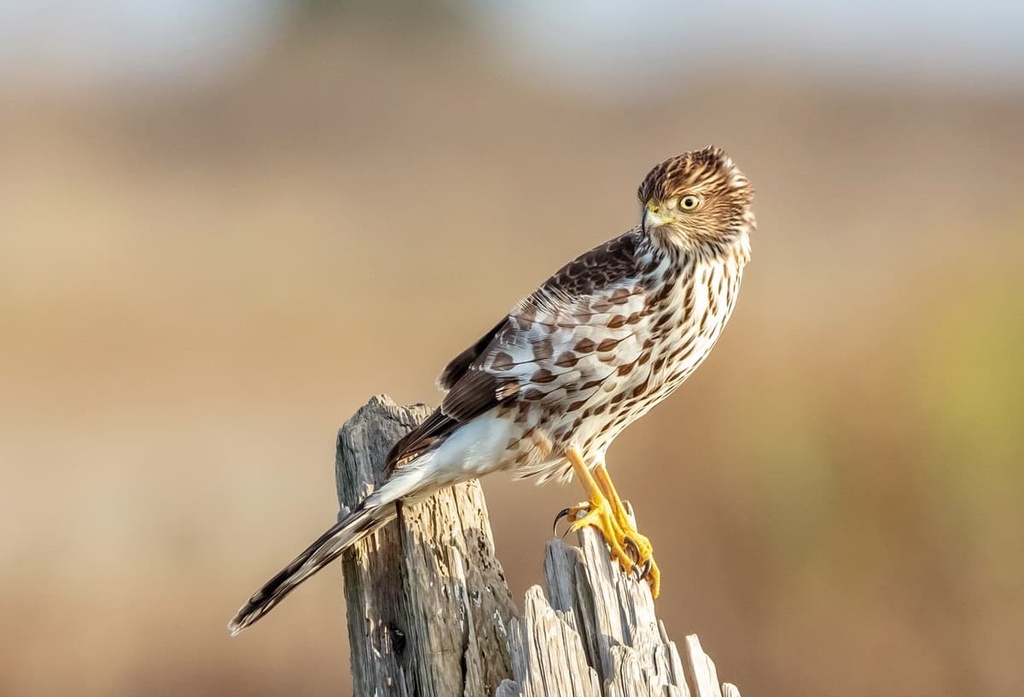
As far as bird species go, the Mountainair Ranger District of the Cibola National Forest offers a lot to love. In the area, you can find a range of raptor species, such as sharp-shinned hawks, Cooper’s hawks, ospreys, red-tailed hawks, and Swainson’s hawks. You can also find American kestrels, golden eagles, peregrine falcons, turkey vultures, northern harriers, and merlins in the forest.
Non-raptors bird species found in the ranger district include the migrating sandhill crane, corvids, turkey, quail, nuthatches, warblers, juncos, swallows, woodpeckers, owls, and a variety of hummingbirds.
The national forest is also one of the main research areas for the Manzano Mountains HawkWatch research group. Most of the group’s research focuses on the migration patterns of the region’s many raptor species. They work on public lands within the Cibola National Forest and they welcome visitors at their main location during the fall season for educational events.
The region that is now the Mountainair Ranger District of the Cibola National Forest features a rich human history that spans several thousand years. Archeological and cultural evidence suggests that humans started traveling and hunting in the Estancia Basin as early as about 12,000 to 10,000 years ago.
Some of the earliest people to live in the region were the Ancestral Puebloans, who were the ancestors for many of the contemporary Pueblo tribal nations in the region. Throughout the last few thousand years, the Ancestral Puebloans built countless villages and settlements in the region.
One of the most famous of these villages in the area around the Mountainair Ranger District is Abó, which is preserved within the nearby Salinas Pueblo Missions National Monument. The national monument was created in 1980 and it is headquartered in the town of Mountainair, where you can also find the range district’s offices.
Nowadays, there are a handful of Tribal Nations with reservations surrounding the Mountainair Ranger District, though these reservations represent just a small fraction of most nation’s ancestral homelands. One of the largest reservations in the area is that of the Isleta Pueblo, which is located just to the west of the national forest.
The Pueblo of Isleta was established in its current location around 1200 CE. It is one of the oldest communities in the region and it was established by descendants of the Shoshocan people, who are believed to have been the first people to have migrated to what is now North America around 30,000 years ago.
In more recent centuries, the Gallinas Mountains were notably the location where the Gallinas Massacre or the Gallinas Mountains Massacre took place as part of the Apache Wars on September 2, 1861. The battle took place between a war party of Mescalero Apache warriors and four Confederate soldiers as they fought to gain military control of the area.
During the late nineteenth and early twentieth centuries, the greater region of the Cibola National Forest was heavily mined and prospected by settlers looking to strike it rich. It also became a fairly popular ranching area during the twentieth century.
The Cibola National Forest was established in 1931, however many of the protected lands within the forest were first set aside as reserves in the late 1800s and early 1900s. Over the years, the forest has become a popular area for hiking and outdoor recreation.
The majority of hiking opportunities in the Mountainair Ranger District can be found in the Manzano Mountain range, where there are 64 miles (103 km) of designated hiking trails. Here are some of the most popular trails in the Manzano Mountains:
There is only one official trail in the secluded Gallinas Mountains. The Gallinas Peak Trail is a 7.7 mile (12.3 km) out-and-back trail that climbs nearly 1,800 feet (548.6 m) to reach the top of the peak. This trail can also be accessed from Forest Road 99 near the top of the mountain for a shorter and easier hike.
Looking for a place to stay near the Mountainair Ranger District of New Mexico? Here are some of the best nearby cities and towns to check out:
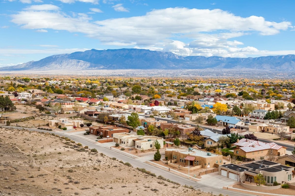
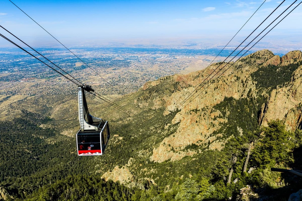
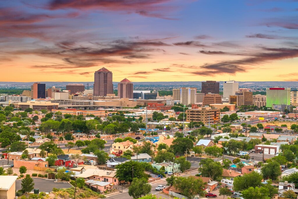
The closest city to the Mountainair Ranger District is Albuquerque, which is located to the north. Albuquerque is New Mexico’s largest city, and it was founded as a Spanish colony in 1706.
It was named after the Viceroy of New Spain, who also happened to be the tenth Duke of Alburquerque. At the time, it served as an outpost on El Camino Real, which connected the northern part of New Spain with Mexico City in what’s now Mexico.
The city is located in the high desert and it has an average elevation of about 5,314 ft (1,619 m). Its population is around 585,000 people and it features an incredible old town that contains a plethora of historic buildings, shops, and restaurants.
Albuquerque is also home to five museums, a zoo, and a botanical garden. The city also hosts the famed International Balloon Fiesta in October, which draws nearly 750,000 people each year.
Albuquerque is accessible by plane, train, and bus and is located off of US Interstate 40 and US Interstate 25, as well as the historic US Route 66. Accommodation options include hotels, motels, and Airbnb properties.
Located to the north of Albuquerque is Santa Fe, the capital of New Mexico. The city is located at the foothills of the Southern Rocky Mountains and, thanks to its average elevation of about 7,000 feet (2,133 m), Santa Fe is the highest and oldest state capital in the US.
Santa Fe currently has a population of around 85,000 people and it’s well-known for its many historic sites. It also has a bustling arts scene that includes around 250 galleries and dozens of museums.
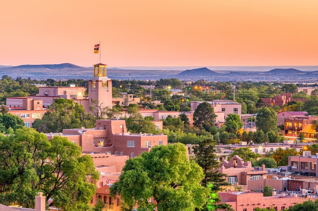
There are plenty of accommodation options for visitors to choose from in Santa Fe. The city’s proximity to the mountains also make it a great option for adventure lovers. You can find a range of hiking and skiing opportunities just outside the city, too, so it’s an awesome place to stay if you’re looking to see more of central New Mexico.
The Mountainair Ranger District is located in the small town of Mountainair, which is situated just to the east of the ranger district. It is located about 10 mi (16 km) from the geographical center of the state of New Mexico.
Mountainair was formally incorporated in 1903 and, despite the fact that it has a population of less than 1,000 people, it is a great destination for anyone looking for a true adventure in the mountains. It’s also known as the “Gateway to Ancient Cities” due to its proximity to the Salinas Pueblo National Monument.