
Scan the QR code and open PeakVisor on your phone
The Southern Rocky Mountains make up the southern part of the much larger Rocky Mountains of North America. This range occupies parts of three western states with the greatest majority of it spread throughout the western half of Colorado. However, the range extends from the city of Casper in central Wyoming to Albuquerque in northern New Mexico, a distance of 540 miles. Within this range are 3,700 named mountains, with the highest and most prominent mountain being Mount Elbert in the Sawatch Range of central Colorado.
Within this range are many sub-ranges containing some of the most rugged and most popular mountains on the entire continent. Although there are a number of higher mountains in North America (Alaska, Canada, Mexico, and California), they are not part of the greater Rocky Mountains chain. They are mostly concentrated in the various coastal ranges. Also, not all of the mountains in Wyoming or New Mexico are included in the Southern Rockies, and that includes the most major sub-ranges in Wyoming, which have considerable significance in the world of mountaineering.
Wetterhorn (l) and Uncompahgre Peak (r), San Juan Mountains
The most important sub-ranges of the Southern Rockies are mostly in Colorado, which alone has 4,253 named mountains, with one range extending into New Mexico and two into Wyoming. They are as follows:
It should be noted that some of these are further divided into even more local sub-ranges each with their own characteristics. Furthermore, these mountains are spread over a number of national forests and wilderness areas. And we must not forget that there are four national parks within or immediately adjacent to the boundaries of the Southern Rocky Mountains. Therefore, it goes without saying that there are countless opportunities for recreation afforded by this large mountain range.

Cathedral Spires, Rocky Mountain National Park
Well, with 3,700 named mountain in the Southern Rocky Mountains, it’s a bit difficult to give detailed trail descriptions or even a listing of major hiking areas. But there is hope – it comes in the form of the internet and major (very major) online retailers that are more than happy to provide the mountain enthusiasts with volumes about hiking in the Rockies. But here am I, who is poorly equipped to provide unlimited information, who can just randomly choose some really great areas and even a trail or two (OK, maybe a few more than just two) to lure the reader to some of my favorite places. If, in certain cases, I don’t have a favorite place (meaning that I haven’t been or hiked there) I will just have to wing it. Well, I will do some research to better inform myself and you, the reader. The last thing I want to do is mislead my hiking friends.
Let’s start with the crown of the Rockies – Colorado. After all, this is the state with the highest average elevation (6,800 feet) of all 50 states – but Wyoming is close at 6,700 feet, with Utah, New Mexico and Nevada not far behind. Alaska, by comparison, only averages 1,900 feet above sea level, yet it is the roof of North America. In fact, Colorado is the only state that lies entirely above 1,000 meters (3,280 feet). It is the most mountainous state in the Union. And I live here.
It might be of interest to many readers that the absolute highest mountain in the entire Rocky Mountains of North America lies in Colorado. You read it above – Mount Elbert. And what may be even more interesting is that Mount Elbert is a relatively easy walk-up hike for anyone in good physical condition and who is acclimated to the altitude. I have climbed it and the only negative aspect of my experience was that I had to run down to tree-line more than 3,000 vertical feet below the summit because a thunderstorm chased me off the mountain. Let this be a warning – it has been said that thunderstorms were invented in the Rockies.
Now let us look at some specifics about the major sub-ranges of the Southern Rocky Mountains. This discussion is not intended to be a concise guide to these mountains by any means. It is simply one hiker’s/writer’s opinion based on personal experience or at least partial knowledge about the mountains in this range.
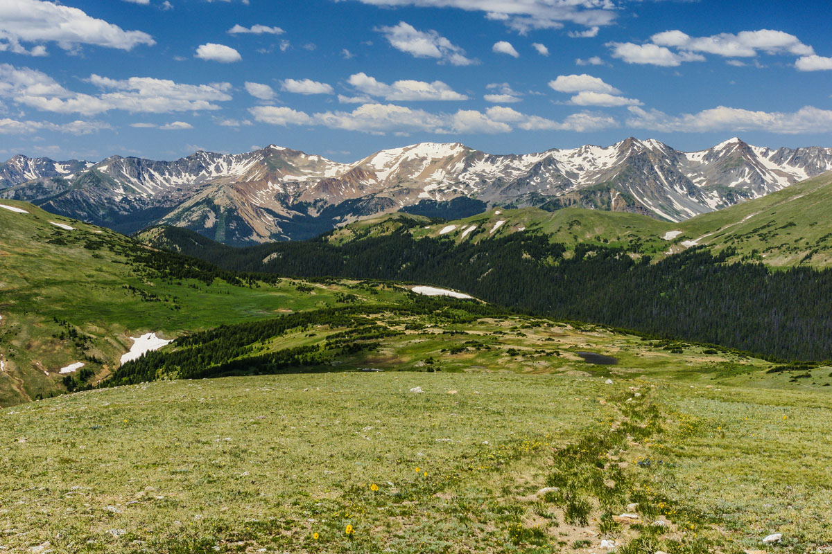
This 175-mile range includes 917 named mountains and, being close to the Front Range Urban Corridor of Colorado and Wyoming, provides ample venues and opportunities for playing in the mountains. This range also includes Rocky Mountain National Park, the third most visited of all national parks, which itself offers countless hiking pleasures. There are several major sub-ranges and six fourteeners that can be found in the Front Range. With 85% of the state’s population within a short drive of most parts of the range, it follows that the Front Range is indeed heavily used for recreation. There are hundreds of good hikes to be experienced here.
The Indian Peaks are particularly popular among locals. The Hessie Trailhead near the town of Nederland and the Brainard Lake Recreation Area near the town of Ward are easily the most popular ways to gain access into the ever popular Indian Peaks Wilderness and the many trails that are to be found here. The King Lake-High Lonesome-Devils Thumb loop is a particularly impressive hike of about 16 miles. It is considered strenuous, but highly rewarding for those who are in good condition.
King Lake, Continental Divide, Indian Peaks Wilderness
The central part of the range contains four of the six fourteeners. Grays Peak (the highest summit on the Continental Divide in North America) and Torreys Peak (the only other summit on the Divide) are relatively easy non-technical climbs and are therefore very popular. They are usually climbed together. But it is Mount Bierstadt that has for years been the most climbed fourteener in the state (until late 2019, when another one took over the lead). It is a “beginner’s fourteener”, extremely popular, easy to get to, and not difficult to climb, with great views.
This stunning range in southwestern Colorado is expansive, contains a number of smaller sub-ranges, has 13 fourteeners, and is regarded as the most scenic by many locals and visitors alike. Aside from many historic towns and attractions, the San Juans afford some of the finest hiking of any mountains on the continent. There are seven wilderness areas scattered around this range. Though the San Juans are the most remote in terms of distance from the populated urban corridor, there is no shortage of visitors to this area. Some of the most popular hiking areas can be found near the charming and historic towns of Ouray, Lake City and Silverton. Here are a few examples.
Downtown Lake City
Lake City is a small, quiet town that many residents of Colorado don’t even know about, let alone out-of-state visitors. It has a rich history from the mining days featuring some interesting characters of the 1800’s. Those who know it are well aware of the charms this place offers in terms of recreation. The trailhead for the highest peak in the entire San Juan range, Uncompahgre Peak (also the fifth-highest peak in the entire Rocky Mountains), can be reached a short drive from this town. Also just 18 miles from town is Grizzly Gulch/Silver Creek Trailhead, which gives access to some wonderful hikes to three fourteeners – Sunshine, Redcloud and Handies Peaks. These hikes are all highly recommended, and do not involve any complicated ascents.
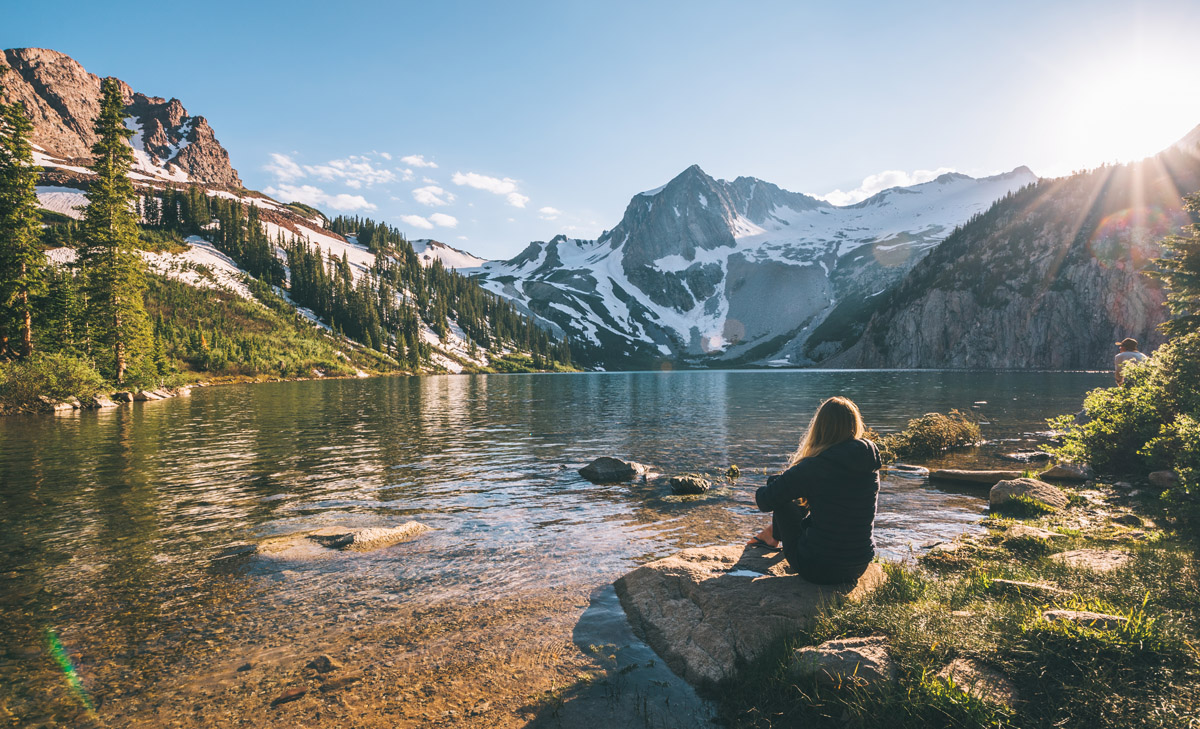
Ouray and its surroundings are often referred to as the “Switzerland of America” and for good reason. From this lovely town it is easy to get to the best-known local fourteener – Mount Sneffels. Two trailheads can be found near here. One is from the wildflower-studded wonderland called Yankee Boy Basin. A 4WD vehicle is required to access this area. The other trailhead can be found about 25 miles away along a gravel road that is usually fine for regular cars in the summer. This is the Blue Lakes Trailhead. One need not have Mount Sneffels on his or her itinerary – the three Blue Lakes make what I think is one of the most beautiful hikes in all of Colorado, in what is known as the Mount Sneffels Wilderness. Of course for those who want to summit the mountain, they can easily continue up from the uppermost of the three lakes.
Blue Lakes, Mount Sneffels Wilderness
Silverton is best known for being the northern terminus of the famous Durango and Silverton Narrow Gauge Railway. About halfway between Silverton and Durango is a most popular trailhead – the one providing access into Chicago Basin in the Needles Mountains. The only way to get here is by the train, which makes a special stop near the trailhead. It is unlikely that day-hikers would do this. The basin is one of the most popular and highly used backpacking destinations as it affords access to three fourteeners – Mount Eolus, Sunlight Peak and Windom Peak.
The impressive Sawatch Range could be called the “backbone” of Colorado since it contains four of the five highest summits in the Rocky Mountains and is home to 15 fourteeners, including the highest of them all – Mount Elbert. There are several major trailheads for getting into these mountains and most of them are easily reached from the two most important towns in the area – Buena Vista and Leadville. The four wilderness areas in this range provide many of the great hiking and camping opportunities afforded here, although these are not confined only to wilderness. Some examples very worthy of consideration for locals and visitors alike follow.
Southern Sawatch Range
The Collegiate Peaks Wilderness is for you if you want to climb some fine fourteeners without having to be concerned about technical routes, although they certainly exist. The North Cottonwood Trailhead will get you into a fine network of trails from which you can climb Mounts Yale, Harvard and Columbia. Two adjacent basins provide excellent camping sites at either Kroenke Lake or Blue Lake.
The Halfmoon Creek Road will take you to two trailheads from which you can climb the two highest summits in the Rocky Mountains of North America. One will take you to Mount Elbert while the other will let you reach Mount Massive. There are several campgrounds along this road, so if you are ambitious you could bag both mountains on consecutive days without having to get into your car at all between the hikes. Such was my plan on the weekend that I climbed Mount Elbert. While I summited Elbert, at the end of the day, the weather turned foul – and I have yet to climb Massive, which probably won’t happen, given my age.
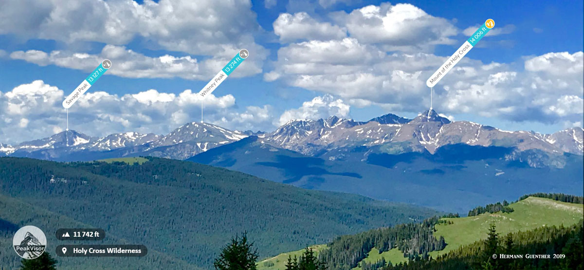
One would be remiss to pass up an opportunity to experience the awesome Holy Cross Wilderness at the northern end of the Sawatch. I have done some of my most enjoyable backpack trips into this wonderful area of many alpine lakes and high peaks including one fourteener, the Mount of the Holy Cross. The Homestake Reservoir Road is my choice for access to unlimited back-country pleasure. The road is about 20 miles north of Leadville. While backpacking into the Missouri Lakes Basin is what you need to do in order to fully explore the greater expanse of this wilderness, it is entirely possible to do a number of incredible day hikes from here. Not to be missed, although this area is very popular.
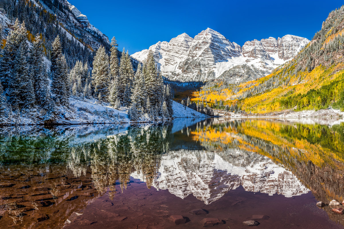
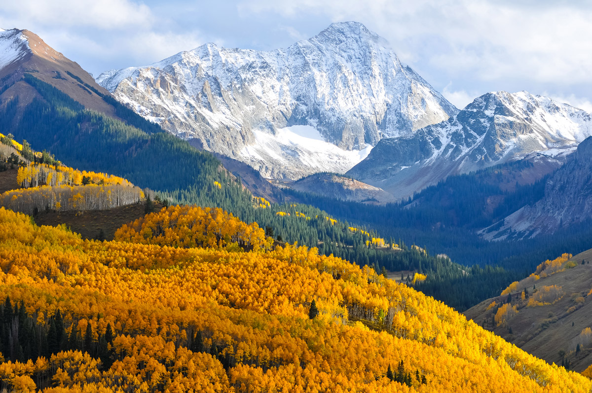
The Elk Range in west-central Colorado is a magnet for visitors from all over the world, and not just because the upscale resort of Aspen happens to be nearby. It could be because of the stunning beauty of these rugged and dangerous mountains. Or it could also be because this range is home to what could be the most photographed mountain scene in all of North America. Whatever the reason, these mountains, which include five awesome fourteeners, attract visitors in hordes and not just out-of-towners – we locals love them too and will even brave the crowds just to spend a few days in this magnificent setting. What more can I say? Let’s go hiking.
Maroon Lake is the spot most new visitors will go, at least for the first time. Some will stay for a short time, take a few photos and then leave. Many will stay a bit longer, lingering around the lake some and then leave. But many will come here to hike, and the Maroon-Snowmass Trail which starts here will take them to places they might not have ever seen the likes of. Sure, the Maroon Bells themselves are targets for serious climbers, but there is so much more to be found after reaching Crater Lake right at the foot of the massive Bells. This may be the busiest trail in the entire Elk Range, but many visitors have no idea how much of the Maroon Bells-Snowmass Wilderness can be reached from this trail. But hikers must be prepared if they want to go beyond Crater Lake.
The Capitol Creek Trailhead is where most ambitious climbers will start their quest to climb the imposing Capitol Peak, an undertaking not to be taken lightly. Just to get to Capitol Lake, which sits at the base of the nearly vertical north face of the mountain, is six miles – this means that climbers are most likely to backpack in part or most of the way to the lake, and then attempt their climb the next day. That is if the weather cooperates. The exposure up there is severe and there are no good ways to bail off the infamous knife-edge ridge that must be negotiated to reach the summit. This hike is best left to experts.
Snowmass Lake Trail is long but generally not difficult. The lake is nine miles in from the trailhead near Snowmass Village. Most people would not do this as a day-hike, and why should they. Spending a few nights camped out near the lake will put you into the middle of a spectacular setting that is hard to beat, and you can even climb a fourteener – the magnificent Snowmass Mountain. I speak from experience – this was one of the best backpacking/hiking/climbing experiences I’ve ever had.
The Gore Range in north-central Colorado is a popular hiking destination, but surprisingly, it is not a mountain world that is sought out to any significant degree by peak-baggers. This is due in part to the fact that there are no fourteeners in this range. Yet there are several formidable thirteeners and other high peaks, though even these peaks go largely unclimbed. On the other hand, this range is considered home to some of the best ridge-scrambling in Colorado. All of this aside, there are some wonderful places to go hiking or backpacking on the large network of trails in this range, especially in the part of the range that is contained within the Eagles Nest Wilderness. There are many trailheads one can use to enter this pristine place. I have done some of my favorite hikes in this area. This range is far less crowded than the other more popular mountain ranges in Colorado.
There are several major trails that start right within the town limits of the major resort of Vail. They all follow steep, narrow glacial valleys. And are they ever a pleasure to hike, as they all lead to beautiful alpine lakes. My personal favorite is the Pitkin Creek Trail that rises steeply to the gem of a lake by the same name. This hike is tough, involving a total elevation gain of about 3,500 feet which includes several elevation losses on the way up. Net elevation difference from start to the lake is 3,000 feet. Round trip distance is almost 11 miles. The last time my wife and I made this hike, we were the only people at the lake.
The Gore Range Trail, which meanders 45 miles starting at the south end of the range at the resort of Copper Mountain, is very popular with backpackers who like to do a five- or six-day expedition. I have hiked various segments of the trail and can vouch for the exceptional terrain that you will encounter here. Since it reaches elevations of almost 12,000 feet, you will definitely know you are in a high alpine environment. Stunning views, pristine lakes, rugged peaks, and no crowds – what more can you ask for?
In all of the hikes and climbs I have done in this range in central Colorado, I cannot recall that there are any more or less mosquitoes here than anywhere else in the state. This high ridge forms a major barrier to east-west travel, there not being any highway crossings and only two gravel back roads over high passes that can only be driven in summer months. This range is home to six fourteeners, one of which, however, does not qualify as “official” based on prominence criteria. I have climbed four of them, including Quandary Peak, which has, as of late 2019, overtaken from Mount Bierstadt the distinction as the most climbed fourteener in Colorado. Naturally, the fourteeners are the main attractions in this relatively small range. But there are other areas in this range where you can hike all day and see almost no other people.
The Buffalo Peaks Wilderness, the only area in the Mosquito Range so designated, is a place so wild and pristine that the times I have hiked here I saw almost nobody else all day. The absence of any fourteeners tends to leave this special place quite secluded. Even the East and West Buffalo Peaks are not regularly climbed. This place contains Colorado’s largest herd of Bighorn Sheep. The 12-mile Buffalo Meadows Loop hike is ideal for someone who wants a wilderness experience without other people around. Although the trail has only gentle grades, the overall elevation gain is still 2,000 feet. So it is a good workout indeed.
The four fourteener combo (not an official designation) is highly popular in this range. Usually undertaken from the Kite Lake Trailhead near the town of Alma, this strenuous hike will let you bag three “official” fourteeners (Lincoln, Democrat and Bross) as well as the “unofficial” Cameron. This, along with the climb to the summit of Quandary Peak, are probably the most visited parts of the Mosquito Range.
Mayflower Gulch is a lovely high-country valley that affords an easy hike into a historic mining area at the western side of the rugged Tenmile Range segment of the Mosquito Range. The valley is renowned for its impressive display of wildflowers in late July and early August. While the trailhead is at 11,000 feet elevation, the hike does not involve serious elevation gain, although it is of course possible to wander about the entire basin. The formidable wall presented by Fletcher Mountain and its approach ridges at the head of the valley is truly impressive.
Mayflower Gulch, Mosquito Range
The long and distinctively narrow Sangre de Cristo Range is 230 miles long with the northern half of the range in Colorado and the southern half in New Mexico. While the New Mexico segment is quite popular for hiking, it is the much higher Colorado segment, with its nine fourteeners, that is of greatest interest to hikers, and especially climbers. And what fourteeners they are! They are among the most difficult and dangerous climbs in the state. I have not climbed any of them, and because this range is a fairly long drive from home, have rarely hiked there. But that means nothing in the greater scheme of things – this mountain range is formidable and deserving of serious attention.
The “Crestones” is a collective term for an impressive cluster of five fourteeners and their lesser neighbors that are sure to get a climber’s adrenaline flowing, and I mean climber not hiker. These five mountains and their approaches (Crestone Peak, Crestone Needle, Kit Carson Peak, Humboldt Peak and Challenger Point) are serious business and are not for the timid or inexperienced, though Humboldt may be a bit more forgiving than the rest. These peaks can be reached from trailheads on either the east or west side of the range. The approaches are long such that bivouacking is often part of the expeditions.
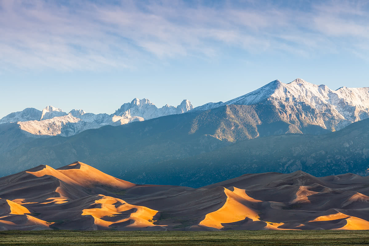
Great Sand Dunes, Sangre de Cristo Range
The Sierra Blanca Massif is another group of four fourteeners about 30 miles south of the Crestones, reigned over by the super-prominent Blanca Peak – the fourth highest peak in the Rocky Mountain of North America. These mountains, which dominate the views in the southern part of the San Luis Valley, are to be taken seriously. The group, in addition to Blanca Peak, includes Little Bear Peak (sounds tame – but it isn’t), Ellingwood Point and Mount Lindsey. This group is famous for the mile-long Little Bear-Blanca Traverse – the most difficult and dangerous ridge in Colorado.
In the New Mexico segment of the “Sangres” can be found two major hiking areas, one of which makes an ascent of the highest mountain in the state, Wheeler Peak, possible. There are no fourteeners in this state. The Wheeler Group is located about 20 miles northeast of the town of Taos, and is best accessed from the Taos Ski Valley, the largest ski resort in the state. There are plenty of hiking opportunities here for all levels of skill and experience. About 25 miles northeast of the capital city of Santa Fe are the Truchas Mountains. Though seemingly close to the city, these mountains are very remote. These mountains are steep and craggy, more like their Colorado neighbors and are seldom visited.
Taos Valley, Wheeler Peak (l)
The Laramie Mountains are a range of moderately high peaks mostly in southeast Wyoming, although part of the range is in north central Colorado. Though they are an extension of Colorado’s Front Range, they are sometimes defined as being located only in Wyoming. Be that as it may, there are some hiking areas in the northern part of the range that are worthy of attention, though considering that they have a very small population base from which to draw, they are not highly used.
The Laramie Peak Trail to the highest summit of the Wyoming segment of the range is considered quite difficult involving a round-trip distance of ten miles and an elevation gain of over 2,700 feet. This most prominent peak in the entire range can be climbed year-round; being entirely below tree-line makes this a good peak for snowshoeing in the winter. Despite the elevation gain, the degree of incline on this switchbacked trail is moderate, thus making it possible for mountain biking.
Though the Twin Peaks Trail, not far from Douglas in the northern segment of the Laramie Mountains, is not exactly high alpine terrain, the three-mile (one way) long trail offers a bit of challenge since it involves an elevation gain of almost 1,800 feet. This is not exactly an overrun area, being so remote, but if you need a bit of a workout while enjoying good views, this might be for you if you are in the area.
Located in southeastern Wyoming and north central Colorado, the Medicine Bow Mountains extend from the Never Summer Mountains in Colorado to the Snowy Range in Wyoming. There are ample hiking opportunities in both parts of the range, with the highest peak being in Colorado. Since we have already discussed many hikes in the Rocky Mountain State, we’ll concentrate on a few respectable hikes north of the state line. The Snowy Range is the jewel of southern Wyoming, so why not take a look here.
Medicine Bow Peak (12,021 feet) is the highest in the Snowy Range and provides some great hiking. The seven-mile loop consisting of the Medicine Bow Peak Trail combined with the Lakes Trail, makes an excellent day hike with some difficult steep sections. The summit sits on a long ridge trending from southwest to northeast, from which stunning views can be had, especially of the many lakes clustered along both sides of the ridge. The Sugarloaf Campground would make a great base from which to explore the many other trails around here.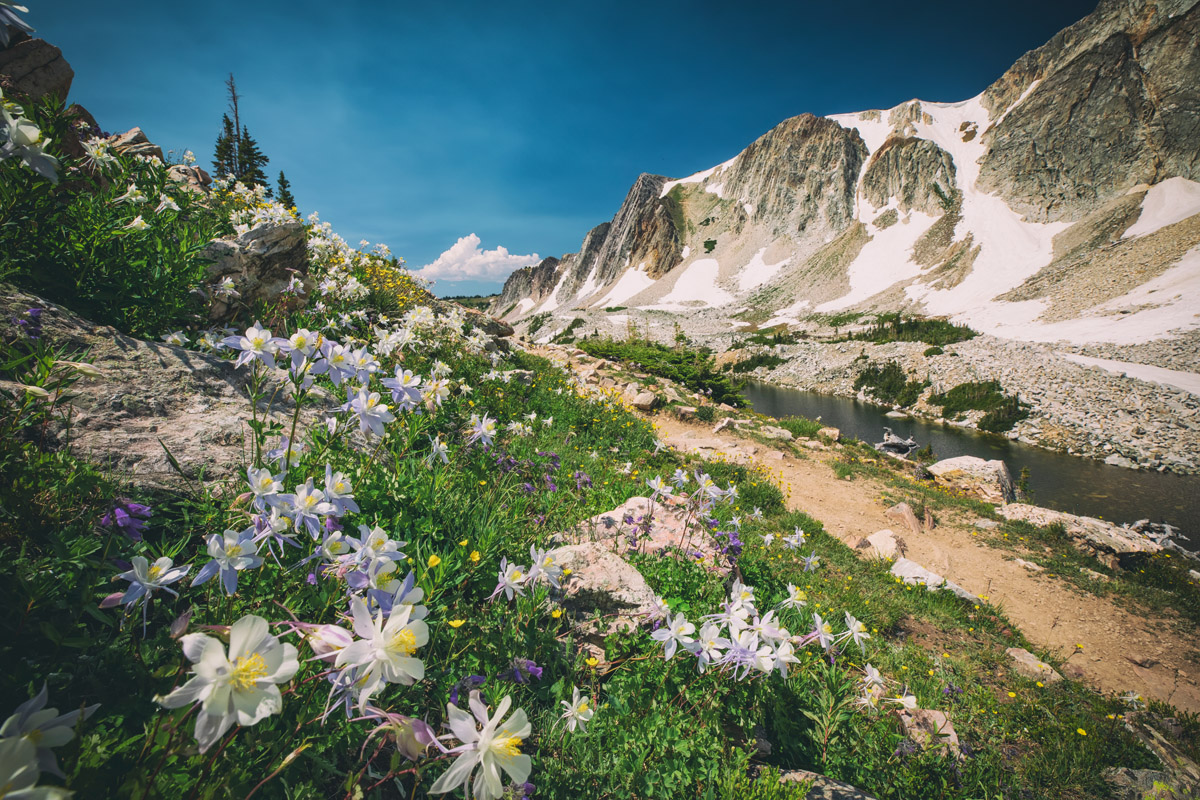
Lakes Trail
For those wanting a more relaxed hike in the Snowy Range, the Gap Lakes Trail in the same general area is very scenic and with little elevation gain, even though it reaches a high point of over 11,000 feet. It is known for wildflowers in summer and autumn colors in the fall. Bring your fishing gear if you are visiting this spectacular area.
There is no shortage of major towns and resorts for staging a short expedition or a lengthy vacation in the Southern Rockies. There are also many small towns which may be the only source for accommodations or restaurants in some remote areas. Some of the finest places for hiking are likely to be found miles from a major city. In fact, the only truly major cities providing full services in or near this range are Denver and Albuquerque. But there are other significant cities that offer most amenities travelers would need, and that includes the state capitals of New Mexico (Santa Fe) and Wyoming (Cheyenne). There are also other smaller cities that can provide basic services and even some scheduled airline service, though most likely only by means of transfers from a major hub. Let’s take a look at some of them, from the point of view of not just the biggest or most convenient in terms of transportation, but also those that provide particular charm and historic significance germane to the region.
Denver - Having a metropolitan area population of over 2 million, it goes without saying that Denver, the Mile High City, offers anything and everything that a visitor needs or wants. With a world-class international airport, world-wide access to Denver is easy. Non-stop flights from as far away as Asia and Europe are routine. Visitors can get in a car at the airport and be in the high country in as little as 90 minutes. And while all amenities one could want in a big city are readily available, it is the proximity to the mountains which is one of the biggest attractions Denver provides.
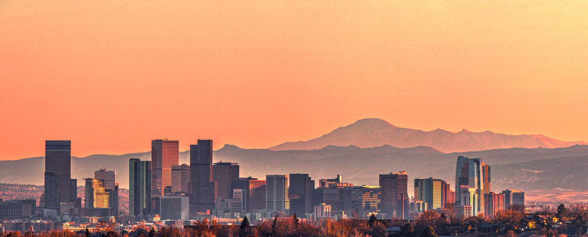
Denver
Boulder - This beautiful city about 25 miles northwest of Denver is a mountain-lover's nirvana. Many famous climbers and mountain explorers call (or have called) Boulder home. Nestled right at the base of the foothills of the Southern Rocky Mountains, Boulder is so well positioned as to make it the perfect base from which to explore much of the nearby high country. It is near Boulder where the Continental Divide meanders to its easternmost location in the United States, less than 20 miles west of the center of town. Even the high foothills looming over the city afford some impressive hiking and climbing opportunities - right within city limits.
Estes Park - This wonderful resort town is best known as the gateway to Rocky Mountain National Park. With a wide range of accommodations (from simple cabins to luxury hotels), a food-lover's delight, and a shopping mecca, this charming town is worth visiting just of its own accord. It simply has a beautiful and stunning setting. But for mountain lovers, Estes, as the locals call it, is an excellent setting for staging countless mountain adventures.
Alamosa - In the middle of the immense San Luis Valley, which forms the western edge of the Sangre de Cristo Range in Colorado, sits the city of Alamosa. With a population of less than 9,000, this is by far the largest town anywhere close to this mountain chain. Yet, the town offers almost any amenity that a visitor would require for an extended stay to explore these mountains - accommodations, restaurants, hospital, golf course, shopping and even an airport with regional scheduled service including to Denver and Albuquerque, New Mexico. This is the place to stay if hiking access to the western approaches to the Sangre de Cristos is desired.
Durango - Durango is a historic town that was established in 1880 to serve the San Juan mining industry. It was named after a town in Mexico by an ex-governor of Colorado. Sporting a rich history of the development of the "wild west", Durango suffers no shortage of activities for the visitor, in addition to its easy access into the high mountains of the region, which can be found just a short drive north of the city. A major regional airport offers connecting service to hub airports such as Dallas, Phoenix and Denver. The city has a large selection of accommodations for any budget. Dining options include some truly great restaurants, many with local western ambiance and flavors.
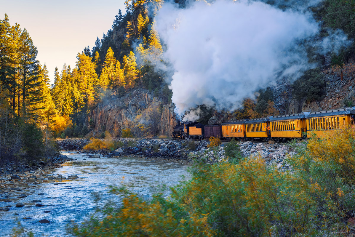
Historic Durango & Silverton Railway
Aspen - Who has not heard of Aspen, Colorado? It started as a silver mining town in the late 1800's and was highly successful until 1893 when the silver market collapsed. The town was so named because it is surrounded by forests of Aspen trees, which in the autumn exhibit an impressive display of gold color. This is the only town in the Elk Range of the Southern Rocky Mountains that has a major airport with scheduled airline service. Aspen is known for high-end lodging, restaurants, boutiques and many celebrities (who fly into Aspen in their private jets).
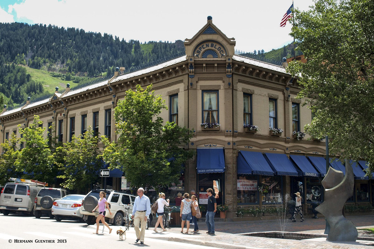
Aspen
Buena Vista – Buena Vista is about as centrally located in the Southern Rocky Mountains as any town can be. Though a small town of only about 3,000 inhabitants, it offers the necessary amenities most visitors could want. It sits at the foot of the mighty Sawatch Range which contains more fourteeners than any other in the Southern Rockies. Even the trailhead to the king of all fourteeners in the state, Mount Elbert, is only 38 miles from town.
Vail - Everyone with an interest in skiing (or not) has heard of the swank resort of Vail in the central Southern Rockies. It started in 1962 as a small ski area and has grown into the largest ski resort in Colorado. It offers everything a visitor could ask for and at prices that are, well, not for everyone, especially during the ski season. Budget accommodations (if any) are rare in this resort that was modeled after high-end resorts in the Alps. But aside from being a high-end ski resort, Vail is positioned in a beautiful valley that offers some fantastic hiking opportunities.
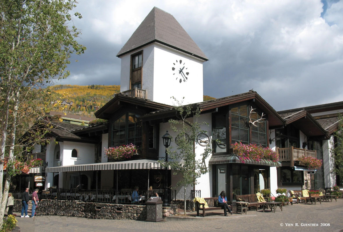
Vail
Grand Lake – This tiny resort town of less than 500 inhabitants, my not be on everybody’s itinerary due to its remote location, but it sure is a lovely place to stay and enjoy at least a small segment of the Southern Rocky Mountains. For one thing, it sits at the western doorstep of the magnificent Rocky Mountain National Park. But it is not only hiking that can be undertaken here; this place offers wonderful water sports, being on the shore of the largest natural lake in Colorado. In the winter, Grand Lake is known as the “Snowmobiling Capital of Colorado”.
Albuquerque - The largest city in New Mexico is about a one-hour drive from the southern end of the Sangre de Cristo Mountains which means it is also the largest city close to the southernmost point of the Rocky Mountains of North America. Albuquerque has a city population of about 560,000 with a metropolitan population of just over 900,000. This town is convenient to the southern parts of the Sangre de Cristo Range in terms of hosting a major international airport and plenty of tourist amenities.
Santa Fe - This may only be the fourth-largest city in New Mexico (population about 68,000), but it is the capital of the state. Not only that, it is by far the highest capital of any U.S. state. At an elevation of 7,199 feet, it is almost 2,000 feet higher than its Colorado counterpart - Denver, the "Mile High City". Its setting at the foot of the Sangre de Cristo Mountains is stunning enough, but it also boasts a dry climate that is envied by many. Simply stated, Santa Fe is one of the gems of the southwestern United States. Its downtown area is an architectural wonderland, with a southwestern theme dominating. This is the place for shopping for Native American handicrafts.
Santa Fe
Taos Ski Valley - For those wanting to be up close and personal with the Sangre de Cristo Mountains of New Mexico, there is no more formidable resort than Taos Ski Valley. This resort has it all - and not just for the winter months. Skiing, snowmobiling, Nordic skiing, hiking, climbing, horseback riding, mountain biking, river rafting (nearby) and fishing can all be found here and nearby. This town is where you will find some fine hiking, just about as far south as you can get in the Rocky Mountains.
Cheyenne – Cheyenne is the capital and largest city in Wyoming, the least populous state in the United States. The city’s population is 59,466 as of 2010. It is considered part of the Front Range Urban Corridor; thus it is considered a gateway to the Rocky Mountains. While Cheyenne is not very near to the mountains, it nevertheless plays a role as a base from which to explore the Wyoming segment of the Southern Rocky Mountains. In a state as sparsely populated such as this, anything under 100 miles is considered just a “short hop”. Therefore, locals don’t consider it a major excursion to go into the Laramie or Snowy Mountains of the range.
Laramie – With a population of just over 30,000, Laramie is the fourth largest city in Wyoming and is conveniently situated at 7,165 feet between the Laramie Mountains and the Snowy Range, making it a convenient base from which to enjoy the recreational aspects of the Wyoming segment of the Southern Rocky Mountains. The town is large enough to provide adequate tourist amenities for those seeking hiking, rock climbing, camping and Nordic skiing in these two ranges.
Casper – The second-largest city in Wyoming, Casper is considered the northernmost end of the Southern Rocky Mountains. Only the northern end of the Laramie Mountains is within a reasonable driving distance of this town, which does have enough tourist infrastructure, mostly clustered along Interstate Highway 25. It played a prominent role in the mass migration of land seeker during the mid-19th century and the general development of the American West.
Saratoga – Most people have probably never heard of Saratoga, Wyoming. This town of 1,690 inhabitants is situated in the “middle of nowhere” in the south central part of the state. If you drive in this area, you don’t want to be caught in a snowstorm and you want to be sure that you have adequate petrol in your car. But if you want to play in the beautiful Snowy Range, this small town may be just right for you. It has a number of accommodations and restaurants, including an RV park, a hot springs resort, and, being on the North Platte River, it offers Blue Ribbon trout fishing. The town’s motto is “where the trout leap in Main Street”.
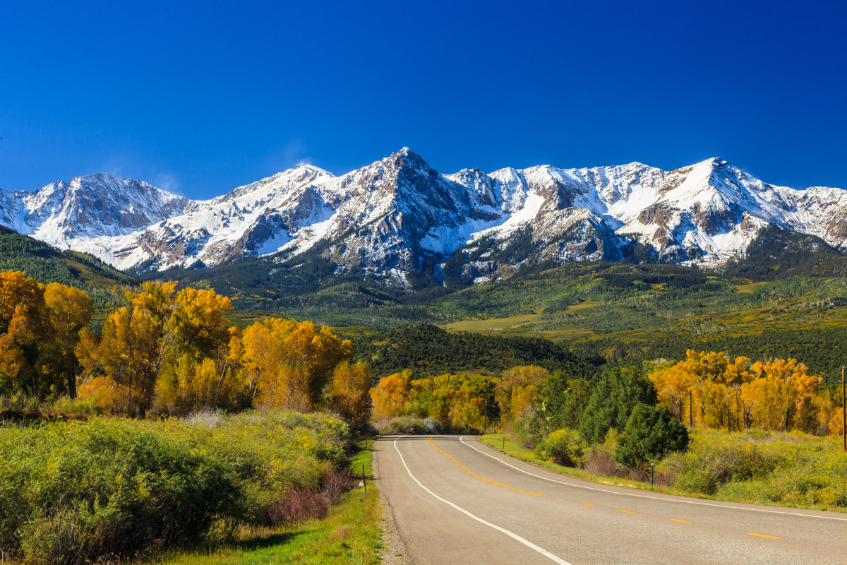
Dallas Divide


14er
ultra
fred-beckey-great-peaks
colorado-ultras


