
Scan the QR code and open PeakVisor on your phone
The Sangre de Cristo Range include 547 named peaks. The highest is Blanca Peak at 4,374 m. Other notable peaks include Crestone Peak, Crestone Needle and Kit Carson Mountain.
There are 488 named mountains in the Sangre de Cristo Range, the southernmost sub-range of the Rocky Mountains of North America. The highest and most prominent mountain is Blanca Peak. This range is approximately 230 miles long, with half that length in the U.S. state of Colorado and the other half in the state of New Mexico. The Colorado segment begins near the town of Poncha Springs and extends southerly to the New Mexico state line, about 45 miles southeast of the city of Alamosa. The New Mexico segment continues in a southerly direction to just southeast of Santa Fe, the state's capital city.
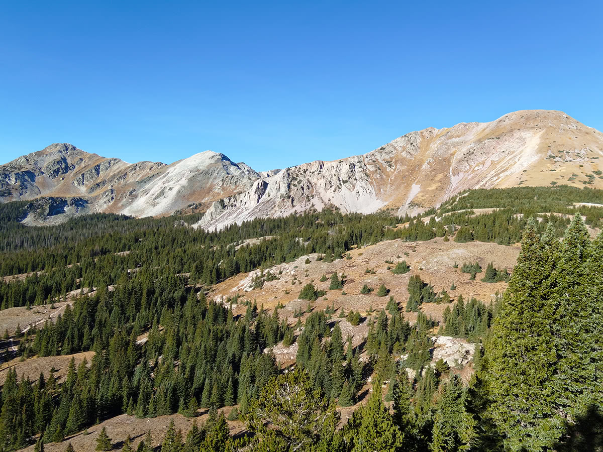
Most of the Sangre de Cristo range finds itself in a region of relatively sparse populations, with the largest city, Colorado Springs, about 70 miles northeast of the northern end of the range. From the south end of the range, it is another 60 miles southwesterly to Albuquerque, New Mexico's largest city. The entire range is located in the Atlantic watershed, with the continental divide mostly distant except at the northern end of the range where the divide approaches to within 10 miles. Much of the range is characterized by a narrow chain of high peaks, especially in Colorado, where it contains no less than ten fourteeners and numerous peaks over 13,000 feet. Some of the most challenging mountains in Colorado are to be found in the Sangre de Cristos. In New Mexico, the mountains in this range are much lower, though there are two clusters of high peaks near Taos and Santa Fe, which contain several thirteeners and a number of other high summits.
It can be safely assumed that the Colorado segment of this range offers more appeal to hikers and especially climbers than does the segment in New Mexico, although surprisingly, there is no ski resort in these mountains. There once was a small ski area, but it failed in the early 1990's. By contrast, the New Mexico segment still has a major and successful ski resort - the Taos Ski Valley - as well as several smaller ones. It is here that the highest peak in New Mexico, Wheeler Peak (elevation 13,161 feet), can be found, thus affording considerable appeal to mountaineers, at least in this area. Further south, closer to Santa Fe, is another cluster of high peaks, dominated by the Truchas Peaks, two of which are thirteeners with enough topographic prominence to be considered independent peaks. Thus, nine of the ten highest mountains in New Mexico having a prominence of at least 500 meters (1640 feet) are in the Sangre de Cristo Range, as are all thirteeners in the state.
A special note about nomenclature about this chain of mountains. In Colorado, it is called the Sangre de Cristo Range, whereas in New Mexico it is called the Sangre de Cristo Mountains. Needless to say, this is a source of confusion as the terms are used interchangeably, but in the end it does not really matter since it is reasonably well understood what mountains one is talking about. In local parlance, they are simply referred to as the Sangre de Cristos or the Sangres.
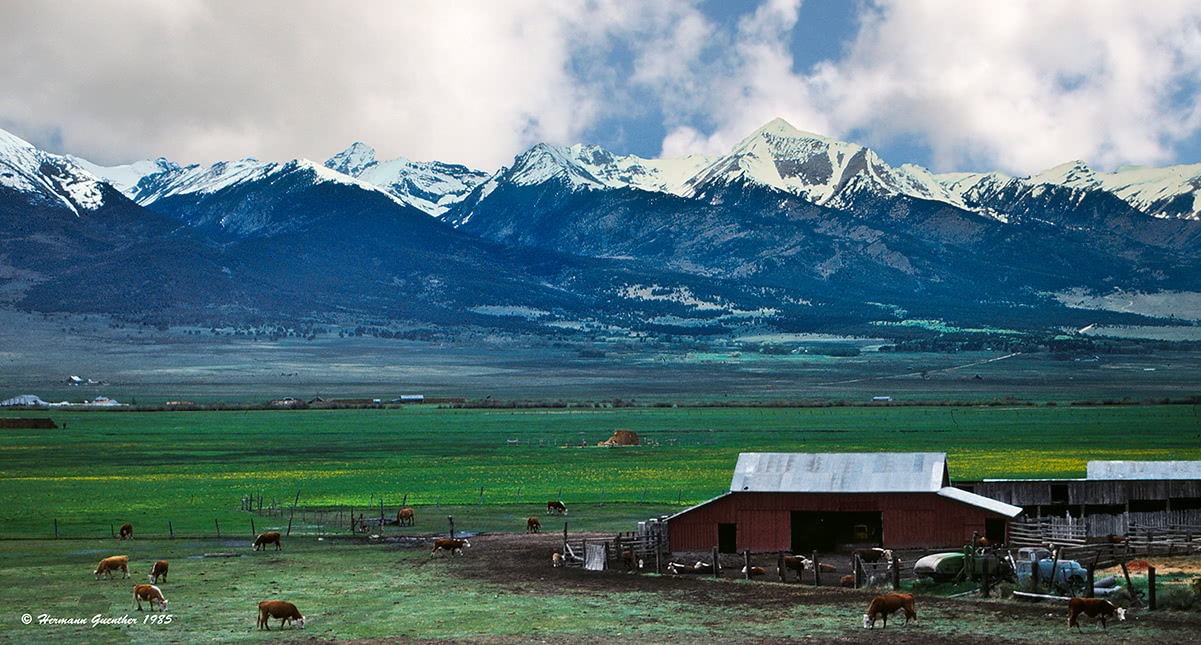
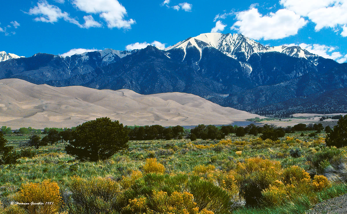
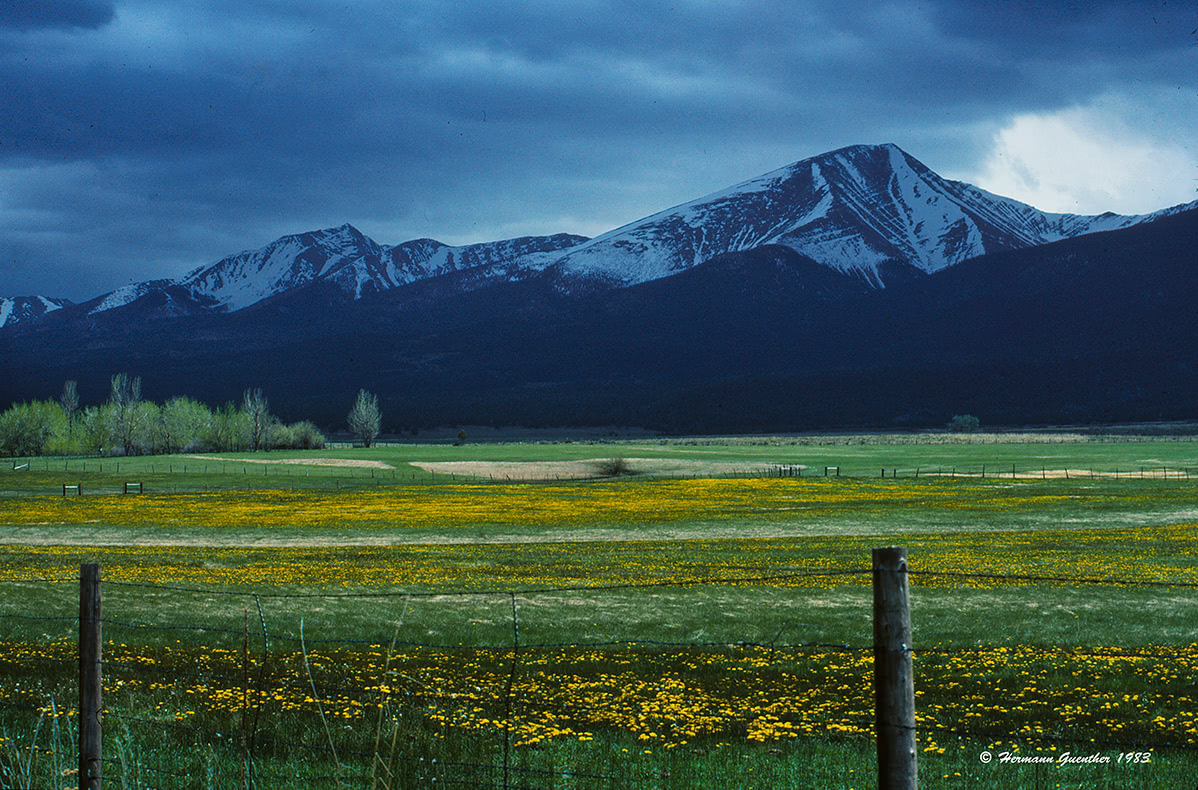
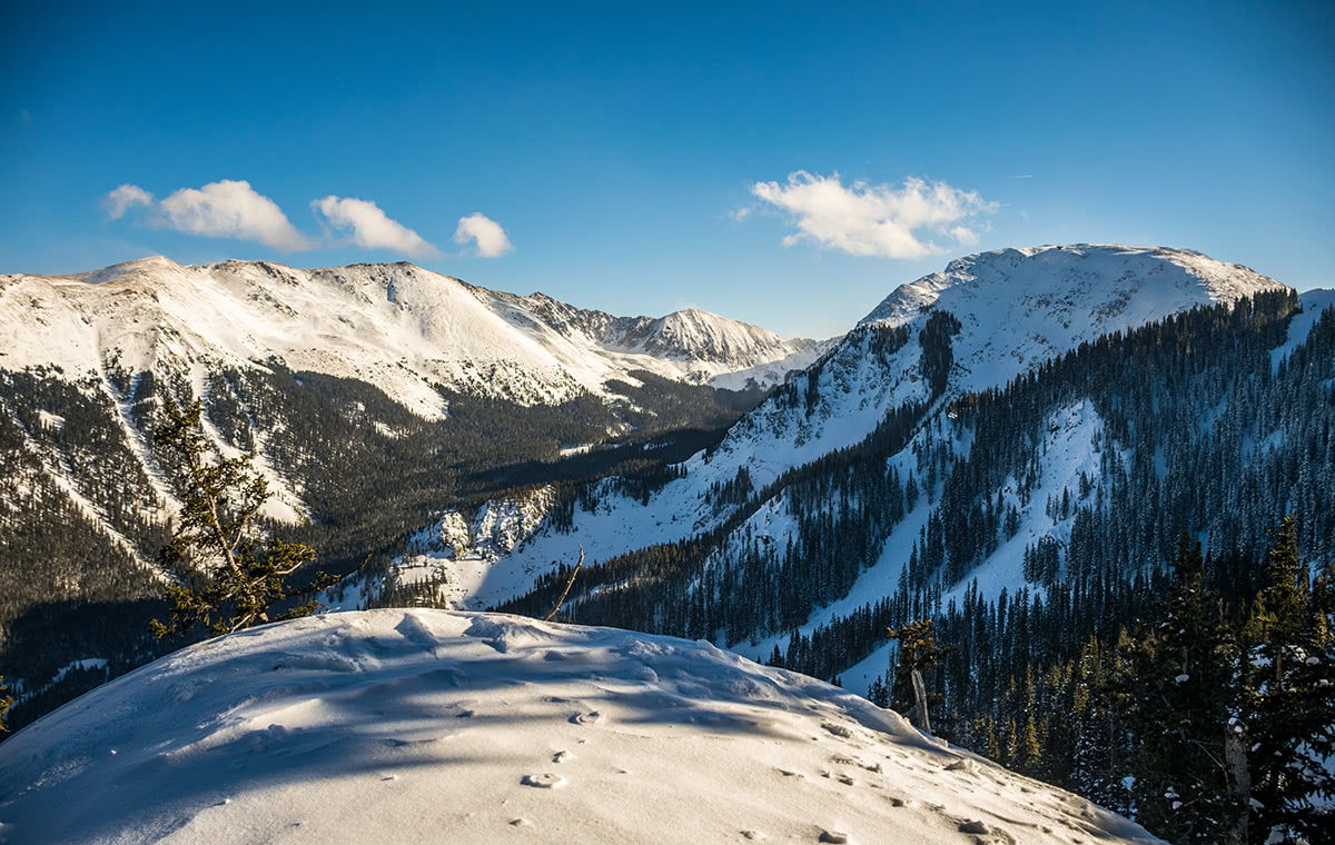
When driving through the San Luis Valley in southern Colorado, one cannot help but be impressed by the high wall of mountains directly to the east of State Highway 17. These mountains have no foothills and rise straight up from the valley floor. For a mountain lover, let alone a dedicated mountaineer, these high and rugged peaks are sure to get the adrenaline flowing. In the middle part of the range, above the small town of Crestone, is a cluster of high mountains called the Crestones. These five fourteeners (Crestone Peak, Crestone Needle, Kit Carson Peak, Humboldt Peak and Challenger Point) and their sub-peaks afford some of the best climbing in Colorado. The two "Crestones" are clearly the most challenging, and experience, condition as well as caution are prerequisites for anyone attempting to climb them. One of the most fascinating natural phenomena at the base of these mountains is the Great Sand Dunes National Park and Preserve. Located on the west side of the range, this large expanse has the highest dunes in North America.
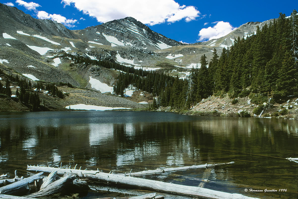
Both east and west sides of the range have a number of trailheads for accessing the back country. Many of these trailheads will be staging points for long hikes involving considerable elevation gains, especially on the west side. Some of the less known trailheads along the west side are on private property and are not as well-used, if at all. Trails such as Cottonwood Creek and Spanish Creek are best avoided because of these issues, and because they can be difficult to follow. Along the east side are many official trails leading up long valleys to scenic high country lakes, with further access to the high peaks. But some of these trails don't have their own trailheads - instead they divert from a longer trail, the 29-mile Rainbow Trail, that follows along the base of the mountain chain. This leads to long approaches before one even starts uphill. Most of this part of the range is within the Sangre de Cristo Wilderness, and occupies parts of two national forests - San Isabel and Rio Grande.
Willow Creek Trailhead - This popular trailhead on the west side of the range can be reached in less than two miles from the center of the town of Crestone. The last mile of this dirt road may not be suitable for all passenger vehicles. This trailhead is commonly used to climb Challenger Point (elev. 14,081) and Kit Carson Peak (elev. 14,165). The peaks are commonly climbed together by first crossing over Challenger, descending to the saddle and then climbing Kit Carson. The return requires another descent into the saddle and back up Challenger. This is a strenuous hike of 14 miles round trip with a total elevation gain of 6,250 feet. Any attempt to descend to the south via the couloir between the two summits should be avoided at all costs.
South Colony Trailhead - This trailhead on the east side of the range is perhaps the most popular, as it provides trail access to all of the high peaks of the Crestone group. It is about 12 miles from the nearby town of Westcliffe to the first parking area. This is where drivers with passenger cars need to park. Those with four-wheel drive and high clearance can drive another 2.5 miles to the so-called "new" South Colony Trailhead. This trail can make a pleasant day hike to the South Colony Lakes and their beautiful setting at the base of the Crestones. A trail continues from the lower South Colony Lake over Broken Hand Pass to Cottonwood Lake which many climbers use as their base to climb Crestone Peak and Needle. From the South Colony Lakes it is also relatively easy to climb Humboldt Peak, and, with additional exertion, Kit Carson Peak and Challenger Point can be climbed from the lakes. But climbing any of the peaks in the Crestone group is likely beyond the scope and capabilities of casual hikers.
This group of fourteeners, dominated by the ultra-prominent Blanca Peak, is located approximately 20 miles east-northeast of the city of Alamosa. These mountains, some of the most magnificent in Colorado, are difficult to approach, in part due to the fact that much of the land on the south and southeast side of the massif is private property. There are in fact only two viable trailheads to access these peaks - one on the west and one on the northeast side. These mountains, of which Blanca Peak is the tallest and one of only three ultra-prominent peaks in Colorado, are truly spectacular. They dominate the views in the southern part of the San Luis Valley. These four fourteeners - Blanca Peak, Little Bear Peak, Ellingwood Point and Mount Lindsey - are best left to the experts, though a well-conditioned hiker can do Lindsey on a long day hike with a degree of difficulty not exceeding 2+.
Lake Como Trailhead - This is the main staging point for climbs of Blanca Peak, Little Bear Peak and Ellingwood Point. It is about 20 miles from the city of Alamosa and 11 miles from the small town of Blanca. At 8,000 feet elevation, it is the lowest trailhead in Colorado for climbing fourteeners. It is theoretically possible to drive all the way to Lake Como at 11,750 feet, another five miles up the road, but that involves negotiating the most challenging four-wheel drive road in Colorado, which is only possible with specially modified vehicles. Most vehicles stop at the lower location, though some continue on up to 10,000 feet and park somewhere along the road, depending on their comfort level. At any rate, those wishing to climb the high peaks will likely camp at Lake Como before making their ascent. This then is the primary staging point for climbing these peaks. Casual hikers don't usually come up here, although Lake Como is very scenic. The only trail to the lake is the jeep road and it is very unpleasant to hike.
Huerfano River Trailhead - This trailhead lies at an elevation of 10,660 feet and is relatively accessible to most passenger cars, although the final two miles can be quite rough such that a four-wheel drive vehicle is advisable. This trailhead provides the only public access for climbing Mount Lindsey. This is not the easiest route to the summit - that one is not available to the public since it is on private property. And while this trailhead is not normally used to climb Blanca Peak, Little Bear Peak and Ellingwood Point, it does provide access for technical climbing of the north faces of Blanca and Ellingwood.
Culebra Peak - This mountain is the southernmost fourteener in the Rocky Mountains of North America. This mountain has a certain "distinction" no other fourteener in the United States has. It is entirely located on private land. But those wishing to climb it may do so - for a handsome fee. According to hearsay, the amount has been steadily climbing, with as high as $150 reported. But the price keeps changing depending on the policies of the owner of the ranch upon which the mountain (plus 18 thirteeners as well) stands. Also, access to the peak is restricted to dates and times dictated by the owner. Because of this, some "peak baggers" choose to exclude this peak from their list of fourteeners. They call themselves the ABC group - All But Culebra. For those who are willing to pay the fee, the only access point is the entrance to the Cielo Vista Ranch, which is just east of the small town of San Luis about 40 miles southeast of Alamosa. It is an easy mountain to climb. In fact, it is hardly a climb - a walk-up hike would be more appropriate. There is a benefit to be realized by paying the fee to climb Culebra - it is the fact that this mountain is completely unspoiled and pristine. When compared to so many of the most popular fourteeners that are trashed out by hikers, there is something to be said for this. After all, a one-day lift ticket at some of the bigger ski areas can cost a lot more than this.
Spanish Peaks - Just to the east of the Culebra Range are two prominent mountains - the Spanish Peaks. The peaks have been designated as a National Natural Landmark because of their geologic make-up. They are located in the Spanish Peaks Wilderness within the San Isabel National Forest and are a very popular hiking area. Because of their prominence, especially the West Peak (elev. 13,626), which rises abruptly some 7,000 feet above the Great Plains, these peaks can be seen for many miles from all directions. The main trailhead is reached by driving State Highway 12 to the summit of Cucharas Pass, from where a gravel road leads to Cordova Pass and the trailhead - about six miles from the highway. There is a small fee to park here but it is the best way to climb West Spanish Peak. Although it is a relatively short trail, it is considered strenuous, as the last half mile rises 2,000 feet in elevation. An alternate trailhead can be found about seven miles south of the town of La Veta at the north end of SH-12. The Wajatoya Trail ascends from here to the saddle between the Spanish Peaks, from where it is possible to climb either peak. The elevation gain to either peak, but especially the West Peak, is significant - about 5,200 feet to the latter. The views from the summits are stunning.
While the major north-south highway in Colorado (Interstate 25) is a relatively short distance east of the Sangre de Cristo Mountains on a straight-line measure, the major cities and towns it serves to the north and to the south are not really suitable bases from which to stage hikes in these mountains. Of course, visitors to this range may well arrive from these cities before settling down in a place that is more convenient for their recreation and exploration. The main focus here is to inform visitors who are not acquainted with this area as to how and where best to base themselves to gain the most advantage in terms of convenience and proximity. As earlier stated, the Sangre de Cristo range is situated in a region of low population density. Following are the best choices for staging adventures in this region.
Alamosa - In the middle of the immense San Luis Valley, which forms the western edge of the Sangre de Cristo Range in Colorado, sits the city of Alamosa. With a population of less than 9,000, this is by far the largest town anywhere close to this mountain chain. Yet, the town offers almost any amenity that a visitor would require for an extended stay to explore these mountains - accommodations, restaurants, hospital, golf course, shopping and even an airport with regional scheduled service including to Denver and Albuquerque, New Mexico. This is the place to stay if hiking access to the western approaches to the Sangre de Cristos is desired. Visitors to the Great Sand Dunes National Park are very likely to base themselves in Alamosa for a multi-day visit.
Westcliffe - If hiking access to the east side of the Sangre de Cristo Mountains in Colorado is desired, the town of Westcliffe may be the best choice for accommodations and eating. With a population of under 600, this is not exactly a major town, but at least there are a few lodging and eating establishments here. But the views of the mountains to the west are epic, and the trailheads are not far from town. A visitor to Westcliffe should not expect to find much more than the most basic amenities here. The city of Salida, with a population of just over 5,000, about 50 miles to the north would be a more viable, but more distant, base from which to explore the northern reach of these mountains.
Crestone - A tiny village of less than 200 souls, Crestone is nestled right at the foot of some of the highest peaks of the Sangre de Cristos. It is known as a spiritual center representing a number of major religions, only about an hour's drive from Alamosa. For some who want a quiet experience in a beautiful setting, there are several bed and breakfast facilities here although other amenities are not abundant.
The New Mexico segment of the Sangre de Cristo Range (i.e. "mountains") may not be as dramatic or spectacular as its Colorado neighbor, but that should not discourage anyone from visiting or exploring this beautiful region. This part of the range occupies parts of two national forests - the Carson National Forest and the Santa Fe National Forest. Contained within this area are four wilderness areas as well. And although New Mexico has no fourteeners, it does have several mountains that top out over 13,000 feet. There are seven named summits in the state that reach above this elevation, although two of them have a topographic prominence of less that 200 feet. They are all in the Sangre de Cristo Mountains, and are found in two separate clusters - one towards the north near Taos and the other in the south near Santa Fe. They are, with some exceptions, all very popular hiking/climbing destinations. To the east of the main range is the Cimarron Range which is a sub-range of the Sangre de Cristos.
Unlike in the Colorado segment of the range, there are a number of highways and forest roads that cross the range in New Mexico. These highways in turn provide access to many trailheads and dozens of campgrounds. One such road is State Highway 63 which extends from the town of Pecos in the south for over 20 miles following the upper Pecos River Valley northward to a few miles beyond Cowles. Along the way, this highway intersects several forest roads that lead to a variety of trailheads and campgrounds, before it ends abruptly in the back country.
In the north, State Highway 38 leads into the interior of the range from the town of Questa, passing several recreation areas before it meets U.S. Highway 64 at the town of Eagle Nest. Highway 64 provides the only significant and most direct access into the interior of the range from Interstate Highway 25. It is also the only direct route from I-25 across the range to the town of Taos. While most access for recreation from the east is relatively sparse, the really significant staging areas for the mountains here are decidedly from the west side. This means that the cities of Taos, Española and Santa Fe are therefore the main destinations from where exploration of the higher peaks is most convenient.
Taos Valley, Wheeler Peak on the left.
Wheeler Peak Group - These mountains are best accessed from Taos Ski Valley. This largest ski resort in New Mexico, located about 20 miles northeast of the town of Taos, is the handiest staging area for hikes and climbs in the mountains around Wheeler Peak, the highest mountain in New Mexico. Casual hikers may only choose to go as far as Williams Lake, for example, but the more adventurous are likely to continue on the Wheeler Peak Trail to explore the higher terrain. Once up on top, the opportunities for further exploration really open up with a network of connected trails and ridges that reach the other summits of this group as well as a number of alpine lakes. These peaks are also accessible from a trailhead that is about eight miles south of the ski resort of Red River which is located on State Highway 38 about 12 miles east of the town of Questa. One note of caution - much of the land on the south slopes of these mountains is owned by the Taos Pueblo, and visitors are required to respect this and not trespass on their land here.
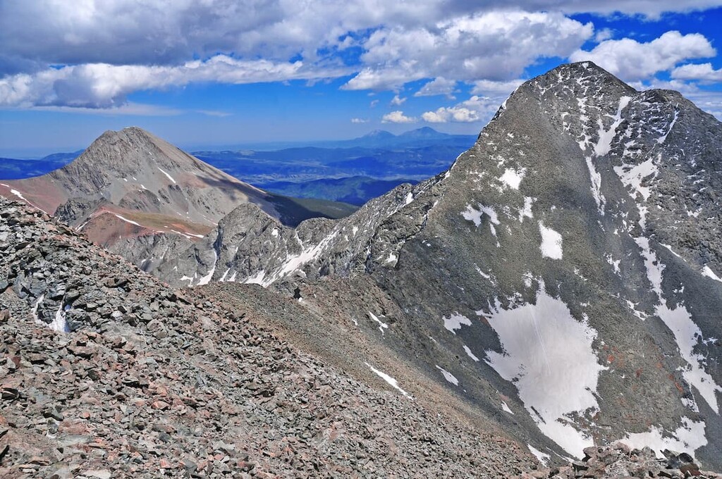
Truchas Mountains - While only about 25 miles northeast of Santa Fe "as the crow flies", the Truchas Massif is an interesting and very remote group of high mountains. They include Truchas Peak (also known as South Truchas Peak), the second-highest independent peak in New Mexico based on its topographic prominence. These mountains lie within the Pecos Wilderness in the Santa Fe National Forest and are not as easily accessible as the Wheeler Peak group near Taos. The Truchas Peaks are steep and craggy, more like their northern neighbors in Colorado. Not surprisingly, Truchas Peak is seldom visited, and it, as well as its neighboring peaks, are not even mentioned in major New Mexico hiking guide books. Because the Truchas Peaks are in close proximity to each other, they are often climbed together, when they are climbed. There are two trailheads accessible from the west side - from the town of Española - the most common one being the Quemado Creek Trailhead. This is the closest approach to the Truchas but caution must be exercised since vandalism to cars is common here. Also, permission is required here as is a high-clearance, preferably four-wheel drive, vehicle. This trailhead affords the shortest approach to these mountains. From the south there is a trailhead near Cowles in the upper Pecos River Valley, but the approach from here to Truchas Peak is very long - a round trip hike of about 24 miles. Another lengthy approach, but one that is considered a more safe place to park a car, starts at the Santa Barbara campground in the north.
The Sangre de Cristo Mountains in New Mexico are flanked by two major highways - Interstate Highway 25 on the east, and U.S. Highway 285 on the west. While highway access from the east side into the interior of the range is possible, there are no significant towns here that would be considered viable staging points for exploring this range. But there are two towns that could be considered for at least preliminary staging points - Raton (population 6,885) and Las Vegas - no, not the glitzy one in Nevada - (population 13,753).
For the visitor who is not familiar with the area and who wants to gain the best advantage during a visit to these mountains, it is the west side, served by Highway 285, that affords the best opportunities for recreation and exploration. There are no big cities here, but various towns present here are remarkable for their scenic as well as historic value.
Santa Fe - This may only be the fourth-largest city in New Mexico (population about 68,000), but it is the capital of the state. Not only that, it is by far the highest capital of any U.S. state. At an elevation of 7,199 feet, it is almost 2,000 feet higher than its Colorado counterpart - Denver, the "Mile High City". Its setting at the foot of the Sangre de Cristo Mountains is stunning enough, but it also boasts a dry climate that is envied by many. There is no shortage of recreational opportunities here and it is the most likely city a visitor would want to make a base for an extended visit. The city has all the amenities of a much bigger town, without many of the accompanying urban problems. Accommodations, dining and cultural venues abound here, but the city does not have a major international airport. That, however, is remedied by the fact that Albuquerque, only an hour away, does.
Simply stated, Santa Fe is one of the gems of the southwestern United States. Its downtown area is an architectural wonderland, with a southwestern theme dominating. To say that the city has Spanish and Puebloan influences would be an understatement. Culturally, the city is a haven for artists of all persuasions - galleries are to be found everywhere. In the world of music, the city is perhaps best known for the Santa Fe Opera which stages world class performances all summer featuring some of the world's best. One must not forget the shopping - this town offers some of the best Native American products available anywhere - and for all price levels. There is no shortage of boutiques and competing sidewalk vendors can be found everywhere, especially during fiesta times. And they all sell high-quality products. With all these offerings, it is sometimes difficult to find time to go hiking or skiing in the mountains.
Taos - Taos is often associated with the famous ski resort - Taos Ski Valley - about 20 miles to the northwest. But there is more - lots more. With a population of only about 6,000, it is a worthy destination in its own right. At an elevation similar to that of Santa Fe, Taos boasts a healthy climate with clean air and stunning views. While not on the scale of Santa Fe, Taos offers a respectable variety of accommodations, dining, recreation and cultural venues and activities, especially those relating to Native American peoples. The Taos Pueblo, a UNESCO World Heritage Site, is one of the oldest continuously inhabited communities in the United States and must be visited. Taos has also become a sizeable art colony with over 80 galleries. Its proximity to the highest mountain as well as the largest ski area in the state, plus three other ski areas, makes Taos an attractive base from which to undertake all kinds of recreational activities, year-round. And don't forget the shopping - Native American products take center stage here. For those visitors who have extra time, the surrounding area and nearby villages offer some amazing historical sites that can be visited in a short drive from town. The spectacular gorge of the Rio Grande River is also nearby.
Taos Ski Valley - For those wanting to be more up close and personal with the Sangre de Cristo Mountains of New Mexico, there is no more formidable resort than Taos Ski Valley. This resort has it all - and not just for the winter months. Skiing, snowmobiling, Nordic skiing, hiking, climbing, horseback riding, mountain biking, river rafting (nearby) and fishing can all be found here and nearby. Accommodations for all budgets, well maybe not for all, and a variety of dining options make this an all-inclusive destination resort. Here, hikers can start their climb of the highest mountain in the state, Wheeler Peak, right from their doorstep. No need for a car once you get here! There is even free bus transportation, including to and from the town of Taos.
Albuquerque - The largest city in New Mexico is about a one-hour drive from the southern end of the Sangre de Cristo Mountains which means it is also the largest city close to the southernmost point of the Rocky Mountains of North America. Albuquerque has a city population of about 560,000 with a metropolitan population of just over 900,000. This makes it by far the largest city anywhere close to the Sangre de Cristo Range, especially the New Mexico segment. While adequate amenities for visitors to the range are available much closer than Albuquerque, the city's significance comes into play by virtue of its international airport with direct service to most major cities in the western half of the United States. The city also serves as the crossroads of two major interstate highways - I-25 and I-40. Therefore, visitors to the Sangre de Cristo Mountains can easily get here no matter where in the world they come from.


The highest peak in the Sangre de Cristo Range is Blanca Peak, at 4,374 m.
The Sangre de Cristo Range have 547 named peaks.


