
Scan the QR code and open PeakVisor on your phone
There are 917 named mountains in the Front Range of Colorado. Grays Peak is the highest point. The most prominent mountain is Pikes Peak.
This large range of mountains extends northward about 175 miles from the Arkansas River Valley west of the city of Pueblo to the Wyoming state line. On the east it is defined by a line of foothills that follow the western edge of the urbanized corridor centered on Interstate Highway 25, from south of Colorado Springs, through the metropolitan area of Denver, to Fort Collins. From west to east, the Front Range averages about 60 miles wide and encompasses a number of sub-ranges. The Continental Divide meanders through parts of the Front Range such that its mountains are distributed over both the Pacific and Atlantic watersheds. There are six fourteeners included in this range with the summits of two of them (Grays Peak and Torreys Peak) perched squarely on the Continental Divide, the only fourteeners in the Rocky Mountains to share this distinction, a fact not widely known to many people. In fact, Grays Peak is the highest elevation on the entire Continental Divide of North America.
The Front Range is generally divided into three secondary ranges (north, central and south) which in turn are further broken down into tertiary ranges or massifs. Some of the most notable of these include, not necessarily in order of importance or prominence, the Indian Peaks, the Never Summer Mountains, the Mummy Range, the Chicago Peaks, the Pikes Peak Massif and the Kenosha Mountains. Contained within the boundaries of the Front Range are 12 designated wilderness areas, dispersed among four national forests and one national park (Rocky Mountain N.P.). With such a diversity of geographic distribution and range of geologic characteristics, and being conveniently located close to the urban corridor which comprises about 85% of the state's population, the Front Range can provide a lifetime of recreational opportunities. Since this means easy access for millions of people, parts of the Front Range are feeling significant pressure, although there are still many places where hikers can find solitude and almost complete absence of human traffic. The highest paved automobile road in North America leads to the summit of Mount Evans (14,246 feet), the closest fourteener to Denver, only 35 miles straight-line distance from the city center and easily visible from most parts of the metropolitan area.
Aside from Rocky Mountain National Park, which has 350 miles of trails and 60 summits over 12,000 feet, and which is the third most visited national park in the United States, some of the most popular areas for hiking and other recreation are the Indian Peaks Wilderness area and its southern extension, the James Peak Wilderness area, both in the northern Front Range. The central Front Range, which sports four of the six fourteeners, is also highly popular, in part due to its proximity to greater Denver and easy access from Interstate Highway 70. The southern Front Range, with the exception of the Pikes Peak area which has its own stand-alone fourteener, is somewhat less popular, although it has its share of devotees, many of whom can't be bothered with the crowds at the more popular areas to the north. These areas are more likely to be frequented by residents of the second-largest population center, the Colorado Springs metropolitan area. As a consequence, sub-ranges such as the Kenosha Mountains, Tarryall Mountains and Rampart Range do not experience the visitation pressure of their northern counterparts.
While there are hundreds upon hundreds of miles of hiking trails in the Front Range, one must not lose sight of the fact that the range also includes six ski areas, four of which have international appeal (Winter Park, Keystone, Arapaho Basin, Loveland) and two (Eldora, Echo Mountain) which are a bit more low-key and appeal mostly to local residents. In addition, the Front Range has hundreds of campgrounds and camping sites, countless lakes and miles of pristine rivers and streams which afford superb fishing opportunities. Hunting is also very much pursued throughout the Front Range.
With such an abundance of recreational venues to choose from in the Front Range, one is understandably compelled to ask "Where do I start?" Because of the huge expanse of this range, it is perhaps best to start with an overview of some of the major sub-ranges and discuss the overall attraction each offers, and follow up with the main access points and trailheads. We will focus more on those areas that are likely to offer the most universal appeal, with an emphasis on informing outsiders who may have only limited time to spend here and want to "get the most bang for their buck". This of course may not address what the locals say are the best places to visit, but this group presumably is already well-informed and doesn't need to be spoon-fed with detailed descriptions or preferences.
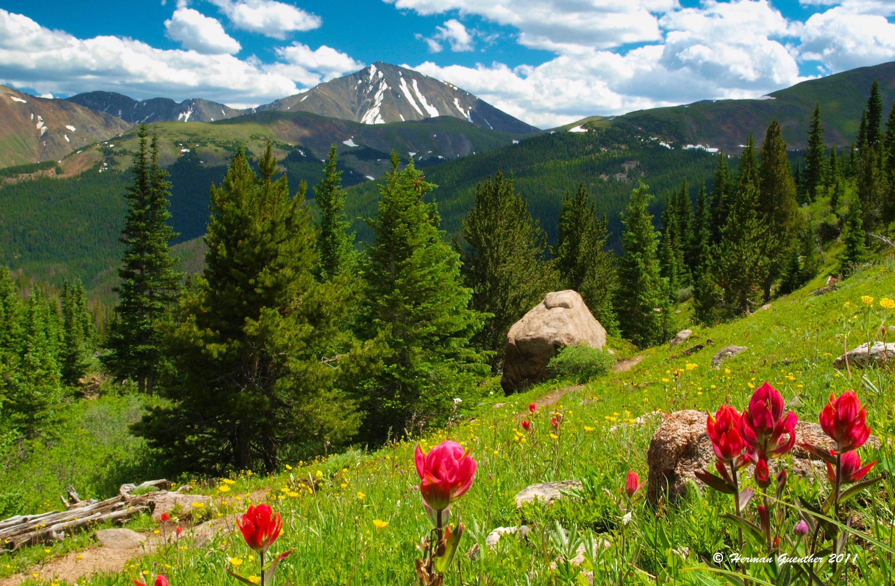
The mountains of both the James Peak Wilderness and the Indian Peaks Wilderness are essentially a continuous chain just north of I-70 and west of Idaho Springs which continues uninterrupted to the boundary of Rocky Mountain National Park and beyond. In fact, there is no year-round highway crossing of the northern Front Range between I-70 and State Highway 14 west of Fort Collins, distance of about 50 miles. This then calls to attention the fact that these mountains impose a formidable barrier to east-west travel. Most of this range straddles the Continental Divide, and the only way across is on foot or on horseback. Yet these mountains offer some splendid hiking for all levels of experience and conditioning. The Eldora Ski area is located on the east side of these mountains. This range can be accessed at several major staging points, mostly along the east side although west side access points are also available, thus affording ambitious hikers the chance to do a one-way traverse if a car shuttle is arranged. Enthusiasts planning such a traverse should take note, however, such a car shuttle can involve a drive of well over 100 miles - each way - depending on the chosen end points of such a hike. Following are some of the most popular and accessible trailhead locations along the east side.
East Portal - This popular trailhead on the east side is so named because it is right by the east portal of the Moffat Railroad Tunnel which extends six miles under the Continental Divide toward Winter Park. This area is easily reached by driving the Peak-to-Peak Highway to the town of Rollinsville, from where it is only eight miles via an excellent gravel road that any passenger car can pass - virtually year-round. The South Boulder Creek Trail begins here and branches off into two other trails in the wilderness. All of them lead to spectacular mountain terrain and a number of pristine alpine lakes. The trail continues up to the Continental Divide at Rollins Pass where it intersects the Continental Divide National Scenic Trail (CDNST), which, as the name implies, follows for miles along the Divide. From this trail it is then possible to drop down into the Fraser Valley where the town of Winter Park is located.
Eldora Trailheads - At the town of Nederland, along the Peak-to-Peak Highway, begins the road to the Eldora Ski Area and the historic town of Eldora. The pavement ends here but passenger cars can continue another ¾ mile to a road junction. The left branch continues several hundred yards further but is only advisable for high-clearance vehicle. This is the Hessie Trailhead. From here, hikers have many options to explore this magnificent wilderness which contains numerous scenic alpine lakes, miles of trails and access to and across the Continental Divide. Though this is a very popular staging area, especially on weekends, there is so much to explore here that visitors are easily dispersed. Back at the road junction, passenger cars can take the right branch and continue another four miles to the Fourth-of-July Trailhead, on a somewhat rough road. Here, hikers can access the popular Diamond Lake, Arapaho Pass and Lake Dorothy. A side trip from this trail will afford a delightful climb of South Arapaho and North Arapaho Peaks (13,397 and 13,502 respectively). From Arapaho Pass, it is possible to cross the Continental Divide and descend into the Fraser Valley.
King Lake Panorama by Hermann Guenther.
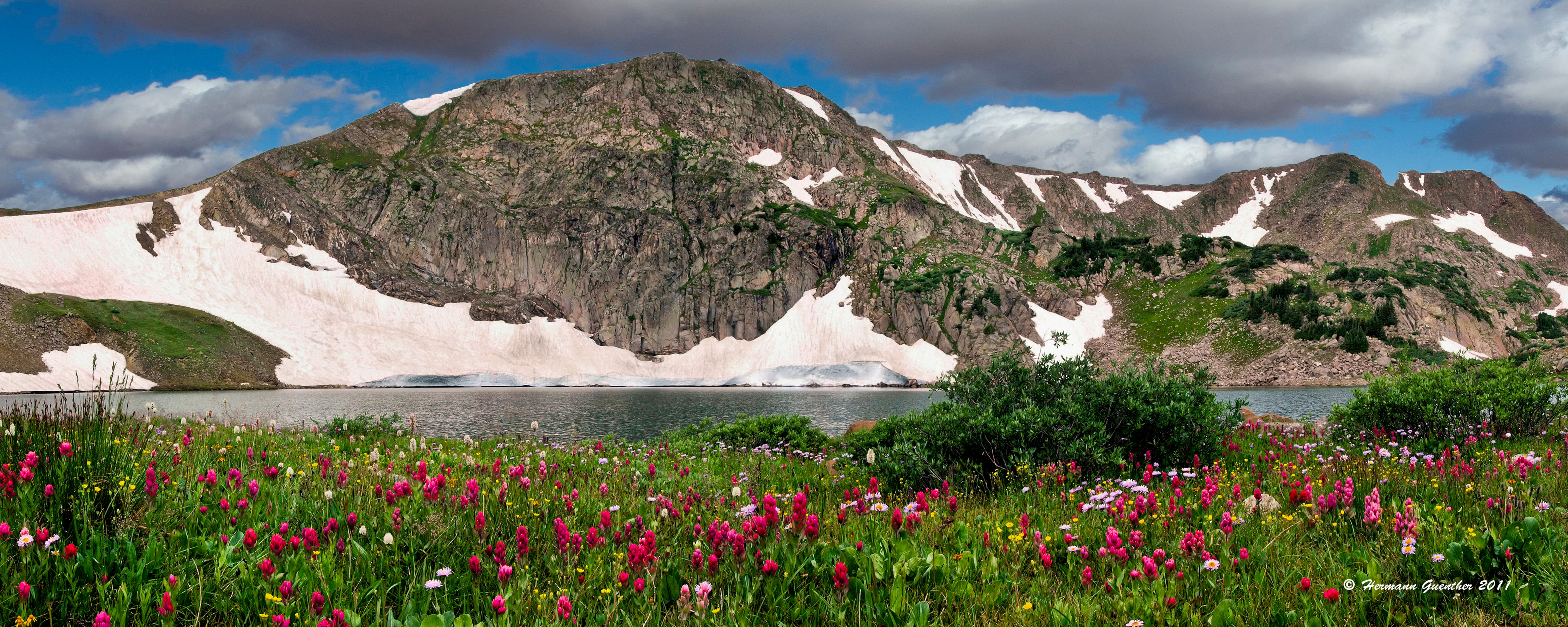
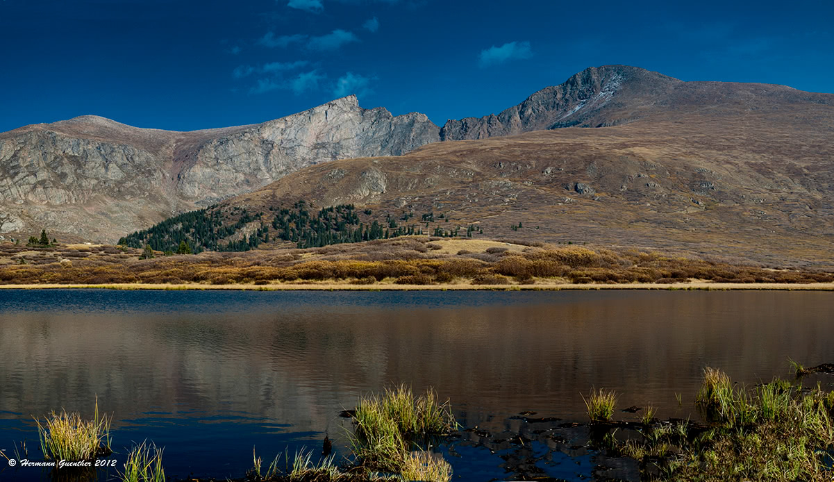
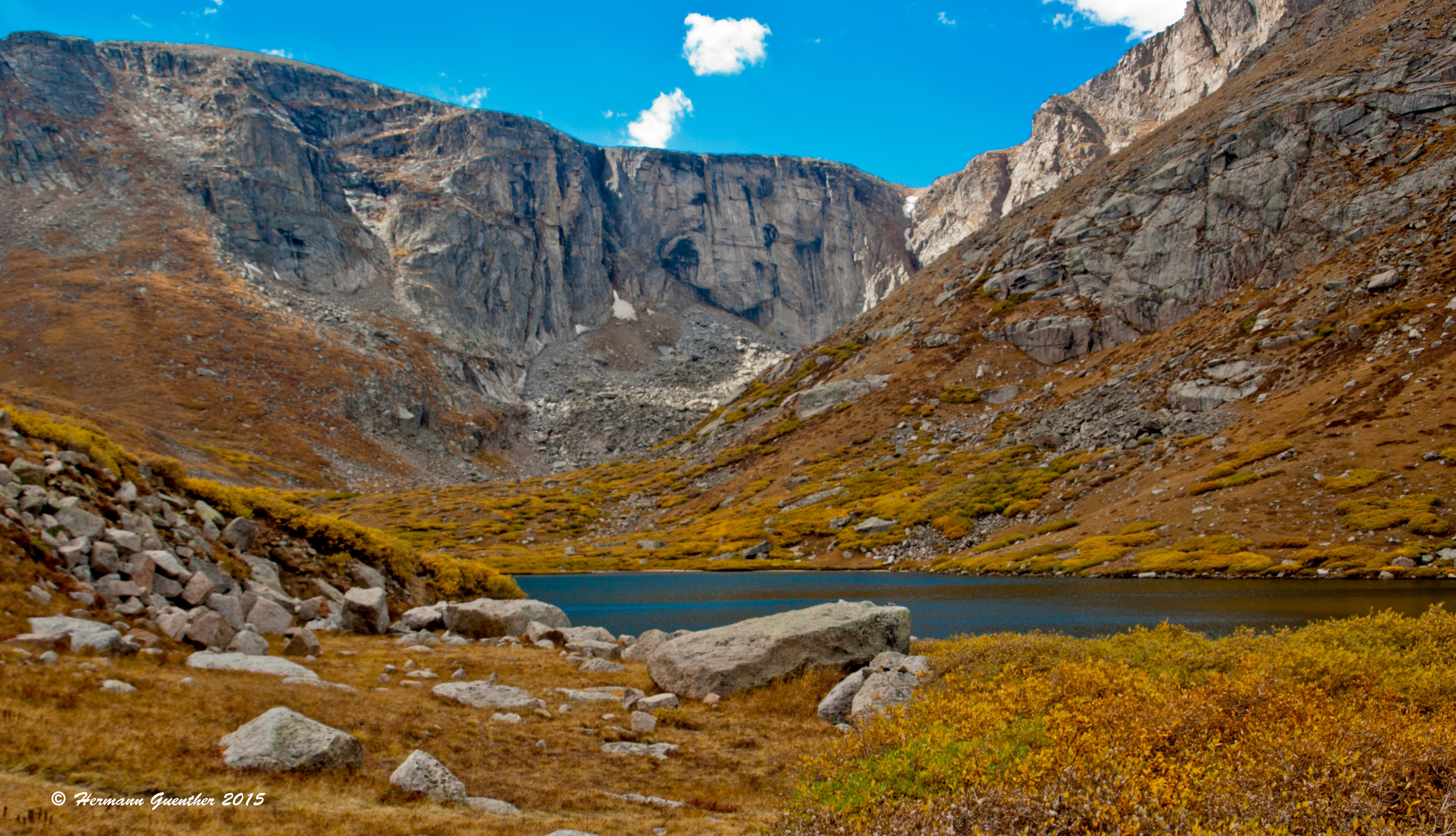
Brainard Lake Recreation Area - About 12 miles north of Nederland on the Peak-to-Peak Highway is the turnoff to the ever popular Brainard Lake Recreation Area. This area experiences heavy visitation and for good reason. There is a large Forest Service campground here as well as several major trailheads, which lead into the spectacular high country. It may be difficult to find a parking space after early morning, especially on weekends, despite the fact that a fee has to be paid here during the summer months. But it is well worth it - there are trails here for all abilities, even just casual hikers. While there are plenty of high summits (over 13,000 feet), the most popular hikes are to two beautiful lakes - Lake Isabelle and Blue Lake (one of many so-named lakes in Colorado). The view across Blue Lake (only a six-mile round trip hike) toward Mount Toll is impressive indeed.
Blue Lake and Mount Toll photo by Hermann Guenther.
The central Front Range is comprised of a group of mountains generally encircled by three major highways: I-70, US-285 and SH-9 (although see Herman Gulch below which accesses a group of high peaks that are outside of these boundaries). This sub-range finds itself on both sides of the Continental Divide and consists of two small but significant groups of high peaks - the Grays/Torreys group and the Chicago Peaks group, which is mostly within the Mount Evans Wilderness area. This relatively compact sub-range is not to be underestimated in terms of importance to the recreational population. It hosts four of the six fourteeners in the Front Range, and they are very easily accessible and very heavily visited. All four of these peaks offer easy routes to their summits and one (Mount Evans) can also be reached by car on the highest paved road in North America, thus affording even "windshield hikers" an opportunity to experience the thin air at over 14,000 feet. Most visitors to these mountains will most likely approach them from I-70 - the major trailheads all being in the Atlantic watershed east of the Continental Divide.
Bakerville Trailhead - Just six miles east of the Eisenhower-Johnson Memorial Tunnels is the Bakerville exit. The signs on the freeway might imply that there is a town here - there is not, although there may be some private landholdings in the area. From here, a four-mile gravel road leads to Stevens Gulch and the traditional trailhead for Grays and Torreys Peaks. The trail to Grays Peak is about four miles and 3,000 feet of elevation gain. Since these two peaks are often climbed together, it is a simple ridge-walk over the saddle connecting Grays to Torreys, with the descent best done by returning to the saddle. While this route is a hike and not a climb, considerably more challenging would be an ascent of Torreys by its northeast ridge over some Class 3 scrambles. This is definitely a climb. When you are standing on either peak or walking the ridge between them, you will be squarely on the Continental Divide. These are the only fourteeners that are on the Divide, with Grays being the highest point on the Continental Divide of North America.
Torreys Peak photo by Hermann Guenther.
Guanella Pass - This high pass is on the road between I-70 at Georgetown and US-285 at the small settlement of Grant. Recent improvements to this road has made the trailhead at the summit far more accessible than it was when much of the road was a rough and bumpy experience. As part of the improvements, two large parking areas were built - they are at times not nearly enough to accommodate all the hikers that want to park at this popular trailhead. A quick glance at a satellite image of the area shows that more cars are parked at the side of the road than in the lots. Why so many cars? It is the trailhead for one of the most popular mountains to climb in Colorado, which is also one of the easiest fourteeners. Mount Bierstadt is named after Albert Bierstadt, a famous German/American landscape painter, who made the first recorded ascent of the mountain in 1863. The hike can be easily extended to include Mount Evans via an intermediate ridge known as the Sawtooth. Most hikers are satisfied just to climb Bierstadt. Guanella Pass is at 11,669 feet, which means the entire hike is above timberline. Exposure to the weather is a consideration when doing this hike.
Mount Bierstadt photo by Hermann Guenther.
Loveland Pass - This high pass (11,990 feet) is a popular bypass route to I-70 through the Eisenhower-Johnson Tunnels because of the great scenery this drive provides. It is also a mandatory bypass for vehicles carrying hazardous materials. Before I-70 was built, this route was the most direct way to get from Denver to Summit County, requiring a slow, and at times treacherous, drive over the Continental Divide. Today, this is a trail access point for some wonderful hiking in the high tundra. Here, ambitious hikers can make an approach to Grays, Torreys and other high peaks in this group - while enduring considerably more miles and elevation gain. It is not one of the more common ways to reach these peaks, but many people enjoy hiking here for the alternative pleasure of hiking in the immediate high tundra with relatively minimal effort.
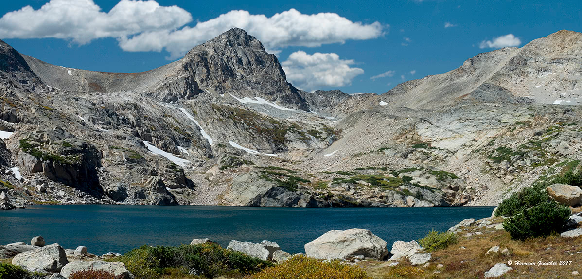
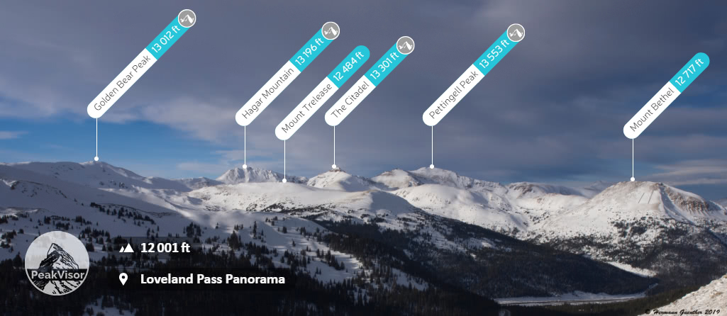
Herman Gulch Trailhead - About three miles east of the Eisenhower-Johnson Tunnels is an exit off I-70 which gives no destination information other than an exit number. But on the north side of the highway here is one of the most popular trailheads in the entire central Front Range. This is the Herman Gulch Trailhead. Most hikers just go up the four miles to Herman Lake at 12,000 feet elevation. An enjoyable hike indeed, since there is plenty of wonderful scenery and, at the right time of summer, an impressive stand of wildflowers. But for those who are more adventurous, there is some amazing high terrain to explore, including such high peaks as Pettingell Peak (13,553 feet), The Citadel (13,301 feet), Hagar Mountain (13,196 feet), and Mount Parnassus (13,574 feet), which is a bit further afield and is easier to approach from Watrous Gulch which can be reached from the same trailhead. Watrous Gulch experiences very little hiking pressure as compared to Herman Gulch, and thus provides a more tranquil hiking experience. This group of mountains can best be seen and appreciated when viewed from a distance - as in this photo taken from the summit of Loveland Pass.
The southern Front Range, though a large expanse of territory, does not exhibit the characteristics of high, rugged mountain terrain as other areas of the range. The highest peaks in this area only reach to the mid-12,000's in elevation and are few in number, the one exception being the Pikes Peak Massif (see below) near Colorado Springs. Most of the terrain here is well below sub-alpine, extending even down to foothills zones. In other words, there is very little true alpine terrain here that would attract multitudes of hikers and especially climbers.
Lost Creek Wilderness - In the southern Front Range, the visitor will experience an encounter with wilderness far different from the overpowering alpine scenery of other parts of Colorado. Yet climbing opportunities can be found here in the form of granite domes, half-domes, spires and buttresses. The Lost Creek area is rather unique as compared to other wilderness areas in Colorado, yet it offers 136 miles of trails, 105 miles of which are within the wilderness boundary. The area is best accessed from various points along US Highway 285 between the towns of Bailey and Jefferson. Some trailheads are directly at the side of the highway, while others require leaving Highway 285 and following other county or forest roads, especially Lost Park Road near the south end of Kenosha Pass, or the Buffalo Creek Road which leaves State Highway 126 in the little town of Buffalo Creek. This area abounds with numerous trailheads, campgrounds and some world class trout fishing opportunities.
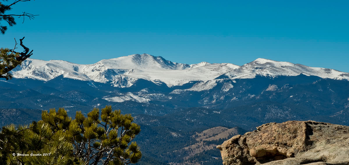
Pikes Peak - The famous Pikes Peak is the easternmost fourteener in North America and is the most prominent mountain in the Front Range. When viewed from the east in the city of Colorado Springs, the mountain looks massive and some of the statistics are staggering. From the town of Manitou Springs, just west of Colorado Springs, the mountain rises 7,800 feet in a horizontal distance of only 7.25 miles. The main trail, the Barr Trail, has the highest elevation gain in Colorado. Beginning at Manitou Springs, the trail is almost 13 miles long- one way - yet is rated Class 1. A shorter alternative (11,4) miles one way, is the less popular Crag Trail, beginning on the northwest side of the mountain. It has only 4,100 feet of elevation gain and is Class 2 in places. Neither trail is difficult - technically.
But aside from these two trails, for years the way most visitors to Pikes Peak (more than a half million annually) reached the summit was by car or train. As of this writing, however, the Pikes Peak Cog Railway, the highest in the world, has been closed for complete refurbishment due to aging equipment and infrastructure. It is scheduled to be reopened in spring of 2021. So at least for the time being, the only easy way up for just about anybody is to drive the Pikes Peak Highway, a 19-mile paved toll road. It is very popular, but it is not the highest paved road in North America - that distinction belongs to the Mount Evans road.
Given the immense expanse of the Front Range, needless to say there are many resorts and towns throughout the range from which easy access is provided by good highways and which offer a host of accommodations, dining options, entertainment venues and shopping for a wide range of tastes and budgets. Following is a partial list of some of these, with no particular preference or endorsement implied.
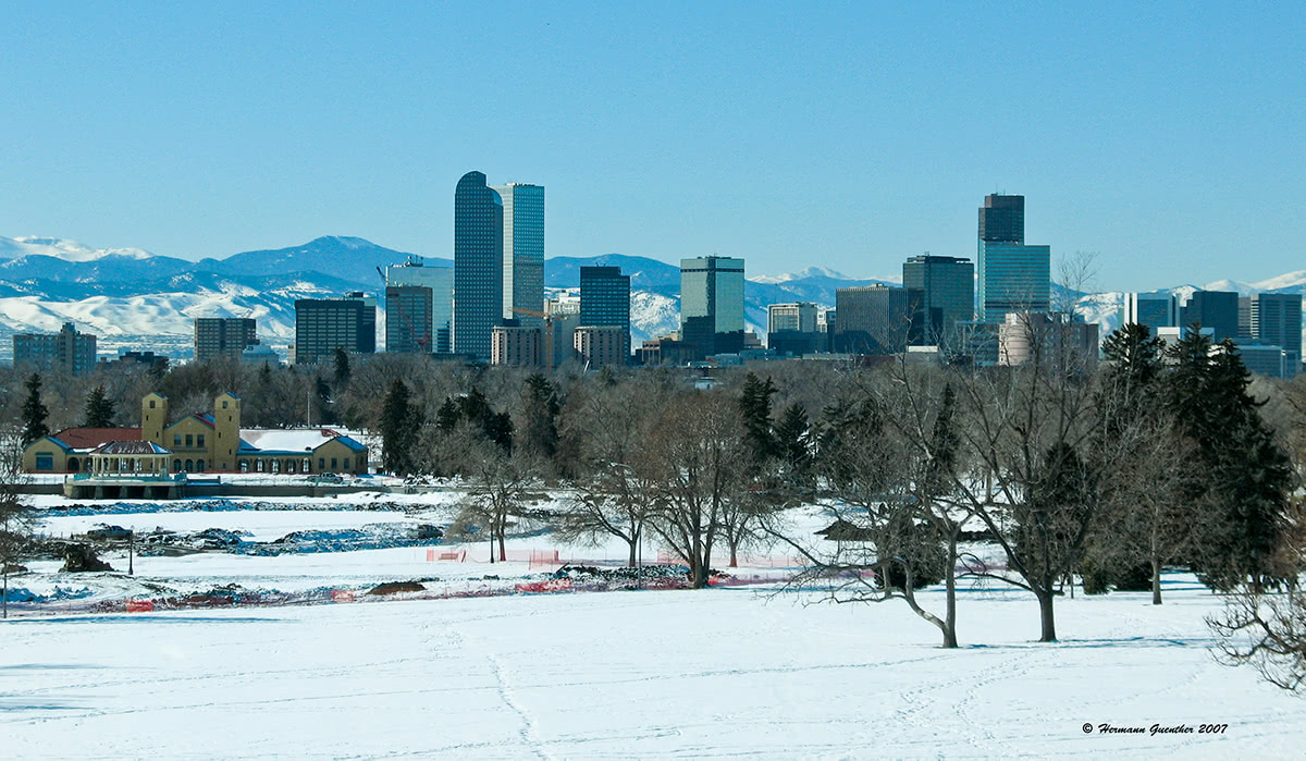
Denver - Having a metropolitan area population of over 2 million, it goes without saying that Denver, the Mile High City, offers anything and everything that a visitor needs or wants. With a world-class international airport, world-wide access to Denver is easy. Non-stop flights from as far away as Asia and Europe are routine. Visitors can get in a car at the airport and be in the high country in as little as 90 minutes. And while all amenities one could want in a big city are readily available, it is the proximity to the mountains which is one of the biggest attractions Denver provides. Since Colorado is so large (over 100,000 square miles), for those visitors wanting to visit other more remote parts of the Colorado Rockies, scheduled airline service is also available. The only Interstate Highway crossing Colorado from east to west is I-70, which passes through the center of Denver.
Colorado Springs - The second-largest city and metropolitan area in Colorado is Colorado Springs. Nowhere else in the country is there a major city so close to a mountain that looms 8,400 feet above it - seemingly right at its doorstep. The famous Pikes Peak is visible from all parts of the city most of the year and is one of the area's major attractions. But there is more. The United States Air Force Academy is located here. It attracts over one million visitors per year making it one of largest tourist attractions in the state. This city offers a good base from which to explore the southern Front Range, but for those who want to concentrate their recreation in places further north, there are other locations that are better positioned. But there is one place in Colorado Springs that is probably second to none for visitors who really want to splurge - the Broadmoor Resort Hotel. It is indeed a beautiful 5-star resort in a spectacular location right at the foot of the mountains.
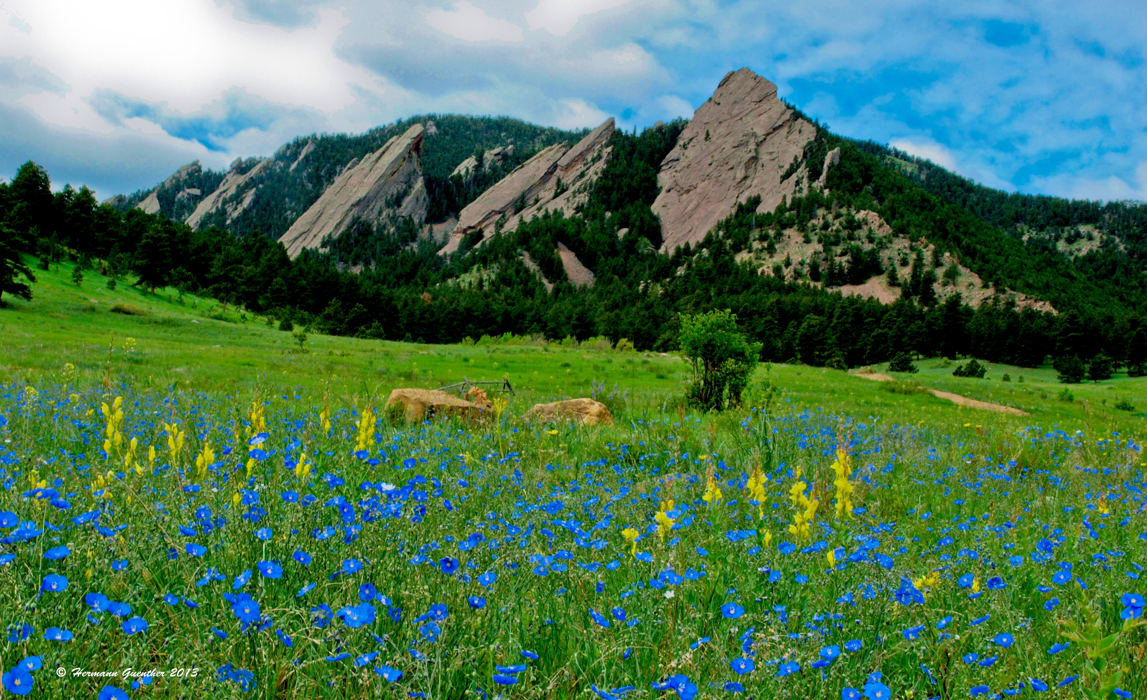
Boulder - This beautiful city about 25 miles northwest of Denver is a mountain-lover's nirvana. Many famous climbers and mountain explorers call (or have called) Boulder home. Nestled right at the base of the foothills of the Rocky Mountains, Boulder is so well positioned as to make it the perfect base from which to explore the entire northern Front Range. It is near Boulder where the Continental Divide meanders to its easternmost location in the United States, less than 20 miles west of the center of town. Even the high foothills looming over the city afford some impressive hiking and climbing opportunities - right within city limits.
The main campus of the University of Colorado commands a large presence in Boulder, as well as providing a youthful population that takes advantage of this spectacular location. The major trailheads previously discussed are but a short drive from the city, such that long day hikes can be easily undertaken without having to go away overnight, even in Rocky Mountain National Park which is barely one hour away.
Estes Park - This wonderful resort town is best known as the gateway to Rocky Mountain National Park. With a wide range of accommodations (from simple cabins to luxury hotels), a food-lover's delight, and a shopping mecca, this charming town is worth visiting just of its own accord. It simply has a beautiful and stunning setting. But for mountain lovers, Estes, as the locals call it, is an excellent setting for staging countless mountain adventures in the northern Front Range. It is a year-round resort, although it experiences significantly reduced visitor numbers in winter. In summer months, it is advisable to book ahead for accommodations. The town can be reached in about 90 minutes from Denver by the shortest highway route, but the slightly longer route via the city of Golden and the Peak-to-Peak Highway is far more scenic and has relatively little traffic.
Grand Lake - Grand Lake, which shares its name with the largest natural body of water in Colorado, is located on the western side of the Front Range. It is the northernmost town of any significance in this region, and it is the end-of-the-line as far as automobile access is concerned. Only in the warmer months of summer and early autumn can visitors continue driving north and then east on U. S. Highway 34 across the Continental Divide, via Rocky Mountain National Park, to the town of Estes Park. In this reach, the highway known as Trail Ridge Road is the highest continuous paved road in North America, reaching an elevation of 12,183 feet. But back in Grand Lake, one should be content to hibernate, at least for a few days, in this alpine gem of a town. Besides access into the high mountains of the northern Front Range, there are plenty of recreational activities available here, including boating, sailing or fishing on Grand Lake as well as the nearby Shadow Mountain Lake and Lake Granby. Grand Lake is home to the world's highest registered yacht club and is also referred to as the Snowmobile Capital of Colorado.
Winter Park - This town is best known as a major ski resort, located in the Fraser Valley on the western side of the northern Front Range. A world-class resort, Winter Park is ideally situated for staging expeditions, or simply day hikes, into the high mountains of the James Peak and Indian Peaks Wildernesses. The town is easily reached in little over an hour from Denver via U.S. Highway 40, which crosses the Continental Divide at Berthoud Pass, elevation 11,307 feet. Winter Park is also handy to the smaller Byers Peak Wilderness area, which has two peaks over 12,500 feet elevation - Byers Peak and Bills Peak, as well as the Vasquez Peak Wilderness Area. One distinction that other resorts in Colorado don't share is that Winter Park is served by Amtrak's California Zephyr train on a daily basis, thus providing an alternative method of getting there from Denver. There is no shortage of accommodations and restaurants in this mountain getaway.
Georgetown and Idaho Springs - These two historic mining towns have become popular tourist destinations in the middle of the central Front Range. Both towns are directly on Interstate Highway 70 and are therefore reached in less than an hour from Denver. These towns, and the I-70 corridor in which they are perched, afford the best access to the Grays/Torreys group as well as the Chicago Peaks group of mountains.
Upper Chicago Lake photo by Hermann Guenther.
They, especially Georgetown, are also handy for those wishing to explore the high country north of I-70 that is served by the Herman Gulch Trailhead, which is only nine miles to the west. There are a variety of accommodations and restaurants available for the visitor, but understandably, the selection is relatively sparse, since these are small towns, with populations of 1,034 and 1,717 respectively. But when in the area, these towns are worth visiting for their historic appeal alone. The Mount Evans Road is best accessed from Idaho Springs.


14er
ultra
fred-beckey-great-peaks
colorado-ultras
14er
ultra
fred-beckey-great-peaks
colorado-ultras


