
Scan the QR code and open PeakVisor on your phone
The Eagles Nest Wilderness is located in the southern half of the Gore Range in north-central Colorado. While the Gore Range encompasses a much greater geographic area than the 133,471-acre wilderness, it is noteworthy that most of the rugged interior of the range is contained within the boundaries of the Eagles Nest Wilderness. With so many rugged peaks and ridges, some of the most rugged terrain in all of Colorado, it may come as a surprise that the entire wilderness has only 15 named mountains. Of these the highest and most prominent is Mount Powell at 13,586 feet of elevation. There are of course many other peaks over 12,000 feet that are not named which afford numerous climbing opportunities.
The Eagles Nest Wilderness is located in Eagle and Summit Counties and is administered by the United States Forest Service, White River National Forest. Wilderness is best defined by the author of the Wilderness Act of 1964, Howard Zahnister: "A wilderness, in contrast with those areas where man and his own works dominate the landscape, is hereby recognized as an area where the earth and its community of life are untrammeled by man, where man himself is a visitor who does not remain." There are several government agencies that administer the 765 wilderness areas in the United States - U.S. Forest Service, U.S. National Park Service, U.S. Fish and Wildlife Service and the U.S Bureau of Land Management. As of 2016, this encompassed a total of 109,129,657 acres, or an area larger than the state of California.
The lack of fourteeners or other renowned high peaks does not imply that the Eagles Nest Wilderness is without recreational appeal. Quite the contrary. The mountains in this wilderness are home to some of the best ridge scrambling in Colorado, although most peaks, even some of the named ones, remain largely unclimbed due to their lower elevations as compared to other more popular areas of the state. Much of the recreational activities in the wilderness consist of hiking, backpacking, back-country skiing, horseback riding and fishing. These are all activities that are permitted under the Wilderness Act.
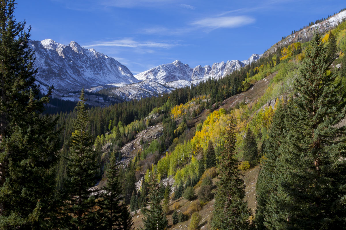
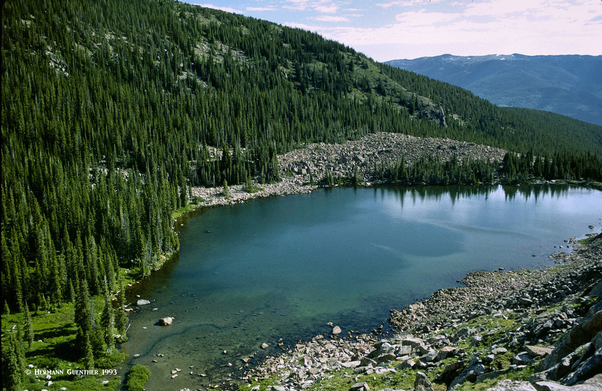
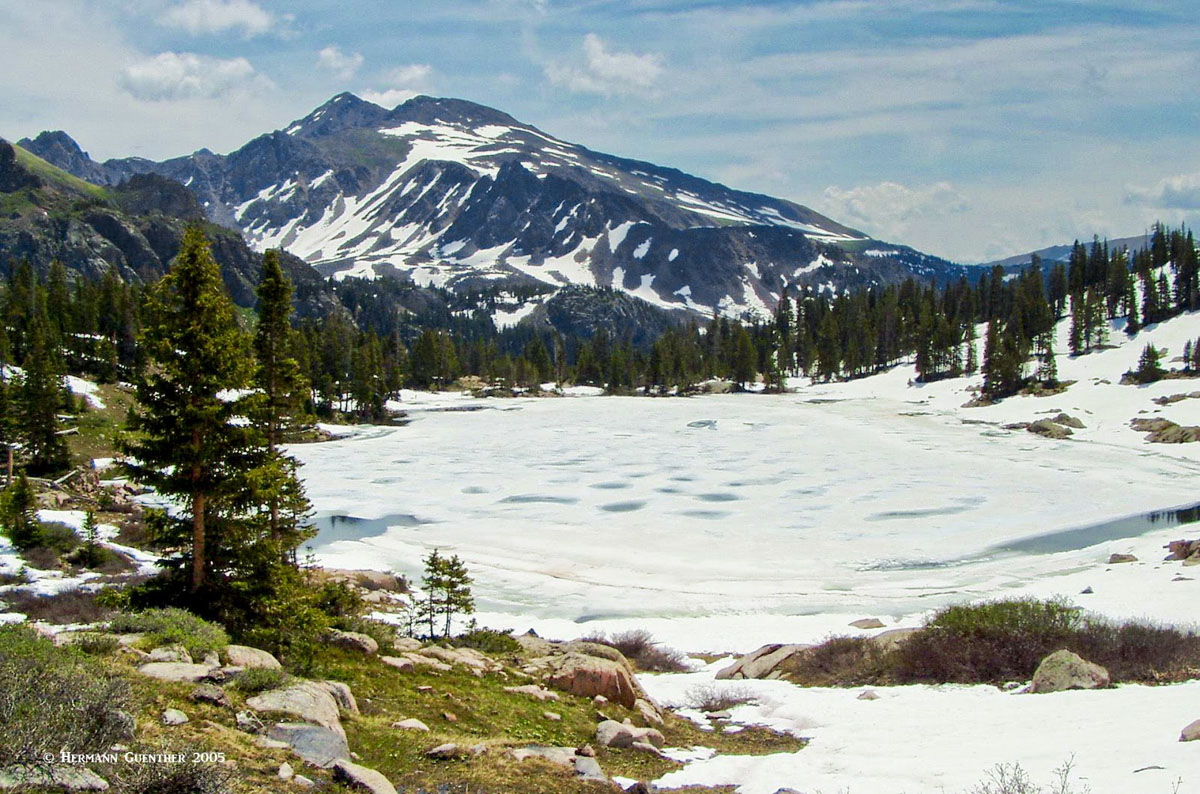
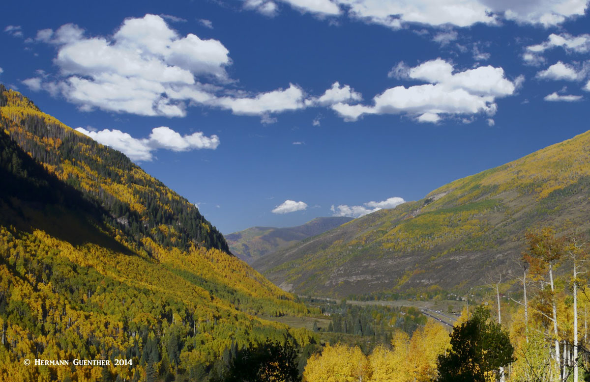
Eagles Nest Wilderness from Shrine Mountain
There are lots of beautiful places to go hiking in the Eagles Nest Wilderness - and many miles of trails make it possible to reach these destinations. Many of these destinations can be difficult to reach in that they involve long distances. This is particularly the case on the east side where private property restricts direct access to the Gore Range Trail from which other trails divert to the higher destinations in the wilderness. This is particularly true for such destinations as the Slate Lakes and Willow Lakes basins. Many of the serious recreational destinations are in the parts of the wilderness that are serviced in part by the 45-mile Gore Range Trail, which begins at the Wheeler Junction (Copper Mountain) and ends at a county road southwest of Green Mountain Reservoir near the town of Heeney. Most of this trail is within the wilderness boundaries, though there are a few short segments that are outside these boundaries.
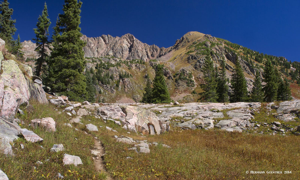
Gore Range Trail - This long trail provides excellent, but in many cases lengthy, access to some spectacular areas contained within the wilderness. From the southern trailhead at Wheeler Junction, just off Interstate Highway 70, the trail rises rapidly into the high terrain of the south central part of the mountains, reaching elevations of almost 12,000 feet. However, it does not stay at very high elevations for its entire length. At about its mid-point, this trail descends toward the east from where it meanders at elevations between 8,700 and 10,000 feet for the rest of its length to the northern terminus. It is along this half of the trail where it serves as a kind of "collector" trail - it is fed by a small number of trails originating from State Highway 9 and from some minor access roads. These trails sometimes end at the Gore Range Trail, which must then be followed either north or south to other trails that then permit hiking further into the wilderness. This means that some popular destinations such as the Willow Lakes can only be reached by following one of the few trails that originate at a parking area and end at the Gore Range Trail, which must then be followed for some distance before another intersecting trail can be taken to go further up.
Gore Range Trail at Red Buffalo Pass, Red Peak
South Gore Range Trailhead - Aside from servicing the long-distance Gore Range Trail, this convenient trailhead is located on the north side of I-70 with ample parking spaces. Most users of this trailhead typically use it to make the pleasant hike to the two Wheeler Lakes or for those with a bit more energy, a continuation to Lost Lake (one of many so-named lakes in Colorado). It is also one of the two trailheads that are used by through-hikers who do the multi-day traverse of the entire wilderness area. The trailhead is accessible for westbound traffic only along I-70, although eastbound traffic can continue east about two miles to the exit at Officer's Gulch where they can turn around and head back west to the parking lot.
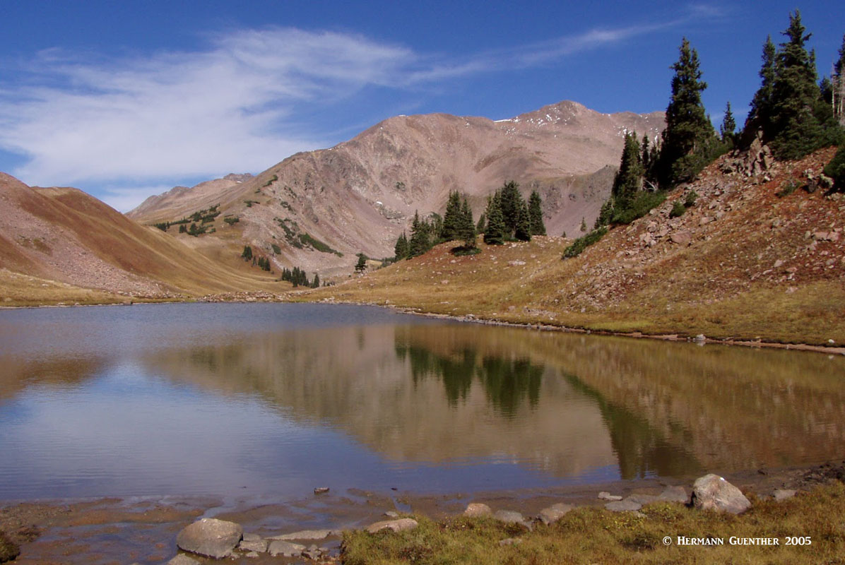
Upper Wheeler Lake, Uneva Pass
North Tenmile Trailhead - This convenient trailhead is right at the end of the interchange ramps to the town of Frisco. This trail has not specific destination but basically ends at the Gore Range Trail. Since the trail follows North Tenmile Creek for its entire length of about four miles, it is not steep and is therefore popular for cross-country skiing. Though this trail eventually enters the wilderness, the first three miles are outside the boundary.
North Tenmile Creek
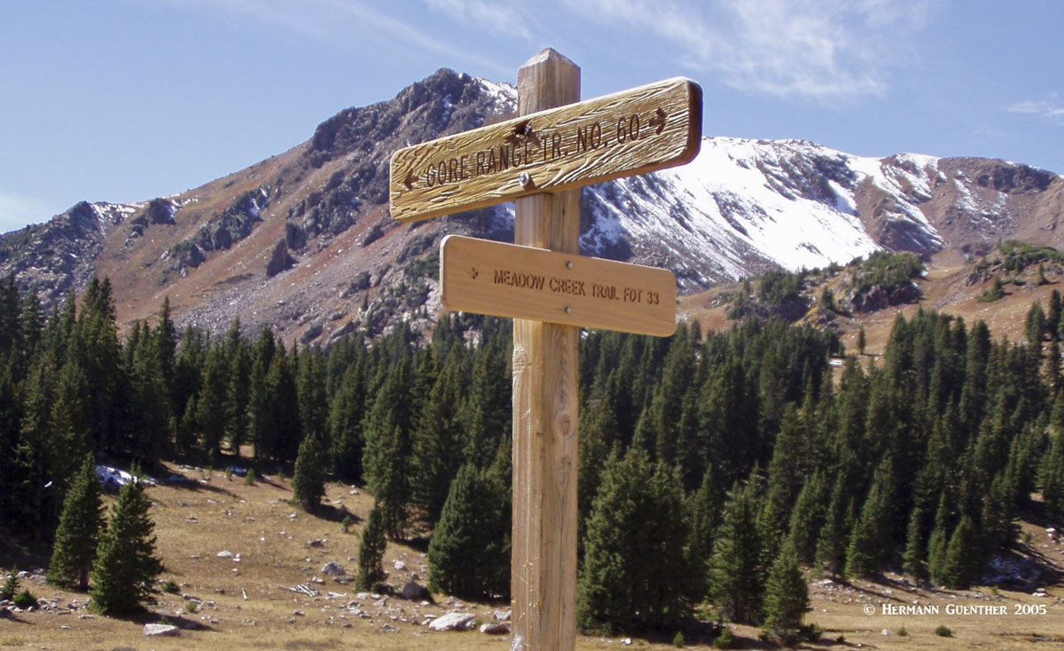
Meadow Creek Trailhead - Just a short distance of the north side of the Breckenridge/Frisco interchange on I-70 is a parking area for the Meadow Creek Trail. This fine trail penetrates deep into the Eagles Nest Wilderness and ends at the Gore Range Trail at an elevation of about 11,400 feet. This trail, in conjunction with the Lily Pad Trail (which branches off from it) and the Gore Range Trail, affords a wonderful 14-mile loop hike around Buffalo Mountain, which reaches its highest point at Eccles Pass, elevation 11,945, which is also the highest point on the Gore Range Trail. A long ridge walk to the summit of Buffalo Mountain is possible from this point, although a shorter alternative is available.
Upper Meadow Creek
Silverthorne Area Trailheads
Buffalo Mountain Trailhead - This major trailhead is located at the top of the Wildernest subdivision, about four miles from the I-70/Silverthorne interchange. For those wanting to climb Buffalo Mountain without doing the long loop around it (see above), this is the logical starting point as the total round trip distance is only about six miles. But this is also perhaps the best starting point for doing the Buffalo Mountain Loop hike since this would eliminate one extra mile of having to hike the entire Meadow Creek Trail. From this trailhead it is also possible to connect to the Mesa Cortina Trail, which is popular for cross-country skiing and which has its trailhead nearby in the same subdivision.
Trail Junction - Buffalo Mountain Loop
Willowbrook Trailhead - A short drive north on State Highway 9 from the I-70/Silverthorne interchange is Willowbrook Road which leads to the trailhead which is less than three miles from the interchange. This trailhead provides the shortest route to the beautiful Willow Lakes and Salmon Lake via the Gore Range Trail which is only just over a mile from the trailhead. It is also possible to access the Mesa Cortina Trail from here.
Willow Lakes Basin, Gore Range
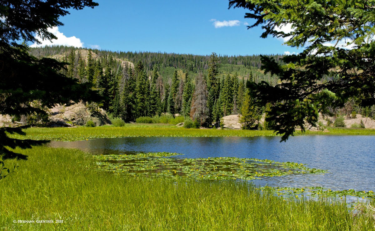
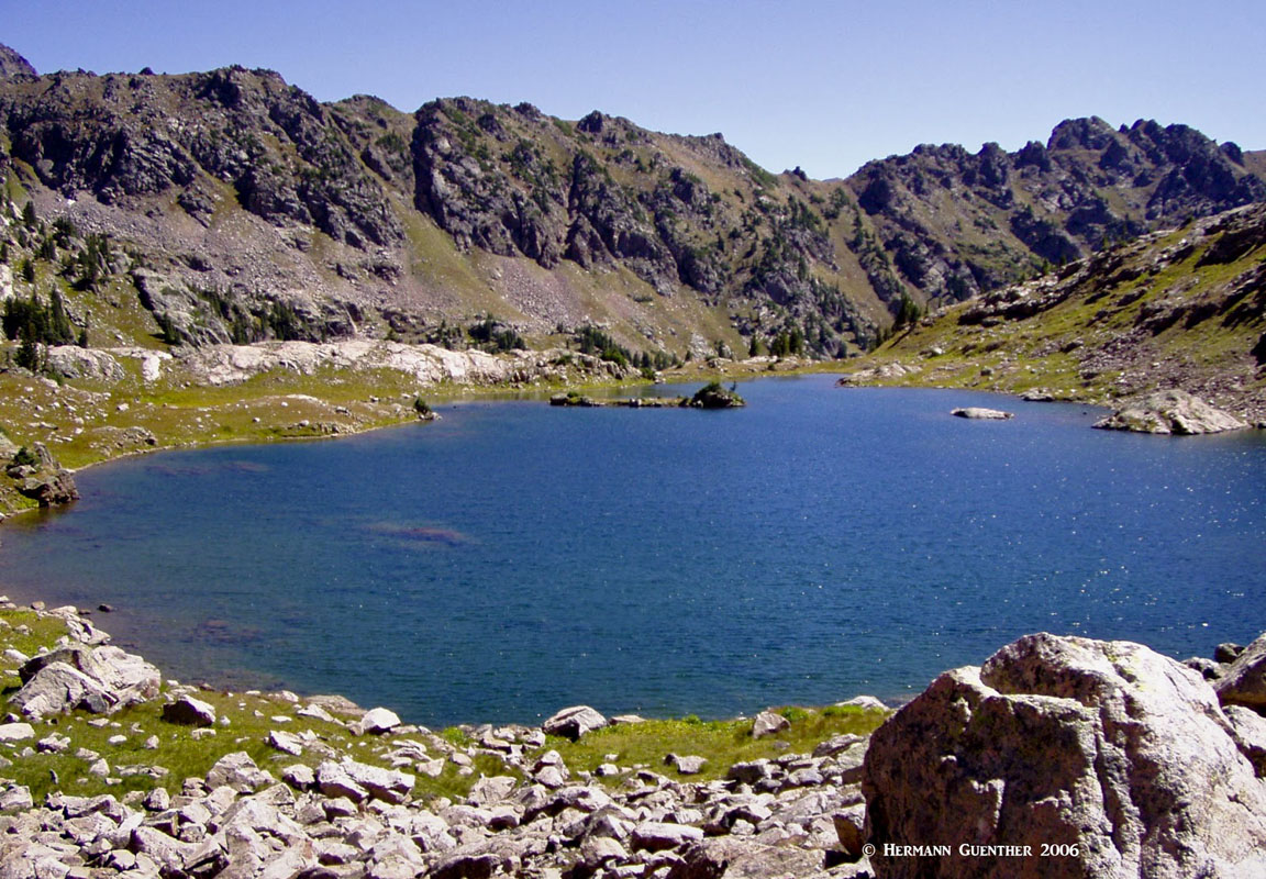
Rock Creek Trailhead - This about 11 miles from the I-70/Silverthorne interchange via State Highway 9 and County Road 1350. From the trailhead (which may not be suitable for low-clearance vehicles at all times) it is less than a half mile to its intersection with the Gore Range Trail. The trail continues past the intersection to an old mining area, but otherwise does not lead to any noteworthy destination. However, the trail provides an alternative route to Boulder Lake which can be reached from the intersection in a little over two miles by going north on the Gore Range Trail. There are some fine views across the lake toward the high peaks of the Gore Range. Using this trailhead to reach the lovely Willow Lakes is possible, but results in a round-trip hike of 18 miles - a tough day indeed. Extending the hike by taking the diversion to include Salmon Lake would add another mile of hiking.
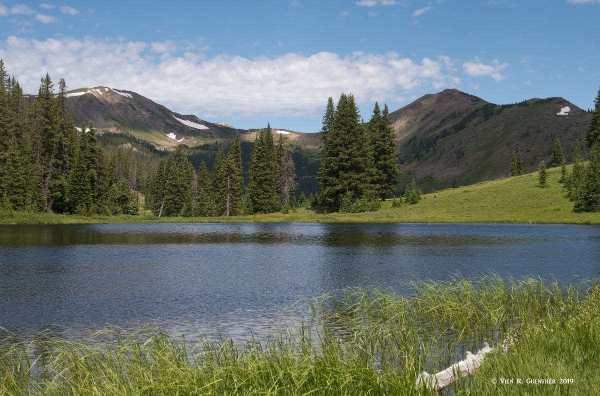
Salmon Lake
Green Mountain Reservoir Trailheads
About 20 miles north of the I-70/Silverthorne interchange along State Highway 9 is the Green Mountain Reservoir, a 5-mile long man-made lake sourced by the waters of the Blue River. Just before reaching the lake is a turnoff to Heeney Road which, as one would expect, leads to the small settlement of Heeney. A couple of miles south of the town is County Road 1725 which in about three miles reaches Lower Cataract Lake. This gem of a lake is a worthy destination on its own, but just before the lake are several parking areas which serve, in addition to the lake, two important trailheads. There is a 2.5-mile trail around the lake itself, much of which is within the Eagles Nest Wilderness, but the two trailheads provide access deeper into the wilderness.
Lower Cataract Lake
Surprise Trailhead - Not surprisingly, this trail leads to Surprise Lake, which lies about 2.6 miles from the trailhead, near where the Surprise Lake Trail ends at its intersection with the Gore Range Trail (there's that trail again!). A nice stopping point for a breather or a snack. But that's not all there is to this place. A short distance to the west along the latter trail is a branch, the Upper Cataract Trail, that leads to, as one would expect, Upper Cataract Lake, and a mile or so further, to Mirror Lake. These are fine backpacking destinations and are reasonably close to the two highest mountains in the Gore Range - Eagles Nest and Mount Powell - although a closer trail approach to Powell is available from a different trailhead (see below). Continuing from this junction, the Gore Range Trail will pass the south shore of Tipperary Lake and continue on to the junction with the Eaglesmere Lakes Trail and then to the two Eaglesmere Lakes. From here, the trail meanders another two miles to its northern terminus.
Tipperary Lake
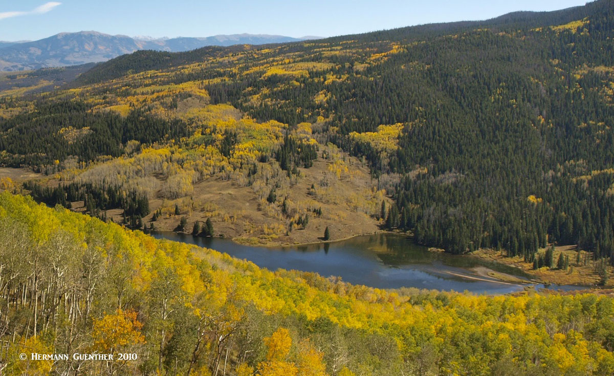
Eaglesmere Lakes Trailhead - This trailhead is very close to the Surprise Trailhead and, in conjunction with that, affords a rather lengthy loop hike. Of course, some might only want to do the much shorter hike to the Eaglesmere Lakes. That in itself is a worthy hike if only for the great views towards the south across the Cataract Creek valley. Eagles Nest (elev. 13,420), the second highest summit in the Gore Range, dominates this impressive view, although the higher Mount Powell is not visible from here. Autumn, when the aspen trees change colors, is a fine time to make this hike.
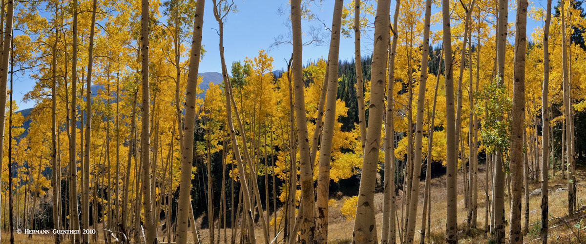
Aspen Trees, Eaglesmere Lakes Trail
The famous ski resort of Vail dominates the Vail Valley, the eastern half of which hugs the southern edge of the Gore Range. With Interstate Highway 70 running right through the valley and town, hiking access to the major trailheads here is easy. Some of the hikes, however, are not quite as easy, let alone trying to climb some of the precipitous peaks that dominate the view for drivers heading eastbound. There are three major trailheads along this stretch of I-70, all just a stone's-throw from the highway. And in all cases, the wilderness boundary, which generally follows the north side of the highway, is only a few hundred feet from the trailheads.
Gore Creek Trailhead - At the eastern end of the valley is the Gore Creek Campground and directly adjacent is the parking area for the Gore Creek Trail. Unlike the other trails emanating from the valley, this trail provides through access to the eastern sections of the Eagles Nest Wilderness, where the trail climbs over Red Buffalo Pass (elev. 11,742) and then joins the Gore Range Trail (what else?). Partway up the Gore Creek Valley is a two-mile spur trail that ends at the beautiful Gore Lake. To do that as a day hike involves a round trip of about 14 miles and almost 3000 feet of elevation gain. It is worth the effort. Also starting at this same trailhead is the trail to Deluge Lake - a shorter round trip length of 9 miles, but an elevation gain of close to 3,500 feet. Also to be recommended. The campground is outside the wilderness boundary, however.
Gore Lake, Red Peak
Pitkin Creek Trailhead - Easily accessible from the East Vail interchange on I-70, the Pitkin Creek Trail does not pamper the hiker. Right from the start, it is steep, and although it has some flatter segments, relief is infrequent and a total accumulated elevation gain of 3,500 feet (net elevation difference of 3,000 feet) in a round-trip distance of eleven miles is sure to leave its mark. But the lake itself is an alpine gem. And for those who think that they need more of a workout, the surrounding peaks are sure to satisfy that urge. This is without a doubt one of the finest hikes in the Gore Range in the humble opinion of this writer. Not to be missed by anyone in reasonably fit condition. It is also advisable to bring a fishing rod - the trout in this lake are fat and hungry. This is the epitome of wilderness - yet so close to one of the largest ski areas in the country.
Pitkin Lake Trail
Booth Creek Trailhead - Also accessible from the East Vail interchange is the Booth Creek Trailhead. Parking at the trailhead is very limited so an early start is advisable. It is best to park in the Vail Village parking structure and then take the free Town of Vail bus to access this trail. The trail to Booth Lake, just like the Pitkin Lake Trail, is strenuous. With a round-trip hike of almost 11 miles and an elevation gain of over 3,000 feet, this wonderful hike is another one in the Vail area that is a must-do venture. For those with an extra reserve of energy, there are many opportunities to scramble to higher perches above the lake and to view its spectacular setting in this high-alpine cirque. The lake has an island - and many fish.
Booth Lake
Piney River Ranch Trailhead - About 12 miles north of the center of Vail Village is the Piney River Ranch, a rustic resort on the western shore of Piney Lake. The excellent gravel road makes getting here with a regular passenger car simple. While the ranch is private, there is a public parking area here. This lake and resort offers one of the best views of Mount Powell, the highest in the Gore Range. The ranch and lake are not in the wilderness, but the trailhead affords access to several trails into the wilderness, the boundary of which is very near. This place also affords one of the best approaches to climbing Mount Powell.
To be realistic, there are only four major towns and/or resorts that are convenient to the Eagles Nest Wilderness, though there are smaller towns that offer more limited amenities for visitors. These are all concentrated in a relatively short (30 miles) corridor along Interstate Highway 70. But they sure have a lot to offer visitors and, with some exceptions, have relatively affordable accommodations. All of these towns offer fine trail access into the Eagles Nest Wilderness, with trailheads located right within town limits. For anyone wanting to find adventure in this stunning wilderness, this area cannot be surpassed as a mountain playground.
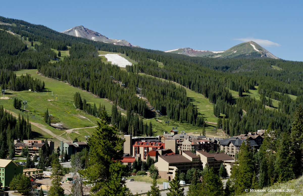
Copper Mountain is not so much a town as it is self-contained resort, mostly geared toward skiing. It is located at the junction of I-70 and State Highway 91at the eastern base of Vail Pass. This is also known as Wheeler Junction. It was opened as a ski resort in 1972. As it is strictly a resort village, Copper's accommodations tend to be mostly condominiums or vacation rentals. There is a selection of restaurants. There are plenty of recreational activities available here, including golf, biking, fishing and hiking. For anyone staying here. the south end of the Gore Range Trail is within walking distance of their accommodations.
Copper Mountain Resort
Everyone with an interest in skiing (or not) has heard of the swank resort of Vail in the central Colorado Rockies. It started in 1962 as a small ski area and has grown into the largest ski resort in Colorado. It offers everything a visitor could ask for and at prices that are, well, not for everyone, especially during the ski season. Budget accommodations are rare in this resort that was modeled after high-end resorts in the Alps. Vail is very accessible and is only a 90-minute drive from Denver (on good days when the traffic is light, which does not happen on weekends or when the roads are snow- and ice-covered), with Interstate Highway 70 going right through the town. But Vail is more than a ski resort. It offers a wide variety of recreational activities including biking, fishing, golf, rafting, high-adrenaline activities, and more and more. But Vail also has some of the finest hiking trails in the state right at its doorstep. Some of the best trails into the Eagles Nest Wilderness start right off the highway, and within minutes, the hiker is in a pristine area unburdened by mechanized or motorized travel methods. This place has a prime location and it is well visited. And those who cannot justify or afford staying here, they can still enjoy strolling the quaint streets of Vail Village and stopping for a nice meal in the many restaurants.
Vail Valley, Interstate Highway 70
Just off Interstate 70 between Copper Mountain and Silverthorne is the charming town of Frisco located on the shores of Dillon Reservoir, the main water supply source for Denver, 70 miles away. It is centrally located with easy access to four major ski areas - Breckenridge, Copper Mountain, Keystone and Arapahoe Basin. Even the famous resort of Vail is only 30 minutes away. In addition to skiing, there are unlimited recreational opportunities available the rest of the year here including camping, hiking, biking, fishing, rafting and boating. Two major trailheads on the north side of I-70 provide trail access deep into the Eagles Nest Wilderness. In summer, Dillon Reservoir can be seen studded with countless sailboats, many of them based at the Frisco Marina. The Frisco Nordic Center is just a few minutes outside of town and offers 16 miles of ski trails and 6 miles of snowshoe trails. There is no shortage of accommodations and restaurants in this beautiful spot in the Rockies.
Frisco
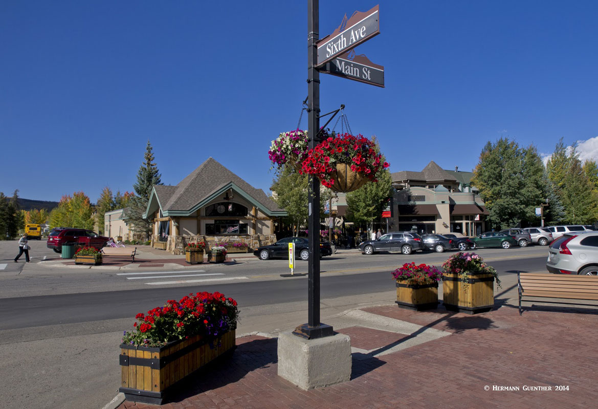
Silverthorne is conveniently located at a significant crossroads in the heart of Summit County that has benefited significantly from the tourist trade. Situated on I-70 just eight miles west of the Eisenhower-Johnson Tunnel and the Continental Divide (and about 2,000 feet lower), there is no shortage of restaurants and lodging, shopping and easy access to four major ski areas. Together with the nearby towns of Dillon and Frisco, visitors would do well to consider this as a base from which to explore much of the Eagles Nest Wilderness. State Highway 9 goes right through the center of town and provides easy access to the entire eastern fringe of the wilderness. U.S. Highway 6 goes from here, past the beautiful Dillon Reservoir, as it climbs over Loveland Pass before it joins I-70 east of the tunnel.


