
Share

Scan the QR code and open PeakVisor on your phone
Scan the QR code and open PeakVisor on your phone
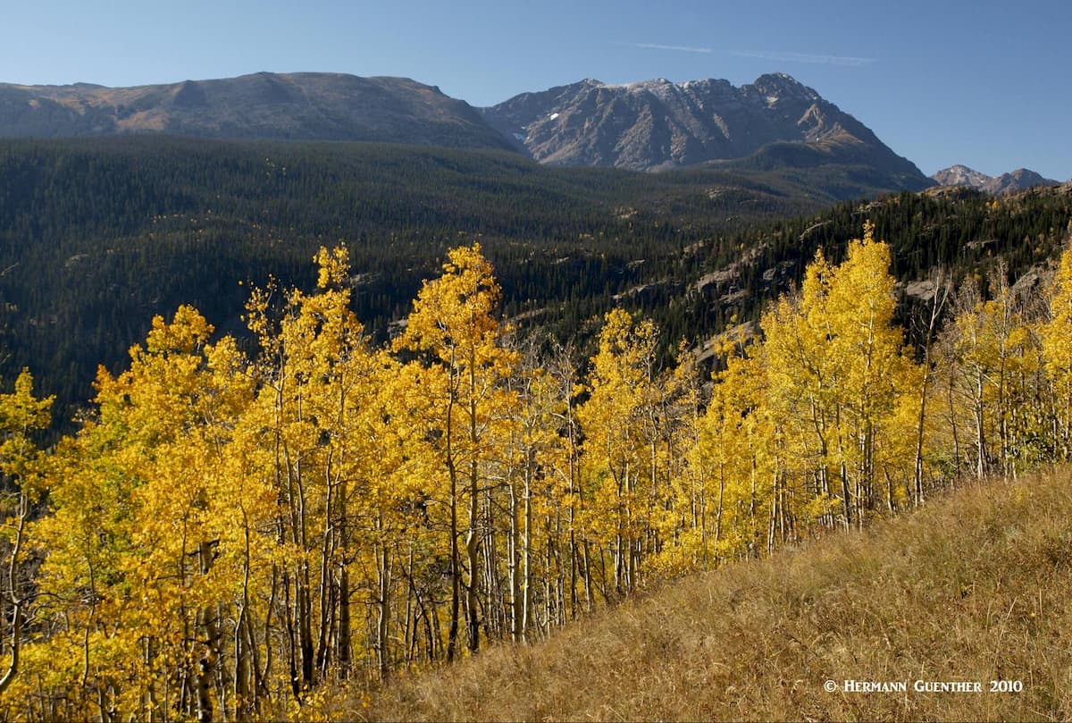
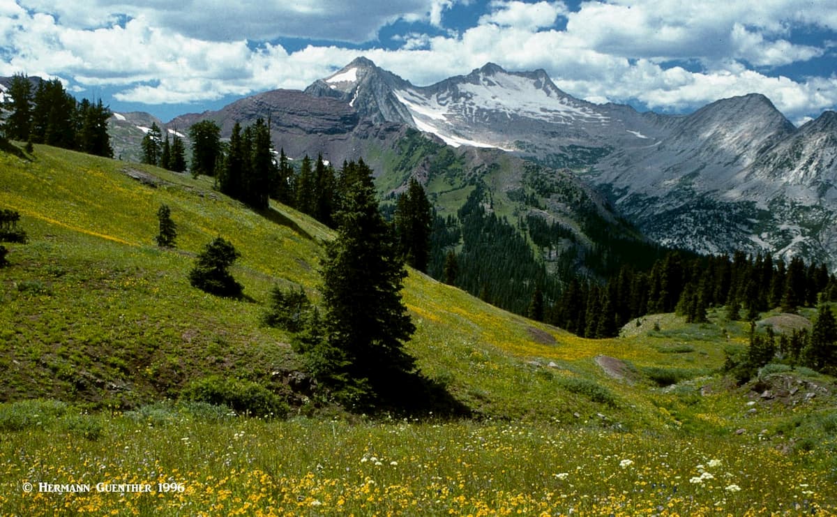
The White River National Forest (WRNF) is located in west-central Colorado and it has superlatives that dwarf most other national forests in the United States. It is the largest in Colorado encompassing 2,285,970 acres (3,572 square miles) and is located in parts of nine counties. It is centrally managed from the U. S. Forest Service offices in Glenwood Springs, supplemented by five ranger districts with offices in six towns scattered throughout the forest. It is contained within an area of 140 miles west to east and 90 miles north to south. There are 237 named mountains in the forest, the highest of which is Grays Peak; the most prominent mountain is South Mamm Peak.
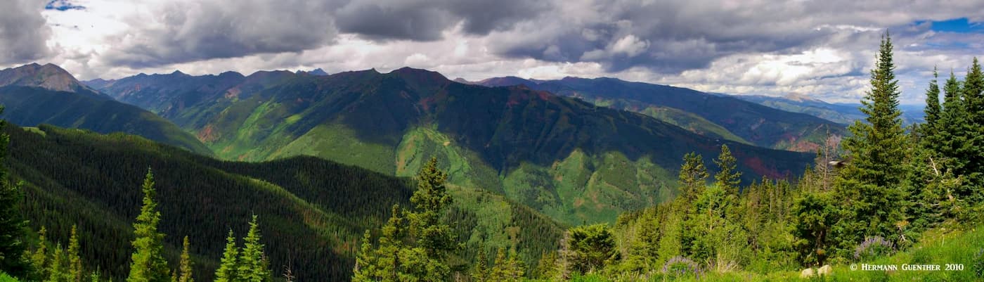
There are eight officially designated wilderness areas within the WRNF, five of which occupy parts of other National Forests in the state. The forest has 1,900 miles of forest system roads and 2,500 miles of hiking trails. It is also home to 12 major ski areas, as well as four large reservoirs. On top of all that, ten of the state’s fourteeners (14 if you include two that do not meet prominence criteria) are to be found in WRNF. Then there are countless miles of fine fishing streams, some of them Gold Medal Trout Waters, that will keep avid anglers happy for a lifetime. And for the hunters of the world, some of the best elk hunting can be found in the Flat Tops Wilderness. Finally, the forest contains some of the finest scenery on the continent. No wonder White River National Forest is the most visited of all the National Forests in the United States.
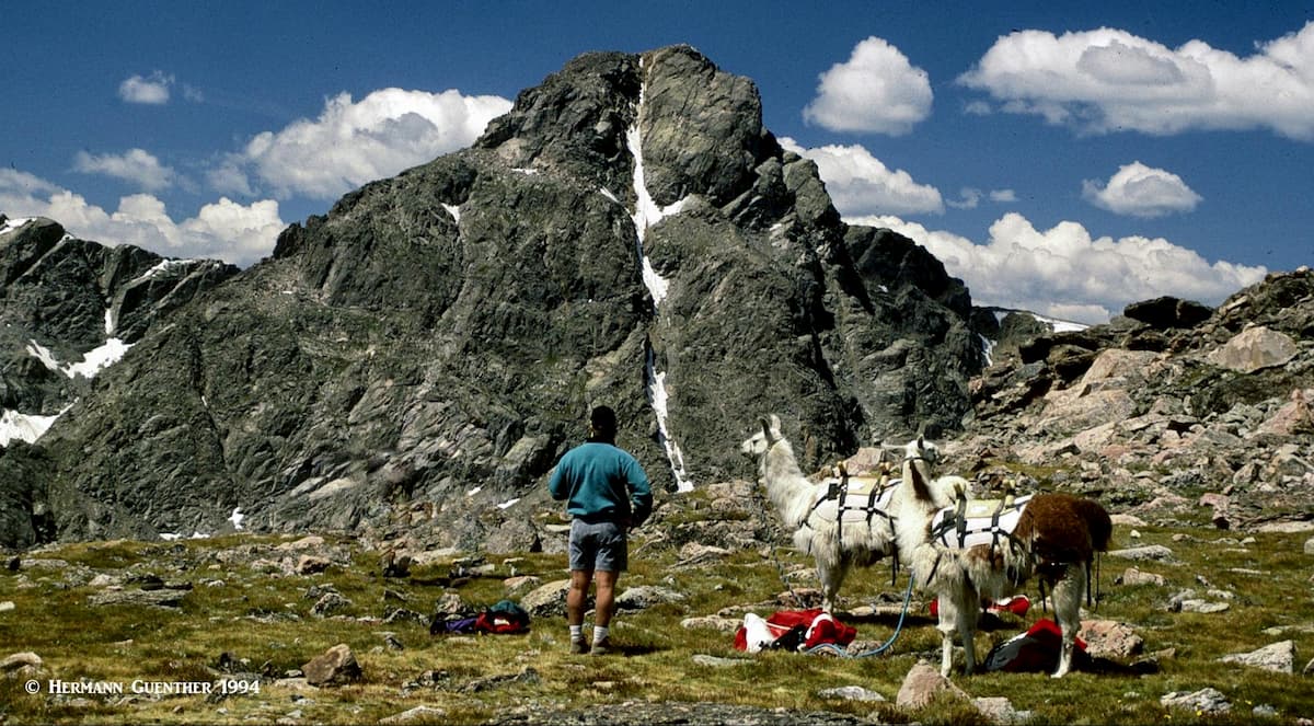
Needless to say, the WRNF affords an abundance of recreational opportunities. In addition, the forest offers numerous camping venues, water sports (think sailing, rafting, kayaking), mountain biking, horseback riding, snowmobiling, four-wheeling, etc., etc. And then there is hiking and climbing. Lots of it. And for many visitors the best places to undertake these activities is in the wilderness areas. But don’t underestimate the many non-wilderness destinations – there are many places where you can get yourself lost in terrific scenery that might be totally devoid of people. But let’s talk about some of the various wilderness areas in the WRNF, and what hiking and climbing opportunities are represented in each of them.
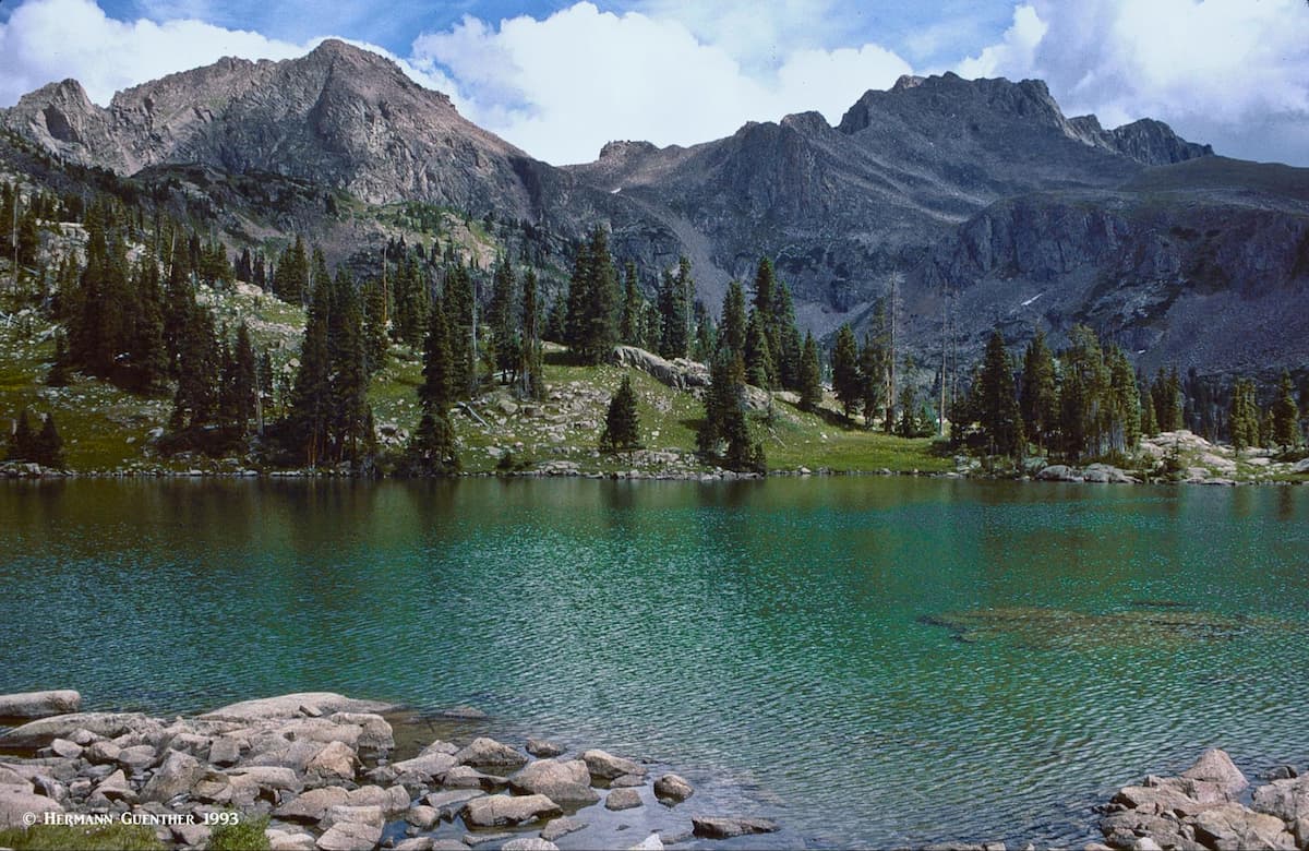
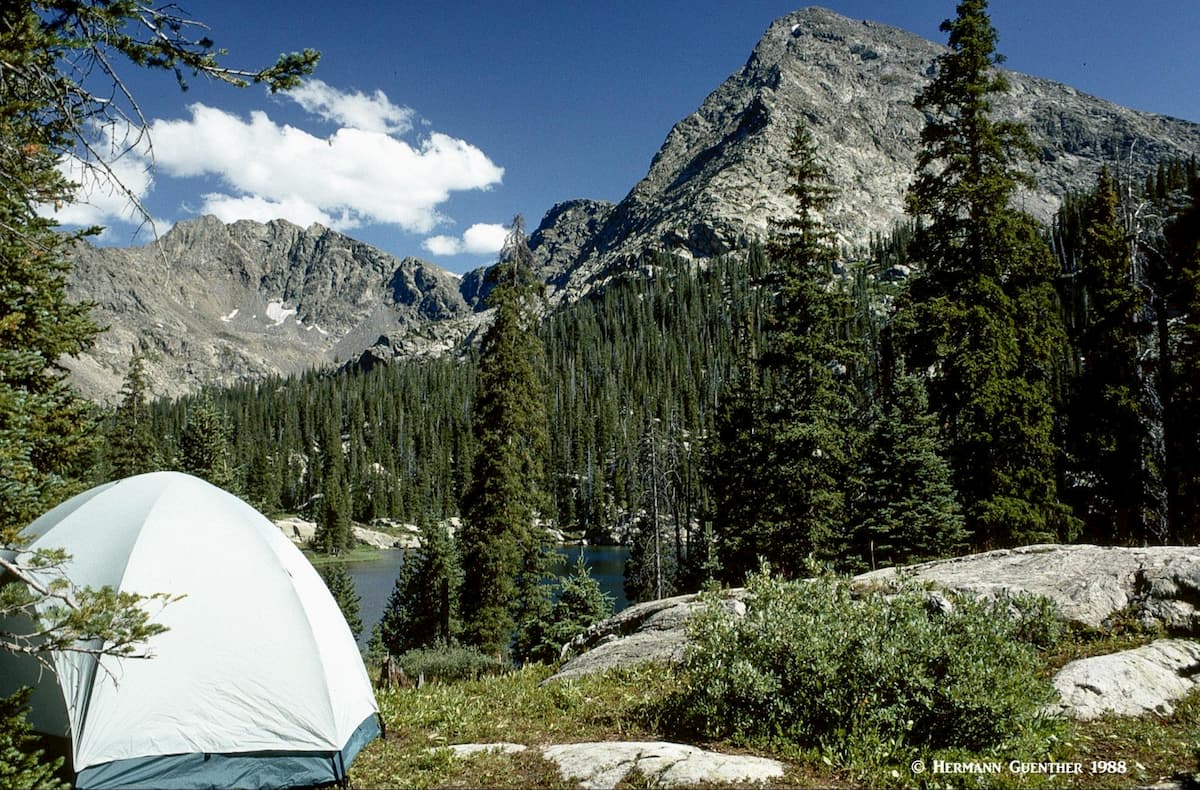
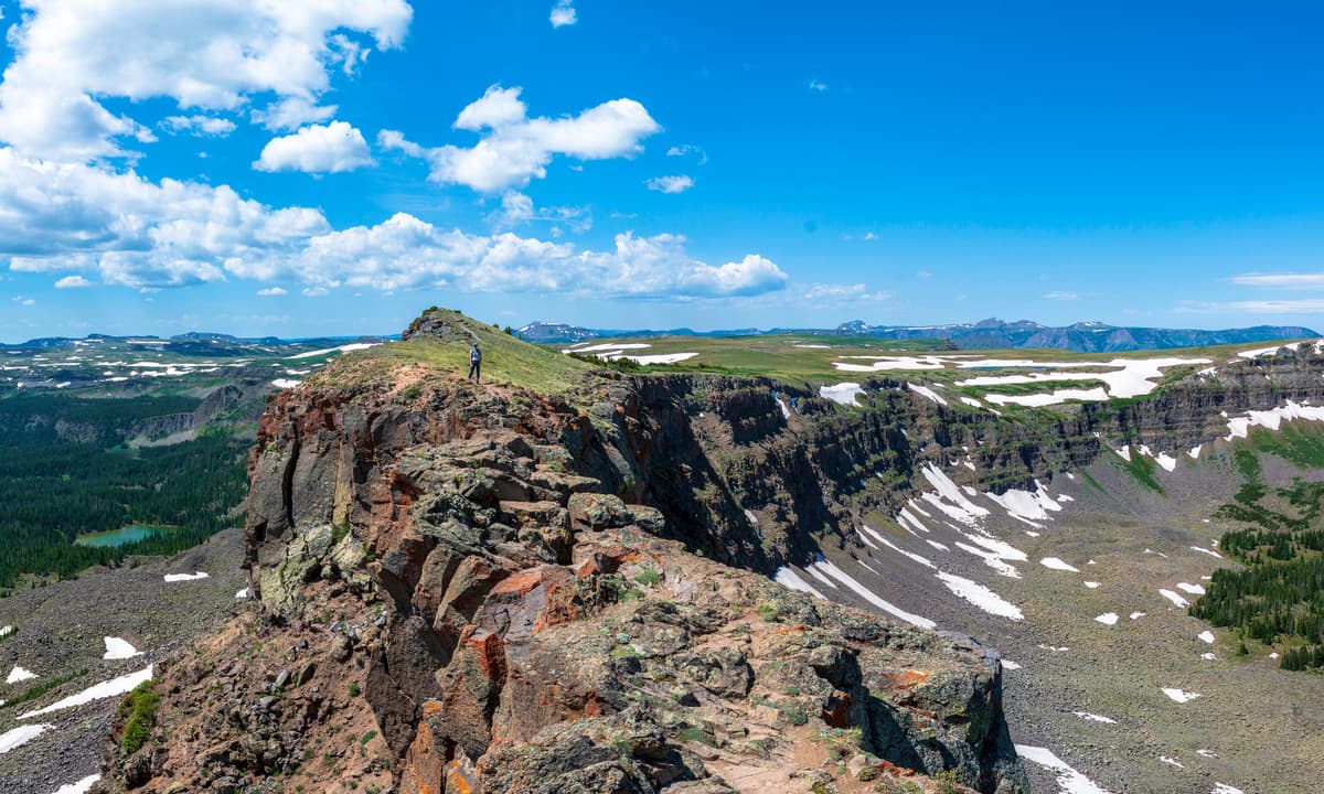
Eagles Nest Wilderness – This wonderful wilderness occupies the southern half of the Gore Range and is entirely within the WRNF. It offers a wealth of hiking trails and some high peaks, although not fourteeners. The mountains in this wilderness are home to some of the best ridge scrambling in the state, although most peaks, even some of the named ones, remain largely unclimbed due to their lower elevations as compared to other parts of the state. But that does not detract from the great experience hikers will find here. The varied terrain interspersed with many pristine alpine lakes makes for some delightful day hikes, many of which I have done over the years. A lot of hikers like to make a multi-day backpack trip by following the entire 45-mile length of the Gore Range Trail. But aside from that, there are several prime hiking areas that are worth mentioning:
Vail Valley Trailheads: When driving through the Vail Valley on Interstate Highway 70 (I-70), it is not immediately apparent that there are several trailheads within just a few hundred feet of the highway. Most of the trails here lead to such alpine gems as Pitkin Lake, Booth Lake, Deluge Lake and Gore Lake. These hikes are all fairly strenuous since they are long, steep and involve considerable elevation gain. It is advisable to be in good condition when attempting these hikes.
Silverthorne Area Trailheads: There are several trailheads in or near the town of Silverthorne, also just a short distance off I-70. The Buffalo Mountain trailhead not only provides direct access to climbing this hulk of a mountain, but also offers the chance to undertake a long 14-mile hike that goes all the way around the mountain, encompassing miles of open terrain above treeline. Another fine hike can be made to the beautiful Willow Lakes and Salmon Lake. This is most advisable as an overnight trip since the distances are long.
Green Mountain Reservoir Trailheads: About 20 miles north of Silverthorne is the Green Mountain Reservoir which is itself a worthy recreation destination. But by taking the turnoff on the Heeney Road and following on County Road 1725, you will get to Lower Cataract Lake, where there are two trailheads that provide access deep into the wilderness. Favorite hikes are to the Eaglesmere Lakes as well as the Upper Cataract Lake, which makes a fine backpack destination. An extended overnight trip here can provide reasonable access to the two highest mountains in the wilderness – Eagles Nest and Mount Powell, both of which are respectable thirteeners.
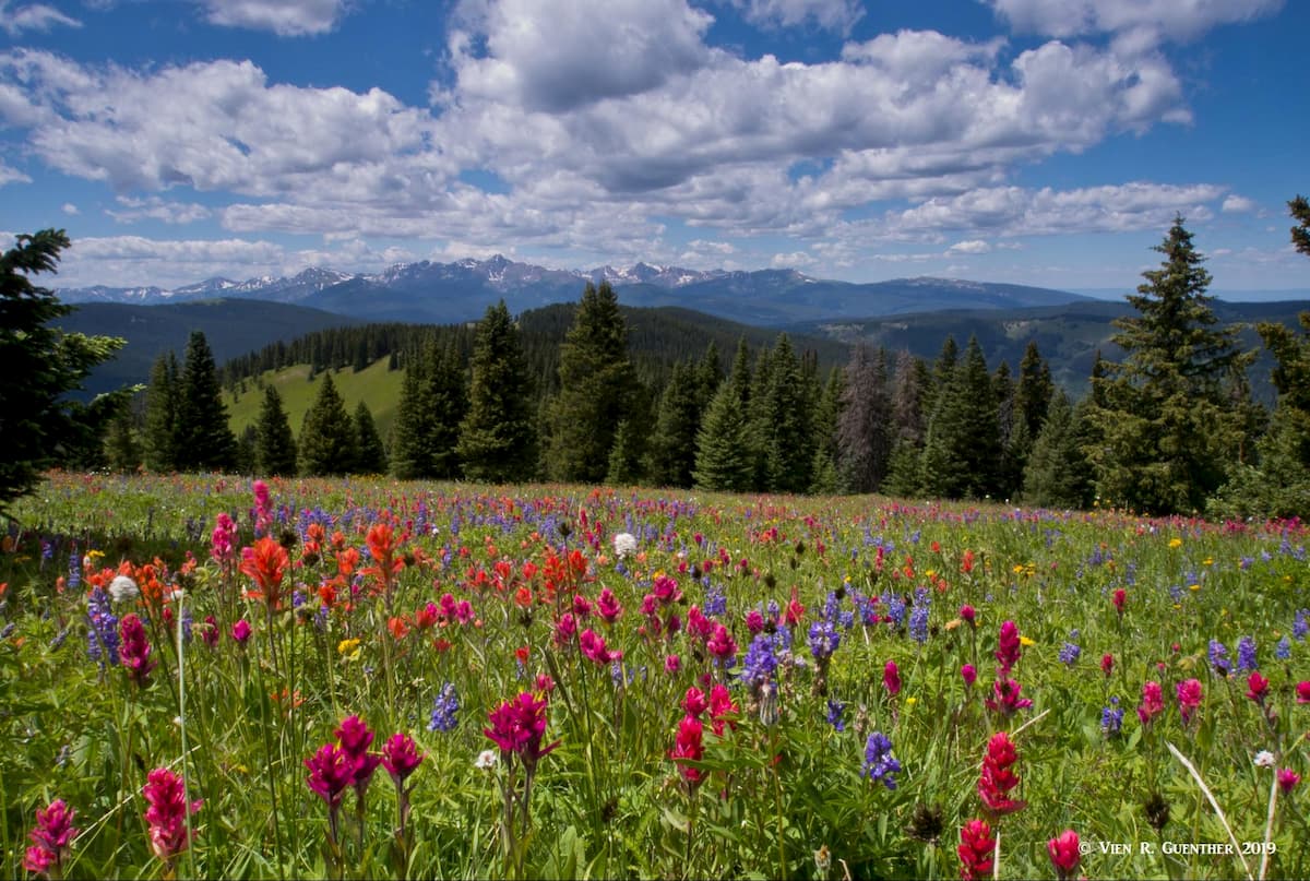
South Gore Range Trailhead: Located on the north side of I-70 at the Wheeler Junction exit (Copper Mountain) is the south end of the Gore Range Trail. This trail can be taken for its entire length or simply to some intermediate destinations. My favorite is to make the relatively easy hike to the two Wheeler Lakes which are off the main trail via a short spur trail. The meadows surrounding the lakes are loaded with wildflowers in the summer. More ambitious hikers can continue to Uneva Pass for a good turnaround destination. An off-trail route on the way can take you to Uneva Peak which affords stunning views in all directions.

Holy Cross Wilderness – This awesome wilderness in the northern part of the Sawatch Range is very popular and is home to one fourteener, as well as a number of interesting thirteeners, several of which I have climbed. The Mount of the Holy Cross, a “low” fourteener that involves a strenuous hike to conquer, reigns supreme over this magical place. This wilderness is a pristine and beautiful landscape of mountains, lakes, streams and more than 160 miles of hiking trails. You will not get bored exploring this extensive area. I have hiked there many times, as well as having made numerous backpack trips, and have been to dozens of the high alpine lakes here. Let’s take a look at a few prime destinations in this wilderness, which can be approached from a number of different roads.
Halfmoon Trailhead: This trailhead, which can be reached via the eight-mile Tigiwon Road is at the north end of the wilderness. This is the most common approach to climb Holy Cross itself. It is also the start of Fall Creek Trail from which you can climb the 13,222-foot Notch Mountain on a spur trail that has countless switchbacks. At the summit you will see the Mount of the Holy Cross up close and personal. But don’t let the photo below mislead you - there is a deep valley between you and Holy Cross. It would take a long roundabout route to get there from this point.
If you continue on the Fall Creek Trail, you will eventually reach the unspoiled Lake Constantine, after which you will arrive at the Tuhare Lakes, and then the Seven Sisters Lakes which are reached by going over Fall Creek Pass at 12,150 feet. From the top of the pass it is an easy ridge walk to the top of Whitney Peak (13,274 feet).
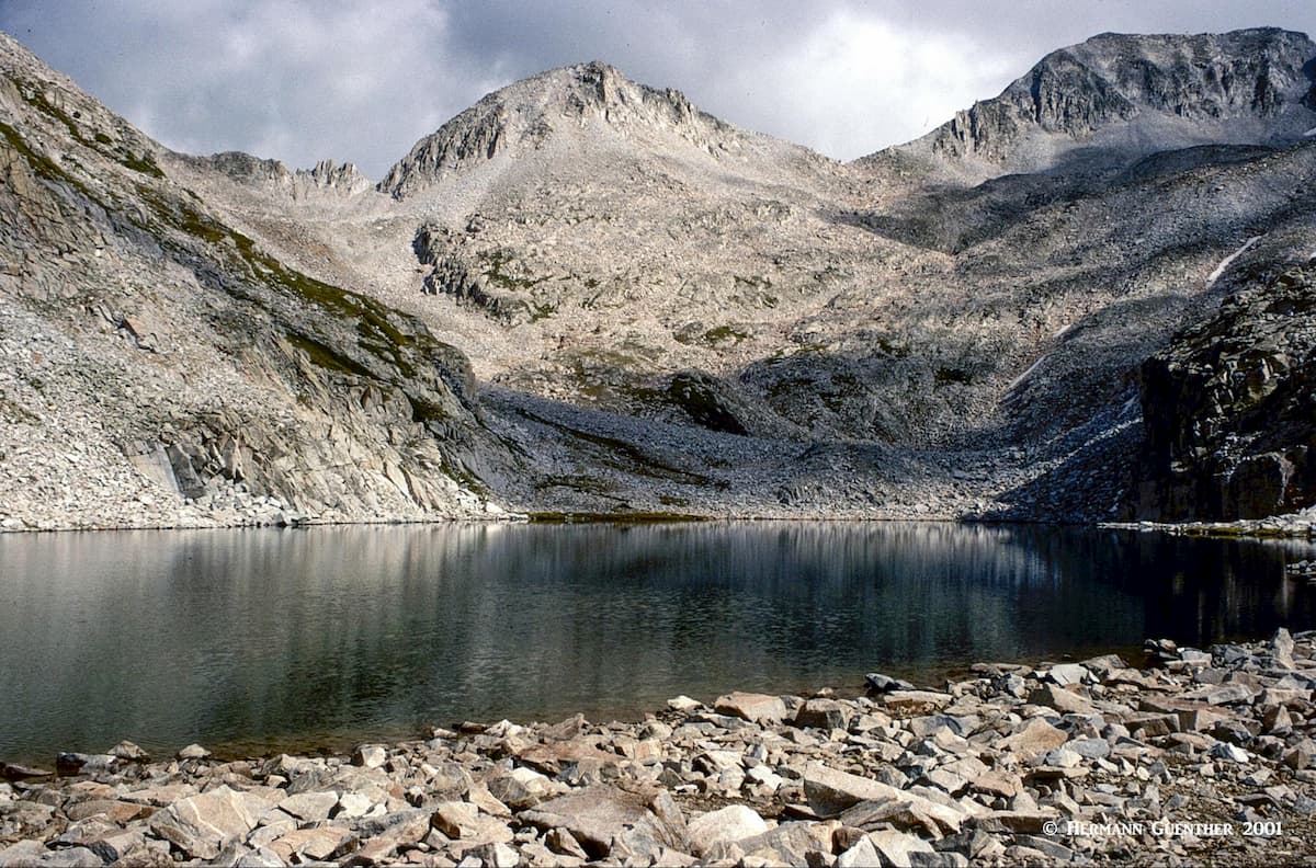
Homestake Trailheads: The Homestake Reservoir Road is 18 miles north of the town of Leadville on U.S. Highway 24. This ten-mile gravel road provides easy access to several trailheads, the most popular of which are certainly the Missouri Lakes and the Fancy Pass Trailheads. The four Missouri Lakes, plus many unnamed tarns, adorn an amazing alpine basin which can provide days of happy exploration. These lakes can be reached on an easy day hike – but why spend only a day here. I have been here many times, mostly for multi-day expeditions. The Missouri Lakes are not the only attractions here – you can hike over Missouri Pass to Treasure Vault and Blodgett Lakes for a nice easy day excursion from your campsite. Alternatively, you can make a loop hike continuing over Fancy Pass and visit Fancy Lake, before returning to your car. This is also a great basin from where you can conquer the 13,127-foot Savage Peak. It is not that savage, but the climb up the summit cone is incredibly steep from the east side.
Lake Charles Trailhead: An alternative entry point into the Holy Cross Wilderness is from the town of Eagle, 30 miles west of Vail on I-70. The 12-mile round trip hike to Mystic Island Lake is less popular than the other two trailheads, but not any less dramatic. The trail passes by Lake Charles, which is a mile before the end of the trail, and makes a perfect place to set up camp – after all, you don’t want to just do this as a day hike, although it can be done. This is a rugged place and offers, besides the two lakes, a lovely valley in which East Brush Creek can provide some fun fly-fishing.
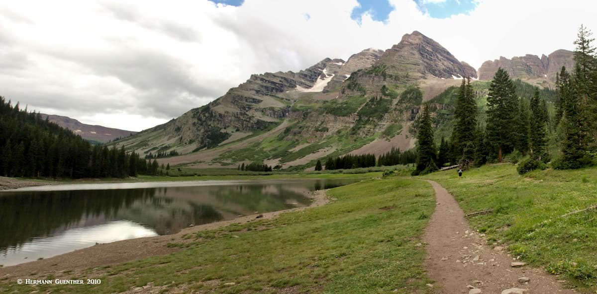
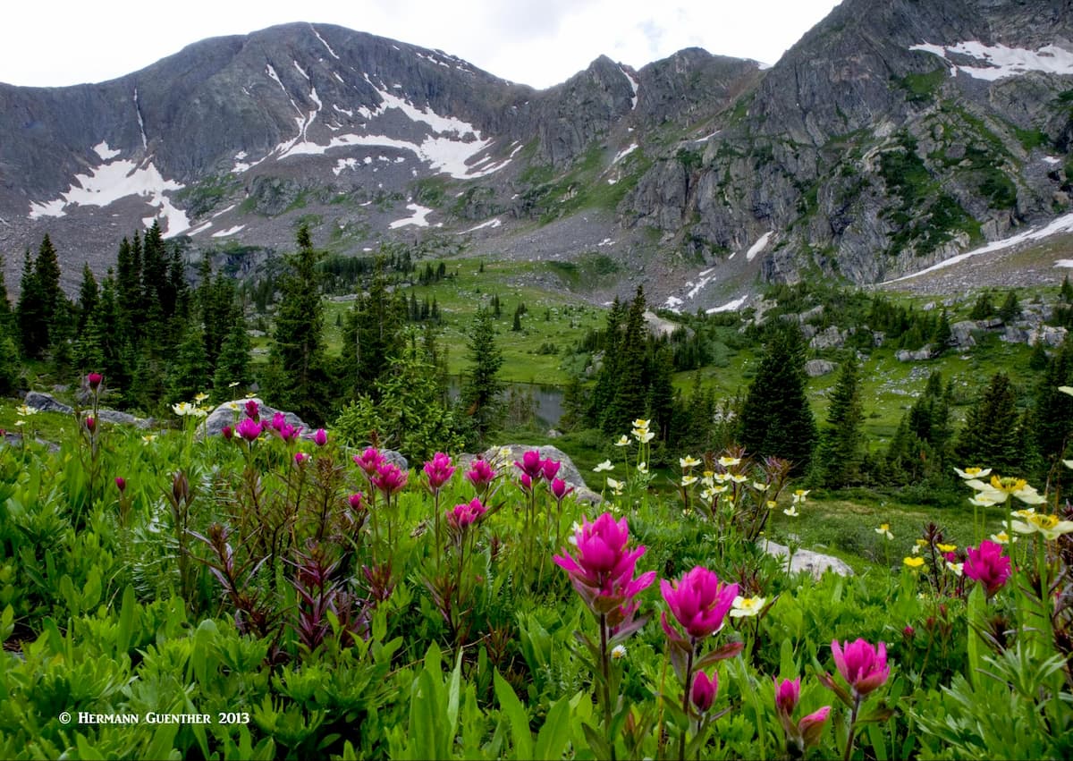
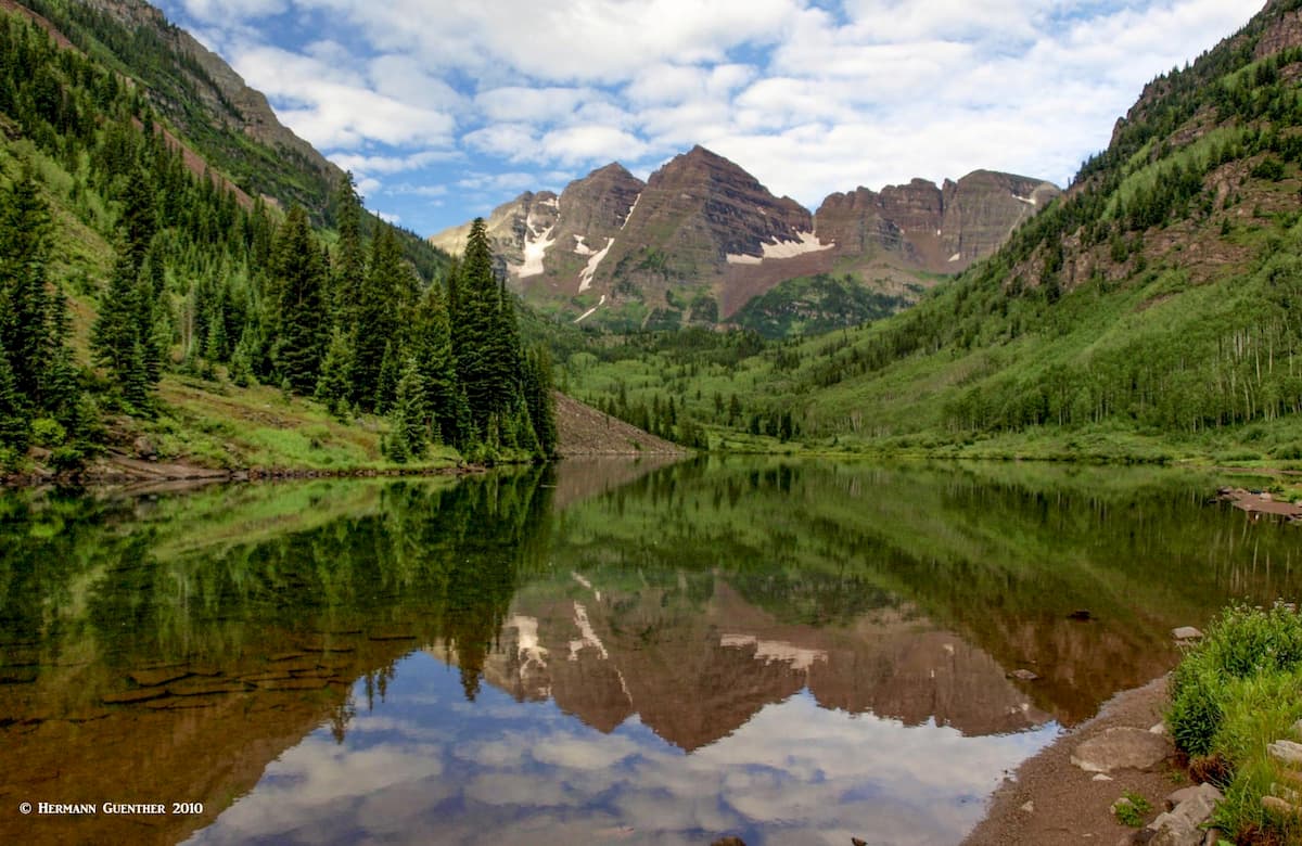
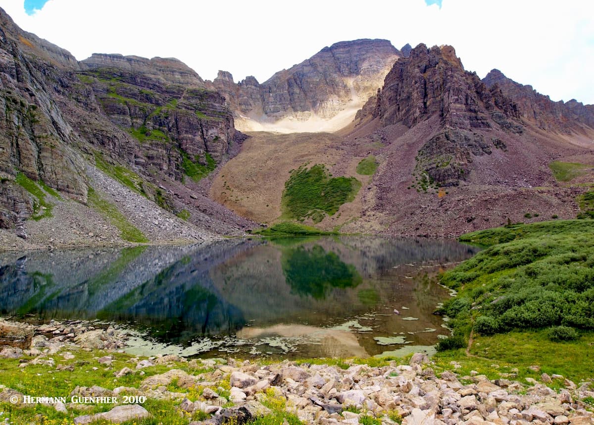
Maroon Bells-Snowmass Wilderness – This incredible wilderness, part of the much larger Elk Range, is easily the showpiece of the entire WRNF. In my opinion, it is second to none. This is for two reasons. The famous Maroon Bells are a tourist attraction like few others – they are claimed to be the most photographed mountains in North America. While the viewing area, the campground and Maroon Lake are not within the wilderness, the scenery is. Then of course, this wilderness offers some of the best hiking and climbing in the state. The five fourteeners (Castle, Capitol, Maroon, Pyramid Peaks plus Snowmass Mountain) offer formidable, and in some cases outright dangerous, climbs that challenge experienced mountaineers and are best avoided by casual hikers. But it is not necessary to climb them – hiking to and between them is exhilarating itself. Let’s check out a few places to go hiking.
Maroon Lake Trailhead: This is where the Maroon-Snowmass Trail begins – just a few steps from the parking lot. Yes, this is the place for those epic photographs – or the millions of selfies. And it is the place where thousands of casual hikers (even families with kids, some of whom have no concept of wilderness etiquette) begin the easy hike to Crater Lake. I say “easy” but that doesn’t mean everyone makes it all the way. Many are “flatlanders” who are unprepared, both in terms of experience, gear and acclimatization to the altitude.
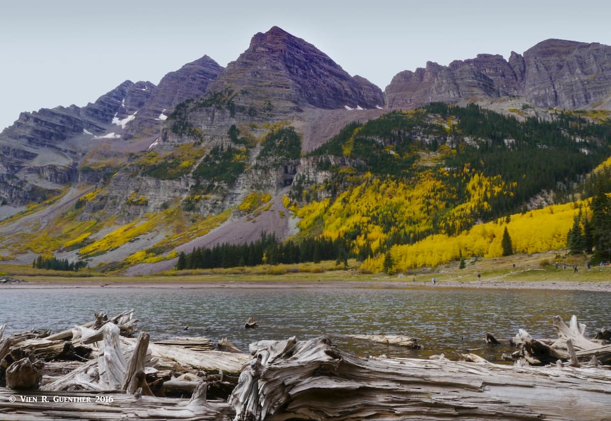
While Crater Lake has a spectacular setting, this is not the ultimate destination for the more serious hikers. The trail splits here, with one going up over West Maroon Pass and beyond, while the main trail climbs over Buckskin Pass toward Snowmass Lake and other splendid destinations. Now, many of us know that there are always climbers who want to conquer the Maroon Bells themselves, despite their reputation as the”Deadly Bells”. This area is the beginning of the normal approach route. North Maroon Peak dominates the view from here - it is not an “official” fourteener, although its neighbor to the left, Maroon Peak, is (see photo below). Most of us will just go back down after enjoying this place for a while.
Snowmass Lake Trailhead: Near Snowmass Village, about 12 miles from Aspen, is the northern end of the Maroon-Snowmass Trail, also the beginning of the main trail to Snowmass Lake, a one-way hike of 8.5 miles. This is a very popular trail because of the incredible terrain it serves, and many go up here to spend several days because a day hike would make a very long and strenuous day. I made a four-day expedition to this wonderful place once since there is so much to be explored here. For one thing, camping at Snowmass Lake makes a great base camp for climbing Snowmass Mountain, a fine climb involving some Class 3 scrambling near the top.
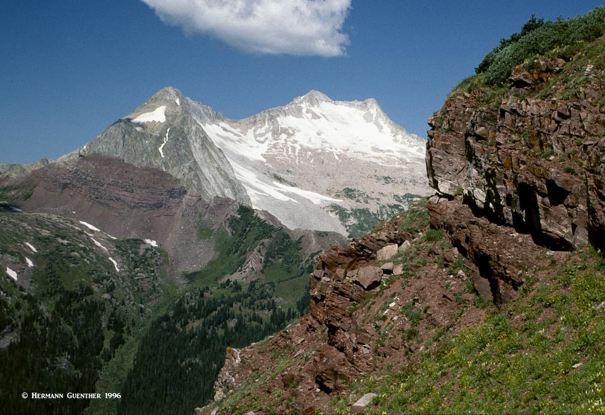
The hike from the lake to Buckskin Pass via the Maroon-Snowmass Trail is truly one of my all-time favorites. The view from the pass over to Pyramid Peak and the Maroon Bells is amazing, while the view looking back toward Hagerman Peak and Snowmass Mountain is to die for.
Castle Valley Trailheads: Along the Castle Creek Road from Aspen to the ghost town of Ashcroft are two trailheads that see far less hiker traffic than those more popular ones above. Both trails originating here lead almost immediately into the wilderness area, at which time you feel that you have left all civilization behind. First you will arrive at the American Lake Trailhead, which is just beside the road in a small clearing. When we arrived here to make this hike, there were no other cars in the small parking lot. The 3.5-mile hike to the pristine American Lake through the colorful aspen forest is a wonderful relief from the crowds at the Maroon Bells.
The trailhead for Cathedral Lake is just a couple of miles beyond the American Lake Trailhead. The small parking area is about a half mile off the road and the trail to the lake is just over three miles, parts of which are quite steep. Shortly before arriving at the lake are some precipitous switchbacks where you want to make sure you don’t wander off the trail. When you arrive at the lake, you will get a dazzling eyeful of colors that seem unreal. While the lake is a beautiful spot to relax and spend some time, it is also possible to take a side hike to Electric Pass, the highest named pass in Colorado accessible by trail. Just be on the lookout for lightning here – this pass was named for a reason. Don’t linger up there when afternoon clouds move in.
Geneva Lake Trailhead: If you have a 4WD vehicle, and have some experience in four-wheeling, this trailhead near the historic town of Marble is where you want to start your hike to Geneva Lake, with further access deep into the wilderness. The lake is a great place to camp for a few nights, and makes an excellent base for an alternative route to the summit of Snowmass Mountain. You can also get to Snowmass Lake from here involving a climb over Trail Rider Pass, from the top of which you will get a stunning view looking down on Snowmass Lake. Another day hike option from Geneva Lake is to go up to Little Gem Lake or, even much higher up, to Siberia Lake.
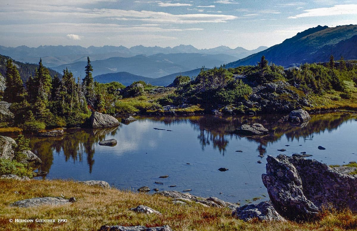
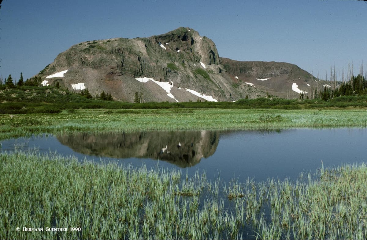
Flat Tops Wilderness – Now this is a wilderness that is truly unique, far different from any other mountain environment in Colorado. Only the Columbia Plateau in the Pacific Northwest is similar. There are no tall spires here and no fourteeners are found in the Flat Tops. This is a massive block of rock that was pushed up and then leveled off except for some rare peaks that rise 1,000 feet above the plateau.
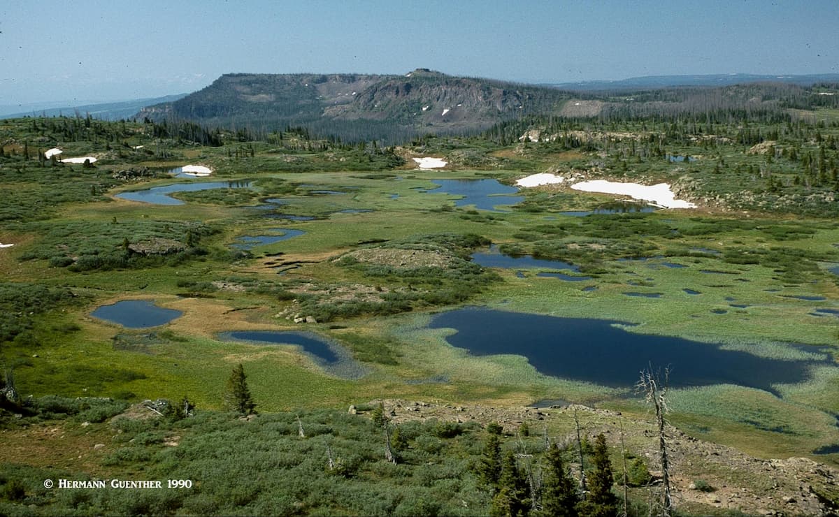
This place has countless lakes, ponds and tarns, most of them nameless, plus at least 100 miles of streams, all of which combine to form amazing trout habitat. This place is an angler’s paradise. With all that water, you can be assured of having millions of mosquitos to share your experience. The trout love them and the mosquitos love us. Come prepared. But that is not all. There is an amazing network of 160 miles of trails crisscrossing the plateau such that hikers and horsemen have a limitless combination of loop routes that they can use to explore this sub-alpine wonderland. The openness of the terrain also affords countless off-trail possibilities to complement the official trail system. There are numerous access points into the wilderness, but many of them are via roads not suitable for passenger cars. But you can drive your car to some of the most popular trailheads, though you will be driving on gravel roads. Let’s look at a few of them.
Trappers Lake Trailheads: Trappers Lake is the largest lake within the boundaries of the wilderness, but you can drive right to the lake without violating wilderness regulations. This place is remote – the nearest towns of any significance are 50 miles away. To get to this place, you will be entering the wilderness from the northwest side. At the end of the road are campgrounds as well as several trailheads. From here, the possibilities for wilderness exploration are limitless.
Stillwater Reservoir Trailheads: This area is a bit less remote as it is on the eastern side of the wilderness. It is reached from the town of Yampa which is on State Highway 131, 43 miles north of I-70 at Wolcott, or 30 miles south of the town of Steamboat Springs. From Yampa to the end of the road at Stillwater Reservoir is 17 miles. Along this road you will find several campgrounds and two additional reservoirs – the Yamcolo Reservoir and the Upper Stillwater Reservoir, which is actually below the main Stillwater Reservoir at the end of the road. Go figure! I don’t understand this one.
There are several trailheads in this area that will give you easy access into the wilderness. One trail to really look for is Trail No. 1119, which will get you to one of the most famous stretches of trail in the wilderness called the Devil’s Causeway. You can get there in less than two miles from the north shore of Stillwater Reservoir, but if you have a fear of heights, just don’t try to cross it. And remember, if you do make it across and get freaked out enough to not want to cross it again, you have a much longer hike back to your car.
There are so many other places to recreate in the WRNF – far too many to discuss here. But for those who are interested and want more information, I encourage you to follow some of the links included in the foregoing discussion, which will offer lots more information and photos about this magnificent national forest.
As large and dispersed as the White River National Forest is, there are many towns that would make good bases for exploring the extensive range of recreational opportunities. Yet no one town is ideally situated to explore all of what the forest has to offer. So now we will have a look at which towns would be the most attractive for supporting recreation in various areas.
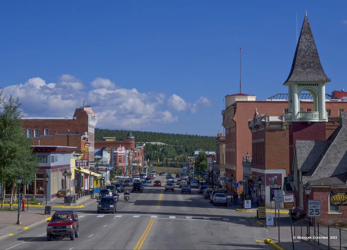
The most recognized town on the eastern end of the WRNF is Breckenridge. A combination of a major ski resort and a charming restored Victorian town, this is a place to spend some time enjoying the great restaurants, galleries and boutiques. Lodging opportunities abound here, offering a wide range of inns, hotels and condominiums. It is an excellent base for exploring significant parts of the WRNF, especially the magnificent Tenmile Range. Quandary Peak, the most climbed fourteener in Colorado, is just a few minutes south of town. It is an easy 10-mile drive to “Breck”, as the locals call it, from Interstate Highway 70, which provides high-speed access from Denver and its international airport.
Just off Interstate 70 between Copper Mountain and Silverthorne is the charming town of Frisco, located on the shores of Dillon Reservoir, the main water supply source for Denver, 70 miles away. It is centrally located with easy access to four major ski areas - Breckenridge, Copper Mountain, Keystone and Arapahoe Basin. Even the famous resort of Vail is only 30 minutes away. In addition to skiing, there are unlimited recreational opportunities available the rest of the year here including camping, hiking, biking, fishing, rafting and boating. Frisco is particularly handy to the many wonderful hiking areas in the Gore Range and Eagles Nest Wilderness. There is no shortage of accommodations and restaurants in this beautiful spot in the Rockies.
Dillon Reservoir, Frisco.
Everyone with an interest in skiing (or not) has heard of the swank resort of Vail in the central Colorado Rockies. It offers everything a visitor could ask for and at prices that are, well, not for everyone, especially during the ski season. Budget accommodations are rare in this resort that was modeled after high-end resorts in the Alps. But Vail is more than a ski resort. It offers a wide variety of recreational activities including biking, fishing, golf, rafting, high-adrenaline activities, and more and more. But Vail also has some of the finest hiking trails in the state right at its doorstep. Some of the best trails into the Gore Eagles Nest Wilderness start right off the highway, and within minutes, the hiker is in a pristine wilderness area. This place has a prime location and it is well visited. Also, the northern part of the Holy Cross Wilderness is easily accessed from Vail. And those who cannot justify or afford staying here, they can still enjoy strolling the quaint streets of Vail Village and stopping for a nice meal in one of the many restaurants. One of our favorite hikes starts just a short distance east of Vail, on the Shrine Pass Road which leaves I-70 at the summit of Vail Pass. The views from the top of Shrine Mountain are some of the finest in Summit County.
Situated at an elevation of 10,152 feet, Leadville is the highest incorporated town in the United States. Historically, Leadville was a major silver mining center and in the late 1890's was second in population only to Denver. Today, it retains its historic charm and contains many historic buildings and sites. The two highest peaks in the Rocky Mountains of North America (Mounts Elbert and Massive), can be easily seen from most parts of the town. For those who want to recreate in the Holy Cross Wilderness, Leadville makes a very convenient base from which to explore the very popular eastern trailheads, all easily reached via U.S. Highway 24. Though not a very big town, Leadville offers a choice of reasonably-priced accommodations and restaurants. It is certainly not a swanky resort town; but it offers a hearty dose of "old west" flavor and atmosphere.
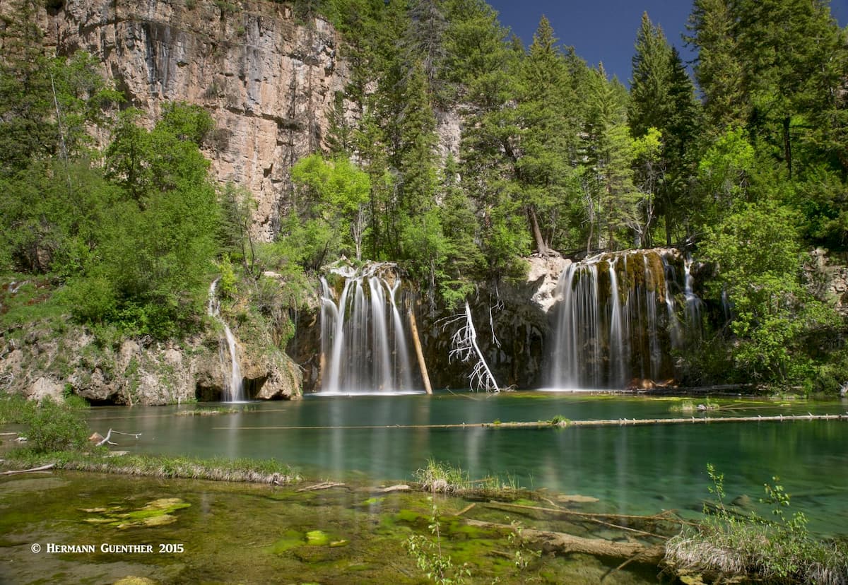
About forty miles north of Aspen is the historic town of Glenwood Springs which is best known for its hot springs and vapor caves. It has grown into a vibrant destination of its own, affording many dining, lodging and recreational choices. The town hosts the main office of the WRNF and is an easy gateway, via excellent highways, to many of the most visited parts of the forest. As with many towns in the Rocky Mountain West, Glenwood Springs started in the late 1800's as a camp of tents, saloons and brothels. This of course attracted hordes of gamblers, gunslingers and prostitutes. It has changed significantly since those days. It is an elegant town in a dramatic setting at the confluence of the Colorado River and the Roaring Fork River. The extensive Flat Tops Wilderness area is directly to the north and its proximity to Aspen make this town an ideal base of operations for those wanting to explore the Maroon Bells-Snowmass Wilderness. And just to the east of town, in the heart of Glenwood Canyon, is the extremely popular Hanging Lake, which can be reached on a steep one-mile trail. Because of the popularity of this spot, the U.S. Forest Service now requires a permit to go there.
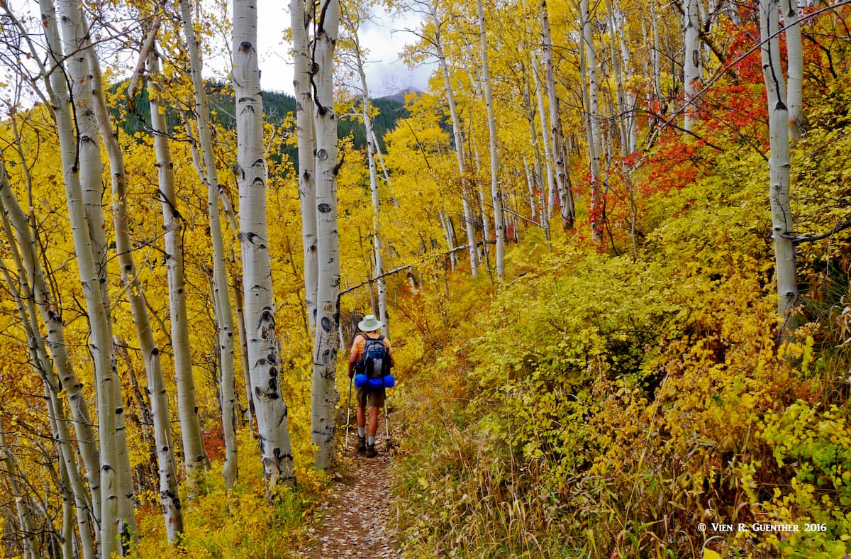
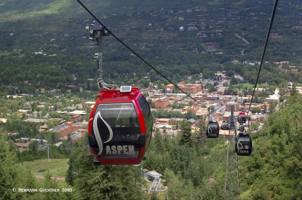
It would be remiss to not mention Aspen in connection with exploring the WRNF. After all, it sits right in the middle of much of what makes this area one of the most sought-after recreation venues in the forest, if not the entire state. It started as a silver mining town in the late 1800's and was highly successful until 1893 when the silver market collapsed. The town was so named because it is surrounded by forests of aspen trees, which in the autumn exhibit an impressive display of gold color. Aspen is known for high-end lodging, restaurants, boutiques and many celebrities (who fly into Aspen in their private jets). The Aspen area boasts four major ski areas - Aspen Mountain, Buttermilk, Aspen Highlands and Snowmass, the latter being a separate resort development about ten miles from Aspen. This is a year-round town that offers unlimited recreational opportunities. For those of us who don’t want to spend the generous amounts of dollars needed to stay in this upscale town, fear not. The nearby towns of Basalt, Carbondale and Glenwood Springs have plenty of affordable accommodations and restaurants.
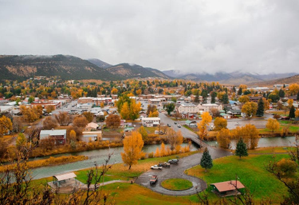
A small town of 2,475 inhabitants, Meeker in northwestern Colorado is the place where you might want to stay and make your base if you plan to enter the Flat Tops Wilderness from the west (i.e. at Trappers Lake). It is nestled in the White River Valley and boasts a historic downtown, clean air and a low crime rate. What more can you ask for? This town is as “out west” as it gets – they still have sheep and cattle drives that go right through town. There are a few accommodations and restaurants in town but don’t expect anything high-end. This town is really isolated from other towns of any significance. It is a 50-mile drive to the trailheads at Trappers Lake. If you opt for camping, you can overnight much closer and get an earlier start on the trail.
Because of the complexity and variations in geographic and topographic databases, it is not always clear which mountains are located within a given geographic area. This is particularly the case when two jurisdictions have a common boundary. When it comes to mountains, it is commonly (but not always) understood that such boundaries follow ridge lines that in most cases define the local geography based on drainage basins. One of the best examples of this is the Continental Divide of North America (as well as other similar divides). In the case of the White River National Forest, there are several major mountain peaks that sit squarely on the Divide or other boundaries, such as between adjacent National Forests. Consequently, these mountains are rightly claimed to be in both National Forests, yet the database may at times show certain peaks in one forest but not in the other. Thus, Grays Peak is the highest mountain in the WRNF, sitting on the boundary between WRNF and Arapaho NF, although it is only named as the highest in the latter. The database for WRNF names Quandary Peak as the highest, which is not the case.
To complicate matters even more, there are sub-categories of mountain domains that straddle such divides or are entirely contained within another jurisdiction. These sub-categories have their own individual databases, such that mountains named within a wilderness database, for example, may not appear in the database for the National Forest in which it is located. In the case of WRNF, there are several such cases. PeakVisor is constantly revising and updating its databases to present the best information available at the time.

Explore White River National Forest with the PeakVisor 3D Map and identify its summits.


