
Scan the QR code and open PeakVisor on your phone
The Sawatch Range include 271 named peaks. The highest is Mount Elbert at 4,401 m. Other notable peaks include Mount Massive, Mount Harvard and La Plata Peak.
The Sawatch Range, a sub-range of the Rocky Mountains of North America, is located in the center of the U.S. state of Colorado. It has 243 named mountains with Mount Elbert both the highest and most prominent. The range extends about 80 miles from Interstate Highway 70 near the Ski Resort of Beaver Creek in the north to just southwest of the town of Poncha Springs in the south. The eastern edge of the range is defined for the most part by the Arkansas River Valley. The much smaller northern segment of the range is defined on the eastern side by the Eagle River Valley. This segment is contained almost entirely within the Pacific watershed, being situated west of the Continental Divide. Most of the range is within the Atlantic watershed although its western fringes are defined for the most part by the Continental Divide. That portion of the range west of the Divide drains into the Colorado River via several tributary rivers. The western extent of the range finds itself almost as far west as the resort of Aspen.
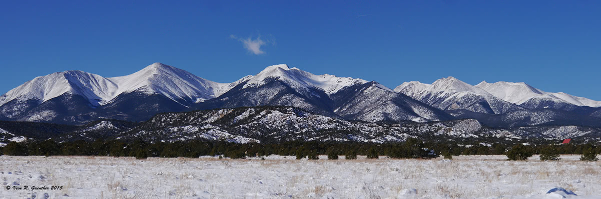
Southern Sawatch Range
The Sawatch Range could be defined as the "backbone" of Colorado, since it contains four of the five highest summits in the Rocky Mountains. Interestingly, this range is home to 15 fourteeners, more than in any other range in Colorado. With the exception of the Mount of the Holy Cross, these fourteeners are all in the Atlantic watershed, specifically, the Arkansas River basin. The range includes 18 peaks having a topographic prominence of over 500 meters (1,640 feet). This would seem to form a major barrier against east-west travel, yet there are three highways that cross this magnificent range, two of which, however, are always closed during winter - a closure that can last more than six months. Both Independence Pass (State Highway 82) and Cottonwood Pass (County Road 306) are over 12,000 feet high - among the highest passes in the state for vehicular travel. That leaves U.S. Highway 50 over Monarch Pass in the south as the only year-round crossing of the range. There is one additional means for driving over the range, but it can hardly be classified as a highway. That is the rough road over Hagerman Pass that requires high-clearance or four-wheel drive vehicles and is only open from late spring until early autumn. This road is not routinely used to get from one place to another but rather to gain access to some of the spectacular high country to be found in this range.
Mount Elbert, Leadville
There are plenty of recreational opportunities to be found in the Sawatch Range given the abundance of high mountains present here. Naturally, a major draw here is the many fourteeners, including Mount Elbert, the highest in Colorado and indeed of the entire Rocky Mountains of North America. When viewed from the highway it does not look nearly impressive enough to be accorded that distinction. But let the facts speak for themselves. All the fourteeners in the range are considered "gentle giants" because they can all be climbed with a maximum difficulty of Class 2, although there are a few more technical routes available for those seeking a greater challenge. This makes these peaks "walk-ups", but that should not be construed as child's play. They are high and steep and very susceptible to varying weather conditions that can make them deadly. In addition, some of them present long trail distances that would entail multi-day excursions requiring at least a one-night bivouac. Trying to climb some of them in a one-day hike would certainly be a strenuous undertaking for all but the most robust hikers.
Beyond climbing fourteeners or countless other high peaks, the Sawatch Range affords numerous other outdoor adventures and recreational opportunities. The range encompasses four wilderness areas (Mount Massive, Holy Cross, Hunter-Frying Pan, and Collegiate Peaks) and three national forests (White River, San Isabel and Gunnison). These present a palette of incredible wild and scenic venues for undertaking more benign activities such as camping, fishing, mountain biking, cross-country skiing and sightseeing. In addition, there is one small ski area at the summit of Tennessee Pass - Ski Cooper - that served as the training site during the second world war for the 10th Mountain Division, which saw action in the Italian Alps. Cooper bills itself as a "family resort" due to its intimate feel and affordability. At the other end of the spectrum is the high-end Beaver Creek Resort which occupies the northernmost slopes of the range.
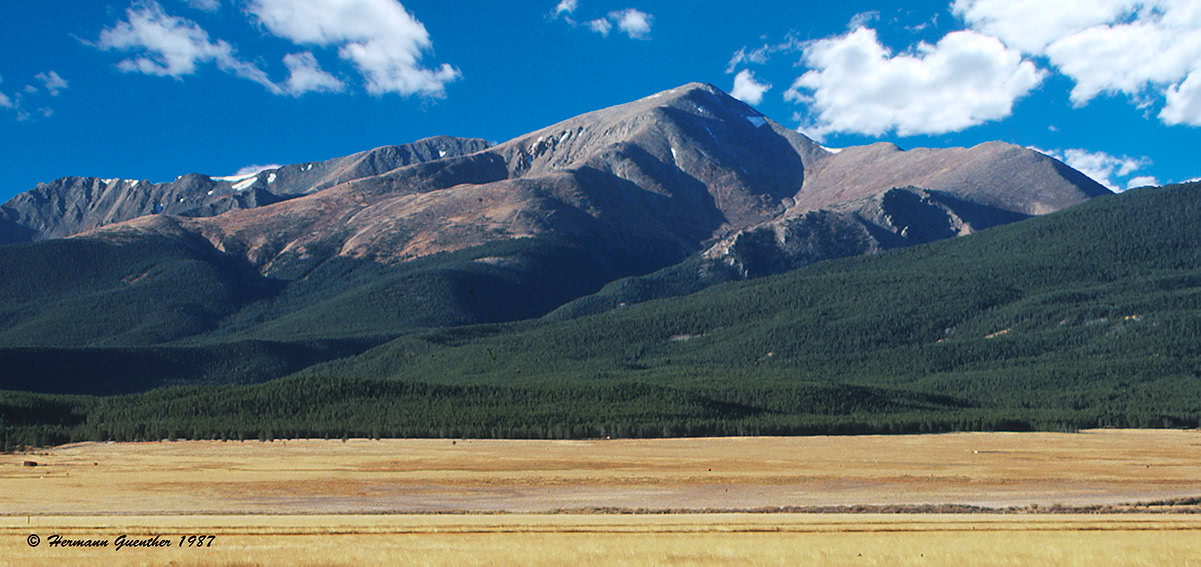
Most access to hiking in the Sawatch Range is from Highway 24 from the north end to Buena Vista and its continuation, Highway 285, from Buena Vista to the south. This corridor flanks the entire eastern edge of the range. Most of the major trailheads are easily reached by regular passenger cars just a short drive from the highway, although a few of the more remote trailheads may require at least high clearance or even four-wheel drive vehicles. Needless to say, this accessibility makes this range very popular, especially since much of the range, or at least its fringes, can be reached in just over a two-hour drive from the Denver and Colorado Springs areas. The fact that U.S. 24/U.S. 285 corridor is itself a major north-south highway across central Colorado adds to the popular appeal of these mountains. In fact, the view of the range that opens as one approaches along the last several miles of Highway 285 as it descends from Trout Creek Pass towards its junction with Highway 24 is stunning to say the least. Sprawling dead ahead is the massive bulk of Mount Princeton (part of the Collegiate Peaks sub-range), a view that is enough to excite any mountain aficionado.
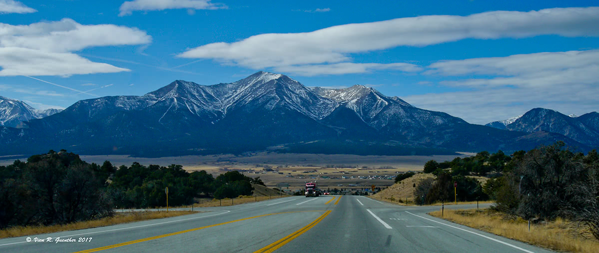
Mount Princeton, Highway 285, Buena Vista
Since there are many trails distributed throughout the range, it is best to group them according to the geographic areas from which they emanate. In the north end, much of the range can be accessed from major forest roads that leave Highway 24 from south of the town of Minturn to north of Tennessee Pass. Some limited access to the extreme northern end of the range can be gained from the town of Eagle right on I-70 about 30 miles west of Vail. These areas provide good road access into the beautiful Holy Cross Wilderness. Slightly further south, from near the town of Leadville, are good roads that provide easy access to the highest peaks of all the Rockies. Even further south, the most popular trail access routes are from the towns of Buena Vista and Poncha Springs into the Collegiate Peaks area. Following is a description of the major ones.
Tigiwon Road and Homestake Road - These two gravel forest roads provide by far the best means from which to explore the incredible Holy Cross Wilderness with its countless high alpine lakes and peaks. For those wishing to climb the only fourteener in this area, Mount of the Holy Cross, the Tigiwon Road is the one to take - easily passable for passenger cars all the way to its end at the Halfmoon Campground. The Fall Creek Trail also starts at this trailhead and leads to two popular thirteeners - Notch Mountain and Whitney Peak - as well as a number of lovely lakes including Lake Constantine and the Tuhare Lakes. While some fairly easy day hikes are possible from this trailhead, backpacking is the best way to explore all that can be found here.
Mount of the Holy Cross from Notch Mountain, Holy Cross Wilderness
Homestake Reservoir Road - This provides even more diverse opportunities for exploring the Holy Cross Wilderness. This very popular and busy road starts at the bottom switchback at the north end of Tennessee Pass and penetrates deep into the range. It is easily passable by passenger cars and provides access to trailheads that lead to numerous alpine lakes that are hard to surpass in terms of their incredible beauty and unbelievable settings. The four Missouri Lakes are perhaps the jewels in the crown of the Holy Cross Wilderness. While they can be reached in an easy day hike, backpacking into that area is the order of the day if one wishes to explore them as well as other lakes deeper in the wilderness, or to climb the popular thirteener, Savage Peak. A minimum of two nights is advisable to truly appreciate this wonderful part of the Rockies. There are plenty of fine camping sites in this magnificent basin.
Missouri Lakes Basin, Holy Cross Wilderness
Halfmoon Creek Road - This road just a few miles outside of Leadville is gravel and easily negotiated by passenger cars. It leads to two campgrounds - and major trailheads for climbing the two highest summits in the Rocky Mountains of North America - Mounts Elbert and Massive. The most popular trail to Mount Elbert starts shortly after the second campground across the road from the parking area for the Mount Massive trailhead, which is also here.
State Highway 82 - This is the highway that leads over Independence Pass to the resort of Aspen. This road provides access to two trailheads for Mount Elbert. The Twin Lakes Trailhead provides the easiest trail for climbing the mountain. It is just a short distance to the north of Highway 82 via County Road 24 past the campground, where the route to the trailhead is somewhat confusing. It's best to inquire locally if one wants to climb this good, but less popular, trail to the summit. The Black Cloud trailhead right beside the highway in the town of Twin Lakes provides a longer and even less crowded ascent of Mount Elbert. A bit further west of Twin Lakes is the Lake Creek Trailhead on the south side of Highway 82. This provides access to the north and west sides of La Plata Peak, the fifth-highest of Colorado's fourteeners. For the truly adventurous climbers, the jagged Ellingwood Ridge to La Plata can also be accessed from this trailhead.
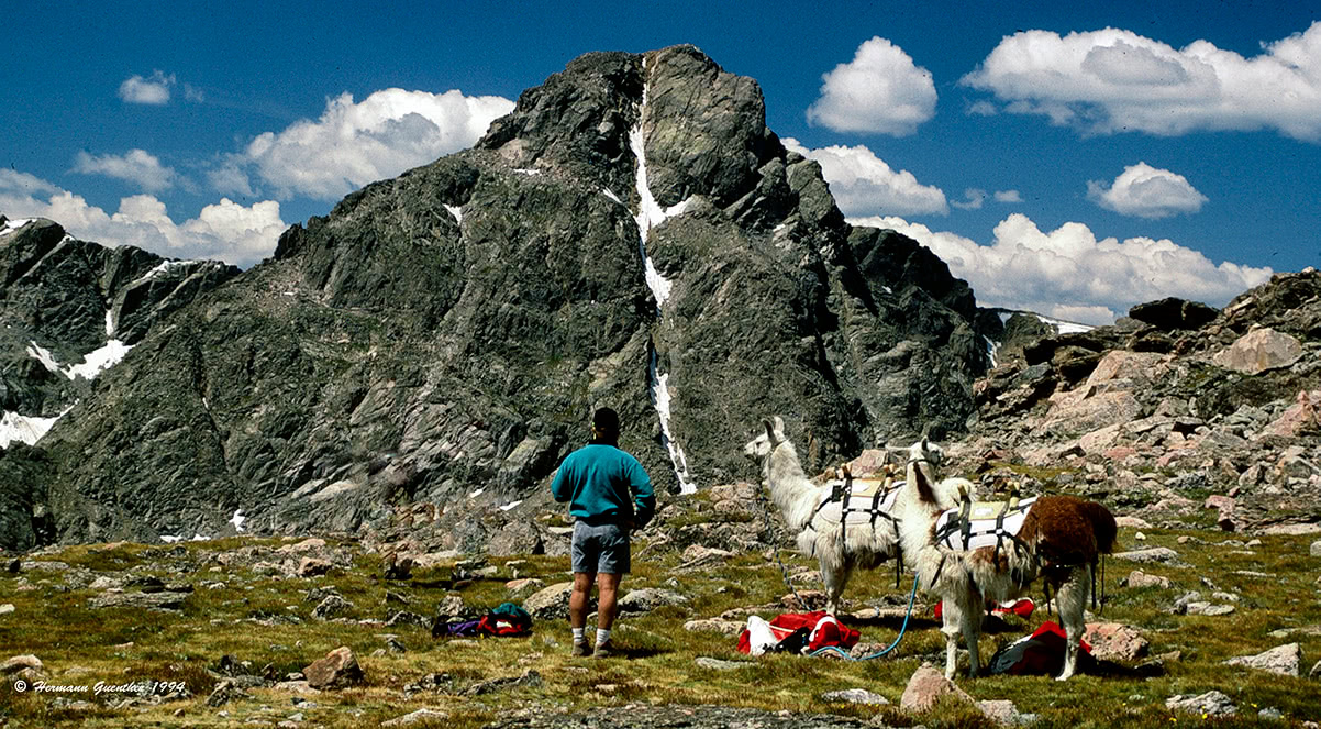
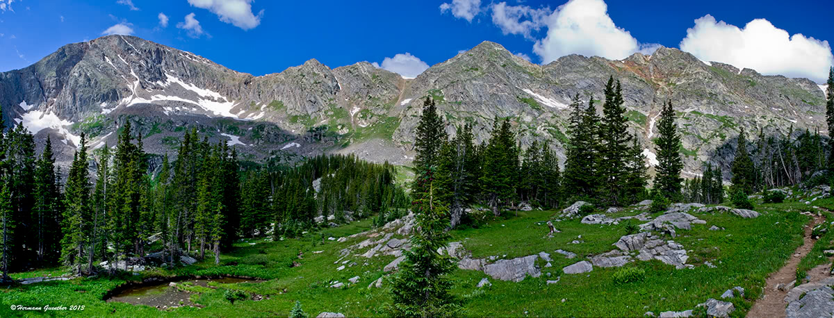
Mount Huron, Collegiate Peaks Wilderness
Clear Creek Trailheads - About five miles south of the SH-82 and US-24 intersection, or 15 miles north of Buena Vista, is the Clear Creek Road (County Highway 390), which leads to a number of trailheads including access to five fourteeners - La Plata Peak, Mounts Oxford and Belford, Missouri Mountain and Huron Peak. This road is passable for most cars at least as far as the old townsite of Winfield. About halfway to Winfield is the Missouri Gulch Trailhead from which Belford, Oxford and Missouri can be climbed. The West Winfield Trailhead further up the road is the most common approach to La Plata Peak, while the South Winfield Trailhead provides the standard approach to Huron Peak. The northwest slopes route on Huron is one of the few fourteener routes in the Sawatch Range with an elevation gain of less than 4,000 feet. This trailhead is also used for hiking to Lake Ann as well as for climbing the Three Apostles.
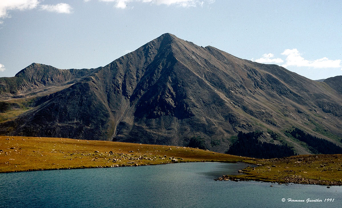
Three Apostles, Collegiate Peaks Wilderness
North Cottonwood and Harvard Lakes Trailheads - These two trailheads are just a few miles outside the town of Buena Vista. They are used for climbing Mount Harvard and Mount Columbia, either individually or in combination. The easiest and most popular route up either peak is from the North Cottonwood Trailhead. Also accessible from this trailhead is Mount Yale; this is usually done in combination with a backpack trip to the beautiful Kroenke Lake, from where a relatively easy assault on Mount Yale can be accomplished via its northwest ridge. This, however, is not one of the standard routes on Yale.
Cottonwood Pass Road - Also known as County Highway306, the Cottonwood Pass Road affords easy access on a paved road to several popular trailheads. The Denny Creek Trailhead provides the most common access for climbing Mount Yale. The trail from this parking area right beside the highway is also used for hikes to the secluded Hartenstein Lake as well as to Browns Pass from where great views can be had north toward a number of high peaks including the impressive Three Apostles. A few miles further up the road toward Cottonwood Pass is the Ptarmigan Lake Trailhead. This easy day hike to a nice alpine lake is very popular, with the small parking area often full thus resulting in many cars being parked along the side of the highway. Some fine stands of wildflowers can be found on this hike.
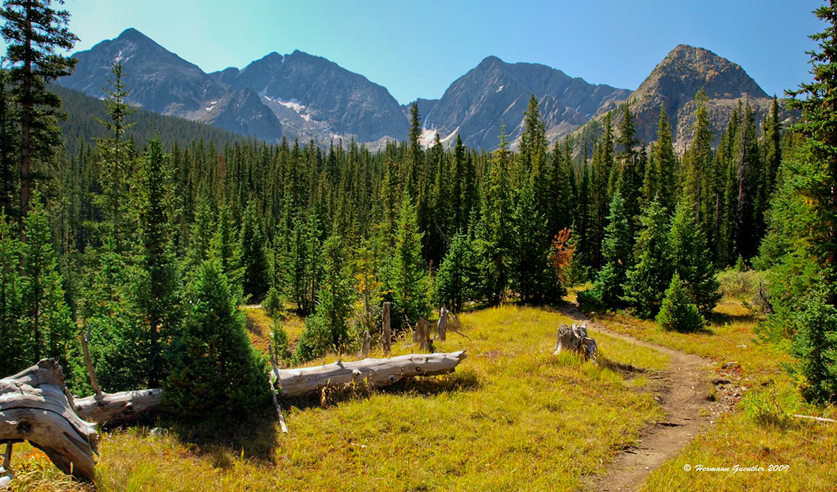
Three Apostles from Browns Pass, Collegiate Peaks Wilderness
Chalk Creek Drive - Also known as St. Elmo Road and County Road 162, this mostly paved road leads to the St. Elmo ghost town, a popular and still inhabited tourist attraction. The road also provides access points for climbing both Mount Princeton and Mount Antero - both popular fourteeners. The "official" trailhead for Mount Princeton is on a side road, called the Mount Princeton Road, at an elevation of 8,900 feet. This is where most passenger cars will park in a large lot. But the road continues up until reaching 11,000 feet, though driving to that point is not advisable for people who value their cars. Further up Chalk Creek Drive are two trailheads for those wishing to climb Mount Antero. The first is at the Cascade Campground which is the trailhead for the north slopes of the mountain. A couple of miles further up is the Baldwin Gulch Road junction which is used as a staging point for those wanting to climb Antero's west slopes. Without a four-wheel drive vehicle it is not possible to drive up Baldwin Gulch Road.
Mount Princeton
County Road 240/Jennings Creek Road - This road is commonly used to access the two southernmost fourteeners in the Sawatch Range - Mount Shavano and Tabeguache Peak. These two mountains are often climbed together, but there are two trailheads along this road depending climbing preferences. One is the Angel of Shavano Trailhead and the other is the Jennings Creek Trailhead. They can both be reached by passenger cars, although the road gets considerably more rough after the first trailhead.
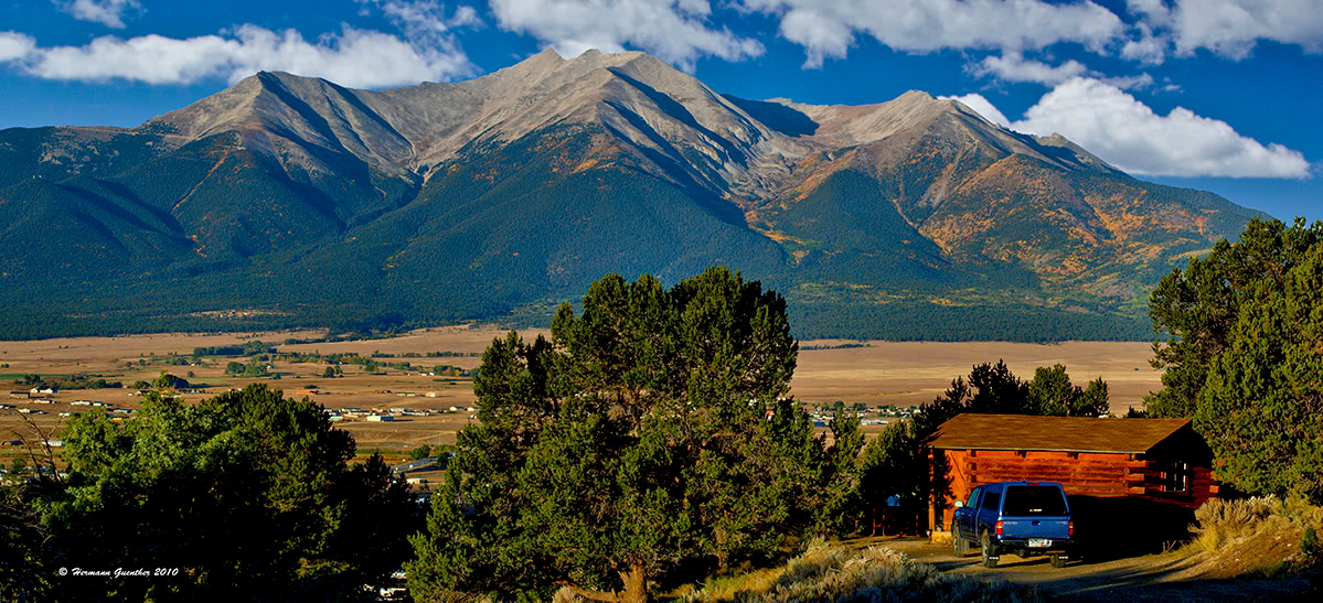
Recreation is the key word in the Arkansas Valley of central Colorado. And it seems that the word is out - tourists flock here in great numbers. Yet the place does not seem overly crowded. This may well be because the size of the Sawatch range is large enough to accommodate the masses. With the abundance of activities possible here, it can be difficult to decide what to do first. For example, fly-fishing the Arkansas River, while viewing the highest mountain in the Rockies as a backdrop, may give an angler pause when the fish are not biting and cause him to ditch his fishing waders in favor of hiking boots. Such is the allure of the Sawatch. And such allure drives the need for tourism infrastructure.
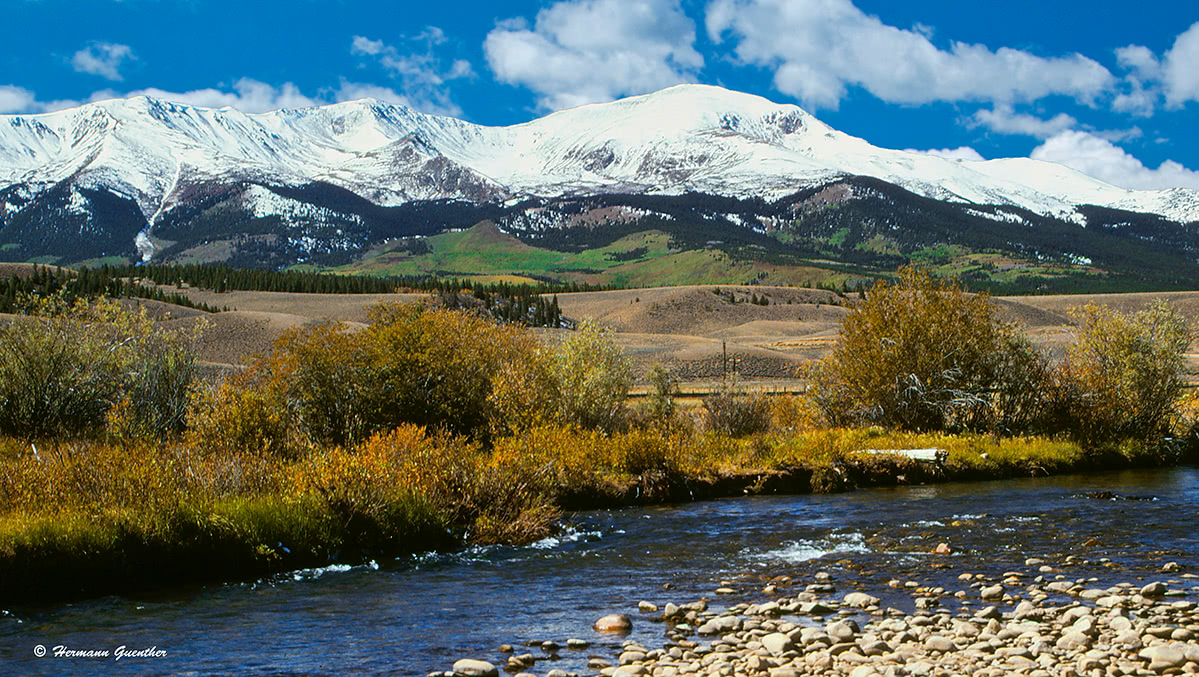
Mount Elbert, Arkansas River
Although the Sawatch Range is easily accessed from two major highways (US-24 and US285), it is not directly served by any major resorts. While the western extremity of the range reaches almost as far as Aspen, that world-renowned resort is however more associated with the Elk Range than the Sawatch. The best route from there into the Sawatch is State Highway 82, which, as earlier mentioned, is closed for a number of months each year.
The major international resorts of Vail, and its younger cousin, Beaver Creek, are of course a short drive from the northern extremity of the Sawatch Range, but their primary focus is on skiing, although they figure more prominently in their role as staging areas for hiking in a different range (see Gore Range). The accommodations and amenities they offer may well be beyond the means and scope of the average mountain climber. That leaves five small towns which can only be considered "major" in the context of the services they can render to visitors of this range.
What was at one time nothing much more than "a wide spot in the road" has become a charming and fashionable alternative to the big resorts mentioned above. Only a couple of miles south of Interstate Highway 70, Minturn is well positioned to serve as a base from which to explore the northern end of the Sawatch Range, especially the wonderful Holy Cross Wilderness. With a population of little more than 1,000 inhabitants, this charming town does have a limited supply of accommodations and eating establishments, but it may be just what some people want in terms of a cozy and quiet place to spend a few nights.
Situated at an elevation of 10,152 feet, Leadville is the highest incorporated town in the United States. Lake County Airport just outside of town is the highest airport in North America, at 9,924 feet. A general aviation facility, it does not have scheduled passenger service, which was discontinued a number of years ago. Historically, Leadville was a major silver mining center and in the late 1890's was second in population to only Denver. Today, it retains its historic charm and contains many historic buildings and sites. The two highest peaks in the Rocky Mountains of North America (Mounts Elbert and Massive), and therefore in the Sawatch Range, can be easily seen from most parts of the town. The summit of Elbert is only 12 miles away and that of Massive is even closer. Needless to say, at this elevation Leadville is a cold place, but that does not deter visitors from enjoying the many recreational activities available here. At the head of the Arkansas River Valley, Leadville is tucked between two major mountain ranges - the Sawatch and the Mosquito Range - which makes the town a handy base for mountaineering nearby. For those who want to recreate in the Holy Cross Wilderness up north, Leadville makes a very convenient base to call home for a few days as well.
Buena Vista sits centrally located on the east side of the Sawatch Range, thus ensuring it a significant role in mountain recreation. Sitting immediately across from the Collegiate Peaks (a sub range of the Sawatch), this charming town of less than 3,000 inhabitants provides most of the amenities visitors could want. It is conveniently located at the junction of the two major north-south highways in central Colorado - U.S. 285 and U.S. 24. Though Buena Vista has a small regional airport, there is no scheduled airline service available here. But town can be easily reached on good roads in just over two hours from Denver, thus making it a convenient destination for visitors from out of state. For accommodations, the town offers a wide range from simple cabins to B&Bs to branded hotels. There is no problem finding restaurants and supermarkets. There are plenty of camping opportunities nearby as well.
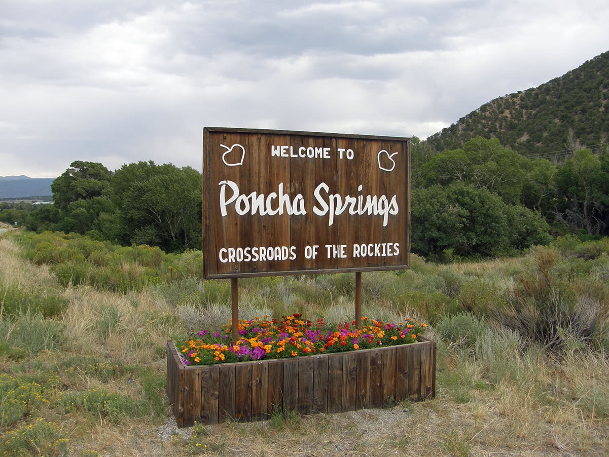
This is definitely a small town! With a population of less than 1,000 inhabitants, the visitor cannot expect to find an expansive tourist infrastructure here. But what makes Poncha Spring significant is its location in that it sits right at the crossroads of two major highways - U.S. 285 and U.S. 50. One crosses Colorado from east to west and the other from north to south. This town is situated at the southern tip of the Sawatch Range and while it comes up short on amenities, it is only five miles from the much larger town of Salida to the east on U.S. 50.
While not as centrally located in the Sawatch Range as the other towns, Salida is the largest city in the central Arkansas Valley, thus giving it a meaningful role in supporting the tourist trade in the Sawatch. With a population of almost 6,000 inhabitants, there are plenty of accommodations, restaurants and other establishments that can cater to most tourist needs. Being adjacent to the Arkansas River, there are many businesses here and nearby that provide the recreational activities that this area is famous for - whitewater rafting on the Arkansas. This river provides some of the best thrills in the business, and in the summer visitors arrive here in droves just to have an opportunity get thrown off a raft into the cold, clear waters of this world-class whitewater venue. It should be noted, however, that parts of this river are not for amateurs.
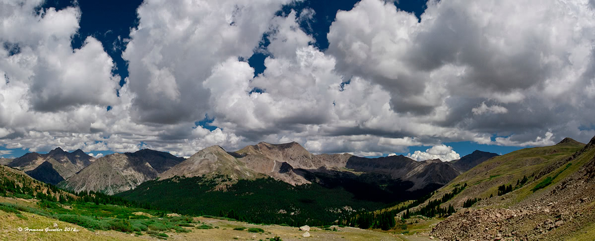
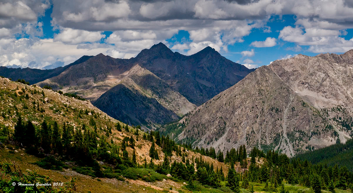
Sawatch Range Panorama from Browns Pass


The highest peak in the Sawatch Range is Mount Elbert, at 4,401 m.
The Sawatch Range have 271 named peaks.


