Scan the QR code and open PeakVisor on your phone
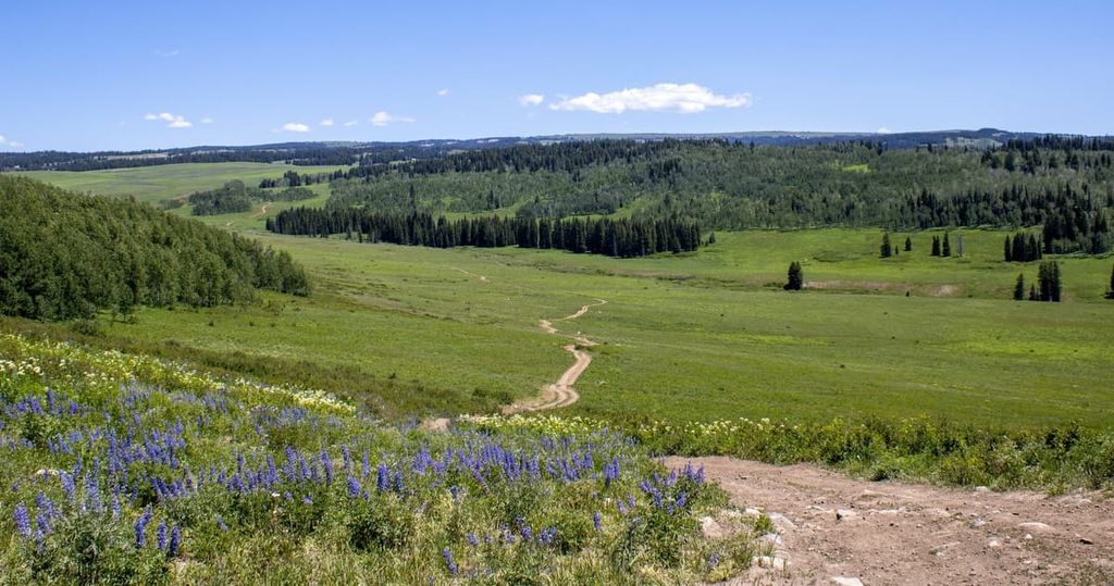
Located in western Colorado, the Flat Tops Wilderness Area spans 235,214 acres (95,187 ha) of rugged and remote terrain, making it the second-largest wilderness area in the state, after the Weminuche Wilderness Area. The Flat Tops Wilderness contains 23 named high points, of which both the highest and most prominent is the eponymous Flat Top Mountain (12,356 ft/3,766 m).
The Flat Tops Wilderness region is part of the White River Plateau of the western part of the US state of Colorado. It is located approximately 50 miles (80 km) to the north of the town of Glenwood Springs in the counties of Garfield, Rio Blanco, and Eagle.
The entire wilderness is located at an elevation of approximately 10,000 feet (3,048 m) and spans 235,214 acres (95,187 ha) of remote mountains and forests. The Flat Tops is known nationally as the first unofficially “protected wilderness” in the United States (see “Human History” below for more information).
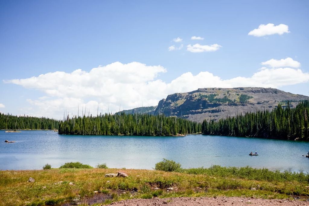
Well over 100 lakes and ponds are spread across the region, both above and below the “flat-topped” cliffs and plateaus that give the wilderness its name. There are also over 100 miles (160 km) of fishable streams in the area.
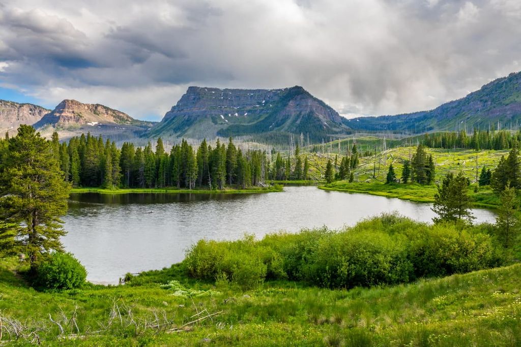
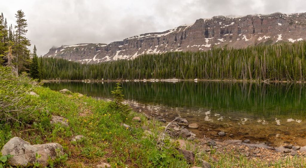
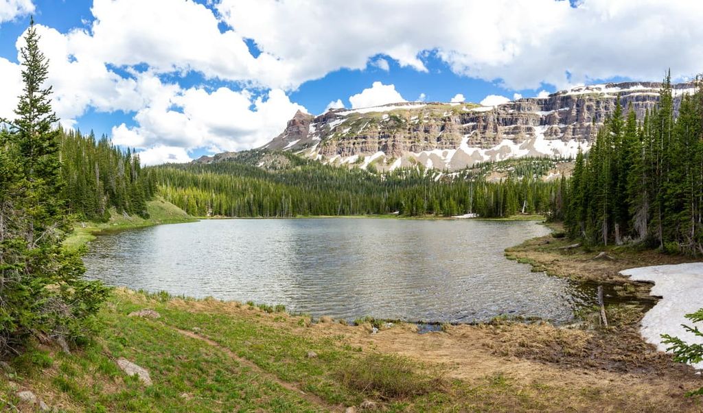
Trappers Lake is perhaps the most well-known location in the Flat Tops. The lake, which is the source of the White River’s North Fork, is the second-largest natural body of water in Colorado, after Grand Lake. Trappers Lake sits in an amphitheater surrounded by the soaring ramparts of the Flat Tops Mountains on all sides.
Trappers Lake is approximately 1.5 miles (2.4 km) long and 0.5 miles (0.8 km) wide, with a surface area of around 320 acres and a depth reaching 180 feet (55 m). It rests at an elevation of 9,600 feet (2900 m) and is widely visited as a fishing site, particularly for cutthroat trout, Colorado’s state fish.
In 2002, the Wilderness was the site of two devastating fires, both started by lightning strikes. These blazes, known as the Big Fish and Lost Lake fires, resulted in more than 22,500 acres (9,105 ha) of land burned (nearly 10 percent of the entire Flat Tops Wilderness). Much of the burned area was around Trappers Lake.
Although remote in its own right, the Flat Tops Wilderness is situated relatively close to a number of other areas of public land. This includes the Sarvis Creek Wilderness and the Mount Zirkel Wilderness to the northeast, the Windy Gulch Wilderness Study Area and Black Mountain Wilderness Study Area to the west, and the Bull Gulch Wilderness Study Area and the Castle Peak Wilderness Study Area to the southeast.
As mentioned above, the Flat Tops are a part of the White River Plateau (or White River Uplift). The White River is a broad plateau that formed during the Eocene epoch, during the latter portion of a mountain-building period in North America known as the Laramide orogeny (named for Wyoming’s Laramie Mountains), which lasted from approximately 70 to 80 million years ago to 35 to 55 million years ago.
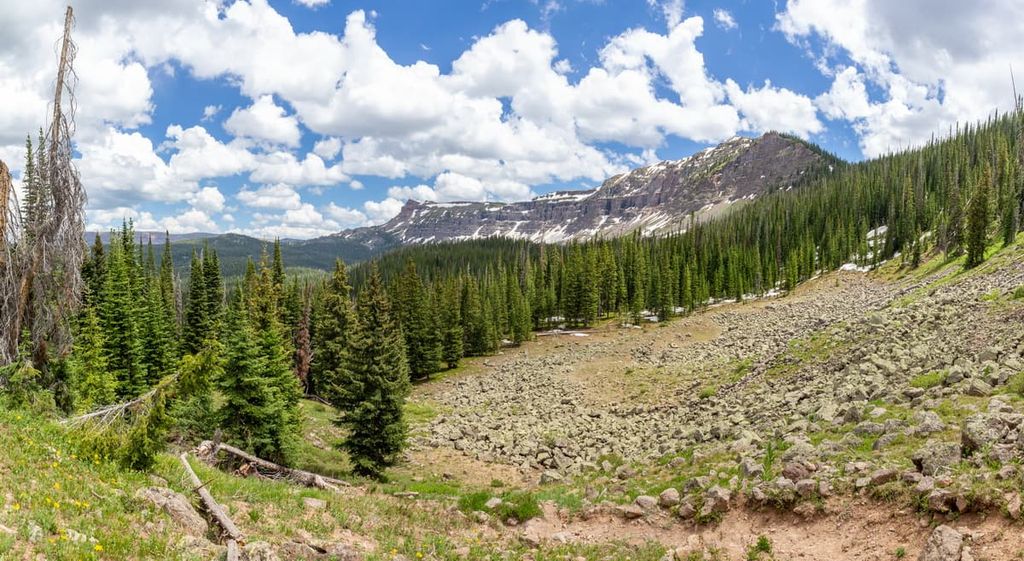
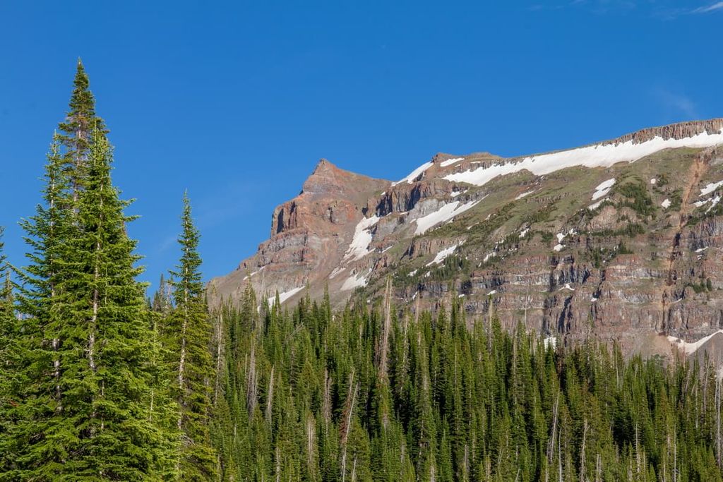
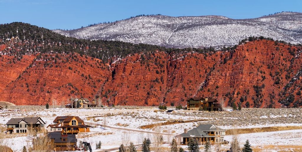
The most notable geologic feature in the Flat Tops Wilderness is its classic “flat-top” mountains. These broad, flat peaks stand out in stark contrast from the rugged heights of the rest of the Colorado Rockies. Their unique shape is due to millions of years of erosion, which has subsequently removed ancient layers of softer sedimentary rock, laying bare a hard basalt cap beneath. This basalt cap is quite deep, stretching more than 1,500 feet (457 m) thick in many places.
Cliff edges in the Flat Tops are noticeably steep, due to erosion as a result of glacial activity during the early Holocene epoch, approximately 10,000 years ago. As a result of this extensive erosion, the Flat Tops, though precipitous and sharp, are much lower than most of Colorado’s other peaks, ranging from 10,000 to 12,000 feet (3,048 m to 3,658 m).
Due to the vast changes in elevation between the peaks and surrounding valleys, the Flat Tops Wilderness is home to several different ecological zones. The primary divides are between subalpine and conifer forests at lower elevations, from 6,500 feet (1,981 m) to 10,000 feet (3,048 m), and alpine tundra above 10,000 feet (3,048 m).
Forests in the Flat Tops primarily consist of lodgepole pine, Douglas fir, and Engelmann spruce. Today, a large skeletal forest consisting of dead fir and spruce trees sits above the higher alpine slopes below the tundra. This is the result of a tragic bark beetle infestation that occurred in the 1940s.
Meanwhile, wildlife in the Flat Tops includes large populations of elk, moose, mule deer, marmot, and black bear. Trappers Lake, in particular, is known for its large insect population, which provides food for avian life such as Steller's jay. As mentioned, the lake is a natural spawning bed for the cutthroat trout, one of the few remaining in the state.
The 2002 Big Fish wildfire near the lake cleared out some of the denser fir and spruce trees, and now smaller tree life, such as aspen groves, and wildflowers, such as the columbine, Colorado’s state flower, can be found.
Historically, the Ute people (specifically the Yampa and Parianuche tribes), called the Flat Tops Wilderness home. The Ute traditionally hunted game in the higher elevations of the region, such as around Trappers Lake, in the summer months, retreating to lower elevations during colder months.
The lake earned its English-language name during the early nineteenth century, due to the bustling beaver pelt trade in the region. Among others, the famed trapper Antoine Robidoux worked the region around Trappers Lake for furs. The lake was reportedly a major source of furs well into the latter half of the nineteenth century.
Settlers of European descent wanted to move into the Flat Tops region due to the viable ranching and resource extraction opportunities in the area. As a result, by the 1880s, the Indigneous peoples of the region had been forced out of the Flat Tops due to various one-sided treatises and violent encounters with settlers. Of note, the Flat Tops never saw any major mining activity, although almost every other region in Colorado’s mountains did.
The original Trappers Lake Lodge was built in 1918. The following year, Arthur Carhart, a recreation engineer, was sent by the US Forest Service to survey the region. Carhart, a devout conservationist, was so impressed with the Flat Tops and Trappers Lake in particular that he recommended that the area be off-limits to development.
The Forest Service heard his pleas and had Trappers Lake declared off-limits by 1920. As a result, many consider Trappers Lake and Flat Tops the first “protected wilderness areas” in the United States.
After Congress passed the Wilderness Act in 1964, it was only a matter of time before the Flat Tops were officially declared a Wilderness region. The Flat Tops Wilderness was created in 1975.
There are over 160 miles (257 km) of trails in the Flat Tops, both in the valleys and atop the surrounding plateaus. According to the US Forest Service, Carhart Trail and Wall Lake Trail are the two most popular trails in the Wilderness. Aside from those two, Devil’s Causeway is another awe-inspiring route that comes highly recommended by locals.
The 5.3-mile (8.5 km) Carhart Trail (#1815) circles Trappers Lake. It is the most popular trail in the area and one of the easiest to access. It’s named for Arthur Carhart, the surveyor whose appraisal resulted in the protection of the Flat Tops from development. The trail sports an elevation gain of 358 feet (109 m).
Forest Service maps for the Carhart Trail can be found here.
Wall Lake Trail (#1818) provides the most direct route to the plateau. This 7-mile (11 km) route is one of the steepest trails in the wilderness. From the Wall Lake Trailhead on the western shore of Trappers Lake, the trail climbs up to the picturesque Wall Lake. This alpine lake sits directly below the 12,002-foot (3,658 m) Trappers Peak. The trail finishes with an intersection with the Trappers Lake Trail (#1816), near the South Fork of the White River.
Forest Service maps for the Wall Lake Trail can be found here.
This 10.6-mile (17 km) loop route features 1,870 feet (570 m) of elevation gain and begins just past the Cold Springs Campground near Stillwater Reservoir, to the east of Trappers Lake. It is also easily accessed via the Carhart Trail, from Trappers Lake, if coming from the west.
The Devil’s Causeway is listed in the Forest Service registry as Trail #1803.3 and is an offshoot of the longer Chinese Wall Trail (#1803), though crossing said causeway as a loop requires linking together a couple of different trails. The highlight is crossing the eponymous Causeway, a rugged, narrow crest with sheer drops stretching 800 feet (244 m) on either side. Exposure aside, the trail itself is rated as moderate, however, and does not require any technical knowledge.
Forest Service maps for the Chinese Wall Trail (including the Devil’s Causeway section) can be found here.
Looking for a place to stay near the Flat Tops Wilderness? Here are some of the best cities and towns to check out in the region:
Meeker (pop. 2,475) is the closest major town to the Flat Tops. It is located approximately 50 miles (80 km) to the west of Trappers Lake, and an hour and a half by car.
The town is just north of the White River and was named after Nathan Meeker. Meeker was a so-called US Indian Agent who was killed along with 11 others during the 1879 Meeker Massacre (one of the incidents that eventually led to the forced removal of the Utes from their homelands).
The town of Meeker is known for the historic Hotel Meeker, where US President Theodore Roosevelt stayed on two separate hunting trips. It’s also home to the annual Meeker Classic Championship Sheepdog Trials, which occur in early September.
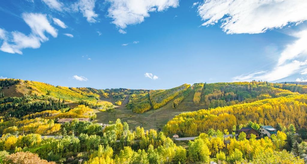
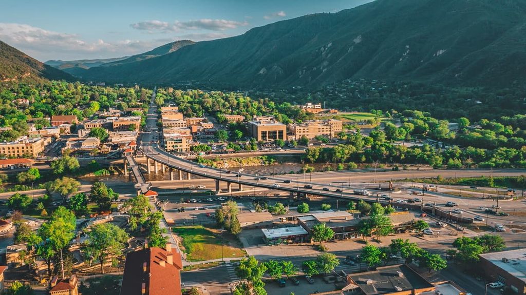
While Glenwood Springs is around three hours from Trappers Lake and the Flat Tops by car, it’s an excellent launch point for travelers visiting from further afield. The resort town is situated just off of Colorado’s I-70, at the confluence of the Roaring Fork River and Colorado River, and is home to many excellent tourist attractions.
Among these are several hot springs and spas, such as Iron Mountain Hot Springs, and the picturesque Hanging Lake, just a few miles east of town. The Glenwood Canyon Adventure Park, an amusement park situated atop a nearby mountain, accessible by cable car, is another notable attraction. Glenwood Springs was famously the home of Wild West lawman Doc Holliday, who died in the Glenwood Hotel following a bout of tuberculosis.
Fires in the Glenwood Canyon in recent years have left significant damage to the surrounding hillside, resulting in frequent mudslides and I-70 road closures, which can make travel difficult at times.
There are approximately 100 campsites near Trappers Lake maintained by the US Forest Service, and dispersed primitive camping is available in many other regions through the wilderness. It’s also worth noting that the Flat Tops Scenic Byway, an 82-mile (132 km) roadway stretching north of Trappers Lake, is a stellar way to see the Flat Tops by car.