Scan the QR code and open PeakVisor on your phone
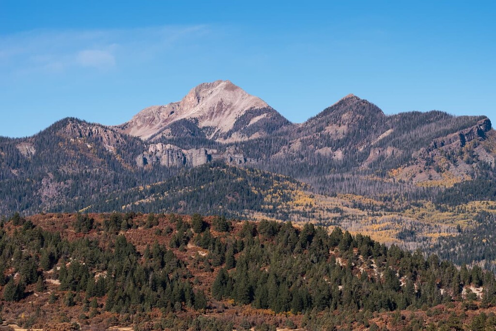
The state of Colorado has 42 designated national wilderness areas. They are spread throughout the Colorado Rocky Mountains and were set aside to preserve and showcase the natural beauty of the state and to provide almost unlimited opportunities for recreation year-round. The largest of these is the Weminuche Wilderness by far – at just under a half-million acres it is more than double the size of the next largest one, and dwarfs most of the others. Located in the remote southwestern corner of the state, it is so immense that many parts of it are inaccessible – even on foot. I have lived in Colorado more than 40 years and have seen very little of it.
The National Wilderness Preservation System was established under the Wilderness Act of 1964 enacted by the United States Congress. Wilderness is defined by the author of the act, Howard Zahnister, as: "A wilderness, in contrast with those areas where man and his own works dominate the landscape, is hereby recognized as an area where the earth and its community of life are untrammeled by man, where man himself is a visitor who does not remain." There are several government agencies that administer 803 wilderness areas in the United States – U.S. Forest Service, U.S. National Park Service, U.S. Fish and Wildlife Service and the U.S. Bureau of Land Management. As of 2019, these areas encompass 111,368,221 acres (174,013 square miles) covering about 4.5% of the country’s land area – larger than the state of California.
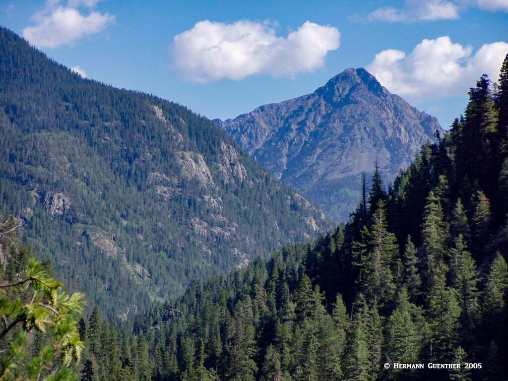
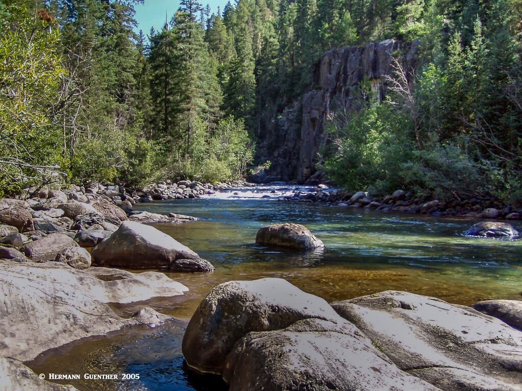
The Weminuche Wilderness encompasses large swaths of two national forests – the San Juan National Forest and the Rio Grande National Forest. It also occupies parts of four counties – San Juan, La Plata, Hinsdale and Mineral. Needless to say, there are no roads of any kind, including jeep trails, that cross the wilderness. Your access into the area is limited to horseback or the “shoe-leather express”. But you will have close to 500 miles of hiking trails from which to choose. You will also find dozens of major streams that feed both the Rio Grande and San Juan Rivers as well as more than 60 glacial alpine lakes. Therefore, you should not be surprised to read that this is one of the most used (and in some areas abused) wilderness areas in the state. The Continental Divide National Scenic Trail traverses the heart of the area for 83 miles. But even with all of that, you can certainly find areas of unspoiled beauty and pristine landscapes.
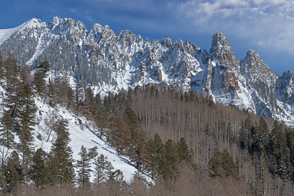
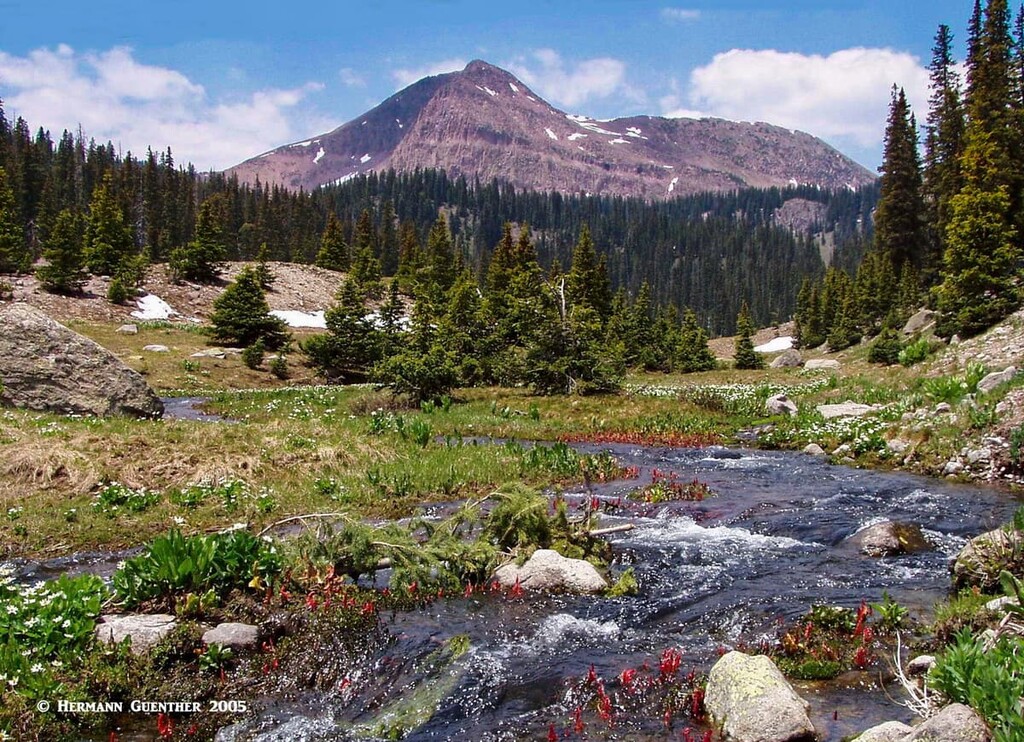
Since this great wilderness is contained entirely within the mighty San Juan Mountains, it follows that mountain recreation is a significant activity to be undertaken here. Elevations range from 7,700 feet at the Animas River to 14,094 at the summit of Windom Peak in the Needle Mountains, which are home to the only three fourteeners in the wilderness. Overall, there are 123 named mountains in the Weminuche Wilderness, which provide ample opportunities for hiking and climbing. As you shall see later, the Needle Mountains attract the greatest numbers of hikers and climbers who are largely responsible for much of the abuse this wilderness endures. I will cover some of this area below, but I will also provide you with insight into some of the less-used areas, those in which I have personally hiked and in which I have encountered few other people.
Travel through the wilderness is limited to those on foot and horseback. The huge network of interconnected trails is accessed from more than 30 trailheads located around the periphery of the wilderness. Regulations pertaining to wilderness areas means that recreational alternatives to hiking and horseback riding are not available within its boundaries. However, visitors can certainly enjoy other activities right outside of the area and still get the feel for the grandeur that exists within the wilderness. Let’s have a brief look at what visitors can expect nearby if they are not into hiking or riding.
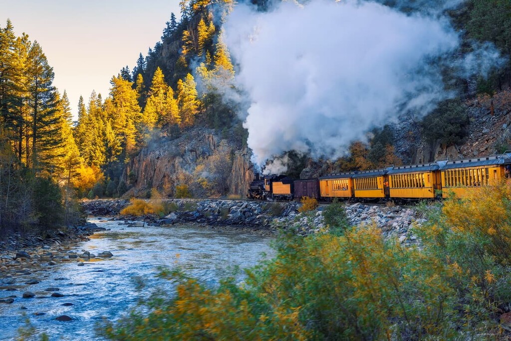
This world-famous historic conveyance follows a narrow corridor that bisects the wilderness in its western expanse, leaving a small section physically separated from the rest. This train is one of the most popular tourist attractions in Colorado and the route through the Animas River Gorge is the showpiece of the entire line. Travelers on this train may not be within the wilderness itself, but with the boundaries virtually right next to the tracks for most of the way, visitors can truly get a wilderness experience, at least in the visual sense. The train stops at two locations within the gorge to afford hikers access into the Needle Mountains. The small section to the west of the train corridor contains the West Needle Mountains, an area that sees relatively few visitors and one that is really worth experiencing, as I have done.
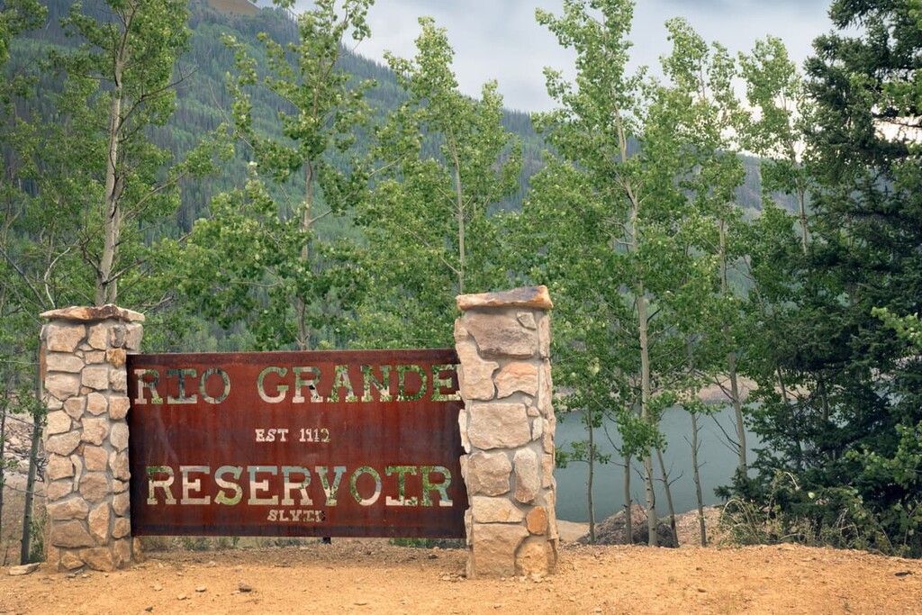
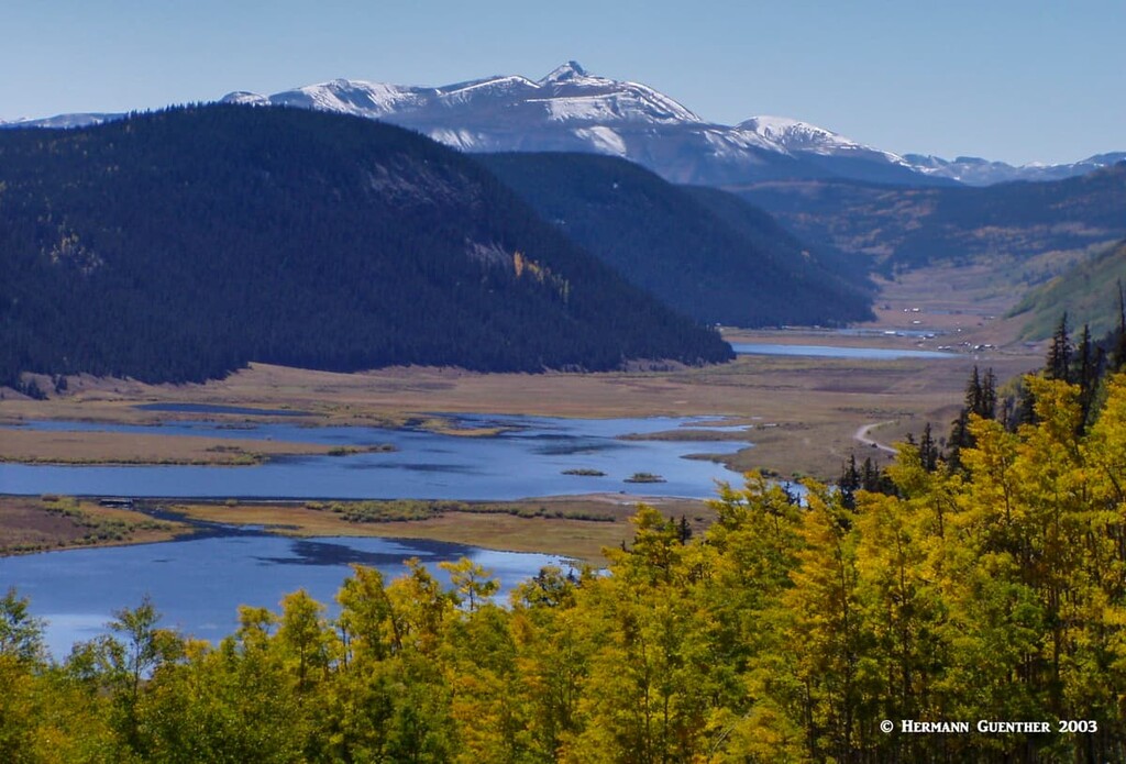
This 5-mile-long lake sits in a narrow valley at the northern edge of the Weminuche Wilderness. The southern shore of the lake defines the wilderness boundary, while a forest road follows the north shore where there is a primitive boat ramp. Though not recommended for large boats and trailers, motors are permitted on this large reservoir. There are trailheads at both ends of the lake - the trails originating here follow several creeks deep into the heart of the wilderness where there are a number of good-size lakes that would make a great backpacking destination. The road to the reservoir features several campgrounds – great destinations for non-hikers and ideal for those wishing to fish in the reservoir or in the Rio Grande River downstream from the lake. Although situated at an elevation of 9,400 feet, the reservoir is accessible year-round, with winter access limited to snowmobiles, snowshoes or skis.
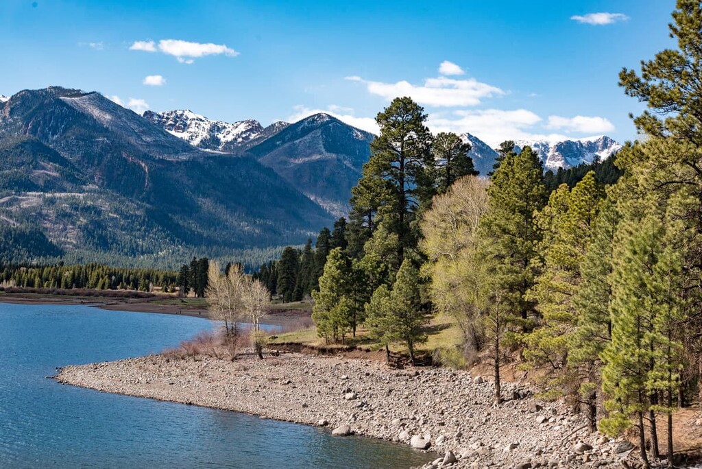
About 20 miles east of Durango, nestled in a scenic valley deep in the San Juan Mountains is Vallecito Reservoir, considered one of the most beautiful bodies of water in Colorado. While it is also not in the Weminuche Wilderness, it is just outside of the southern boundary. All kinds of water sports are allowed at this lake, which lies at an elevation of 8,000 feet. It is a great place for year-round fishing (yes, through the ice even), camping and hiking. There are at least six major campgrounds and two trailheads that provide quick access right into the wilderness. While some of the campgrounds are clearly best suited for water recreation, a couple of them are very handy for hikers.
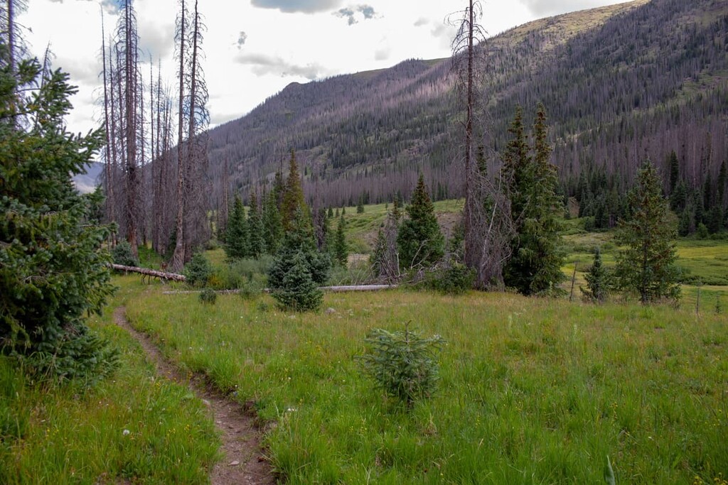
With at least 30 trailheads along the periphery of the Weminuche Wilderness, and almost 500 miles of hiking trails, it stands to reason that there is no shortage of hiking opportunities in this place. The more difficult dilemma is to decide where to go hiking. Here we point out several such areas, including what is the most popular in the entire wilderness. But we will also give you some other ideas where you might find more of a true wilderness experience as I have done.
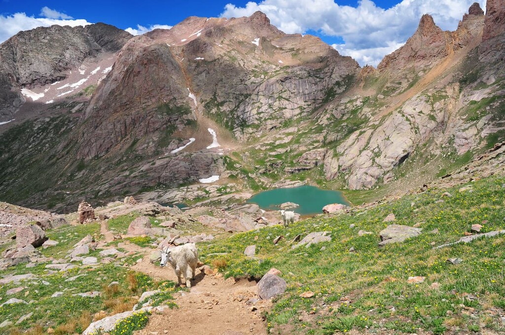
When I mentioned earlier that the Weminuche Wilderness is one of the most abused such designated areas in the state, it is Chicago Basin that comes to mind and may well be the driving factor for this reputation. This is simply because the basin is by far the preferred approach to the only fourteeners in the entire wilderness. The three fourteeners are Mount Eolus, Windom Peak and Sunlight Peak. Combined with the fact that these mountains are spectacular and getting to the trailhead involves the amazing ride on the Durango and Silverton Narrow Gauge Railroad, peak baggers (meaning fourteeners) flock to this place in droves every summer. It is not simply the obsession with fourteeners that brings them here, there are plenty more all over the state, it is one of the most dramatic mountain settings in Colorado, if not in the entire country.
It is because of this many visitors, most of which will camp in the basin at least one night, that the environment is being overstressed to the extent that the area is, despite being a wilderness, overrun by too many people. This is exacerbated by the fact that there are no camping spots along the long trail until you reach the basin itself. A herd of mountain goats, non-native here, were introduced some years ago and are now becoming a big concern since they are threatening the native bighorn sheep population. They are also a nuisance to backpackers whom they harass for easy food. These goats have become almost domesticated, yet there is no active effort to eliminate or reduce them as is being done in other protected areas around the country. But despite these negative aspects, the Chicago Basin is one magnificent place for hiking and climbing. For more details about routes into the Needles Mountains, this link will provide ample information.
Andrews Lake is a pleasant spot for recreation for the entire family, but it is also the trailhead for a fine hike into the westernmost segment of the Weminuche Wilderness. It can be found by driving north on U.S. Highway 550 about 40 miles from Durango (or south about eight miles from Silverton). A short drive off the highway takes you to two parking areas; the first one is for oversized vehicles while the second one closer to the lake is for cars. A short one-mile trail around the lake is a pleasant walk for almost anyone. The views across the lake are splendid in almost every direction.
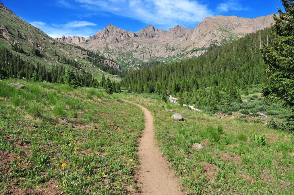
But if you want a real hike and have plenty of time, you should take the trail to Crater Lake. It will take you well into the wilderness and the West Needle Mountains – the views along the entire trail (11 miles round-trip) are fantastic, especially the view of Engineer Mountain off to the west. The elevation difference from the trailhead to the lake is less than 1,000 feet, though the total elevation gain out and back is slightly over 2,000 feet due to many ups and downs along the way.
When I did this hike, I extended it to include a loop around Crater Lake as well as a side excursion to the pass above the lake. From there, you can look down into the Animas River Valley and some parts of the great Weminuche Wilderness. This is also the spot from where climbers would normally begin their ascent of Twilight Peak (13,146 feet), the most prominent mountain in this part of the wilderness and the third-most prominent in the entire wilderness. I did not attempt to climb it since I was alone and saw no other people on this hike. Good thing too, as I encountered a pretty significant thunderstorm on the way back to the trailhead. But if you want a relatively easy, but long, hike, you could do worse than this one. More importantly, if you want a true wilderness experience, this is the place.
The hike starting at this trailhead (about 14 miles from the town of Pagosa Springs, following County Road 400, which becomes Forest Road 645 at the San Juan National Forest boundary) is really grand, even if you only go as far as Fourmile Falls, two of the great waterfalls in Colorado. The trail enters the wilderness about one-half mile from the parking lot. It is about four miles to the falls, so it would be classified a moderate hike. But you should definitely continue along upper Fourmile Creek to Fourmile Lake, a real alpine gem. That will make for a 12-mile day hike. Most hikers will return via the same trail, but there is a longer alternative that turns this into a 14.5-mile hike. From the lake you can return to the same trailhead by taking the lightly used Anderson Trail.
There are several trailheads at or near either end of this large lake. The trails originating here are long and don’t serve any immediate destinations that you could do in a day-hike. This is backpacking country and you will find solitude here that you would not find in, for example, Chicago Basin. If you really want to “get away from it”, this is where you need to hike. One noteworthy destination that can be reached from the trailhead at the Thirty Mile Campground at the east end of the reservoir is the Rio Grande Pyramid. Deep within the Weminuche Wilderness, it stands as a solitary guardian that dominates the environs. To climb it would involve a long day trip of 22 miles round trip – therefore it is advisable to plan for at least two days, preferably three. A climb of this magnificent mountain, Colorado’s 97th highest, is claimed to be among the most special experiences that a person can have in the Colorado Mountains.
About 20 miles east of Durango is the beautiful Vallecito Reservoir where you can find all kinds of recreation including camping and hiking. About three miles past the north end of the lake is a campground as well as the Vallecito Creek Trailhead. The trail rises gently toward the north, almost always alongside the creek, and it is up to you how far you want to go. If you are really ambitious, you can hike all the way to the Purgatory Resort – this 33-mile trek will take you right through the Needle Mountains and even over Columbine Pass into the fabulous Chicago Basin (see above). I only went up the valley about seven miles before I decided it was time to turn around since I had just done the hike to Crater Lake (see above) the previous day. I wish I had had more time to explore that beautiful part of the Weminuche Wilderness. On the east side of the lake are several campgrounds and trailheads from which you can hike deep into the wilderness. These trails are very lightly trafficked which means solitude is your reward for hiking here.
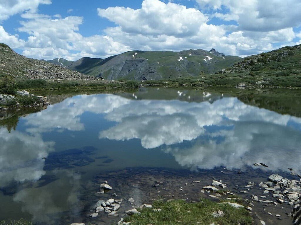
This trailhead is located an eight-mile drive east and south of the town of Silverton. The road can be driven in a normal passenger car although the last mile or so can be quite rough. The hikes described below are almost entirely within the Weminuche Wilderness. The trailhead gives you several options for hiking although the fairly easy 5-mile round-trip hike to the three lakes is a great alternative to some of the other more popular hikes in the area. The lakes are in a beautiful setting surrounded by high tundra and soaring peaks, making this hike unforgettable, especially when the wildflowers are in bloom. It is possible to extend the hike south to include the Verde Lakes and to even turn this hike into an 8-mile loop involving about 2,200 feet of total elevation gain. Since the trailhead elevation is already at almost 11,000 feet, keep in mind that you will be climbing to well over 12,000 feet depending on how much you extend your hike beyond the first lakes. Possible exposure to the weather should be considered before setting out.
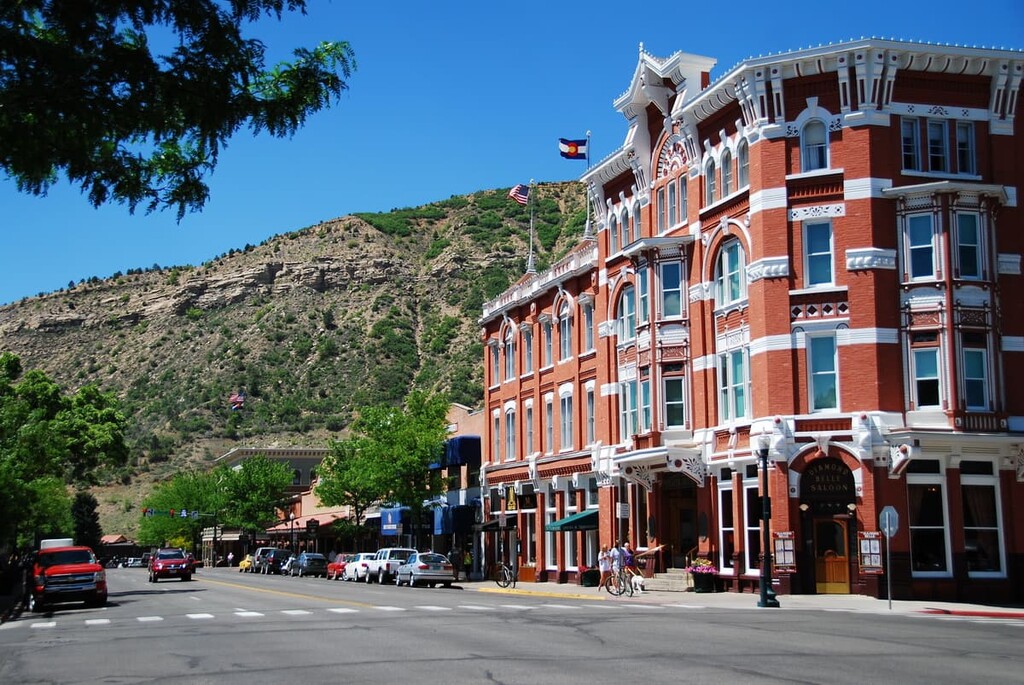
Without question, this major town in southwest Colorado should be considered a good base from which to explore at least the western segments of the Weminuche Wilderness. Durango is the largest city in southwest Colorado, thus making it a viable choice for accommodations, even for making day excursions from town to the recreation sites in the West Needles area and hikes near Vallecito Reservoir. I made my base in Durango when I made the fantastic hike to Crater Lake (see above) – the drive to the trailhead was a little more than a half hour. Durango certainly has no shortage of accommodations, restaurants and shopping venues. Even high-end hotels can be found here. The city can be easily reached by good highways and even has a regional airport that provides scheduled airline service to major hub airports such as Dallas, Phoenix and Denver. While we are focused on recreation in the Weminuche Wilderness, we should not lose sight of the fact that Durango offers many other tourist attractions, not the least of which is the Durango and Silverton Narrow Gauge Railroad – which you can ride on your way to Chicago Basin. And don’t forget, the Mesa Verde National Park, a UNESCO World Heritage Site, is just 35 miles to the west. It is worth exploring the historic downtown Durango on foot – you will find restaurants with western charm (and tastes) as well as boutiques offering genuine Native American products – not made in “you know where”.
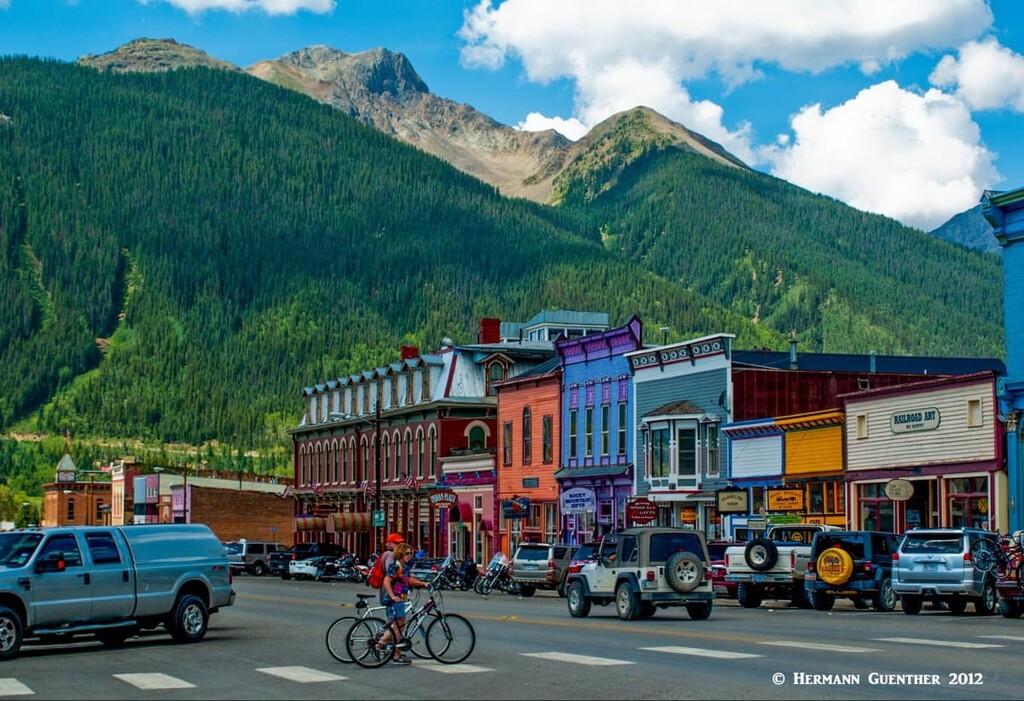
Appropriately named, due to its silver mining history, this little town is well positioned for exploring the northwestern parts of the Weminuche Wilderness. It can at times seem completely isolated, especially in the winter when the only access to the town is via U.S. Highway 550, which gets closed due to heavy snowfall and avalanche danger. This is the northern terminus of the Durango and Silverton Narrow Gauge Railway, which brings thousands of visitors, although not in the winter. When the train is operating, the town is not quite so remote and isolated, and all of these visitors require amenities. Therefore, the town does have a large selection of accommodations and restaurants for those wanting to stay and explore the area. Silverton offers a great number of outdoor activities, summer and winter, too numerous to list here. It is unlikely that anyone would get bored in this idyllic mountain hamlet with its stunning setting.
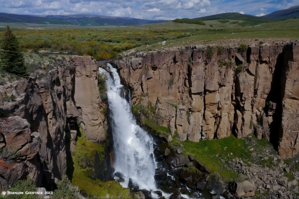
If you want to explore the eastern Weminuche Wilderness, you would do well to consider making Creede your base for a few days. While not a major town by any standards, it is the closest town to the Rio Grande Reservoir and the trailheads located there. Creede is a very charming town that was a major silver mining boomtown in the late nineteenth century. In a two year span from 1889 to 1891, its population jumped from 600 to 10,000 residents. But mining quickly declined after the "Silver Panic" and the town ceased to maintain a significant mining industry. But Creede did not become a ghost town like so many others even though the population declined significantly. Today it has less than 300 residents. The town does not offer much in the way of tourist infrastructure - the choice of accommodations and dining options is slim indeed, but its small "downtown" is a pleasure to explore and is worth a stop of at least a few hours - more if the visitor wants to visit the spectacular North Clear Creek Falls, one of the finest waterfalls in Colorado. The headwaters area of the Rio Grande in the nearby Weminuche Wilderness is a favorite for hikers, including those who want to climb the Rio Grande Pyramid, which can be seen from a scenic viewpoint just a few miles outside of town.
This elegant town, sitting at the western end of Wolf Creek Pass, is conveniently positioned as a base for exploring the southern reaches of the Weminuche Wilderness. At first sight, one would immediately want to spend a few nights here. Since I first moved to Colorado in 1980, this town has grown in leaps and bounds. Though its population is only 2,085 (2019 estimate), it seems a lot larger due to its resort character. Where there used to be only one or two traffic signals, there are now at least seven or eight. Lately it seems that every time we drive through town, there is another one. But Pagosa Springs is pretty special, and its location in the middle of spectacular scenery doesn’t leave much to be desired. Major shopping centers and supermarkets can be found here along with some pretty high-end hotels. As the town’s name implies, there are bath houses and natural hot springs resorts and spas. For those who like to pull their own home behind powerful pickup trucks, there are plenty of RV resorts where to park them. And don’t forget, the Chimney Rock National Monument is only 20 miles west of town. It is an off-the-beaten-path archaeological site that preserves 200 ancient homes and ceremonial buildings of the ancient Puebloan Peoples. I stayed in a mountain cabin north of town when I did the hike to Fourmile Falls and Lake. The town’s namesake mountain, Pagosa Peak, looms high outside of town.