Scan the QR code and open PeakVisor on your phone
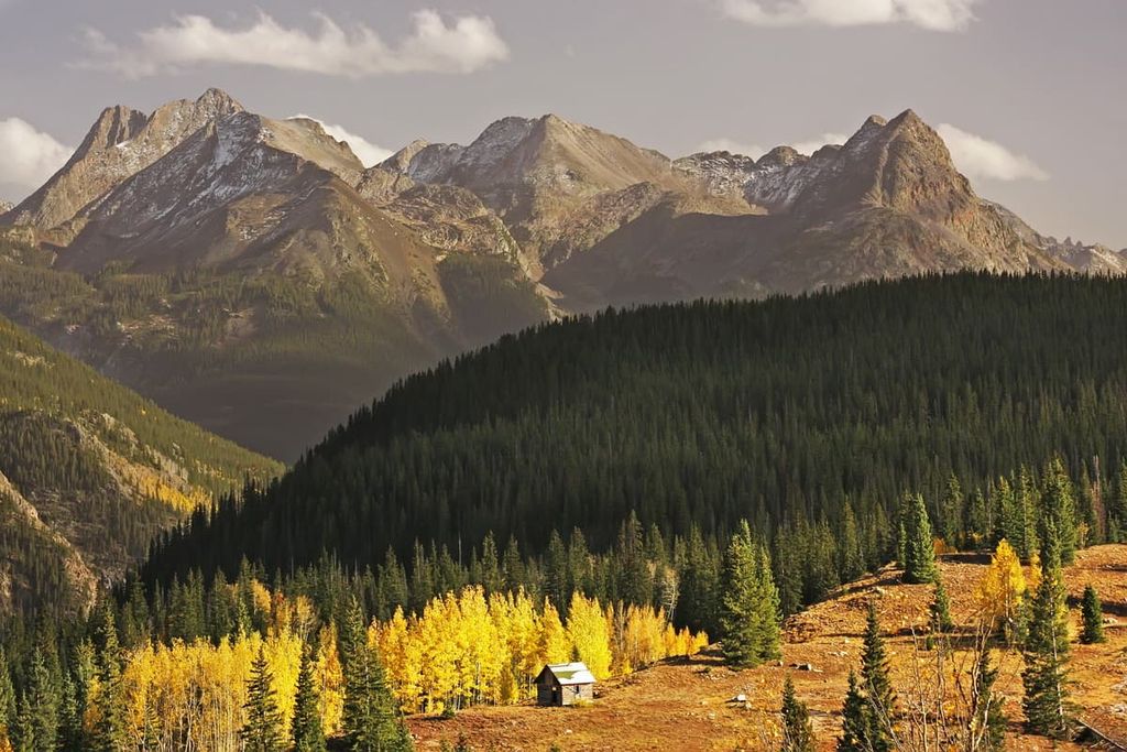
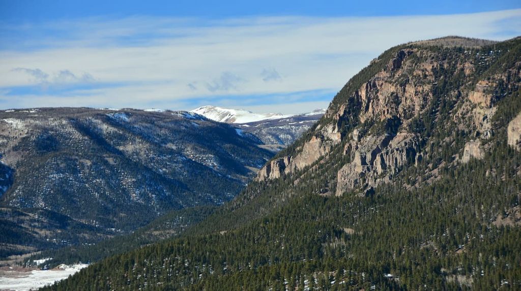
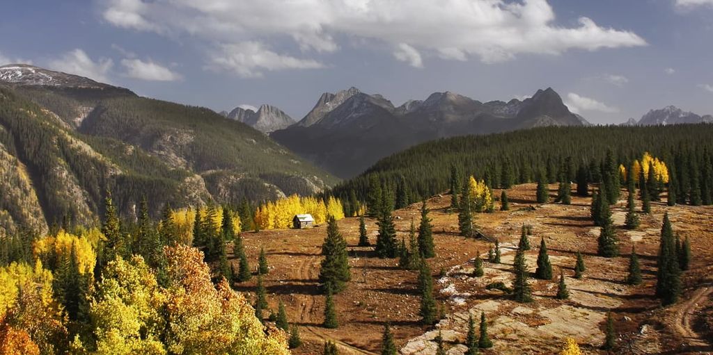
Encompassing a mix of alpine meadows, high-elevation deserts, rugged mountain peaks, and the headwaters of one of North America’s mightiest rivers, Rio Grande National Forest is a massive area of federally managed land located in the southwestern part of the US state of Colorado. The forest contains 155 named peaks, the highest and most prominent of which is Blanca Peak (14,350 ft/4,375 m).
Rio Grande National Forest is a large area of federally managed land located in the southwestern part of the US state of Colorado near the state’s border with New Mexico. The national forest is situated within parts of nine counties, including Custer, San Juan, Alamosa, Mineral, Archuleta, Saguache, Rio Grande, Hinsdale, and Conejos.
With a total area of over 1.8 million acres (728,000 ha), Rio Grande National Forest is approximately the same size as Gallatin, Coconino, San Juan, Lewis and Clark, and Dixie national forests in Montana, Arizona, and Utah.
Rio Grande National Forest is centered around the headwaters of its namesake Rio Grande. The Rio Grande begins in the alpine of the San Juan Mountains and then continues for approximately 236 miles (380 km) through the forest’s San Luis Valley and into the foothills of the Sangre de Cristo Range before heading into New Mexico.
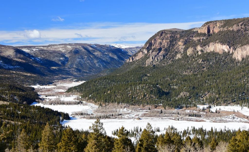
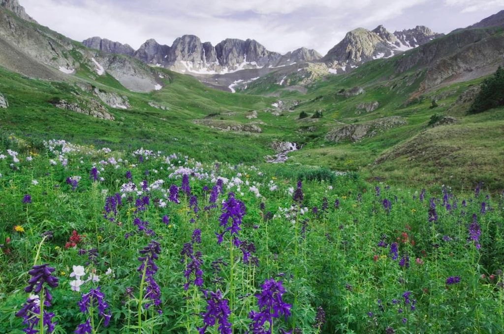
The San Luis Valley, in particular, is one of the most interesting parts of the forest. In fact, the headwaters of the Rio Grande flow through the valley, which is often considered to be one of the largest high-elevation deserts that’s located near a major mountain range.
While a decent portion of the valley is part of the Rio Grande National Forest, a small portion is located in Great Sand Dunes National Park and Great Sand Dunes National Preserve, which feature huge dunes up to 750 ft (230 m) in height.
Rio Grande National Forest also contains parts of four wilderness areas. These include:
Additionally, Rio Grande National Forest is located within driving distance of a large number of other areas of public land. This includes San Juan National Forest, Uncompahgre National Forest, Pike National Forest, San Isabel National Forest, Carson National Forest, and Comanche National Grassland.
Other nearby outdoor recreation areas include Rio Grande del Norte National Monument, Monte Vista National Wildlife Refuge, and Baca National Wildlife Refuge.
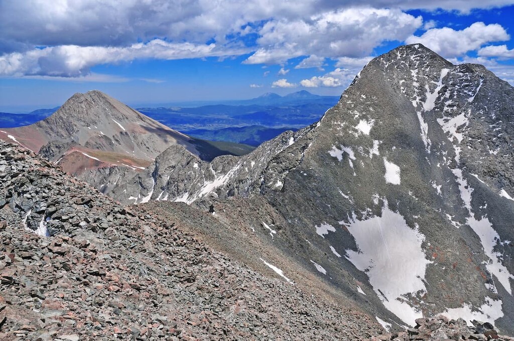
The land within the Rio Grande National monument is dominated by two primary mountain ranges: the San Juan Mountains and the Sangre de Cristo Range.
Both ranges are part of the greater Southern Rocky Mountains, which stretch from south-central Wyoming down to north-central New Mexico. The Southern Rockies are, in turn, a continuation of the greater Rockies, which extend northward to the province of British Columbia in Canada.
Each of these two ranges features its own unique geologic history and topographical features. Here’s what you need to know before visiting the region:
Geologically, the oldest rocks in the Sangre de Cristo Range date back as far as the Precambrian. These rocks, which are mostly highly metamorphosed gneisses, are as old as 1.8 billion years old in places.
However, the range also features much younger sedimentary rocks, such as Leadville Limestone, Harding Sandstone, and Fremont Dolomite, most of which date to the Ordovician and Devonian.
The range itself started to form as part of the Ancestral Rockies during the Pennsylvanian. These peaks were quickly worn down by erosion and new layers, such as the Minturn Formation and the Crestone Conglomerate, were deposited on top of the highly eroded peaks.
The region then experienced a widespread mountain building event known as the Laramide orogeny, which is generally regarded as the primary event that created the Rocky Mountains. This took place during the Late Cretaceous and early Tertiary (80 to 40 million years ago), and it created the bulk of the peaks we see in the Rockies today.
However, about 26 million years ago, the region also experienced a major rifting event. This event created the Rio Grande Rift as the Earth’s crust began to separate. It’s not entirely clear why this happened in the region, but this event helped create the San Luis Valley.
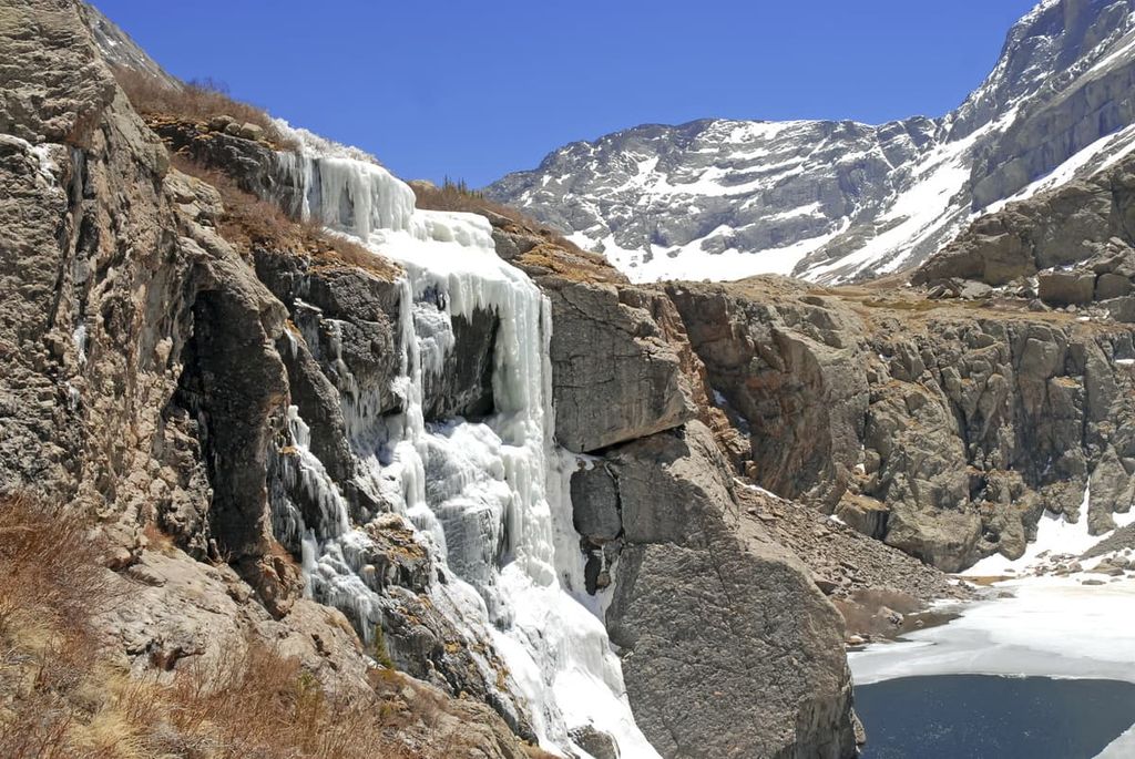
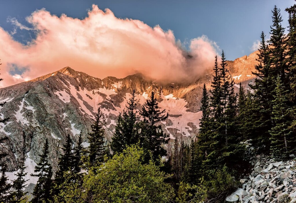
More recently, during the last major glaciation, the Sangre de Cristo Range was heavily glaciated. These sheets of ice were responsible for carving out much of the mountainous scenery that we see in the range today. This includes the range’s many cirques and the large piles of glacial till called moraines that have been deposited throughout the landscape.
Major peaks within the Sangre de Cristo Range of the Rio Grande National Forest include Blanca Peak, Kit Carson Mountain, Challenger Point, Ellingwood Peak, and Little Bear Peak.
The San Juan Mountains share many geological features and events with the nearby Sangre de Cristo Range.
As is the case with the Sangre de Cristo Range, the San Juans are geologically part of the Southern Rocky Mountains. They boast very old rocks that date back as far as the Precambrian at their core as well as substantially younger rocks from the Cenozoic that are found at the surface.
Furthermore, the San Juan Mountains feature evidence of extensive volcanism. There are a number of igneous plutons and intrusions throughout the range, some of which date to a fairly recent volcanic period that created the Conejos Formation about 30 million years ago.
Furthermore, the volcanic activity in the region has given the San Juan Mountains an unusually high concentration of mineral veins. In fact, the region was heavily mined for silver and gold during the 1860s and 1870s.
In more recent geological time, the San Juans were, like the Sangre de Cristos, heavily glaciated. These glaciers helped create many notable features, including the massive box canyon located near Telluride.
Major peaks in the San Juan Mountains of the Rio Grande National Forest include Pole Creek Mountain, Carson Peak, Canby Mountain, Bent Peak, and South River Peak.
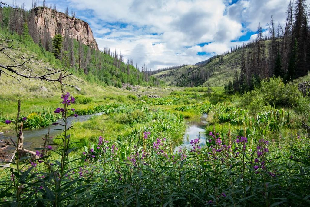
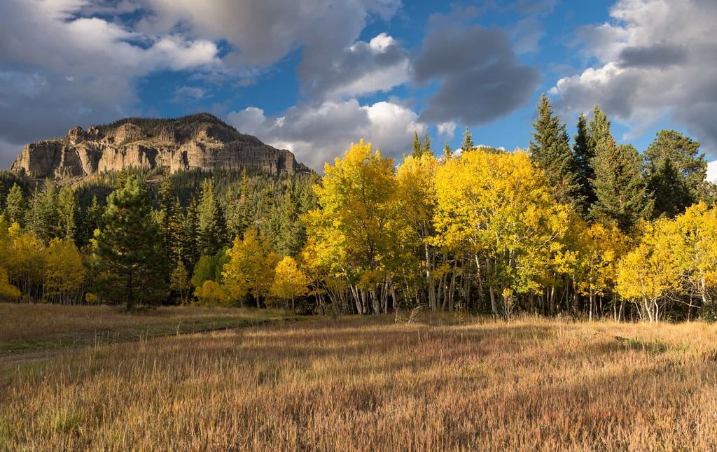
Thanks to the expansive lands and varied topography of the region, the Rio Grande National Forest is home to a diversity of flora and fauna. In fact, the forest contains everything from dense woodlands to high alpine meadows, desert, and everything in between.
At lower elevations, the forest is home to shrubs and drought-tolerant plants. There are wide areas of rangeland at lower elevations in the region. Here, the land is dominated by grasses and shrubs that provide vital ecological and economic importance for the region. This is particularly true in the mostly flat San Luis Valley, which is heavily used for agriculture.
Higher elevations below the treeline in the forest are dominated by various pinyon pines, junipers, oak, aspen Douglas firs, and spruces. However, the forest is experiencing a significant challenge in the form of spruce-beetle, which has been killing large swaths of trees in the region.
Wildlife in the forest is typical of the region as a whole. There are bighorn sheep, mountain lions, elk, black bears, mule deer, prairie dogs, and even sandhill cranes. One of the most notable species found in the area is the Canada lynx.
The land that is now part of the Rio Grande National Forest has been home to humans for countless generations. It is part of the traditional territory of many Indigenous peoples, including the Jicarilla Apache Nation, the Ute Indian Tribe of the Uintah and Ouray Reservation, the Southern Ute Indian Tribe, the Ute Mountain Ute Tribe, the Comanche Nation (Nʉmʉnʉʉ), and many Pueblo nations, among others.
What is now the Rio Grande National Forest was potentially first visited by people of European descent during the late sixteenth century. During this time, Spanish conquistadors, such as Francisco Vásquez de Coronado, ventured throughout what is now the southwestern United States. However, while it is known that he traveled through what is now New Mexico, it’s not believed that he made it into what is now Colorado.
Nevertheless, it is clear that European-Americans ventured into what is now Colorado during the nineteenth century. It is also likely that French fur trappers and traders made it to southern Colorado even earlier.
During the 1830s, John Gantt and Jefferson Blackwell established a trading post ner what is now Pueblo, Colorado. In the 1860s, miners and prospectors began to arrive in what is now the northern part of the Rio Grande National Forest in search of gold.
This was the beginning of a period of forced removal of Indigenous peoples from their ancestral homelands in the San Juans and the Sangre de Cristo Mountains. In some cases, tribal nations were simply forced off their lands and in others, “agreements” were made with the US government.
In one such agreement, the Brunot Agreement, the Ute ceded some of their territory to the US for mining purposes only. This was meant to be in exchange for eternal hunting rights and yearly monetary compensation. The tribe was also supposed to maintain sovereign control over millions of acrs that were not used for mining.
However, the terms of the treaty were not upheld and the tribe was forced to relinquish their land to the US government. In 2009, after decades of work, the tribe signed a Memorandum of Agreement with the state of Colorado providing the Southern Ute Indian Tribe with special rights to hunt and fish on their traditional territory. Nevertheless, this was only after the 1895 Hunter Act further took land away from the Ute Mountain Ute and the Southern Ute tribes.
Mining became the most important economic activity in the region at the end of the nineteenth and the early part of the twentieth centuries. Eventually, mine activity dwindled, particularly after the stock market crash in 1929.
Since then, much of the region’s economy has shifted toward tourism and land conservation. This happened in part due to the closing of many mines but also out of public concern for the conservation of tiber and other important natural resources. Local farmers also wanted to protect the watershed to ensure that they had enough water to irrigate their crops.
The Rio Grande National Forest was officially established in 1908 by President Theodore Roosevelt. It combined land from the former Cochetopa National Forest and the San Juan National Forest. The forest was later expanded in 1944.
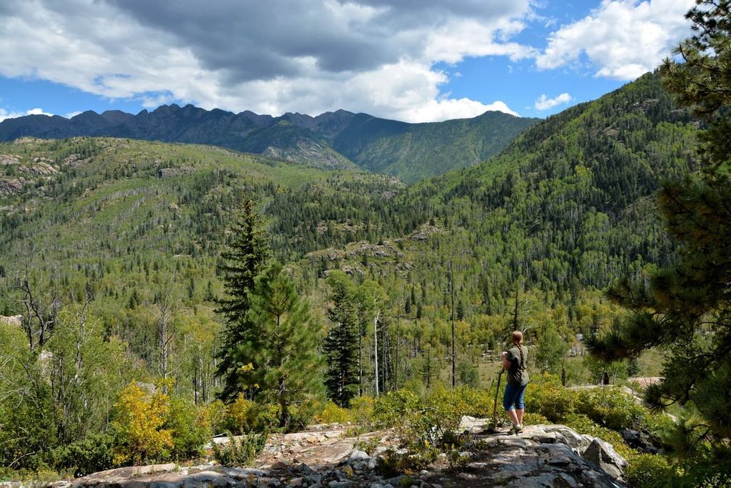
These days, the Rio Grande National Forest contains some of the most popular hiking destinations in southern Colorado. The forest is also particularly well known for its excellent skiing, and it also features the mighty Continental Divide, which runs for about 236 miles (380 km) through the region.
The Rio Grande National Forest is home to thousands of miles of hiking trails and other opportunities for outdoor adventure. Here are some of the best places to check out in the forest:
The Colorado 14ers are a collection of 53 peaks in the state that have elevations over 14,000 feet (4,267 m) and prominence of more than 300 feet (91 m). These peaks are some of the most popular hikes in the state for people looking to go peakbagging.
There are five Colorado 14ers in Rio Grande National Forest:
Note that there are trails leading to the summits of most Colorado 14ers. However, some of the trails are very long, such as the 19.2 mile (30.9 km) out-and-back trek to Blanca Peak. Other trails are very lightly traveled so they may require strong navigation skills.
Additionally, keep in mind that summiting a Colorado 14er means climbing to a high elevation where altitude sickness is possible.
Also note that Colorado often sees severe thunderstorms in the afternoon during the summer months. Avoid being on exposed terrain, such as a summit or ridge, during the afternoon. Start your hike early so you can be off the mountain before the storms arrive.
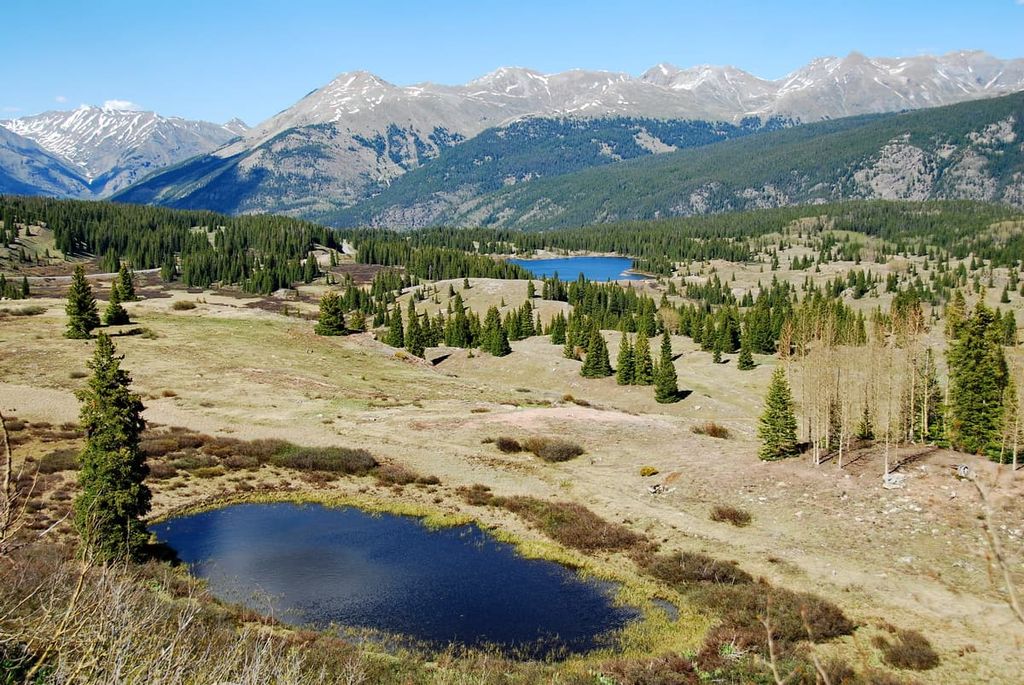
La Garita Wilderness is a federally protected area located in the central part of the Rio Grande National Forest. It is known for its sprawling vistas and scenic alpine landscapes.
The wilderness spans parts of both the Rio Grande and the Gunnison national forests. It is home to about 35 miles (56 km) of the Continental Divide as well as the famed Wheeler Geologic Area.
Popular hikes in the wilderness include treks to the summit of San Luis Peak. Additionally, the wilderness contains approximately 27 miles (43 km) of the Continental Divide and the Colorado Divide Trails, which follow the same route through the region.
Situated in the eastern part of the Rio Grande National Forest, the Sangre de Cristo Wilderness is a long, narrow stretch of federally protected land. It encompasses a prominent section of the Sangre de Cristo Range that towers above Great Sand Dunes National Park.
There are approximately 180 miles (290 km) of hiking trails in the Sangre de Cristo Wilderness, though not all are part of the Rio Grande National Forest. One notable hike in the wilderness includes the trek to the summit of Crestone Needle, which is often considered to be one of the more challenging 14ers.
The South San Juan Wilderness is located in the southernmost part of the Rio Grande National Forest. It is also partly located in the San Juan National Forest. Much of the southernmost extent of the San Juan Mountains is located within the wilderness, including part of the Continental Divide.
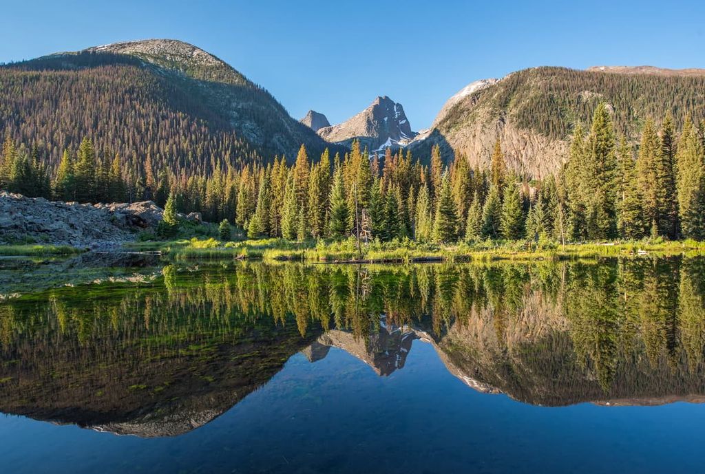
The forest is particularly known for its many alpine lakes, most of which were left behind at the end of the last glacial maximum. There are also hundreds of miles of trails in the wilderness, including the popular South Fork Conejos Trail. Additionally, you can climb the Conejos Peak Trail to reach the summit of Conejos Peak.
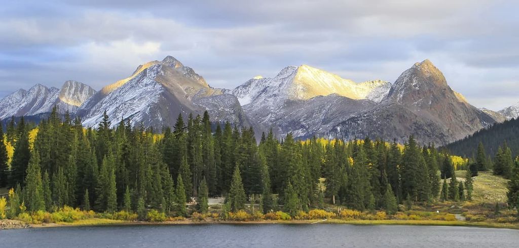
Located in the heart of the Rio Grande National Forest and in part of the San Juan National Forest, the Weminuche Wilderness is a massive protected area situated along the Continental Divide. In fact, the wilderness is actually nearly three-quarters the size of the US state of Rhode Island.
Here, heavy snowfall provides endless skiing opportunities while wildflower blooms dominate the summer season. There are seemingly endless opportunities for hiking and adventure in the wilderness, thanks to its network of around 500 miles (900 km) of trails.
Popular hikes in the wilderness include the Needle Creek Trail to Chicago Basin, the Continental Divide Trail, and hikes to the summits of Windom Peak, Mount Eolus, and Sunlight Peak.
If you’re looking to fully immerse yourself in the amazing landscapes of the Rio Grande National Forest, you have plenty of accommodation options to choose from. The forest offers frontcountry and backcountry camping, as well as a number of cabin rentals.
There are more than three dozen different campgrounds located within Rio Grande National Forest.
Some of the campgrounds in the forest offer more amenities than others, though, as a general rule, there are few options that offer hook-ups for RV campers. Rather, most campgrounds in the forest offer just a vault toilet, potable water, fire rings, grills, and picnic tables. However, some do not have potable water, so be sure to research this ahead of time.
Some popular campgrounds include:
Note that many of the campgrounds in the forest offer reservations. You can make a reservation online at Recreation.gov. If reservations are not available, sites are then reservable on a first come, first served basis.
As is the case with most national forests, visitors to Rio Grande National Forest can camp for free away from most developed areas. Dispersed campers are limited to a total of 14 days of camping in the forest within a 30 day period.
When dispersed camping, remember that you must camp at least 150 feet (45 m) from any bodies of water and that you must follow Leave No Trace Principles at all times. Additionally, if you are dispersed camping near a road, remember that you may not drive your vehicle more than 300 ft (91 m) off of a designated road.
Additionally, there are a few areas in the forest that are not open to dispersed camping. This includes:
For more information about specific camping prohibitions, contact a forest ranger at a regional district office. Additionally, if you are looking to camp on land adjacent to the forest, you may have to contact the offices of the San Luis Valley BLM.
There are a handful of cabins available to rent in Rio Grande National Forest. All of these cabins are historic log cabins or refurbished guard stations. They offer a unique way to enjoy time in the backcountry of the forest without sacrificing some modern comforts in the process. The cabins available for rent in the forest include:
Cabin rentals in the Rio Grande National Forest are available by reservation only. To make a reservation, head to Recreation.gov and search for the cabin you’re interested in. Alternatively, you can call the forest service directly at 877-444-6777 to make a reservation.
Looking for a place to stay in the Rio Grande National Forest? Here are some of the best cities and towns to check out in the region:
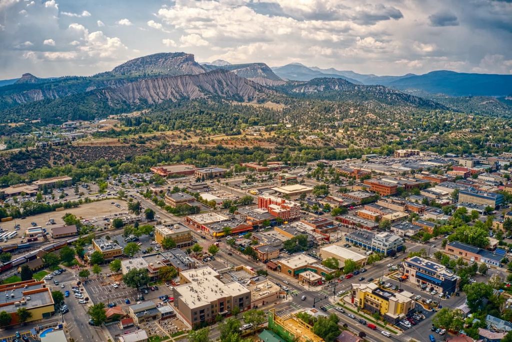
Home to approximately 17,000 people, Durango is the most populous community in La Plata County. The community is known for its fantastic outdoor adventure opportunities.
Durango is located just to the southwest of Rio Grande National Forest and it offers access to some of the most popular hiking destinations in the southern part of Colorado. The community is actually the southern terminus of the popular Colorado Trail. It is also home to Purgatory Resort, a popular ski area in the San Juan Mountains.
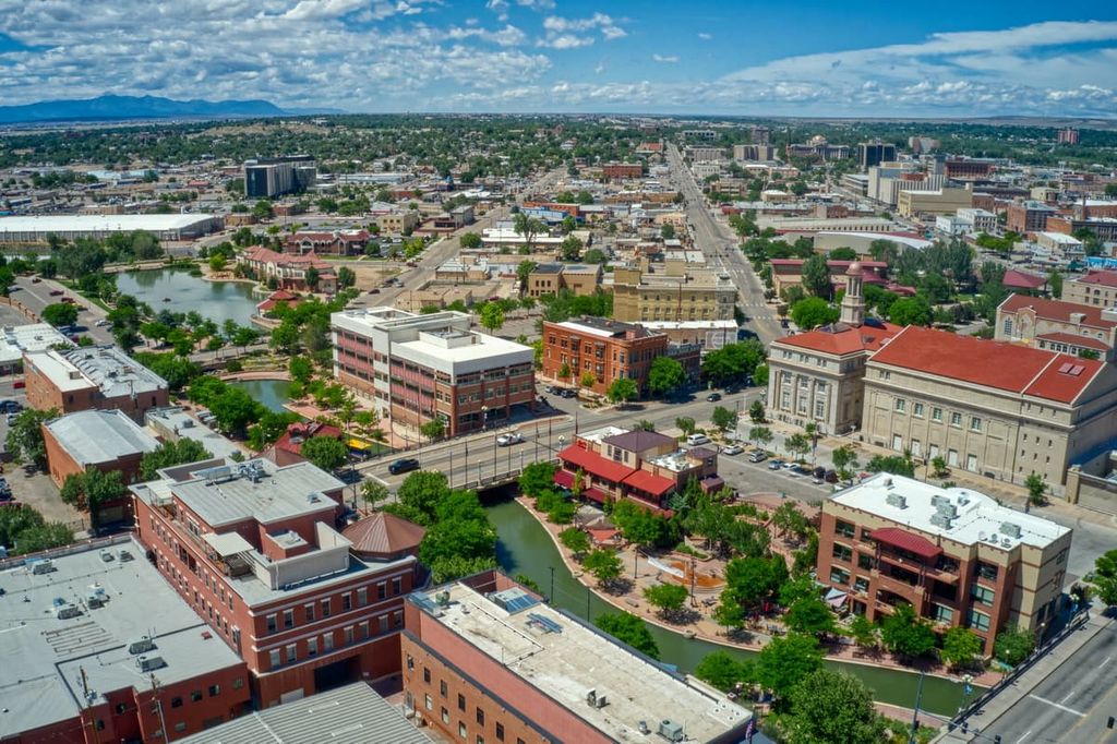
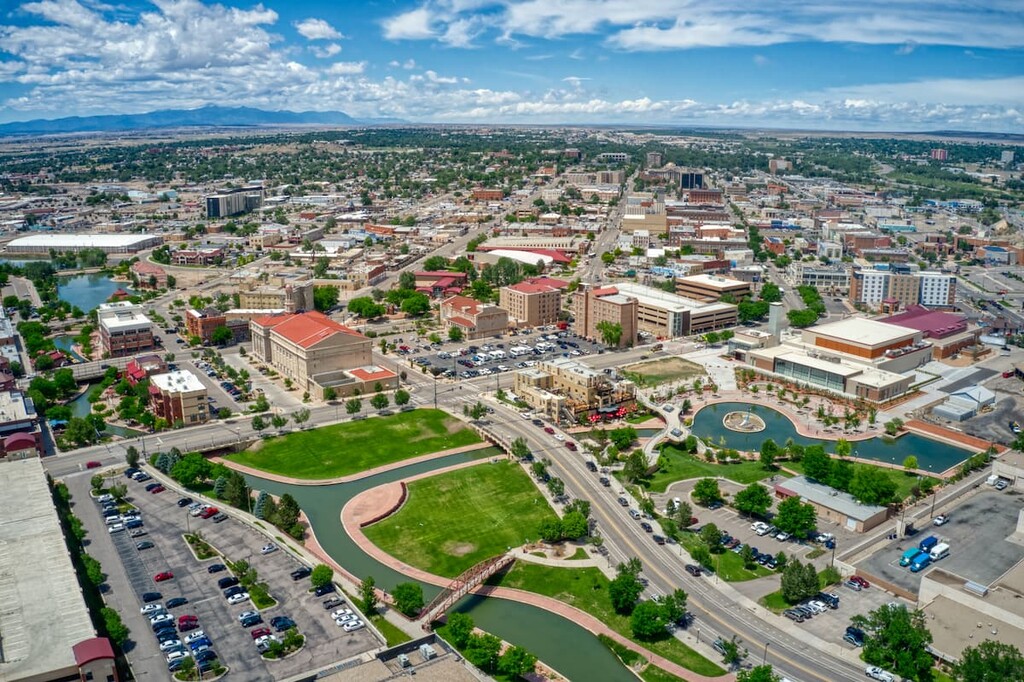
The city of Pueblo is one of the largest communities in southern Colorado. Pueblo is home to more than 100,000 residents and it is just a modest drive to the east of Rio Grande National Forest.
Pueblo has long been known for its burgeoning steel industry and its warmer weather. Although it’s located just to the east of the Rockies, Pueblo is a popular tourist destination. In fact, it hosts the Colorado State Fair each year and it’s home to a number of important museums. Pueblo also has decent bus, train, and air connections to Denver and other neighboring communities.
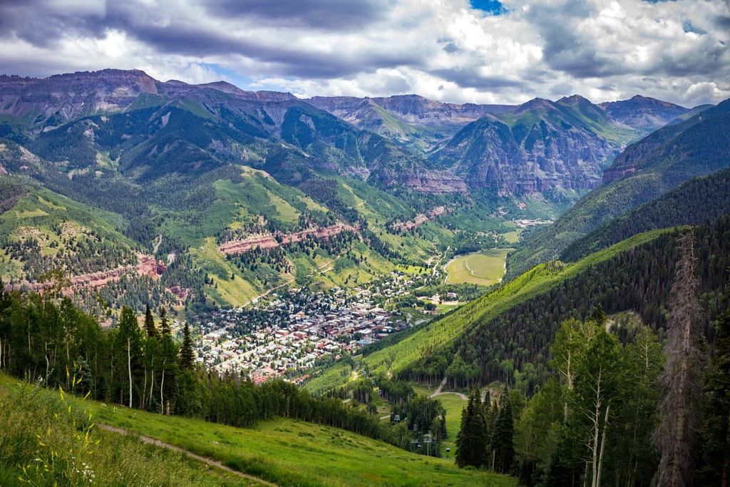
Telluride is a town of some 2,500 people located to the west of the Rio Grande National Forest. The town is particularly well-known as a ski destination thanks to the fact that the uber-popular Telluride Ski Resort is situated just outside of town.
Additionally, Telluride is home to the Hardrock 100, which is an annual ultramarathon. The town also features an abundance of hiking trails, including a hike to Bridal Veil Falls and Ajax Peak. Telluride also has a regional airport and good public transportation options—not to mention the Telluride Gondola, which offers free transportation into the San Juan Mountains.
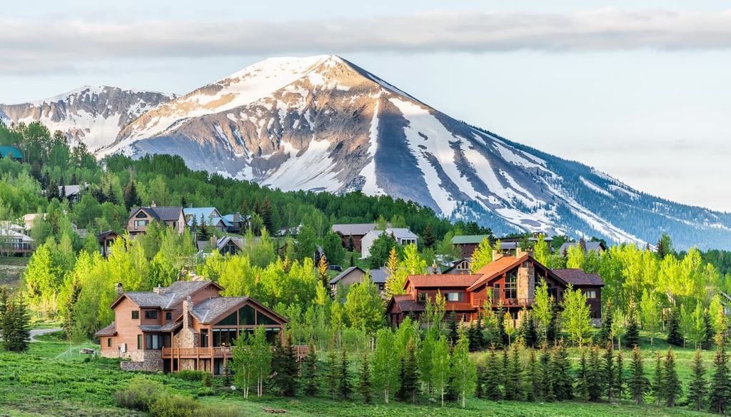
Located to the northwest of the Rio Grande National Forest, Gunnison is a city with approximately 6,000 residents. Gunnison is a very popular tourist destination among outdoor recreationalists thanks, in part, to the fact that the Crested Butte Mountain Resort and Monarch Ski Area are located just a short drive outside of town.
In the summer months, Gunnison also offers unparalleled access to the region’s many state and national recreation areas. Gunnison is also arguably one of the most underrated rock climbing areas in the state of Colorado.