
Scan the QR code and open PeakVisor on your phone
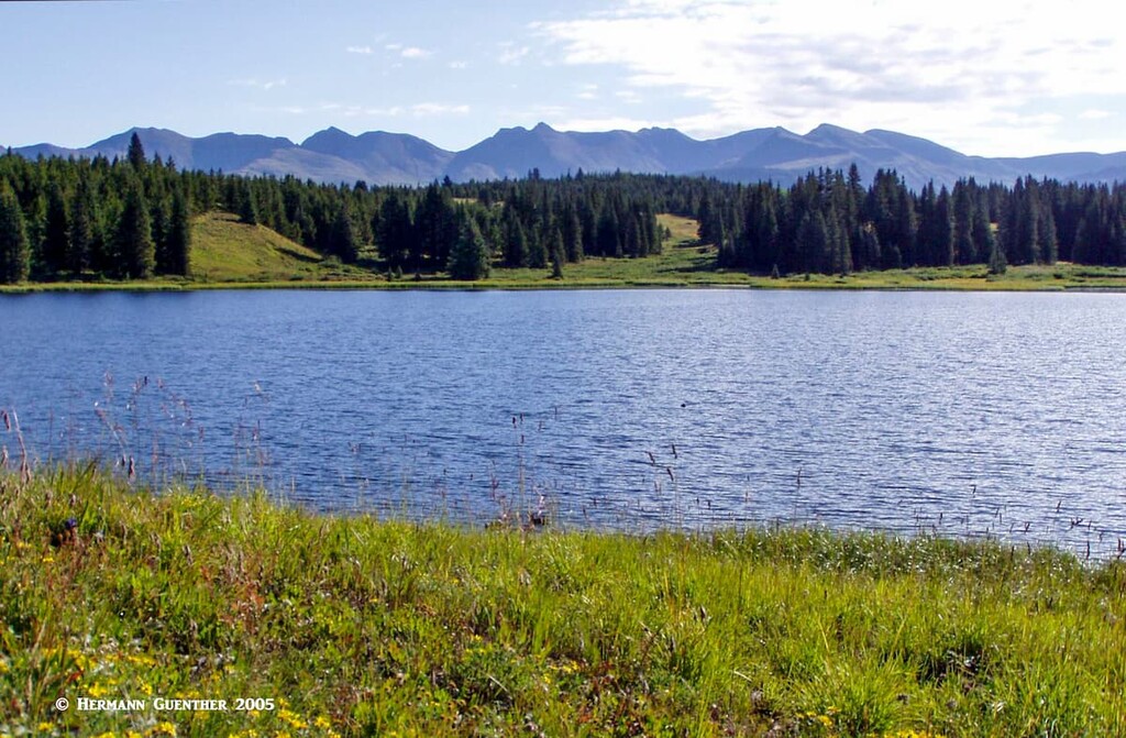
San Juan County (Spanish for Saint John) is one of 64 counties in the state of Colorado. It was originally part of adjacent La Plata County but was separated out on January 31, 1876 to become what it is today. It is the fifth smallest county in the state in terms of area, encompassing only 387 square miles of which only one square mile is water. The small area that consists of water is made up mostly of high alpine lakes. At 728 inhabitants as of the 2019 estimate, San Juan is the least populous county in Colorado. But to make up for those “deficiencies”, it is, with a mean elevation of 11,240 feet, not only the highest county in Colorado but also the highest in the United States, being located in the heart of the San Juan Mountains.
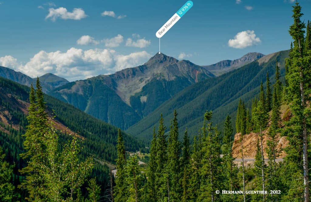
Given that San Juan County is right in the middle of one of the largest mountain ranges in Colorado, it follows that the adjacent counties are equally mountainous, although those to the west (Dolores County and San Miguel County) are so large that they extend across the Colorado Plateau all the way to the Utah state line. To the north is the wonderful Ouray County, while Hinsdale County with its colorful history lies to the east and La Plata County to the south. Each of those counties is home to at least one fourteener. Most of San Juan County lies west of the Continental Divide and much of it in the San Juan National Forest, though a small part of the Rio Grande National Forest (east of the Divide) occupies the small easternmost part of the county.
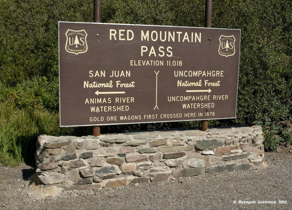
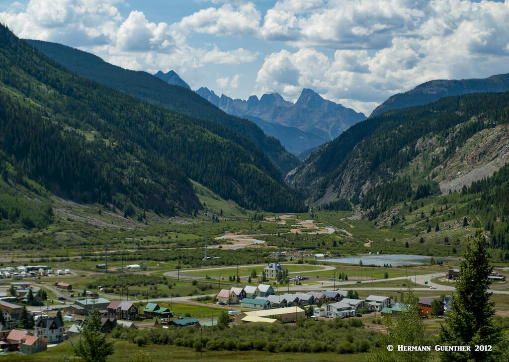
So it goes without saying that San Juan County is obviously very mountainous - so much so that only one highway (US-550) is able to find its way across its unforgiving terrain from north to south. None cross from east to west. The town of Silverton is the county seat and the only incorporated municipality. Most of the population lives here – it’s hard to tell where the rest live. In the winter, Silverton can find itself completely isolated during and after heavy snowstorms, which can get severe here such that the highway can remain closed for extended periods. The town can only be approached by highway over two high passes – Red Mountain Pass and Molas Pass – one north of town and the other just to the south. In summer, there are some jeep roads over the mountains that enter the county, including the popular Alpine Loop Scenic Byway.
So, what could easily be the most mountainous county in Colorado must inevitably also be one of the premier hiking and climbing centers in the state. Well, yes and no. What San Juan County lacks is fourteeners. Not even one to be found here, not even one just straddling the county line for that matter. But most visitors here are not bothered by that. After all, 75 of the 96 named mountains in the county are over 13,000 feet high, and most of these are “official thirteeners”, with many of them reaching the high “13s”. Even the lowest named mountain in the county is 10,725 feet in elevation. The lowest elevation in the county is just under 8,300 feet at the point where the Animas River flows south into La Plata County. So there is indeed a great selection of mountains from which to choose your workout venue. But you don’t have to hike or climb to find plenty of enjoyment in this high-alpine paradise.
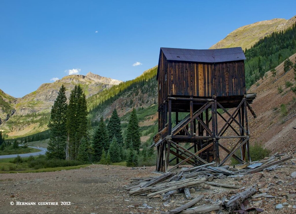
Most visitors will enter San Juan County by driving on US-550, the only highway crossing the county. Those coming from the north (from Ouray) will go over the spectacular Red Mountain Pass which defines the boundary between this county and Ouray County to the north. The scenery is sure to make you stop many times along the way. You will pass a number of historic mining relics, which are definitely worth stopping to see, on your way south toward Silverton.
If you are coming from the south (i.e. from Durango in La Plata County) you will eventually reach Molas Pass from where the highway makes its long, steep plunge into the valley where Silverton sits. This valley in fact is the only flat piece of territory of significant size in the entire county. Whatever approach you take, you will be rewarded with breathtaking scenery. However, if you are coming from the south (Durango) in the summer months, you have a second option. You can ride the rails – the rails of the Durango and Silverton Narrow Gauge Railroad. Opened in 1882 to transport gold and silver ore mined in the San Juan Mountains, today it hauls tourists – lots of them – over the 45 miles between the two towns. On the way it passes the spectacular gorge of the Animas River and needless to say, this is one of the top tourist attractions in Colorado. You need to book far in advance.
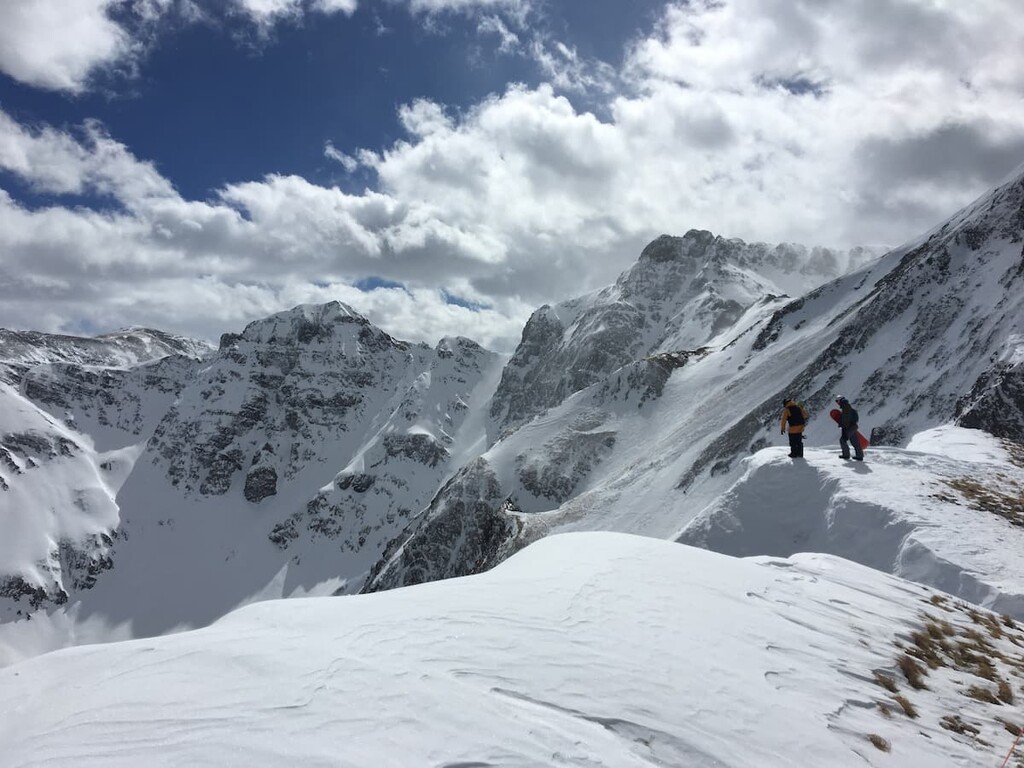
As you well know, Colorado is known for skiing, yet there is no “traditional” alpine ski resort in San Juan County. That’s because there is no space to build one – just too many mountains. But you can ski (or snowboard) here – if you have the skills and, in some cases, the money. The Silverton Ski Area is one of few places in North America where you can do some real alpine skiing – no groomed trails, just one chairlift to get you up the mountain, only deep powder in which to play, and scenery to knock your eyes out. But this is not a mom-and-pop ski area with bunny slopes. This is serious business for experts only. Many people skip the chairlift and use the helicopter lift method ($$$). Most people will also enlist the services of professional guides. Getting lost or trapped in an avalanche are risk factors here, but for those who survive the experience (virtually all do), it is something to talk about for a lifetime.
And then there is a thing called hiking, places for which are in abundance in San Juan County. In the following paragraphs I will tell you about some of the places where you can indulge in some fine high country trekking.
There are a number of fine hikes to be done in San Juan County, affording diverse groups of visitors something special depending on their abilities and conditioning. Do you want some easy family hikes suitable for just about anybody? They can be found here. Intermediate hikes to some scenic spots are available for those who are more conditioned and can handle longer distances. Spectacular destinations that involve more strenuous trails are to be found here as well. For those who want to undertake multi-day long distance expeditions, there are trailheads here from which such treks can be undertaken. Finally, while there are dozens of spectacular high mountains in the county, climbing them is not the major attraction here since none of them are the “signature” mountains that “peak baggers” want to climb – they are not fourteeners.
Almost all of the best hikes in San Juan County can be found within a ten-mile drive from Silverton, with the very finest only seven miles from town. Let’s have a look at some of these.
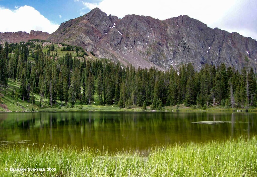
Ice Lake Trailhead – Drive just over two miles north on US-550 from town and then go left on Forest Road 585 for another five miles to this very popular trailhead. All the hikes from here are considered strenuous by most sources. The trail that starts here diverges into branches that can be hiked individually or in combination, depending on factors such as conditioning and weather, which can change rapidly and without warning here. The three major lakes here are all above 12,000 feet which means just to get to any one of them means elevation gains of from around 2,700 feet to around 2,900 feet – more if you want to combine two or more lakes in one hike. I believe that anyone who is well-conditioned and acclimated to the altitude can do any combination here, although it will result in a tough day. These are not technical hikes or climbs.
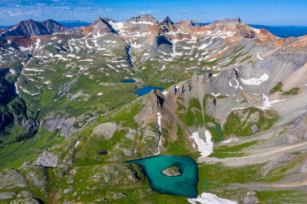
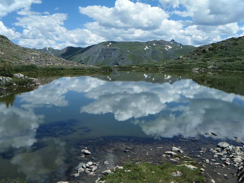
The three main lakes that you will find here are Island Lake, Ice Lake and Fuller Lake. They are sometimes collectively called the Ice Lakes, which sit in two high-alpine basins surrounded by spectacular peaks, all between 13,700 and 13,900 feet in elevation. While these can all be climbed from these basins, that is not what most hikers here will do. It is the beauty of this place that attracts the multitudes. Typically, in late July and August, these basins are covered in wildflowers. Since everything up here is above timberline, there is little natural shelter to be found so that hikers are cautioned about rapidly developing summer thunderstorms. (A note of caution – as of October of 2020, the trails here were closed due to an active wildfire. They are bound to be reopened once it is considered safe to do so.)
The one-way distance to either Island Lake of Ice Lake is only around 3.5 miles, which should tell you that the trail is steep. If you plan to take in all three lakes, you will be looking at a round-trip hike of almost 10 miles with well over 3,000 feet of overall elevation gain. Strenuous to be sure, but not nearly approaching the magnitude of climbing most fourteeners. I have not made that hike yet, although I had started to do so only to have to cancel because of storms that were developing even early in the morning. This one is still on my bucket list.
Clear Lake Trailhead – Just to the east of the above trailhead is the beginning of Clear Lake OHV (jeep) trail. While this is not a hiking trail (why would you want to walk here just to breathe the dust kicked up by four-wheelers?), it leads to another high alpine lake at just under 12,000 feet, located in its own basin just north of the Ice Lakes Basin. This may be the thing to do if you want to climb to some of the high ridges and summits surrounding Clear Lake. Just be mindful of the weather – you will be really exposed up here.
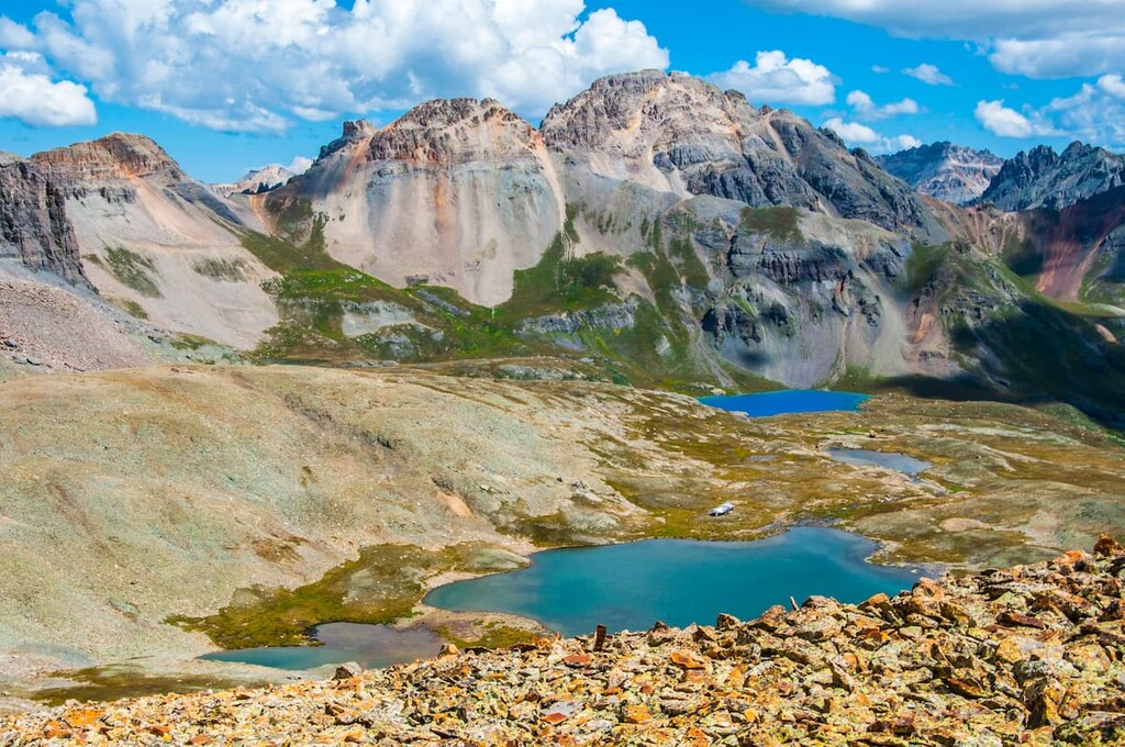
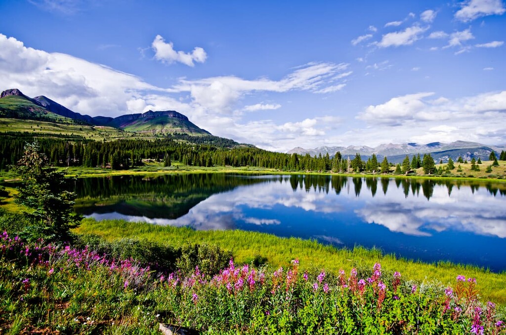
Highland Mary Lakes Trailhead – Drive east from Silverton on State Highway 110 about four miles, then south on Forest Road 4 another four miles. Most of this can be driven in a normal passenger car, although the last mile can be pretty rough. The trailhead gives you several options for hiking although the fairly easy 5-mile round-trip hike to the three lakes is a great alternative to the more rugged hikes described above. The lakes are in a beautiful setting surrounded by high tundra and soaring peaks, making this hike unforgettable, especially when the wildflowers are in bloom. It is possible to extend the hike south to include the Verde Lakes and to even turn this hike into an 8-mile loop involving about 2,200 feet of total elevation gain. Since the trailhead elevation is already at almost 11,000 feet, keep in mind that you will be climbing to well over 12,000 feet depending on how much you extend your hike beyond the first lakes.
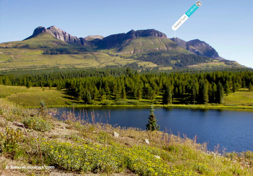
Molas Lakes Trailheads – Drive south a little over five miles from Silverton to the Molas Lake Park and Campground. From here you can do an easy 6-mile round-trip hike to the Little Molas Lake, which lies to the west and about 800 feet higher than the main Molas Lake. You can start this hike at either end, but if you are like me, you might want to start at the lower lake so that you end your hike going downhill. But either way, this is an easy hike and great for families with children and for those who are not quite conditioned to the altitude yet. Keep in mind that doing this hike will require that you cross the highway twice –but that should be no big deal. It is after all just a two-lane road. If you want to do a little bit of peak-bagging, you can start at the upper lake (Little Molas) and climb Sultan Mountain (13,327 feet) while taking in Spencer Peak (13,068 feet) on the way. This 7-mile round-trip hike is considered strenuous not because of the distance, but because of the 3,000-foot total elevation gain.
Andrews Lake Trailhead – Drive another three miles or so south from Molas Lake and you will find Andrews Lake. Be sure to stop at the Molas Pass overlook about halfway there. You will be impressed by the views here. When you get to Andrews Lake, which is a short distance off the highway, you will find two parking areas, the first one being for oversized vehicles while the one closer to the lake is for cars. Park here. If you just want a short stroll that just about anyone can do, take a walk around the lake – it’s only one mile and almost completely level. The views across the lake are splendid in just about every direction. But that is not what I came here for.
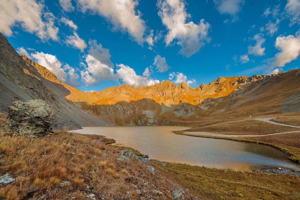
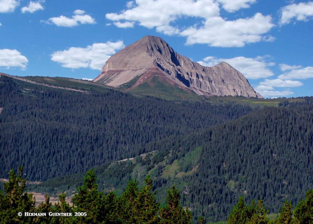
I should mention that not much of San Juan County consists of wilderness - at least by definition. In fact only a very small part of the county has any designated wilderness, and that is a tiny part of the state’s largest such area, the Weminuche Wilderness. The hike from Andrews Lake to Crater Lake (here is another one by that name!) will take you into this wilderness and the West Needles Mountains. This beautiful hike of at least 11 miles round-trip will give you some fantastic views, especially of Engineer Mountain which you will see off to the west for much of the hike. While the elevation difference from the trailhead to the lake is less than 1,000 feet, the total gain out and back is just over 2,000 feet due to many ups and downs along the way.
When I did this hike, I extended it to include a loop around Crater Lake as well as a side excursion to the pass above the lake. From there, you can look down into the Animas River Valley and the great Weminuche Wilderness. This is also the spot from where climbers would normally begin their ascent of Twilight Peak (13,146 feet), the most prominent mountain in San Juan County. I did not attempt to climb it since I was alone and saw no other people on this hike. Good thing too, as I encountered a pretty significant thunderstorm on the way back to the trailhead. But if you want a relatively easy, but long, hike, you could do worse than this one. The views along the way are really worth the effort.
The Andrews Lake Trailhead also affords you an opportunity to climb a prominent mountain, Snowdon Peak, the fifth most prominent in San Juan County. A round-trip hike of only a bit over five miles and about 2,000 feet elevation gain, it will reward you with incredible views. If you make it. This hike is difficult because of very steep terrain after a long flat approach and some significant scrambling to the top. Not too many people climb this mountain, which does sit in the Weminuche Wilderness Area.
Given the fact that there is only one town in San Juan County, and that its population of this town is less than 700 people, we can dismiss the notion that visitors can find a major resort here. So for that, we need to migrate out of the county to other towns that are nearby in adjacent counties. But first, let’s talk about Silverton.
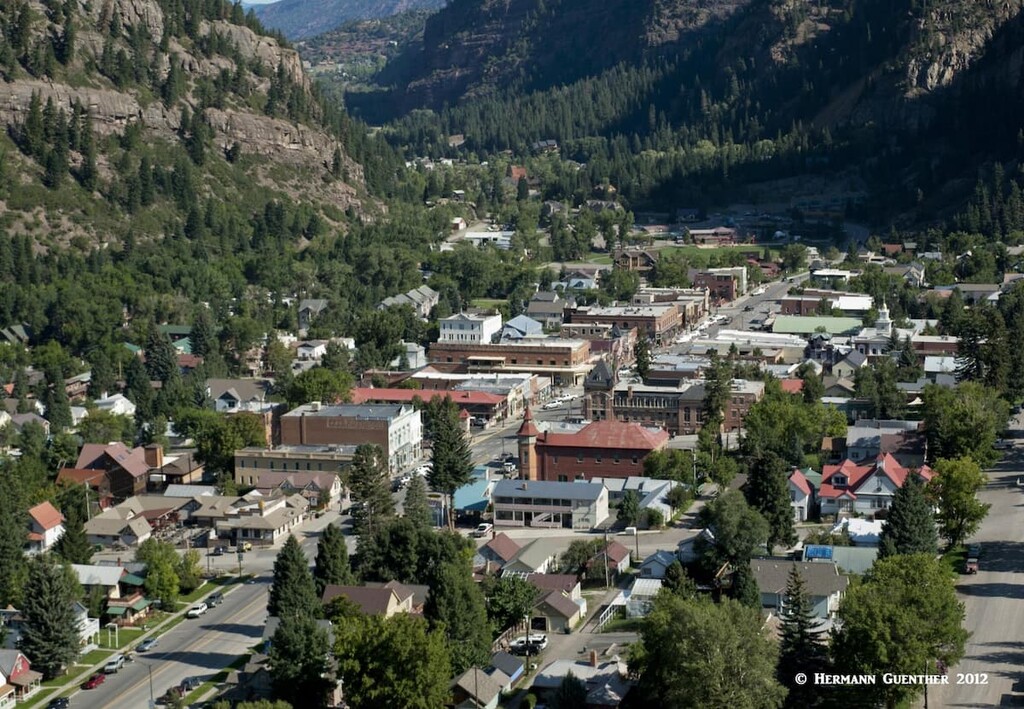
Appropriately named, due to its silver mining history, this little town is tucked right into the middle of the massive San Juan Mountains. It can at times seem completely isolated, especially in the winter when the only access to the town is via U.S. Highway 550, which gets closed due to heavy snowfall and avalanche danger. Silverton is the seat of, and the only incorporated town in, San Juan County, and its 637 inhabitants probably like its apparent isolation - until the tourists arrive. This is the northern terminus of the Durango and Silverton Narrow Gauge Railway, which brings thousands of visitors, although not in the winter. When the train is operating, the town is not quite so remote and isolated, and all of these visitors require amenities. Therefore, the town does have a large selection of accommodations and restaurants for those wanting to stay and explore the area. Silverton offers a great number of outdoor activities, summer and winter, too numerous to list here. It is unlikely that anyone would get bored in this idyllic mountain hamlet with its stunning setting.
This incredibly pretty town about 22 miles north of Silverton in Ouray County is a good place to consider a home base even for exploring the wonders of San Juan County. The beautiful drive along the Million Dollar Highway (as US-550 is called in this area) and over Red Mountain Pass makes the recreation venues in San Juan County easily accessible even for day hikes. Ouray and its surroundings are affectionately called the "Switzerland of America" - and for good reason. The scenery from and of the town is simply stunning. Despite its population of just over 1,000 permanent residents, Ouray offers a considerable selection of accommodations and dining options. Aside from being a hiking and climbing mecca, Ouray is famous for its many hot springs, five of which are developed for the tourist trade. So if you want to soak your sore muscles in a natural hot spring after pulling off one of those fantastic hikes near Silverton, you just need to drive those few short miles back over the pass.
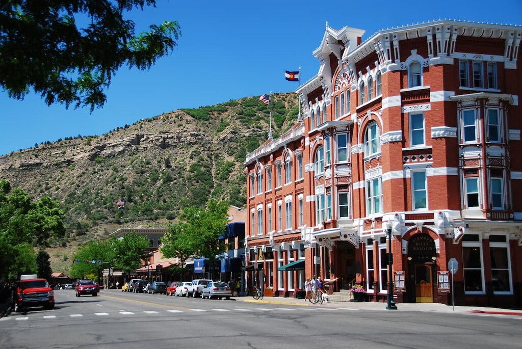
Less than 50 miles south of Silverton, and only about 25 miles from the San Juan County line, Durango is the largest city in southwest Colorado, thus making it a viable alternative for accommodations, even for making day excursions from town to the recreation sites in San Juan County. I made my base in Durango when I made the fantastic hike to Crater Lake (see above) – the drive to the trailhead was a little more than a half hour. Durango certainly has no shortage of accommodations, restaurants and shopping venues. Even high-end hotels can be found here. The city can be easily reached by good highways and even has a regional airport that provides scheduled airline service to major hub airports such as Dallas, Phoenix and Denver. While we are focused on recreation in San Juan County up north, we should not lose sight of the fact that Durango offers many other tourist attractions, not the least of which is the Durango and Silverton Narrow Gauge Railroad – so you can ride the rails to Silverton instead of driving your own car. And don’t forget, the Mesa Verde National Park, a UNESCO World Heritage Site, is just 35 miles to the west. It is worth exploring the historic downtown Durango on foot – you will find restaurants with western charm (and tastes) as well as boutiques offering genuine Native American products – not made in “you know where”.


