Scan the QR code and open PeakVisor on your phone
Of the 64 counties in Colorado, Hinsdale is the third-least populous with an estimated 820 residents as of 2019. That amounts to a population density of 0.3 inhabitants per square mile! Half of that population lives in the largest and only town – Lake City, the county seat. What the county lacks in people, it makes up in a colorful history and an amazing mountain landscape. This in turn makes it a popular summertime recreation destination – especially for visitors from Texas. Most people that I know here in the Denver area, including most of our friends, have never heard of Lake City.
Hinsdale County, which encompasses the eastern half of the magnificent San Juan Mountains, is home to 65 named mountains, with Uncompahgre Peak both the highest and most prominent. It is the sixth highest mountain in Colorado and in fact the sixth highest in the Rocky Mountains of North America. The county shares some significant mountains with adjacent counties such as San Juan, Ouray and Mineral Counties. Consequently, some peaks such as Wetterhorn, Courthouse Mountain and others may not be enumerated here, but can be found in the database for those counties, since they straddle the border between them. Nevertheless, five fourteeners (including Wetterhorn Peak as well as Handies, Uncompahgre, Redcloud and Sunshine Peaks) are part of this high county.
The county also shares parts of four national forests (Gunnison, Rio Grande, San Juan and Uncompahgre) as well as four wilderness areas (La Garita, Powderhorn, Uncompahgre and Weminuche). The famous Colorado Trail as well as the Continental Divide National Scenic Trail (CDNST) traverse the county. The Continental Divide crosses the county twice. There is only one paved highway in the entire county, State Highway 149, and it only crosses the northeastern segment. It is easily one of the most scenic in the entire state. There are a few seasonal 4WD roads into and across the mountains, but not much else, making Hinsdale one of the most roadless and most remote counties in the United States. So it goes without saying that Hinsdale County is a magnet for recreation, with hiking and climbing undoubtedly the prime activities.
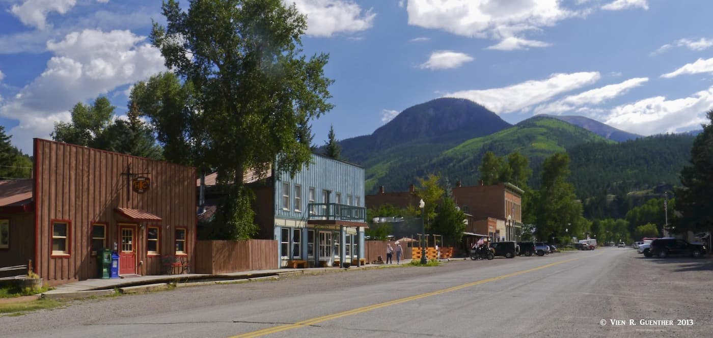
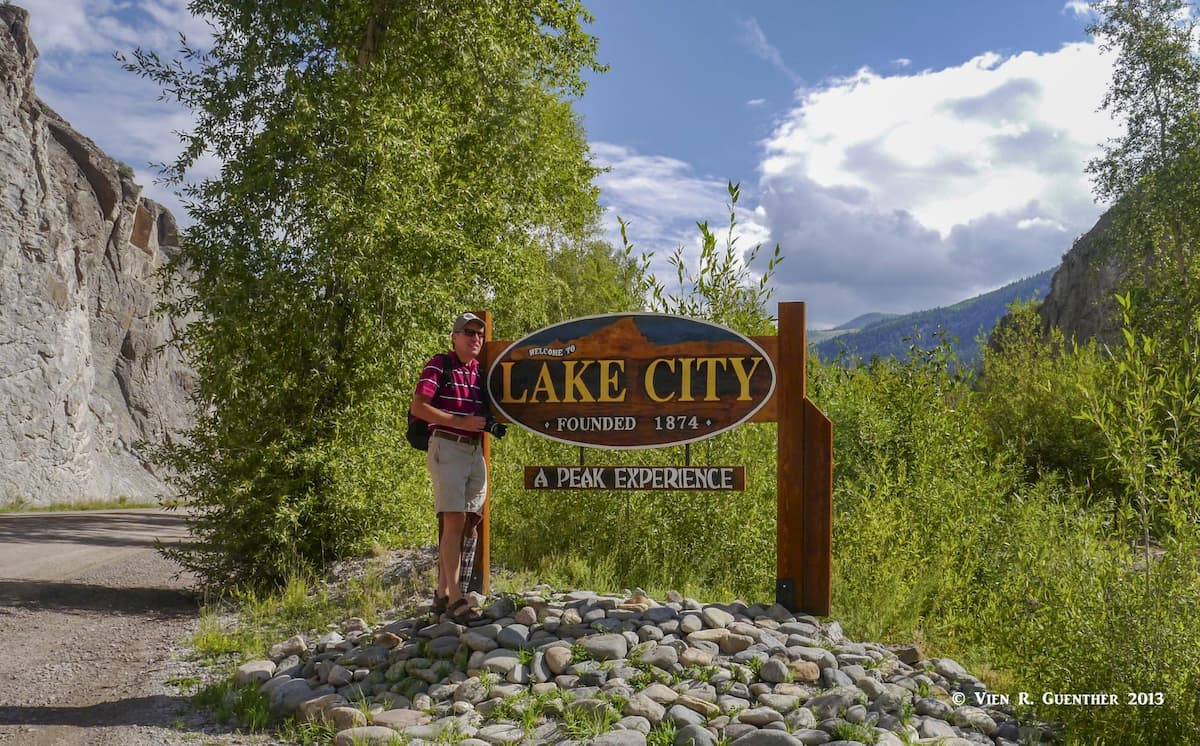
But before we get into specifics about hiking in this mountain paradise, we would be remiss to ignore some of the history for which Hinsdale County is best known. This history revolves around the only town in the county – Lake City, which was incorporated in 1873 as a supply center in support of the silver mining industry. At one time, the town had as many as 5,000 settlers (more than ten times what it has today). By 1879, the mineral deposits had been exhausted and the boom went to bust, with the exception of a brief upturn in the economy which lasted into the 1890s. But by the 1930s, tourism had emerged as a viable industry, and eventually, in 1978, the Lake City Historic District became listed in the National Register of Historic Places. The town still has wooden sidewalks.
Perhaps what most people have heard about Lake City and Hinsdale County is the tale of Alferd Packer (yes, the spelling is correct) – Colorado’s famed cannibal. To make the story short, in 1875 he acted as a guide for five men who were prospecting in the mountains where they became snowbound southeast of Lake City. When he came out of the mountains in the spring, he said that the miners had abandoned him and that he had nearly starved. But he looked really healthy and the first thing he asked for was whiskey instead of food, which aroused suspicions. When the bodies were eventually found, they showed signs of cannibalism and Packer was arrested and held in jail – until he escaped. When he was found in Cheyenne, Wyoming in 1813, he was arrested again and returned to Lake City for trial, where he was convicted and sentenced to hang. Then the Colorado Supreme Court reversed the conviction in 1885, but he was tried again the following year, when he was sentenced to 40 years. He was paroled and released in 1901. He died in Deer Creek in Jefferson County, Colorado. He was interred in nearby Littleton with a full military burial, since he had served during the American Civil War. It is rumored that before his death he became a vegetarian.
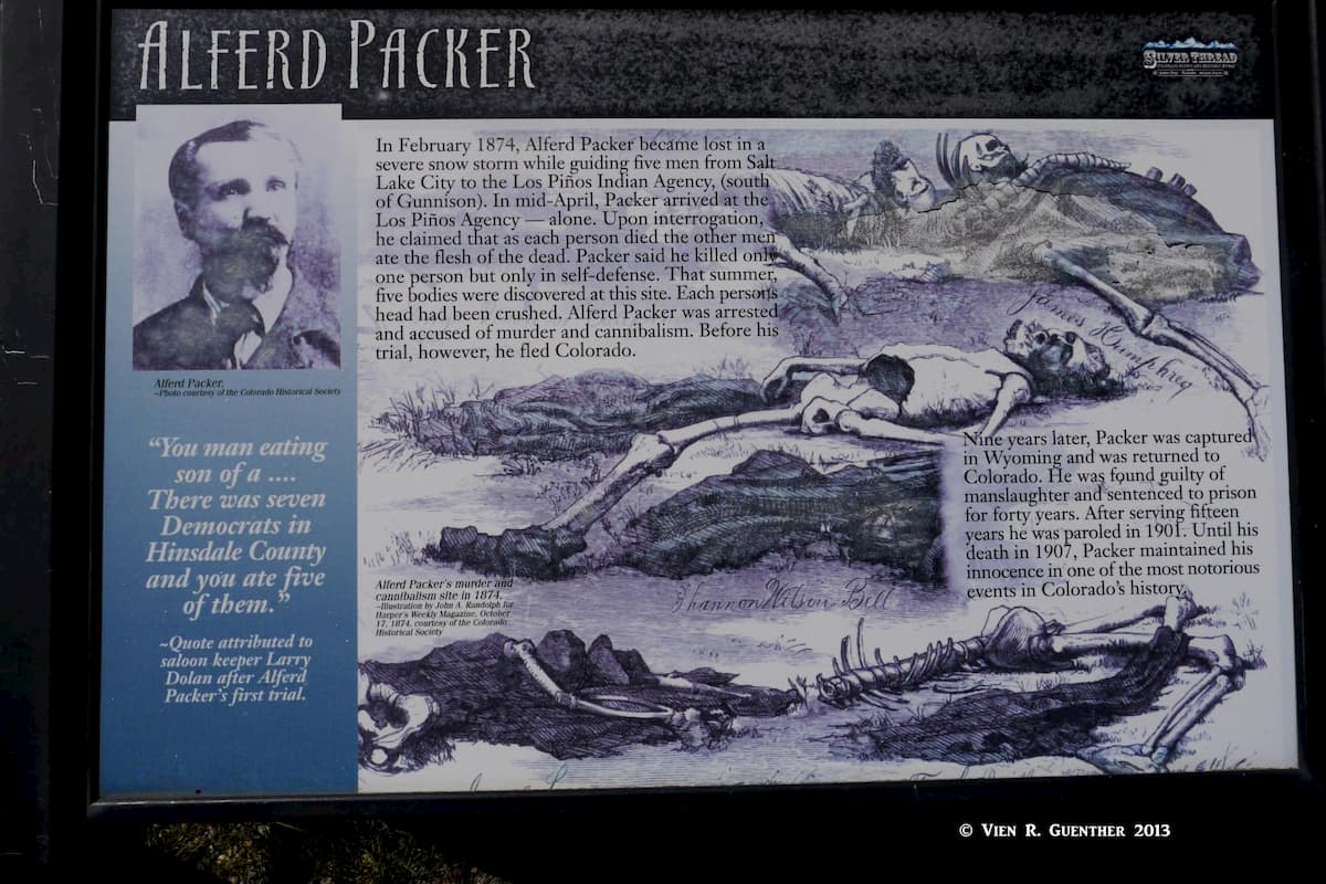
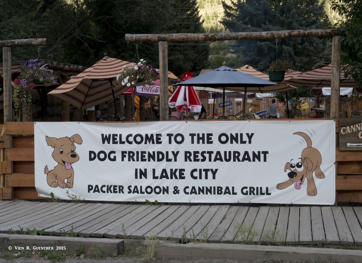
The Hinsdale County Museum, in “downtown” Lake City holds an extensive collection of Packer memorabilia. The area near town where the bodies of his victims were found is now called Cannibal Plateau. Since those days, Alferd Packer has become somewhat of a folk hero. He is commemorated by an annual Alferd Packer Jeep Tour and Barbecue. The cafeteria in the University of Colorado in Boulder is called the Alferd Packer Memorial Grill. He is also honored in Lake City with a saloon bearing his name. We had a fine meal there with some friends who also happened to be staying in town at the same time. I always have to laugh when I read the stories about Alferd Packer.
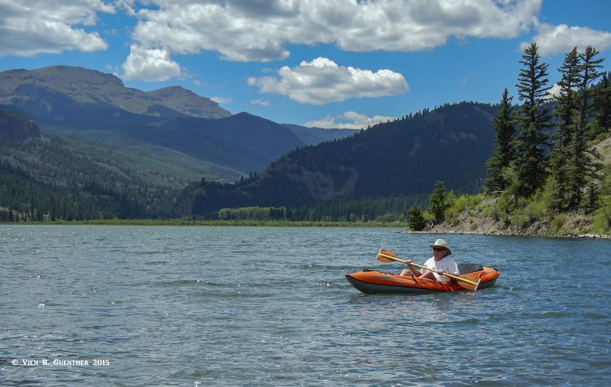
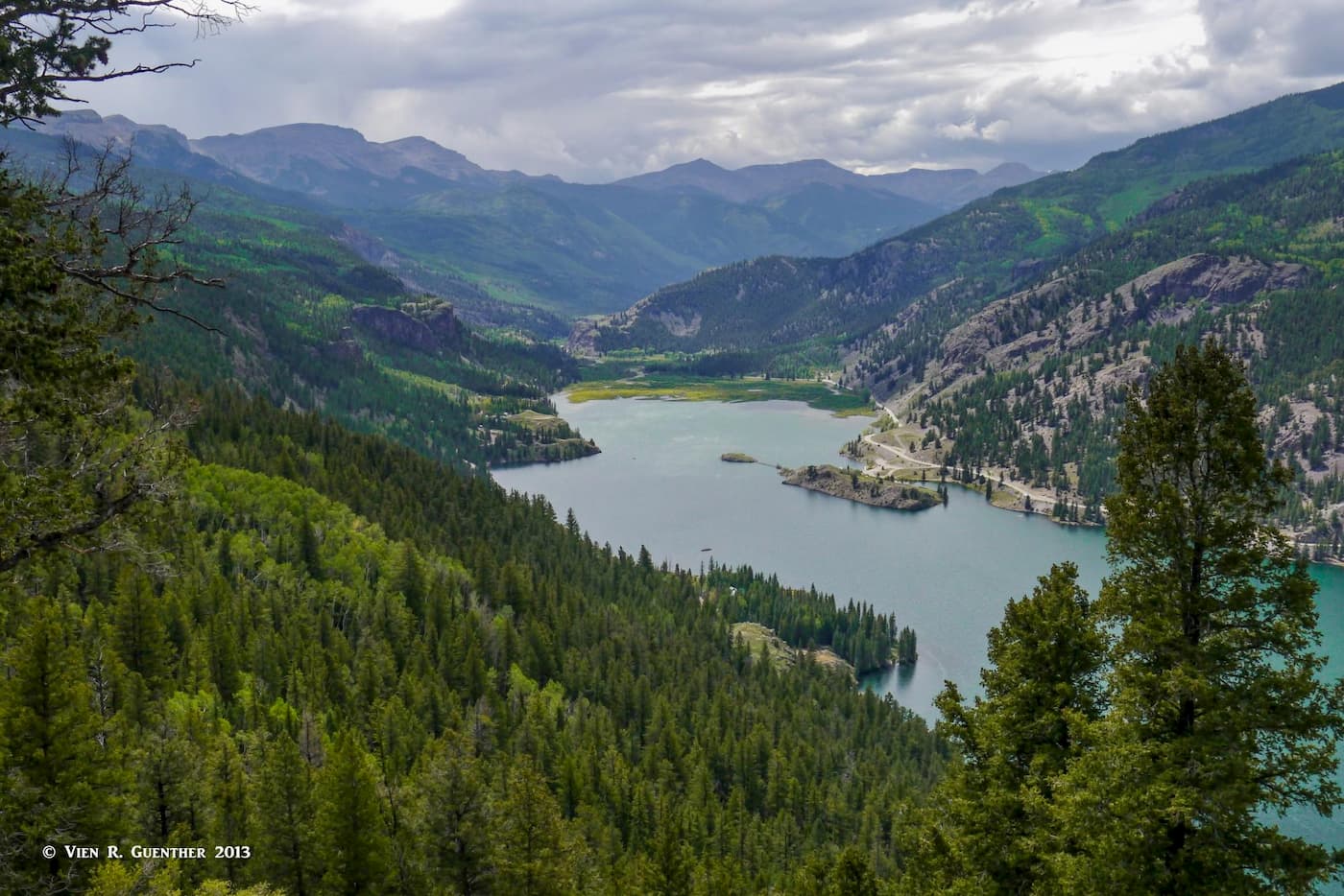
Without doubt, this beautiful place is about hiking, but it is fitting to first touch on what else there is to do here. This is easily one of my all-time favorite places in Colorado. Let’s start with the beautiful Lake San Cristobal about four miles south of Lake City. It is the second-largest natural lake in Colorado, formed about 700 years ago by a natural earthflow or landslide which created a dam across the Lake Fork of the Gunnison River. This then is clearly a fine venue for boating and fishing. We have even taken our kayak to explore the lake and try our hands at some fishing.
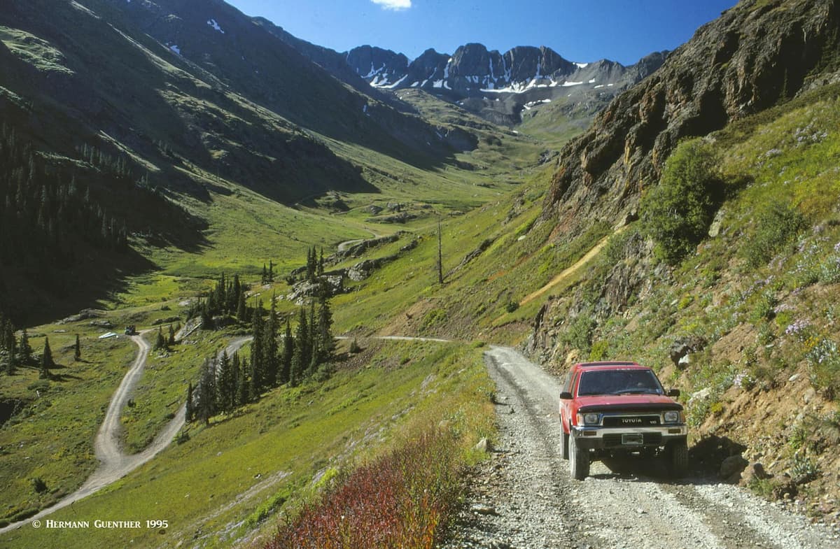
Camping is another popular activity – one which I have done several times in conjunction with fishing, hiking and climbing. OK, even sightseeing and staying in a hotel or cabin is acceptable to us. Perhaps one of the most popular activities is jeeping. You see, Lake City is one of the terminal points of the amazing Alpine Loop Scenic Byway, a 63-mile 4-wheel-drive road through the heart of the San Juan Mountains, passing over two 12,000-foot passes (Cinnamon and Engineer). I have done this once and it is memorable. Don’t even think about doing this with your ordinary road vehicle, even if it has all-wheel-drive. You need a high-clearance vehicle for this one. If you don’t have one, they are available for rent. Also, don’t do this if you are a white-knuckle driver.
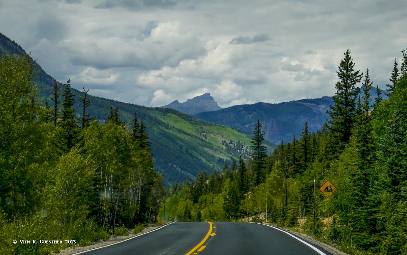
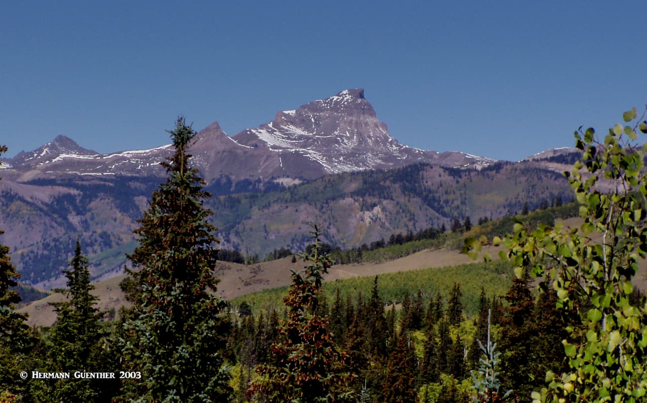
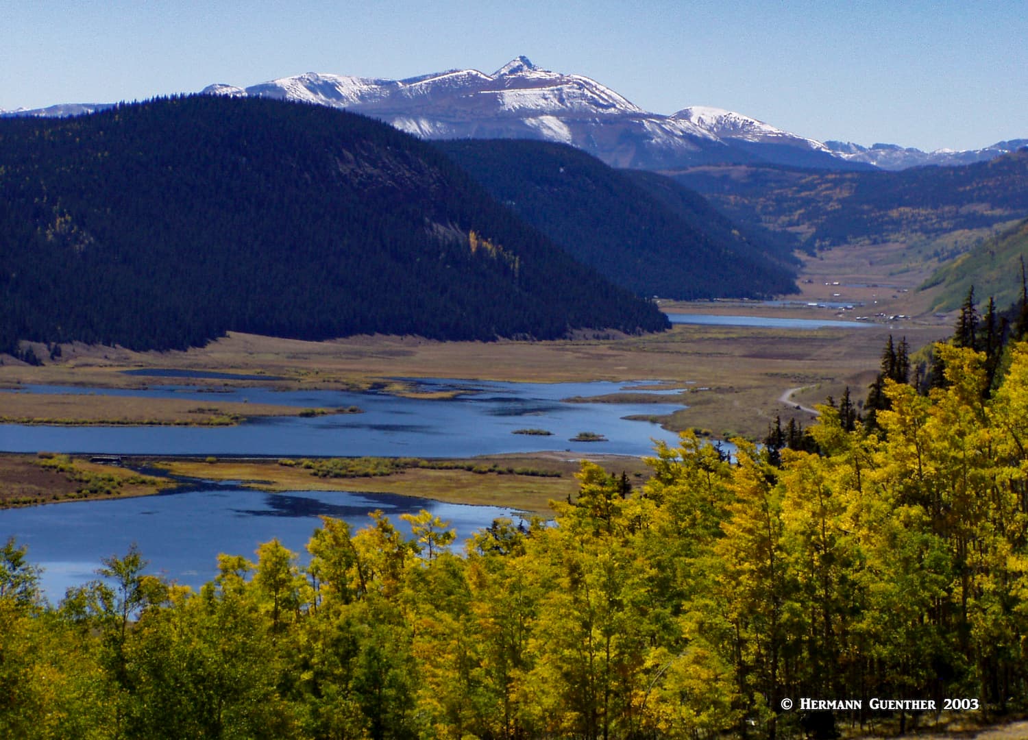
If you are simply interested in sightseeing, then Hinsdale County is a feast for the eyes, even if you are only driving on State Highway 149. There are several scenic overlooks along the stretch of the highway within the county, in addition to attractions just off the highway, which are totally worth stopping to see. For example, there is the Rio Grande Headwaters overlook, from which you look down a long valley across several lakes to the 13,822-foot Rio Grande Pyramid, which looms over the landscape at the end of the valley.
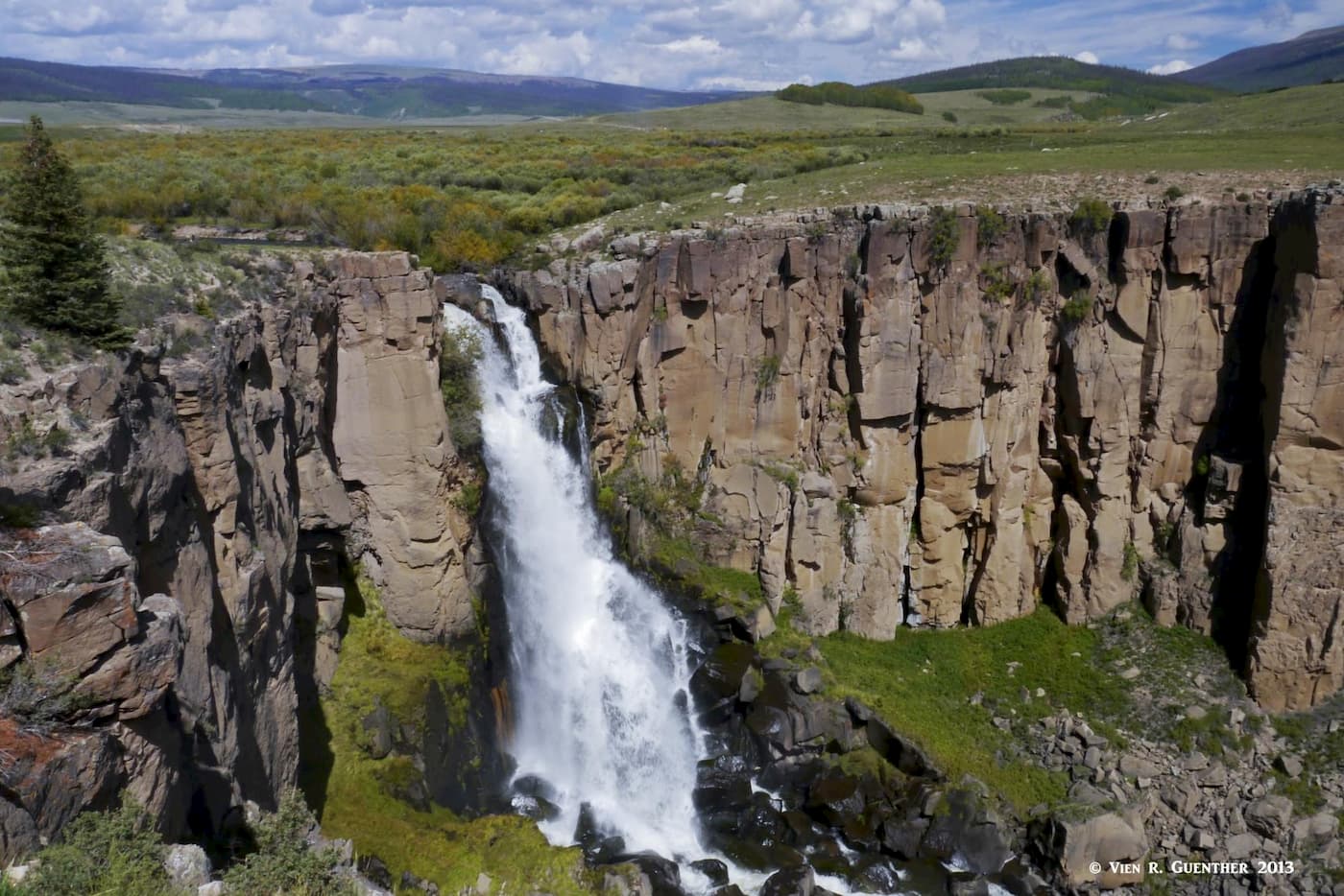
Just a couple of miles farther north on the highway, via a short forest road, is the spectacular North Clear Creek Falls. North Clear Creek eventually flows into the Rio Grande River. This place has a picnic area, restrooms and several overlooks, including one that is accessible for wheelchairs. There is a trail along the rim of the canyon but no official trail to the bottom.
Somewhat closer to Lake City on the west side of the 11,530-foot Slumgullion Pass is the Windy Point Observation Site. Here you will get a fantastic view north towards the Uncompahgre Wilderness and the high fourteeners there. Farther down the mountain highway is one more viewpoint, the Lake San Cristobal Overlook, where you get perhaps the best view of this gem of a lake. Now, if you’ve had enough sightseeing, and have lots of time to go hiking, read on.
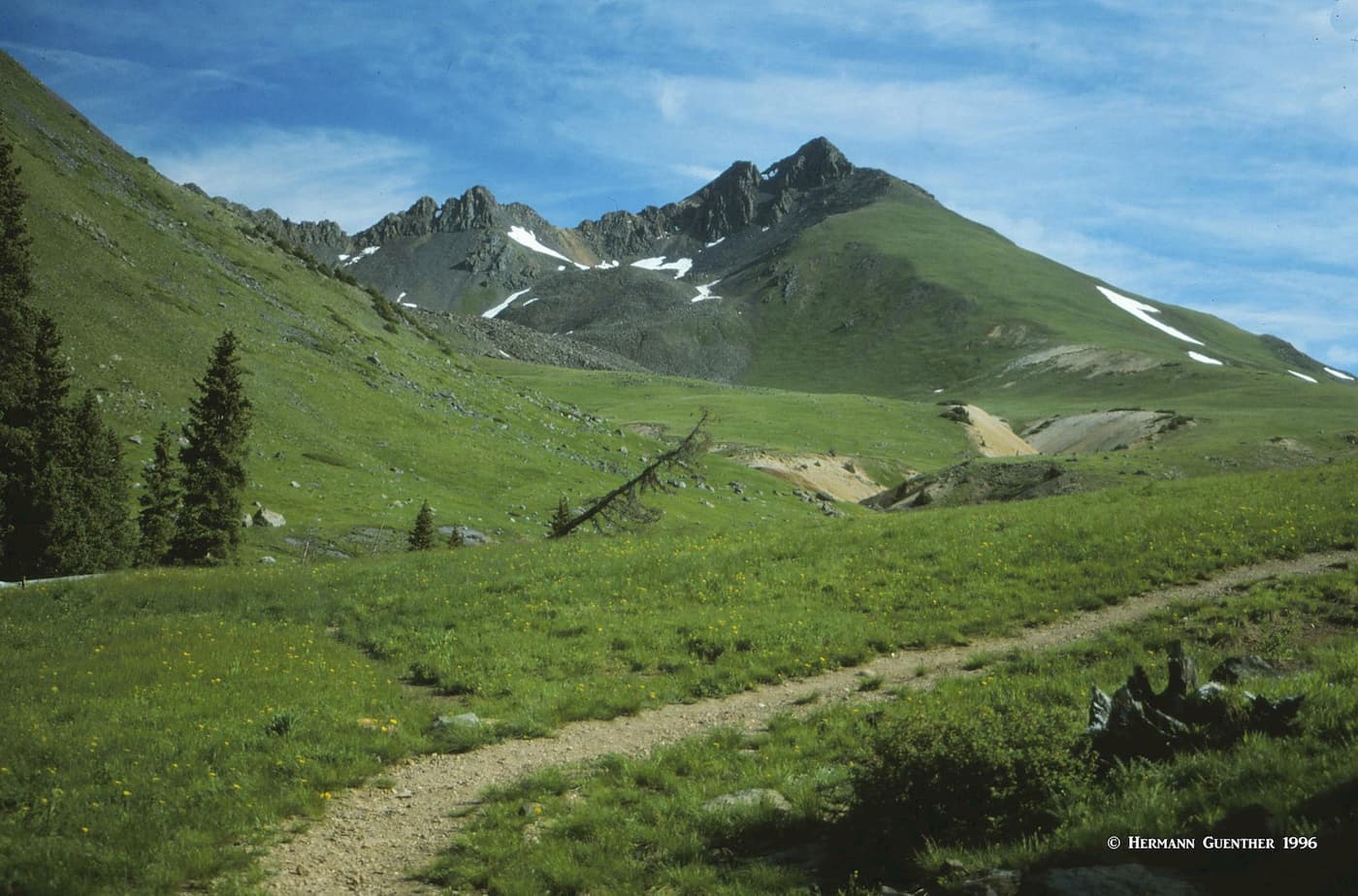
Undoubtedly, the very best hiking in Hinsdale County is centered around Lake City, with some trailheads right in or nearby town, with the others not too many miles away. Certainly, all the hikes we discuss here are easily reached from town such that they can be done as day hikes while based in Lake City. If you are camped in one of the Forest Service campgrounds upstream from Lake San Cristobal, as I have done, then your drive to some of the trailheads is even shorter. In no case will you have to drive much more than 20 miles from Lake City to get to any of the principal trailheads.
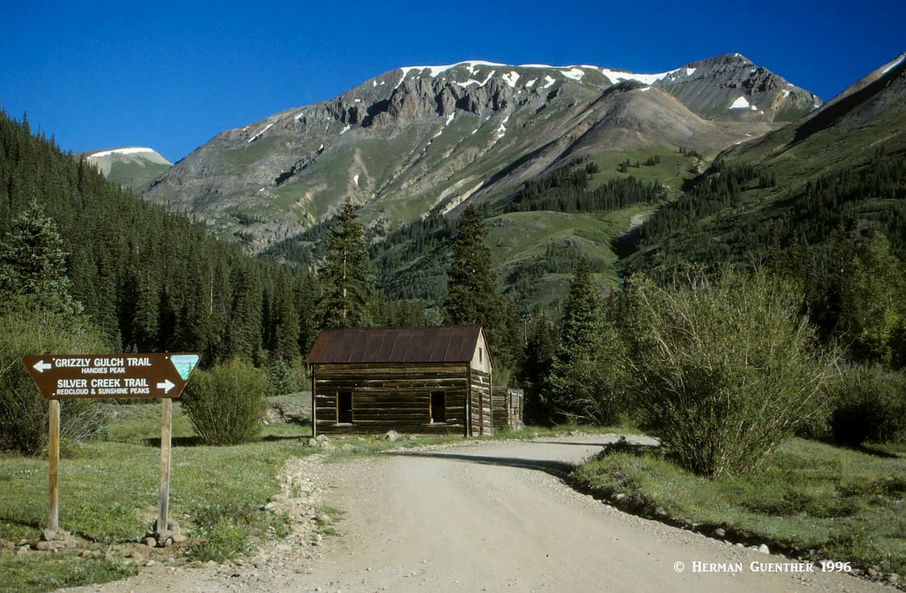
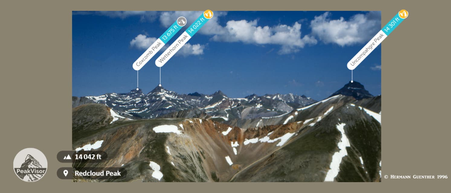
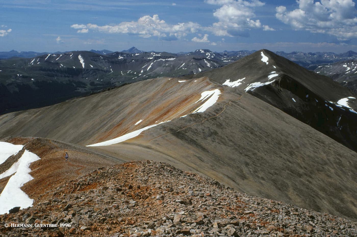
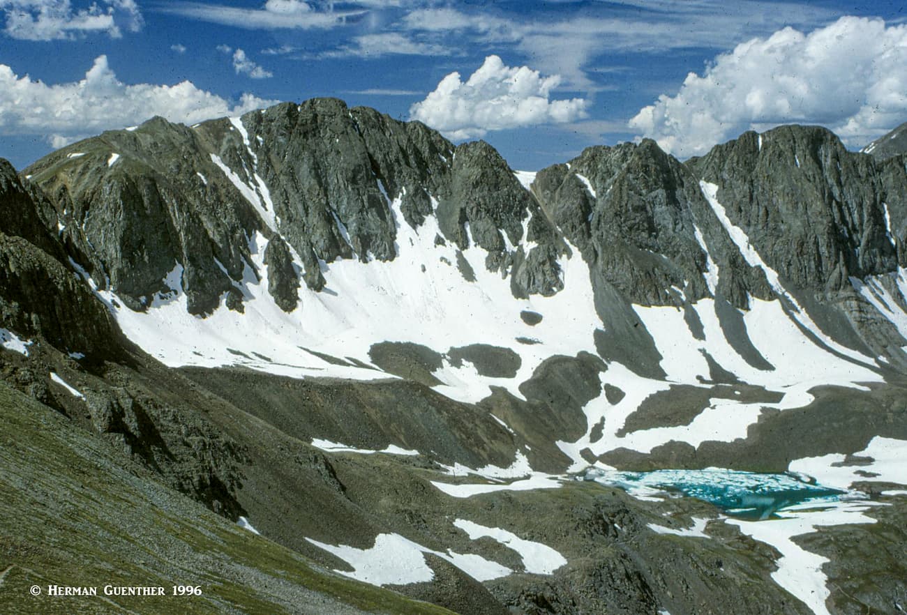
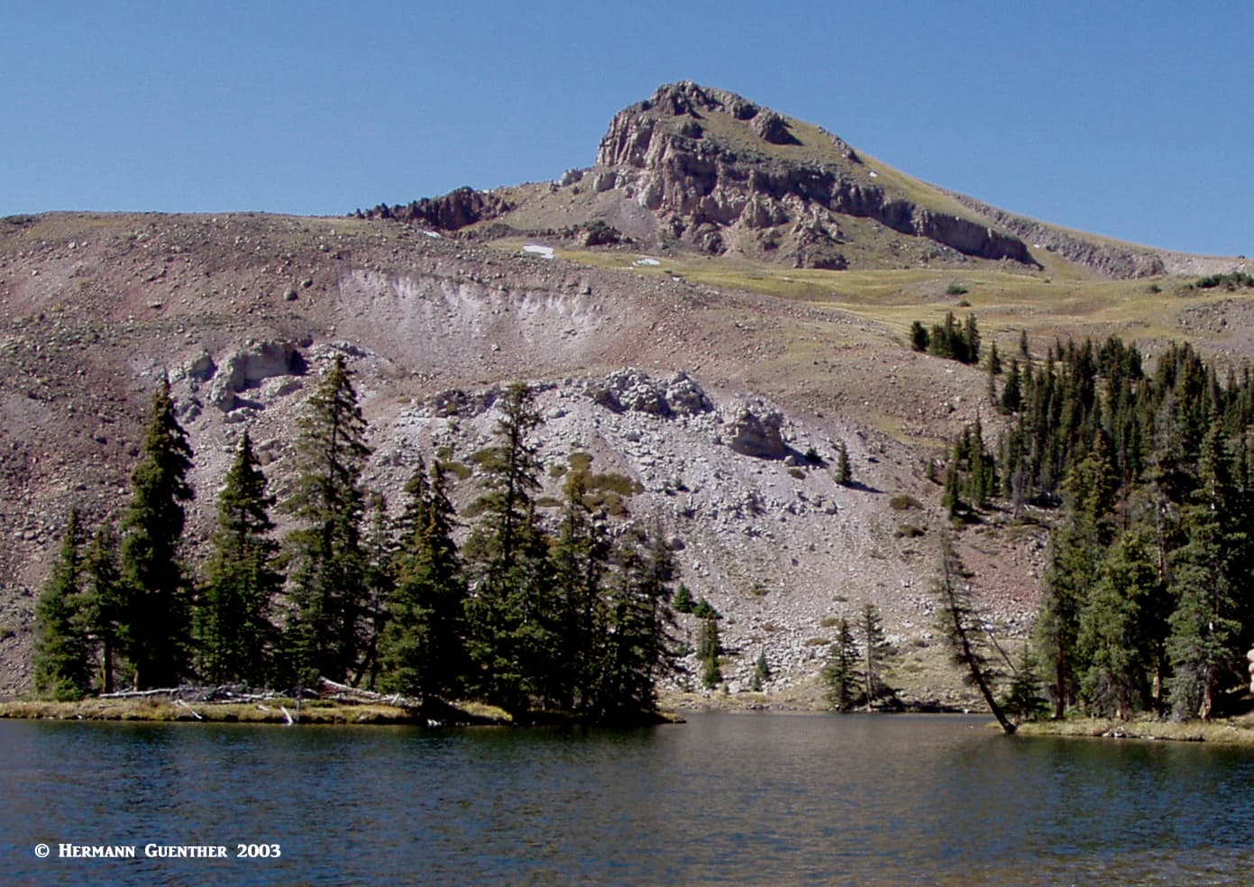
Only 19 miles from Lake City via the Alpine Loop Scenic Byway (you can drive to here in an ordinary passenger car), this popular trailhead lets you climb three fourteeners, although I would not recommend trying to do all of them in one hike. But you can certainly do two of them without too much difficulty – Redcloud Peak and Sunshine Peak. Following the Silver Creek Trail for about four miles will get you onto a high ridge, which you then follow south to the easy summit of Redcloud Peak. From here you will get fantastic views in all directions, but especially toward Wetterhorn and Uncompahgre Peaks to the north.
But from here, you want to traverse south along the gentle ridge connecting Redcloud to Sunshine Peak. If you then return the way you came, you will have completed a hike of 12 miles with a total elevation gain of 4,550 feet – the latter due to the fact that you will most likely return the way you came and have to climb over Redcloud again. There are two alternatives for getting back down. One is to head down the northwest face of Sunshine via a deep gully – not often used – that can save you about 1,000 feet of total elevation gain.
Another way is to descend Sunshine by the east ridge which will eventually get you to a trailhead by the road opposite the Mill Creek Campground. This is what I did, and I don’t really recommend it. Yes, it saves you about 1,000 feet of elevation gain, but you will most likely not see another soul on that route. And when you get down, you are five miles down the road from where you started, and unless you have a car shuttle, you will have to walk back up to your starting point, which regains the 1,000 feet of elevation you think you saved. That’s how I did it – it turned out to be a 15-mile hike - and that five miles back along the road stopped being fun after the first mile. Of course I was only 50 years old at that time, so I had plenty of endurance. Don’t do it if you are alone - there are some serious cliffs along the south side of Sunshine where you could get into major trouble if you get off route.
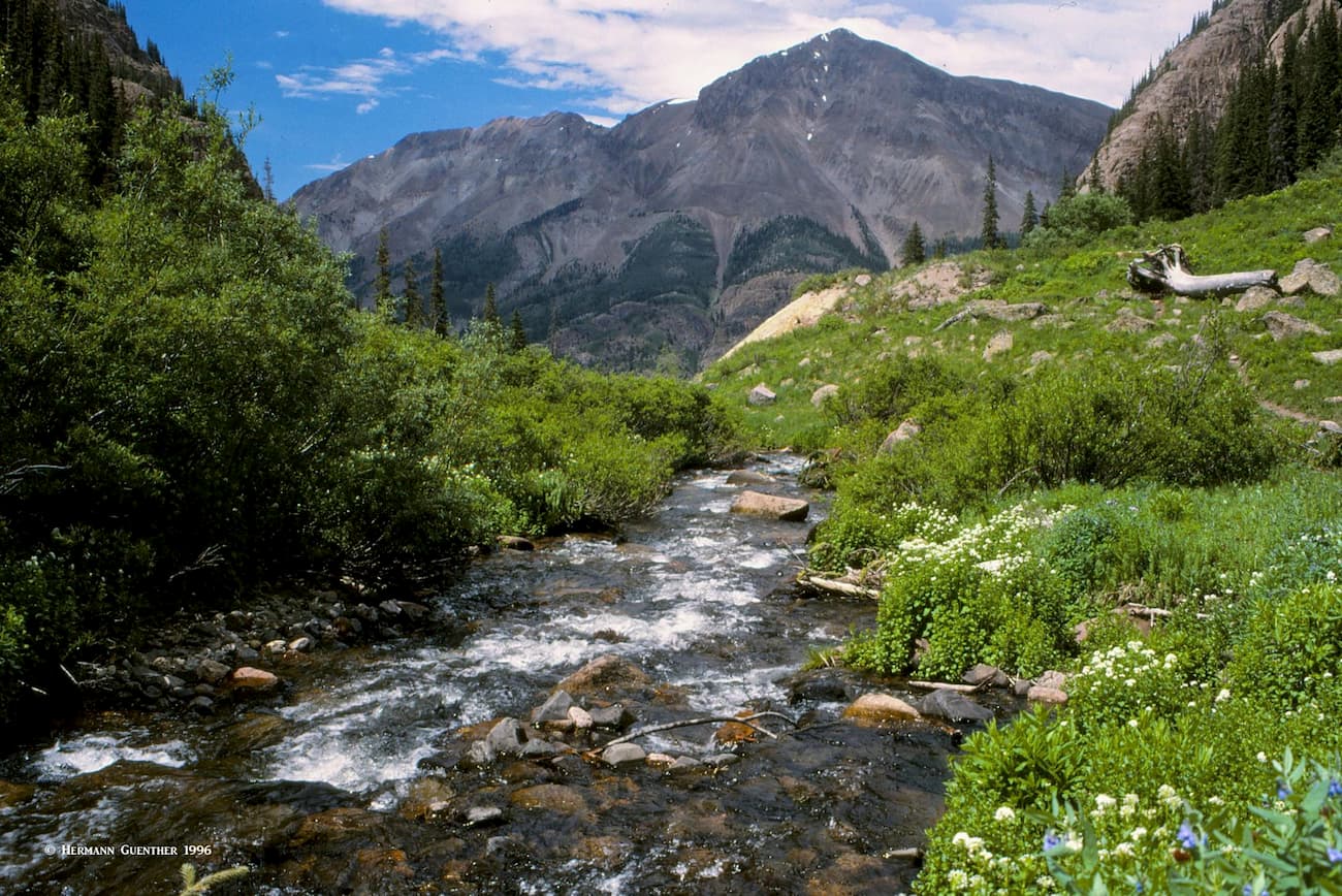
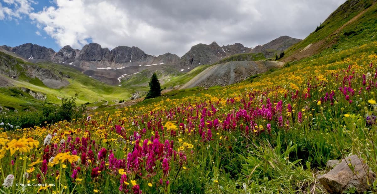
Back at the original trailhead, you can opt to climb another fourteener – Handies Peak. This is a much easier hike than the one I just described – even if you do it the way I did. The standard route is an eight-mile round trip with only about 3,660 feet of elevation gain, assuming you come back down the same way you went up. What I did was to turn this hike into another loop by leaving the summit of Handies via the American Basin Trail, passing the very high Sloan Lake situated at almost 13,000 feet.
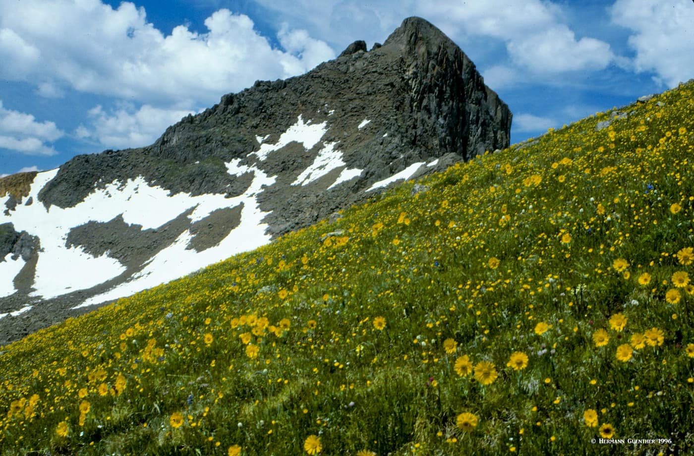
If you are doing this climb at the right time of summer, you will be overwhelmed by fields of wildflowers in American Basin before this trail reaches the road (also the Alpine Loop Scenic Byway). Then it is an almost four-mile hike back to the beginning trailhead, except that this is all downhill now. Doing the hike this way becomes a pleasant round trip of 11 miles, instead of the eight-mile out-and-back route. Not so difficult and you have continuously varying scenery without repeating your steps. A very nice way to bag Handies Peak. If you were to climb Handies from American Basin and return the same way, this would save about 1,000 feet of elevation gain, making Handies one of the easiest fourteeners to climb.
(Note: These last two hikes take place in an area that is under study for wilderness status – the proposed Handies Peak and Redcloud Peak Wilderness Areas.)
If you need a break from climbing fourteeners, here is a pleasant alternative hike that will take you to a scenic alpine lake that lies at 12,100 feet in a broad valley with stupendous views toward Sunshine Peak. This trailhead is 16 miles from Lake City along the same Alpine Loop Scenic Byway, but is located slightly off that road via a short gravel road. You can get to this point with any passenger car. The trail starts climbing at a moderate grade which it generally maintains for the first three miles. After that, it levels out for the final mile across open meadows until it reaches the lovely Cataract Lake (by no means the only lake in Colorado so named).
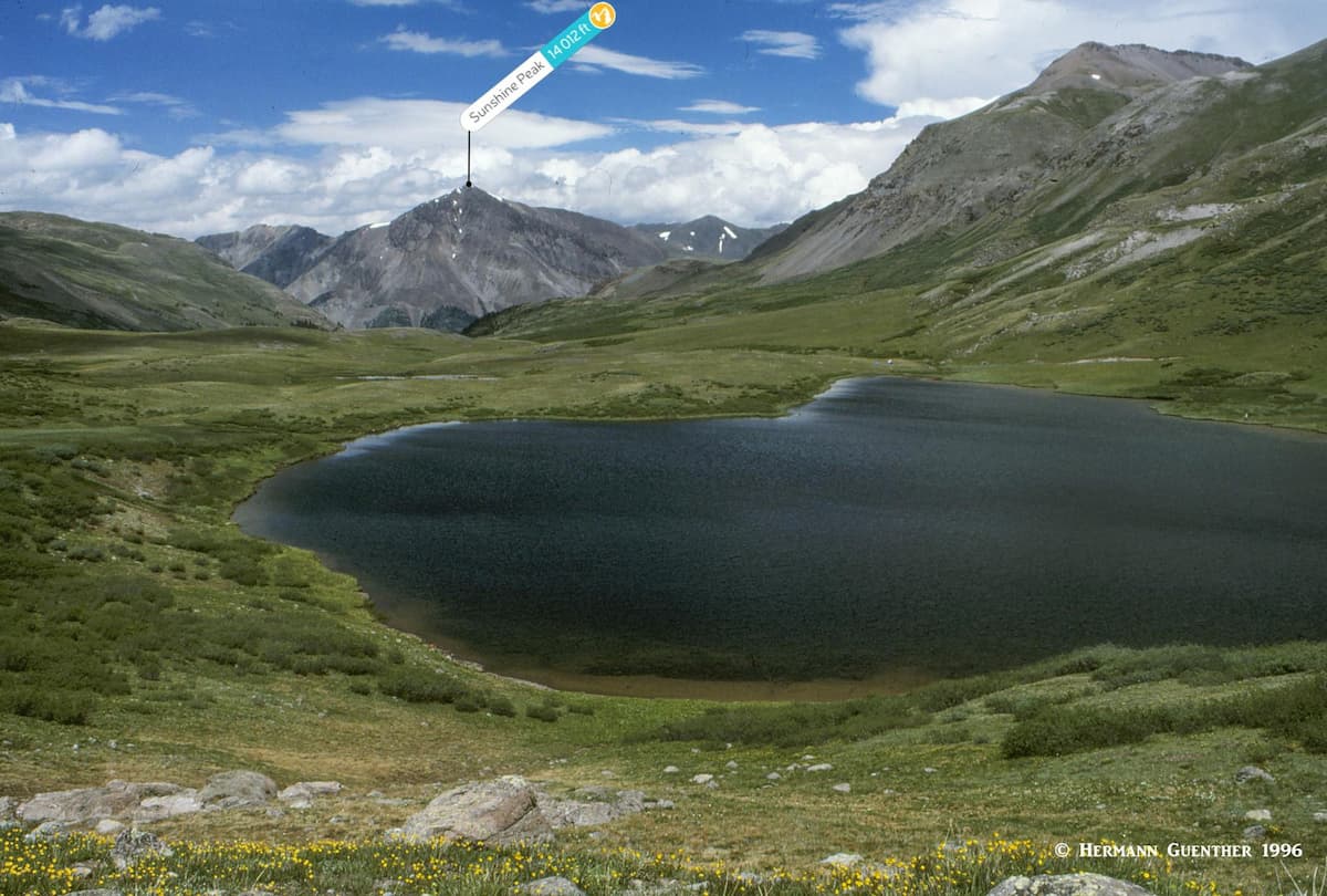
After arriving at the lake you have the option of continuing to climb to the high ground to the south where you will soon encounter the CDNST as it follows the Continental Divide for hundreds of miles. I chose to extend my hike this way since the weather was fine with no chance for thunderstorms (very common in the Rockies) that would otherwise cause me to retreat to lower ground. This is a very exposed treeless area. My total hike to this beautiful spot was 11 miles round trip.
About 12 miles from the center of Lake City is the Matterhorn Creek Trailhead from which a number of fine hikes and climbs can be undertaken. The drive follows the Alpine Loop Scenic Byway (here also known as the Henson Creek Road or County Road 20) to the old Capitol City historic site, where you have to turn off on Forest Road 870 which you follow for about three miles. This last segment is rough but passable for most passenger cars. I made it in my low-clearance car though had to take care not to bottom out. The trailhead is another half mile up along Matterhorn Creek on a 4WD road. It’s best to walk this last stretch.
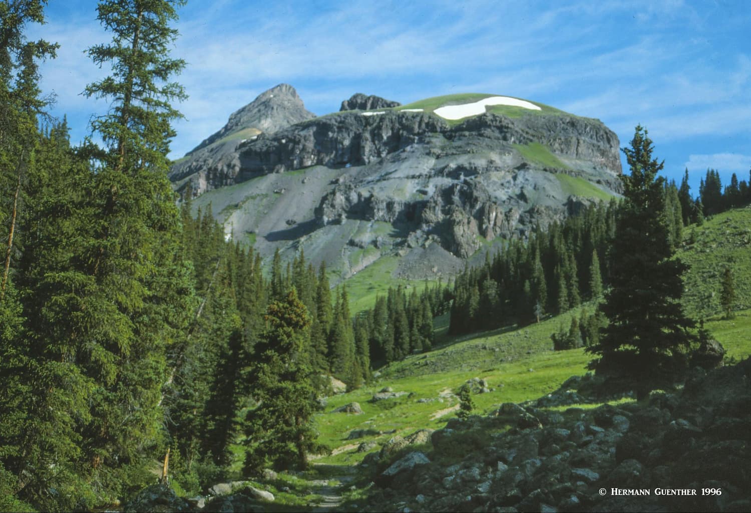
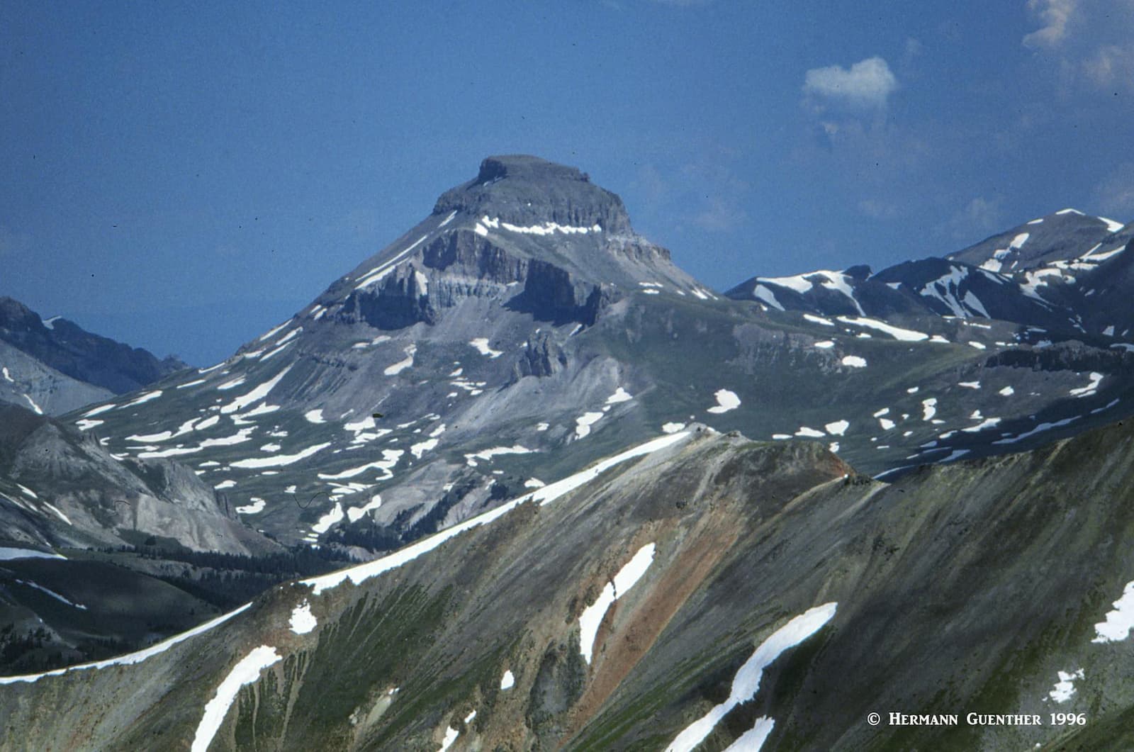
OK, let’s make something very clear – this is not the Matterhorn that you see on the packaging of certain Swiss chocolates. But this trailhead does give you climbing access to the two northern fourteeners in Hinsdale County as well as to the less-than-formidable Matterhorn Peak of the Colorado “alps”. From here you will find the easiest route to Wetterhorn Peak, about seven to eight miles round trip via the southeast ridge. I have not climbed either of these fourteeners, but I did do a long hike here - after completing the previous three hikes described above and taking one day off for rest and recovery.
This trailhead also offers the option to climb Uncompahgre Peak by its southwest slopes, but that involves a round trip of 13 to 14 miles with an elevation gain of up to 4,300 feet. And, as long as you are here, you can also make a quick ascent of Matterhorn Peak – after which you can impress your friends with your accomplishment. When you get to the open meadows at the pass between Uncompahgre and Matterhorn Peaks, the ascent of the latter is a short hike across a steep meadow followed by a Class 3 scramble to the summit. That was the extent of my “Matterhorn” experience, although I have also hiked on the lower slopes of the real one in Switzerland (which is only a thousand feet higher, but a somewhat more alpine undertaking).
If you are going to climb Uncompahgre Peak, this is most likely where you will begin your hike. The first of two trailheads is nine miles from the center of Lake City via County Road 20, which is part of the Alpine Loop Scenic Byway. This is where the Nellie Creek Road begins and it is eight miles to the true trailhead to which you can drive, but only if you have a 4WD vehicle. So if you rely only on a normal passenger car, you will have a long 15.4-mile round trip hike. From the actual trailhead, the total hike to the summit and back is 7.6 miles. This is the easiest route to the top and involves only 2,900 feet of elevation gain. For the entire gradual approach to the mountain you will be staring at the majesty of Uncompahgre Peak. The views from the top are incredible. From here it is also possible to combine your hike with Wetterhorn Peak, but be prepared for a very long day.
If you want to make a beautiful hike that starts right within the town limits of Lake City, here is an opportunity to actually walk to the trailhead from your accommodations, depending on where you are staying. The 10-mile round trip hike to Crystal Lake involves an elevation gain of about 3,000 feet but is very worthwhile. The beginning of the hike is quite steep, but the trail does level off a bit as it approaches the treeline. The views along this trail are awesome, first of the town itself and then of the mountains all around.
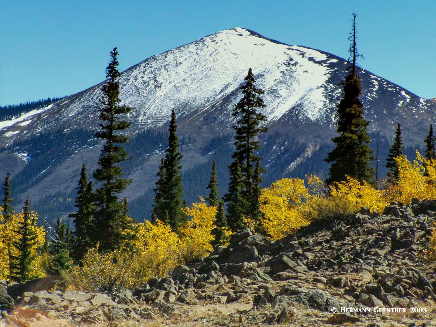
Crystal Lake is a typical alpine gem that you really want to see. The view of Crystal Peak (12,920 feet) across the lake makes you simply want to continue the hike all the way to its summit, though it may be a bit of a challenge since the route does not appear to be direct. I turned around at the lake because I had some time limitations. Autumn is a nice time to do this hike, as I did. Plenty of aspen trees around to paint the landscape the typical Colorado gold. Also from this same trailhead, you can make the much shorter and easier hike to Thompson Lake, from which you can continue to the Larson Lakes. From there, if you really have plenty of energy in reserve, you can go all the way to the Larson Lakes.
I mentioned earlier that Hinsdale County is one of the most remote counties in the United States. That should immediately be a signal as to the paucity of major towns and resorts. In fact, Lake City is all there is – at least in the immediate vicinity of the best hiking places in the county. But we do not want to exclude two other fine towns, Gunnison and Creede, each of which is a little over one hour drive away – in opposite directions. Let’s talk about Lake City first, because that is where you are most likely to settle in if you are planning multiple days of recreation in this haven of mountains, lakes and rivers.
Contrary to what its name implies, this is anything but a city. It is a small town, and the seat of Hinsdale County (the third-smallest in Colorado in terms of population), with only about 400 inhabitants. It is so named because of its proximity to nearby Lake San Cristobal, the second largest natural lake in Colorado. As with many towns in the San Juan Mountains, Lake City's economic driver shifted from mining to tourism in the early years of the 20th century. Now the town attracts visitors that love to recreate in the mountains and pursue interests such as fly fishing, hiking, jeeping, nordic skiing, climbing and camping. While the town does have a few motels and restaurants, there are a number of cabin and cottage developments as well as campgrounds that appear to be the preference of visitors planning to stay more than a few days. This wonderful town is not about luxury - it is for people who come here to truly enjoy the pleasures that the mountain environment has to offer. In the winter, much of Lake City shuts down and is left to its residents and hard-core outdoors enthusiasts. But it is a great place to base oneself for memorable hiking and mountaineering. The main trailheads for five fourteeners and other hiking venues in the county are all less than one hour from the center of town, some just minutes away.
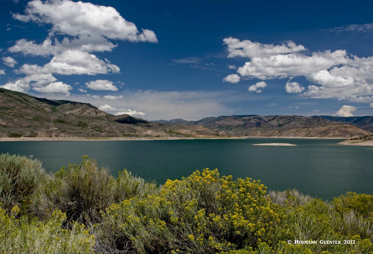
This very pleasant high-country city, with a population of around 6,500, is only 55 miles north of Lake City along the excellent State Highway 149. It is a very scenic drive of just over one hour, as long as you don’t make countless photo stops along the way. The town is conveniently situated at the south edge of the Elk Range, thus making it ideal for exploring much of south central Colorado. In addition to a regional airport with scheduled airline service, Gunnison has a full range of accommodations, restaurants and shopping venues. I have been in Gunnison many times and find it a very livable town – except in winter when it is often the coldest place in the state. But if you want to explore more than just the mountains of Hinsdale County, you would be well advised to consider making this town your base. And as long as you are here, you might well consider a visit to the historic town of Crested Butte and its ski area only a half hour away. There you will also find some excellent hiking opportunities. Just outside of Gunnison is the Blue Mesa Reservoir, the largest lake entirely within Colorado. It is a major recreation destination itself.
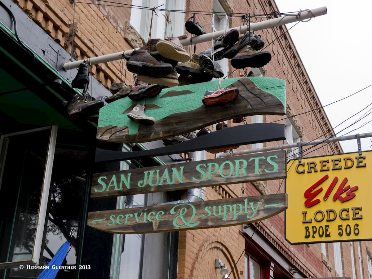
Only 50 miles and just over one hour to the south of Lake City is the tiny but historic and charming town of Creede, the seat of the even less populous Mineral County. While not a major town by any standards, Creede was a major silver mining boomtown in the late nineteenth century. In a two year span from 1889 to 1891, its population jumped from 600 to 10,000 residents. But mining quickly declined after the "Silver Panic" and the town ceased to maintain a significant mining industry. Like Lake City, Creede has its share of old west history, along with its colorful characters of less-than-upright reputation.
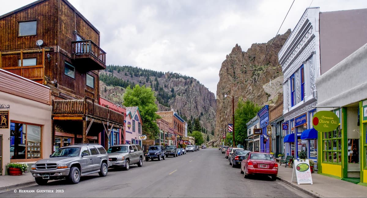
But Creede did not become a ghost town like so many others even though the population declined significantly. Today it has less than 300 residents. The town does not offer much in the way of tourist infrastructure - the choice of accommodations and dining options is slim indeed, but its small "downtown" is a pleasure to explore and is worth a stop of at least a few hours - more if the visitor wants to take advantage of the first-rate fly fishing on the Rio Grande River and its tributary streams. We loved this town so much that we decided to spend the night here on our first visit rather than just continue on after a couple of hours.