Scan the QR code and open PeakVisor on your phone
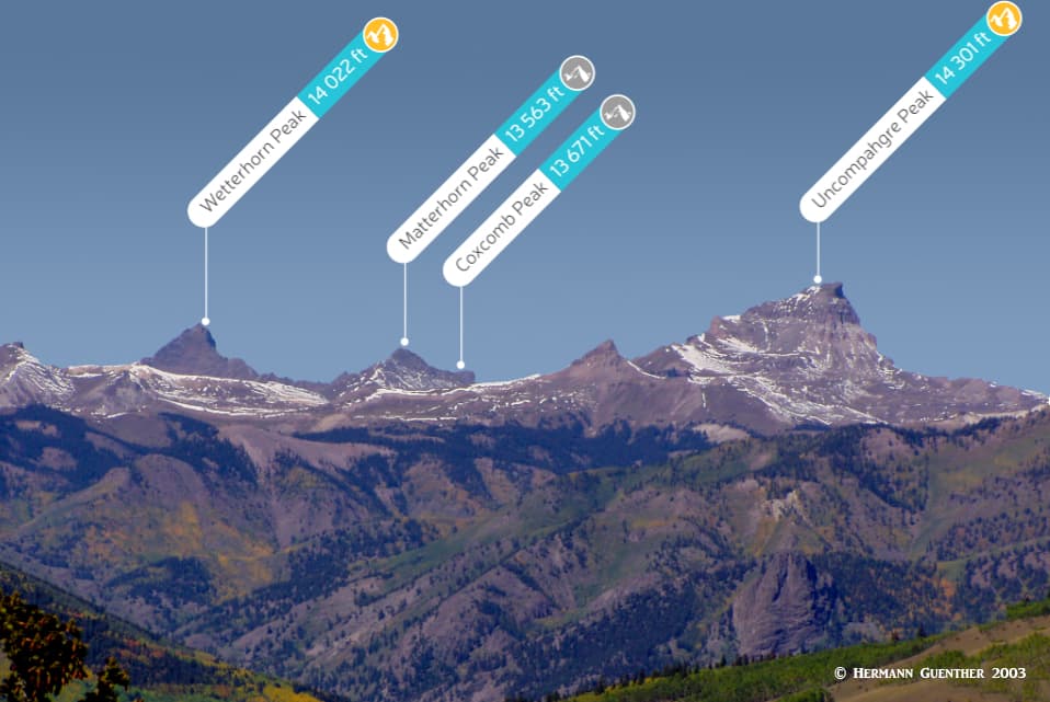
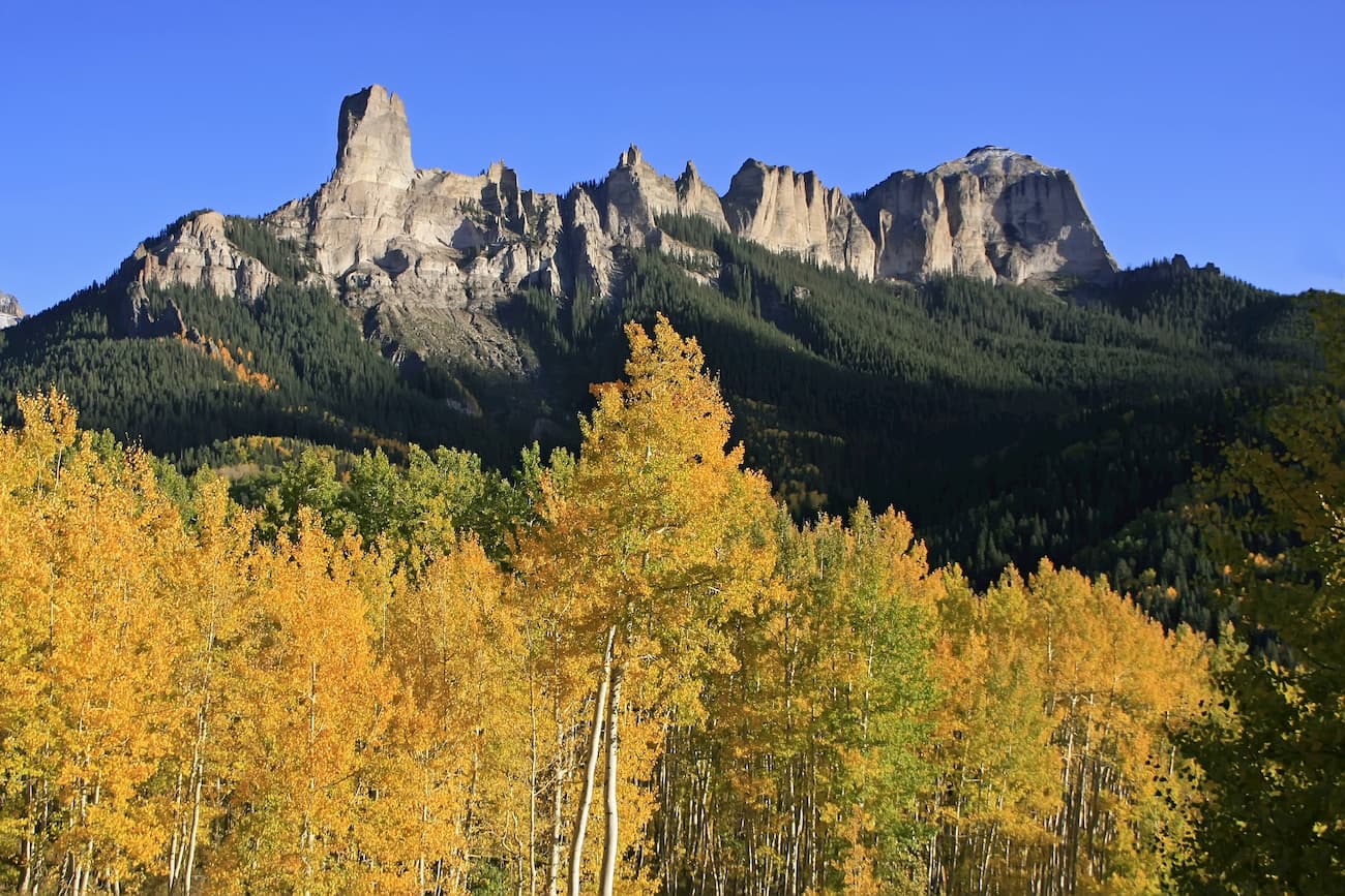
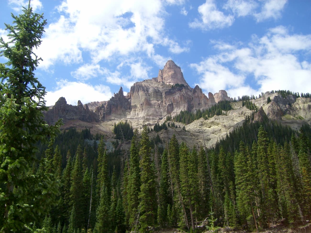
The Uncompahgre Wilderness area contains one of the most jaw-dropping alpine views in Colorado. The impressive craggy summits of high ridges and soaring peaks such as Courthouse Mountain and Coxcomb Peak will without doubt capture the attention of visitors driving south on U.S. Highway 550 from Montrose to Ridgway and onward toward Ouray. Many precipitous peaks populate the area, including two fourteeners, Wetterhorn and Uncompahgre Peaks. This wilderness is unlike any other in the state. It is best described in the words of Colorado’s own celebrated landscape photographer and conservationist, John Fielder: “There is no wilderness in Colorado like Uncompahgre. From the alpine tundra, spectacular castle-like formations rise to 14,000 feet, a sight I have not seen anywhere else.” And he has seen all there is to see in Colorado as is evidenced by the more than 40 books about the mountains he has published.
First designated as the Big Blue Wilderness in 1980 pursuant to the Wilderness Act of 1964, in 1993 its name reverted back to its original name of Uncompahgre which dates back to the 1930’s when it was part of the Forest Service’s original primitive areas. Wilderness is best defined by the author of the Wilderness Act, Howard Zahnister: "A wilderness, in contrast with those areas where man and his own works dominate the landscape, is hereby recognized as an area where the earth and its community of life are untrammeled by man, where man himself is a visitor who does not remain." There are several government agencies that administer the 765 wilderness areas in the United States - U.S. Forest Service, U.S. National Park Service, U.S. Fish and Wildlife Service and the U.S. Bureau of Land Management. As of 2016, this encompassed a total of 109,129,657 acres, or an area larger than the state of California.
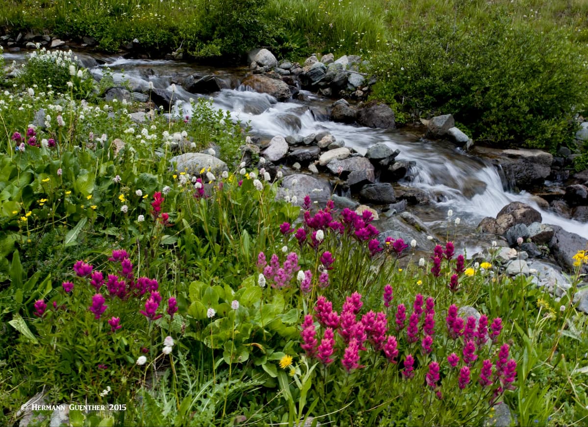
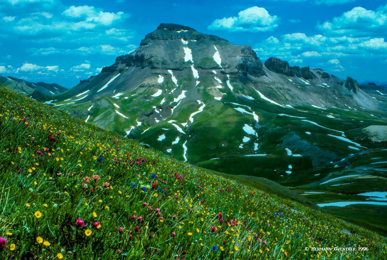
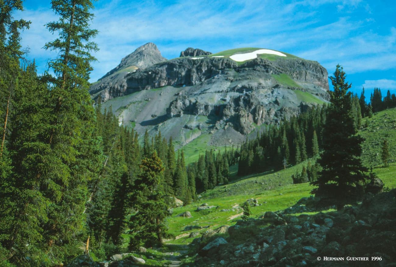
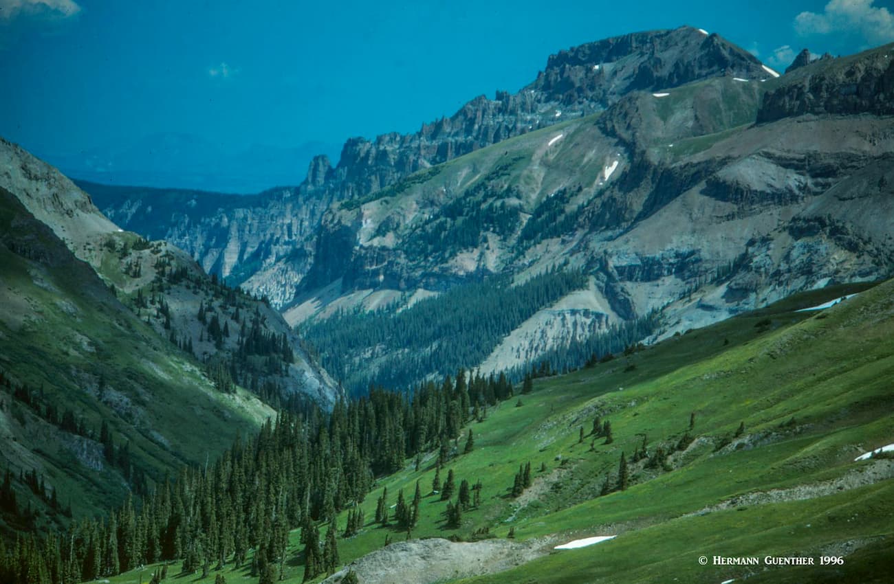
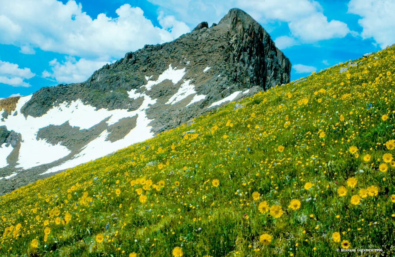
The Uncompahgre Wilderness is located in southwestern Colorado at the northern edge of the San Juan Mountains. It encompasses 102,721 acres and its elevations range from 8,400 to 14,301 feet, with Uncompahgre Peak both the highest and most prominent of the 16 named mountains in the wilderness. The wilderness has 110 miles of trails, but few alpine lakes of any significance – tarns would be a more likely description. But in their stead, there are miles of wonderful streams that are sure to keep fly-fishermen excited with the fine stocks of rainbow, cutthroat and brook trout. And there is plenty of wildlife that call this wilderness their home. Summer brings meadows loaded with wildflowers of every color, as is so typical of the San Juans.
The Uncompahgre Wilderness offers some unique hiking opportunities. The southern part of the wilderness, easily reached from Lake City, is where the most popular hikes are to be found, at least for climbers. Here is where you would most likely start your approach to the two fourteeners, Wetterhorn and Uncompahgre.
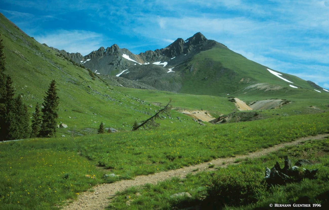
Alternatively, you can approach the wilderness from the north to reach several trailheads. That will take miles of travel on gravel roads. The north is characterized by long U-shaped north-south trending glacial valleys defined by several branches of the Cimarron River. There are miles of trails here, generally following the riverbeds, which can be combined into long loop hikes. Some of these hikes will take you close to or even around such imposing mountains as Coxcomb Peak, Precipice Peak and Courthouse Mountain with its craggy profile dominated by Chimney Rock.
Access to the high mountains in the south is possible from these valleys, but the hikes will be long and would most likely require overnight trips into the backcountry. All the trails mentioned here are suitably interconnected such that they present many variations of hikes that can be combined into long multi-day excursions. A popular approach is via the Wetterhorn Basin Trail that bypasses Coxcomb Peak on its western side. The latter mountain requires technical gear and experience to climb.
Nellie Creek Trailhead – If you are going to climb Uncompahgre Peak, this is most likely where you will begin your hike. The trailhead is nine miles from the center of Lake City, but the last four miles along the Nellie Creek Road are only suitable for 4WD vehicles. So if you rely only on a normal passenger car, you will have a long 15.4-mile round trip hike. From the actual trailhead, the total hike to the summit and back is 7.6 miles. This is the easiest route to the top and involves only 2,900 feet of elevation gain. From here it is also possible to combine your hike with Wetterhorn Peak, but be prepared for a very long 16-mile day.
Matterhorn Creek Trailhead – OK, let’s make something very clear – this is not the Matterhorn that you see on the packaging of certain Swiss chocolates. But this trailhead does give you climbing access to both fourteeners in the wilderness as well as to the less-than-formidable Matterhorn of the Colorado “alps”. From here you will find the easiest route to Wetterhorn Peak, about seven to eight miles round trip via the southeast ridge.
This trailhead also offers the option to climb Uncompahgre Peak by its southwest slopes, but that involves a round trip of 13 to 14 miles with an elevation gain of up to 4,300 feet. And, as long as you are here, you can also take in a quick ascent of Matterhorn Peak – after which you can impress your friends with your accomplishment. When you get to the open meadows at the pass between Uncompahgre and Matterhorn, the ascent of the latter is a short hike across a steep meadow followed by a Class 3 scramble to the summit. That was the extent of my “Matterhorn” experience, although I have hiked on the lower slopes of the real one (which is only a thousand feet higher).
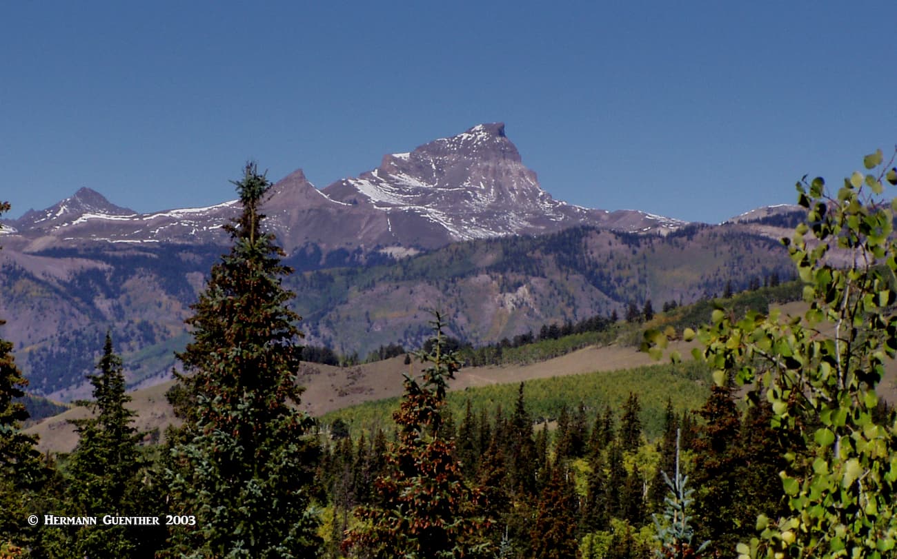
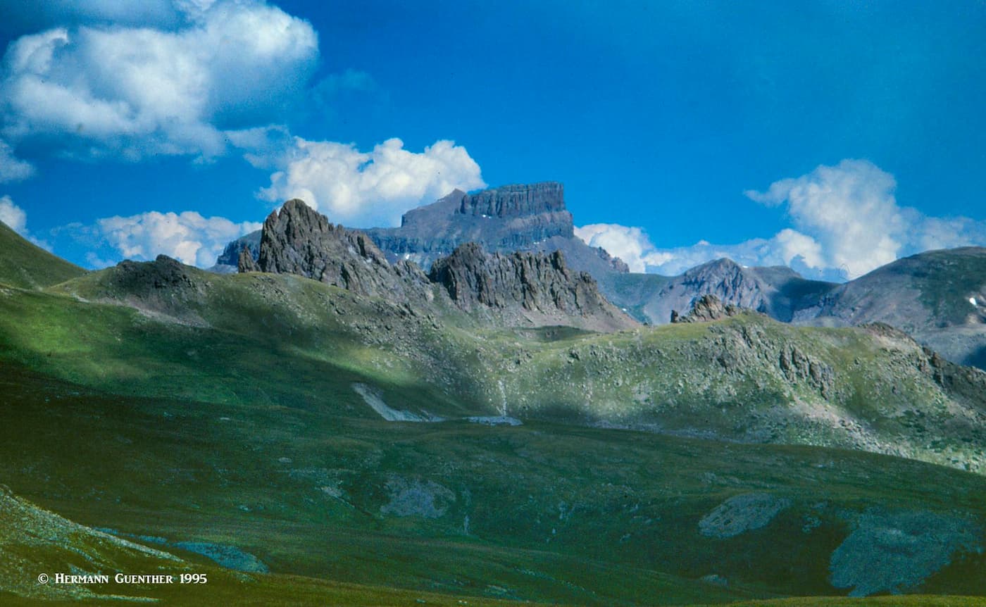
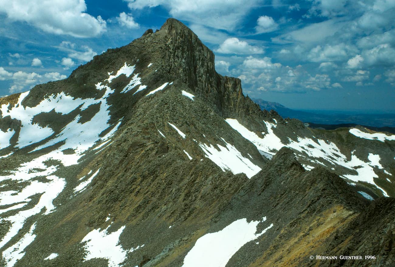
For an arduous Class 4 experience you might want to try traversing the east ridge connecting Matterhorn with Wetterhorn. This is a true alpine challenge that is best left to experienced mountaineers. I had a good look at it from above and decided to postpone this one until another life (see photo below).
Ouray Area Trails – One of the finest trail combinations near Ouray will require a car shuttle since the respective trailheads are some distance apart. A few miles north of town, at the end of the Dexter Creek Road (Forest Road 871) is the Horsethief Trailhead which is where the Horsethief Trail begins. While this trail is not in the wilderness except at the upper end, it skirts the wilderness boundary for much of the way. It passes over the Bridge of Heaven, a narrow ridge which affords stunning views of a number of San Jaun peaks, including Mount Sneffels and Wetterhorn. The trail then joins the unforgettable Bear Creek National Recreation Trail in the area of the wilderness known as American Flat. The Bear Creek Trail can then be taken as the return route to US-550 just south of Ouray where your other car shuttle should be parked. This is a strenuous13-mile day hike. Part of this trail hangs on the side of steep cliffs with spine-tingling drop-offs.
East Fork-Middle Fork Cimarron River Trails – This long 14-mile hike is a loop of sorts that takes you far into the back country from the northern boundary of the wilderness. Since two trailheads are involved in completing this hike, it requires a car shuttle, although it can be done as a continuous loop if you don’t want to do a car shuttle. The two trailheads are five miles apart, a segment that can be walked along a forest road. This hike leads into the headwaters of the Cimarron River and to the base of both Wetterhorn and Uncompahgre Peaks. For those who have plenty of time, this is clearly an alternative approach to both fourteeners, either or both of which can then be reached via the traditional trails from the pass below Matterhorn (the same trails that started at the Matterhorn Creek Trailhead). The additional distance to ascend the peaks is not included in the 14 miles of this hike.
Little Cimarron-Fall Creek Loop – The two trails for this hike in the northern part of the wilderness have separate trailheads that are only four miles apart along a forest road. But the hike can be done with a car shuttle that would require 16 miles of hiking while eliminating the extra four miles that you would have to walk along the road. Along this route, you will experience two of the magnificent glacial valleys as well as a high ridge separating them. Though long, this hike is considered easy to moderate.
A note about winter excursions in the wilderness: This wilderness is not considered suitable for skiing. The steepness of the terrain and remote access in the winter make the potential for avalanches severe, and rescue can be far away both in terms of time and distance.
This amazing wilderness is comfortably tucked into a small area of the northern San Juan Mountains between two highways – US-550 on the west and SH-149 on the east. And there are only two towns that make viable bases for exploring the wilderness – Ouray and Lake City. They are directly on opposite sides and close to the southern wilderness boundary. As the crow flies, they are 19 miles apart. The shortest all-season highway route connecting them is 136 miles and almost three hours. So if you decide you want to stay in one of these towns to explore the Uncompahgre Wilderness, you need to plan carefully so that you don’t find yourself too far from your chosen area.
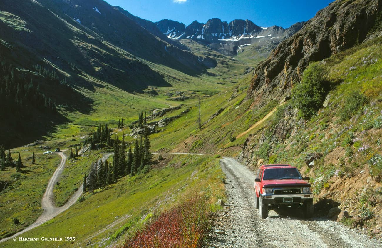
In the summer months, you can drive the 30 road miles between the two towns in two and one-half hours (not including photo-stops) via the Alpine Loop Scenic Byway. But you need a high-clearance 4WD vehicle to be able to negotiate the Alpine Loop over either Cinnamon Pass (12,640 feet high) or Engineer Pass (12,800 feet high). The Byway (the lower parts of which can be driven in an ordinary passenger car) begins and ends in Lake City but it also has two spurs that divert from it in the high terrain between the passes – one goes to Ouray and the other to Silverton.
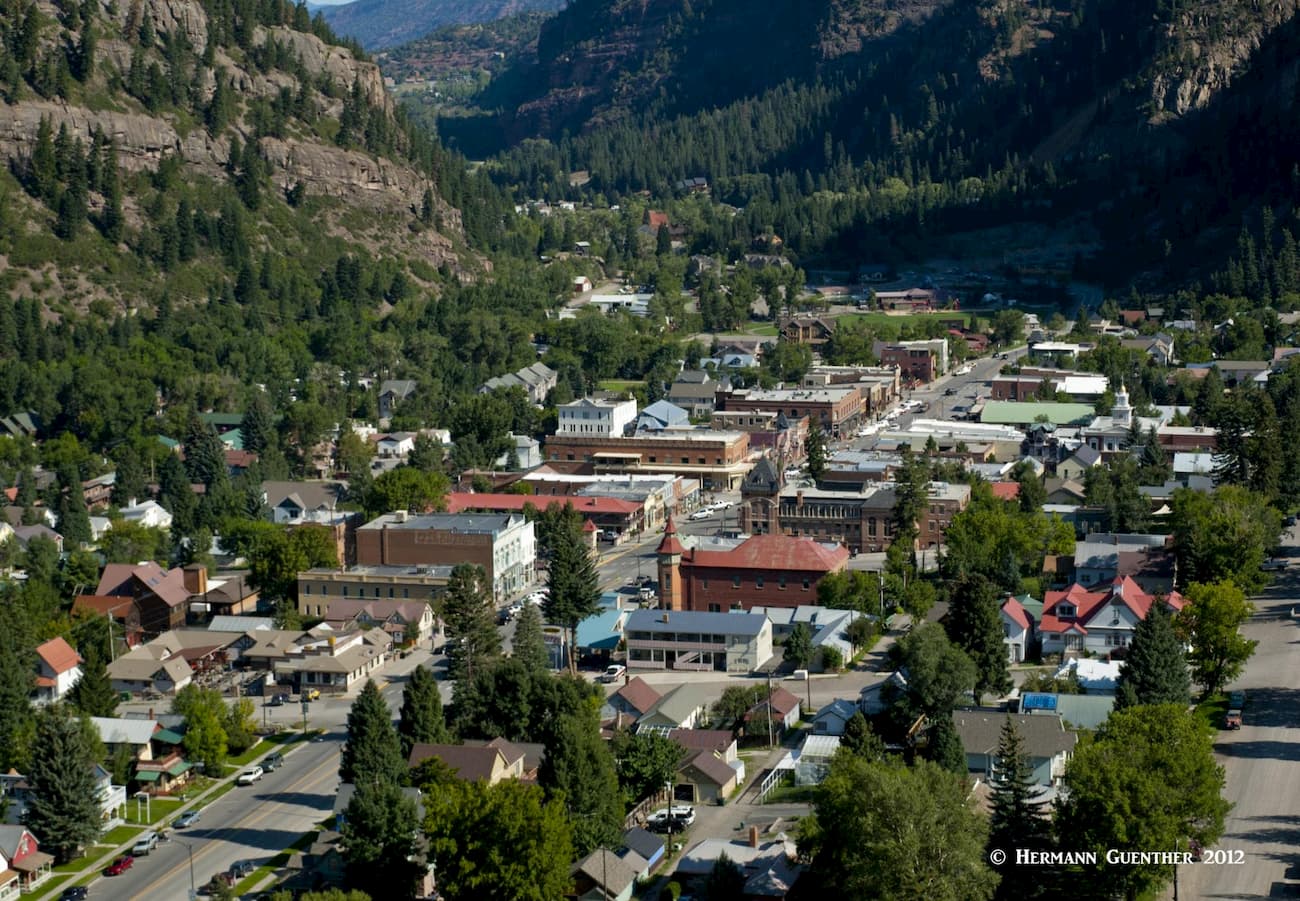
The pretty town of Ouray (named after a famous Indian Chief) is only 35 miles south of Montrose or 95 miles south of Grand Junction, the largest towns anywhere near the wilderness. Ouray and its surroundings are affectionately called the "Switzerland of America" - and for good reason. The scenery from and of the town is simply stunning. Despite its population of just over 1,000 permanent residents, Ouray offers a considerable selection of accommodations and dining options. Aside from being a hiking and climbing mecca, Ouray is famous for its many hot springs, five of which were developed for the tourist trade. For hikers, there are so many options from which to choose. The nearby Yankee Boy Basin is world-renowned for its annual display of wildflowers. There are several trailheads near the town that provide access into the Uncompahgre Wilderness, including the exciting Bear Creek Trail, which will test the nerves of some timid hikers.
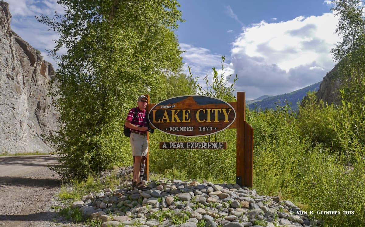
Contrary to what its name implies, this is anything but a city. It is a small town, and the seat of Hinsdale County (the smallest in Colorado), with a population of about 400. It is so named because of its proximity to nearby Lake San Cristobal, the second largest natural lake in Colorado. As with many mountain towns in the San Juans, Lake City's economic driver shifted from mining to tourism in the early years of the 20th century. Now the town attracts visitors that love to recreate in the mountains and pursue interests such as fly fishing, hiking, jeeping, nordic skiing, climbing and camping. While the town does have a few motels and restaurants, there are a number of cabin and cottage developments as well as campgrounds, that appear to be the preference of visitors planning to stay more than a few days. This wonderful town is not about luxury - it is for people who come here to truly enjoy the pleasures that the mountain environment has to offer. In the winter, much of Lake City shuts down and is left to hard-core outdoors enthusiasts. But it is a great place to base oneself for memorable hiking and mountaineering. The main trailheads for the two dominant fourteeners in the Uncompahgre Wilderness are just minutes from the center of town.