
Scan the QR code and open PeakVisor on your phone
Gunnison County is one of 64 counties in Colorado, the fifth-largest in the state in terms of area – 3,260 square miles, 21 of which is lakes. The county seat is the city of Gunnison which sits in a wide, flat valley at the confluence of Tomichi Creek and the Gunnison River. Though much of the county lies in the Gunnison Basin, it has its share of high mountains, especially along its northern and eastern boundaries, the latter being defined by the Continental Divide. As large as the land area of the county is, it comes as no surprise that it shares borders with eight other counties – Pitkin (north), Chaffee (east), Saguache (southeast), Hinsdale (south), Ouray (southwest), Delta (west), Montrose (west) and Mesa (northwest). In addition to Gunnison, the only city in the county, there are four other towns, a number of unincorporated communities and a few ghost towns.
The county has an extensive history dating back to at least 1150 A.D., though the first recorded expedition in this part of the state was led by Don Juan Rivera in 1765. When Colorado became a state in 1876, Gunnison County was formed. The county population started to expand in 1879 due to miners, speculators and adventurers seeking wealth. Much of this growth happened in the less mountainous south segment where cattle ranching took hold by 1880. The short growing season here was not conducive to farming such that ranchers had to level fields and build irrigation canals for watering the fields for hay. This is still very evident as you drive across the county on US-50.
The county is so large and some parts are so remote that in order to get from one part to another, you would have to drive through parts of two other counties to get there, especially in winter when the only direct route, a gravel road over Kebler Pass, is closed. A minimum of 120 miles and almost three hours just to get to Gunnison. Even if the road over Kebler Pass is open, the drive will still take at least 2½ hours. It gets even worse – if you live in the northernmost parts of the county and you want to go to Crested Butte in winter, the drive will take well over three hours and encompass at least 150 miles. I suppose those people are not likely to go skiing there.
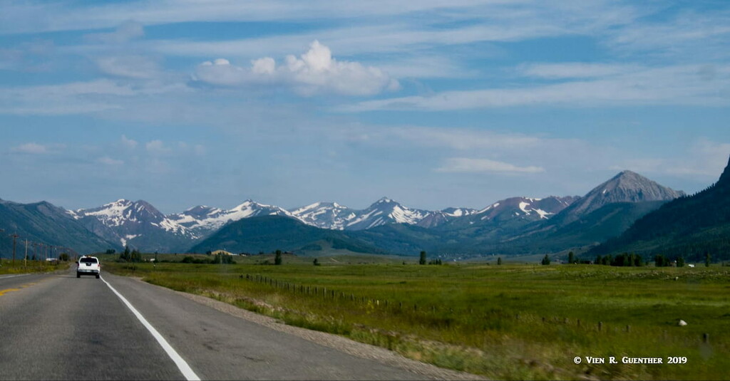
The geography of Gunnison County is quite different from other counties in the mountainous parts of Colorado. When driving across the county from east to west on U.S. Highway 50, the only highway that fully crosses the entire county in its southern segment, you will be impressed by rolling hills covered in sagebrush and various high-country grasses. It is only in the far distance that you will see the high mountains. In the middle of this stretch is the pleasant town of Gunnison.
The average or mean elevation in Gunnison County is 9,488 feet, certainly not as high as other counties in the Rocky Mountain region, ranging from a low of just over 5,900 feet at the North Fork of the Gunnison River to a high of 14,252 feet at the summit of Castle Peak which is also the highest in the Elk Range. That is a huge elevation difference indicating that there is a large range of terrain and ecosystem variations which can easily be translated into a variety of recreation types to be found here. In fact, there is so much to do in this varied county that a visitor will never get bored here, even if doing nothing more than visiting historic towns and sites. Here are a few of them:
Marble – This tiny town is renowned for its immense marble quarry. While this place has a population of only 134, it is so worth visiting, and it even offers a selection of lodges and other accommodations. A number of sites in town are listed on the National Register of Historic Places. Marble is famous for the Yule Quarry that began operations in the late 19th century. Stone cut out of the mountain here was used in construction of the Tomb of the Unknown Soldier and parts of the Lincoln Memorial in Washington, D.C., as well as other historic buildings around the United States. This quarry produced some of the finest marble ever quarried anywhere and is said to be of exceptional quality. It is even now still exported to Europe and Asia. The quarry was recently sold to the Italian group R.E.D Graniti S.p.A., which tells you something, since Italy itself is renowned for fine marble. At the edge of the little town is the scenic Beaver Lake with incredible views into the Elk Range beyond.
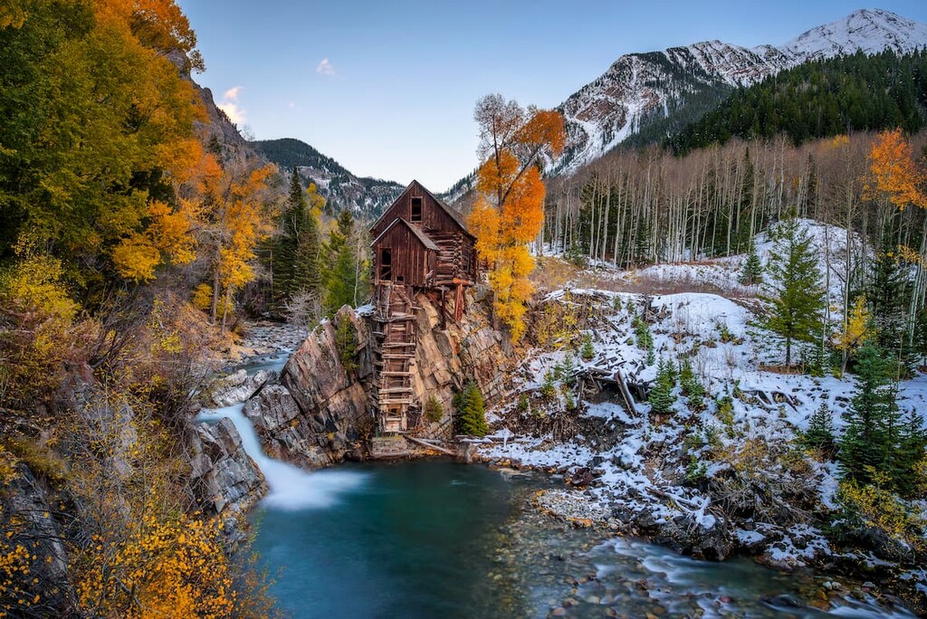
Crystal City - If you have a 4WD vehicle, and a bit of nerve, you can drive to the nearby historic mill at this ghost town on the upper Crystal River, photos of which are almost as widespread as those of the Maroon Bells. As with other ghost towns, this was a mining camp from 1881 to 1917 by which time it was mostly abandoned. There are still some buildings there, but its few residents only live there in the summer. Can’t get there in the winter very easily.
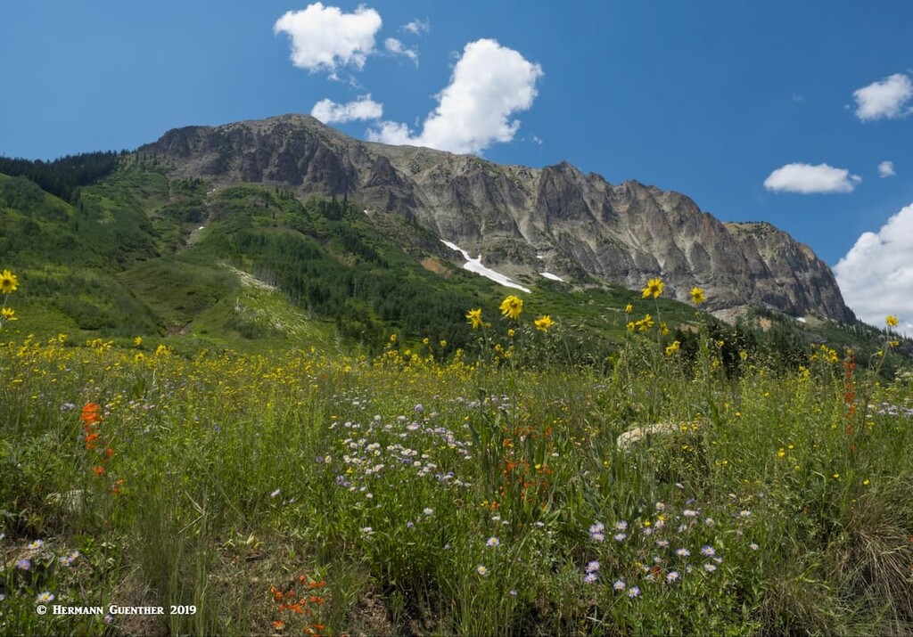
Gothic – This little town of 1,000 inhabitants back during the Colorado Silver Boom became a ghost town in the early 20th century. During its heyday, this little out-of-the-way place welcomed a number of dignified guests, including President Ulysses Grant (1880). In 1928, ten years after it was declared a ghost town, the site was purchased by a Dr. John Johnson who converted it into the Rocky Mountain Biological Laboratory, which specializes in the research on climate change, ecology, the study of marmots and lots more. During the summer, an average of 160 scientists, professors and students live in the former town. More than 1,500 scientific publications based on work conducted there have been published. You can drive a normal passenger car to and through the town site on a good gravel road – but not much farther. On the way you will pass along the foot of the mighty Gothic Mountain and its impressive cliffs. It’s worth doing if you have a little extra time, like maybe after a hike.
As far as other recreation sites to be found in this extensive county, just have a look at the following:
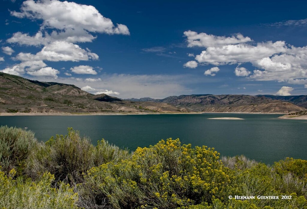
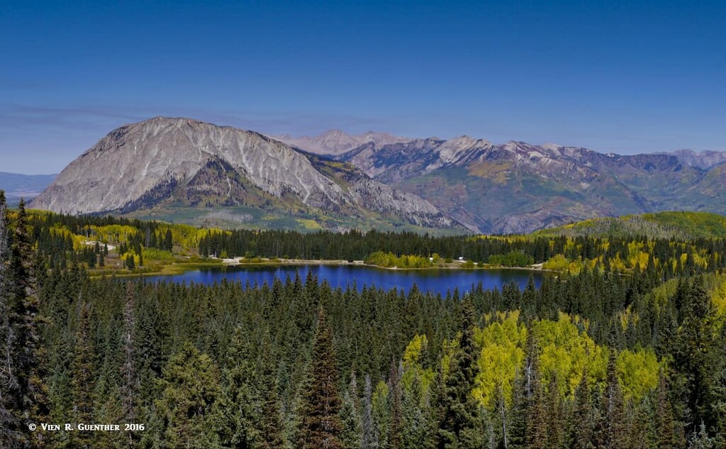
Curecanti National Recreation Area - Just to the west of Gunnison is the Blue Mesa Reservoir, the largest lake located entirely within Colorado (only the Navajo Reservoir, most of which is in New Mexico, is larger). The 390-foot-high dam was built on the upper Gunnison River in 1966 for generation of hydroelectric power. But the lake is part of the Curecanti National Recreation Area, managed by the National Park Service. This is a fisherman’s heaven, holding the largest Lake Trout and Kokanee Salmon fishery in Colorado. Most of the recreation sites by the lake can be accessed from US-50, although there are some remote facilities that can only be reached by boat or unpaved roads. There are three visitor centers, two marinas, and five boat launch facilities. The recreation area extends far beyond the lake to the west, all the way to the Black Canyon of the Gunnison National Park.
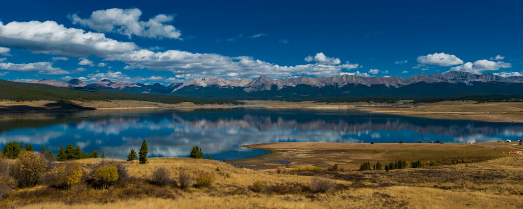
Taylor Park – About halfway between Gunnison and Crested Butte is a good paved road that winds its way through a canyon carved by the Taylor River. The road eventually emerges onto a high alpine basin known as Taylor Park, and the main attraction here is the Taylor Park Reservoir. This is a destination for lovers of water sports, camping, biking, hiking, horseback riding, rafting, kayaking, four-wheeling and many more. There are lots of camping sites, both along the river as well as in Taylor Park itself – many are developed campgrounds and many more are free, dispersed sites along many forest roads that lead through and out of the basin. There are boat rentals of all kinds, with fishing boats most common, though you can even rent large pontoon boats up to 26 feet long at the full service marina. If you just want to stay in a cabin or lodge, of which there are plenty here, and do some sightseeing, you can always drive the excellent gravel road up to and over Cottonwood Pass (elevation 12,126 feet) all the way to Buena Vista. The road east of the Continental Divide is paved and gives access to some fine hiking trails in the Collegiate Peaks Wilderness.
Crested Butte - This is the only major ski resort in Gunnison County. The historic town of Crested Butte is 27 miles north of Gunnison along State Highway 135, while the actual ski area and resort are another three miles further up the Gothic Road. Crested Butte is a former coal mining town and is now called the “Last Great Colorado Ski Town”. The Colorado General Assembly has also designated Crested Butte the “Wildflower Capital of Colorado”. An annual wildflower festival is held here every summer. Some great hiking can be found just outside the town limits and not much farther away to the north in the Raggeds Wilderness and the Maroon Bells-Snowmass Wilderness, which encompasses parts of the Elk Range.

There are 243 named mountains in Gunnison County. Castle Peak is the highest and Mount Gunnison is the most prominent. With so many mountains, of which three are fourteeners, it follows that there is lots of territory available for hikers and climbers to explore, and I can tell you that I have done just that, but by no means have I explored all of it. So here I speak partly from personal experience, though familiarity with much of the surroundings here helps me to better inform you. Now, I must state that many of the highest peaks in the county straddle the county lines and are available for exploration from trailheads outside of Gunnison County. Nevertheless, they are considered attributes of the county and are therefore counted among the many spectacular features to be explored here.
There are two national forests here – the greater part of the Gunnison National Forest is in this county, but also part of the White River National Forest finds itself here. More significant perhaps is the fact that seven wilderness areas find this county home – three of them contained entirely within county boundaries (West Elk, Fossil Ridge, Raggeds Wilderness Areas). Then you will also find parts of the Collegiate Peaks, Maroon Bells-Snowmass, Uncompahgre and Powderhorn Wilderness Areas in Gunnison County. This obviously presents a great expanse as well as variety of terrain to explore. We will not discuss all of them here in detail since they do not contribute much to the overall hiking potential of the county.
The West Elk Wilderness may be the fifth-largest in the state (176,172 acres), but it receives relatively few visitors mainly due to its lack of major peaks (no fourteeners) and the numerous alpine lakes that typically attract recreational users to other wilderness areas. Yet the volcanic ridges and long valleys offer many opportunities for extended expeditions on 200 miles of trails following creeks and ridge tops. The deer and elk herds numbering in the thousands attract crowds of hunters in late autumn.
The Powderhorn Wilderness lies partly in Gunnison County and partly in Hinsdale County. It is a seemingly endless, undulating plain of tundra, broken only by steep escarpments containing a few scenic lakes including the Powderhorn Lakes. It has been called the largest continuous extent of tundra in the lower 48 states. With elevations reaching 13,000 feet, this plateau affords panoramic views of the San Juan, Elk and Sawatch Ranges, though it is not a popular hiking destination and adds minimally to the overall county recreation experience. Yet it has its charms that would appeal to hikers wanting solitude and a wilderness experience unlike many others in Colorado. Perhaps the most striking feature of this remote wilderness is Cannibal Plateau – named for Colorado’s famous man-eater, Alferd Packer, who has gone down in history for having dined on five friends while lost here during the winter of 1874 (see this article).
A small segment of the Uncompahgre Wilderness is in Gunnison County and there are some hiking and horse trails here. But the best part of this wilderness is in adjacent Hinsdale County and I refer you to the links in this paragraph for much more information about this wilderness.
There are lots of fine hiking opportunities to be found in the area around Crested Butte. Some are right in or near the town and others are a short, scenic drive away. All of the following hikes can be done as easy day-hikes from your place of residence in or near the town. Let’s check out a few of them and if you like what you see, also follow this link for more information and photos.
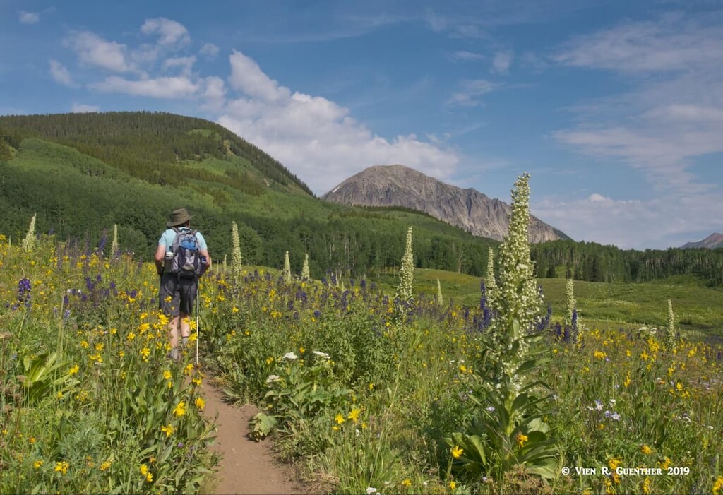
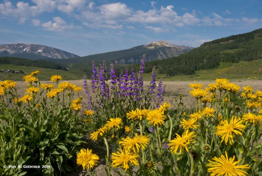
Snodgrass Mountain Trailhead – Just adjacent to the Mount Crested Butte ski area is a major trailhead that is worth exploring. Perched right in the middle of fields of wildflowers, Snodgrass Mountain is by no means a dominant feature of the landscape, yet it is a popular hiking venue. There are several trails here, some of which are open to bikers. We decided to do a loop hike here in order to experience the amazing stands of wildflowers. While we did not go all the way to the summit, which would be quite easy, we wanted to stay in the lower zones in order to experience flowers that stood up to five feet tall. Very unlike any other wildflower displays we have ever seen. Plus, this hike offered some stunning views of the surrounding mountains as well as the ski area itself. Not a strenuous hike but surely worthwhile.
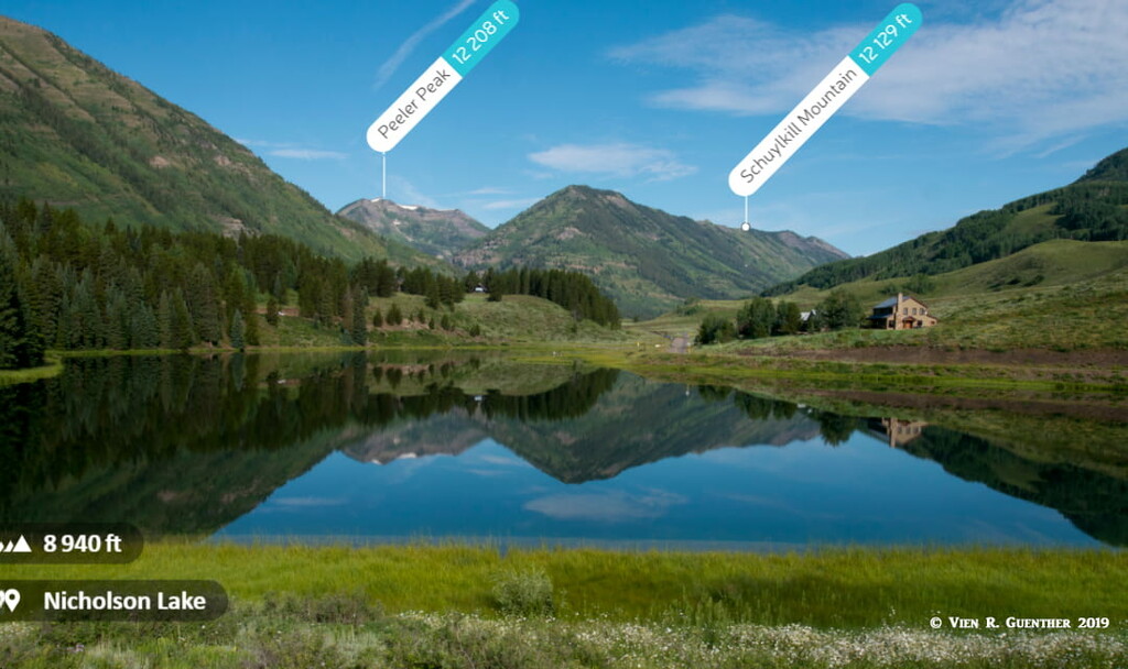
Oh-Be-Joyful Trailhead – Just to the northwest of Crested Butte along County Road 734 is Oh-Be-Joyful Trailhead. How it got its name I am not sure, but when you hike this wonderful trail into the Raggeds Wilderness, you will surely experience the joy of hiking in a pristine wilderness. Along the road getting there, you will pass by the beautiful Nicholson Lake – be sure to stop and photograph the grand view across the lake toward Peeler Peak framed in the valley that you will shortly be hiking, or toward Whetstone Mountain in the opposite direction. There’s a good chance that you will get nice reflections early in the morning.
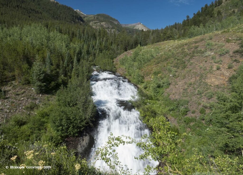
When you get to the trailhead, you will find a campground here, right beside the Slate River, which you will have to cross to get to the trail. If you have a high-clearance vehicle you can drive across it after mid-summer when the water level drops after the spring runoff. If you don’t – we had our car, not our 4WD truck – you are out of luck. Unlike many such places, this trailhead does not have a footbridge. What to do? Take your boots and socks off and wade across. But don’t take too long, that water is COLD. But it is all worth it for this is a pleasant hike along the Oh-Be-Joyful Creek, where you will be in a pristine valley sporting many waterfalls and cascades.
Here you can go as far as you want, depending on how much time you have. This is a long valley and the further you go, the more mountain scenery opens up. We turned this into an 8-mile hike since we still had other things to explore in the Crested Butte area. But now to get back across the river to our car.

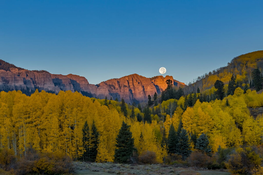
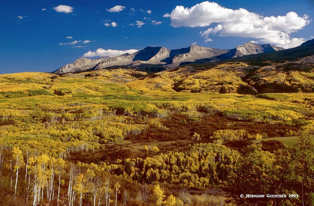
Three Lakes Trail – The road from the Paonia State Park on SH-133 in the northwestern corner of Gunnison County to Crested Butte is known as the Kebler Pass Road (County Road 12). It is not open in winter but when it is, you will see one of the largest stands of aspen trees in the country. This immense cluster of golden aspens is reputed to be one of the largest living organisms in the world, on a par with the Great Barrier Reef. This makes simply driving this road in late September or early October a divine pleasure by itself. Now imagine going hiking here.
About halfway to the summit of the pass from the west end is a short spur road that will take you to a campground and the trailhead to the popular Three Lakes Trail. You can drive to this spot in an ordinary passenger car. This easy loop hike to three different lakes is close to, but not in, the Raggeds Wilderness Area. The largest lake called Lost Lake Slough is close to the campground. Here is where you begin the hike and you can take it in either direction – clockwise is my preference because you will be walking directly into the grand views in the open areas. Marcellina Mountain and the Raggeds Wilderness form a magnificent vista from here. The length of this hike varies by how you do it. If you just go to the two upper lakes (Dollar lake and Lost Lake) the total length of your hikes will be only about 3.5 miles. But if you want to go around those two lakes, which of course is necessary for stunning views, you will add about one mile to your hike. Total elevation gain is only about 600 feet, thus making this hike suitable for children and less-than-totally-fit casual hikers. A great idea if you only have time for a half-day hike.
One would not normally think of accessing the great hiking areas of this wonderful wilderness from Gunnison County, and for the most part, that would be correct. Most of the fine hikes here are found in the Pitkin County parts of the wilderness. Those areas are highly popular and spectacular. But there are some ways to get into this wilderness from Gunnison County. Let’s check out a couple of them.
Lead King Basin Trailhead – This fine trailhead and hiking area is not accessible by passenger cars – no way! You have to leave civilization at the town of Marble and then you have two options to get to the trailhead. One is by way of the ghost town of Crystal City (see above) from where you follow a rough road along the North Fork of the Crystal River. The other way is to take the Lost Trail Road from Marble across a high ridge involving many switchbacks. This road is not quite as rough but still requires 4WD and can be impassible when it is wet and muddy. I have done both and prefer the latter when it is dry. In either case, the trail to Geneva Lake and beyond starts here. Due to the remoteness in this part of the Elk Range, it is best to plan this as a multi-day backpack trip, with lots of good places to set up camp, especially at Geneva Lake. From there you can take day hikes to other destinations but the dominant view from the lake is toward Snowmass Mountain looming not far above.
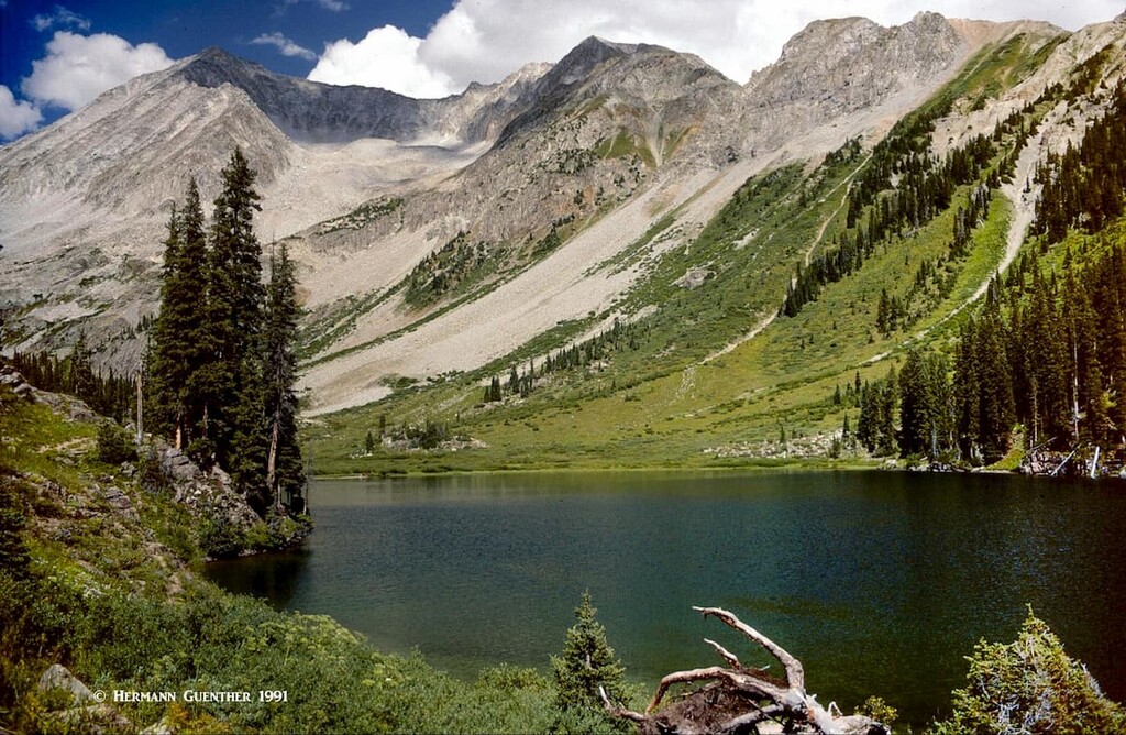
While camped here, you can continue hiking up the valley to Little Gem Lake and Siberia Lake (very aptly named). An alternative day hike would be to continue on the Geneva Lake Trail across Trail Rider Pass and on to Snowmass Lake – where you will see lots more people than at Geneva Lake. This is the best place from which to climb Snowmass Mountain, though it could be climbed from the Geneva Lake side. If you prefer the latter approach, you must climb past Little Gem Lake and then scramble up the west face of the mountain. This is the shorter approach but will require some serious route finding if you want to keep the difficulty at Class 3.
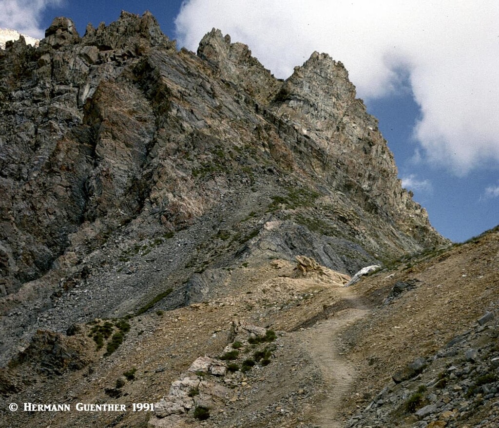
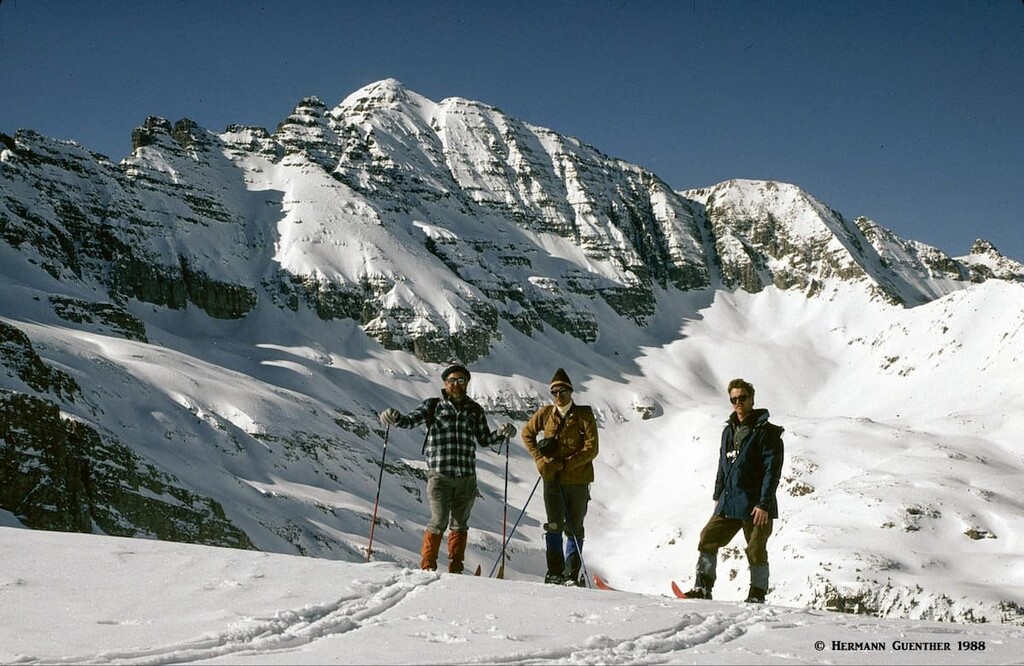
Pearl Pass Approaches – You need to have a 4WD vehicle with high clearance to do any hikes here. The Pearl Pass Road goes from Crested Butte to the Ashcroft ghost town not far from Aspen on the other side of the Elk Range. About nine miles up to Pearl Pass Road you will reach a trailhead for the Twin Lakes. This six-mile round trip hike with about 1,600 feet of elevation gain is a great experience and not highly trafficked. If you continue over Pearl Pass and get to a basin where there are two small huts (Tagert and Green-Wilson), you can find a trailhead for climbing Castle Peak, the highest mountain in Gunnison County. In order to find it, you must continue driving up Montezuma Basin to the end of this relentless road where you will find the trailhead at 12,800 feet after passing the ruins of the Montezuma Mine. This approach is the easiest route up any of the fourteeners in the Maroon Bells-Snowmass Wilderness. I have only been in this area on some winter backcountry ski outings, so there were no vehicles on the Pearl Pass Road – and my friends and I had that entire area to ourselves for four days each time (see photo below).
Powderhorn Lakes Trailhead – Though these scenic lakes are in adjacent Hinsdale County, they are most easily reached from this trailhead in the southernmost part of Gunnison County. The trailhead is easily reached from SH-149 north of Lake City via a decent ten-mile dirt road (County Road 58), somewhat rough but generally suitable for ordinary passenger cars. Since these lakes are easily reached by a four-mile trail (one way distance), they are actually the most popular destination in this wilderness. They sit at treeline in a basin below the Calf Creek Plateau and are surrounded by broken walls of volcanic rock. From the north side of the upper lake you can follow a trail to the plateau above and to Cannibal Point for great views.
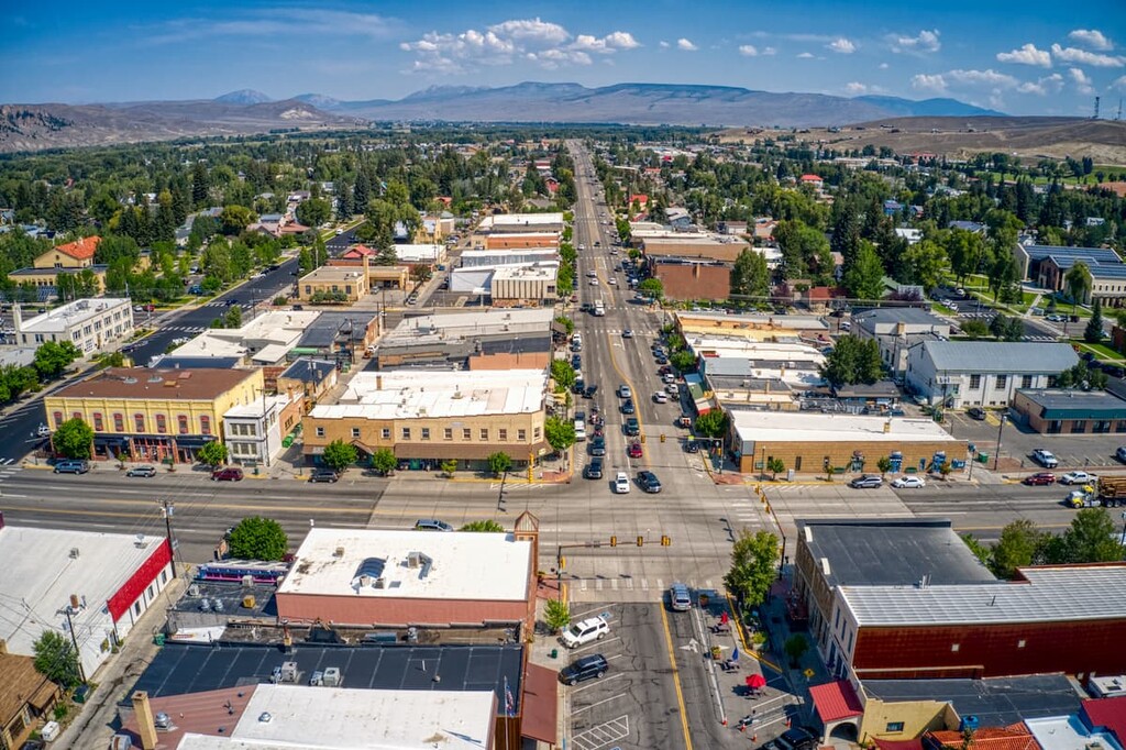
Gunnison, as so many towns in Colorado, got its start during the statewide mining surge of the 1870s. After the railroad’s arrival in 1880, and establishment of the cattle industry, the town continued to grow steadily. Realizing that farming was not a viable industry due to low rainfall and a short growing season given the high elevation and alpine environment, local farmers turned to ranching and began breeding cattle. To do this effectively, ranchers had to clear the land and level the terrain for grazing purposes. This involved construction of irrigation ditches to water the fields for growing hay for their horses and cattle. When you drive near and through the town, you will still see ample evidence of ongoing ranching activity. Based on the 2019 population estimate, there are now 6,640 residents in the city. Because of the town’s location, the many valleys converging at this location funnel extremely cold air which settles right in Gunnison. This makes this town one of the coldest places in the United States in winter. Though the town does not receive much snowfall, it is not uncommon for snow to be on the ground from November to April. Gunnison is home to the Western Colorado University.
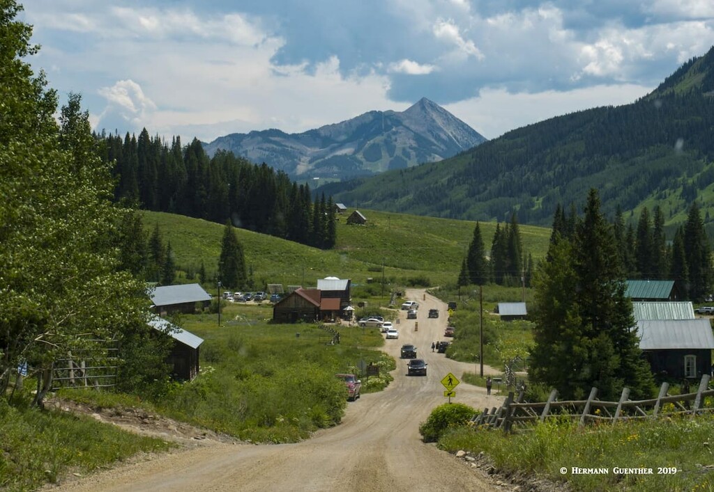
Most people think of Crested Butte as a single entity. But in fact, there are really two towns, each with its own municipal designation – the town of Crested Butte and the town of Mount Crested Butte, the latter being home of the Crested Butte Mountain Resort. No matter what you want to call it, this is a wonderful place to spend some time exploring - hiking, biking and skiing. As you drive north from Gunnison on SH-135, you will soon become aware of a dominant mountain in front of you. This is the peak known as Crested Butte – just to add to your confusion. The ski area sits on its slopes. It is the sixth most prominent mountain in Gunnison County, acing out many far higher peaks in the surrounding mountains. Even the three fourteeners in the county do not match its prominence.
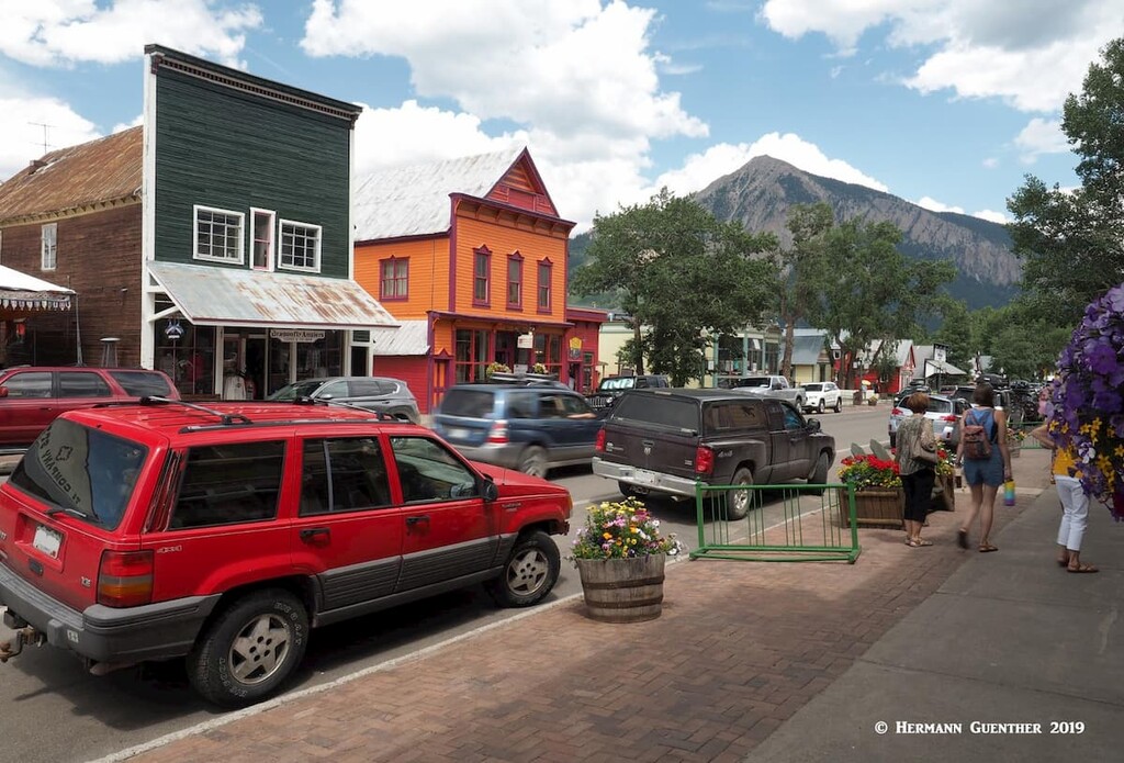
The town of Crested Butte, with a 2019 population of 1,723 inhabitants, got its modern start during the mining days of the 1860s and 1870s as so much of the Rocky Mountain West. Prior to that, the valley where the town is located was once used as a summer residence of the native Ute Tribe. But they were quickly displaced when European-Americans displaced them. The first white people to explore the valleys were trappers and then surveyors. The current grid-like layout of the town’s streets, especially the historic center, is a holdover from those days. While many smaller towns failed after the mining bust, Crested Butte survived because it served as a supply base for the surrounding area. Today, of course, the town maintains a prominent role in support of tourism and especially skiing. The historic part of town is a pleasure to explore, with its many restored Victorian buildings, restaurants, inns, shops and boutiques. Crested Butte is known as the Wildflower Capital of Colorado. A visitor would do well to spend some time here regardless of the time of year.
Mount Crested Butte is the other town. It is home to the Crested Butte Mountain Resort and its 2019 population is estimated at 876 people. As opposed to the town of Crested Butte three miles downhill, this municipality has the look of a modern ski resort, lacking the historic charm of its neighbor. Modern homes, hotels and condominiums dot the hillside below the ski area. But one must not belittle its status – it is a very scenic place and offers lots of opportunities for recreation. Having the mighty Elk Range as a backdrop does not hurt either.


