
Scan the QR code and open PeakVisor on your phone
There are 33 named mountains in the Collegiate Peaks Wilderness Area of the Sawatch Range. The highest and most prominent mountain is Mount Harvard. Numerous high peaks dominate this pristine area and its easy access make this wilderness a favorite for recreation both for Colorado residents as well as for visitors from all over the United States and abroad. About 40 miles of the Continental Divide snake across this expansive wilderness. It has been said on various websites that the Divide reaches no higher point, between the Isthmus of Panama and the Arctic Circle, than in the Sawatch Range. That is incorrect - the highest point on the Divide is Grays Peak, located in the Front Range of Colorado.
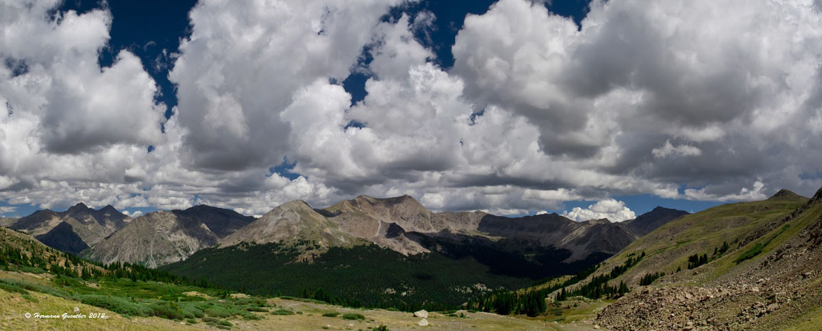
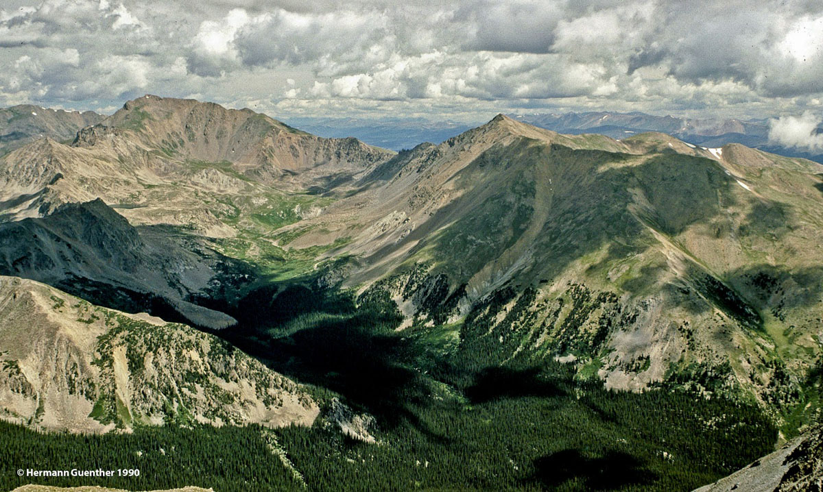
Collegiate Peaks Wilderness from Browns Pass
The Collegiate Peaks Wilderness is located in the heart of the Sawatch Range in central Colorado. It is a hiking paradise. The wilderness is in itself not a specific range of mountains but rather an area of natural beauty and value that is best defined by the author of the Wilderness Act of 1964, Howard Zahnister: "A wilderness, in contrast with those areas where man and his own works dominate the landscape, is hereby recognized as an area where the earth and its community of life are untrammeled by man, where man himself is a visitor who does not remain." There are several government agencies that administer the 765 wilderness areas in the United States - U.S. Forest Service, U.S. National Park Service, U.S. Fish and Wildlife Service and the U.S Bureau of Land Management. As of 2016, this encompassed a total of 109,129,657 acres, or an area larger than the state of California.
The Collegiate Peaks Wilderness was designated by the United States Congress in 1980 pursuant to the Wilderness Act and encompasses parts of three national forests - San Isabel, White River and Gunnison. It is thought that this wilderness has the highest average elevation of any wilderness in the lower 48 states. It includes eight fourteeners - Huron Peak, Missouri Mountain, Mount Columbia, Mount Oxford, Mount Yale, Mount Belford, La Plata Peak and Mount Harvard. Of the five "Collegiate" peaks - named after famous universities - four are included in the wilderness. The fifth, Mount Princeton, does not qualify as wilderness for reasons discussed later. Mount Harvard is the third highest summit in Colorado and, as a result, is also the third highest mountain in the Rocky Mountains of North America.
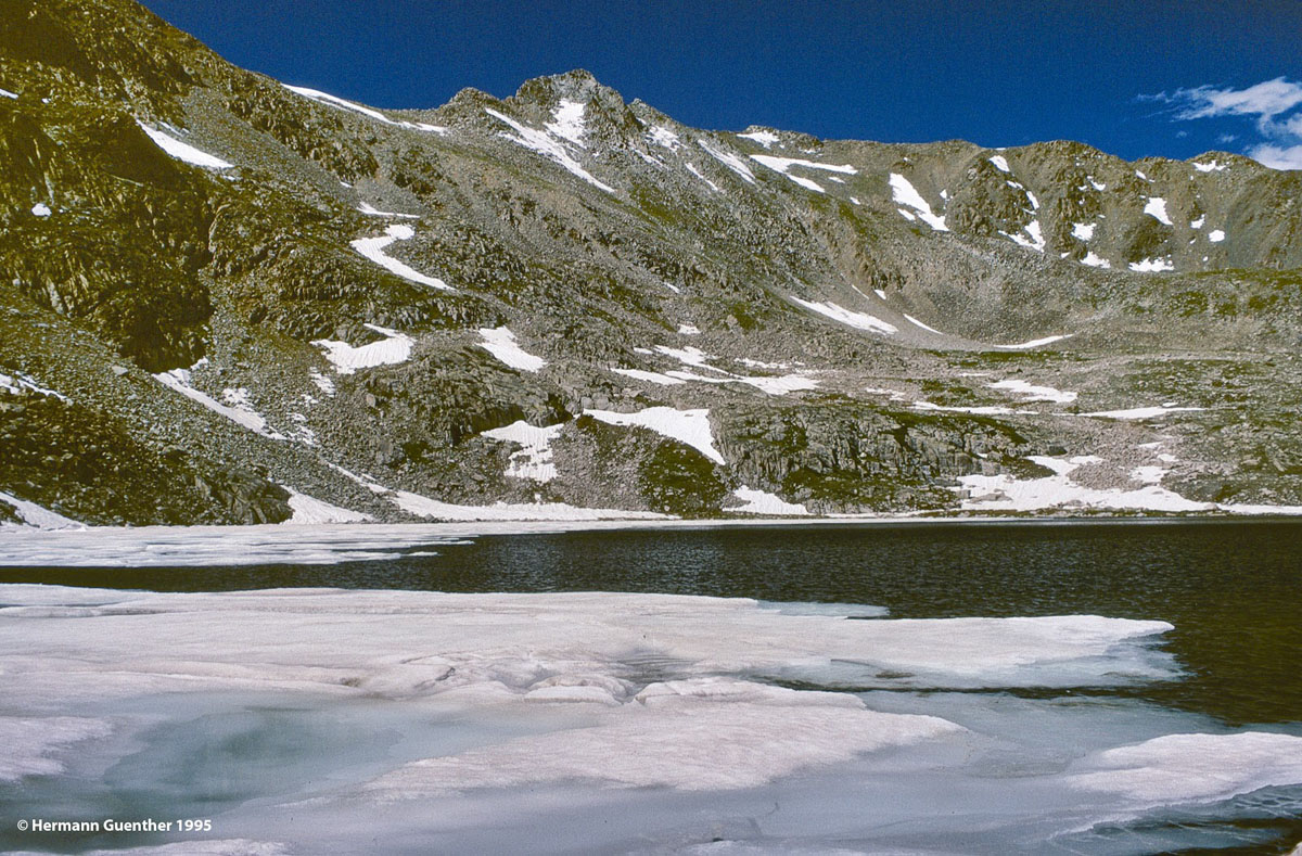
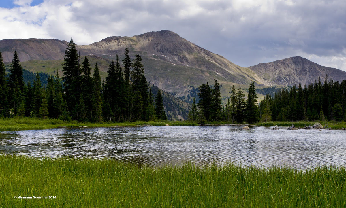
Bear Lake, Mount Harvard
Since roads are not permitted in a wilderness area, the boundary line of this wilderness has deep indentations which are a legacy of man's quest for gold and other valuable elements which are still being sought to this day just outside of the wilderness. These boundaries are largely defined by old mining roads which are now used to gain access to the many trailheads into the wilderness. This is also why Mount Princeton is not actually within the wilderness - there are roads (rough, 4WD roads mainly) far up onto the mountain, some of which are used to gain access to still-active mining claims. Such activities are not permitted in a wilderness. In fact, to be designated wilderness, all activities involving mechanized or motorized equipment are banned within the boundaries. This includes even mountain bikes or hang-gliders.
Yet, because Mount Princeton is a "Collegiate" peak, it is often associated with the others and visitors may not be aware of its status. After all, the scenery and challenge as a climber's mountain are the equal of the other high peaks that are in the wilderness. But visitors should be reminded that if they are seeking a true "wilderness" experience, then Mount Princeton cannot satisfy that demand.
With an area of 167,584 acres of territory, the Collegiate Peaks Wilderness has no shortage of terrain to explore and there certainly are miles of maintained trails and routes to many of the summits, including the eight fourteeners that are contained within the wilderness area. There are more than a dozen trailheads that help to disperse the crowds that visit this area. For those seeking some semblance of solitude, the trails in the White River National Forest portion of the wilderness lead to lovely alpine lakes and expansive bowls full of wildflowers and wildlife, thus ensuring a much quieter environment that what is found closer to the high peaks to the east. These are mainly accessible from Highway 82 and Lincoln Creek Road east of the summit of Independence Pass, and therefore on the Pacific watershed side of the Continental Divide. But the main and most popular trails are all to be found east of the Divide and are thus in the Arkansas River basin. And they are all reached from U.S. Highway 24 and the various county and forest roads that emanate from it.
This road is found about 15 miles north of the center of Buena Vista. This gravel road leads for 12 miles from U.S. Highway 24 to the historic town site of Winfield. It is possible to drive beyond this point but is not advisable for regular passenger vehicles as the road gets progressively more rough. About eight miles in along this road is the important Missouri Gulch Trailhead at an old town-site known as Vicksburg.
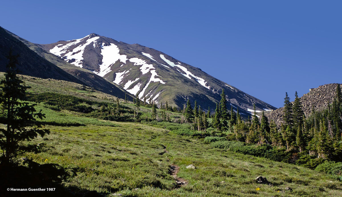
Missouri Gulch, Mount Belford
This peasant but steep trail provides access to three fourteeners - Mount Belford and Mount Oxford, as well as Missouri Mountain. Just about a half mile past Winfield toward the west is the West Winfield Trailhead. This provides the easiest ascent of La Plata Peak, the fifth highest mountain in Colorado. Also from Winfield it is possible to drive another two miles to the Lake Ann Trailhead, which provides access to a very enjoyable hike to a lovely high basin which holds the impressive Lake Ann as well as two smaller unnamed ponds in a plateau called Harrison Flat. The trail offers some stunning views of the Three Apostles, high thirteeners that will out-challenge many fourteeners. But before reaching this trailhead, closer to Winfield, is the South Winfield Trailhead, where the "standard" route to the top of Huron Peak begins. At 14,003 feet, this is the second-lowest of Colorado's fourteeners. The road from this trailhead to the Lake Ann Trailhead is not suitable for anything but high-clearance/4WD vehicles.
The Three Apostles - Lake Ann Trail
Pine Creek Trailhead - About 13 miles north of the center of Buena Vista is County Road 388 which leads about three miles to the popular Pine Creek Trailhead. The first half of this road is suitable for cars, but the rest of the way to the trailhead requires 4WD. The Pine Creek Trail leads into Missouri Basin from which it is possible to climb Mount Oxford to the north and Mount Harvard, the state's third-highest mountain, on the south side, the latter being a very stiff climb for sure. Other diversions into the wilderness are possible from this trail but will surely require lengthy multi-day hikes.
North Cottonwood Trailhead - This highly popular trailhead is just over eight miles from the center of Buena Vista. It provides access to trails that penetrate deep into the wilderness. The main trail diverges into the Horn Fork Trail to Bear Lake, which in turn provides the most common approaches for climbing two popular fourteeners (Mount Harvard and Mount Columbia), and the Kroenke Lake Trail, which provides an alternative approach to Mount Yale versus the standard routes. For non-climbers, each of these two trails takes hikers to two wonderful basins which are worthy of the effort to get to them.
Cottonwood Pass Road (County Road 306) - This fine paved road leads from Buena Vista to the 12,126 foot high Cottonwood Pass on the Continental Divide (where the pavement ends). This road provides easy access to several trailheads that in turn offer several routes deep into the wilderness. Closest to town is the Avalanche Trailhead which accesses the 567-mile Colorado Trail that follows in or adjacent to the wilderness along its east boundary in this area. Further west along Road 306 is the popular Denny Creek Trailhead, which provides access to what is becoming the most popular route to climb Mount Yale. But this trail also diverges to provide some wonderful hiking experiences to the relatively little-visited Hartenstein Lake as well as to Browns Pass. Both of these destinations are worthy of visiting as moderate day hikes. The views across Hartenstein Lake toward Mount Yale are epic, not to mention the views, north and south, from Browns Pass (12,020 feet). From the pass, it is possible to explore miles of trails, including the vast Texas Creek area, that lead into parts of the wilderness that are rarely seen by casual hikers since distances are so long that overnight backpacking is necessary.
Mount Yale, Hartenstein Lake
Lake Creek Trailhead - This trailhead, located on Highway 82 just under 15 miles west of U.S. Highway 24, or 29 miles east of Aspen via Independence Pass, is not for casual hikers. It is for climbers who want to ascend La Plata Peak, fifth highest mountain in Colorado, via alternative routes to the standard route from Winfield (see above). There are two routes to climb this mountain from here, and route-finding is a bit of a challenge for both routes. The northwest ridge route is a Class 2 hike involving 4,300 feet of elevation gain. But it is the second route that is of serious interest to experienced mountaineers - the Ellingwood Ridge. Elevation difference from base to summit is the same as via the northwest ridge, but the elevation gain is an additional 700 feet - at least. This jagged ridge with countless ups and downs should not be underestimated, and certainly not be undertaken by even moderately experienced hikers. This is serious business and can get any less than well-seasoned climber into trouble. Stamina and route selection ability along the ridge are essential.
The Collegiate Peaks Wilderness is easily accessible from only two major towns along its eastern edge, though there are several smaller settlements that can provide some tourist services. Without question, the town of Buena Vista serves as the most convenient gateway and staging venue for exploring most of the wilderness by virtue of its proximity to the major trailheads. But one should not rule out making the highest incorporated city in the United States (elevation 10,152 feet), Leadville, a base for exploring this grand wilderness area. A bit more removed from most of the attractions in the wilderness is the posh resort of Aspen. It is not reasonable to consider this playground of the rich and famous a viable staging resort for exploring the bulk of the wilderness for more than five or six months of the year - heavy winter snows close the shortest route between Aspen and Buena Vista for all that time. But Aspen is handy for those who want to explore the less popular trails that can be found west of Independence Pass.
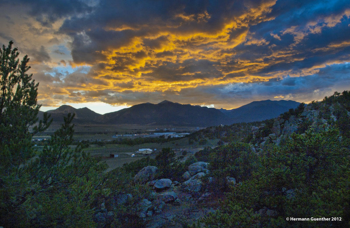
Buena Vista sits centrally located on the east side of the Collegiate Peaks Wilderness, thus ensuring it a significant role in mountain recreation. Sitting immediately across from the Collegiate Peaks, this charming town of less than 3,000 inhabitants provides most of the amenities visitors could want. It is conveniently located at the junction of the two major north-south highways in central Colorado - U.S. 285 and U.S. 24. Though Buena Vista has a small regional airport, there is no scheduled airline service available here. But the town can be easily reached on good roads in just over two hours from Denver, thus making it a convenient destination for visitors from out of state. For accommodations, the town offers a wide range from simple cabins to B&Bs to branded hotels. There is no problem finding restaurants and supermarkets. There are plenty of camping opportunities nearby as well.
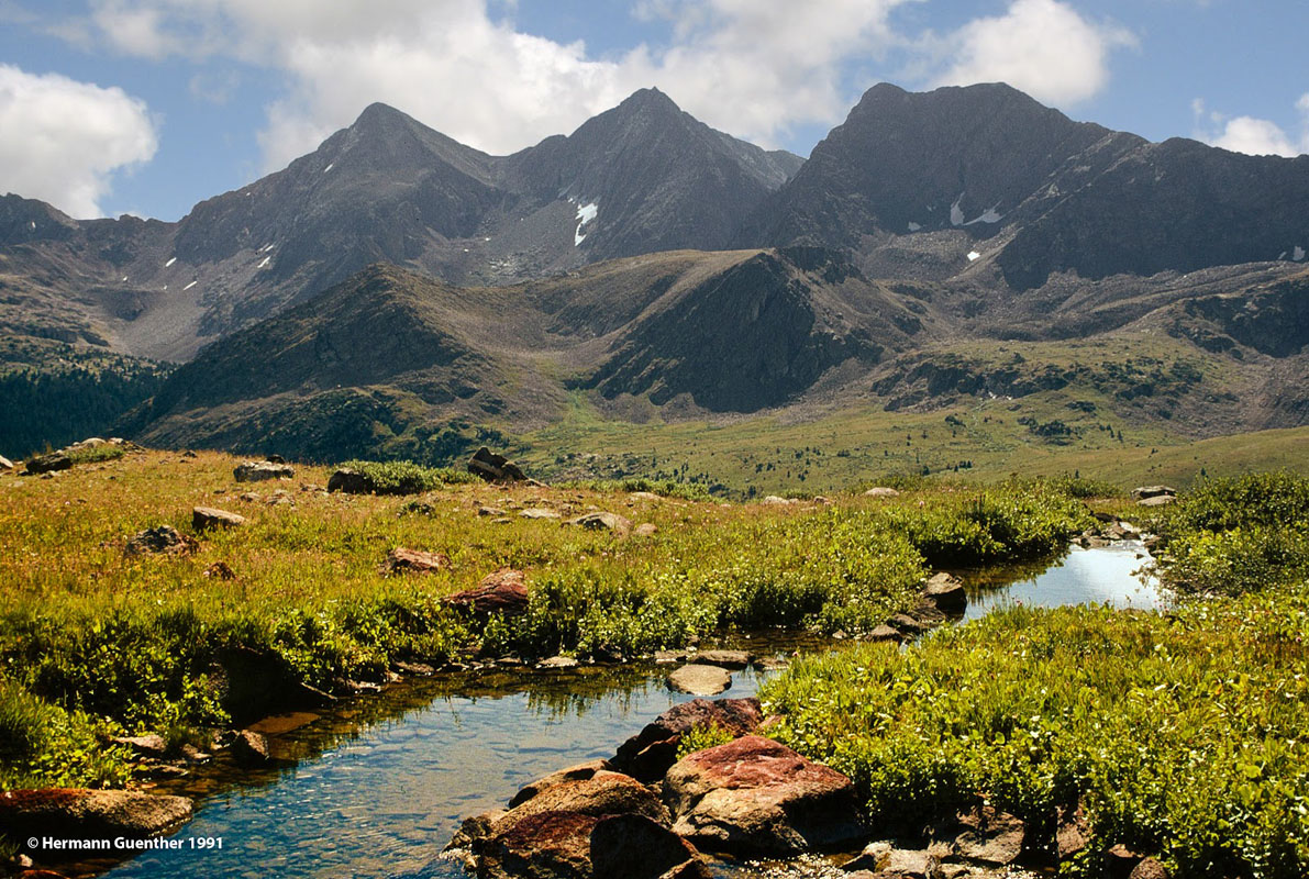
Buena Vista - Mount Yale and Mount Columbia (r)
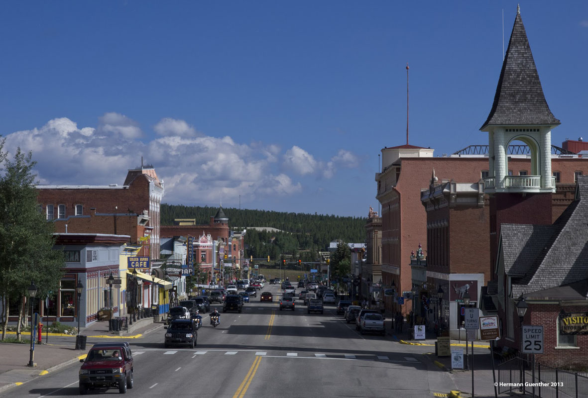
Situated at an elevation of 10,152 feet, Leadville is the highest incorporated city in the United States. Lake County Airport just outside of town is the highest airport in North America, at 9,924 feet. A general aviation facility, it does not have scheduled passenger service, which was discontinued a number of years ago. Historically, Leadville was a major silver mining center and in the late 1890's was second in population only to Denver. Today, it retains its historic charm and contains many historic buildings and sites. The two highest peaks in the Rocky Mountains of North America (Mounts Elbert and Massive), though not part of the Collegiate Peaks Wilderness, can be easily seen from most parts of the town. Needless to say, at this elevation Leadville is a cold place, but that does not deter visitors from enjoying the many recreational activities available here. At the head of the Arkansas River Valley, Leadville is tucked between two major mountain ranges - the Sawatch and the Mosquito Ranges - which makes the town a handy base for mountaineering nearby. Since Leadville is only 35 miles from Buena Vista, and even less from some of the major trailheads in the Collegiate Peaks Wilderness, this interesting town is easily a convenient place to use as a base for excursions into the wilderness. There are adequate accommodations and restaurants, some with an “Old West” ambiance, available in and near the town.
Leadville
Who has not heard of Aspen, Colorado? It started as a silver mining town in the late 1800's and was highly successful until 1893 when the silver market collapsed. The town was so named because it is surrounded by forests of Aspen trees, which in the autumn exhibit an impressive display of gold color. This is the only town in the vicinity of the Collegiate Peaks Wilderness that has a major airport with scheduled airline service. Aspen is known for high-end lodging, restaurants, boutiques and many celebrities (who fly into Aspen in their private jets). While Aspen is about 60 miles from Buena Vista, and less to some of the key trailheads in the wilderness, it is not suitably situated when it comes to the long winter months when that distance can easily triple because of the long detour drivers would have to make when Independence Pass is closed. Therefore, Aspen's viability as a "nearby" resort in terms of a base for exploring the wilderness is questionable. But it is mentioned here simply because it is the one resort much of the world has heard of.
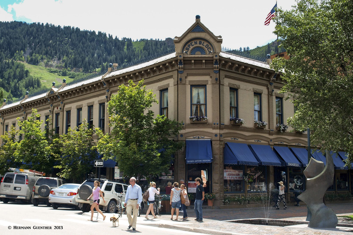
Aspen


