
Scan the QR code and open PeakVisor on your phone
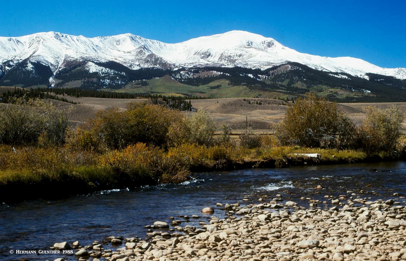
The San Isabel National Forest (SINF) is located in south-central Colorado and encompasses 169 named mountains of which the highest and most prominent is Mount Elbert, which is also the highest peak in the Rocky Mountains of North America and therefore the highest mountain in Colorado. The forest contains 19 of the state’s 53 fourteeners, more than any other National Forest, as well as parts of the Sawatch Range, Mosquito Range, the Collegiate Peaks, Culebra Range and the Sangre de Cristo Range. Seven designated wilderness areas lie in the SINF, four of which extend into adjacent National Forests, and two onto land managed by the National Park Service and the U.S. Fish and Wildlife Service.
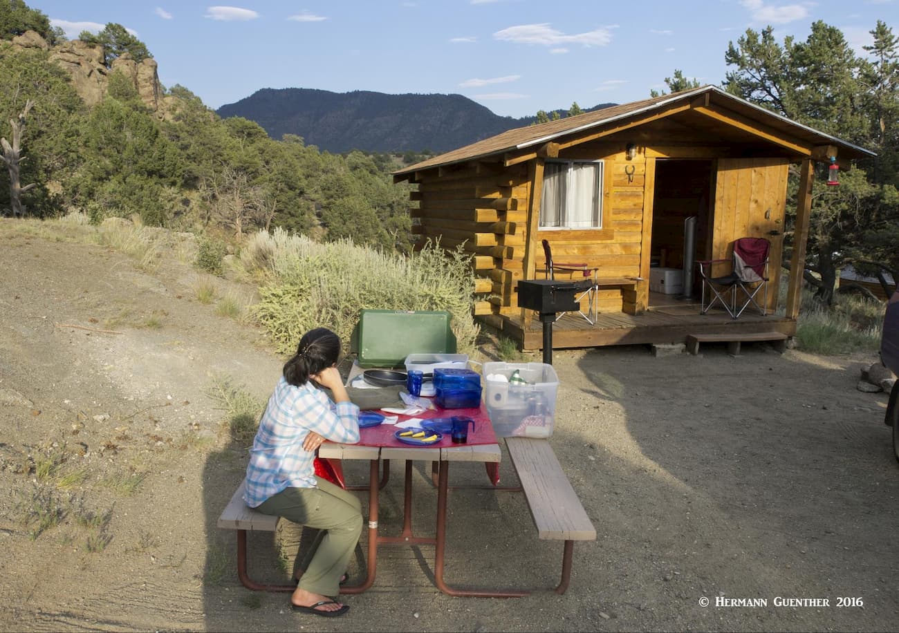
The forest is quite spread out in different segments and consequently occupies parts of eleven counties. This forest offers a great variety of recreational activities, from very benign to high-adrenaline. There are many campgrounds from which to base your outdoor adventures, from water sports, to fishing to hiking and, for those who are up to it, climbing some of the state’s highest and most forbidding terrain. There are also several major towns for visitors to base themselves if they prefer less rustic accommodations. For those who might like a tradeoff between a hotel room and a tent, there are many places where you can stay in a cabin – we have done that often and find that approach a nice alternative to camping.
The northern segment of the forest is divided into an eastern and western part, with the Arkansas River Valley running conspicuously between them. The western part borders on the Gunnison and White River National Forests, while the eastern part shares a border with Pike National Forest. The southern segment is likewise separated into eastern and western parts although much further apart, with the dividing geographic feature being the Wet Mountain Valley. The western part shares a boundary with the Rio Grande National Forest, while the eastern part extends well into the foothills zone and even reaches almost to the Great Plains. In addition to these segments, there is one small straggler of the forest way to the south, isolated almost near the New Mexico border, encompassing part of the Culebra Range as well as the magnificent Spanish Peaks.
There is no dearth of places to go hiking in the SINF, not the least of which is climbing the highest summit in the entire Rocky Mountains of North America – the gentle giant known as Mount Elbert. But with a total of 19 fourteeners from which to choose, you can be assured of hikes and climbs that are far more challenging and dangerous than Elbert. But peak-bagging is not essential to enjoying the great outdoors the forest has on offer. There are many miles of wonderful hiking trails to scenic alpine lakes and mountain passes that require no more than a moderate level of fitness and a desire to witness nature at its best.
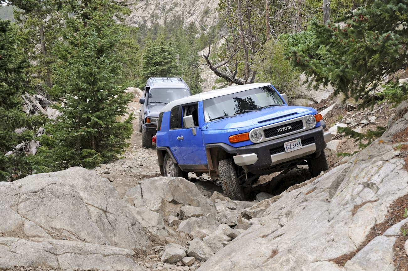
And then there are other wonderful recreational destinations – lakes and rivers with excellent fishing, boating and rafting. The famous Arkansas River, a short section of which is within the forest boundary, although much of it is constantly in sight of the forest, is renowned for exciting river rafting. Also, over 100 miles of the river is designated a Gold Medal River affording exceptional trout fishing. It is the longest stretch of such designated waters in the state. If four-wheeling is your cup of tea, there are plenty of jeep trails to challenge even the most addicted aficionados of this motor sport. You can drive your 4WD high up on the slopes of several fourteeners outside of wilderness areas.
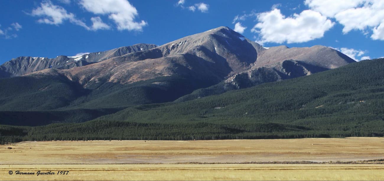
About 12 miles south of Leadville, on Forest Road 110 are two trailheads in close proximity to each other. They both afford the most direct access to the two highest mountains in the Rocky Mountains of North America – Mount Elbert on the south side and Mount Massive on the north side respectively. The two trails are both considered relatively easy and are the most popular routes to the two summits, although the round trip distances are quite different – 13.4 miles for Massive and 9 miles for Elbert. The total elevation gain for both is almost identical. The Mount Massive Wilderness is located in this area, though it has few trails other than the Mount Massive Trail and the Continental Divide National Scenic Trail.
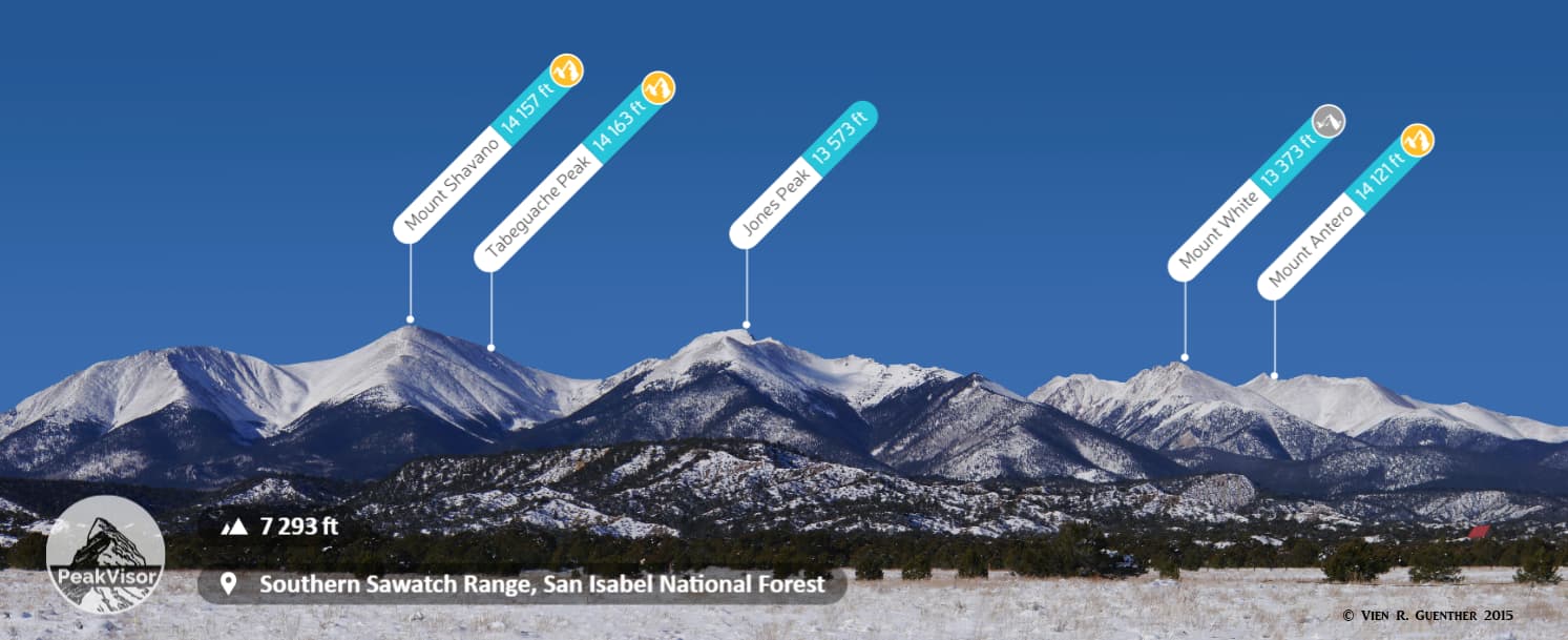
Much of the northern segment of the SINF is easily accessible from a number of trailheads within a short drive of the centrally-located town of Buena Vista. This includes all of the Collegiate Peaks Wilderness with its eight fourteeners. Five of these can be reached from the Clear Creek Road (Forest Road 390), about 24 miles north of town on US-24. Along this gravel road, which is mostly suitable for passenger cars, you will find the Missouri Gulch Trailhead which will take you to Mounts Belford and Oxford, as well as Missouri Mountain. If you want to climb all three of these fourteeners in combination, it would be a very tough day of 14.5 miles and 7,400 feet of total elevation gain. Even if you don’t include Missouri, you will still have a hike of 11 miles and 6,000 feet of total elevation assuming you return the way you came. You will summit Belford twice on these hikes.
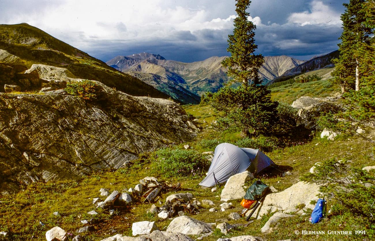
Near the end of the Clear Creek Road are the Winfield Trailheads, which provide trail access to two more fourteeners – La Plata Peak and Huron Peak. Depending on how far from the old town site you want to park will determine whether or not you can drive your passenger car to the actual trailheads. While 4WD is not necessary, a high clearance vehicle will do well enough. Both mountains are on opposite sides of the valley so they are not climbed together. These trailheads provide the most popular ascent routes for these peaks. Also, about 2.5 miles south of Winfield is the trailhead for the hike to Lake Ann, a popular and easy day hike, although I have camped above the lake for some additional adventure.
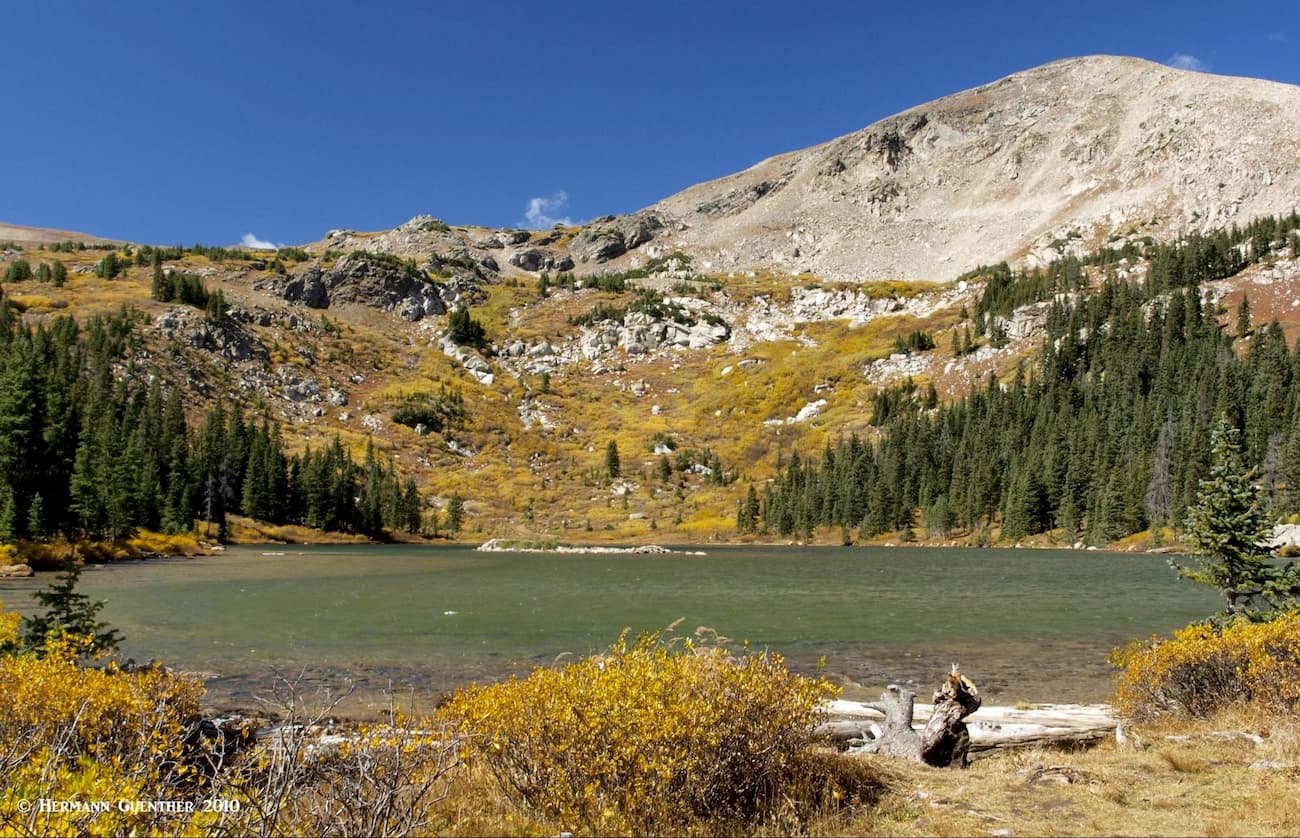
The Cottonwood Pass Road (County Road 306), which leaves from the center of Buena Vista, has several fine trailheads that provide access to some pristine alpine lakes as well as to Browns Pass from which splendid views of the Collegiate Peaks Wilderness can be had. The Denny Creek Trailhead is the most popular starting point for a climb of Mount Yale. The trail to the beautiful Ptarmigan Lake can be found a few miles further up this road. While this is not in a designated wilderness, this area has all of the attributes of one.
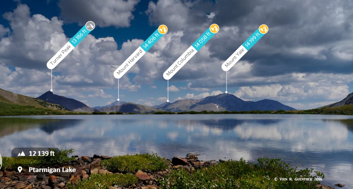
The Silver Creek Trailhead is just a few miles west of Buena Vista and serves as an excellent starting point for climbs of Mount Harvard (third highest peak in the Rocky Mountains) and Mount Columbia, as well as an alternative route to Mount Yale. There are also two fine alpine lakes here that make excellent spots to camp before ascending any of these peaks. Kroenke Lake is where I camped before my ascent of Mount Yale.
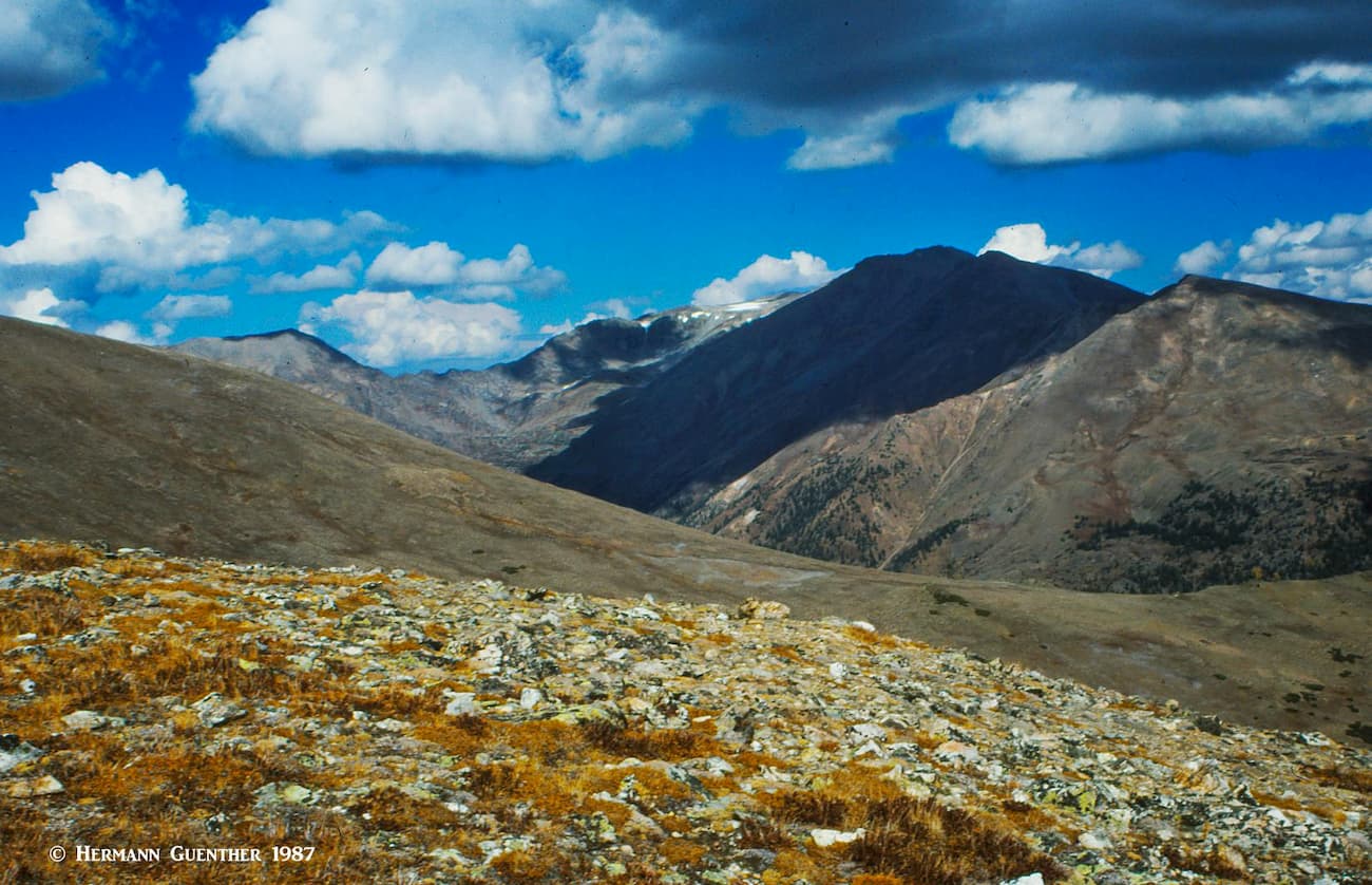
Aside from the mighty Sawatch Range, another truly major hiking domain in the SINF is in the Sangre de Cristo Range, which is home to no less than nine fourteeners. And these are some serious mountains, not for casual hikers to be sure. Though only four of these fourteeners are physically within the boundaries of the forest (or right on the boundary with the adjacent Rio Grande National Forest), they are all frequently climbed from trailheads on the eastern side of the range (SINF side), so they are included here as major hikes in the southern segment of the SINF.
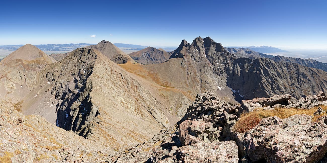
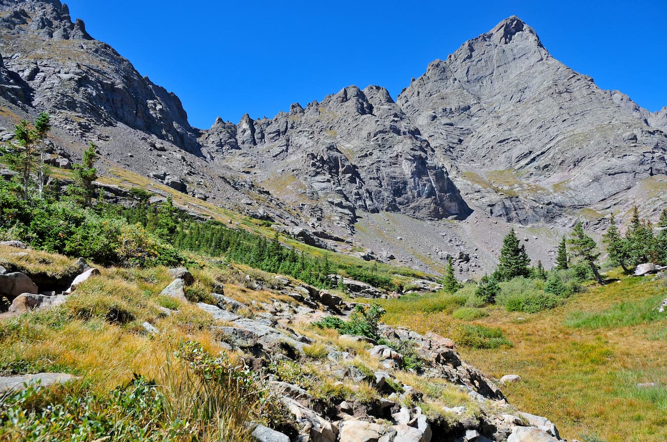
The Crestone Group is highly popular with fourteener peak-baggers. The five official fourteeners in this group are Kit Carson Peak, Challenger Point, Crestone Peak, Crestone Needle and Humboldt Peak. While Kit Carson and Challenger are more likely to be climbed from the west side via the Willow Lake route, the Crestones and Humboldt see more traffic from the east side via the South Colony Lakes approaches. These mountains, especially the Crestones, are serious business and casual hikers have no business being up there. They are among the most difficult fourteeners in Colorado. The South Colony Lakes Trailhead is the only one that gives reasonable access to all of five of these peaks. For non-climbers, the hike to the South Colony Lakes is exceptionally scenic and requires no advanced skills – just stamina depending on where you start your hike and whether or not you have a 4WD vehicle. The closest town to this trailhead is Westcliffe.
The Sierra Blanca Massif is a whole different story. The four fourteeners here are Ellingwood Point, Little Bear Peak, the ultra-prominent Blanca Peak and Mount Lindsey. With the exception of Lindsey, which can be climbed by well-conditioned hikers on a long day hike with a degree of difficulty not exceeding 2+, these mountains are best left for experts. They are located about 20 miles from the city of Alamosa, and there are only two viable trailheads from which to reach them. The only public access for climbing Lindsey is on the northeast side of the group, from where the other three can also be accessed, although the main climbing access to the three others is from the Lake Como Trailhead on the west side. Casual hikers rarely come here, since this trailhead is the lowest one in the state for climbing fourteeners and the “road” to Lake Como, at elevation 11,750 feet, is considered Colorado’s most challenging four-wheel drive road. It is only possible with specially modified vehicles. Hiking up the road is reputed to be very unpleasant.
Most climbers of these peaks will camp at Lake Como after a long, hot hike from the trailhead and proceed from there for their summit attempts. The ridge connecting Little Bear and Blanca is considered Colorado’s most difficult fourteener traverse. The author of the preeminent fourteeners guide book advises you to consider your future before you attempt this one-mile ridge. He says this is one unhappy place to be during a storm, and bailing from the ridge is difficult at best.
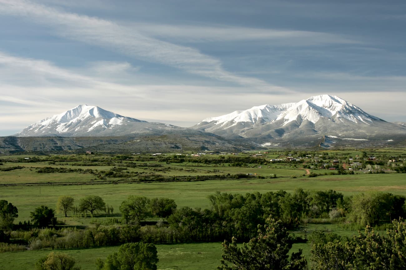
The southernmost segment of the SINF is dominated by the mighty Spanish Peaks, two prominent mountains that can be seen from as far away as Colorado Springs 102 miles to the north, Alamosa 85 miles to the west, and Raton, New Mexico 65 miles to the south. If you are driving north- or southbound on I-25 in the southern half of Colorado, you simply cannot miss seeing these impressive mountains. These peaks are east of and separate from the Culebra Range of the Sangre de Cristo Mountains. West Spanish Peak, the higher of the two, has 13,583 feet of elevation with a prominence of 3,648 feet. It is the easternmost mountain over 13,000 feet in the United States. Because of their unique geology, the Spanish Peaks were made a National Natural Landmark in 1976 and designated a Wilderness Area in 2000.
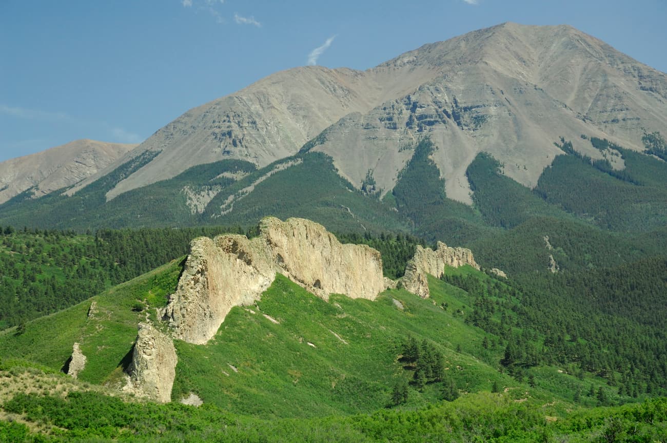
Although it is higher, West Spanish Peak is the more commonly climbed of the two, since it is actually easier and more accessible. The major trailhead is a few miles off State Highway12 via Forest Road 46 which starts at Cucharas Pass. This is a good gravel road that will take you to 11,005-foot Cordova Pass where there is a campground and trailhead parking (you will have to pay a modest fee to park here). The total distance to the summit is only four miles with an elevation gain of about 2,600 feet. That’s the good news. The bad news is that you will gain the final 1,600 feet in the last mile along a very rocky route to the summit. It is strenuous but totally worthwhile, as the 360-degree views are stunning. Two important things to consider before undertaking this epic hike – bring plenty of water as there is none along the trail, and keep an eye on the weather. Lightning is a real threat on this isolated and exposed peak. You should plan on leaving the summit no later than noon.
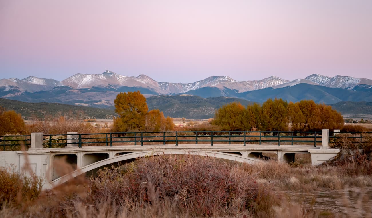
Buena Vista sits centrally located in the northern segment of the San Isabel National Forest, thus ensuring it a significant role in mountain recreation. Sitting immediately across from the Collegiate Peaks, this charming town of less than 3,000 inhabitants provides most of the amenities visitors could want. It is conveniently located at the junction of the two major north-south highways in central Colorado - US-285 and US-24. Though Buena Vista has a small regional airport, there is no scheduled airline service available here. But the town can be easily reached on good roads in just over two hours from Denver, thus making it a convenient destination for visitors from out of state. For accommodations, the town offers a wide range from simple cabins to B&Bs to branded hotels. There is no problem finding restaurants and supermarkets. There are plenty of camping opportunities nearby as well.
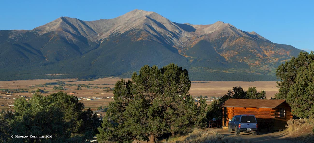
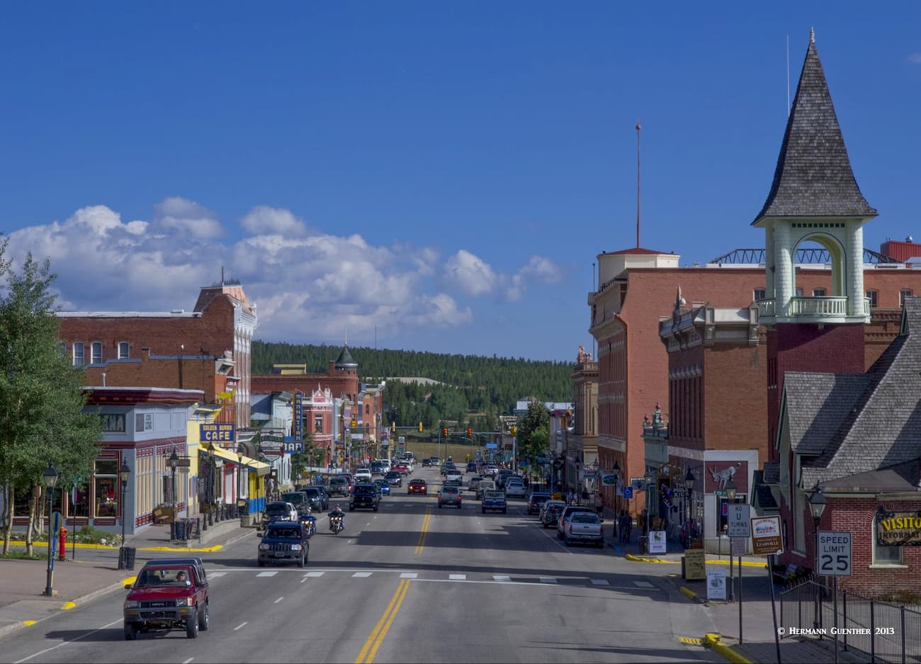
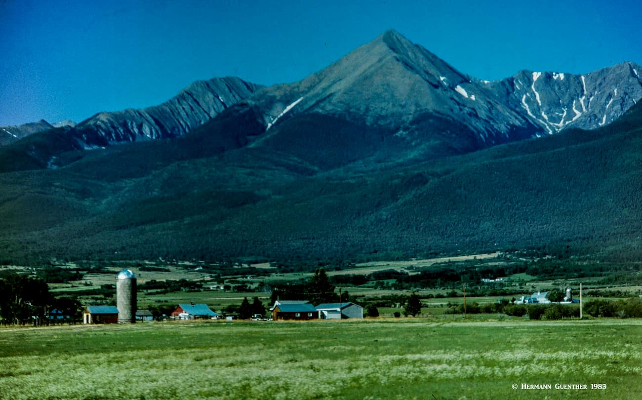
Situated at an elevation of 10,152 feet, Leadville is the highest incorporated city in the United States. Lake County Airport just outside of town is the highest airport in North America, at 9,924 feet. A general aviation facility, it does not have scheduled passenger service, which was discontinued a number of years ago. Historically, Leadville was a major silver mining center and in the late 1890's was second in population only to Denver. Today, it retains its historic charm and contains many historic buildings and sites. The two highest peaks in the Rocky Mountains of North America, Mounts Elbert and Massive, can be easily seen from most parts of the town. Needless to say, at this elevation Leadville is a cold place, but that does not deter visitors from enjoying the many recreational activities available here. At the head of the Arkansas River Valley and the northern end of the SINF, Leadville is tucked between two major mountain ranges - the Sawatch and the Mosquito Ranges - which makes the town a handy base for mountaineering nearby. There are adequate accommodations and restaurants, some with an “Old West” ambiance, available in and near the town.
In the middle of the immense San Luis Valley, which forms the western edge of the Sangre de Cristo Range in Colorado, sits the city of Alamosa. Though this town is surrounded by large parts of the Rio Grande National Forest, it is very conveniently positioned for climbing some of the most popular peaks in the San Isabel National Forest. With a population of less than 9,000, this is by far the largest town anywhere close to this mountain chain. Yet, the town offers almost any amenity that a visitor would require for an extended stay to explore these mountains - accommodations, restaurants, hospital, golf course, shopping and even an airport with regional scheduled service including to Denver and Albuquerque, New Mexico. This is the place to stay if hiking access to the western approaches to the Sangre de Cristos is desired, especially the high peaks of the Sierra Blanca Massif. Visitors to the Great Sand Dunes National Park as well as the National Wildlife Refuge are very likely to base themselves in Alamosa for a multi-day visit.
If hiking access to the east side of the Sangre de Cristo Mountains is desired, the town of Westcliffe may be the best choice for accommodations and eating. The major trailhead for the Crestone group of fourteeners, the South Colony Lakes Trailhead, is just a few miles from Westcliffe, making this town easily the most convenient town where to find accommodations and food. With a population of under 600, this is not exactly a major town, but at least there are a few lodging and eating establishments here. But the views of the Sangre de Cristo Mountains to the west are epic, which is sure to make eager hikers and climbers want to get to the trailheads as quickly as possible. A visitor to Westcliffe should not expect to find much more than the most basic amenities here. The city of Salida, with a population of just over 5,000, about 50 miles to the north would be a more viable, but more distant, base from which to explore these mountains.
Because of the complexity and variations in geographic and topographic databases, it is not always clear which mountains are located within a given geographic area. This is particularly the case when two jurisdictions have a common boundary. When it comes to mountains, it is commonly (but not always) understood that such boundaries follow ridge lines that in most cases define the local geography based on drainage basins. One of the best examples of this is the Continental Divide of North America (as well as other similar divides). In the case of the San Isabel National Forest, there are several major mountain peaks that sit squarely on drainage divides or other boundaries, such as between adjacent National Forests. Consequently, these mountains are rightly claimed to be in both National Forests, yet the database may at times show certain such peaks in one forest but not in the other.
To complicate matters even more, there are sub-categories of mountain domains that straddle such divides or boundaries or are entirely contained within another jurisdiction. These sub-categories have their own individual databases, such that mountains named within a wilderness database, for example, may not appear in the database for the National Forest in which it is located. In the case of SINF, there are several such cases. Mount Massive, the second highest mountain in Colorado, is located within the wilderness of the same name, which is entirely within the SINF, yet it is not included in the database for this forest. This likewise applies to all of the mountains in the other wilderness areas that are entirely or partly in the SINF. This also means that the second highest peak in the SINF is not Blanca Peak, as implied by the list below, but is in fact Mount Massive. Blanca is the fourth highest in this forest. In fact, the five highest mountains in the Rocky Mountains of North America are all in the SINF, while only two of them are named here. PeakVisor is constantly revising and updating its databases to present the best information available at the time.


