
Scan the QR code and open PeakVisor on your phone
Spanish Peaks Wilderness Area has 5 named peaks. The highest is West Spanish Peak at 4,140 m. Other notable peaks include Spanish Peaks, East Spanish Peak and Middle White Peak.
The Spanish Peaks Wilderness Area lies within San Isabel National Forest in southern Colorado in the southwestern US. There are 5 named mountains in the wilderness area, the highest and most prominent of which is East Spanish Peak (13,583 ft/4,140 m). Another notable peak in the wilderness area is West Spanish Peak, which is also located along the eastern side of the Southern Rocky Mountains.
The Spanish Peaks Wilderness Area is located in the southwestern part of the US state of Colorado. It is situated in Huerfano and Las Animas counties, just to the southwest of the city of Walsenburg and about 115 mi (185 km) to the south of Colorado Springs.
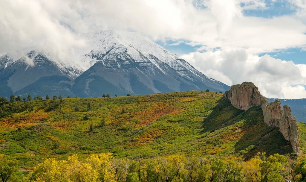
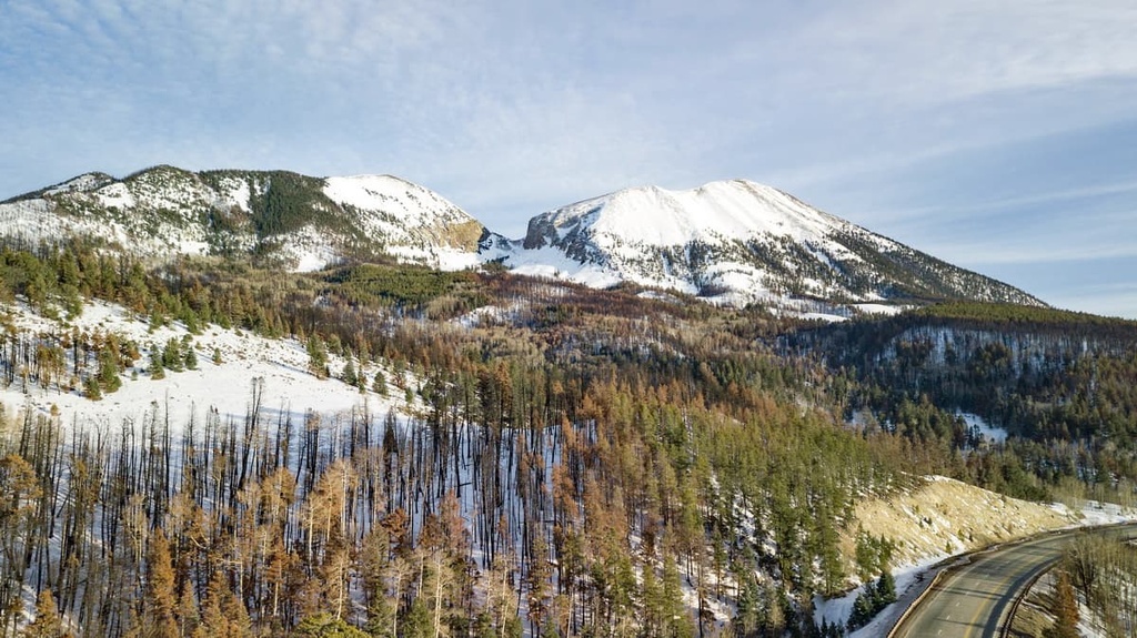
The US Forest Service manages the 19,266 acres (7,792 ha) of public lands in the wilderness, including East Spanish Peak and West Spanish Peak, which are often collectively referred to as Double Mountain. These two peaks rise almost 7,000 ft (2,134 m) from the valley floor with summits of 12,688 ft (3,867 m) and 13,361 ft (4,072 m), respectively.
Blanca Peak and Culebra Peak are two other notable 14ers that lie near the wilderness area to the west. However, though close in proximity, the Spanish Peaks are geologically distinct from mountains in the neighboring Sangre de Cristo Range.
While tectonic uplifting and faulting raised the Sangre de Cristos, the Spanish Peaks are what are known as ‘stocks.’ This means that they formed when magma flowed underground into gaps in sedimentary rock.
As the magma spread and cooled below ground, these enormous patches of granite splintered the surrounding rock and pushed upwards. Softer sedimentary rock gradually eroded away, leaving behind the raised and exposed volcanic-like peaks that we see in the region to this day.
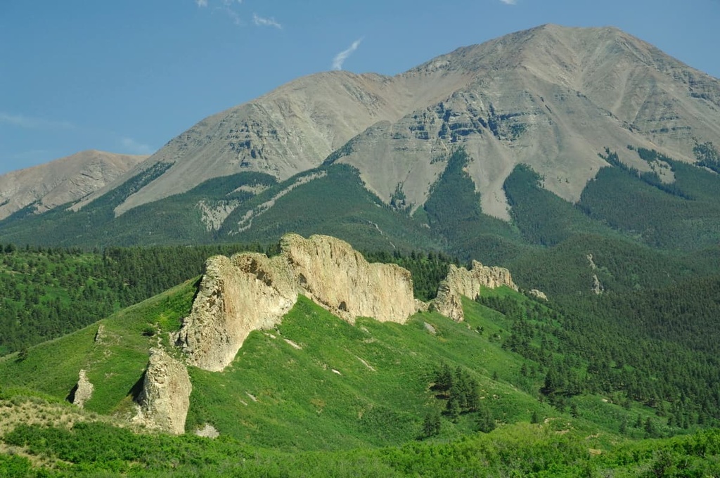
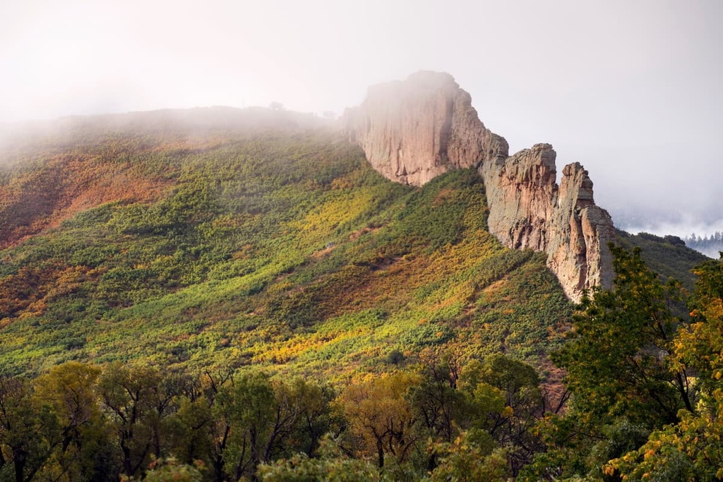
Another unique feature found in the area is a large collection of dikes. A ‘dike’ is a geological term for slabs of rock that cut across fractures of other types of rock. In the Spanish Peaks Wilderness, dikes tend to radiate out of large rock slabs like spokes from a wheel.
One of the most notable dikes in the region is Apishapa Arch, a reinforced arch over County Road 46 in Las Animas County that was cut out from a magmatic dike. In fact, the Spanish Peaks were designated a National Natural Landmark in 1976 in part because the region is home to hundreds of exposed igneous dikes.
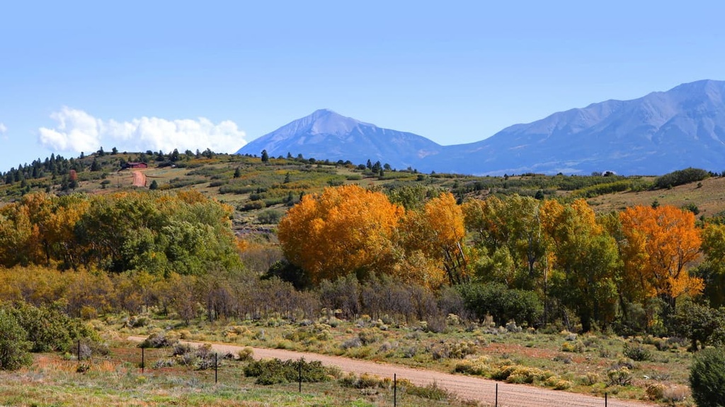
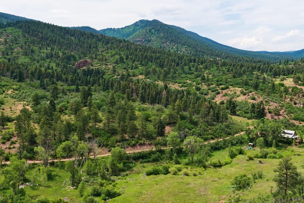
There are three types of forests found in the Spanish Peaks Wilderness Area: pinyon-juniper, scrub oak, and ponderosa. However, where previous logging and mining activity cleared the forest in past decades, aspens tend to be the most dominant tree species.
The Spanish Peaks State Wildlife Area neighbors the Spanish Peaks Wilderness Area to the south. The wildlife area focuses on conserving, sustaining, and improving habitat for local wildlife. Many species of birds and other animals live in the grasslands and montane forests in both the wilderness area and the state wildlife area.
There are several species of jays, bluebirds, warblers, and nuthatches that can be found in both regions. Other wildlife species found in the region include elk, mule deer, black bears, mountain lions, big horned sheep, and the occasional Abert’s squirrel, the latter of which is a uniquely tuft-eared squirrel.
The Spanish Peaks hold cultural significance for several tribes with ancestral ties to the region including the Ute, Apache, and Comanche.
These peaks are also referred to by their traditional names, which include Wahatoya, Huajatolla, and Guajatoya. Due to the fact that summer storms in the region often bring rain and lightning to the Spanish Peaks, many Indigenous tribes in the region associate the peaks with a god of rain.
The Spanish Peaks served as guideposts along the Santa Fe Trail, which was a trade route established in 1821 to link Missouri and New Mexico. Mexican and American traders alike used the trail for nearly six decades.
Gold was discovered on West Spanish Peak around 1875, spurring a brief period of mining in the area that petered out after several years. A second wave of mining in the region began around 1900 and continued sporadically until the 1940s.
The wilderness area itself was first designated as a National Natural Landmark in 1975. It was later designated as a federally protected wilderness area in the year 2000 as part of the Spanish Peaks Wilderness Act of 2000 (PL 106-456), which itself was an amendment to the 1993 Colorado Wilderness Act.
The main hiking destination of the region is the Spanish Peaks, although there are a handful of shorter hikes that can be done nearby.
Summiting both East Spanish Peak and West Spanish Peak on the same day is not easy. Adequate planning and preparation are required to tackle the long distance and difficult navigation between the two peaks. One should pay attention to cairns and trail markers above treeline while traversing the scree and talus fields in the alpine regions of the Spanish Peaks.
Also, keep in mind that thunderstorms can move in quickly in the region. Therefore, hikers are advised to pay attention to the weather and begin their descent by mid-day or early afternoon.
With that in mind, here are a few of the best hikes in the Spanish Wilderness Area to check out during your next visit to the region.
The more popular of the two peaks, this challenging 7.9 mi (12.7 km) out-and-back trail to West Spanish Peak climbs just over 2,600 ft (792 m) in elevation from the trailhead at Cordova Pass.
Although it begins in montane forest and meadows, once past the treeline, this trail runs across rocky mountain slopes and the final mile (1.6 km) or so is quite steep. It is recommended that you stay near the ridge while hiking across scree and occasional rock buttresses on this hike.
Although it is the shorter of the two peaks, access to East Spanish Peak begins from a lower trailhead which means greater elevation gain overall. The trail to the summit of East Spanish Peak is approximately 8.8 mi (14.2 km) long round trip and it has 3,238 ft (987 m) of elevation gain.
The lower starting point for this hike is at Wahatoya Trailhead, but hikers with a 4WD vehicle can continue 2 miles (3.2 km) further on the road to reach the upper trailhead.
The Wahatoya Trail can be completed as a moderate 3 mile (4.8 km) out-and-back trail, or as a more strenuous 12 mi (19.3 km) trail that traverses the wilderness area and cuts across the saddle between the Spanish Peaks to arrive at Apishapa Trail.
Note that the road to the trailhead is rough. It is best reached with high clearance, all- or four-wheel drive vehicles.
This easy path connects to the trail for West Spanish Peak at Cordova Pass. It is just over 1 mile (1.6 km) long, but it rewards hikers with stunning views of meadows, ponderosa forests, and mountainous landscapes.
Looking for a place to stay near the Spanish Peaks Wilderness Area? Here are some of the best cities and towns to check out in the region.
The Spanish Peaks Wilderness is located 20 mi (32 km) to the south of Walsenburg, a small town with a population of around 3,000 people.
Walsenburg is home to Lathrop State Park, and it offers a modest selection of accommodation and restaurants for visitors to choose from. State Highway 12, a National Scenic Bypass known as The Highway of Legends, connects Walsenburg to La Veta and, ultimately, to Trinidad.
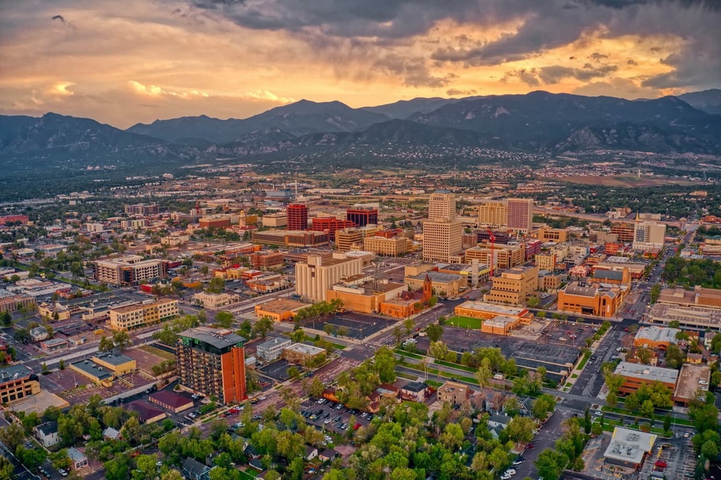
Colorado Springs, which is nicknamed Olympic City USA, is located only 115 mi (185 km) to the north of the Spanish Peaks Wilderness Area. With a population of around 460,000 people, this vibrant city near Pikes Peak is home to a regional airport, a rich cultural scene, and access to numerous outdoor activities such as trails and destinations for hiking, climbing, and biking.
The Garden of the Gods is a popular attraction located near town. Guided tours of The Garden of the Gods are available for a small fee, but it’s free to hike on your own among the 1,300 acres (526 ha) of sandstone formations.
Another great destination located near Colorado Springs is the Manitou Cliff Dwellings. The dwellings are a recovered and replicated Ancestral Puebloan cliff structure that dates back to around 1200 CE. They are situated only a 15-minute drive from the city center of Colorado Springs, so they’re well worth visiting if you’re in the area.
Pike National Forest, Red Rock Canyon Open Space, and Cheyenne Mountain State Park are all a stone’s throw away from the city, too. Since it is located just 70 mi (113 km) to the south of Denver, Colorado Springs is the perfect middle ground between Colorado’s capital and some of southern Colorado’s best hiking and wilderness areas.
La Veta is a tiny town with a population of around 1,000 people that’s located at the base of the Spanish Peaks with a small selection of lodging and RV camping options.
Camping is available near La Veta at Cordova Pass Campground, which is just 23 mi (37 km) away. The campground typically operates May through October, depending on weather, and it provides easy access to the West Spanish Peak Trail.


The highest peak in Spanish Peaks Wilderness Area is West Spanish Peak, at 4,140 m.
Notable peaks in Spanish Peaks Wilderness Area include West Spanish Peak, Spanish Peaks, East Spanish Peak, Middle White Peak and North White Peak.


