
Scan the QR code and open PeakVisor on your phone
The Pike National Forest is positioned just about in the geographic center of Colorado. It extends from southwest of the Denver metropolitan area to the western edge of the Colorado Springs area. The forest is located in its entirety east of the Continental Divide which defines part of its northwestern boundary, where it also borders on the Arapaho National Forest and a small section of the White River National Forest. On the west it has a common boundary with part of the San Isabel National Forest with which it is jointly administered by the U.S. Forest Service. It contains 155 named mountains, some of which it shares on a common boundary with other national forests. The highest mountain is Mount Lincoln and the most prominent is Pikes Peak.
The forest includes all or parts of three wilderness areas – Mount Evans, Lost Creek and Buffalo Peaks. The named mountains within those areas may or may not be included in the overall count of named mountains in the forest as they are often included in the database for those areas instead. The forest is also home to six fourteeners, two of which are perched on boundaries with other forests with which they are shared. The six are Mounts Evans, Bierstadt, Lincoln, Bross, Democrat and of course Pikes Peak, the namesake of the forest. There is also a seventh named fourteener - Mount Cameron – but due to prominence criteria, it is not an “official” one. That always brings up a question – if you only climb the “unofficial” one without climbing its higher parent, haven’t you actually climbed a fourteener? I’ll not get further into that discussion.
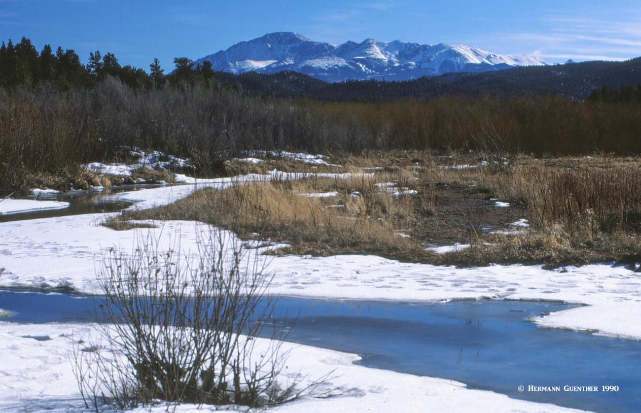
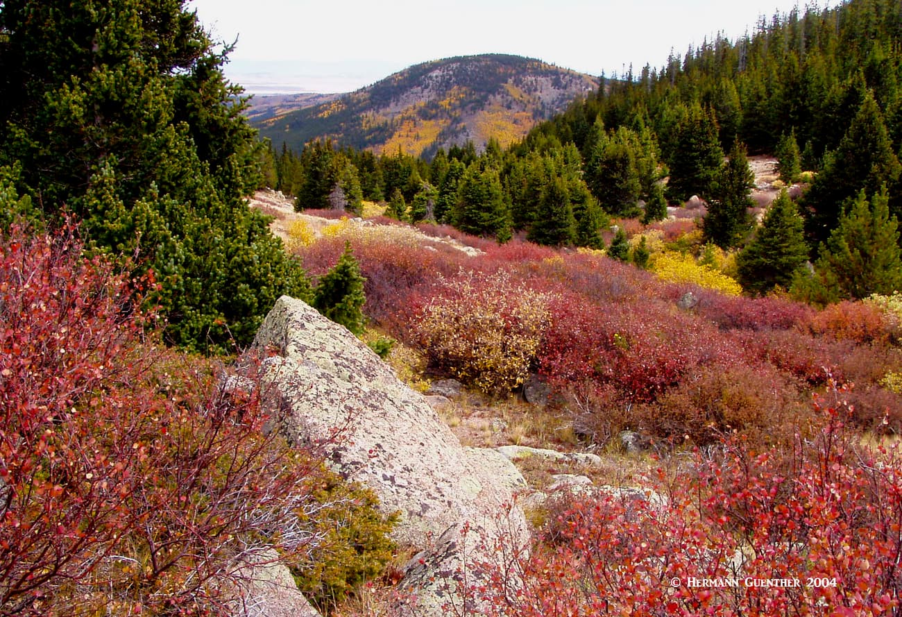
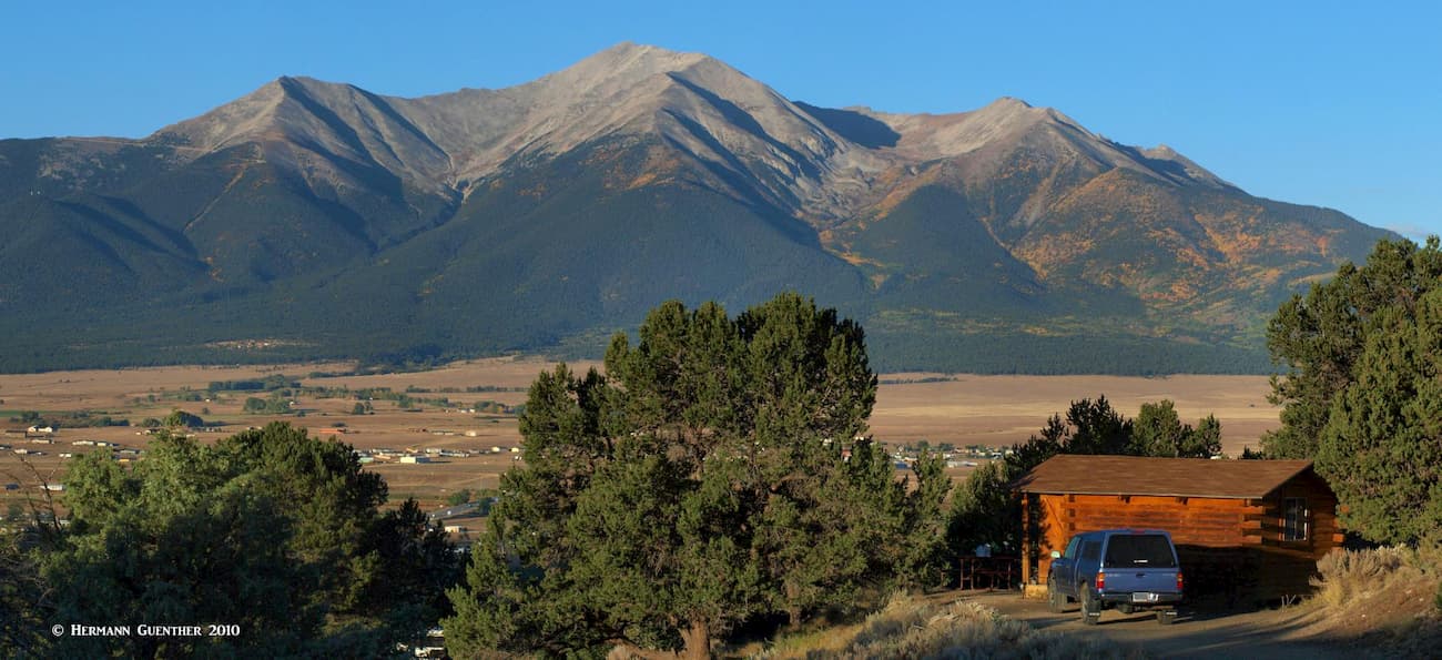
The Pike National Forest has an interesting geographic characteristic – it almost completely surrounds a very large alpine valley known as South Park. This is a huge flat grassland encompassing 1,000 square miles that varies in elevation from 9,000 feet to 10,000 feet and is enclosed by high mountains of the Mosquito Range and parts of the Southern Front Range. This basin supports some farming and ranching and is a haven for recreation especially at its fringes where it meets the mountains. But also, running across the length of the basin is the South Platte River system which drains the entire basin and feeds three large reservoirs, making this valley a prime fishing destination – even in winters, which can be fiercely cold and windy. Ice fishing is the sport of choice at this time of year and the trout can be big. Antero Reservoir on the western side of the valley is a popular recreation area.
There are three major highways that cross South Park and provide excellent access to all parts of the forest – US-285 (primary access from the Denver area), US-24 (primary access from Colorado Springs), and SH-9 which runs from south to north. They are not multi-lane highways as you would see elsewhere, but they are excellent collector roads that, along with a number of minor feeder roads (some unpaved but perfectly suitable for ordinary passenger cars), provide convenient access into all parts of the forest. The only major towns in South Park are Fairplay and Hartsel and they are very small; the more significant resort towns of Breckenridge and Buena Vista, however, are very handily nearby and are frequently used as bases from which to explore the forest.
The Pike National Forest offers a wide array of recreational opportunities not the least of which is miles of hiking trails and countless summits to climb. There are more campgrounds and day-use areas than you can count, plus many large lakes for boating and fishing, as well as several Gold Medal Waters from prime trout fishing. Even with so many venues for playing, you can expect to see a lot of visitors, especially in the summer months, since this forest is extremely handy to the largest population centers in Colorado. But there are places where you can find solitude, especially in the off-season. A number of the major recreation areas in the forest charge a fee to use them, but that doesn’t seem to keep the crowds away. Let’s talk about where the major hiking areas are and what you can expect to find there.
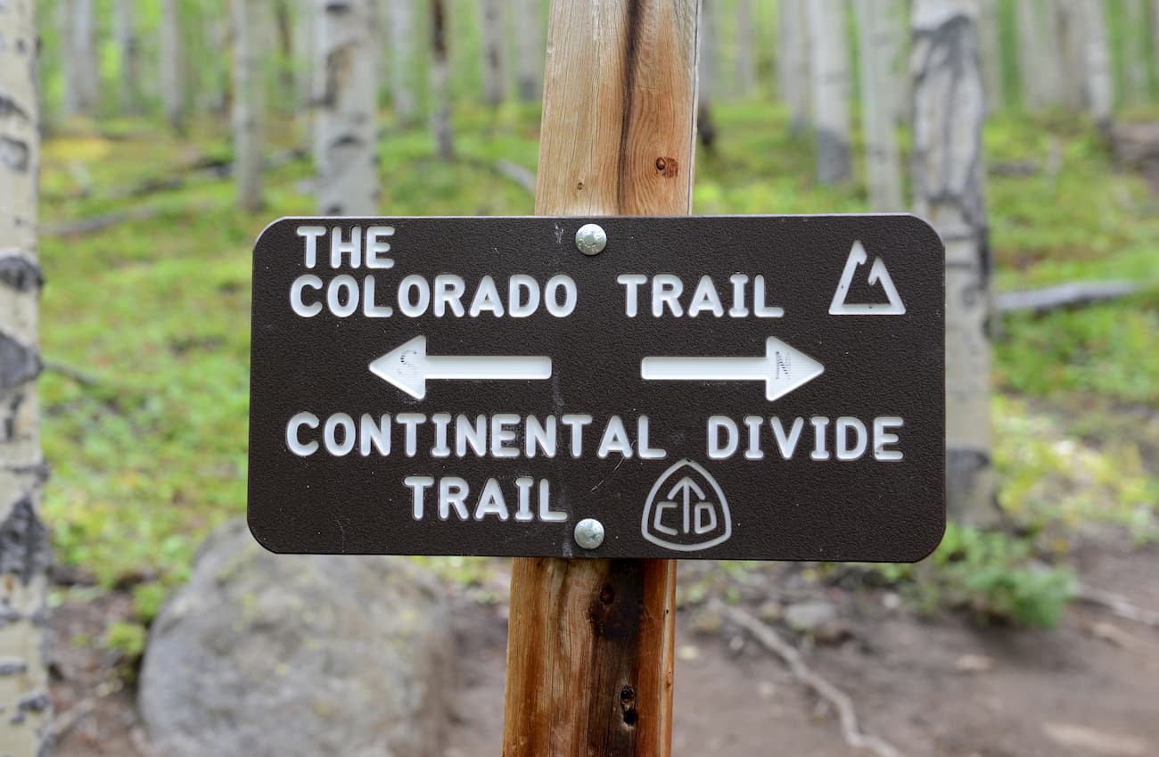
Colorado Trail – This 485-mile long-distance trail crosses Colorado from near Denver to Durango in the southwestern part of the state. In places it follows the Continental Divide National Scenic Trail. Many people will only hike or ride portions of it (it is one of the few major long trails in the country that allow bikes, with the exception where the trail crosses wilderness areas). While there are trailheads at each end, the trail can be accessed at many different points along the way. A large segment of the trail, about 80 miles, crosses the Pike National Forest, making it arguably one of the best-known trails in the forest. It winds its way from the northerly end at Waterton Canyon to the point where it exits the forest and enters the White River National Forest in the vicinity of Breckenridge. Along the way it crosses the Lost Creek Wilderness.
Mount Evans Wilderness – The Mount Evans Wilderness is shared about equally between the Pike and the Arapaho National Forests. But perhaps the most popular trailhead is at the summit of 11,669-foot Guanella Pass from where hordes of hikers will attempt to climb what is said to be the easiest fourteener in Colorado – Mount Bierstadt. Ever since the road over the pass was fully improved and paved, it is no longer a challenge to get here, and the addition of two large parking areas has resulted in Bierstadt becoming the most climbed fourteener – until it was overtaken by Quandary Peak in the Mosquito Range in late 2019. Just look for Guanella Pass on Google Earth and you will understand why this place is so popular – there are far more cars parked along the side of the road than in the two parking lots. The top of the pass also serves as a trailhead to the two Square Top Lakes, a far less strenuous hike for those who are not up to the challenge of a fourteener.
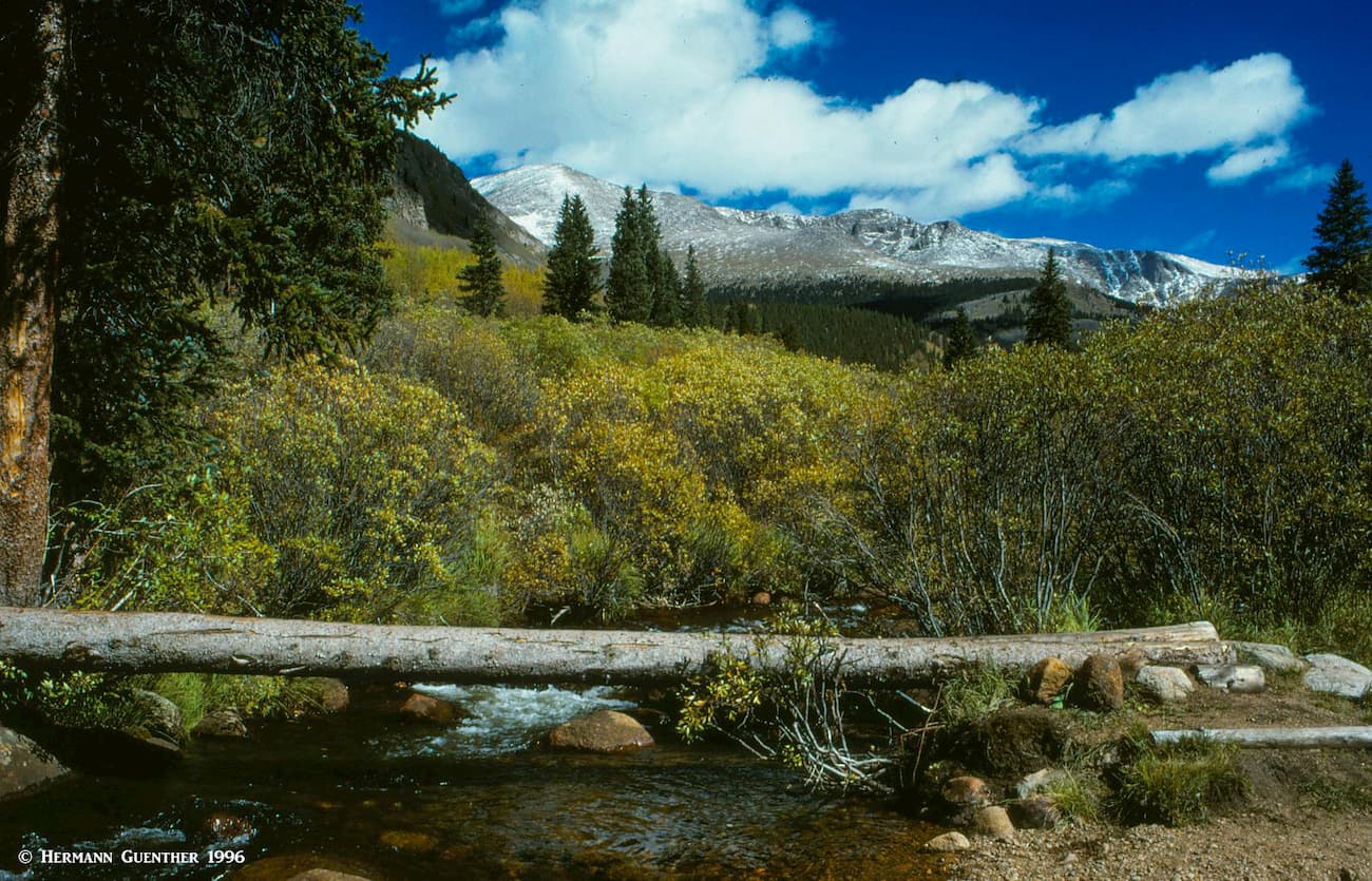
A few miles south of Guanella Pass on the same road is the Abyss/Burning Bear Trailhead. From here you can hike deep into the wilderness. The trail ends at Abyss Lake, which is tucked into a deep valley between Mounts Bierstadt and Evans. It is almost eight miles to the lake, which makes for a long day hike. I have done it as a day hike a couple of times, but I found that making a three-day backpack trip and camping about halfway to the lake is much more relaxed. The trail follows Scott Gomer Creek for half its length to where another trail branches off and continues to the summit of Guanella Pass. This is a nice spot to set up camp; I saw almost no other people while I camped there. But that was a number of years ago – everything has changed in recent years.
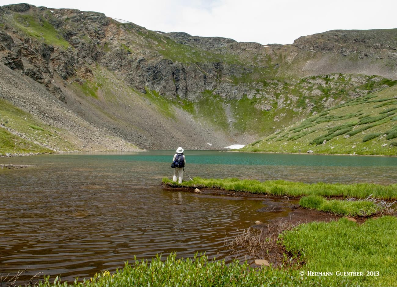
Shelf Lake Trailhead - A few years ago my wife and I discovered a hidden gem also off the Guanella Pass Road. The road along Geneva Creek to the trailhead, however, is not suitable for regular passenger cars – high clearance is necessary to get there. The hike to this magic alpine lake is only three miles but requires 2,000 feet of elevation gain. As you work your way up Smelter Gulch, with Square Top Mountain looming above, you will discover some of the most amazing wildflowers anywhere – we saw almost no other hikers.
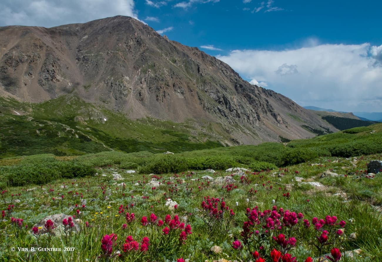
We went back in the early autumn to do the same hike again and we were the only people on the entire trail, all the way up and back. Another time, also in the height of summer, it looked like we would be alone again, but there was a group of youngsters up there enjoying the wonderful scene. The wildflowers were every bit as eye-popping. That lake, at 12,000 feet, is truly one of the most scenic ones we know - hiking up above the lake further improves the view.
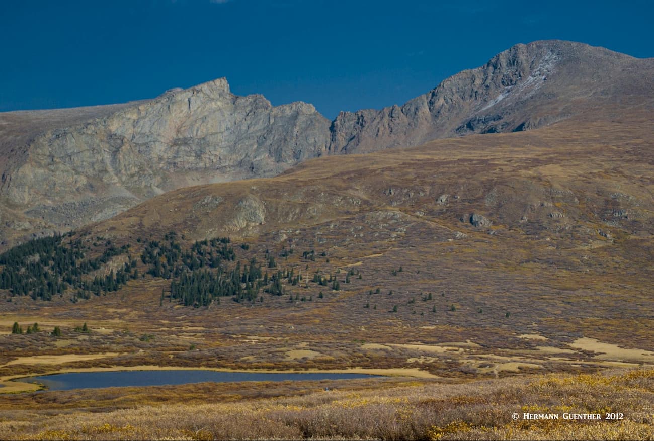
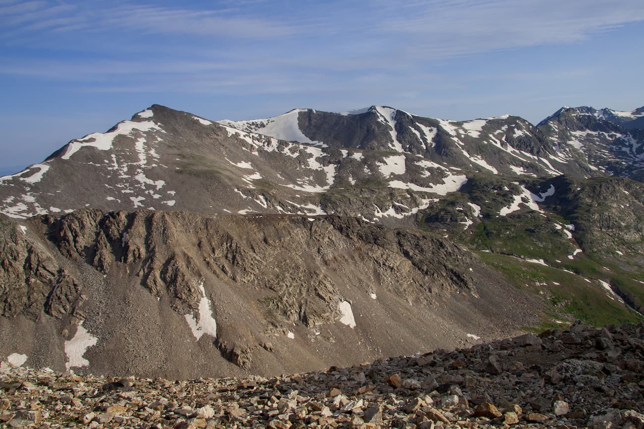
Southern Mosquito Range – If you drive south from Breckenridge on SH-9 over Hoosier Pass, you will arrive at a group of three fourteeners that can be climbed all in a one-day hike. Mounts Democrat, Bross and Lincoln, the highest in the entire Pike National Forest. Now if you plan to climb all three of them, you will also bag another fourteener, Mount Cameron, but it won’t count since it is not an “official” one. If you want to climb the gentle east slopes of Lincoln, you can start at the Quartzville Creek Trailhead just off SH-9 and simply follow an old mining road to just below the summit. The rest is easy. An easier alternative, and a far more popular trailhead, can be found at Kite Lake just outside the town of Alma, a few miles further south along SH-9. The lake sits at an elevation of 12,000 feet below Mount Democrat and is about six miles from the town. The last mile is considered too rough for most passenger cars. The hike is about eight miles and involves 3,300 feet of elevation gain.
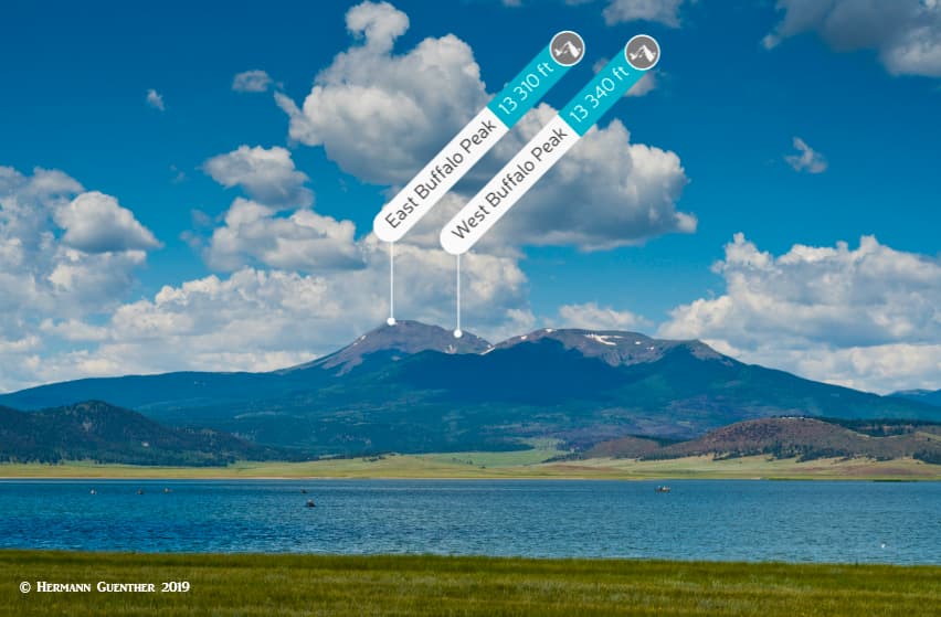
Buffalo Peaks Wilderness - Located at the south end of the Mosquito Range is the relatively new Buffalo Peaks Wilderness, named after the two peaks of the same name (East Peak 13,000 feet and West Peak 13,326). It is the only designated wilderness area in the Mosquito Range. Because of highly visited and more glamorous areas nearby, such as the Collegiate Peaks, this wilderness area offers a more enjoyable experience, where human visitors are relatively few. The whole wilderness area only has 18 miles of trails, most of which is the lovely Buffalo Peaks Wilderness Loop. The trailhead for this 12-mile hike is located on the Weston Pass Road which connects U.S Highway 285 south of Fairplay with Leadville at the upper end of the Arkansas River Valley. Trail access to the two peaks is relatively limited, in most cases involving a need for a four-wheel drive vehicle. The peaks themselves offer fine views for those willing to make the trek to them.
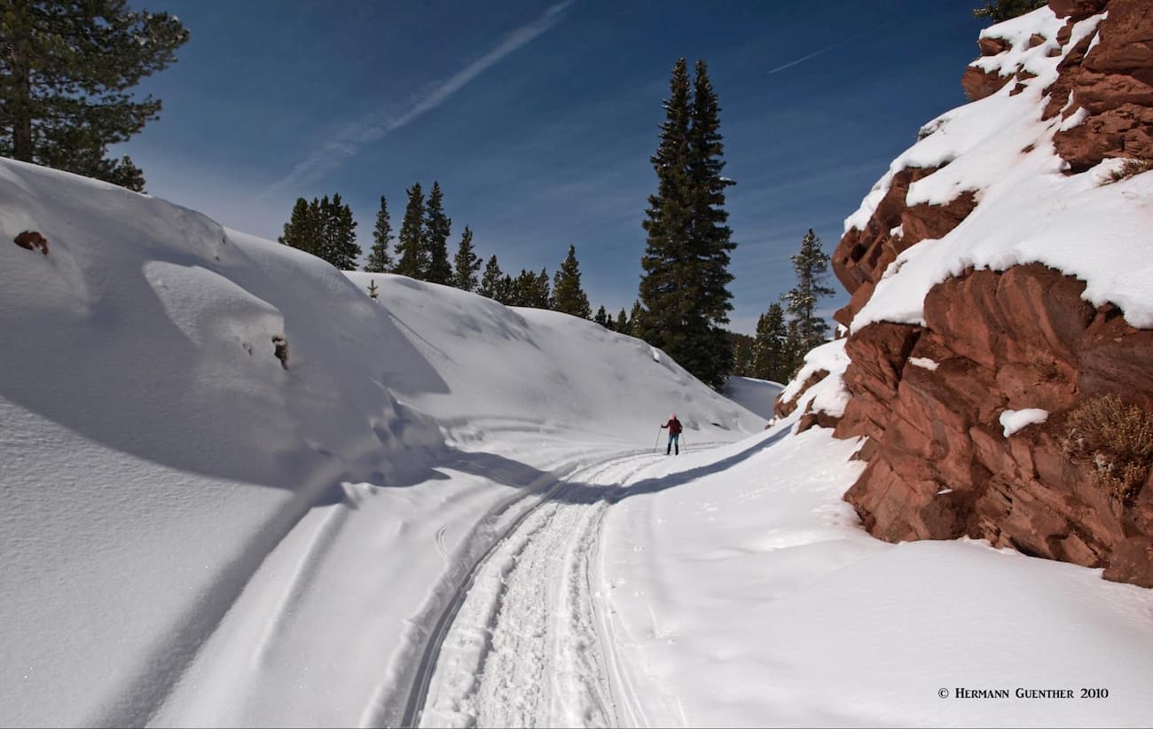
Boreas Pass – The Boreas Pass Road, a good gravel road, follows the route of an old railroad grade connecting the small town of Como (on US-285) with Breckenridge. It doesn’t offer much in the way of hiking, but in the winter, when the road is closed to traffic, this is a popular place to go cross-country skiing. Near the upper reaches, you will get some spectacular views across the valley toward the high peaks of the Mosquito Range.
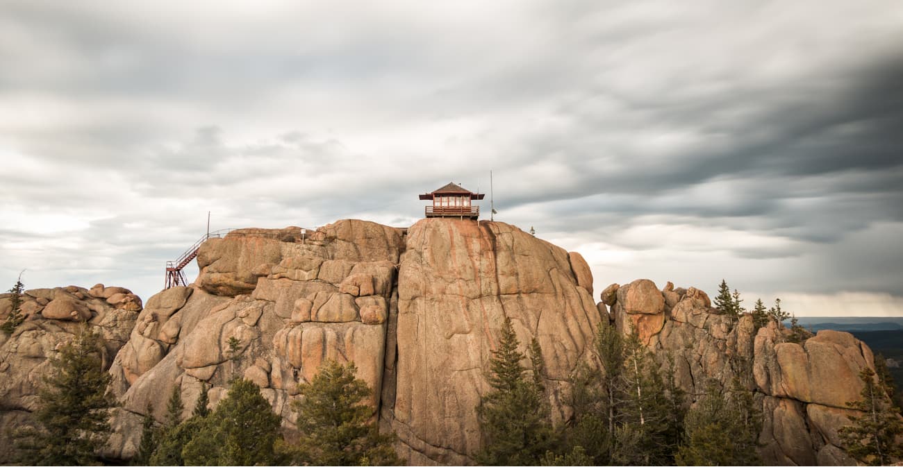
Rampart Range – At the extreme eastern edge of the Pike National Forest is the Rampart Range, a series of foothills located in what is almost entirely public lands. The highest Mountain is Devil’s Head, elevation 9,754 feet, which is also in one of the most popular hiking areas of the range. The mountain is known for the Devil’s Head Fire Lookout, the last fire lookout tower in Colorado still in continuous use by the U.S. Forest Service. The tower is over 50 years old and is listed on the National Register of Historic Places. It is open for public visitation when it is staffed, typically late-May through early-September. The trail to the tower is 1.4 miles long and ends with a climb up 143 stairs to the tower. Don’t expect solitude here, but the views from the tower extend 100 miles in all directions.
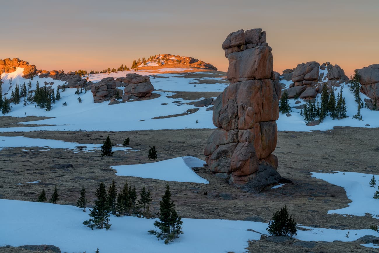
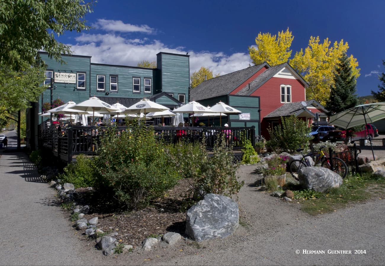
Lost Creek Wilderness - In the southern Front Range, the visitor will experience an encounter with wilderness far different from the overpowering alpine scenery of other parts of Colorado. Yet climbing opportunities can be found here in the form of granite domes, half-domes, spires and buttresses. The Lost Creek area is rather unique as compared to other wilderness areas in the state, yet it offers 136 miles of trails, 105 miles of which are within the wilderness boundary. The area is best accessed from various points along US Highway 285 between the towns of Bailey and Jefferson. Some trailheads are directly at the side of the highway, while others require leaving US-285 and following other county or forest roads. Among these are Lost Park Road near the south end of Kenosha Pass, or a series of forest roads that leave State Highway 126 between the little towns of Buffalo Creek and Deckers. This area abounds with numerous trailheads, campgrounds and some world class trout fishing opportunities.
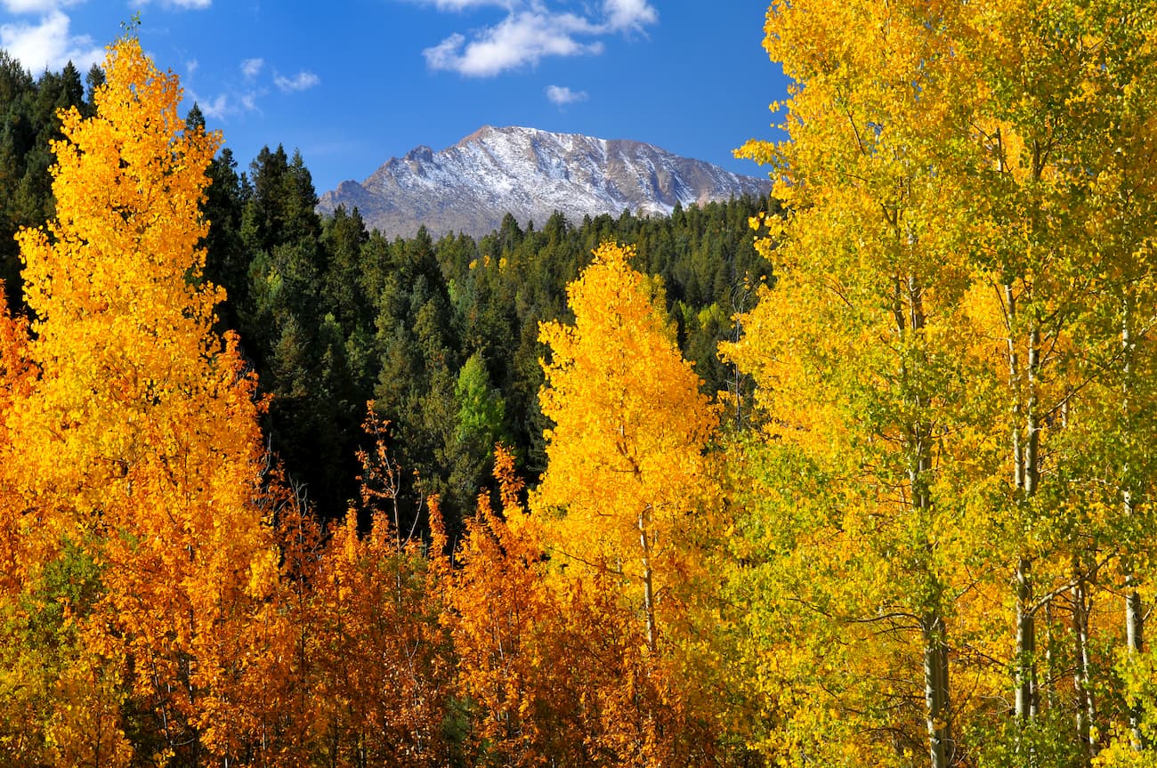
Pikes Peak - The famous Pikes Peak is the easternmost fourteener in North America and is the most prominent mountain in the Front Range and the second-most prominent in Colorado. When viewed from the east in the city of Colorado Springs, the mountain looks massive and some of the statistics are staggering. From the town of Manitou Springs, just west of Colorado Springs, the mountain rises 7,800 feet in a horizontal distance of only 7.25 miles. The main trail, the Barr Trail, has the highest elevation gain in Colorado. Beginning at Manitou Springs, the trail is almost 13 miles long- one way - yet is rated Class 1. A shorter alternative (11.4 miles one way), is the less popular Crag Trail, beginning on the northwest side of the mountain. It has only 4,100 feet of elevation gain and is Class 2 in places. Neither trail is difficult - technically.
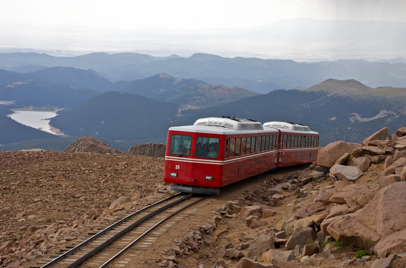
But aside from these two trails, for years the way most visitors to Pikes Peak (more than a half million annually) reached the summit was by car or train. As of this writing, however, the Pikes Peak Cog Railway, the highest in the world, has been closed for complete refurbishment due to aging equipment and infrastructure. It is scheduled to be reopened in spring of 2021. So at least for the time being, the only easy way up for just about anybody is to drive the Pikes Peak Highway, a 19-mile paved toll road. It is very popular, but it is not the highest paved road in North America - that distinction belongs to the Mount Evans road.
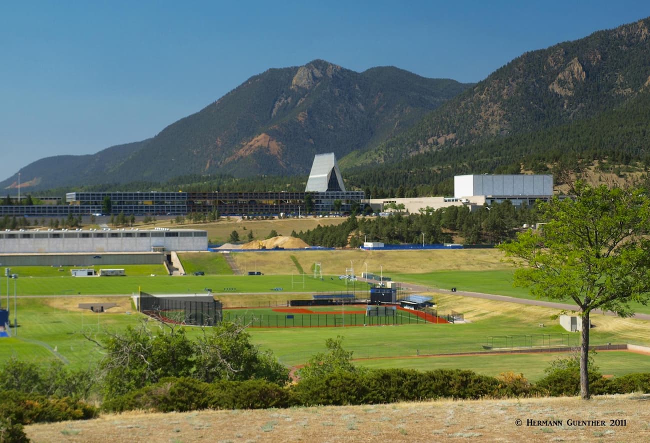
The second-largest city and metropolitan area in Colorado is Colorado Springs. Nowhere else in the country is there a major city so close to a mountain that looms more than 8,000 feet above it - seemingly right at its doorstep. The famous Pikes Peak is visible from all parts of the city most of the year and is one of the area's major attractions. But there is more. The United States Air Force Academy is located here. It attracts over one million visitors per year making it one of largest tourist attractions in the state. This city offers a good base from which to explore the Pike National Forest. It has all the amenities that tourists could want from basic to high-end. But there is one place in Colorado Springs that is probably second to none for visitors who really want to splurge - the Broadmoor Resort Hotel. It is indeed a beautiful 5-star resort in a spectacular location right at the foot of the mountains.
The historic town of Fairplay is the largest town in Park County of which it is also the county seat. Its population in 2018 was 762 and its elevation is 9,953 feet which makes it the fifth-highest incorporated place in Colorado. So if the town is so small, why is it a major town at all? Well, it sits at the crossroads of two major highways (SH-9 and US-285) which makes it very centrally positioned for serving as a base to explore much of the Pike National Forest. For one thing, the high peaks of the Mosquito Range are just a very short drive from town. The wonderful Buffalo Peaks Wilderness is equally close to town – the peaks themselves are clearly visible from here. The only tourist attraction in the town is the open-air museum called South Park City – a collection of relocated historic structures. But the town does not offer much in the way of tourist amenities. For that, you need to go to Breckenridge, only 22 miles to the north on SH-9 over Hoosier Pass, or Buena Vista, 38 miles to the south on US-285.
U.S. Highway 285 in Fairplay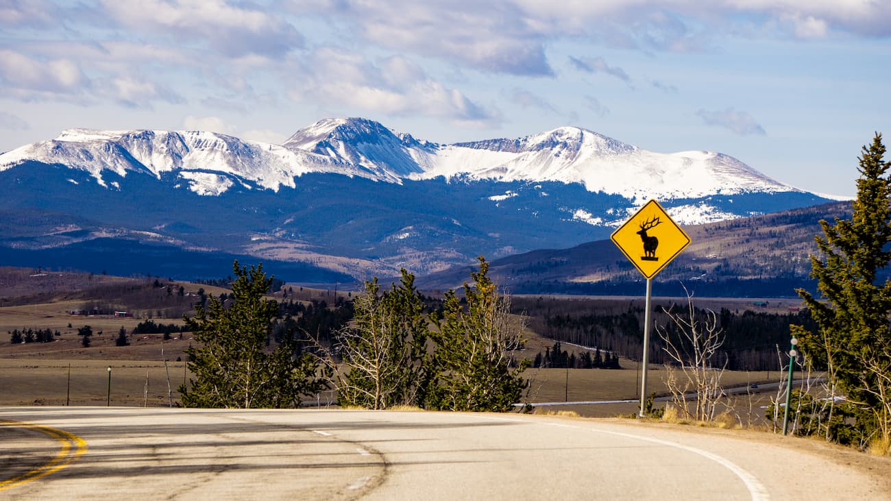
The most recognized town on the eastern side of the Mosquito Range is Breckenridge. A combination of a major ski resort and charming restored Victorian town, this is a place to spend some time enjoying the great restaurants, galleries and boutiques. Lodging opportunities abound here, offering a wide range of inns, hotels and condominiums. It is an excellent base for exploring the northwestern parts of the Pike National Forest including the higher peaks of the southern Mosquito Range. It is an easy 10-mile drive from Interstate Highway 70 which provides high-speed access from Denver and its international airport. In winter, the town hosts the International Snow Sculpture Championships, which is a free event open to the public. Teams come from around the world, including places as far away as Mongolia.
While Buena Vista sits at the southern end of the Mosquito Range, its role in mountain recreation is more oriented toward the Sawatch Range, especially the Collegiate Peaks, than it is toward the Mosquito Range. Yet visitors who prefer to stay in this town can easily access some of the southern expanses of the latter, including the Buffalo Peaks Wilderness which is just a short drive away. It is located at the junction of two major north-south highways in central Colorado - US-285 and US-24. Therefore, Buena Vista is likely to capture visitors destined for the southern Mosquito Range mountains. It is a more low-key (and perhaps more affordable) resort than Breckenridge, for example, yet it offers a range of accommodations and eating establishments. Much of the western part of the Pike National Forest is easily accessible from here. The town can be reached on good roads in just over two hours from Denver.


14er
ultra
fred-beckey-great-peaks
colorado-ultras
14er
ultra
fred-beckey-great-peaks
colorado-ultras


