Scan the QR code and open PeakVisor on your phone
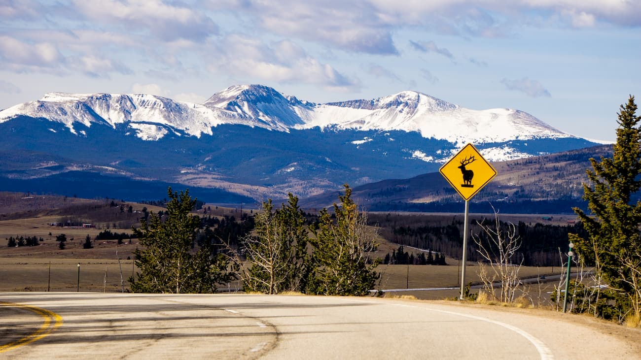
The Buffalo Peaks Wilderness is located at the southern end of the Mosquito Range in central Colorado. At 43,410 acres in size, it is not one of the larger wilderness areas in the state. In fact, of the 41 such designated areas in Colorado, only 17 are smaller. What perhaps sets the Buffalo Peaks apart from most of the others is that it receives relatively few visitors, even though it is well positioned in a part of the state that finds itself teeming with crowds pursuing greater and more popular summits. The throngs of recreation enthusiasts gravitate to the many fourteeners in the rest of the Mosquito Range (five in all) and the nearby Sawatch Range (15), just to the west.
Buffalo Peaks was designated under the Colorado Wilderness Act of 1993 to be included under the National Wilderness Preservation System established under the Wilderness Act of 1964 enacted by the United States Congress. Wilderness is defined by the author of the act, Howard Zahnister, as: "A wilderness, in contrast with those areas where man and his own works dominate the landscape, is hereby recognized as an area where the earth and its community of life are untrammeled by man, where man himself is a visitor who does not remain." There are several government agencies that administer 803 wilderness areas in the United States – U.S. Forest Service, U.S. National Park Service, U.S. Fish and Wildlife Service and the U.S. Bureau of Land Management. As of 2019, these areas encompass 111,368,221 acres (174,013 square miles) covering about 4.5% of the country’s land area – larger than the state of California.
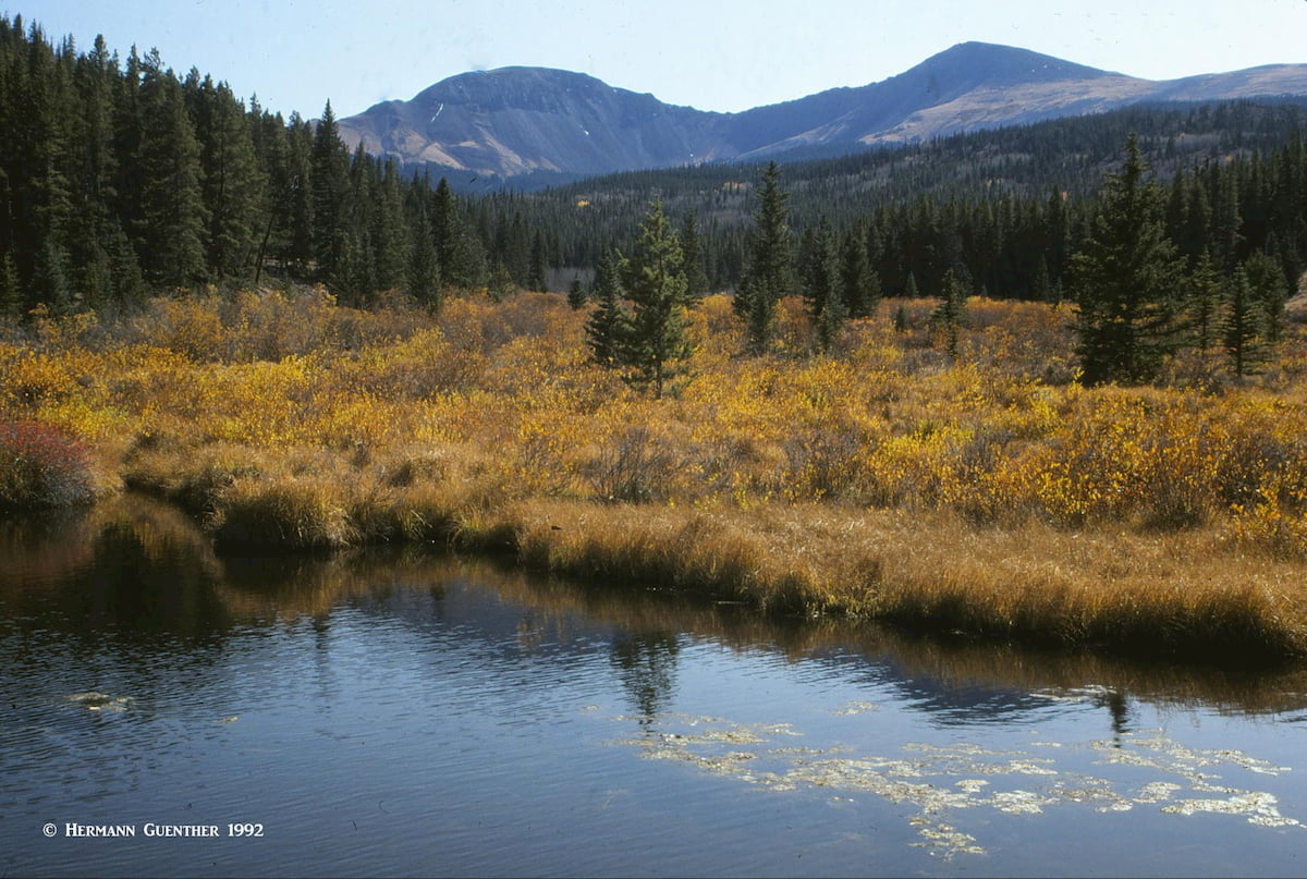
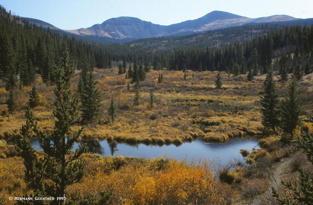
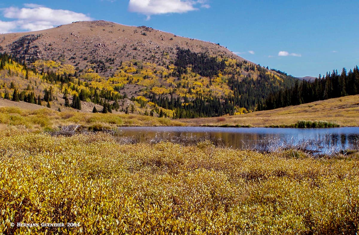
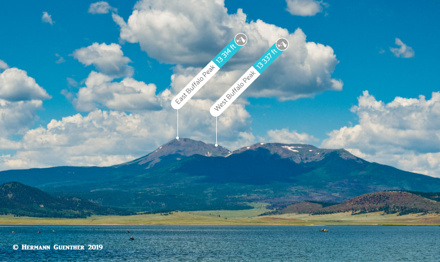
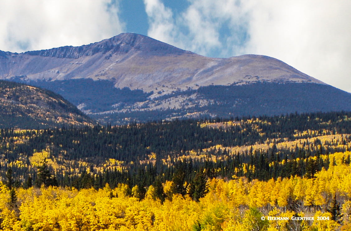
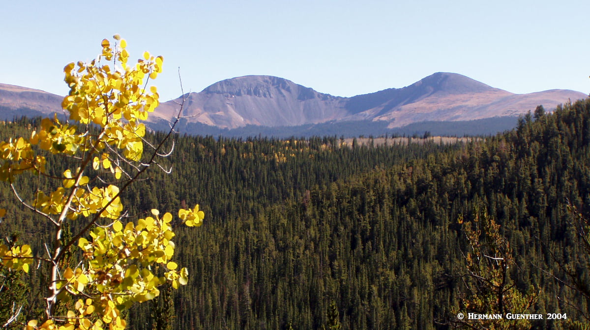
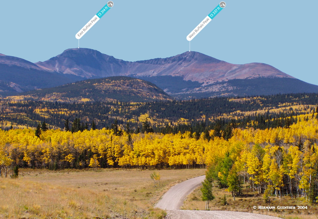
The pristine Buffalo Peaks Wilderness, which straddles the Pike and San Isabel National Forests, gets its name from the two high Buffalo Peaks located about 15 miles southwest of the town of Fairplay in Park County. Elevations in the wilderness range between 9,200 and 13,327 feet at the top of West Buffalo Peak. The two high-domed peaks are visible from throughout South Park on the east and the Arkansas River Valley on the west. Unlike the nearby Collegiate Peaks across the Arkansas Valley, the Buffalo Peaks contain no deep glaciated valleys and no lakes other than many impressive beaver ponds. Twenty-five to thirty million years ago, volcanic ash and lava flows filled a valley here, and the subsequent uplifting and erosion shaped the summits we see today. Gentle forests, extensive meadows and the relative absence of visitors reward hikers who venture here. I was certainly rewarded the times that I ventured into this beautiful place.
The Buffalo Peaks Wilderness has only 18 miles of trails, two of which make up the wonderful 12-mile Buffalo Meadows Loop route. There are no official trails to either of the two Buffalo Peaks or to the other two named mountains in the wilderness. Since climbers are far more likely to be challenged by the many fourteeners nearby, which are much easier to access, this partly explains why so few people visit this pristine wilderness. The few climbers that do come here for scaling the peaks will be amply rewarded by solitude and fantastic views from their summits. Those who attempt the traverse between the two summits are likely to be treated with opportunities to view a healthy herd of Bighorn Sheep. The wilderness is home to one of the largest herds of these magnificent animals (150 individuals) in Colorado.
There are really only three trailheads from which to wander into the Buffalo Peaks Wilderness, and they are a bit off the beaten track. Although they can be reached via Forest Service roads, I cannot speak to the quality of two of these roads since they are gravel and might not be suitable for all vehicles depending on the year and the time of year. But the County Road 22, alternatively known as the Weston Pass Road, is definitely suitable for passenger cars, at least as far as the Weston Pass Campground. Let’s take a look at what hiking and climbing opportunities are to be found here.
West Buffalo Peak is sometimes referred to as the guardian of the southern Mosquito Range. Its elegant domed summit with its steep east facing cliffs offers amazing views of the spine of the Mosquitoes to the north and the entire Sawatch Range to the west. It is about 30 feet taller than East Buffalo Peak and separated by a 12,800 foot saddle. The traverse from East Buffalo to West Buffalo is a worthwhile endeavor. While nothing more than a Class 2 hike, the views are outstanding and the cliffs on the north and east side are enough to instill a measure of respect. The north ridge on the west Peak is the easiest way up this mountain and makes an ideal descent route when combining the two peaks.
Buffalo Peaks Trailhead – This trailhead is one of the best spots from which to attempt climbing both peaks. It can be reached by driving on Forest Service Road 431, also known as the Buffalo Peaks Road (of course). The road can be reached by driving 15 miles south of Fairplay on US-285. From the intersection it is only eight miles to the unmarked trailhead, which is somewhat obvious since it is at a high point on a small saddle. From here the road continues downhill into the Rough-and-Tumbling Creek drainage. Start your hike here, following old logging roads and doing some old-fashioned bushwhacking. A recommended way to combine both peaks is to aim for the east peak first, then make the traverse to the west peak from which you can follow the gentle north ridge back down to your starting point. Depending on how much you deviate from the most direct path, you should be able to complete this loop hike in less than nine miles with a total elevation gain of around 4,000 feet. Since there are no designated trails here, and given the fact that you will most likely be alone, be sure you are prepared with GPS, maps, etc. and know how to read them. Route-finding skills are advisable and hiking with a companion is a good idea in this remote place.
Fourmile Creek Trailhead– For approaching the wilderness from the south (i.e. from Buena Vista) you need to drive on County Road 371 from Main Street until you get to County Road 375 which you follow for seven miles to the trailhead. This lovely trail follows Fourmile Creek while passing below the southwest slopes of West Buffalo Peak. Once it reaches a drainage divide, the trail enters the Buffalo Meadows area and then continues into the Rough-and-Tumble Creek drainage where it intersects the Buffalo Meadows Loop (see below). For those wanting to climb only the West Buffalo Peak, this would be a viable alternative to the loop route described above, though the hike would be longer while the total elevation gain would be comparable. To combine both peaks from this trail would be a more difficult undertaking.
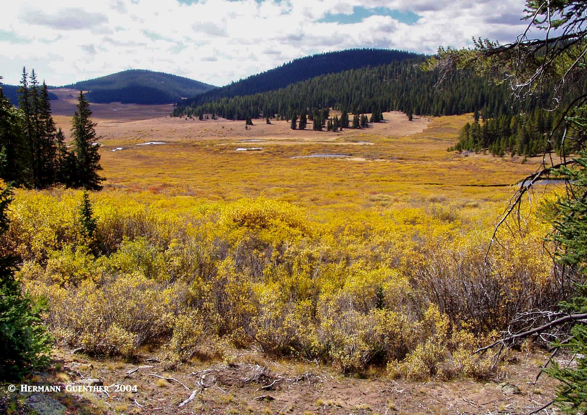
Rich Creek Trailhead – This is the place where you can start the delightful 12-mile Buffalo Meadows Loop. Yes, it is long, but not at all difficult as long as you have the stamina to complete it. Some will turn this hike into an overnight backpack trip. The chances are good that no matter how you do it, you will meet few other people. I have done this hike several times and had the place mostly to myself for the entire time. Autumn is a great time to make this hike since the colors are simply stunning, though it is said that the wildflowers in summer are nothing short of spectacular. The trailhead is located on County Road 22 (Weston Pass Road) at the convergence of Rich Creek and the south fork of the South Platte River, about ten miles from the US-285 intersection, which is 11 miles south of Fairplay. There are several other ways to get to the same spot using a variety of county roads, some with terrific views of the Buffalo Peaks.
You can do this hike in either direction, although the counterclockwise option affords more gentle ascents. Regardless, either way you will have the same total elevation gain. If you do nothing else in this amazing wilderness, this is the hike to do as long as you are not trying to bag the two Buffalo Peaks. For about half the length of this hike (assuming you go counterclockwise) you will be following Rich Creek up into the meadows where the terrain flattens out significantly. Eventually, you will cross over the divide that separates the Rich Creek drainage from that of Rough-and-Tumbling Creek. The name of the latter clearly reflects the nature of the terrain here – a steeper and deeper creek valley. Before returning to your starting point, you will once again cross over a mild ridge that separates the two creek drainages, which very soon converge into the South Platte River as they pass under County Road 22 (Weston Pass Road).

A little more than a mile from this trailhead is the Weston Pass Campground where I have camped on one occasion. From the campground there is a short trail which can be used as an alternative access to the Rich Creek Trail. It climbs onto and over a ridge from which you will get an amazing view of the Buffalo Peaks (is that why it is called the Ridgeview Trail???). When doing the loop hike from here you will be adding about two miles to the overall length of the hike. This also means that you will be crossing another ridge twice – on the way out and on the way back to your campsite. But it is so well worth doing. I would love to do this again, but that would be pushing me beyond my current limits.

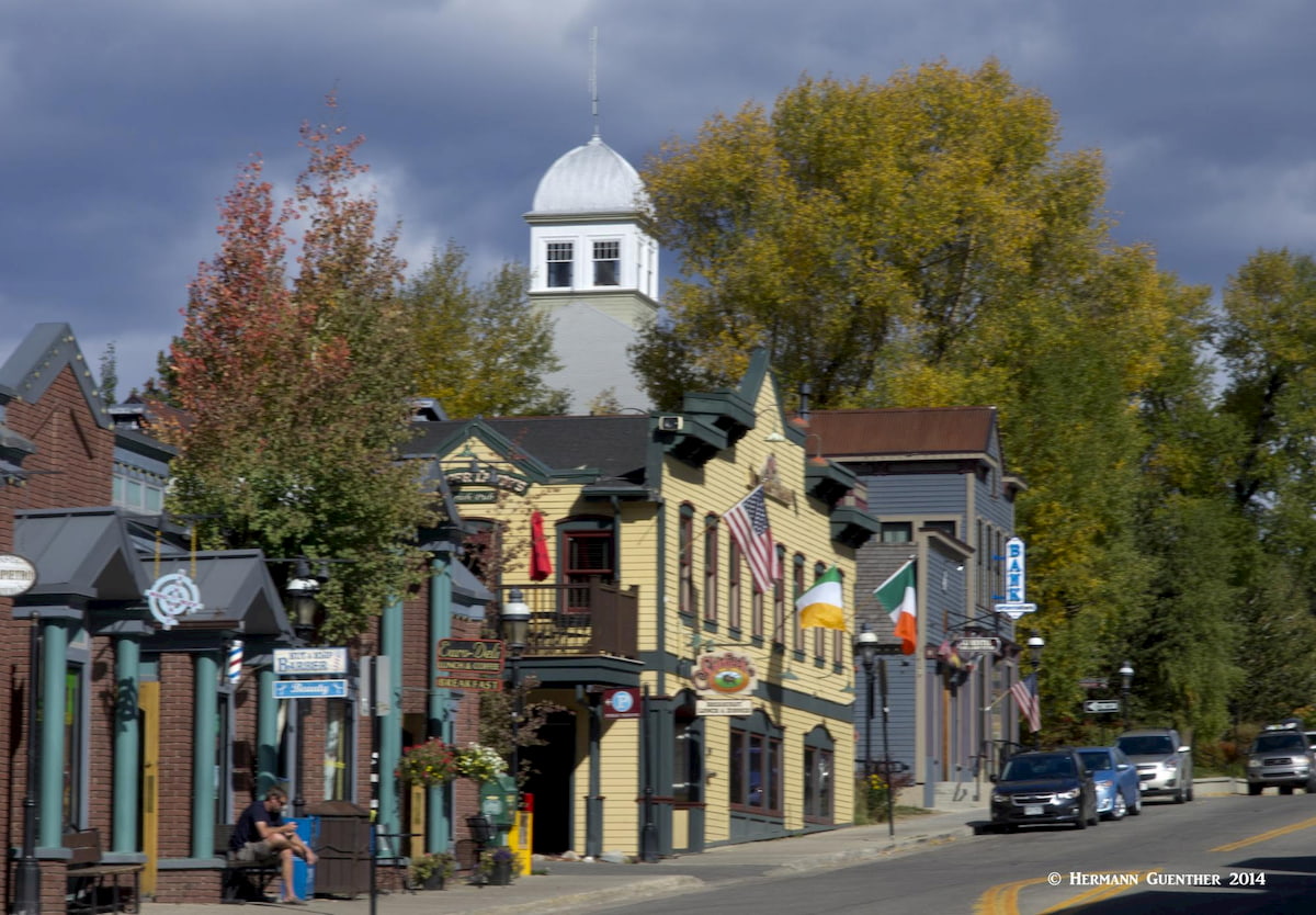
The historic town of Fairplay is the largest town in Park County of which it is also the county seat. Its population in 2018 was 762 and its elevation is 9,953 feet which makes it the fifth-highest incorporated place in Colorado. If exploring the east side of the Buffalo Peaks Wilderness, this is the closest town where you might want to settle in for a few nights (unless you plan on camping, which is very popular in this area). So if the town is so small, why is it a major town at all? Well, it sits at the crossroads of two major highways (SH-9 and US-285) which makes it very centrally positioned for serving as a base to explore the wilderness. Additionally, the high peaks of the Mosquito Range are just a very short drive from town. The only tourist attraction in the town is the open-air museum called South Park City – a collection of relocated historic structures. Be advised though – tourist amenities are scarce in this tiny town. For that, you need to go to Breckenridge, only 22 miles to the north on SH-9 over Hoosier Pass, or Buena Vista, 38 miles to the south on US-285. When leaving town on US-285, you will get a terrific view of the Buffalo Peaks.
The most recognized town on the eastern side of the Mosquito Range is Breckenridge. A combination of major ski resort and charming restored Victorian town, this is a place to spend some time enjoying the great restaurants, galleries and boutiques. Lodging opportunities abound here, offering a wide range of inns, hotels and condominiums. It is an excellent base for exploring the entire Mosquito Range and it is even close enough to the Buffalo Peaks Wilderness such that day hikes, especially on the east side of the wilderness, can be easily accomplished from here since it is only about a one-hour drive. Breckenridge is renowned for not only its great skiing, but also for so many great hiking and climbing venues. It sports the highest chairlift in the world for those who want to get up into thin air with minimal effort.
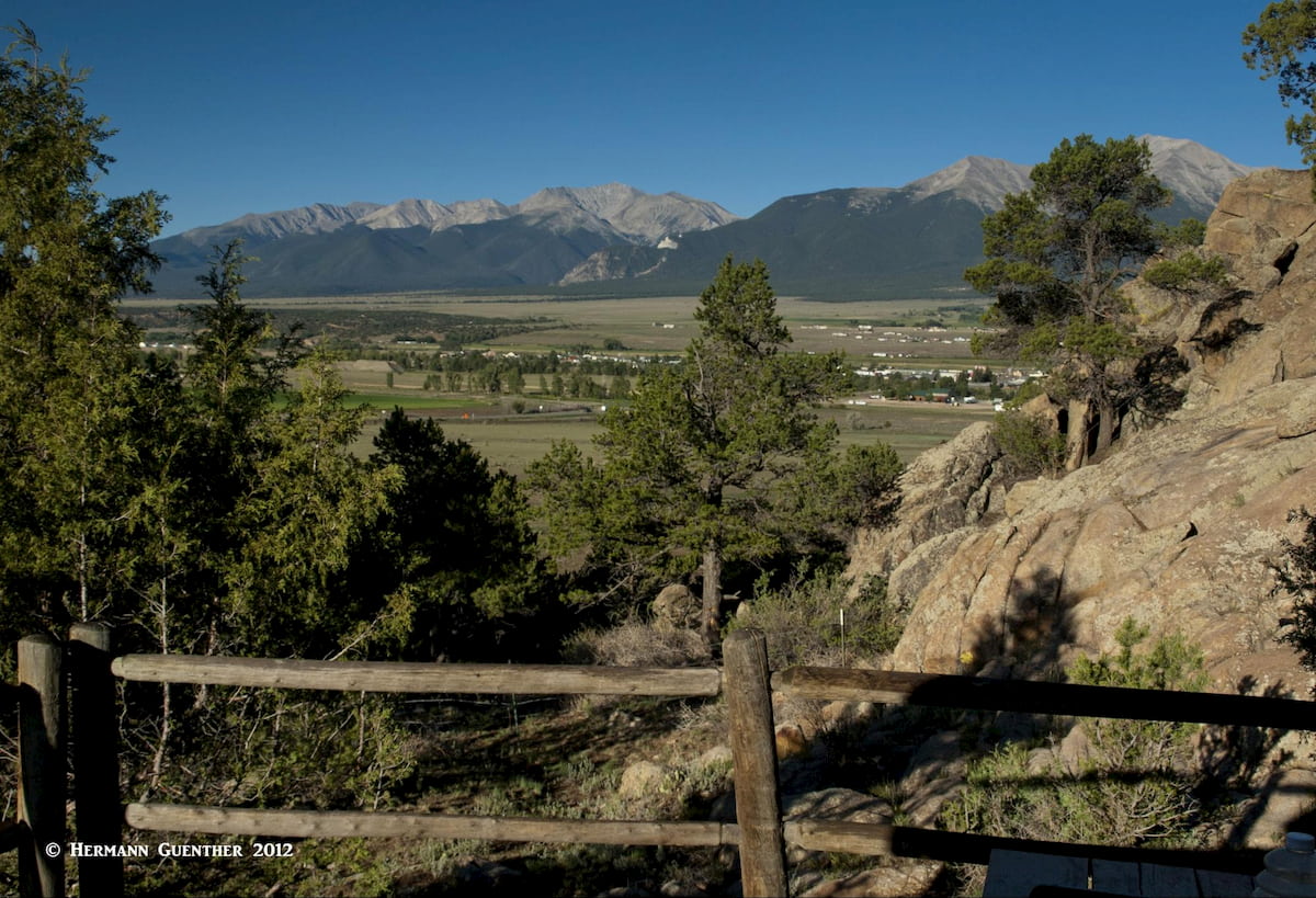
Buena Vista is centrally located in the Arkansas River Valley between two great mountain ranges – Mosquito and Sawatch – making it a handy place to find accommodations if you want to explore the Buffalo Peaks Wilderness. It is a more low-key resort than Breckenridge. In fact, if you are thinking of entering the wilderness from the south or west, you can’t do much better than this town, which offers a good selection of lodging options and restaurants. The Fourmile Creek Trailhead is just a short drive from the center of town, although a high-clearance or 4WD vehicle is likely necessary to get there. Being located at the junction of two major highways, US-285 and US-24, Buena Vista can be reached from Denver in just over two hours.
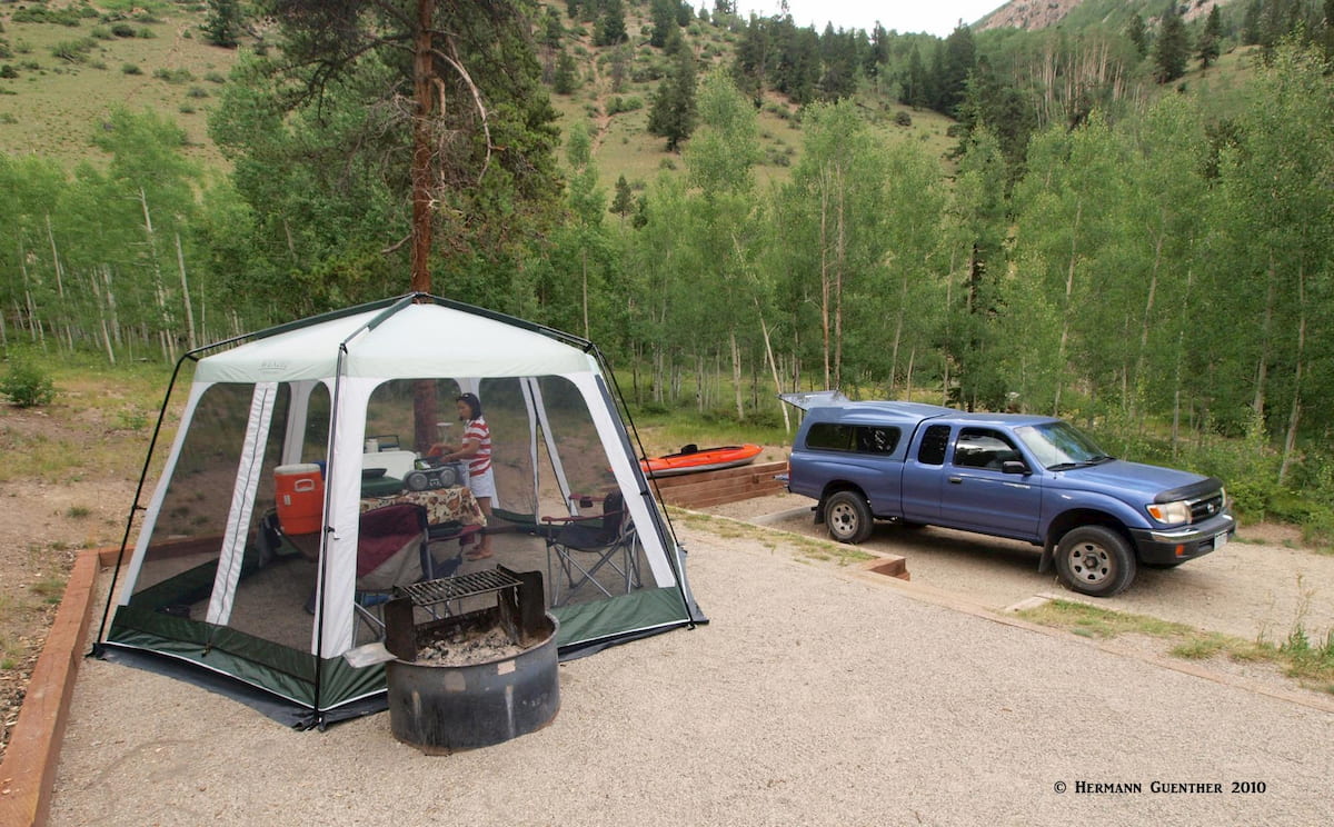
This beautiful area of Colorado is a great place to go camping – from backpacking in the wilderness to fully equipped RV parks for those who are willing to haul truck-sized campers, of which we see many whenever we go to recreate in this area. We have camped in simple campgrounds – sleeping in the back of our pickup truck – with almost no amenities. Alternatively, we enjoy staying in simple camping cabins. As we get older, we enjoy this slightly more comfortable way of camping – we still have to bring sleeping bags and cooking equipment (stove, utensils, coolers, etc.) but this is something we really enjoy. Buena Vista is a great place for this kind of adventure, offering many establishments that provide cabins – some simple ones while others have complete kitchens and bathrooms, heat and even air conditioning. We always prefer this to staying in hotels. But the choices are unlimited in the Arkansas Valley.