Scan the QR code and open PeakVisor on your phone
The Arapaho National Forest is located in the north-central part of the U.S. State of Colorado. It straddles the Continental Divide with most of the forest occupying the western side. It shares boundaries with four other national forests – Roosevelt on the east, Pike on the south, White River on the west and Routt on the north. It also abuts the southern and western boundaries of Rocky Mountain National Park. The forest is easily one of the most recreation-oriented national forests in the entire state – it is home to four alpine ski areas (Loveland Basin, Mary Jane, Winter Park, and Echo Mountain) and several Nordic skiing centers. Within its boundaries you will also find a number of huge lakes and reservoirs, countless alpine glacial lakes and miles of pristine rivers and streams, some affording Gold Medal trout fishing. And then there are the mountains offering countless miles of hiking trails. There are even three fourteeners towering above this forest.

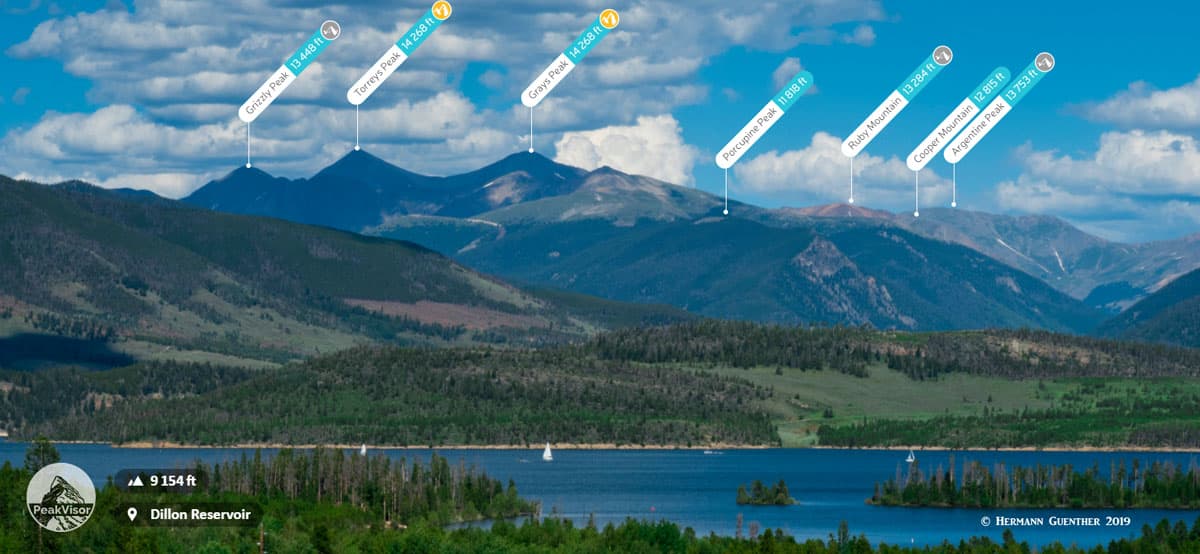
Though the Arapaho National Forest straddles the Continental Divide, the majority of the 101 named mountains are either directly on the Divide or east of it. In fact, the highest and most prominent mountain in the forest, Grays Peak, sits directly on the divide. Not only is Grays the highest in the forest – it is the highest mountain on the entire Continental Divide of North America, and it, along with its neighbor, Torreys Peak, are the only fourteeners on the entire Divide. Yet they are both fairly easy climbs (more on that later). Also much of the boundary between Arapaho National Forest and Roosevelt National Forest to the east is defined by the Continental Divide. As a result there are many high peaks that are likewise shared by both forests. For recreational purposes, access to the divide and these peaks is mainly from the east side since it is closer to the crowded Front Range urban area.
The central Front Range part of the forest, which includes the three fourteeners (Mount Evans being the third one in addition to Grays and Torreys), is very conveniently served by Interstate Highway 70 (I-70), thus making this area a very popular venue for recreation. Even the Eisenhower/Johnson Tunnels under the Continental Divide can be reached from much of the greater Denver area in just under an hour (ski season and weekends excepted). I frequently get to one of my favorite trailheads in about 45 minutes. Thus, with having a major highway pass directly through the heart of the Arapaho National Forest, there is no excuse for not taking advantage of some of the great adventures and scenery that can be experienced here. I will share some of them with you now.
No matter where you will seek your recreation in the Arapaho National Forest, most likely you will start by driving west on I-70 (assuming of course you are coming from the Denver area). Then you will have several options to divert to a number of fine places to go hiking or simply to enjoy the amazing scenery. First, you could get off the highway at Idaho Springs and head up into the Mount Evans area. If you continue onward, you will reach the major junction of U.S. Highway 40 which will take you into Grand County and the resort of Winter Park, from where you will have access to the wonderful mountains of the James Peak, Indian Peaks and Byers Peak Wilderness areas.
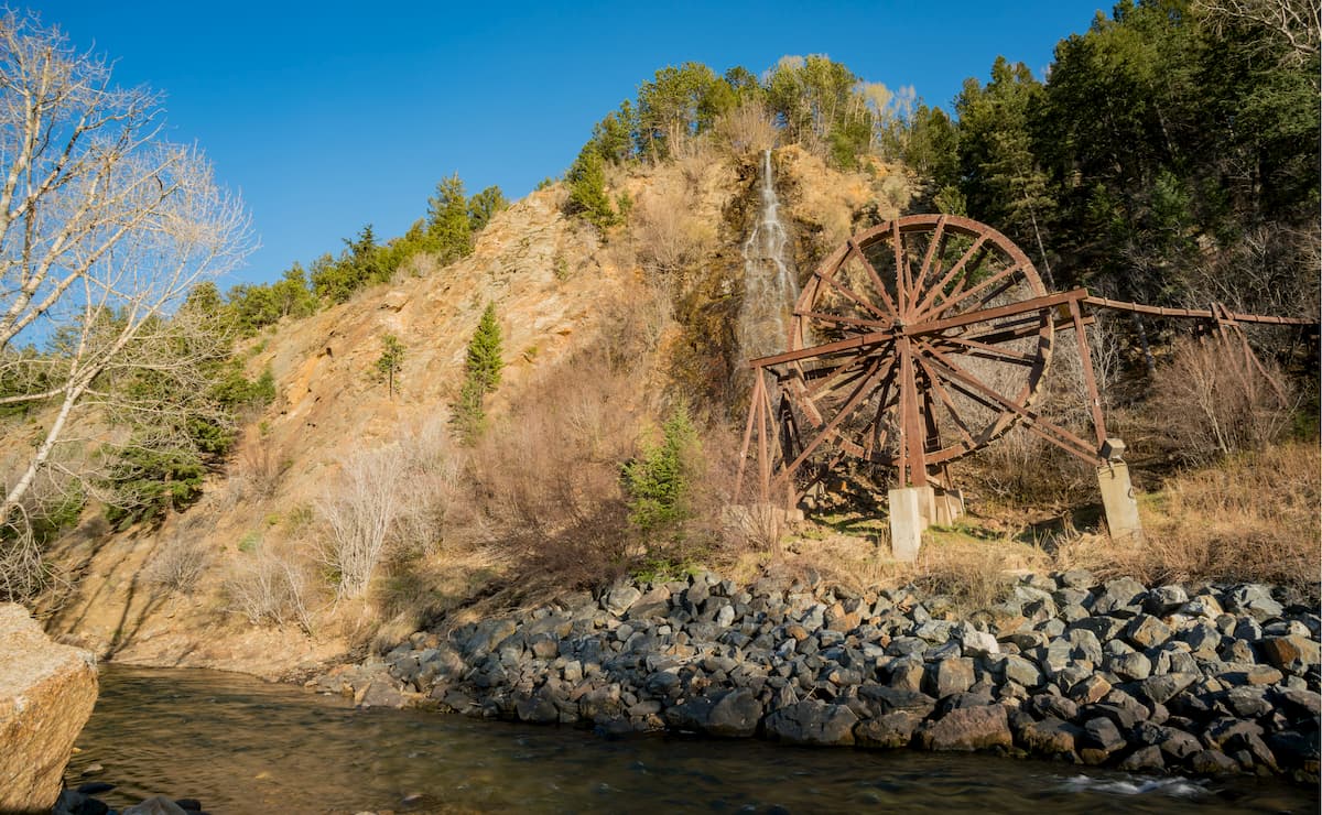
Continuing past this junction, don’t forget to consider a diversion into the Victorian Town of Georgetown and then continue on up to Guanella Pass. There are some nice hikes to be found here, although some will take you into the adjacent Pike National Forest, which starts at the summit of Guanella Pass. Want to skip this one? Just stay on I-70 for another seven miles to the Bakerville exit. Don’t expect much of a town here – in fact, don’t expect any town here. But just drive up the three-mile Stevens Gulch Road to the famous trailhead for Grays and Torreys Peaks. The gravel road is rough and very popular, but oh so nice when you get to the Stevens Mine site. When you see the open basin in front of you, you won’t be able to wait to get your hiking boots on.
Then, another three miles further up on I-70, you will get to an interchange that seems to serve nothing, since the exit has no place name, just a number. Don’t be fooled by this. The locals know what is there – the Herman Lake Trailhead – and you can bet that you will find lots of cars in the large parking lot here. This is the one I said that I can reach in 45 minutes from home. This large backcountry area will give you many hiking options besides just the lake at trail’s end.
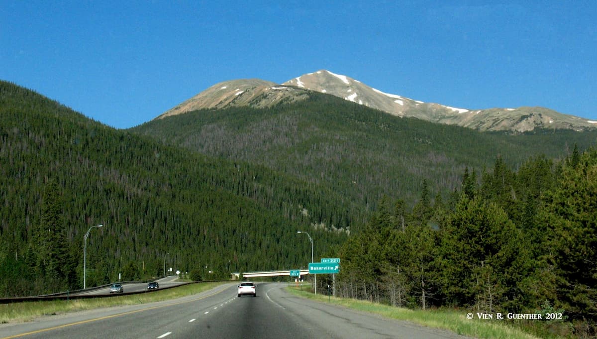
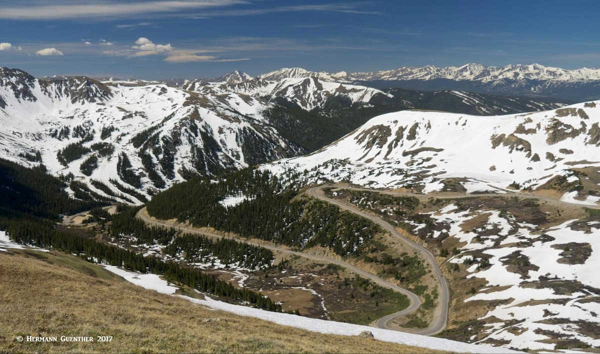
Finally, drive just two more miles on I-70 and you will get to the Loveland Pass/Loveland Ski Area exit. This is where the old U.S. Highway 6 starts its climb up and over the Continental Divide, reaching the 11,995-foot summit of the pass. Before I-70 was built in the 1970’s, this was the only way to go in order to get to Summit County and the western slope of the mountains. From up there, you can take in some wonderful high-tundra hiking - if you don’t get blown off by the wind. The 13,228-foot Mount Sniktau is a fine and fairly easy hike from the pass - assuming you are conditioned for the high altitude.
OK, let’s go hiking! The following descriptions are all based on hikes that I have done in 40 years of living in Colorado.
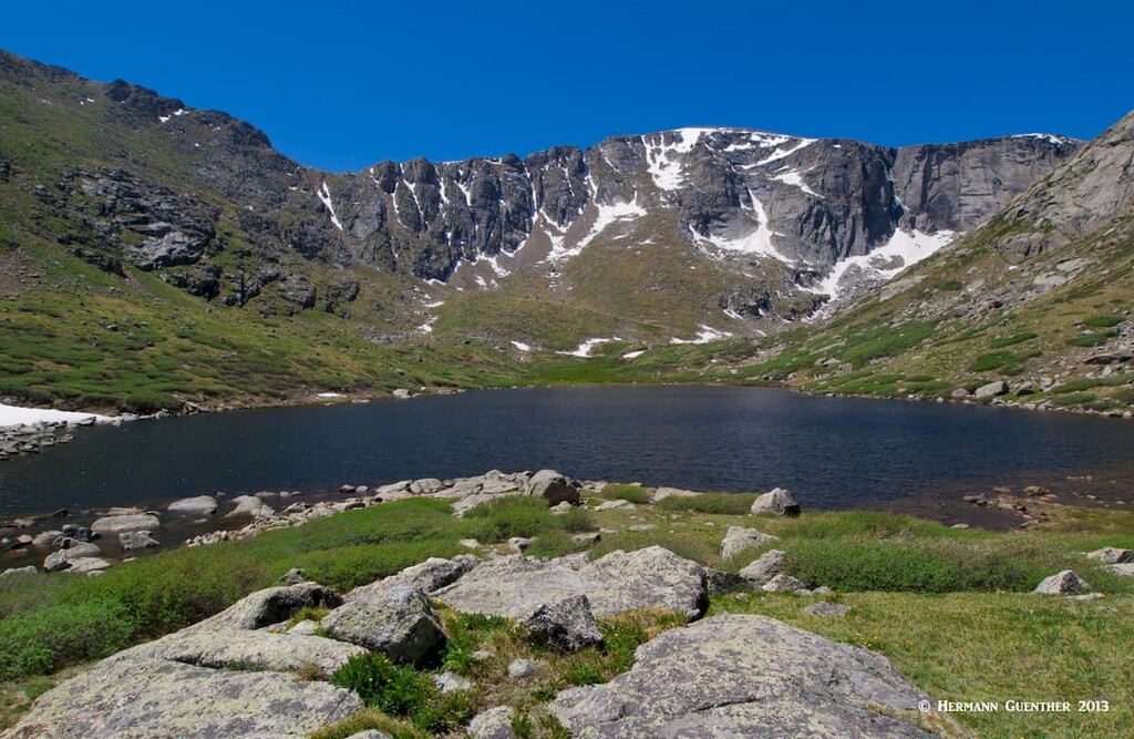
Echo Lake/Mount Evans Trailhead – The drive from Idaho Springs on Highway 103 is scenic all the way to Echo Lake, which is a Denver-owned park although it is nowhere near the city. At Echo Lake, you can opt to drive to the top of Mount Evans – if you dare, since anyone with fear of heights should probably avoid doing this. But we came here to hike, and the best hike here is the one to the two Chicago Lakes. Most of this hike, which starts in a parking area behind the lake, is in the Mount Evans Wilderness area. If you choose to go to the Upper Chicago Lake, which I strongly recommend, you will have a round trip hike of about 10 miles. The trail bypasses the lower lake, although an informal spur leads to it. I would skip that and head for the upper lake, which is an alpine gem, though the trail is a little tough. From here, you can follow a primitive trail that goes up to Summit Lake (which you can drive to), and really ambitious hikers can continue all the way to the summit of Mount Evans. That would be a tough hike indeed.

Byers Peak Trail – This popular trail begins about 15 miles west of the resort of Winter Park – it takes driving a short distance on US-40 and then on several Forest Service Roads to get there. This fine hike is in the Byers Peak Wilderness, the smallest mountain wilderness in Colorado. About one half of Byers Peak consists of alpine tundra and therein lies the great attraction of the area. Though the summit elevation is only 12,815 feet, not all that high by Colorado standards, there is an elevation gain of 2,988 feet in the 4.5 miles to the top. But that distance includes about two miles of old road that is closed to vehicles. Only at the end of this road does the serious climbing begin. Because of this it is rated as difficult, although I did not think that it was all that hard when I did it 25 years ago. The segment above treeline has amazing wildflowers at the right time of summer. The trail actually continues beyond the peak for some of the finest alpine ridge hiking in Colorado. Since Byers Peak is the highest peak in the wilderness, and one of the most prominent in the Arapaho National Forest, it is wise to be mindful of the afternoon thunderstorms that are common here.

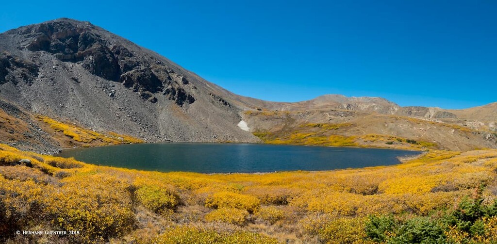
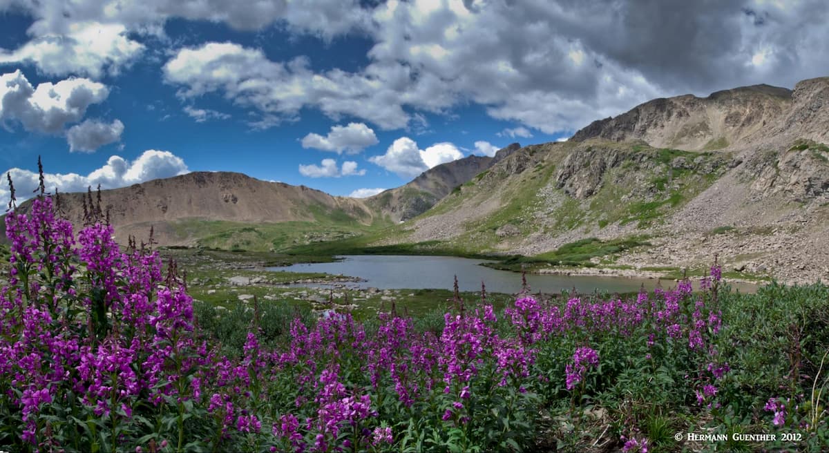
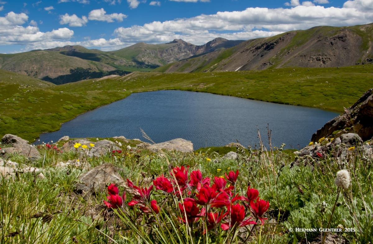
Silver Dollar Lake Trail – If you get off I-70 at Georgetown and drive the Guanella Pass road about ten miles, you will get to a parking area at the Naylor Lake Road, which you can drive to the actual trailhead, although not all passenger cars may be able to negotiate this steep and sometimes rough gravel road. I always park in the lot at the bottom of this road – the added hiking distance is only 0.7 mile each way. The trail climbs steadily but not steeply to treeline at which point you will get a fine view down to the private Naylor Lake. From this point onward you will be in the open until you reach Silver Dollar Lake. If you turn around at the lake and go back down, you will have made a hike of only five miles. This is very popular and you will find lots of seniors doing this hike.

But you really don’t want to turn back just yet. The best part is above you. For one thing, as you climb steeply above the lake, you will see how it got its name - it is as round as a lake gets. Also, as you climb over the tundra, you will see an amazing display of wildflowers, and then the trail levels out a bit and actually goes slightly downhill into a beautiful basin that contains another alpine gem – Murray Lake. There will be a lot less people up here. And you will be at an elevation of 12,000 feet. Now, if you are like me, getting to this point is still not good enough. I just had to find a way to get around Murray Lake – and I did, but it involved hiking far above the lake behind some cliffs that drop straight down into it. Now you have arrived at a special place, with killer views, where I have only ever seen two people and only the first time there. Getting this far turns this into a seven-mile round trip hike. Not difficult at all and so worthwhile. My wife and I do this every time we go there.
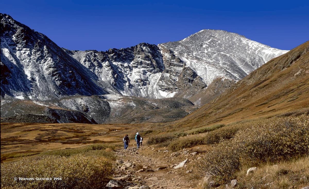
Grays and Torreys Trail – As you drive up the Stevens Gulch Road, if it’s a nice day and it’s weekend, you will see cars parked along the road even as far as one mile below the somewhat disorganized parking situation at the trailhead. It wasn’t nearly that bad back in the years when I climbed these two popular fourteeners. But don’t let that discourage you. What’s an extra two miles of hiking, when you are about to make a nine-mile round trip hike involving 3,600 feet of elevation gain? If you are tough enough to handle the hike, you can deal with the additional distance when the parking area is full. Also, if you are going to hike all the way up there, you really should take in both summits – they are only 0.8 miles apart.
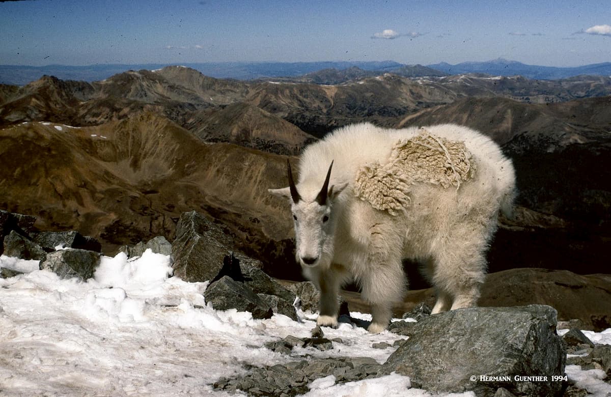
As an interesting alternative to the main trail, you can take the Class 3 Kelso Ridge route to the summit of Torreys and then walk the connecting saddle to Grays. The last time I climbed these fine mountains, I found myself on the top of Torreys Peak all alone – except for a mountain goat that snuck up behind me while I was sitting on a rock and eating my sandwich. I don’t think that is a common occurrence these days. A precious moment for sure.
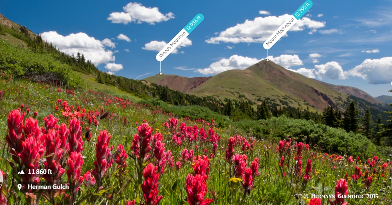
Herman Gulch Trailhead – The very popular trail to Herman Lake is less than four miles long and rises about 1,700 feet to a spectacular high basin (12,000 feet) containing the small lake. This is one of my favorite hikes, since not only can you go to the lake, you can bag a number of high peaks in an ambitious loop hike. Also, from the lake you can climb Pettingell Peak (13,550 feet), the Citadel (13,301 feet), Hagar Mountain (13,250 feet), or Mount Bethel (12,700 feet) or..or..or..
Most people just go to the lake, which these days is enough for me. But in days gone by, I did some massive hikes here. A classic is to take a branching trail near the base into the adjacent Watrous Gulch and then climb the imposing 13,574-foot Mount Parnassus (no, not the one in Greece), then continue with a fabulous ridge walk over Woods Mountain and Mount Machebeuf before eventually re-joining the main trail just below the lake. You will sleep well that night! Ah, this makes me want to put on my hiking boots right now. Hiking anywhere in this complex in early August will reward you with amazing displays of wildflowers.
Loveland Pass Trailhead – While the limited parking at the top of Loveland Pass is mostly used by tourists who want to take selfies at the sign indicating your elevation, there is some excellent hiking to be experienced here. For example, you can climb Torreys Peak from here - a 10-mile round trip hike with a total elevation gain of 5,500 feet. But you get to bag Grizzly Peak (13,427 feet) – twice. Not for the casual hiker. But much easier is the gentle climb to 13,228-foot Mount Sniktau via a wonderful ridge walk. I’ve climbed it a few times; however, on the last two attempts my wife and I had to abandon the hike due to high wind that just about blew us off the Continental Divide. On the opposite side of the road, at the pass summit, you can do some wonderful tundra walking without a specific destination in mind. Just hike cross-country as far as you want – just remember to find your way back and be especially mindful of the weather. There is no place to hide from lightning up here. Also, do be careful where you put your feet - the tundra is very fragile.
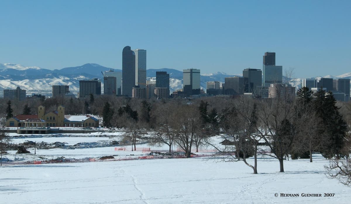
Denver - Having a metropolitan area population of over 2 million, it goes without saying that Denver, the Mile High City, offers anything and everything that a visitor needs or wants. With a world-class international airport, world-wide access to Denver is easy. Non-stop flights from as far away as Asia and Europe are routine. Visitors can get in a car at the airport and be in the high country in as little as 90 minutes. And while all the amenities one could want in a big city are readily available, it is the proximity to the mountains which is one of the biggest attractions Denver provides. Since Colorado is so large (over 100,000 square miles), for those visitors wanting to visit other more remote parts of the Colorado Rockies, scheduled airline service is also available. The only Interstate Highway crossing Colorado from east to west is I-70, which passes through the center of Denver. It is the best way to get to the Arapaho National Forest.
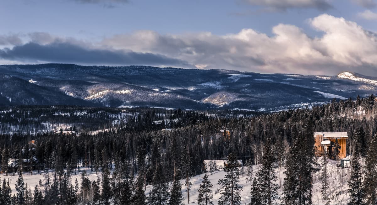
Winter Park - This town is best known as a major ski resort, located in the Fraser Valley on the western side of the Continental Divide. A world-class resort, Winter Park is ideally situated for staging expeditions, or simply day hikes, into the high mountains of several wilderness areas, including the Indian Peaks and James Peak Wildernesses. The town is easily reached in little over an hour from Denver via U.S. Highway 40, which crosses the Continental Divide at Berthoud Pass, elevation 11,307 feet. Winter Park is also handy to the Byers Peak Wilderness area, which has two peaks over 12,500 feet elevation - Byers Peak and Bills Peak, as well as the Vasquez Peak Wilderness Area. One distinction that other resorts in Colorado don't share is that Winter Park is served by Amtrak's California Zephyr train on a daily basis, thus providing an alternative method of getting there from Denver. There is no shortage of accommodations and restaurants in this mountain getaway.
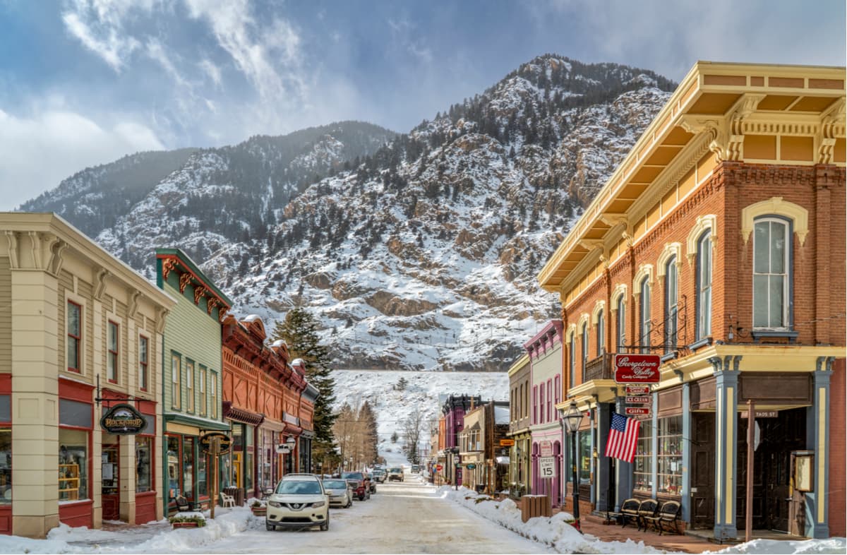
Georgetown and Idaho Springs - These two historic mining towns have become popular tourist destinations in the middle of the central Front Range. Both towns are directly on Interstate Highway 70 and are therefore reached in less than an hour from Denver. These towns, and the I-70 corridor in which they are perched, afford the best access to the Grays/Torreys group as well as the Chicago Peaks group of mountains.
They, especially Georgetown, are also handy for those wishing to explore the high country north of I-70 that is served by the Herman Gulch Trailhead, which is only nine miles to the west. There are a variety of accommodations and restaurants available for the visitor, but understandably, the selection is relatively sparse, since these are small towns, with populations of 1,034 and 1,717 respectively. But when in the area, these towns are worth visiting for their historic appeal alone. The Mount Evans Road is best accessed from Idaho Springs.
Because of the complexity and variations in geographic and topographic databases, it is not always clear which mountains are located within a given geographic area. This is particularly the case when two jurisdictions have a common boundary. When it comes to mountains, it is commonly (but not always) understood that such boundaries follow ridge lines that in most cases define the local geography based on drainage basins. One of the best examples of this is the Continental Divide of North America (as well as other similar divides). In the case of the Arapaho National Forest, there are a number of major mountain peaks that sit squarely on the Divide, which also serves in part as the boundary between the Arapaho and Roosevelt National Forests. Consequently, these mountains are rightly claimed to be in both National Forests, yet the database may at times show certain peaks in one forest but not in the other. To complicate matters even more, there are sub-categories of mountain domains that straddle such divides, as is the case with the Indian Peaks Wilderness - which is in both Arapaho and Roosevelt National Forests. These sub-categories have their own individual databases, such that mountains named in the wilderness may not appear in the database for either of the National Forests. PeakVisor is constantly revising and updating its databases to present the best information available at the time.